This is intended to be a complete list of properties and districts listed on the National Register of Historic Places in Cape May County, New Jersey. The locations of National Register properties and districts (at least for all showing latitude and longitude coordinates below) may be seen in a Google map by clicking on "Map of all coordinates".[1]
| [3] |
Site name[4] |
Image |
Date listed |
Location[1] |
City or Town |
Summary |
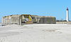
| 1 |
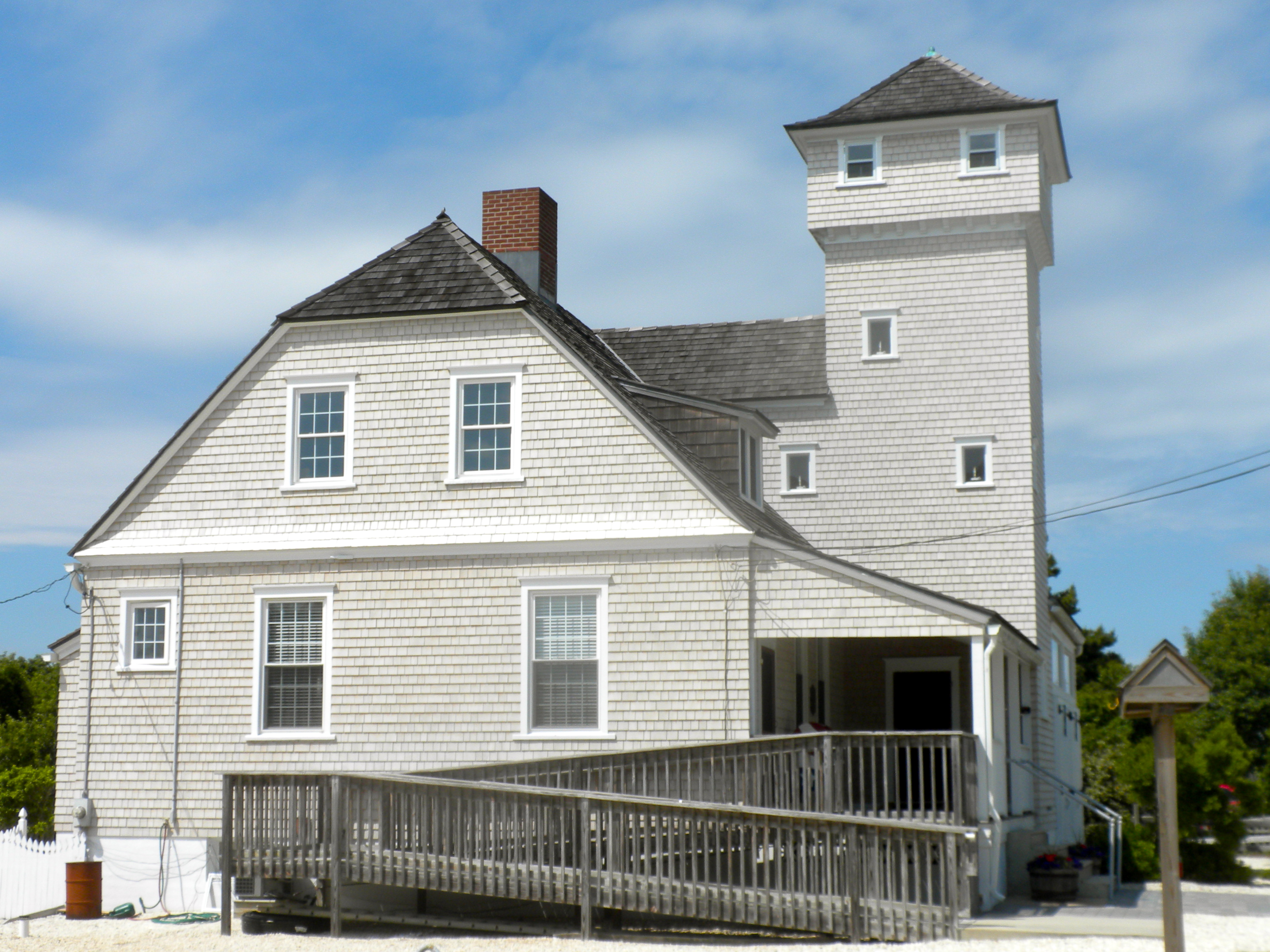
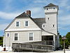
Avalon Life Saving Station |
 |
01979-03-02 March 2, 1979 |
76 W. 15th St.
39°6′14″N 74°42′46″W / 39.10389°N 74.71278°W / 39.10389; -74.71278 (Avalon Life Saving Station) |
Avalon |
|
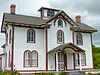
| 2 |
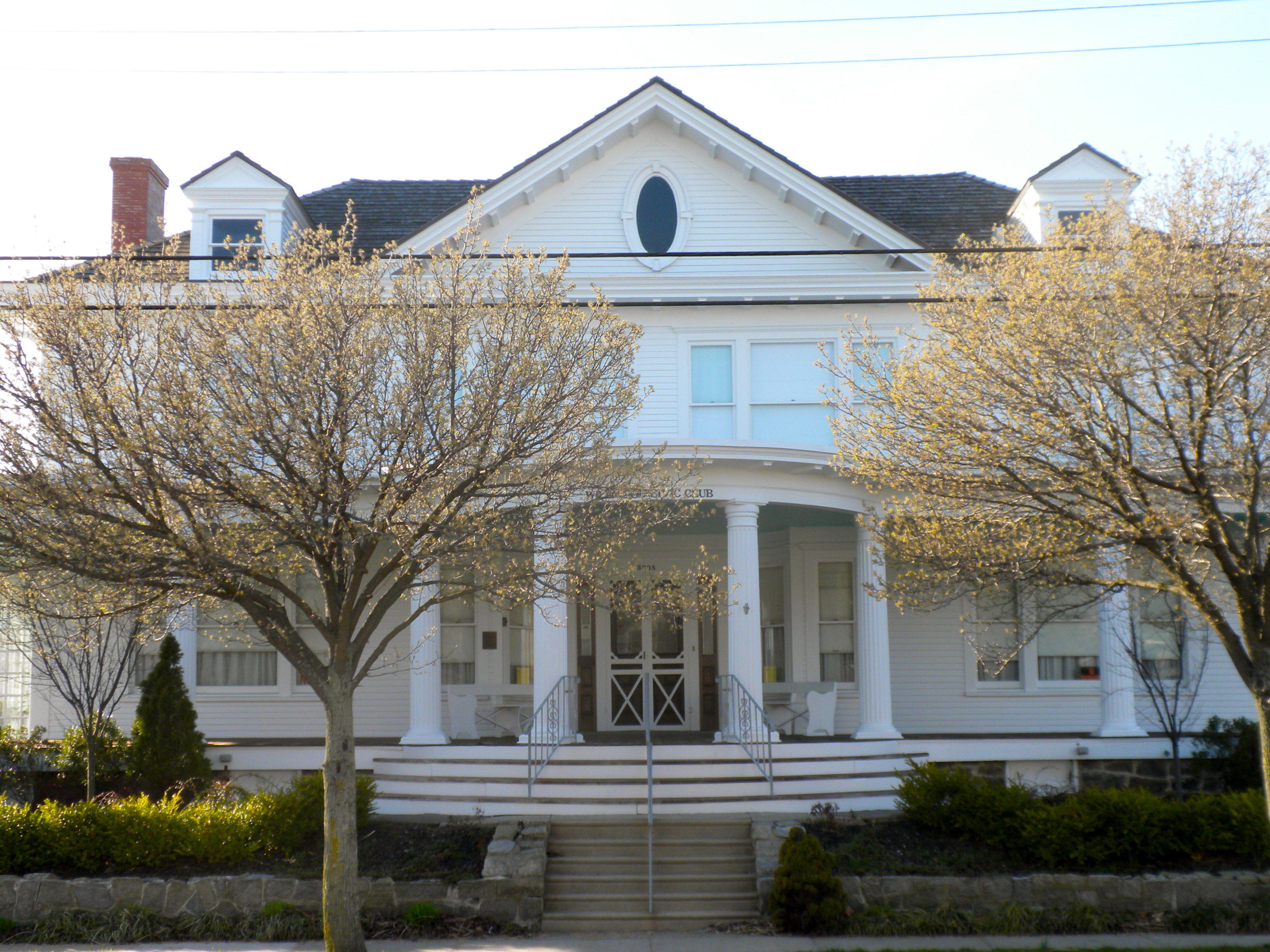
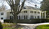
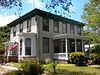
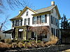
J. Thompson Baker House |
 |
01996-05-31 May 31, 1996 |
3008 Atlantic Ave.
38°59′24″N 74°48′36″W / 38.99°N 74.81°W / 38.99; -74.81 (Baker, J. Thompson, House) |
Wildwood |
|
| 3 |
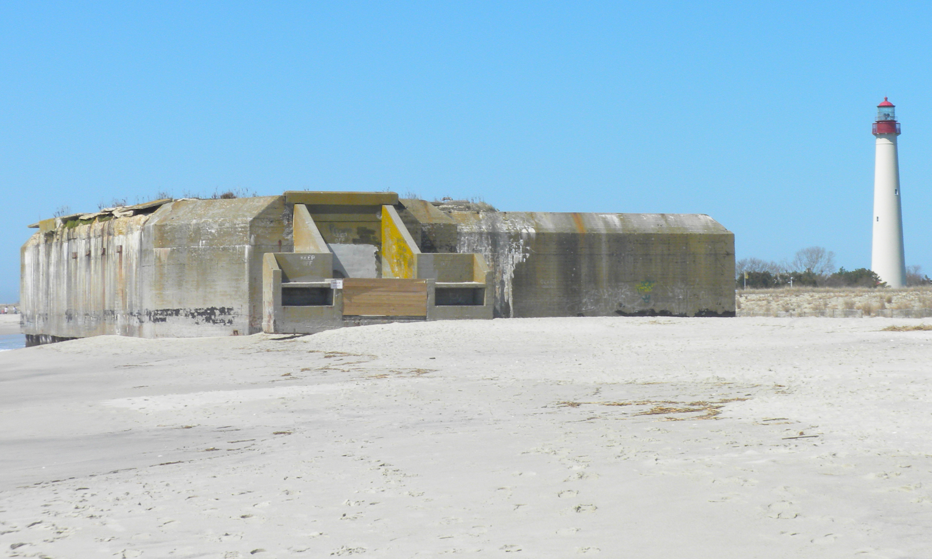
Battery 223 |
 |
02008-06-25 June 25, 2008 |
Beach at Cape May State Park
38°55′53.3598″N 74°57′19.9188″W / 38.931488833°N 74.955533°W / 38.931488833; -74.955533 (Battery 223) |
Lower Township |
|
| 4 |
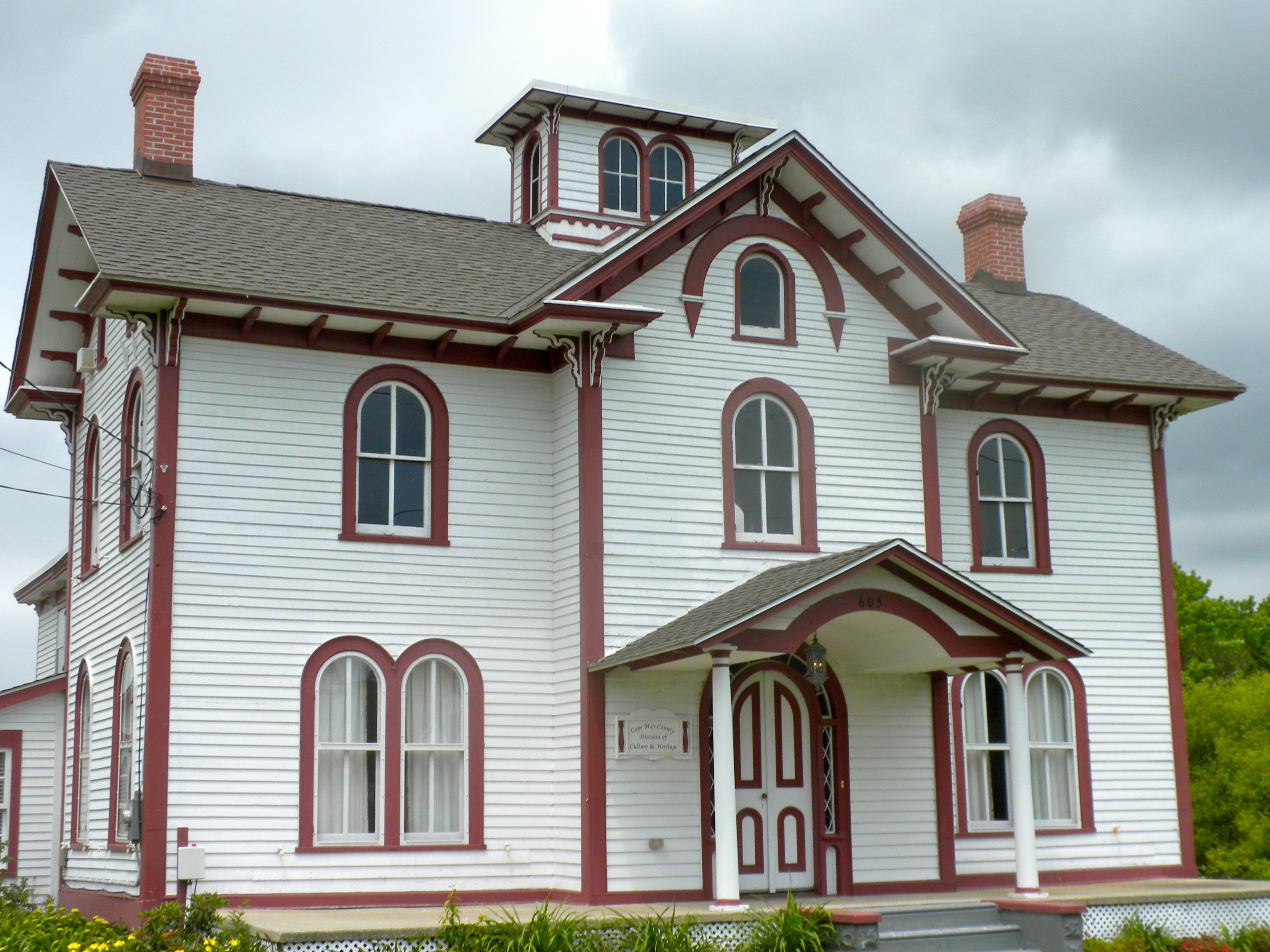
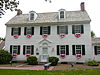
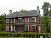
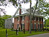
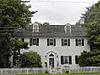
Thomas Beesley Jr. House |
 |
01998-02-12 February 12, 1998 |
605 NJ 9 N
39°5′55″N 74°48′50″W / 39.09861°N 74.81389°W / 39.09861; -74.81389 (Beesley, Thomas, Jr., House) |
Middle Township |
|
| 5 |
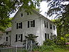
Thomas Beesley Sr. House |
 |
01992-12-17 December 17, 1992 |
12 Beesley's Pl.
Beesley's Point
39°16′47″N 74°37′46″W / 39.27972°N 74.62944°W / 39.27972; -74.62944 (Beesley, Thomas, Sr., House) |
Upper Township |
|
| 6 |
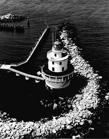
Brandywine Shoal Light Station |
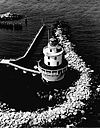 |
02007-01-08 January 8, 2007 |
In lower Delaware Bay, about 8.8 mi. WNW of Cape May Point
38°59′10″N 75°6′47″W / 38.98611°N 75.11306°W / 38.98611; -75.11306 (Brandywine Shoal Light Station) |
Cape May Point |
|
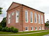
| 7 |
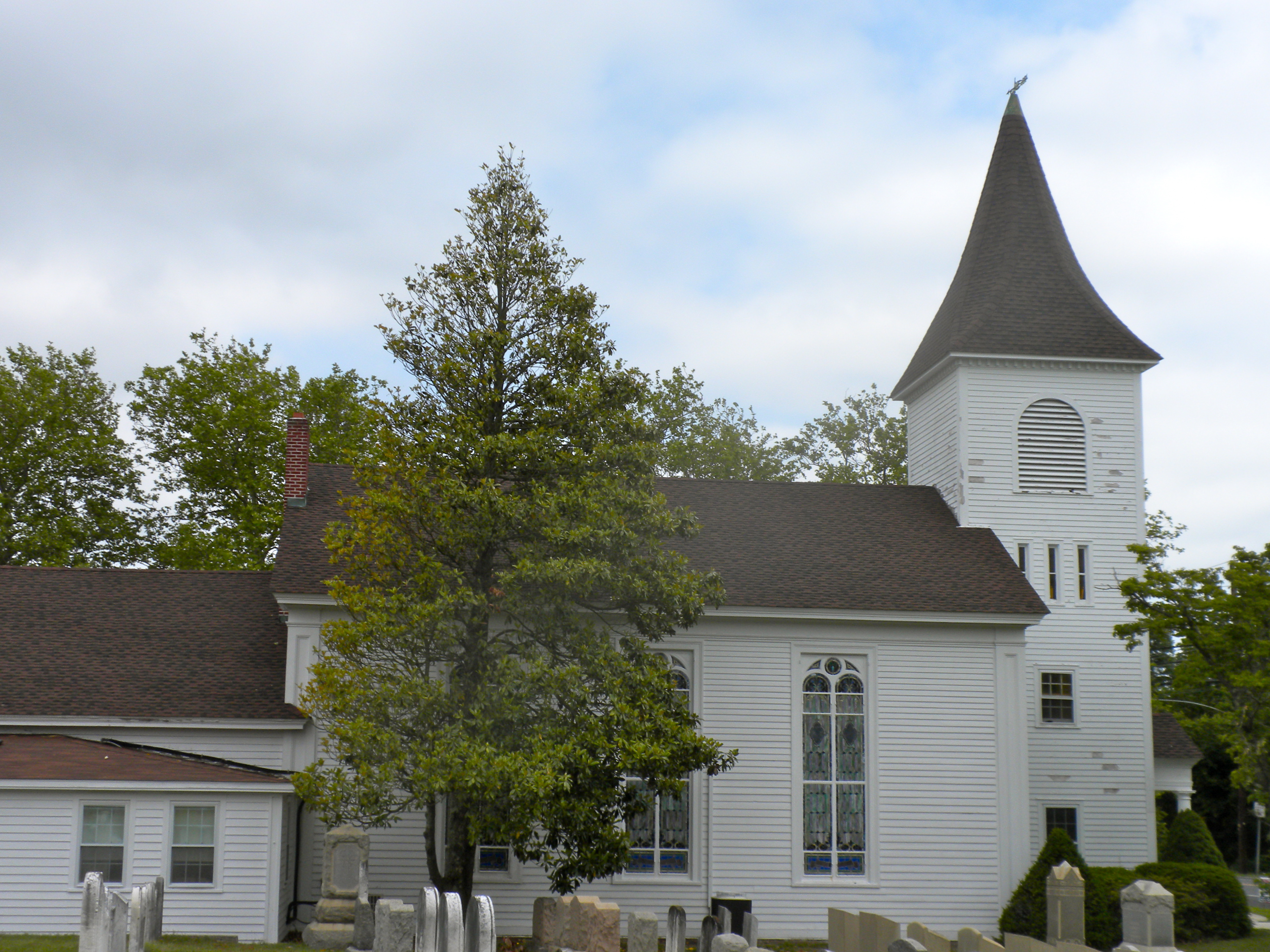
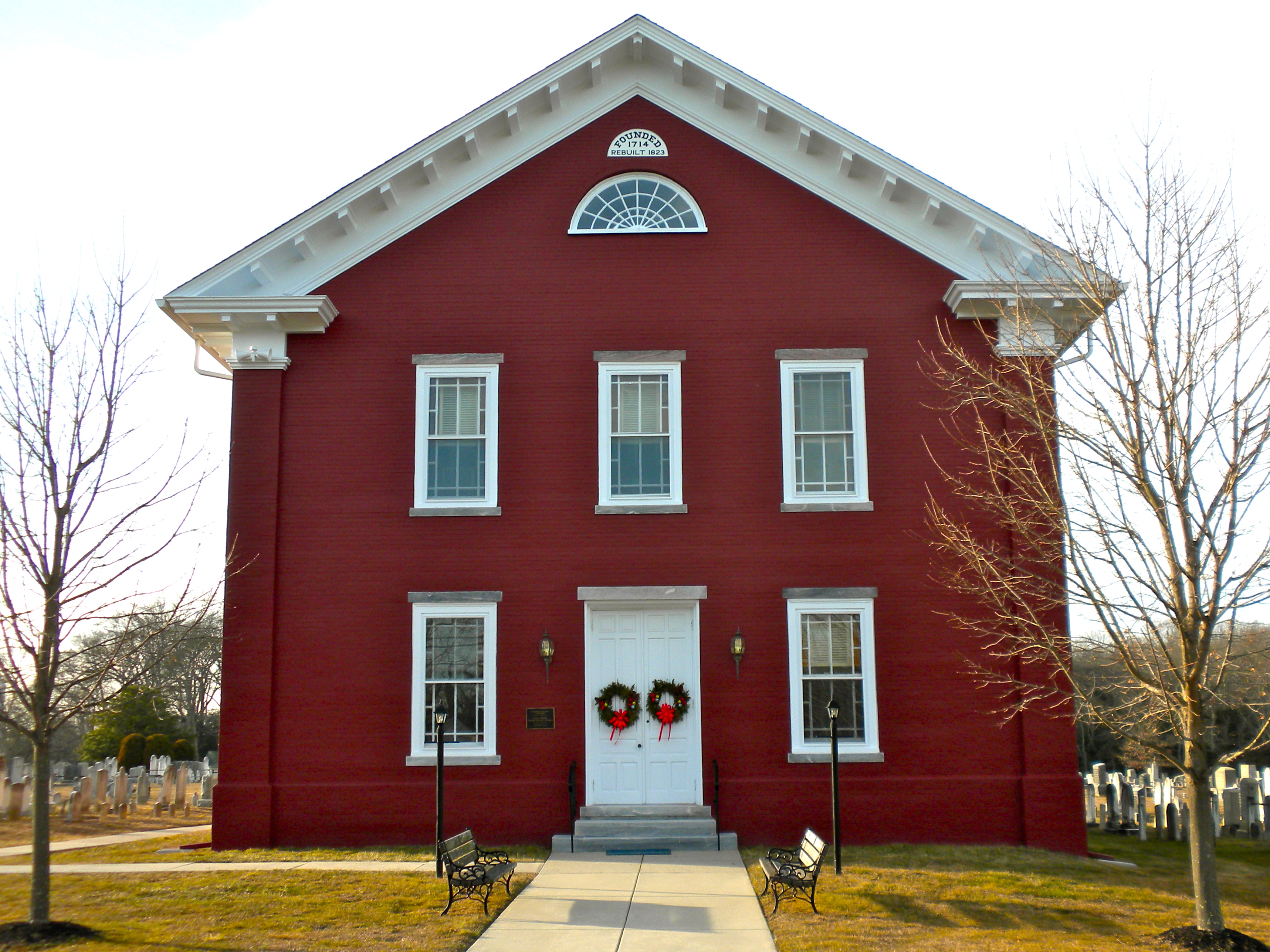
Calvary Baptist Church |
 |
01980-11-25 November 25, 1980 |
SW of Ocean View at Seaville Rd. and NJ 9
39°10′14″N 74°44′26″W / 39.17056°N 74.74056°W / 39.17056; -74.74056 (Calvary Baptist Church) |
Dennis Township |
Built 1855 |
| 8 |
Cape May Historic District |
 |
01970-12-29 December 29, 1970 |
Cape May
38°56′24″N 74°54′46″W / 38.94°N 74.91278°W / 38.94; -74.91278 (Cape May Historic District) |
Cape May |
600 buildings |
| 9 |
Cape May Lighthouse |
 |
01973-11-12 November 12, 1973 |
Cape May Point State Park
Lighthouse Ave.
38°55′58″N 74°57′39″W / 38.93278°N 74.96083°W / 38.93278; -74.96083 (Cape May Lighthouse) |
Cape May |
Built 1859 |
| 10 |
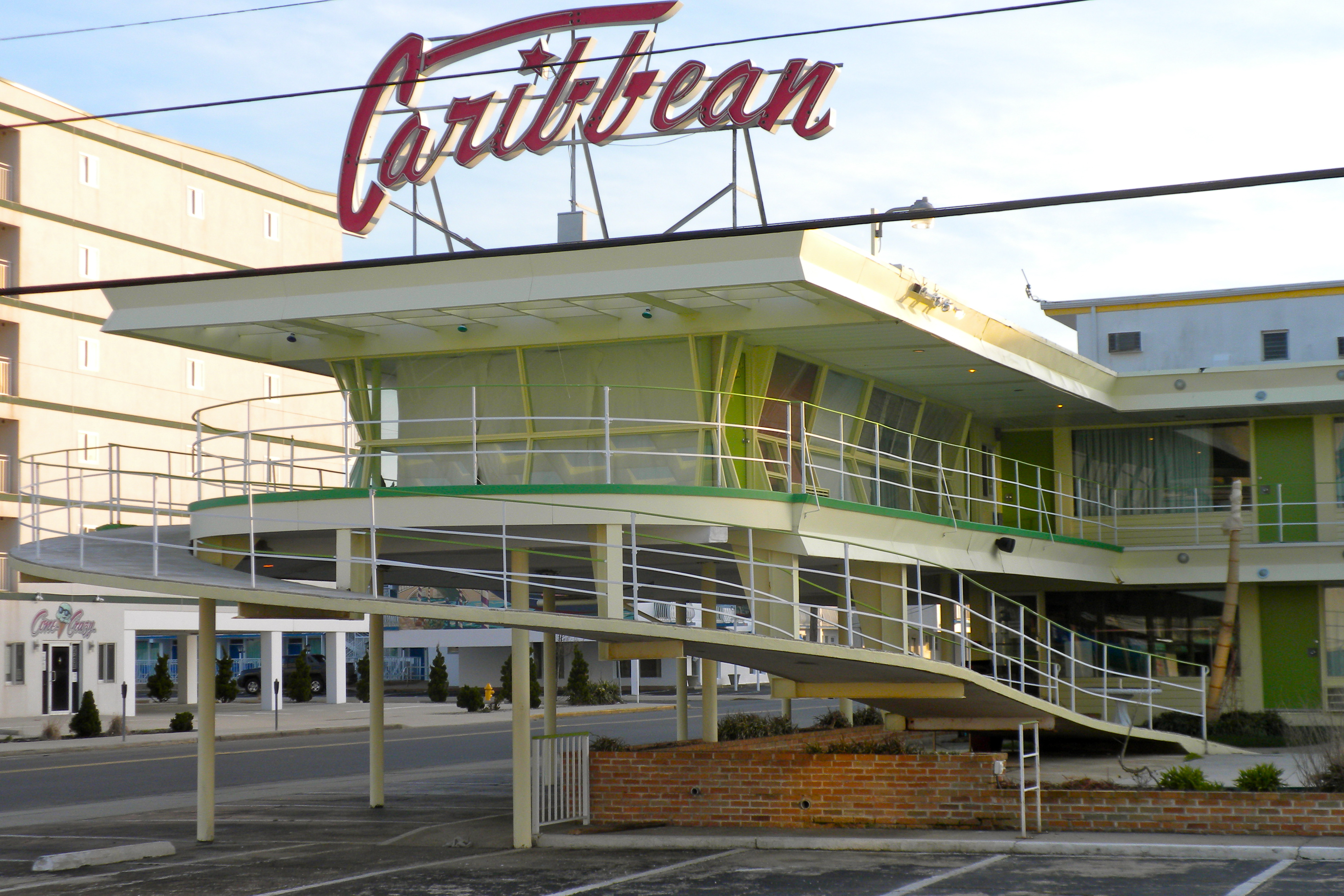
Caribbean Motel |
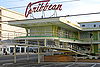 |
02005-08-24 August 24, 2005 |
5600 Ocean Ave.
38°58′45″N 74°49′32″W / 38.97917°N 74.82556°W / 38.97917; -74.82556 (Caribbean Motel) |
Wildwood Crest |
Built 1958 |
| 11 |
Chateau Bleu Motel |
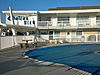 |
02004-03-25 March 25, 2004 |
911 Surf Ave.
39°0′5″N 74°47′42″W / 39.00139°N 74.795°W / 39.00139; -74.795 (Chateau Bleu Motel) |
North Wildwood |
|
| 12 |
Owen Coachman House |
 |
02005-09-09 September 9, 2005 |
1019 Batts Ln.
38°57′44″N 74°55′46″W / 38.96222°N 74.92944°W / 38.96222; -74.92944 (Coachman, Owen, House) |
Lower Township |
|
| 13 |
Cold Spring Grange Hall |
 |
01998-03-30 March 30, 1998 |
720 Seahore Rd.
38°58′39″N 74°54′48″W / 38.9775°N 74.91333°W / 38.9775; -74.91333 (Cold Spring Grange Hall) |
Lower Township |
|
| 14 |
Cold Spring Presbyterian Church |
 |
01991-06-14 June 14, 1991 |
780 Seashore Rd.
38°58′35″N 74°54′59″W / 38.97639°N 74.91639°W / 38.97639; -74.91639 (Cold Spring Presbyterian Church) |
Lower Township |
|
| 15 |
Dennisville Historic District |
 |
01987-11-24 November 24, 1987 |
Petersburg Rd., Main St., Church Rd., Hall Ave., Fidler and Academy Rds., and NH 47
Dennisville |
Dennis Township |
|
| 16 |
Joseph Falkinburg House |
 |
01994-10-03 October 3, 1994 |
922 Delsea Dr.
South Dennis
39°10′22″N 74°49′15″W / 39.17278°N 74.82083°W / 39.17278; -74.82083 (Falkinburg, Joseph, House) |
Dennis Township |
|
| 17 |
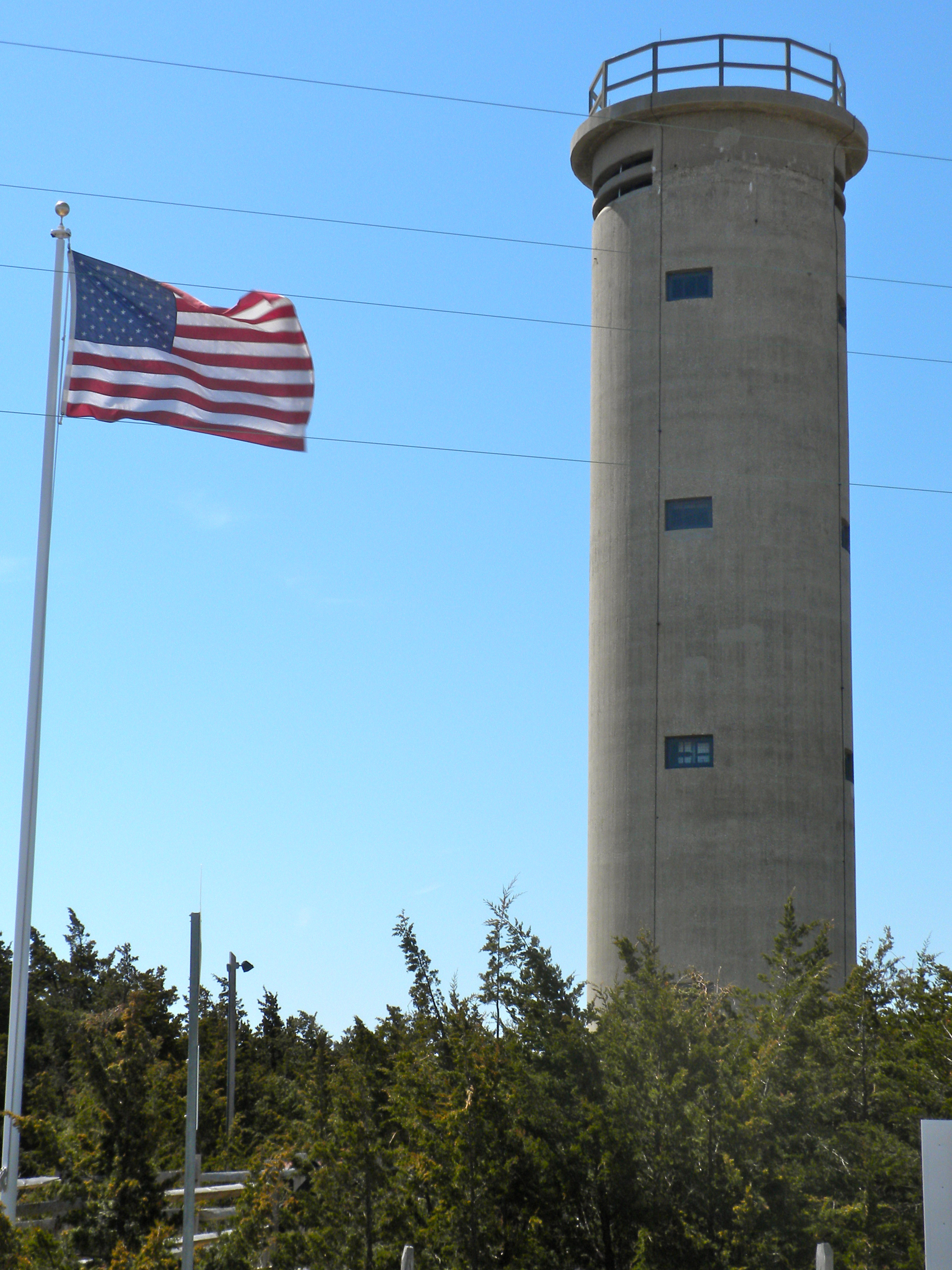
Fire Control Tower No. 23 |
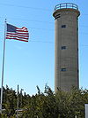 |
02003-11-17 November 17, 2003 |
Sunset Boulevard
38°56′36″N 74°58′3″W / 38.94333°N 74.9675°W / 38.94333; -74.9675 (Fire Control Tower No. 23) |
Lower Township |
|
| 18 |
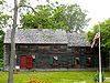
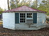
Fishing Creek Schoolhouse |
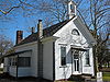 |
01980-03-06 March 6, 1980 |
2102 Bayshore Rd.
39°0′51″N 74°56′20″W / 39.01417°N 74.93889°W / 39.01417; -74.93889 (Fishing Creek Schoolhouse) |
Villas |
|
| 19 |
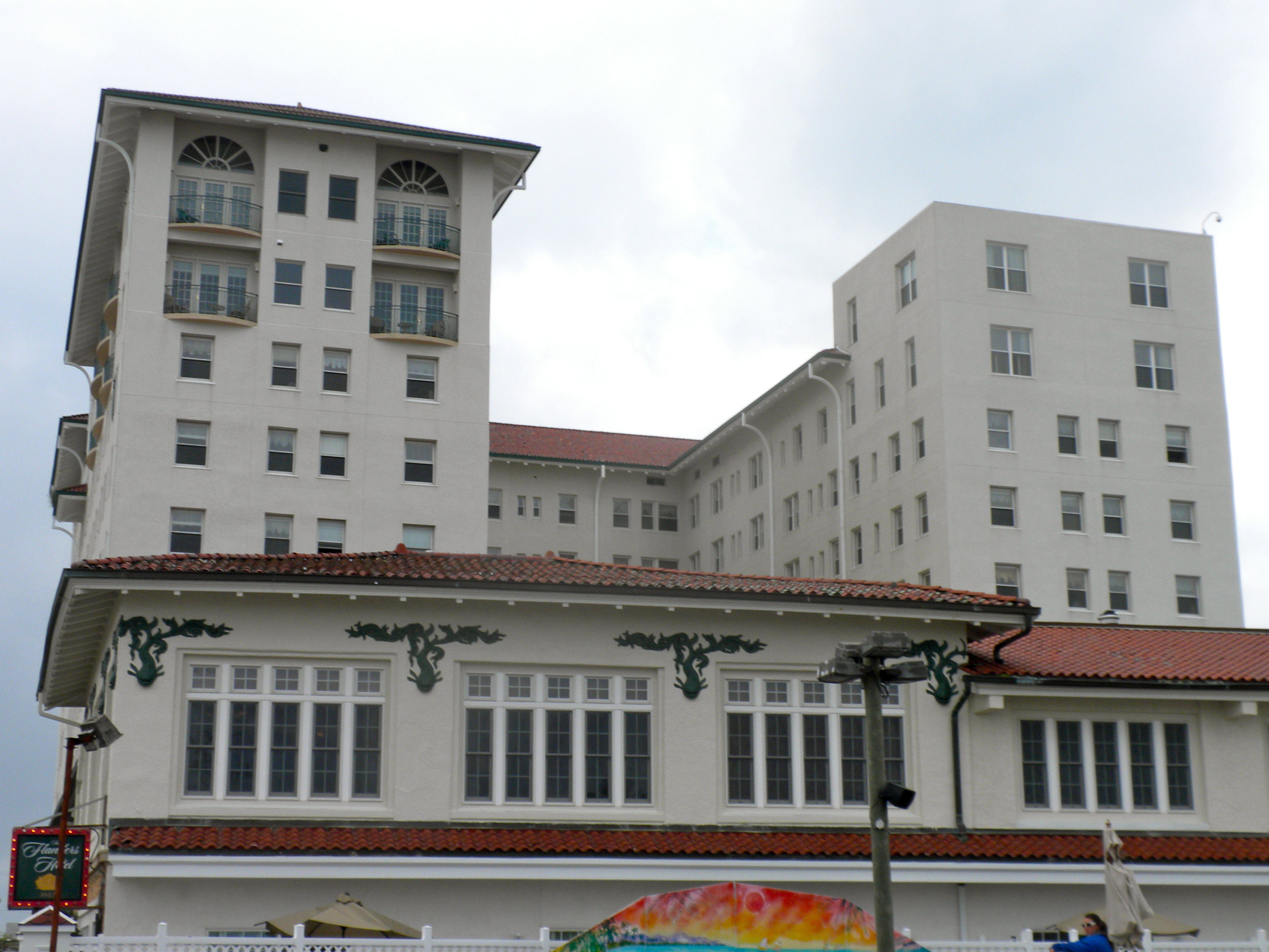
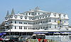
The Flanders Hotel |
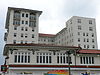 |
02009-11-20 November 20, 2009 |
719 E. 11th St.
39°16′28.98″N 74°34′36.45″W / 39.2747167°N 74.5767917°W / 39.2747167; -74.5767917 (Flanders Hotel, The) |
Ocean City |
New listing; refnum 09000939 |
| 20 |
John Wesley Gandy House |
 |
01999-11-12 November 12, 1999 |
26 Tyler Rd.
Greenfield
39°14′2″N 74°42′24″W / 39.23389°N 74.70667°W / 39.23389; -74.70667 (Gandy, John Wesley, House) |
Upper Township |
|
| 21 |
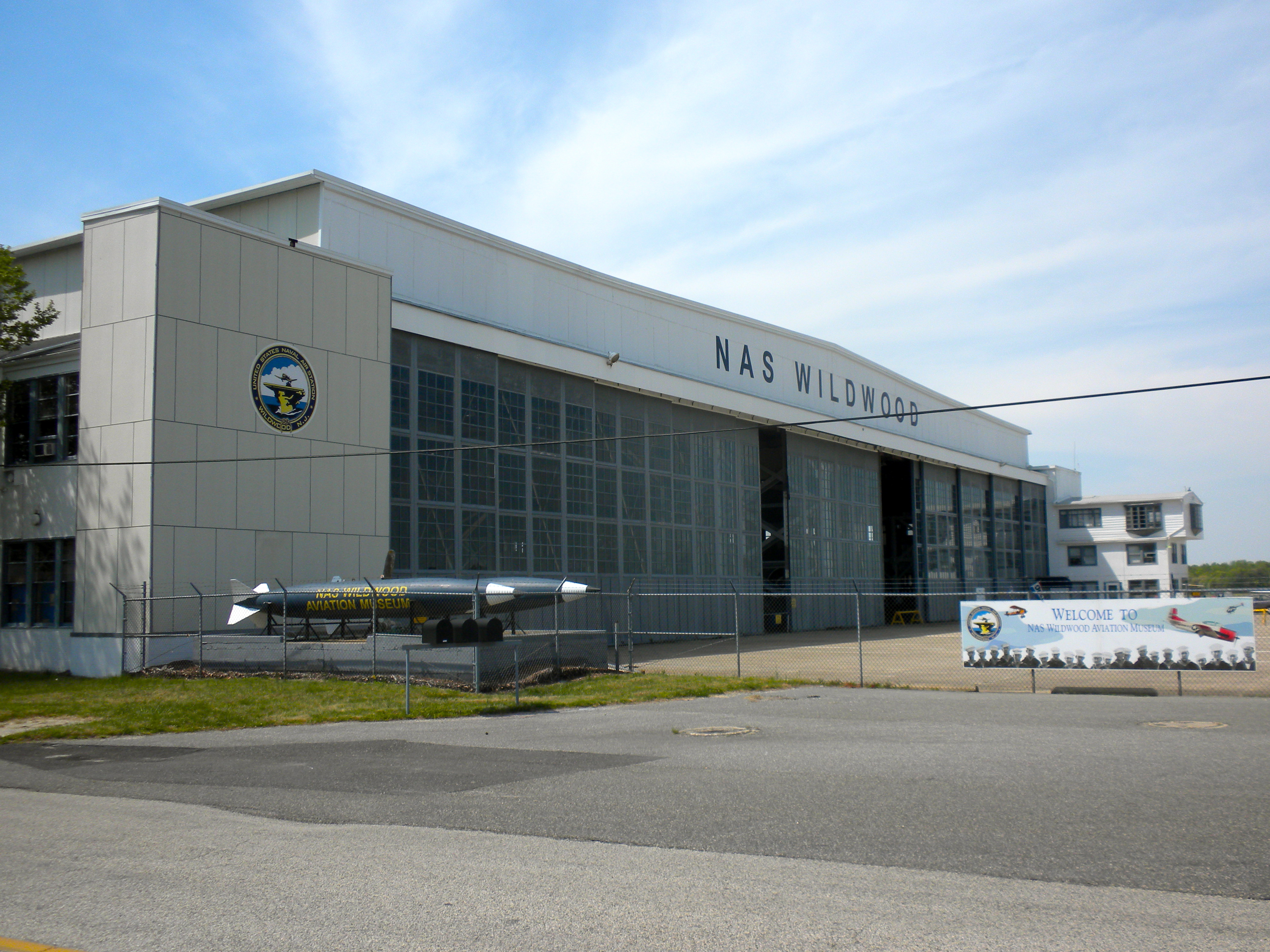
Hangar No. 1-United States Naval Air Station Wildwood |
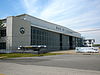 |
01997-08-21 August 21, 1997 |
Jct. of Forrestal and Langley Rds.
Cape May Airport
39°0′18″N 74°54′37″W / 39.005°N 74.91028°W / 39.005; -74.91028 (Hangar No. 1--United States Naval Air Station Wildwood) |
Lower Township |
|
| 22 |
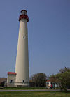
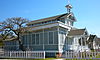
Hereford Lighthouse |
 |
01977-09-20 September 20, 1977 |
Central Ave.
39°0′24″N 74°47′32″W / 39.00667°N 74.79222°W / 39.00667; -74.79222 (Hereford Lighthouse) |
North Wildwood |
Built 1874 |
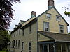
| 23 |
George Hildreth House |
 |
01999-07-28 July 28, 1999 |
731 Seashore Rd.
38°58′42″N 74°54′44″W / 38.97833°N 74.91222°W / 38.97833; -74.91222 (Hildreth, George, House) |
Lower Township |
|
| 24 |
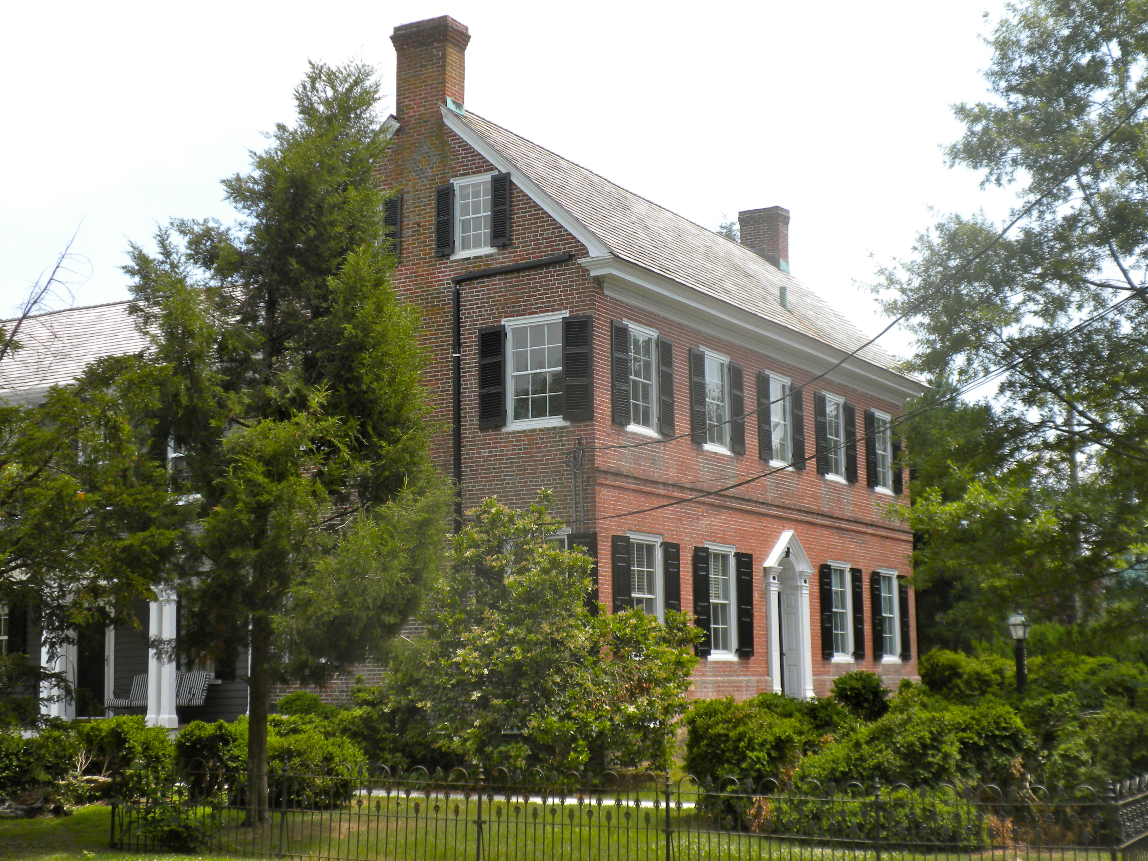
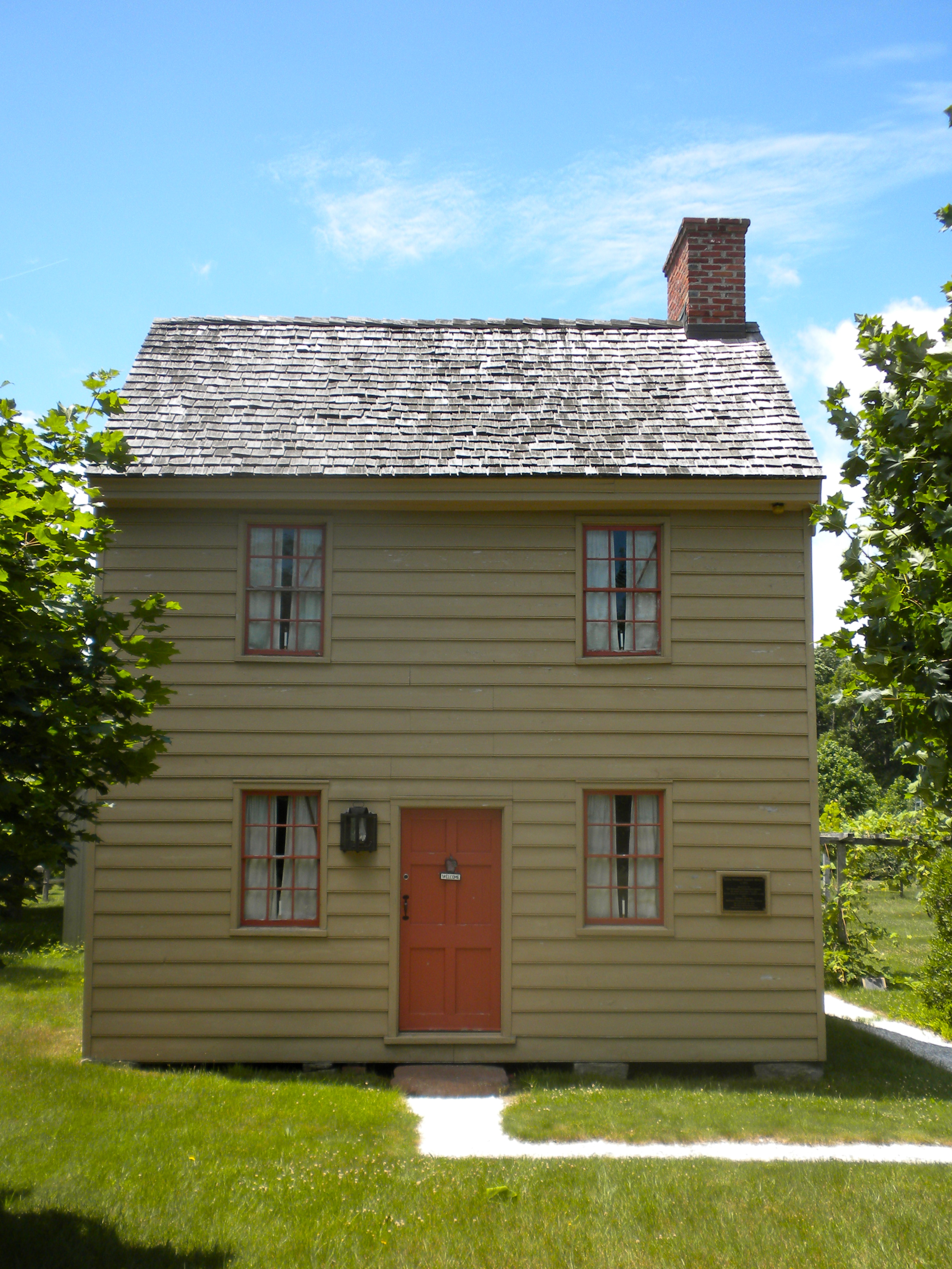
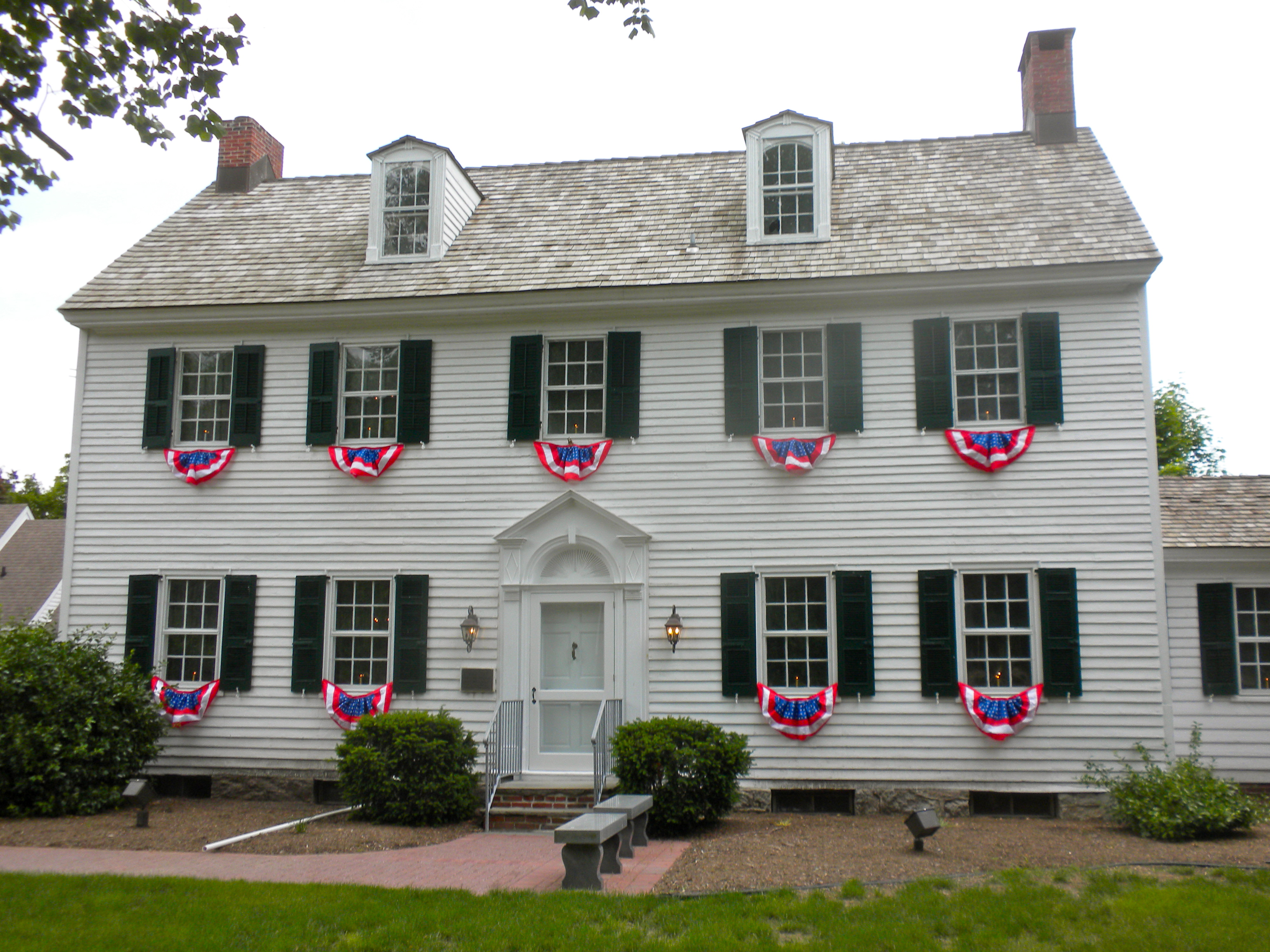
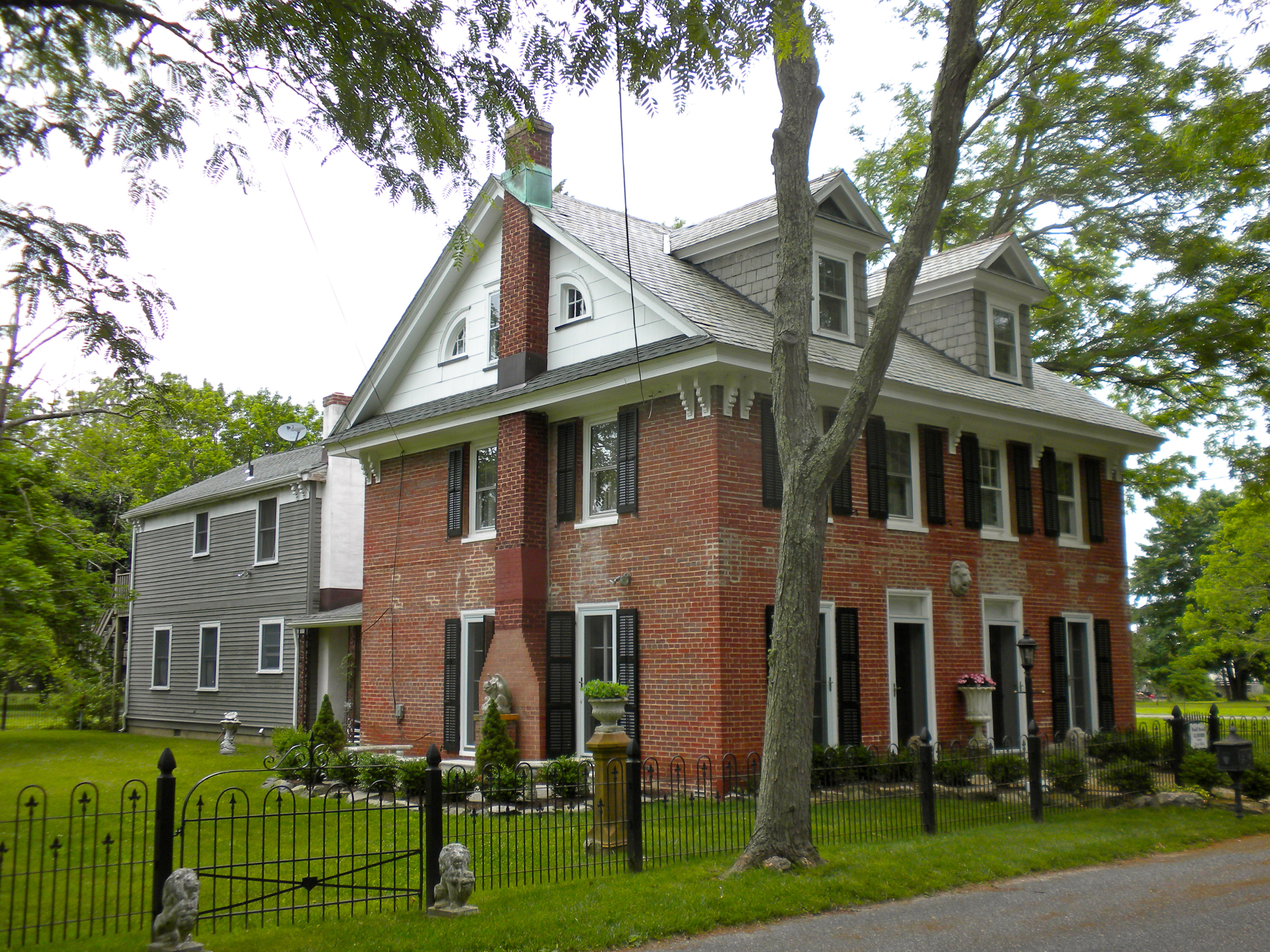
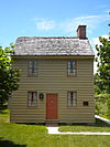
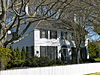
John Holmes House |
 |
01979-06-12 June 12, 1979 |
U.S. 9
39°5′46″N 74°48′48″W / 39.09611°N 74.81333°W / 39.09611; -74.81333 (Holmes, John, House) |
Cape May Court House |
|
| 25 |
Thomas Leaming House |
 |
01997-08-01 August 1, 1997 |
1845 US 9 N
39°8′30″N 74°46′1″W / 39.14167°N 74.76694°W / 39.14167; -74.76694 (Leaming, Thomas, House) |
Middle Township |
|
| 26 |
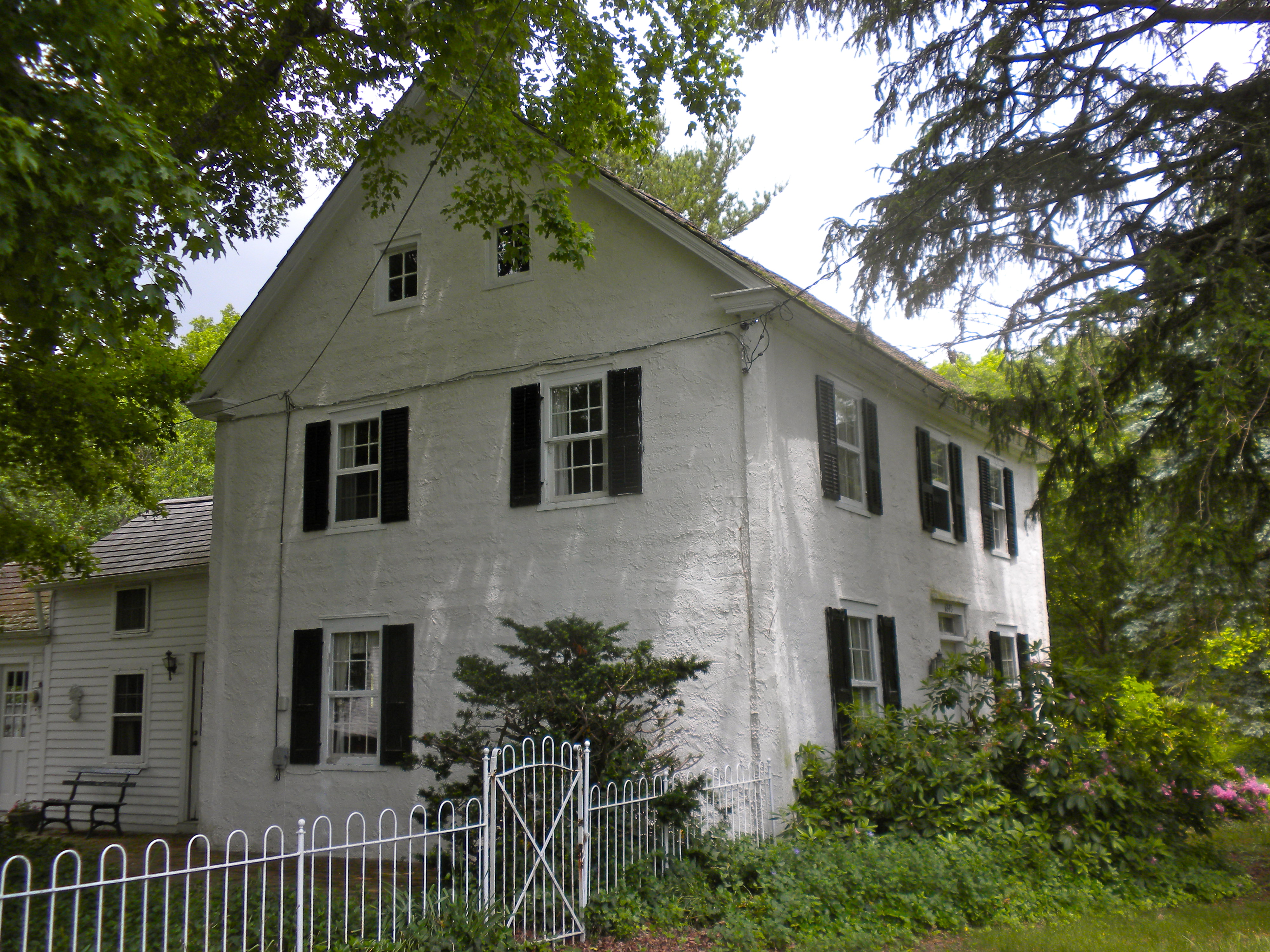
Henry Ludlam House |
 |
01993-08-12 August 12, 1993 |
1336 NJ 47
Dennisville
39°11′43″N 74°50′31″W / 39.19528°N 74.84194°W / 39.19528; -74.84194 (Ludlam, Henry, House) |
Dennis Township |
|
| 27 |
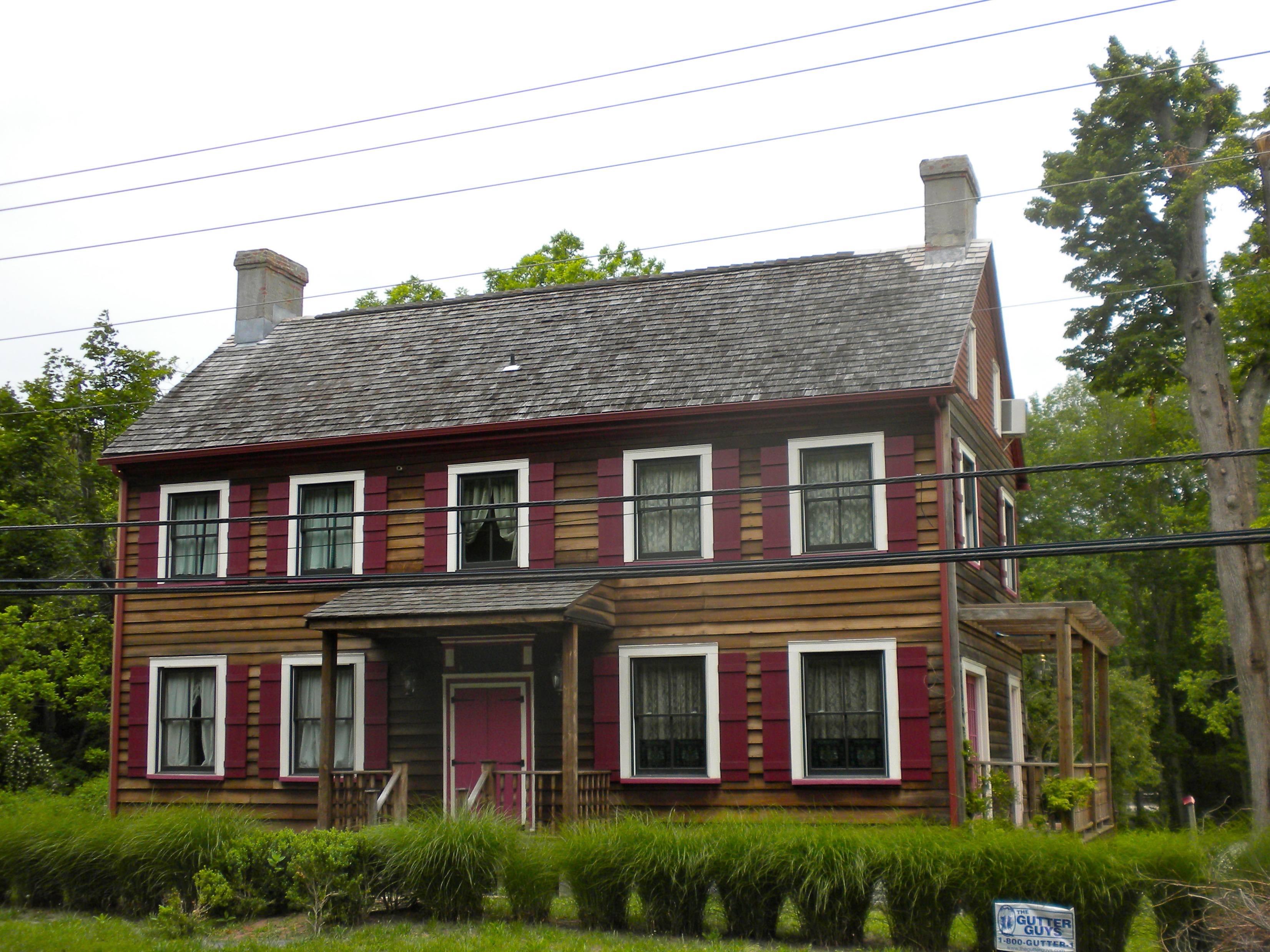
Thomas Ludlam Jr. House |
 |
02004-11-26 November 26, 2004 |
707 NJ47
39°10′9″N 74°49′31″W / 39.16917°N 74.82528°W / 39.16917; -74.82528 (Ludlam, Thomas Jr., House) |
Dennis Township |
|
| 28 |
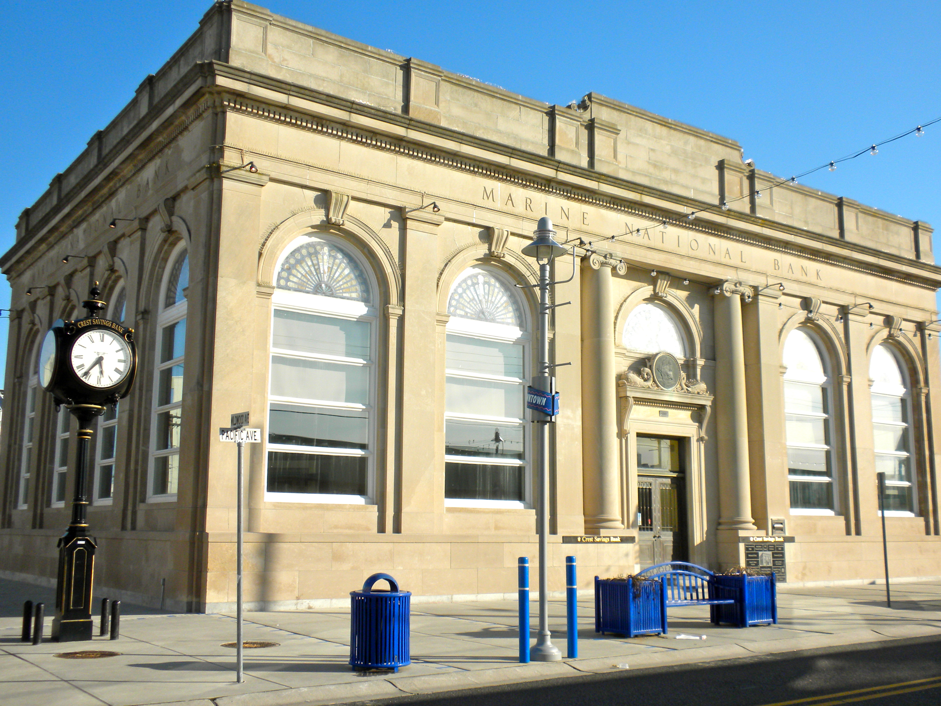
Marine National Bank |
 |
02000-12-20 December 20, 2000 |
3301 Pacific Ave.
38°59′24″N 74°48′47″W / 38.99°N 74.81306°W / 38.99; -74.81306 (Marine National Bank) |
Wildwood |
|
| 29 |
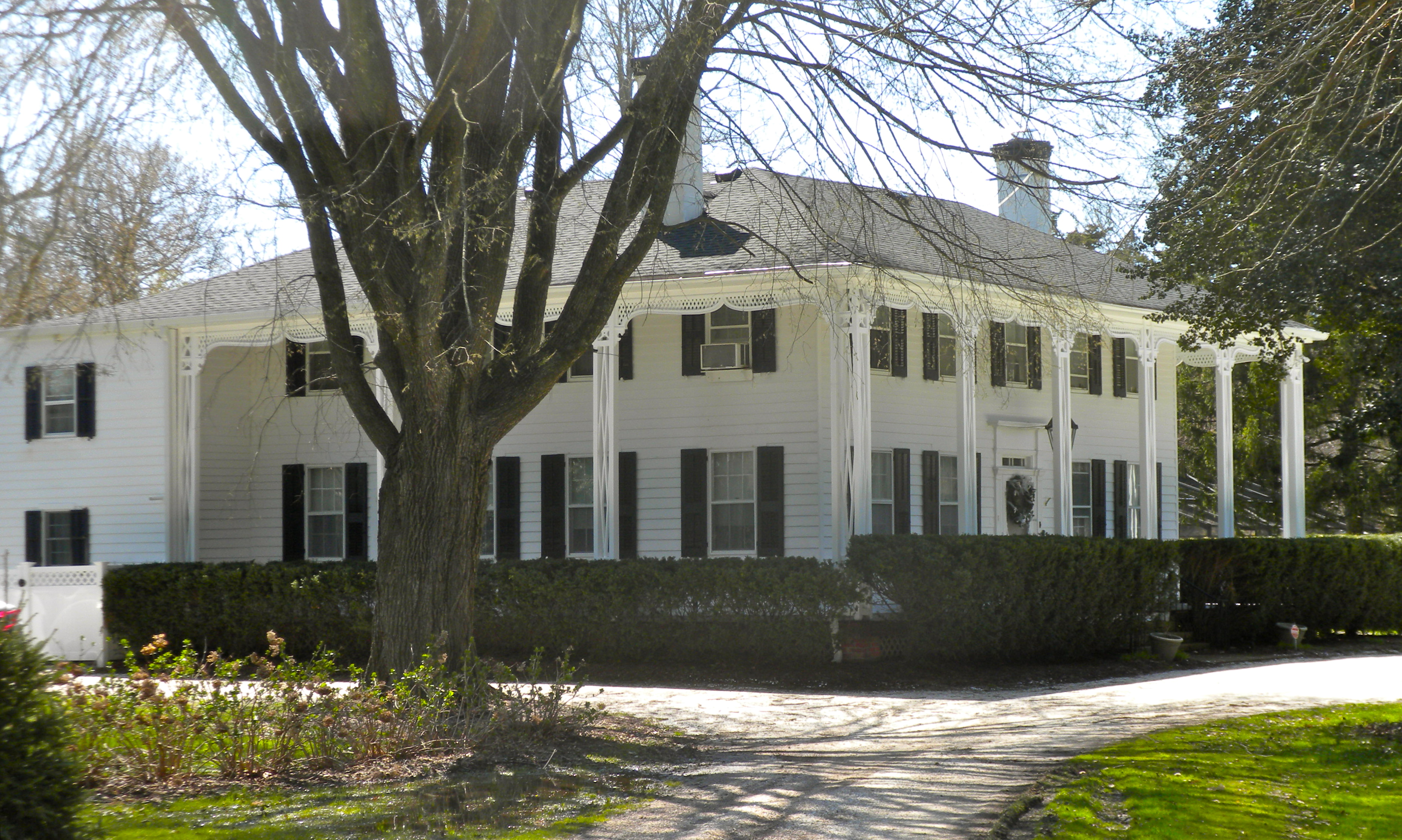
Marshallville Historic District |
 |
01989-11-28 November 28, 1989 |
Roughly Marshallville Rd. at Co. Rt. 557
39°17′53.88″N 74°46′41.67″W / 39.2983°N 74.7782417°W / 39.2983; -74.7782417 (Marshallville Historic District) |
Upper Township |
|
| 30 |
New Asbury Methodist Episcopal Meetinghouse |
 |
01980-09-17 September 17, 1980 |
Shore Rd.
39°8′25″N 74°46′10″W / 39.14028°N 74.76944°W / 39.14028; -74.76944 (New Asbury Methodist Episcopal Meetinghouse) |
Cape May Court House |
|
| 31 |
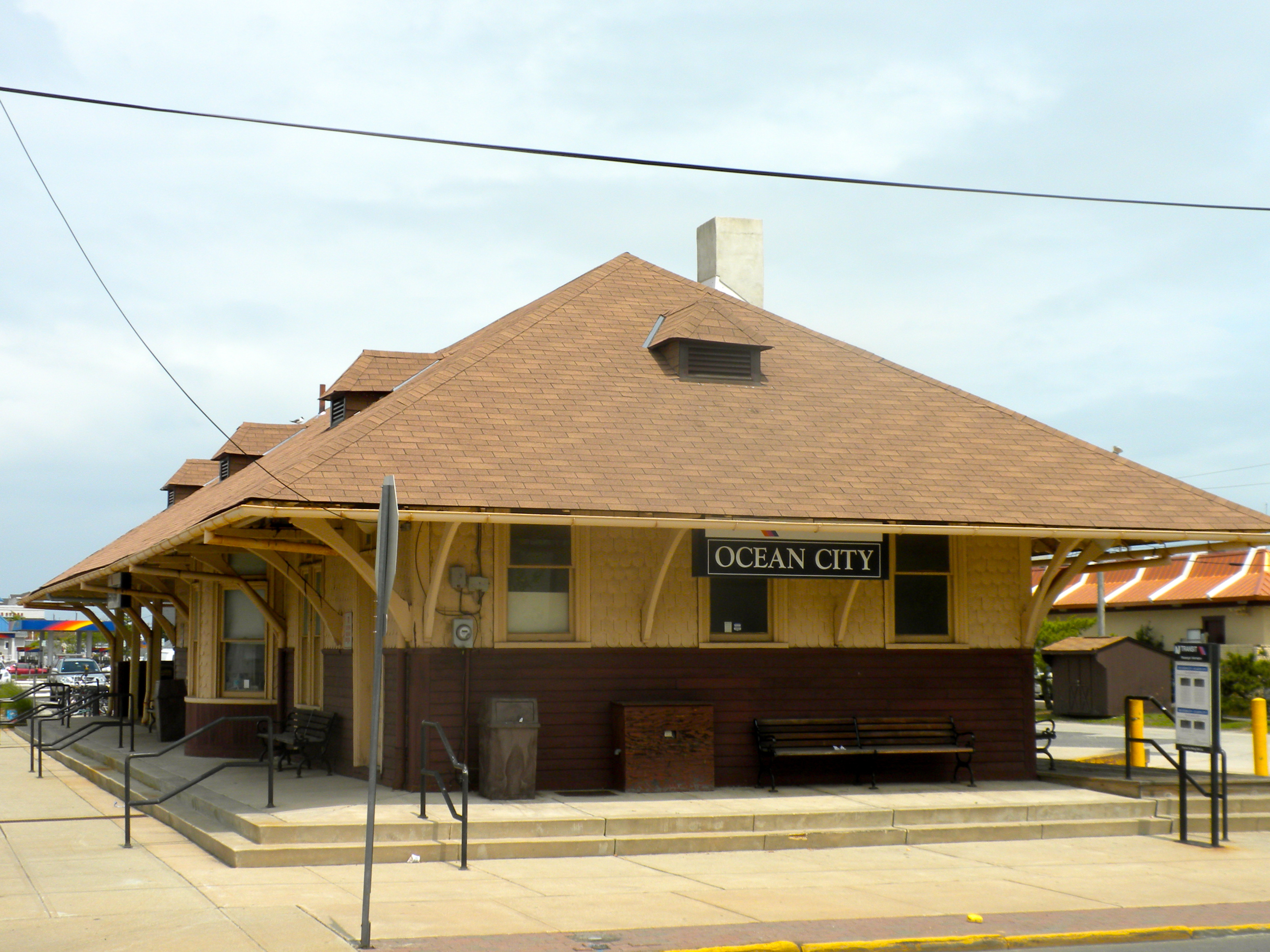
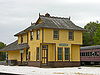
Ocean City 34th Street Station |
 |
01984-06-22 June 22, 1984 |
34th St.
39°15′6″N 74°36′49″W / 39.25167°N 74.61361°W / 39.25167; -74.61361 (Ocean City 34th Street Station) |
Ocean City |
Demolished.[5] |
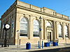
| 32 |
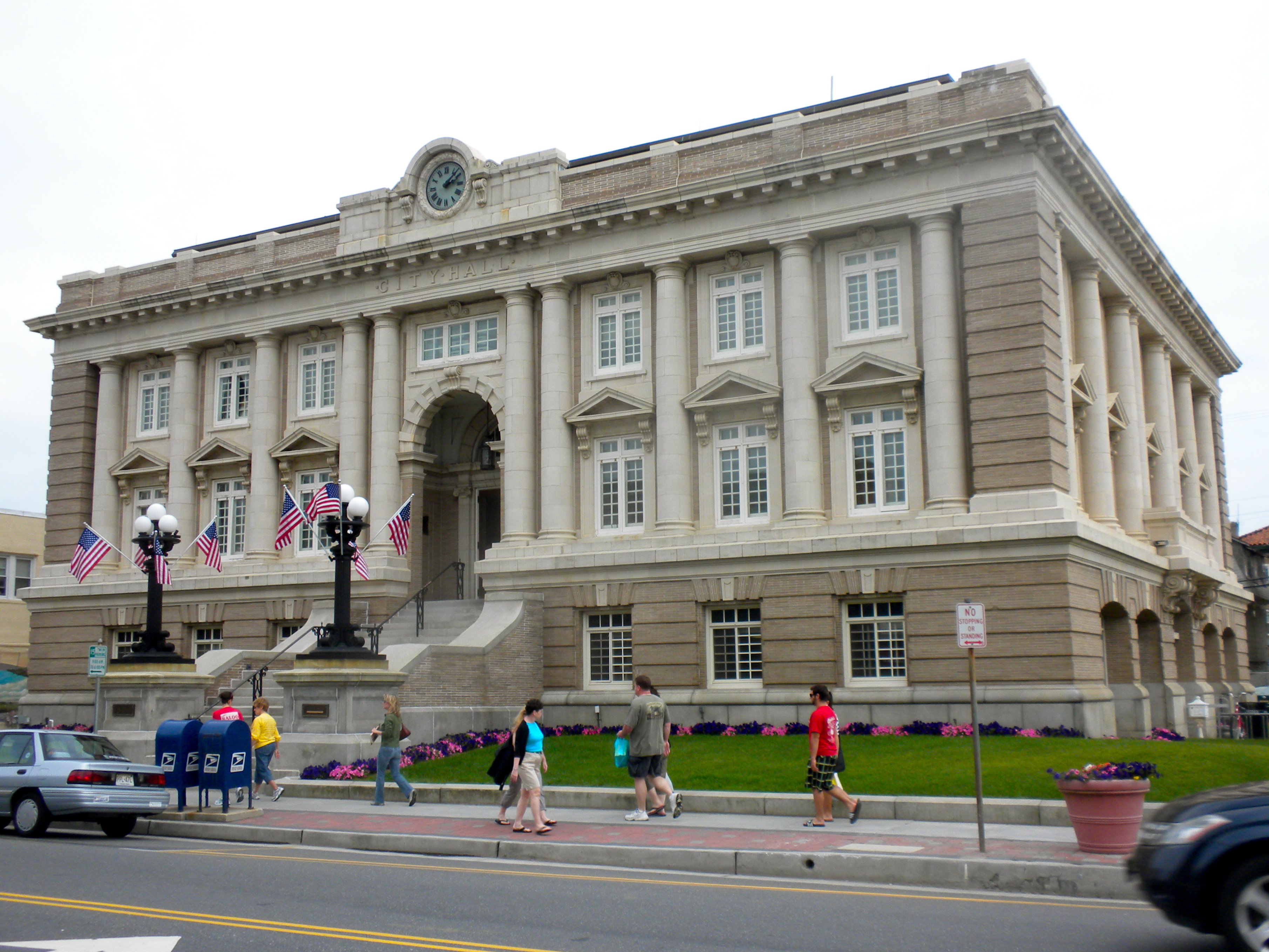
Ocean City City Hall |
 |
01997-06-13 June 13, 1997 |
Jct. of 9th St. and Asbury Ave.
39°16′43″N 74°34′34″W / 39.27861°N 74.57611°W / 39.27861; -74.57611 (Ocean City City Hall) |
Ocean City |
|
| 33 |
Ocean City Residential Historic District |
 |
02003-03-20 March 20, 2003 |
Roughly bounded by 3rd and 8th Sts. and Central and Ocean Aves.,
39°16′52″N 74°34′14″W / 39.28111°N 74.57056°W / 39.28111; -74.57056 (Ocean City Residential Historic District) |
Ocean City |
|
| 34 |
Ocean City Tenth Street Station |
 |
01984-06-22 June 22, 1984 |
Between 9th and 10th Sts.
39°16′44″N 74°34′43″W / 39.27889°N 74.57861°W / 39.27889; -74.57861 (Ocean City Tenth Street Station) |
Ocean City |
|
| 35 |
Octagonal Poultry House |
 |
02008-03-14 March 14, 2008 |
720 US 9 (Lower Township)
38°58′46″N 74°54′45″W / 38.97944°N 74.9125°W / 38.97944; -74.9125 (Octagonal Poultry House) |
Cold Spring |
|
| 36 |
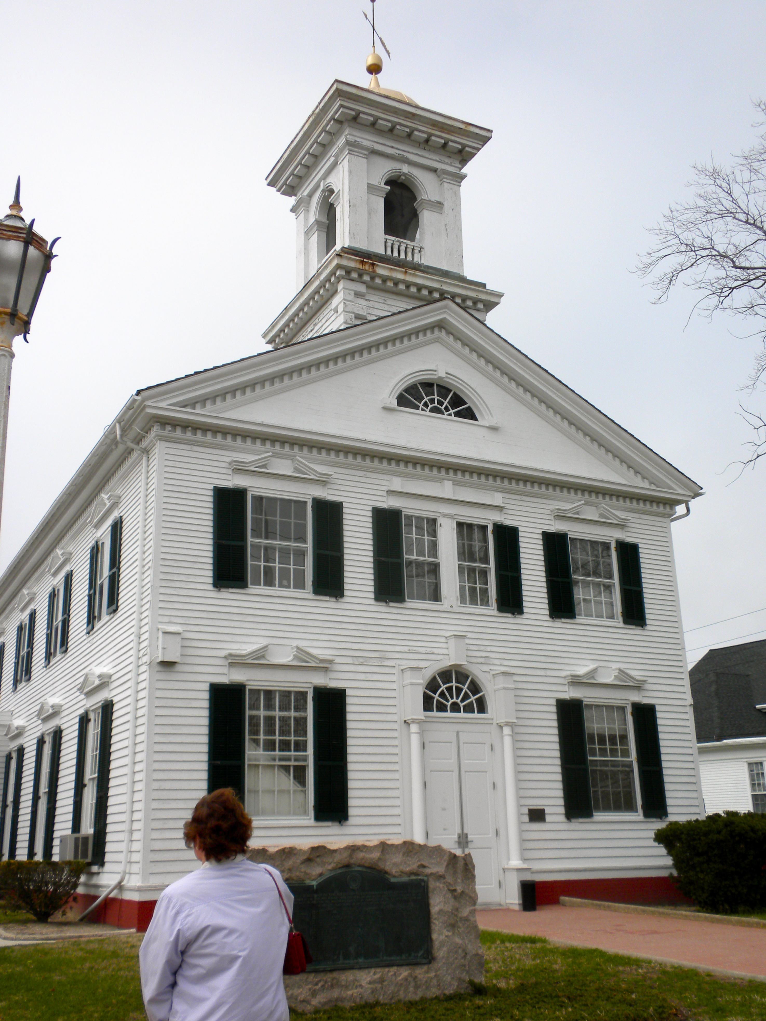
Old Cape May County Courthouse Building |
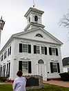 |
01981-12-22 December 22, 1981 |
N. Main St.
39°5′2″N 74°49′26″W / 39.08389°N 74.82389°W / 39.08389; -74.82389 (Old Cape May County Courthouse Building) |
Cape May Court House |
|
| 37 |
Jonathan Pyne House |
 |
01997-02-14 February 14, 1997 |
609 Sea Grove Ave.
38°56′18″N 74°57′35″W / 38.93833°N 74.95972°W / 38.93833; -74.95972 (Pyne, Jonathan, House) |
Lower Township |
|
| 38 |
Reeves-Iszard-Godfey House |
|
02005-03-09 March 9, 2005 |
3097 Shore Rd.
39°11′49″N 74°42′42″W / 39.19694°N 74.71167°W / 39.19694; -74.71167 (Reeves--Iszard--Godfey House) |
Upper Township |
|
| 39 |
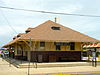
Rio Grande Station |
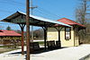 |
02007-02-13 February 13, 2007 |
720 NJ 9
38°58′31″N 74°54′41″W / 38.97528°N 74.91139°W / 38.97528; -74.91139 (Rio Grande Station) |
Lower Township |
|
| 40 |
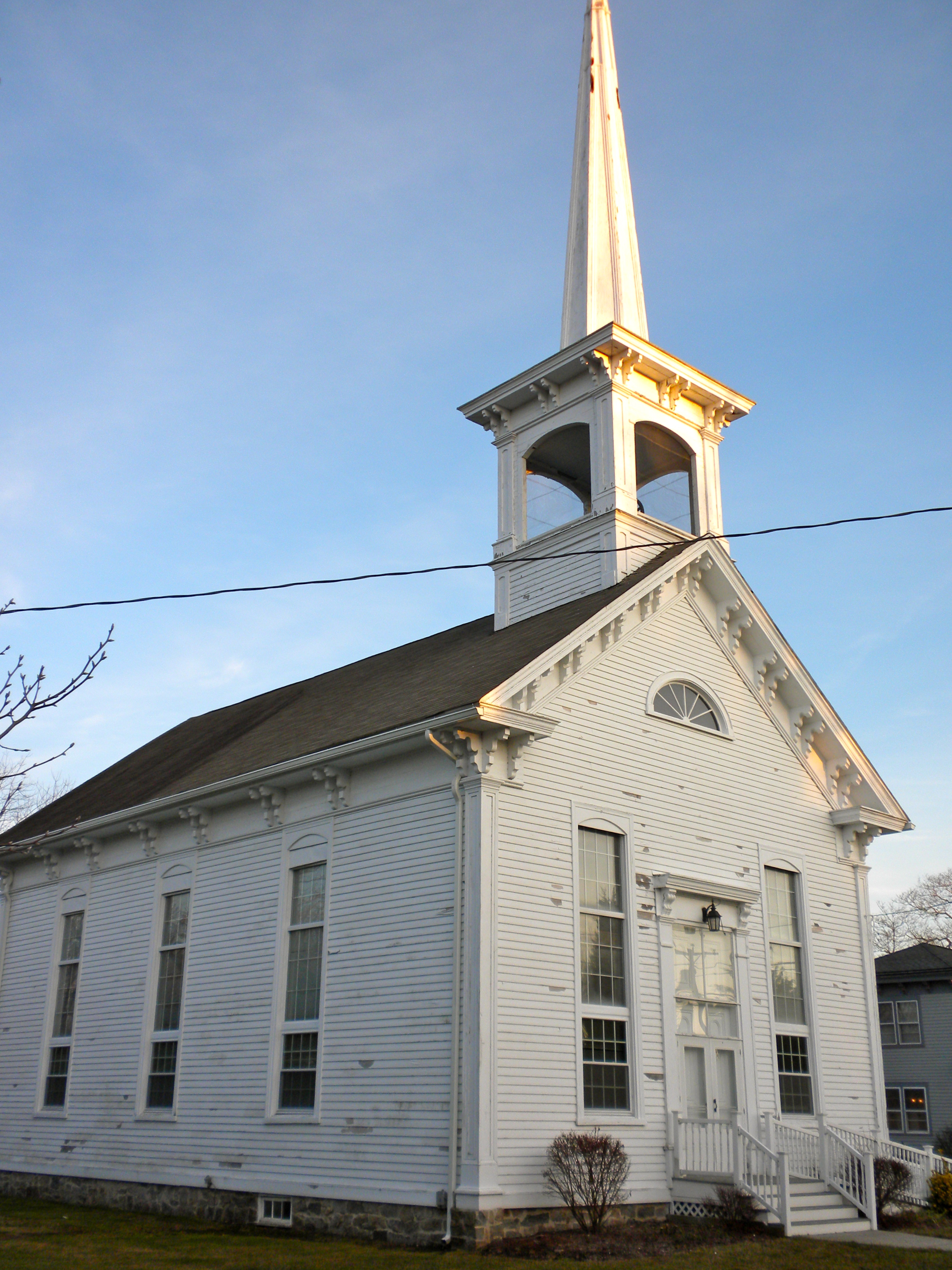
Saint Peter's-By-The-Sea Episcopal Church |
 |
01995-08-03 August 3, 1995 |
Jct. of Ocean Ave. and Lake Dr.
38°56′3″N 74°58′0″W / 38.93417°N 74.966667°W / 38.93417; -74.966667 (Saint Peter's-By-The-Sea Episcopal Church) |
Cape May Point |
|
| 41 |
South Tuckahoe Historic District |
 |
01997-03-07 March 7, 1997 |
Roughly, along NJ 557 and NJ 50 from the Tuckahoe River to Kendall Ln., Upper Township
39°17′20″N 74°45′10″W / 39.28889°N 74.75278°W / 39.28889; -74.75278 (South Tuckahoe Historic District) |
Tuckahoe |
|
| 42 |
TBM-3E "Avenger" Torpedo Bomber Warplane |
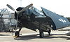 |
02003-02-11 February 11, 2003 |
500 Forrestal Rd.
Cape May Airport
39°0′17″N 74°54′36″W / 39.00472°N 74.91°W / 39.00472; -74.91 (TBM-3E "Avenger" Torpedo Bomber Warplane) |
Lower Township |
|
| 43 |
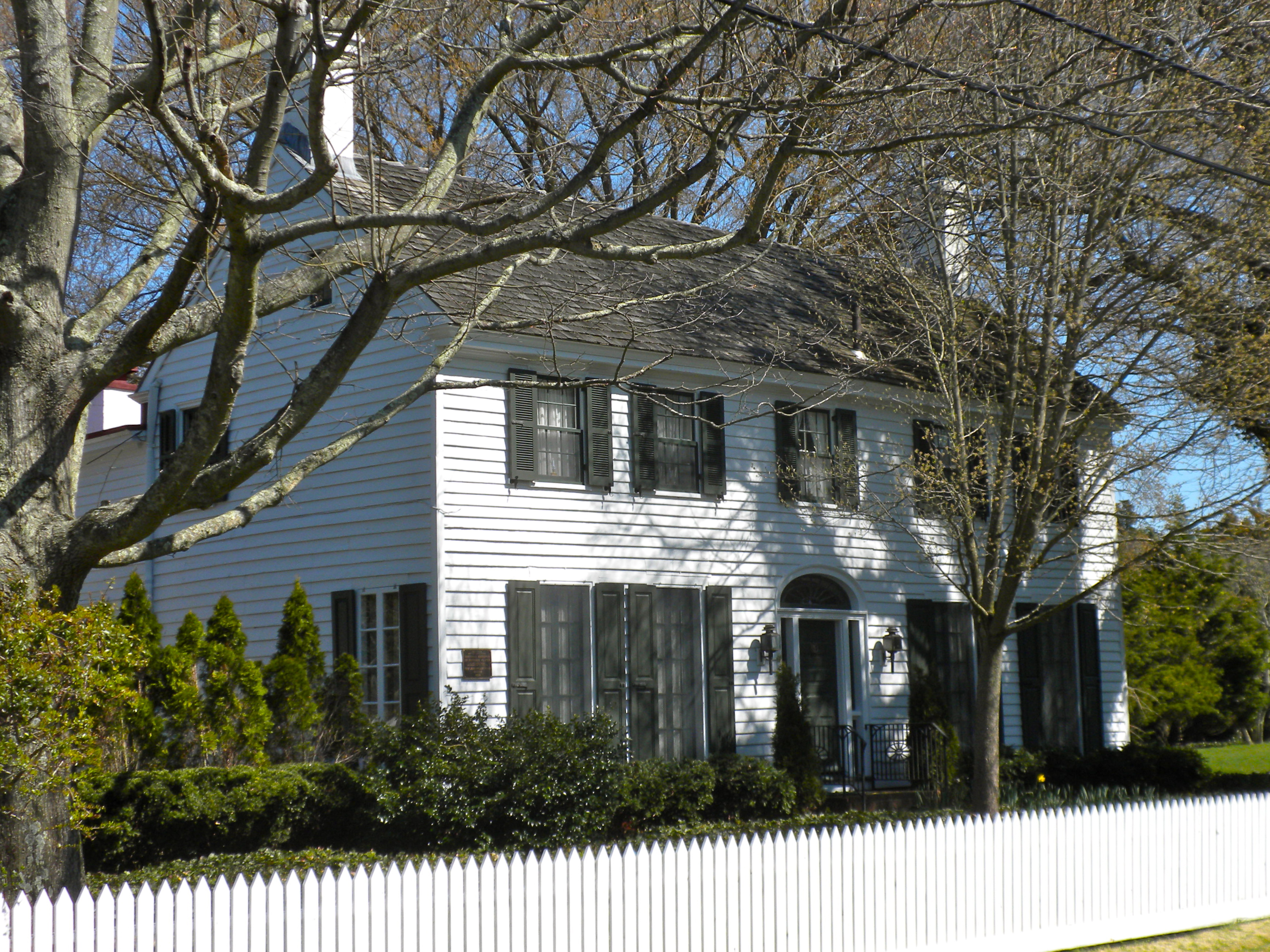
William S. Townsend House |
 |
01984-04-05 April 5, 1984 |
96 Delsea Dr.
Dennisville
39°11′35″N 74°49′56″W / 39.19306°N 74.83222°W / 39.19306; -74.83222 (Townsend, William S., House) |
Dennis Township |
|
| 44 |
Tuckahoe Station |
 |
01984-06-22 June 22, 1984 |
Railroad Ave. and Mill Rd.
39°17′28″N 74°45′39″W / 39.29111°N 74.76083°W / 39.29111; -74.76083 (Tuckahoe Station) |
Tuckahoe |
|
| 45 |
U.S. Life-Saving Station No. 35 |
 |
02008-11-08 November 8, 2008 |
11617 2nd Ave.
39°2′21.58″N 74°46′8.36″W / 39.0393278°N 74.7689889°W / 39.0393278; -74.7689889 (U.S. Life-Saving Station No. 35) |
Stone Harbor |
|
| 46 |
Whilldin-Miller House |
 |
02003-02-12 February 12, 2003 |
416 S. Broadway
38°56′4″N 74°55′53″W / 38.93444°N 74.93139°W / 38.93444; -74.93139 (Whilldin--Miller House) |
West Cape May |
|
| 47 |
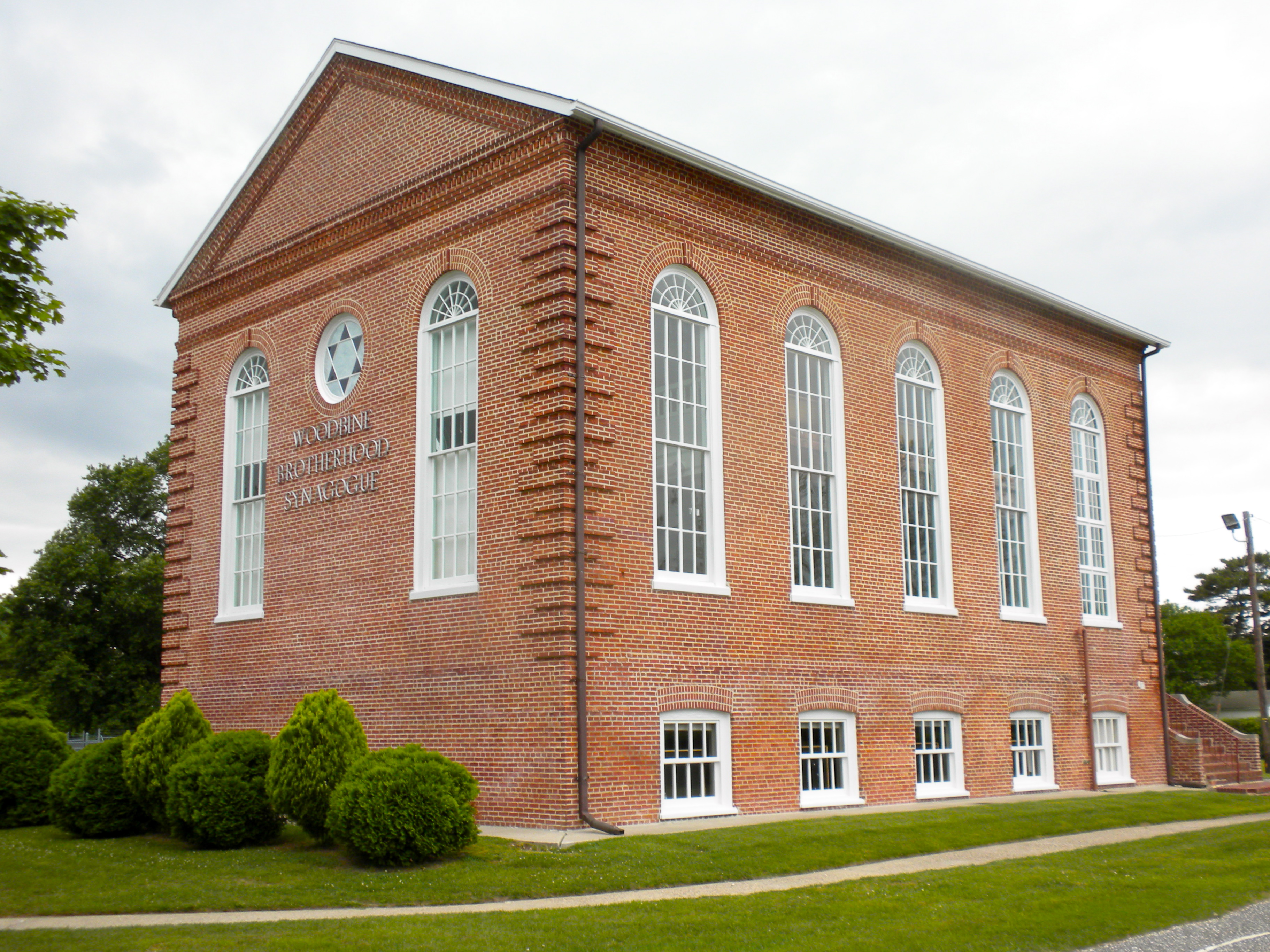
Woodbine Brotherhood Synagogue |
 |
01980-09-17 September 17, 1980 |
612 Washington Ave.
39°14′21″N 74°49′8″W / 39.23917°N 74.81889°W / 39.23917; -74.81889 (Woodbine Brotherhood Synagogue) |
Woodbine |
|
 Category:National Register of Historic Places •
  Portal:National Register of Historic Places
 State of New Jersey