- National Register of Historic Places listings in Mercer County, New Jersey
-
List of the National Register of Historic Places listings in Mercer County, New Jersey
Contents: Counties in New Jersey Atlantic - Bergen - Burlington - Camden - Cape May - Cumberland - Essex - Gloucester - Hudson - Hunterdon - Mercer - Middlesex - Monmouth - Morris - Ocean - Passaic - Salem - Somerset - Sussex - Union - Warren This is intended to be a complete list of properties and districts listed on the National Register of Historic Places in Mercer County, New Jersey. The locations of National Register properties and districts (at least for all showing latitude and longitude coordinates below) may be seen in a Google map by clicking on "Map of all coordinates".[1]
-
- This National Park Service list is complete through NPS recent listings posted November 10, 2011.[2]
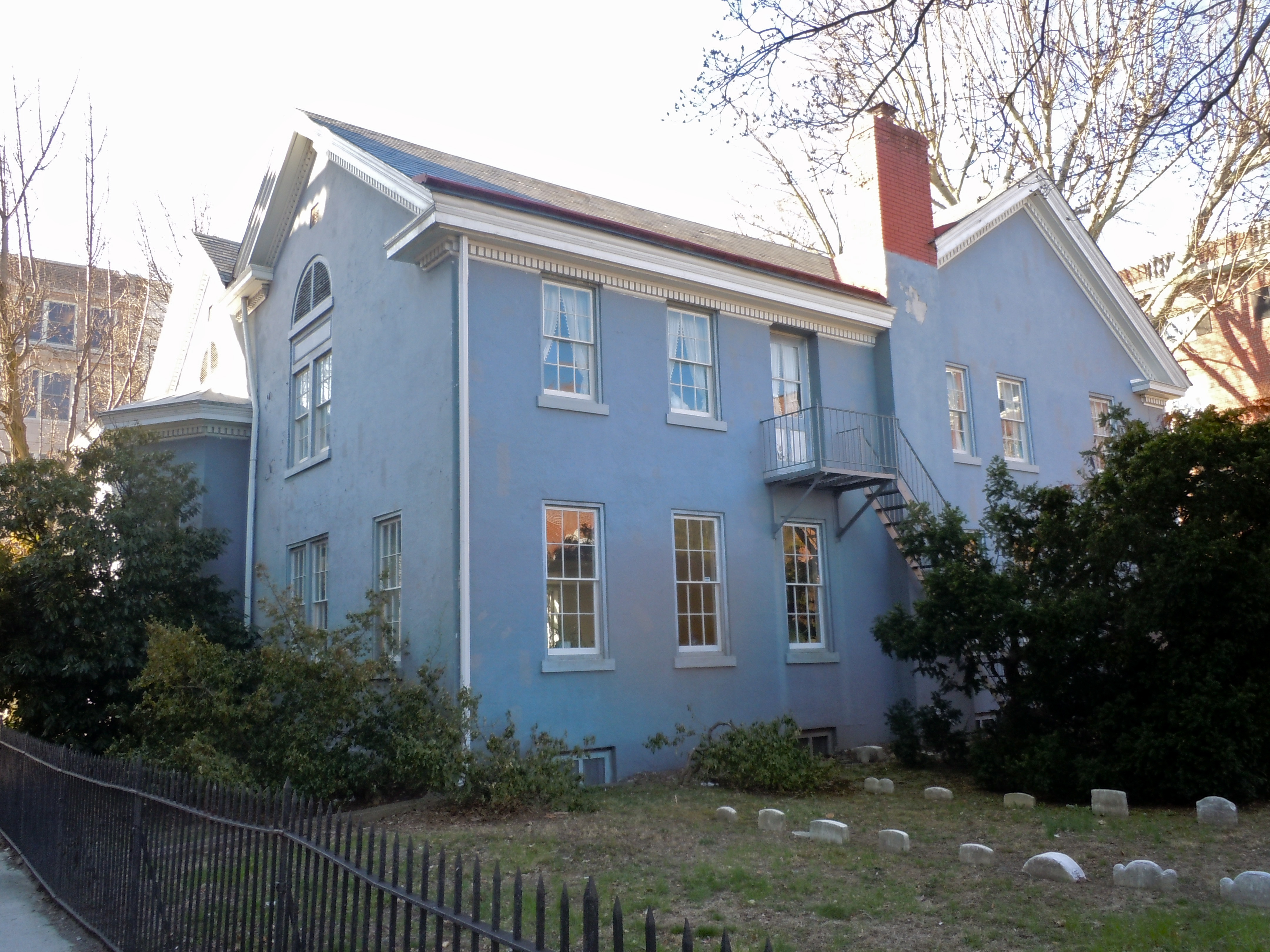
[3] Site name[4] Image Date listed Location[1] City or Town Summary 1 Abbott Farm Archeological Site December 8, 1976 Address Restricted Trenton 2 John Abbott II House 
June 18, 1976 2200 Kuser Rd.
40°12′14″N 74°40′51″W / 40.20389°N 74.68083°WTrenton 3 Abbott-Decou House July 1, 1976 58 Soloff Dr.
40°11′8″N 74°43′11″W / 40.18556°N 74.71972°WTrenton 4 Adams and Sickles Building 
January 31, 1980 1 W. End Ave.
40°13′36″N 74°46′45″W / 40.22667°N 74.77917°WTrenton 5 Anderson-Capner House 
April 3, 1973 700 Trumbull Ave.
40°14′20″N 74°44′7″W / 40.23889°N 74.73528°WLawrence 6 Archeological Site No. 1-18th Century Vessel (28ME196) August 14, 1986 Address Restricted Trenton 7 Baker-Brearley House 
August 31, 1979 E of Lawrenceville on Meadow Rd
40°17′32″N 74°42′6″W / 40.29222°N 74.70167°WLawrenceville 8 Bellevue Avenue Colored School 
January 2, 1997 81 Bellevue Ave.
40°13′32″N 74°46′17″W / 40.22556°N 74.77139°WTrenton 9 Berkeley Square Historic District 
November 20, 1980 Roughly bounded by W. State St., Parkside, Riverside, and Overbrook Aves.
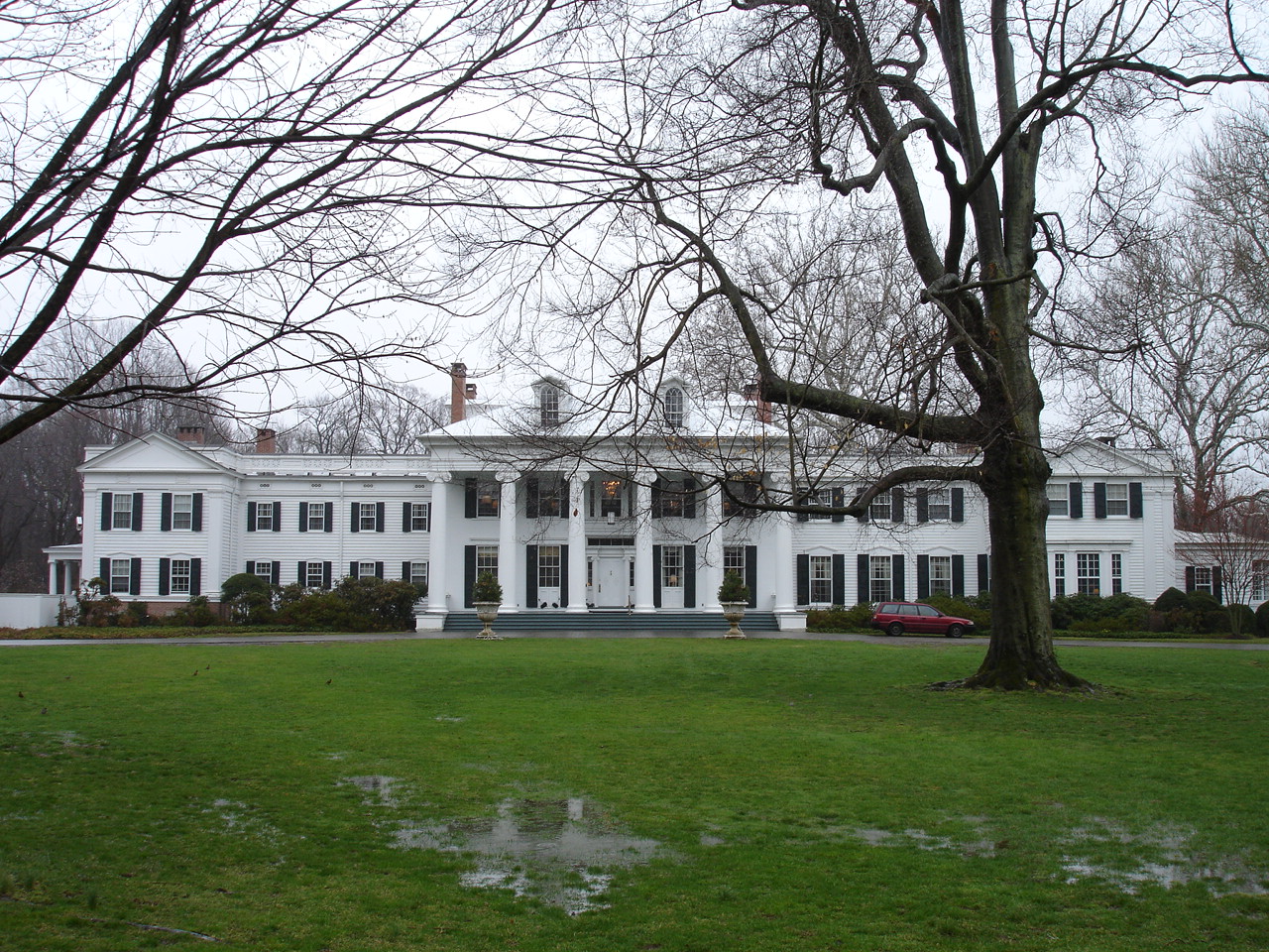
40°13′49″N 74°47′23″W / 40.23028°N 74.78972°WTrenton 10 Bow Hill 
January 25, 1973 Jeremiah Ave. off Lalor St.
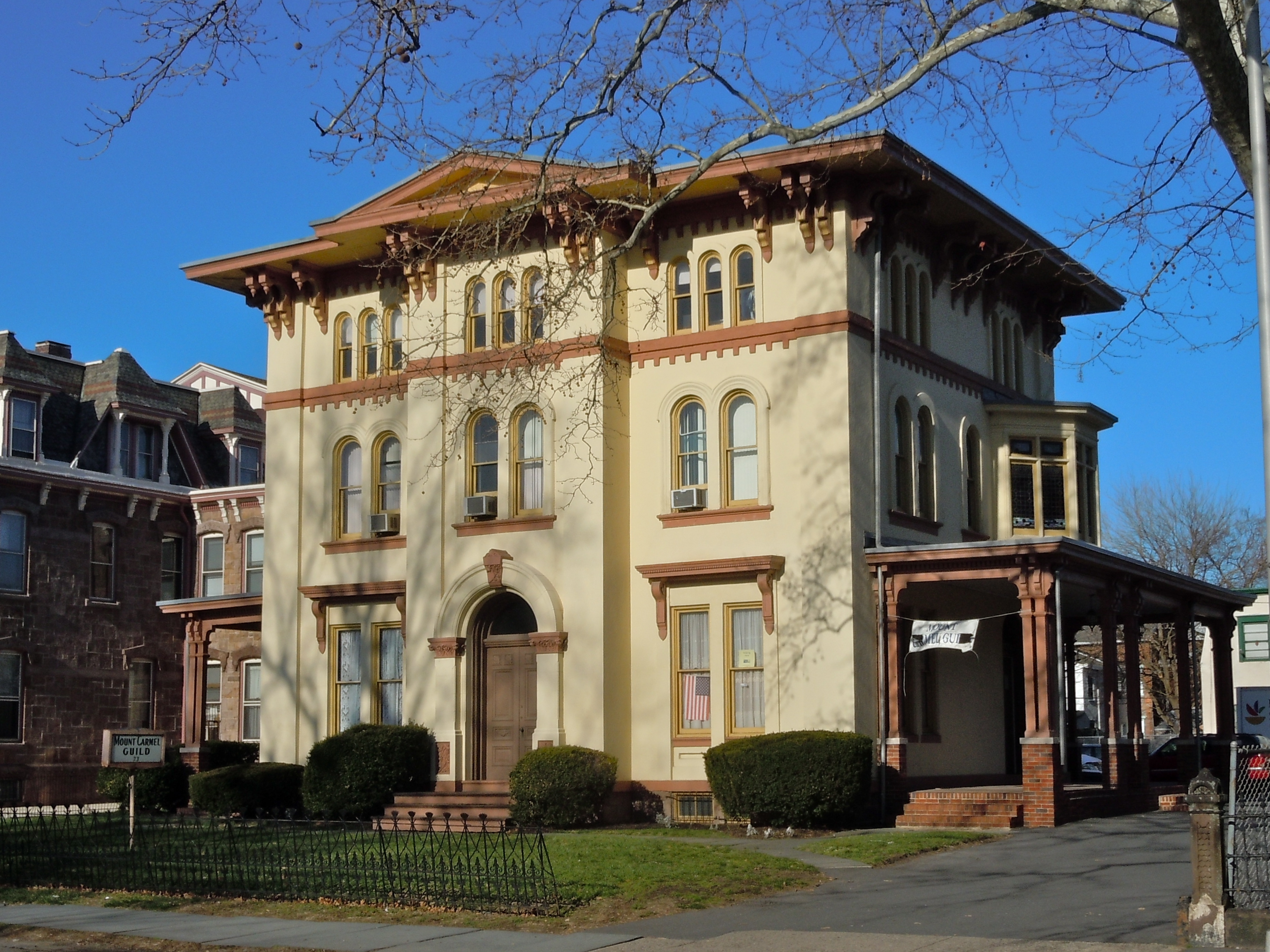
40°11′32″N 74°44′39″W / 40.19222°N 74.74417°WTrenton 11 Charles Brearley House 
April 14, 1995 73 N. Clinton Ave.
40°13′23″N 74°45′18″W / 40.22306°N 74.755°WTrenton 12 Broad Street National Bank 
January 17, 2008 143 E. State St.
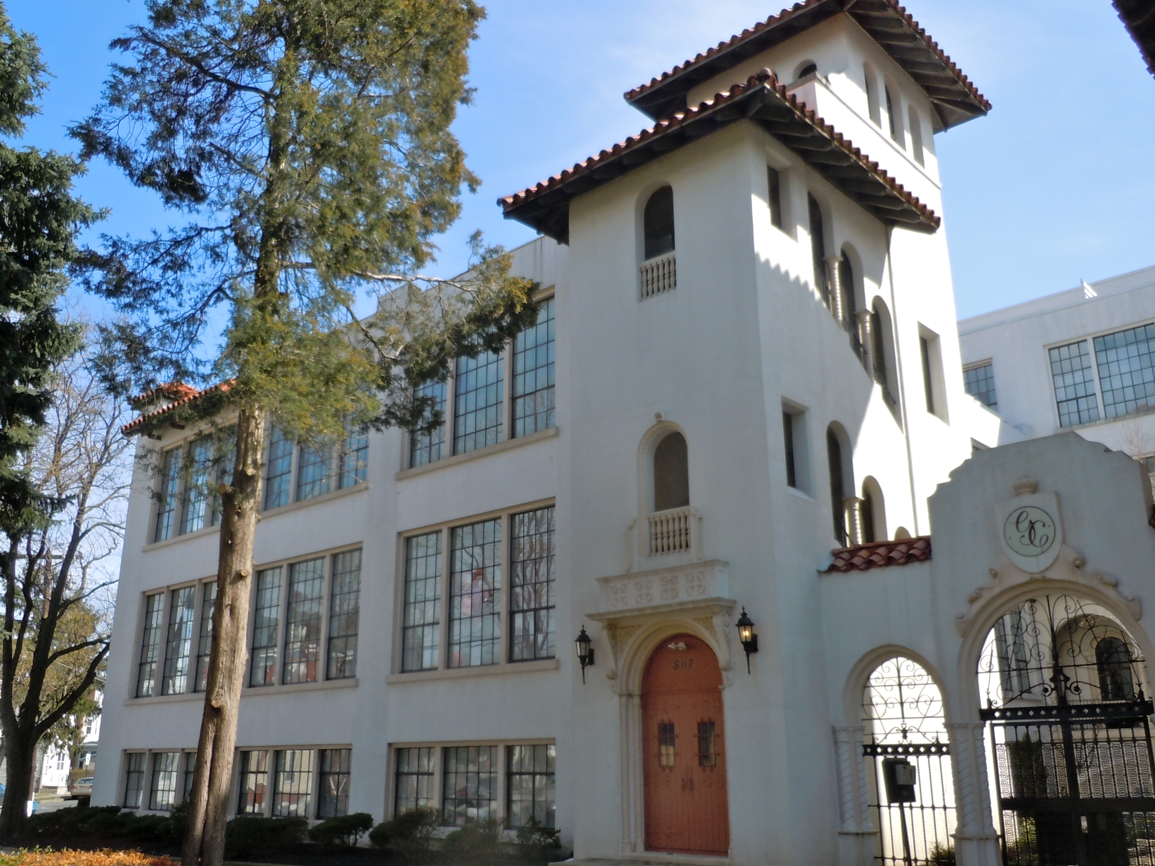
40°13′18″N 74°45′44″W / 40.22167°N 74.76222°WTrenton 13 Clay, Henry and Bock and Company Cigar Factory 
June 12, 1979 507 Grand St.
40°12′11″N 74°44′45″W / 40.20306°N 74.74583°WTrenton 14 Grover Cleveland Home 
October 15, 1966 15 Hodge Rd.
40°21′5″N 74°40′4″W / 40.35139°N 74.66778°WPrinceton 15 Crosswicks Creek Site III November 26, 1990 Address Restricted Bordentown 16 Delaware and Raritan Canal 
May 11, 1973 Follows the Delaware River to Trenton, then E to New Brunswick
40°32′40″N 75°2′50″W / 40.54444°N 75.04722°WTrenton 17 Gen. Philemon Dickinson House 
May 17, 1974 46 Colonial Ave.
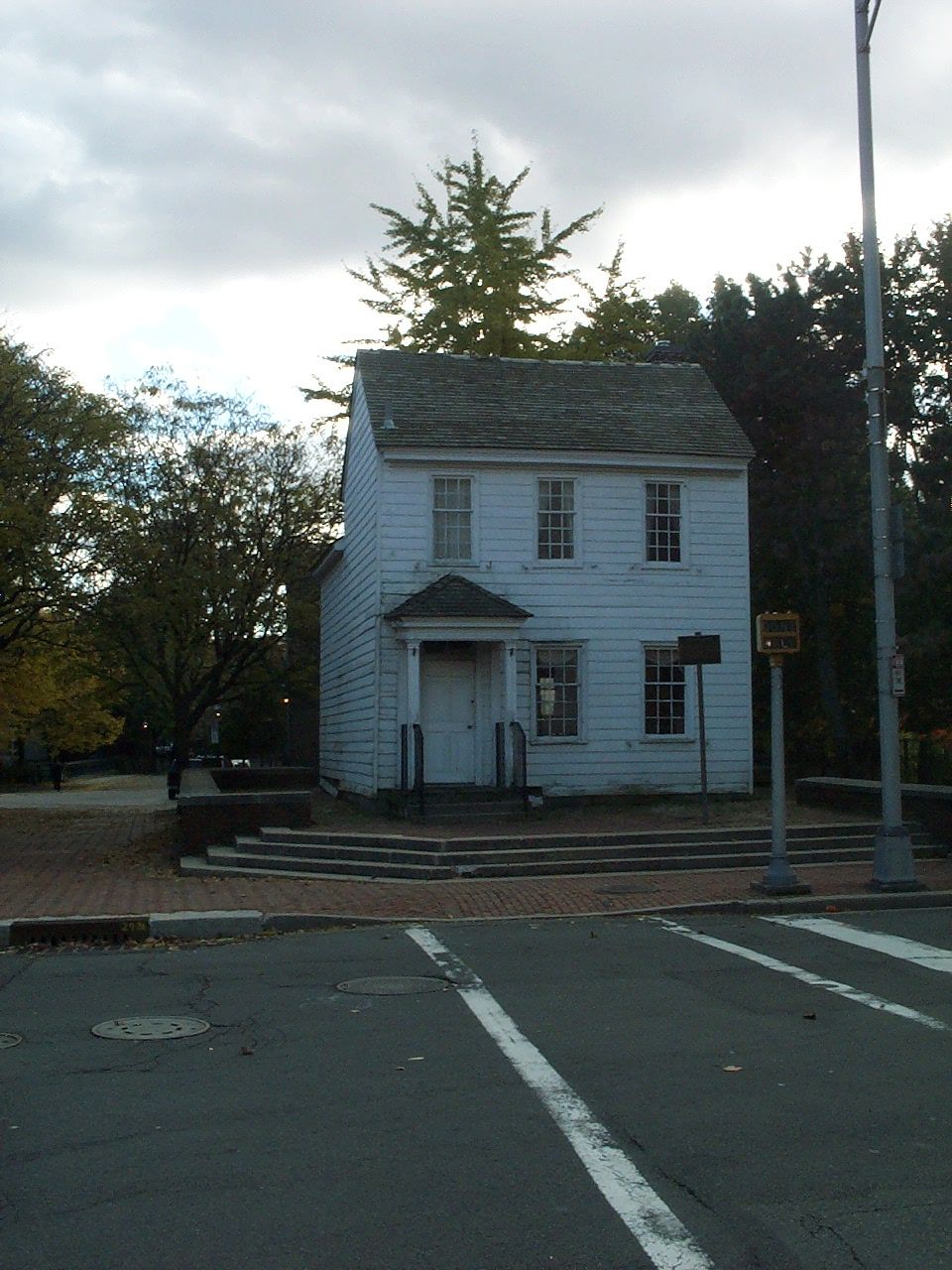
40°13′36″N 74°47′1″W / 40.22667°N 74.78361°WTrenton 18 Douglass House 
December 18, 1970 Corner of Front and Montgomery Sts.
40°13′9″N 74°46′9″W / 40.21917°N 74.76917°WTrenton 19 Drumthwacket 
June 10, 1975 344 Stockton Rd.
40°20′22″N 74°40′29″W / 40.33944°N 74.67472°WPrinceton 20 East Trenton Public Library March 5, 2008 701 N. Clinton St.
40°14′7″N 74°44′30″W / 40.23528°N 74.74167°WTrenton 21 Albert Einstein House 
January 7, 1976 112 Mercer St.
40°20′40″N 74°39′59″W / 40.34444°N 74.66639°WPrinceton 22 First Presbyterian Church 
September 9, 2005 120 East State St.
40°13′22″N 74°45′49″W / 40.22278°N 74.76361°WTrenton 23 First Presbyterian Church of Pennington August 24, 2011 13 S. Main St.
40°19′39″N 74°47′25″W / 40.3275°N 74.79028°WPennington 24 Golden Swan-True American 
April 30, 2008 101-107 S. Warren St.
40°13′9.12″N 74°45′57.64″W / 40.2192°N 74.7660111°WTrenton 25 William Green House December 4, 1973 Off NJ 31 on Green Lane
40°15′53″N 74°46′40″W / 40.26472°N 74.77778°WEwing Township 26 Green-Reading House March 12, 1998 107 Wilburtha Rd.
40°15′35″N 74°51′2″W / 40.25972°N 74.85056°WEwing Township 27 Harbourton Historic District December 31, 1974 Jct. of Harbourton/Rocktown Rd. and Harbourton/Mt. Airy Rd.
40°21′8″N 74°51′12″W / 40.35222°N 74.85333°WHarbourton 28 John D. Hart House October 18, 1972 Curlis Ave.
40°19′17″N 74°46′59″W / 40.32139°N 74.78306°WPennington 29 Hart-Hoch House March 14, 1973 SW of Pennington on CR 546 and Scotch Rd.
40°18′34″N 74°48′43″W / 40.30944°N 74.81194°WPennington 30 Joseph Henry House 
October 15, 1966 Princeton University campus
40°20′58″N 74°39′32″W / 40.34944°N 74.65889°WPrinceton 31 Donald Grant Herring Estate January 17, 1992 52, 72 and 75 Arreton Rd., Princeton Township
40°22′56″N 74°39′57″W / 40.38222°N 74.66583°WRocky Hill 32 Higbee Street School 
April 14, 1995 20 Bellevue Ave.
40°14′4″N 74°45′57″W / 40.23444°N 74.76583°WTrenton 33 Highfields September 23, 1994 End of Lindbergh Rd., East Amwell Township
40°25′26″N 74°46′4″W / 40.42389°N 74.76778°WHopewell 34 Hog Island Cranes June 17, 1980 Trenton Marine Terminal
40°11′27″N 74°45′22″W / 40.19083°N 74.75611°WTrenton 35 Hopewell Station 
June 22, 1984 Railroad Pl.
40°23′29″N 74°45′48″W / 40.39139°N 74.76333°WHopewell 36 House at 379 West State Street January 23, 1980 379 W. State St.
40°13′29″N 74°46′41″W / 40.22472°N 74.77806°WTrenton 37 Hunt Farmstead October 28, 1988 197 Blackwell Rd.
40°19′18″N 74°45′39″W / 40.3217782°N 74.760717640°WPennington 38 In and Out Social Club 
March 26, 1987 714-716 S. Clinton Ave.
40°12′34″N 74°45′6″W / 40.20944°N 74.75167°WTrenton 39 Jugtown Historic District January 22, 1987 Nassau and Harrison Sts., Harrison St. N, and Evelyn Pl.
40°21′14″N 74°38′49″W / 40.35389°N 74.64694°WPrinceton 40 Kingston Mill Historic District April 10, 1986 Roughly bounded by Herrontown, River, Princeton-Kingston Rds., and lots W of Princeton Twp.
40°22′28″N 74°37′34″W / 40.37444°N 74.62611°WPrinceton 41 Rudolph V. Kuser Estate 
August 24, 1979 315 W. State St.
40°13′23″N 74°46′36″W / 40.22306°N 74.77667°WTrenton 42 Lake Carnegie Historic District 
June 28, 1990 Roughly bounded by Lake Carnegie shoreline from Conrail bridge at W end to dam W of Kingston at E end
40°20′51″N 74°38′12″W / 40.3475°N 74.63667°WPrinceton 43 Lawrence Township Historic District September 14, 1972 Lawrenceville and vicinity N, including both sides of U.S. 206
40°18′1″N 74°43′12″W / 40.30028°N 74.72°WLawrenceville 44 Lawrenceville School 
February 24, 1986 Main St.
40°17′45″N 74°43′49″W / 40.29583°N 74.73028°WLawrenceville 45 Ichabod Leigh House March 4, 1975 Pennington-Rocky Hill Rd.
40°22′21″N 74°43′55″W / 40.3725°N 74.73194°WHopewell 46 Thomas Maddock's Sons Company March 14, 2008 240 Princeton Ave. (Hamilton Township)
40°15′26.58″N 74°42′16.82″W / 40.2573833°N 74.7046722°WEast Trenton Heights 47 Mansion House 
February 6, 1973 Cadwalader Park
40°14′12″N 74°47′22″W / 40.23667°N 74.78944°WTrenton 48 Maybury Hill 
November 11, 1971 346 Snowden Lane
40°22′2″N 74°38′34″W / 40.36722°N 74.64278°WPrinceton 49 Mercer Street Friends Center 
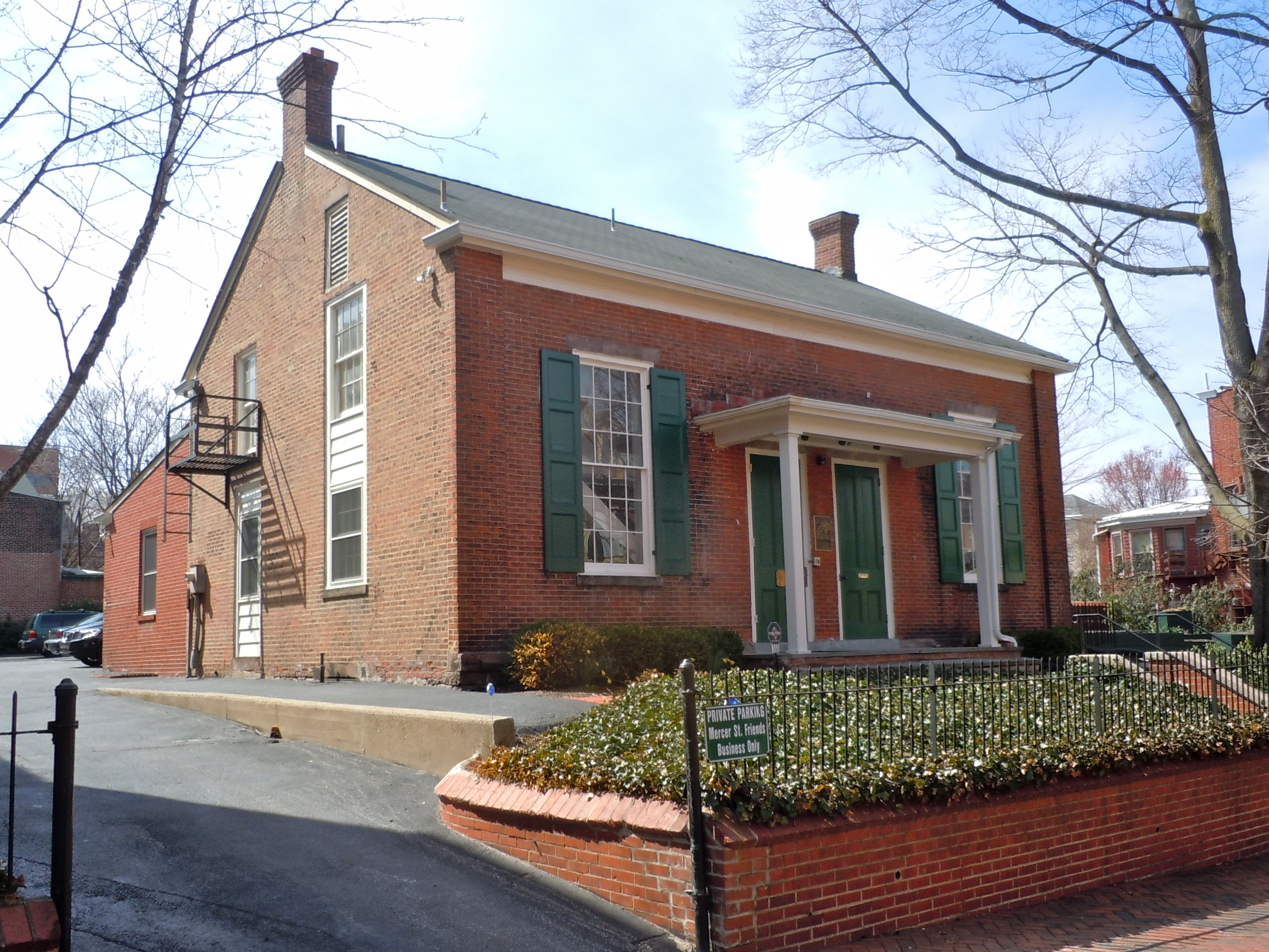
August 12, 1971 151 Mercer St.
40°13′2″N 74°45′40″W / 40.21722°N 74.76111°WTrenton 50 Mill Hill Historic District 
December 12, 1977 Roughly bounded by Clay, Jackson, Front, Market, Broad, and Greenwood Sts.
40°13′1″N 74°45′40″W / 40.21694°N 74.76111°WTrenton 51 Morven 
January 25, 1971 55 Stockton St.
40°20′51″N 74°40′1″W / 40.3475°N 74.66694°WPrinceton 52 Mott School and Second Street School April 15, 1986 Centre and 643-645 Second Sts.
40°12′7″N 74°45′24″W / 40.20194°N 74.75667°WTrenton 53 Mount Rose Distillery December 12, 1996 Address Restricted Hopewell 54 Mountain Avenue Historic District February 2, 1995 73-143 Mountain Ave.
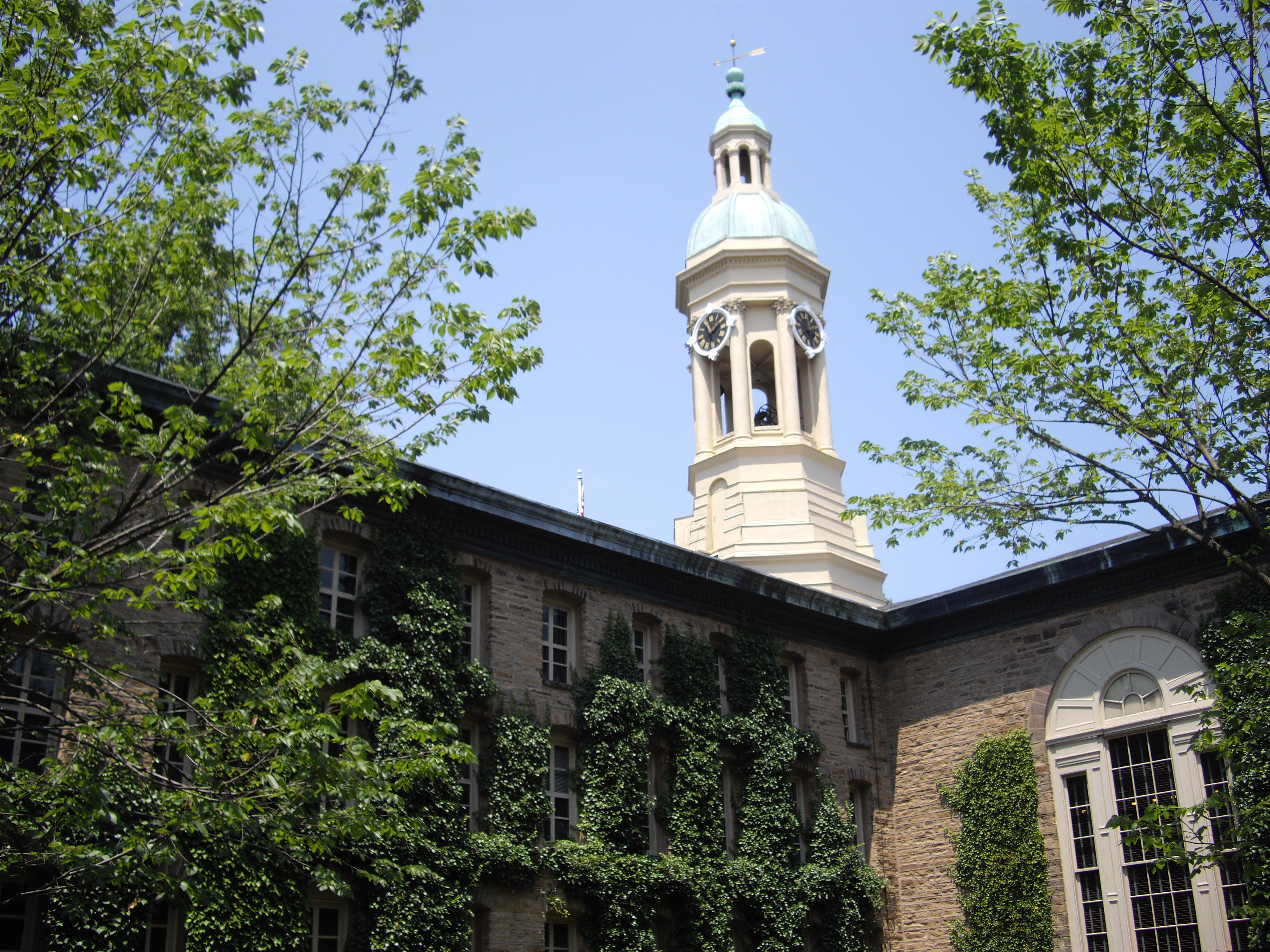
40°21′25″N 74°40′25″W / 40.35694°N 74.67361°WPrinceton 55 Nassau Hall, Princeton University 
October 15, 1966 Princeton University campus
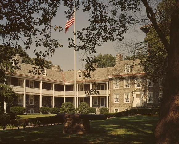
40°20′55″N 74°39′34″W / 40.34861°N 74.65944°WPrinceton 56 Old Barracks 
January 25, 1971 S. Willow St.
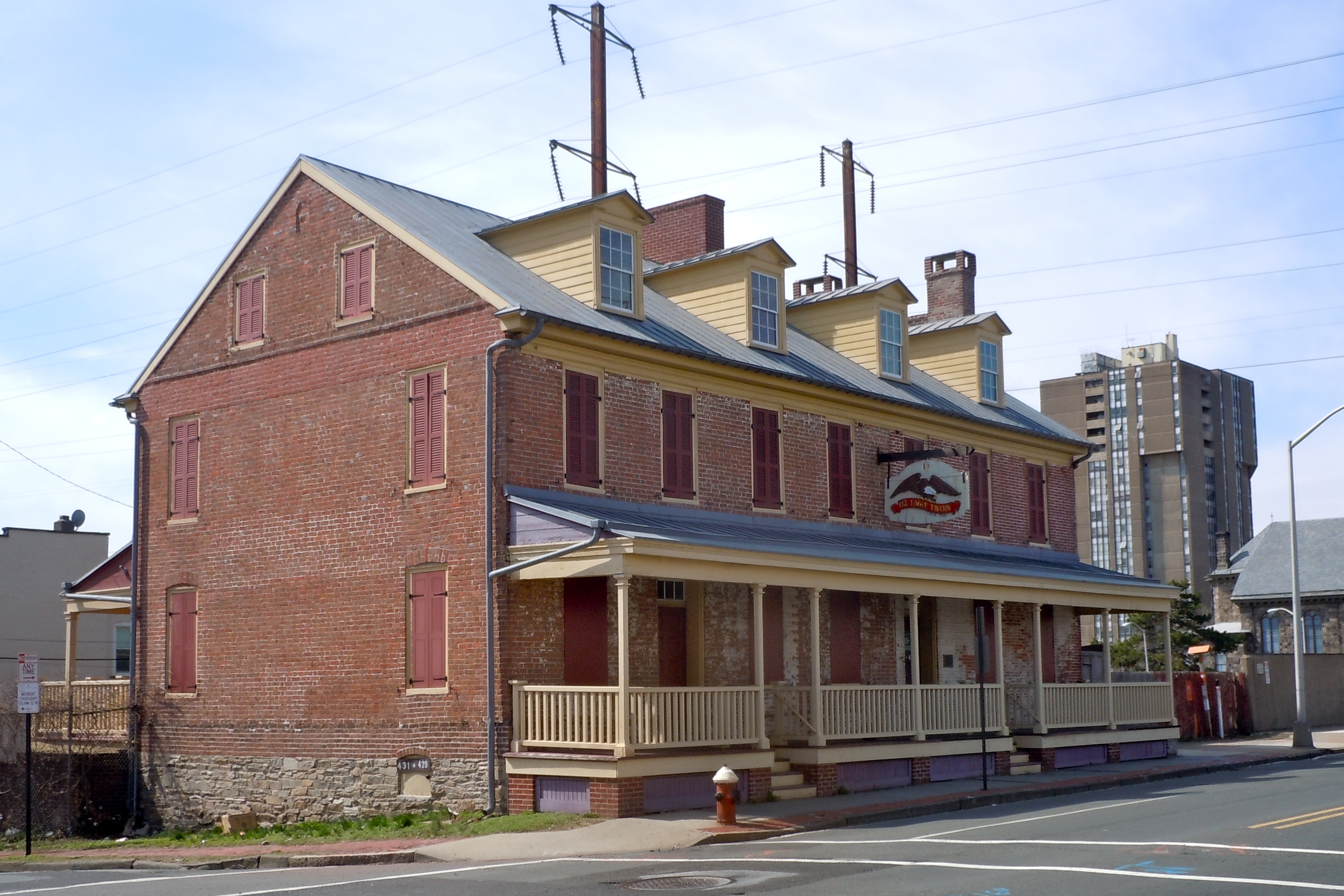
40°13′10″N 74°46′7″W / 40.21944°N 74.76861°WTrenton 57 Old Eagle Tavern 
November 3, 1972 431, 433 S. Broad St.
40°12′47″N 74°45′34″W / 40.21306°N 74.75944°WTrenton 58 Old Ryan Farm September 10, 1971 Federal City Rd.
40°17′27″N 74°47′2″W / 40.29083°N 74.78389°WTrenton 59 Isaac Pearson House 
February 1, 2006 Hobson Ave. at Emiline Ave.
40°11′16″N 74°42′44″W / 40.18778°N 74.71222°WHamilton Township 60 Pennington Railroad Station December 31, 1974 Corner of Franklin and Green Ave.
40°19′58″N 74°47′41″W / 40.33278°N 74.79472°WPennington 61 Penns Neck Baptist Church December 28, 1989 US 1 at Princeton-Hightstown Rd.
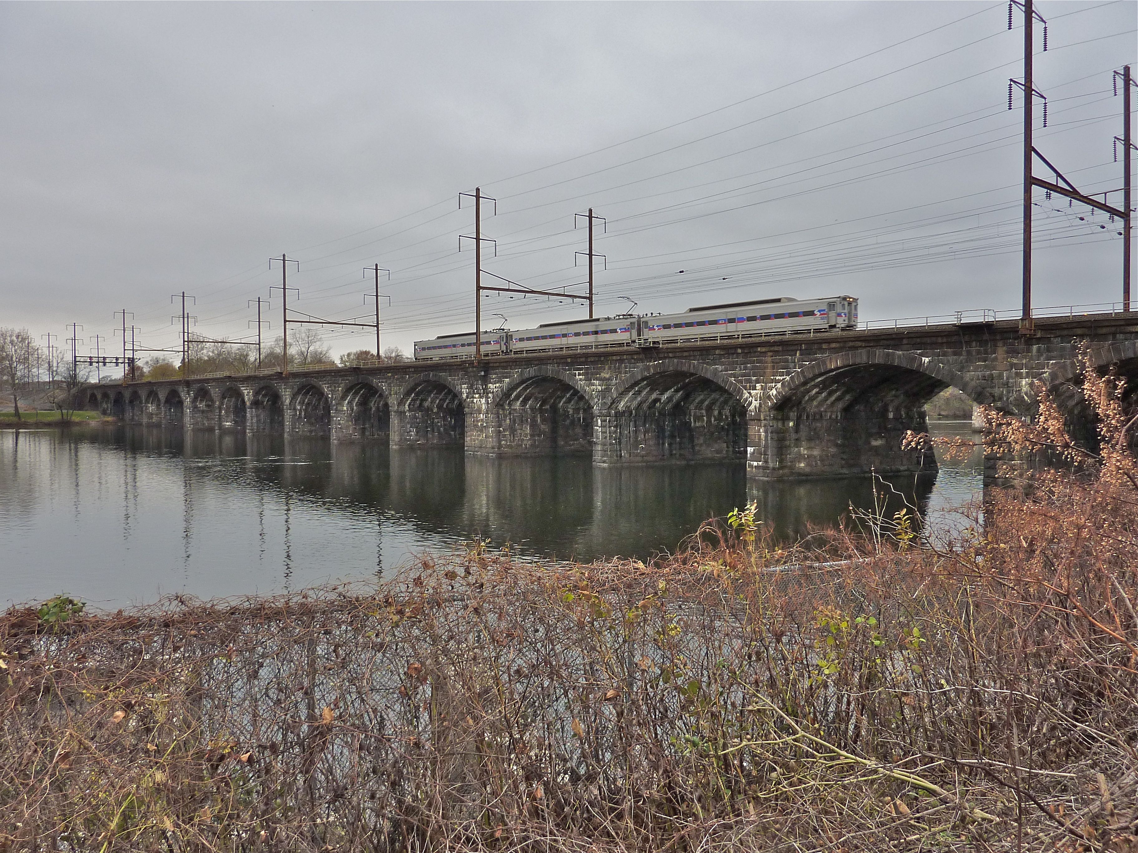
40°19′55″N 74°38′15″W / 40.33194°N 74.6375°WPenns Neck 62 Pennsylvania Railroad Bridge 
June 6, 1979 Spans Delaware River
40°12′24″N 74°46′9″W / 40.20667°N 74.76917°WTrenton 63 Philadelphia and Reading Railroad Freight Station 
May 14, 1979 260 N. Willow St.
40°13′34″N 74°46′3″W / 40.22611°N 74.7675°WTrenton 64 Joseph Phillips Farm May 2, 1977 N of Titusville on Hunter Rd.
40°20′23″N 74°53′56″W / 40.33972°N 74.89889°WTitusville 65 Pleasant Valley Historic District June 14, 1991 Centered on jct. of Pleasant Valley Rd. with Woodens Ln. and Hunter Rd., Hopewell and West Amwell Twps.
40°20′18″N 74°53′44″W / 40.33833°N 74.89556°WLambertville 66 President's House 
July 17, 1971 Nassau St.
40°20′56″N 74°39′36″W / 40.34889°N 74.66°WPrinceton 67 Princeton Battlefield 
October 15, 1966 Princeton Battlefield State Park
40°19′45″N 74°40′36″W / 40.32917°N 74.67667°WPrinceton Princeton Battlefield Historic District (Boundary Increase) (added 1989-10-10): Roughly Quaker Rd. from Stockton Rd. to Stony Brook 68 Princeton Historic District June 27, 1975 Irregular pattern between Lytle St. and Haslet Ave. from Lovers Lane to Olden Sts.
40°20′48″N 74°39′51″W / 40.34667°N 74.66417°WPrinceton 69 Princeton Ice Company August 28, 2007 57 Mountain Ave.
40°21′26.2″N 74°40′16.79″W / 40.357278°N 74.6713306°WPrinceton 70 Prospect 
February 4, 1985 Princeton University campus
40°20′49″N 74°39′24″W / 40.34694°N 74.65667°WPrinceton 71 Roebling Machine Shop 
September 4, 1997 675 S. Clinton Ave.
40°12′35″N 74°45′11″W / 40.20972°N 74.75306°WTrenton 72 John Rogers House January 31, 1978 S of Princeton on S. Post Rd.
40°15′22″N 74°37′38″W / 40.25611°N 74.62722°WPrinceton 73 Sacred Heart Church 
May 2, 2002 343 Broad St.
40°12′59″N 74°45′40″W / 40.21639°N 74.76111°WTrenton 74 Samuel Sloan House March 28, 1974 238 S. Main St.
40°15′58″N 74°31′32″W / 40.26611°N 74.52556°WHightstown 75 Smith-Ribsam House June 9, 1988 45 Pine Knoll Dr.
40°16′27″N 74°43′28″W / 40.27417°N 74.72444°WEldridge Park 76 Somerset Roller Mills November 19, 1974 NJ 29
40°16′45″N 74°51′13″W / 40.27917°N 74.85361°WTitusville 77 St. Michael's Episcopal Church 
April 29, 1982 140 N. Warren St.
40°13′20″N 74°45′55″W / 40.22222°N 74.76528°WTrenton 78 State House District 
August 27, 1976 Roughly bounded by Capitol Plaza, Willow, State and Lafayette Sts.
40°13′14″N 74°46′15″W / 40.22056°N 74.77083°WTrenton State House Historic District (Boundary Increase) (added 1992-04-02): W. State St. S side, W of New Jersey State House 79 Israel Stevens House March 15, 2005 2167 Brunswick Ave.
40°15′19″N 74°44′0″W / 40.25528°N 74.733333°WLawrence 80 Stockton Street Historic District November 25, 2005 126-136 Stockton St., 219-237 Rogers Ave.
40°16′19″N 74°33′54″W / 40.27194°N 74.565°WHightstown 81 Stokely-Van Camp Industrial Complex 
March 11, 1983 Lalor Street at Stokely Ave.
40°11′59″N 74°45′16″W / 40.19972°N 74.75444°WTrenton 82 Joseph Stout House October 29, 1974 Province Line Rd.
40°24′34″N 74°44′44″W / 40.40944°N 74.74556°WHopewell 83 Titusville Historic District March 17, 1983 River Dr.
40°18′22″N 74°52′44″W / 40.30611°N 74.87889°WTitusville 84 William Trent House 
April 15, 1970 539 S. Warren St.
40°12′46″N 74°45′58″W / 40.21278°N 74.76611°WTrenton 85 Trenton and Mercer County War Memorial-Soldiers' and Sailors' Memorial Building 
December 11, 1986 W. Lafayette St.
40°13′6″N 74°46′6″W / 40.21833°N 74.76833°WTrenton 86 Trenton Battle Monument 
May 6, 1977 Warren and Broad Sts.
40°13′32″N 74°45′54″W / 40.22556°N 74.765°WTrenton 87 Trenton City Hall 
January 30, 1978 309 State St.
40°13′12″N 74°45′34″W / 40.22°N 74.75944°WTrenton 88 Trenton City/Calhoun Street Bridge 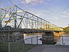
November 20, 1975 Spans Delaware River between Morrisville, PA and Trenton, NJ
40°13′11″N 74°46′42″W / 40.21972°N 74.77833°WTrenton 89 Trenton Friends Meeting House 
April 30, 2008 142 E. Hanover St.
40°13′16.25″N 74°45′45.52″W / 40.2211806°N 74.7626444°WTrenton 90 Trenton Jewish Community Center Bath House and Day Camp 
February 23, 1984 999 Lower Ferry Rd.
40°15′33″N 74°47′58″W / 40.25917°N 74.79944°WEwing 91 Tusculum January 5, 1978 N of Princeton on Cherry Hill Rd.
40°21′58″N 74°40′17″W / 40.36611°N 74.67139°WPrinceton 92 University Cottage Club November 19, 1999 51 Prospect Ave.
40°20′53″N 74°39′7″W / 40.34806°N 74.65194°WPrinceton 93 Col. John Van Cleve Homestead February 16, 1983 NW of Pennington on Poor Farm Rd.
40°21′11″N 74°49′27″W / 40.35306°N 74.82417°WPennington 94 Jeremiah Vandyke House March 29, 1978 Featherbed Lane
40°24′34″N 74°46′51″W / 40.40944°N 74.78083°WHopewell 95 Washington Crossing State Park October 15, 1966 Between Yardley and New Hope, on the Delaware River
40°17′57″N 74°52′7″W / 40.29917°N 74.86861°WYardley 96 Washington Road Elm Allee January 14, 1999 Washington Rd., bet. the Penns Neck Cirlce and The D&R Canal
40°20′8″N 74°38′37″W / 40.33556°N 74.64361°WWest Windsor 97 Isaac Watson House January 21, 1974 151 Westcott St.
40°11′25″N 74°43′39″W / 40.19028°N 74.7275°WTrenton 98 John Welling House March 14, 1973 Curlis Ave. at Birch St.
40°19′17″N 74°46′58″W / 40.32139°N 74.78278°WPennington 99 West Trenton Station 
June 22, 1984 Sullivan Way
40°15′27″N 74°48′57″W / 40.2575°N 74.81583°WWest Trenton 100 John White House January 29, 1973 1 mi. N of Lawrenceville on Cold Soil Rd.
40°18′52″N 74°43′42″W / 40.31444°N 74.72833°WLawrenceville 101 Windsor Historic District April 10, 1992 Roughly bounded by properties along Main St. and Church St.
40°14′27″N 74°35′6″W / 40.24083°N 74.585°WWindsor 102 Witherspoon Street School for Colored Children March 9, 2005 35 Quarry St.
40°21′19″N 74°39′46″W / 40.35528°N 74.66278°WPrinceton 103 Jeremiah Woolsey House January 27, 1975 SW of Pennington on Washington Crossing Rd.
40°18′32″N 74°49′36″W / 40.30889°N 74.82667°WPennington References
- ^ a b The latitude and longitude information provided in this table was derived originally from the National Register Information System, which has been found to be fairly accurate for about 99% of listings. For about 1% of NRIS original coordinates, experience has shown that one or both coordinates are typos or otherwise extremely far off; some corrections may have been made. A more subtle problem causes many locations to be off by up to 150 yards, depending on location in the country: most NRIS coordinates were derived from tracing out latitude and longitudes off of USGS topographical quadrant maps created under the North American Datum of 1927, which differs from the current, highly accurate WGS84 GPS system used by Google maps. Chicago is about right, but NRIS longitudes in Washington are higher by about 4.5 seconds, and are lower by about 2.0 seconds in Maine. Latitudes differ by about 1.0 second in Florida. Some locations in this table may have been corrected to current GPS standards.
- ^ "National Register of Historic Places: Weekly List Actions". National Park Service, United States Department of the Interior. Retrieved on November 10, 2011.
- ^ Numbers represent an ordering by significant words. Various colorings, defined here, differentiate National Historic Landmark sites, a [[National Historic Site (United States)|]], and several National Register of Historic Places Districts from other NRHP buildings, structures, sites or objects.
- ^ "National Register Information System". National Register of Historic Places. National Park Service. 2008-04-24. http://nrhp.focus.nps.gov/natreg/docs/All_Data.html.
U.S. National Register of Historic Places Topics Lists by states Alabama • Alaska • Arizona • Arkansas • California • Colorado • Connecticut • Delaware • Florida • Georgia • Hawaii • Idaho • Illinois • Indiana • Iowa • Kansas • Kentucky • Louisiana • Maine • Maryland • Massachusetts • Michigan • Minnesota • Mississippi • Missouri • Montana • Nebraska • Nevada • New Hampshire • New Jersey • New Mexico • New York • North Carolina • North Dakota • Ohio • Oklahoma • Oregon • Pennsylvania • Rhode Island • South Carolina • South Dakota • Tennessee • Texas • Utah • Vermont • Virginia • Washington • West Virginia • Wisconsin • WyomingLists by territories Lists by associated states Other  State of New Jersey
Topics Regions - Atlantic Coastal Plain
- Central Jersey
- Delaware River Region
- Delaware Valley
- Gateway Region
- Gold Coast
- Highlands
- Jersey Shore
- Meadowlands
- New York metro area
- North Hudson
- North Jersey
- Pascack Valley
- Piedmont
- Pine Barrens
- Raritan Bayshore
- Ridge-and-Valley Appalachians
- Southern Shore Region
- Skylands Region
- South Jersey
- Tri‑State Region
- West Hudson
Counties Major cities Categories:- Mercer County, New Jersey
- National Register of Historic Places in New Jersey
-


Wikimedia Foundation. 2010.