- Hightstown, New Jersey
Infobox Settlement
official_name = Hightstown, New Jersey
settlement_type = Borough
nickname =
motto =
imagesize =
image_caption =
image_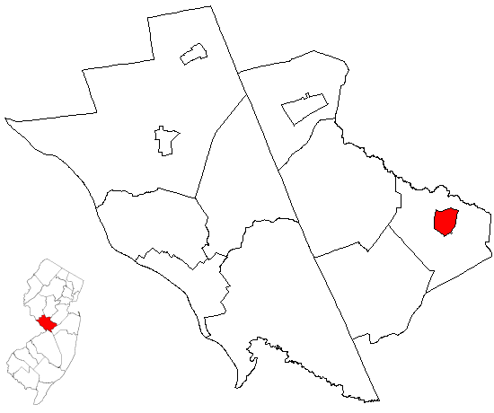
mapsize = 250x200px
map_caption = Hightstown highlighted in Mercer County. Inset
mapsize1 = 250x200px
map_caption1 = Census Bureau map of Hightstown, New Jerseysubdivision_type = Country
subdivision_name =United States
subdivision_type1 = State
subdivision_name1 =New Jersey
subdivision_type2 = County
subdivision_name2 = Mercer
government_footnotes =
government_type =Borough (New Jersey)
leader_title =Mayor
leader_name = Robert F. Patten (R, 2010)
leader_title1 = Administrator
leader_name1 = Candace Gallagher [ [http://www.hightstownborough.com/borough_directory.htm Borough Directory] , Borough of Hightstown. AccessedDecember 20 ,2007 .]
established_title = Incorporated
established_date =March 5 ,1853 unit_pref = Imperial
area_footnotes =
area_magnitude =
area_total_km2 = 3.2
area_land_km2 = 3.2
area_water_km2 = 0.1
area_total_sq_mi = 1.2
area_land_sq_mi = 1.2
area_water_sq_mi = 0.0population_as_of = 2006
population_footnotes =
population_total = 5300
population_density_km2 = 1641.7
population_density_sq_mi = 4251.9timezone = Eastern (EST)
utc_offset = -5
timezone_DST = EDT
utc_offset_DST = -4
elevation_footnotes = [Gnis|885254|Borough of Hightstown,Geographic Names Information System , accessedDecember 20 ,2007 .]
elevation_m = 33
elevation_ft = 108
latd = 40 |latm = 16 |lats = 4 |latNS = N
longd = 74 |longm = 31 |longs = 31 |longEW = Wpostal_code_type =
ZIP code
postal_code = 08520
area_code = 609
blank_name = FIPS code
blank_info = 34-31620GR|2 [ [http://mcdc2.missouri.edu/webrepts/commoncodes/ccc_nj.html A Cure for the Common Codes: New Jersey] , Missouri Census Data Center. AccessedJuly 14 ,2008 .]
blank1_name = GNIS feature ID
blank1_info = 0885254GR|3
website = http://www.hightstownborough.com
footnotes =Hightstown is a Borough in Mercer County,
New Jersey ,United States . As of theUnited States 2000 Census , the borough population was 5,216.Hightstown was incorporated as a borough by an Act of the
New Jersey Legislature onMarch 5 ,1853 , within portions of East Windsor Township. The borough became fully independent c. 1894. Additional portions of East Windsor Township were annexed in 1913, 1915 and 1927."The Story of New Jersey's Civil Boundaries: 1606-1968", John P. Snyder, Bureau of Geology and Topography; Trenton, New Jersey; 1969. p. 162.]Geography
Hightstown is located at coor dms|40|16|11|N|74|31|27|W|city (40.269759, -74.524161)GR|1.
According to the
United States Census Bureau , the borough has a total area of 1.2square mile s (3.2km² ), of which, 1.2 square miles (3.2 km²) of it is land and 0.04 square miles (0.1 km²) of it (1.60%) is water.Hightstown is an independent municipality located entirely within the boundaries of East Windsor Township.
Hightstown is the central most point of New Jersey and is roughly equidistant from
Philadelphia andNew York City .Hightstown Bypass
The history of the bypass dates back to when it was originally planned as Route 92. Running from Route 33, it would have crossed
U.S. Route 130 and traveled northwest to a proposed interchange with the then-proposedSomerset Freeway . Decades of lengthy battles resulted in both plans being canceled, and the only surviving section was the bypass of Hightstown itself. This freeway was given another designation, Route 133 and runs from CR 571 to Route 33. It only has two interchanges and has traffic signals at both ends. Without a proper connection to theNew Jersey Turnpike , the bypass has not lived up to its original expectations and congestion through Hightstown still largely remains. Discussions have been made of potentially extending the bypass further south to provide a connection with U.S. Route 130 south of Hightstown, however this section would more than likely carry the Route 33 designation. Some have also suggested that a direct connection to the New Jersey Turnpike from the freeway bypass may also eliminate much congestion from downtown traffic.Demographics
USCensusPop
1910= 1879
1920= 2674
1930= 3012
1940= 3486
1950= 3712
1960= 4317
1970= 5431
1980= 4581
1990= 5126
2000= 5216
estimate= 5300
estyear=2006
estref= [http://factfinder.census.gov/servlet/SAFFPopulation?_event=Search&geo_id=06000US3402129310&_geoContext=01000US%7C04000US34%7C05000US34021%7C06000US3402129310&_street=&_county=hightstown&_cityTown=hightstown&_state=04000US34&_zip=&_lang=en&_sse=on&ActiveGeoDiv=geoSelect&_useEV=&pctxt=fph&pgsl=060&_submenuId=population_0&ds_name=null&_ci_nbr=null&qr_name=null®=null%3Anull&_keyword=&_industry= Census data for Hightstown borough] ,United States Census Bureau . AccessedDecember 20 ,2007 .]
footnote=Population 1930 - 1990. [ [http://www.wnjpin.net/OneStopCareerCenter/LaborMarketInformation/lmi01/poptrd6.htm New Jersey Resident Population by Municipality: 1930 - 1990] , Workforce New Jersey Public Information Network. AccessedMarch 1 ,2007 .] As of thecensus GR|2 of 2000, there were 5,216 people, 2,001 households, and 1,300 families residing in the borough. Thepopulation density was 4,251.9 people per square mile (1,637.3/km²). There were 2,081 housing units at an average density of 1,696.4/sq mi (653.2/km²). The racial makeup of the borough was 76.53% White, 8.51% African American, 0.36% Native American, 2.28% Asian, 0.08% Pacific Islander, 9.64% from other races, and 2.59% from two or more races. Hispanic or Latino of any race were 20.05% of the population.There were 2,001 households out of which 30.3% had children under the age of 18 living with them, 51.7% were married couples living together, 8.5% had a female householder with no husband present, and 35.0% were non-families. 27.9% of all households were made up of individuals and 9.6% had someone living alone who was 65 years of age or older. The average household size was 2.60 and the average family size was 3.15.
In the borough the population was spread out with 22.5% under the age of 18, 8.0% from 18 to 24, 36.8% from 25 to 44, 21.9% from 45 to 64, and 10.8% who were 65 years of age or older. The median age was 36 years. For every 100 females there were 103.4 males. For every 100 females age 18 and over, there were 101.2 males.
The median income for a household in the borough was $64,299, and the median income for a family was $72,092. Males had a median income of $46,375 versus $35,428 for females. The
per capita income for the borough was $28,605. About 4.3% of families and 7.3% of the population were below thepoverty line , including 9.1% of those under age 18 and 4.4% of those age 65 or over.As of the 2000 census, 6.31% of Hightstown's residents identified themselves as being of
Ecuador ian ancestry, which was the second highest of any municipality in New Jersey and the sixth highest percentage of Ecuadorian people in any place in the United States with 1,000 or more residents identifying their ancestry. [ [http://www.epodunk.com/ancestry/Ecuadorian.html Ecuadorian Communities] ,Epodunk . AccessedJune 28 ,2006 .]Government
Local government
Hightstown is governed under the Borough form of New Jersey municipal government. The government consists of a Mayor and a Borough Council comprising six council members, with all positions elected at large. A Mayor is elected directly by the voters to a four-year term of office. The Borough Council consists of six members elected to serve three-year terms on a staggered basis, with two seats coming up for election each year. ["2005 New Jersey Legislative District Data Book",
Rutgers University Edward J. Bloustein School of Planning and Public Policy , April 2005, p. 63.]As of 2008 , theMayor of the Borough of Hightstown is Robert F. Patten (R), whose term of office ends onDecember 31 ,2010 . Members of the Hightstown Borough Council are Council President Walter L. Sikorski (D, 2010), Jeffrey Bond (D, 2010), Constance Harendza-Harinxma (D, 2008), Lawrence D. Quattrone (D, 2009), Ryan Rosenberg (D, 2008) and David Schneider (D, 2009). [ [http://www.hightstownborough.com/mayor_and_council.htm 2008 Mayor and Council] , Borough of Hightstown. AccessedJune 17 ,2008 .]Federal, state and county representation
Hightstown is in the Fourth Congressional District and is part of New Jersey's 12th Legislative District. [ [http://www.lwvnj.org/pubs/CG06.pdf 2006 New Jersey Citizen's Guide to Government] , New Jersey
League of Women Voters , p. 58. AccessedAugust 30 ,2006 .]Education
Students in public school for Kindergarten through 12th grade attend the
East Windsor Regional School District , a comprehensive publicschool district serving students from East Windsor Township and Hightstown Borough, along with students in grades 7 - 12 from Roosevelt Borough as part of asending/receiving relationship . [ [http://education.state.nj.us/rc/rc07/narrative/21/1245/21-1245-000.html East Windsor Regional School District 2007 Report Card Narrative] ,New Jersey Department of Education . AccessedApril 15 ,2008 . "The East Windsor Regional School District, located in central New Jersey at New Jersey Turnpike Exit 8, is a growing K-12 public school district serving the communities of the East Windsor Township and the Borough of Hightstown as well as Roosevelt Borough students grades 7 through 12."]The district has four K-5 elementary schools — [http://www.eastwindsorregionalschools.com/walterblack/default.htm Walter C. Black Elementary School] with 581 students, [http://www.eastwindsorregionalschools.com/perrydrew/default.htm Perry L. Drew Elementary School] with 692 students, [http://www.eastwindsorregionalschools.com/ethelmcknight/default.htm Ethel McKnight Elementary School] with 572 students, [http://www.eastwindsorregionalschools.com/gracerogers/default.htm Grace N. Rogers Elementary School] with 502 students — [http://www.eastwindsorregionalschools.com/melvinkreps/default.htm Melvin H. Kreps School] grades 6 - 8 with 1,139 students and
Hightstown High School with 1,370 students in grades 9 - 12.Hightstown is also home to the
Peddie School , acoeducation al high school founded in 1864.References
External links
* [http://www.hightstownborough.com/ Hightstown Borough website]
* [http://www.eastwindsorregionalschools.com/ East Windsor Regional School District]
*NJReportCard|21|1245|0|East Windsor Regional School District
* [http://nces.ed.gov/ccd/schoolsearch/school_list.asp?Search=1&DistrictID=3404320 Data for the East Windsor Regional School District] ,National Center for Education Statistics

Wikimedia Foundation. 2010.