- National Register of Historic Places listings in Mercer County, Ohio
-
 Location of Mercer County in Ohio
This is a list of the National Register of Historic Places listings in Mercer County, Ohio.
This is intended to be a complete list of the properties and districts on the National Register of Historic Places in Mercer County, Ohio, United States. The locations of National Register properties and districts for which the latitude and longitude coordinates are included below, may be seen in a Google map.[1]
There are 29 properties and districts listed on the National Register in the county.
-
- This National Park Service list is complete through NPS recent listings posted November 10, 2011.[2]
Current listings
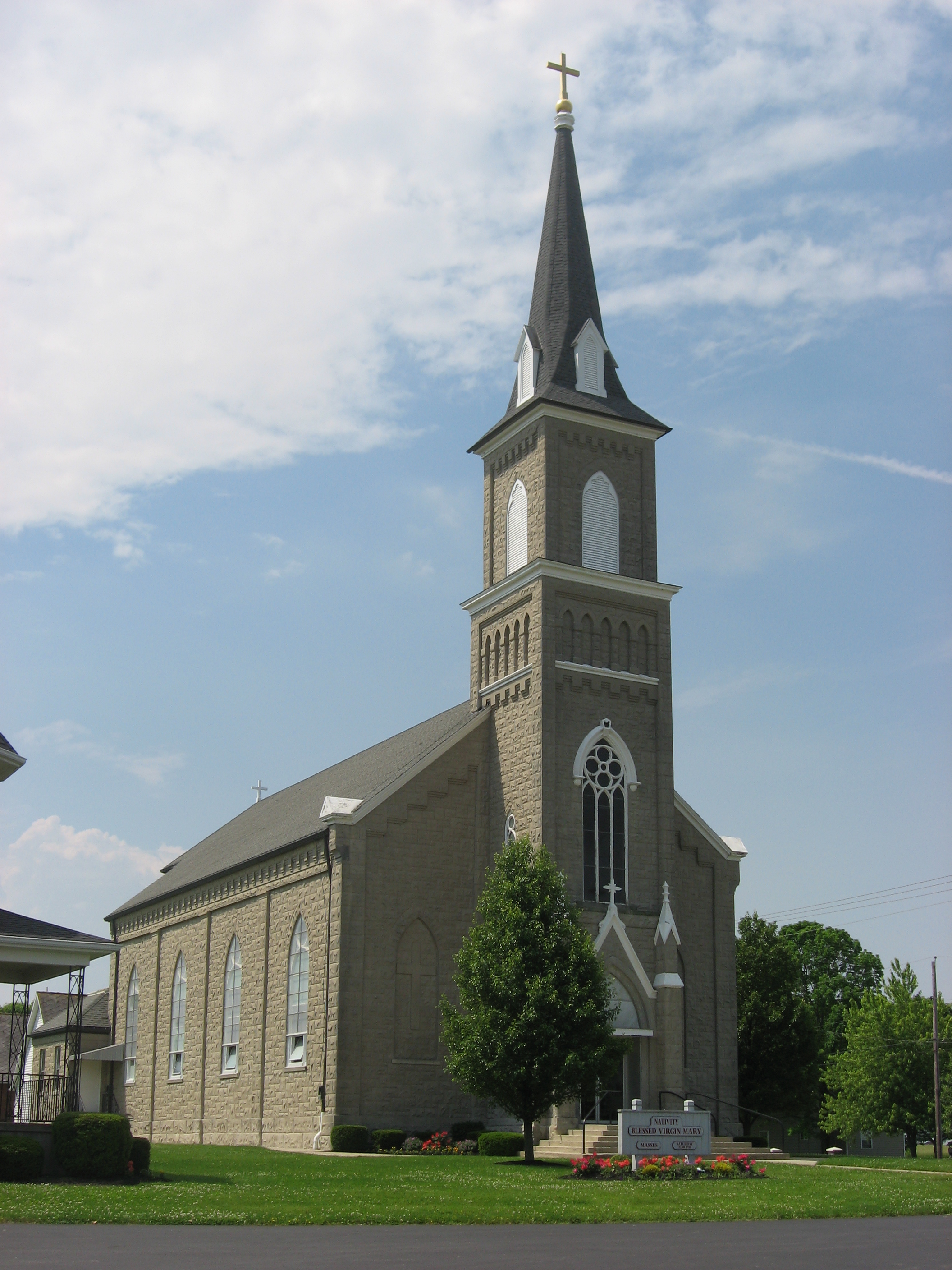
[3] Landmark name [4] Image Date listed Location City or town Summary 1 Cassella Catholic Church and Rectory 
July 26, 1979 State Route 119 in Cassella
40°24′24″N 84°33′03″W / 40.406667°N 84.550833°WMarion Township 2 Celina Main Street Commercial Historic District 
November 30, 1982 Roughly bounded by Walnut, W. Livingston, Ash, and Warren Sts.
40°32′58″N 84°34′15″W / 40.549444°N 84.570833°WCelina 3 Chickasaw School and Rectory 
July 26, 1979 Maple St.
40°26′10″N 84°29′35″W / 40.436111°N 84.493056°WChickasaw 4 Coldwater Catholic Church Complex 
July 26, 1979 E. Main and 2nd Sts.
40°28′49″N 84°37′42″W / 40.480278°N 84.628333°WColdwater 5 Fort Recovery Site 
November 10, 1970 State Route 49
40°24′50″N 84°46′51″W / 40.413889°N 84.780833°WFort Recovery 6 Matthias Gast House and General Store 
December 29, 1978 State Route 119 in Maria Stein
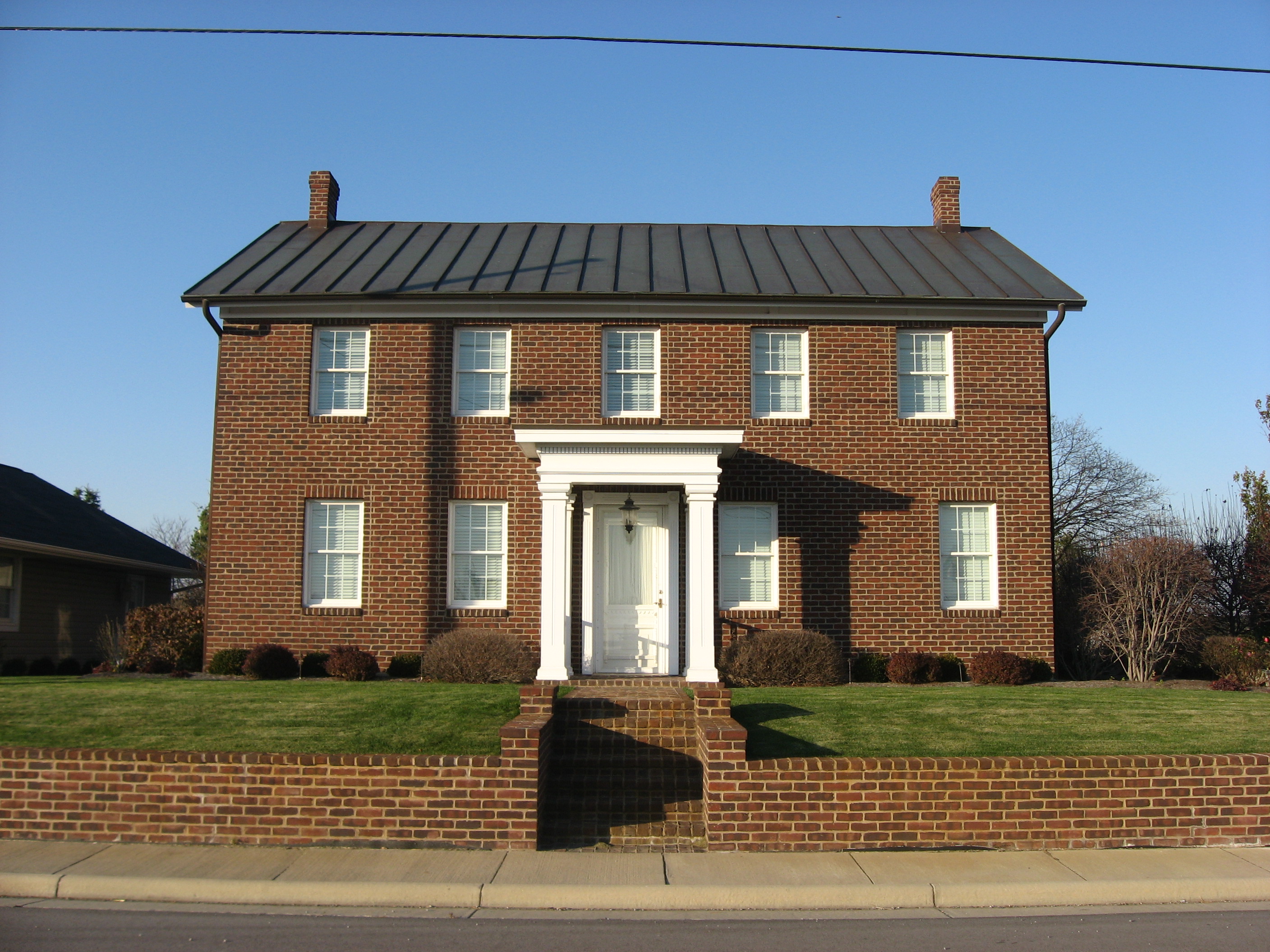
40°24′28″N 84°28′13″W / 40.407778°N 84.470278°WMarion Township 7 Sen. Thomas J. Godfrey House 
November 26, 1980 602 W. Market St.
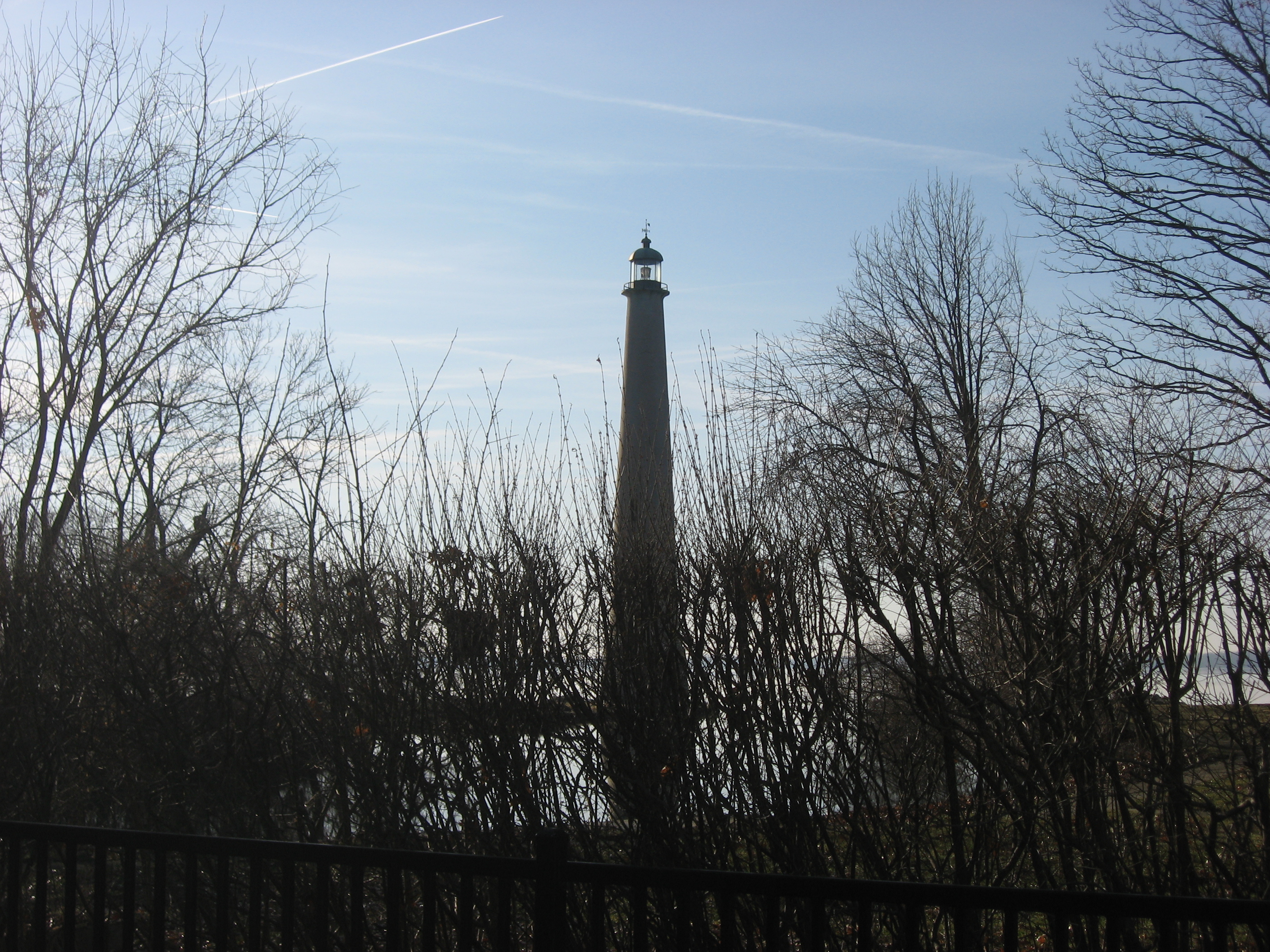
40°32′56″N 84°34′50″W / 40.548889°N 84.580556°WCelina 8 Grand Lake St. Marys Lighthouse 
June 2, 1982 Grand Lake St. Marys-Northwood Addition, east of Celina
40°32′36″N 84°28′53″W / 40.543333°N 84.481389°WJefferson Township 9 Gruenwald Convent 
July 26, 1979 0.5 miles south of Cassella
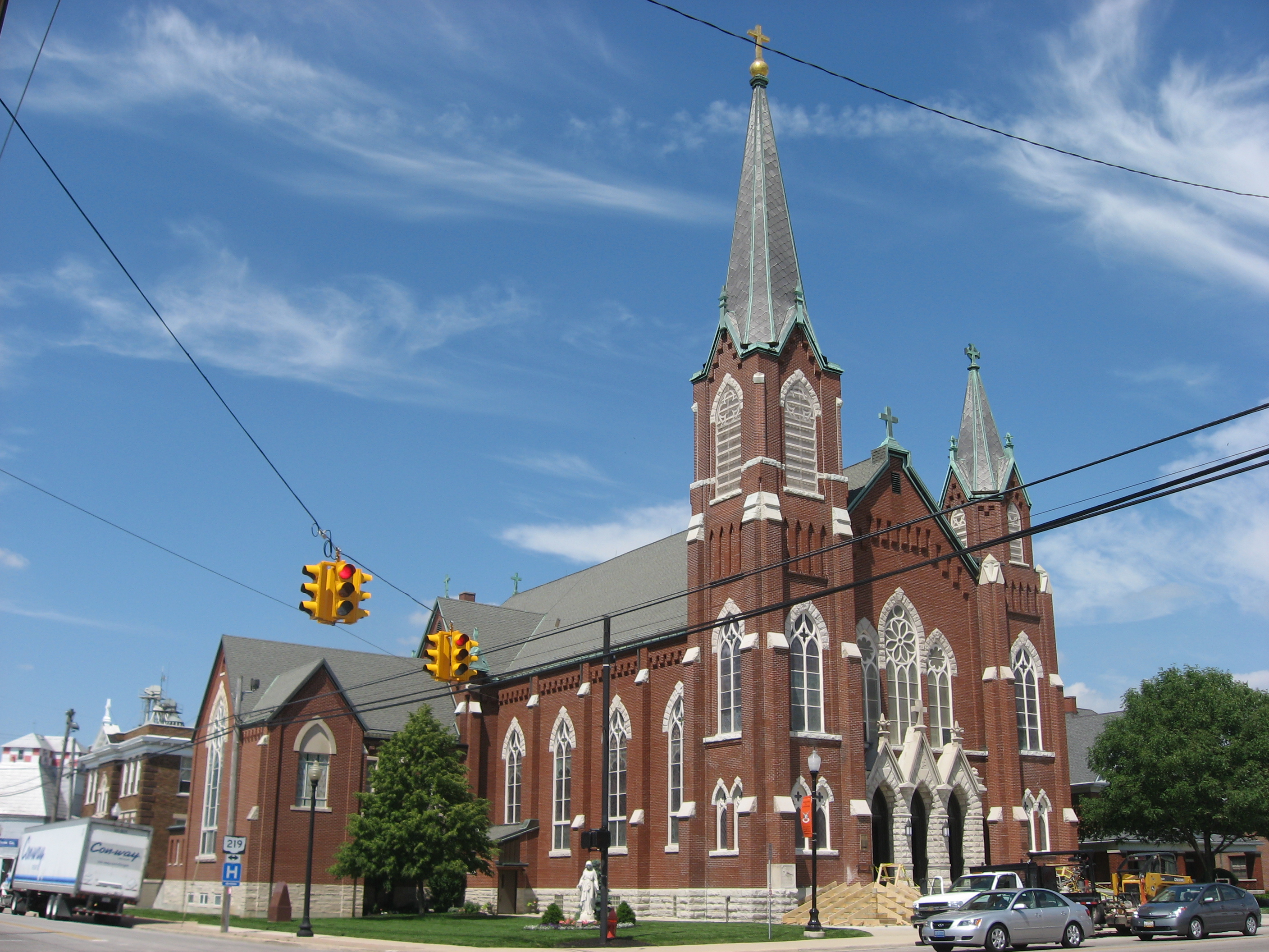
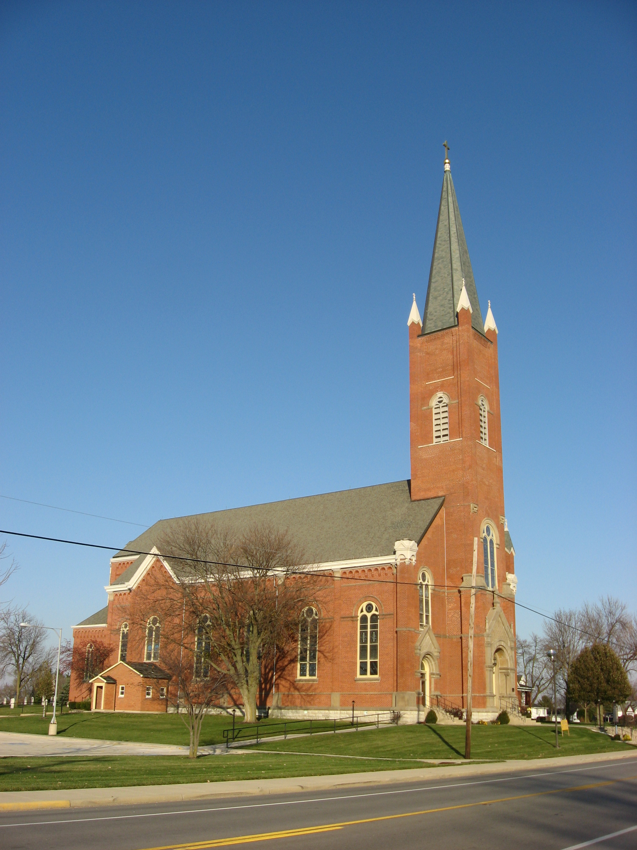
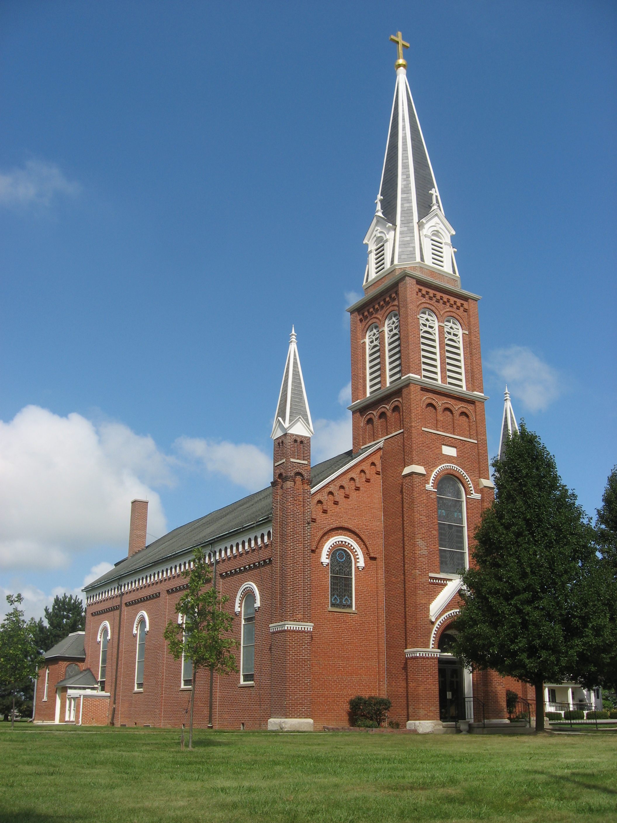
40°24′01″N 84°33′03″W / 40.400278°N 84.550833°WMarion Township 10 Immaculate Conception Catholic Church Complex 
July 26, 1979 Anthony and Walnut Sts.
40°33′07″N 84°34′22″W / 40.551944°N 84.572778°WCelina 11 Maria Stein Catholic Church and Rectory 
July 26, 1979 St. John's Rd. and State Route 119 in Maria Stein
40°24′29″N 84°28′22″W / 40.408056°N 84.472778°WMarion Township 12 Maria Stein Convent 
May 6, 1976 St. John's and Rolfes Rd. in Maria Stein
40°24′57″N 84°28′34″W / 40.415833°N 84.476111°WMarion Township 13 Mendon Town Hall 
December 29, 1978 S. Main St.
40°40′23″N 84°31′07″W / 40.673056°N 84.518611°WMendon 14 Otis Hospital 
November 25, 1980 441 E. Market St.
40°32′58″N 84°33′52″W / 40.549333°N 84.564444°WCelina 15 Philothea Catholic Church and Priest House 
July 26, 1979 Philothea Rd. in Philothea, between St. Henry and Coldwater
40°27′03″N 84°39′18″W / 40.450833°N 84.655°WButler Township 16 Calvin E. Riley House 
November 30, 1978 130 E. Market St.
40°32′55″N 84°34′10″W / 40.548611°N 84.569444°WCelina 17 St. Aloysius Catholic Church 
July 26, 1979 U.S. Route 127 and State Route 274, west of Carthagena
40°26′11″N 84°34′12″W / 40.436389°N 84.57°WMarion Township 18 St. Anthony Catholic Church, Padua 
July 26, 1979 State Route 49 and St. Anthony Rd. in Padua
40°30′32″N 84°47′07″W / 40.508889°N 84.785278°WWashington Township 19 St. Bernard Catholic Church and Rectory 
July 26, 1979 Main St.
40°21′08″N 84°38′45″W / 40.352222°N 84.645833°WBurkettsville 20 St. Charles Seminary and Chapel 
July 26, 1979 0.5 miles south of Carthagena, off U.S. Route 127
40°25′57″N 84°33′48″W / 40.4325°N 84.563333°WMarion Township 21 St. Francis Catholic Church and Rectory 
July 26, 1979 Cranberry and Ft. Recovery-Minster Rd. in Cranberry Prairie
40°23′34″N 84°34′55″W / 40.392778°N 84.581944°WGranville Township 22 St. Henry Catholic Church 
July 26, 1979 Main St.
40°25′03″N 84°38′15″W / 40.4175°N 84.6375°WSt. Henry 23 St. Joseph Catholic Church and Rectory 
July 26, 1979 Sawmill and St. Joe Rds. in St. Joe
40°25′41″N 84°44′19″W / 40.428056°N 84.738611°WRecovery Township 24 St. Paul's Catholic Church and Rectory 
July 26, 1979 Junction of Sharpsburg and Meiring Rds. in Sharpsburg
40°22′02″N 84°42′41″W / 40.367222°N 84.711389°WGibson Township 25 St. Peter Catholic Church and Rectory 
July 26, 1979 St. Peter and Philothea Rds. in St. Peter
40°27′03″N 84°44′48″W / 40.450833°N 84.746667°WRecovery Township 26 St. Rose Catholic Church Complex 
July 26, 1979 Main St. in St. Rose
40°24′26″N 84°30′53″W / 40.407222°N 84.514722°WMarion Township 27 St. Sebastian Catholic Church and Rectory 
July 26, 1979 Sebastian Rd. and State Route 716A in St. Sebastian
40°26′39″N 84°31′00″W / 40.444167°N 84.516667°WMarion Township 28 St. Wendelin Catholic Church, School, and Rectory 
July 26, 1979 Ft. Recovery-Minster Rd. and Township Line in Wendelin
40°24′00″N 84°41′27″W / 40.4°N 84.690833°WRecovery Township 29 Wallischeck Homestead 
November 27, 1978 North of Fort Recovery
40°26′40″N 84°48′05″W / 40.444444°N 84.801389°WRecovery Township See also
References
- ^ The latitude and longitude information provided in this table was derived originally from the National Register Information System, which has been found to be fairly accurate for about 99% of listings. For about 1% of NRIS original coordinates, experience has shown that one or both coordinates are typos or otherwise extremely far off; some corrections may have been made. A more subtle problem causes many locations to be off by up to 150 yards, depending on location in the country: most NRIS coordinates were derived from tracing out latitude and longitudes off of USGS topographical quadrant maps created under North American Datum of 1927, which differs from the current, highly accurate GPS system used by Google maps. Chicago is about right, but NRIS longitudes in Washington are higher by about 4.5 seconds, and are lower by about 2.0 seconds in Maine. Latitudes differ by about 1.0 second in Florida. Some locations in this table may have been corrected to current GPS standards.
- ^ "National Register of Historic Places: Weekly List Actions". National Park Service, United States Department of the Interior. Retrieved on November 10, 2011.
- ^ Numbers represent an ordering by significant words. Various colorings, defined here, differentiate National Historic Landmark sites and National Register of Historic Places Districts from other NRHP buildings, structures, sites or objects.
- ^ "National Register Information System". National Register of Historic Places. National Park Service. . http://nrhp.focus.nps.gov/natreg/docs/All_Data.html.
Municipalities and communities of Mercer County, Ohio County seat: Celina City 
Villages Burkettsville‡ | Chickasaw | Coldwater | Ft. Recovery | Mendon | Montezuma | Rockford | St. Henry
Townships Unincorporated
communitiesCarthagena | Cassella | Maria Stein | Padua | Sebastian
Footnotes ‡This populated place also has portions in an adjacent county or counties
Categories:- National Register of Historic Places in Ohio by county
- Mercer County, Ohio
-


Wikimedia Foundation. 2010.