- National Register of Historic Places listings in Athens County, Ohio
-
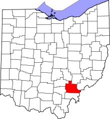 Location of Athens County in Ohio
This is a list of the National Register of Historic Places listings in Athens County, Ohio.
This is intended to be a complete list of the properties and districts on the National Register of Historic Places in Athens County, Ohio, United States. The locations of National Register properties and districts for which the latitude and longitude coordinates are included below, may be seen in a Google map.[1]
There are 28 properties and districts listed on the National Register in the county, including 1 National Historic Landmark.
-
- This National Park Service list is complete through NPS recent listings posted November 10, 2011.[2]
Current listings
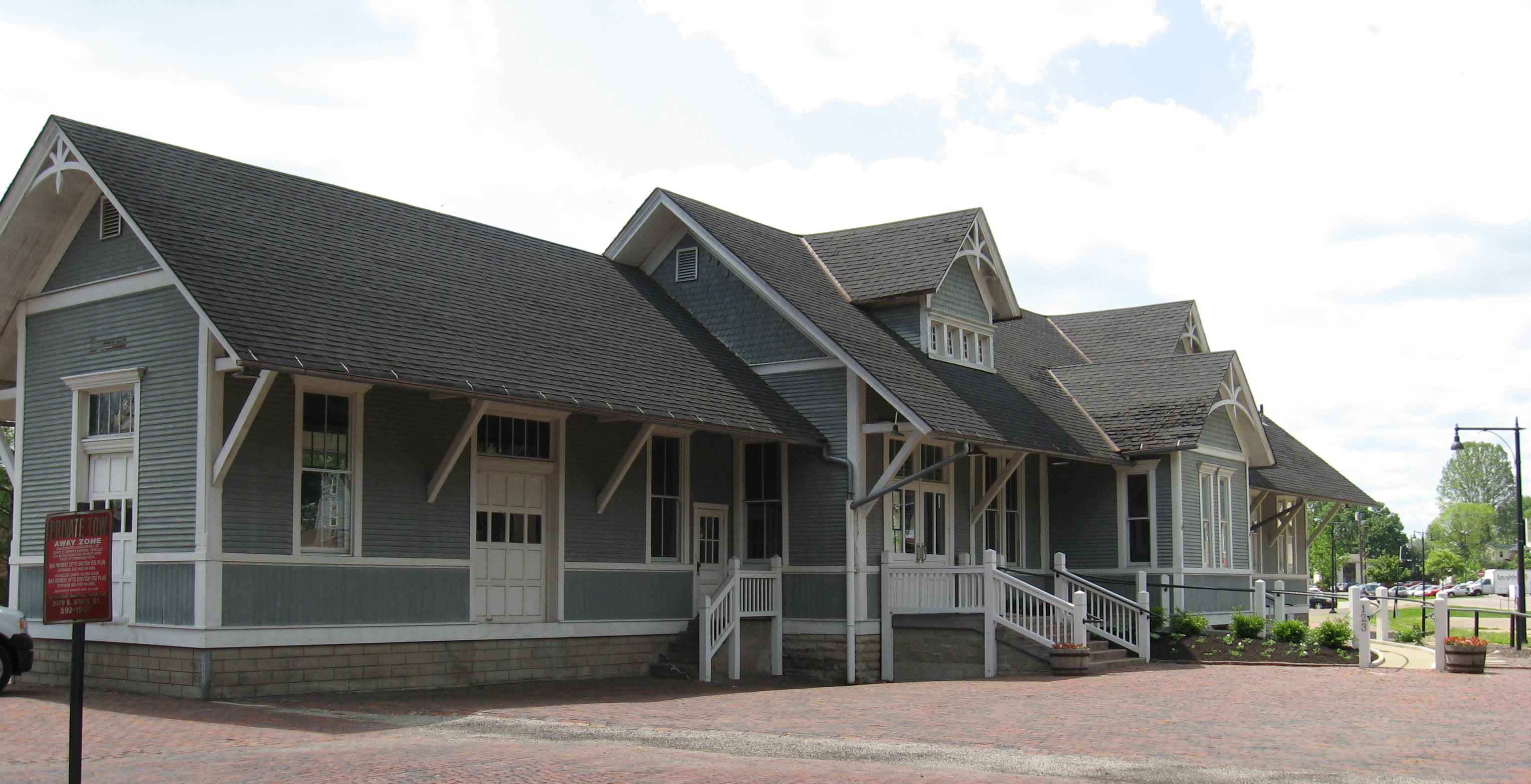
[3] Landmark name [4] Image Date listed Location City or town Summary 1 Athens B & O Train Depot 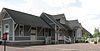
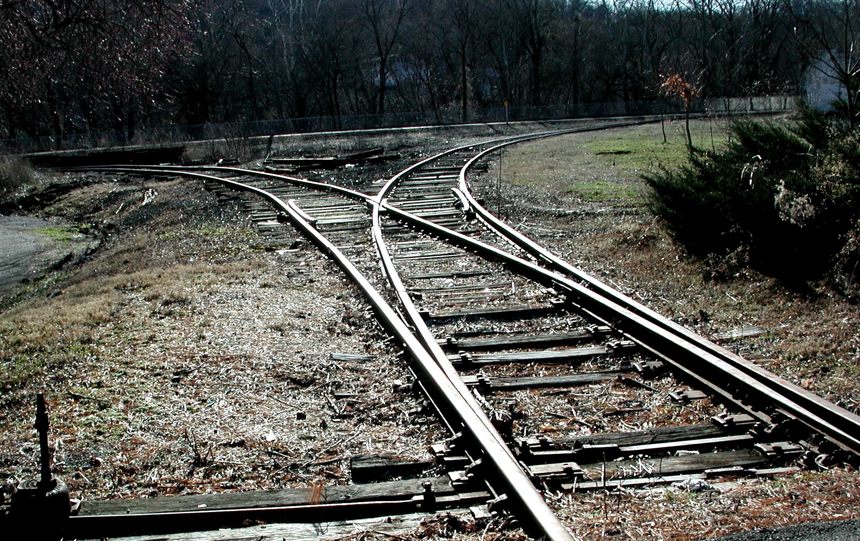
January 11, 1983 Depot St.
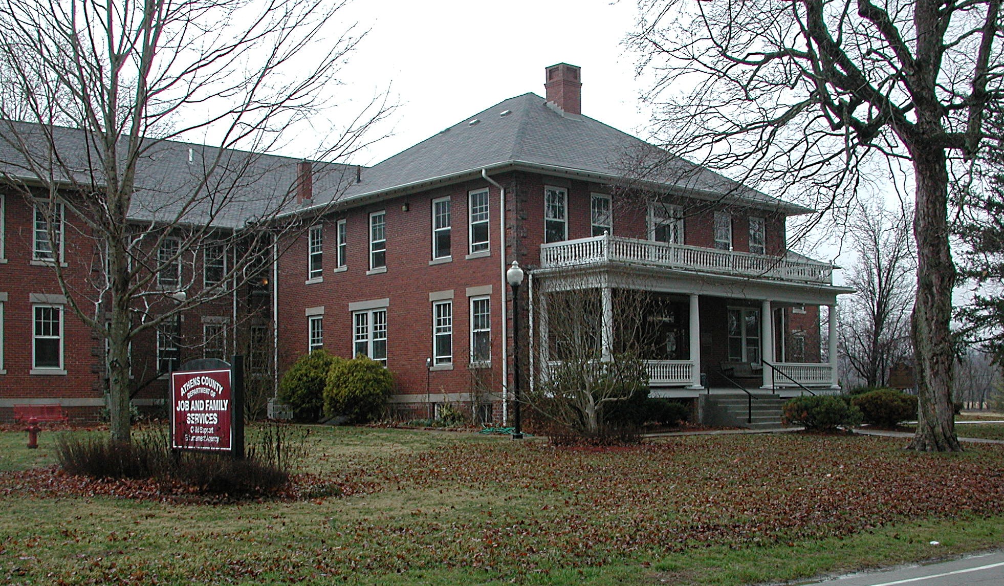
39°19′44″N 82°06′21″W / 39.328889°N 82.105833°WAthens The former railroad station for the B&O Railroad, an east-west line through Athens County. 2 Athens County Infirmary 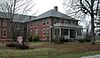
May 1, 2003 13183 State Route 13
39°23′34″N 82°07′08″W / 39.392667°N 82.118917°WDover Township Currently known as "The County Farm" or "The County Home." Today, it houses Job & Family Services. 3 Athens Downtown Historic District 
September 30, 1982 N. Court St. between Carpenter and Union Sts. and Congress and College Sts.
39°19′48″N 82°06′04″W / 39.329894°N 82.101094°WAthens 4 Athens Governmental Buildings 
November 29, 1979 E. State, E. Washington, Court, and W. Union Sts.
39°19′35″N 82°06′02″W / 39.326389°N 82.100556°WAthens 5 Athens State Hospital 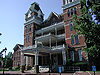
March 11, 1980 State Route 682 and Richland Ave.
39°18′56″N 82°06′07″W / 39.315531°N 82.101906°WAthens The former state mental hospital, and formerly a working farm. Today owned by Ohio University and known as The Ridges. 6 Athens State Hospital Cow Barn 
April 25, 1978 Southwest of Athens off U.S. Route 33
39°18′52″N 82°06′55″W / 39.314444°N 82.115278°WAthens Township Today known as the Dairy Barn; an art gallery 7 Beasley Building 
October 7, 1982 93 W. Union St.
39°19′44″N 82°06′18″W / 39.328889°N 82.105°WAthens Currently known as Beasley Mills and used as subsidized apartments. 8 Blackwood Covered Bridge 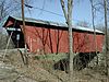
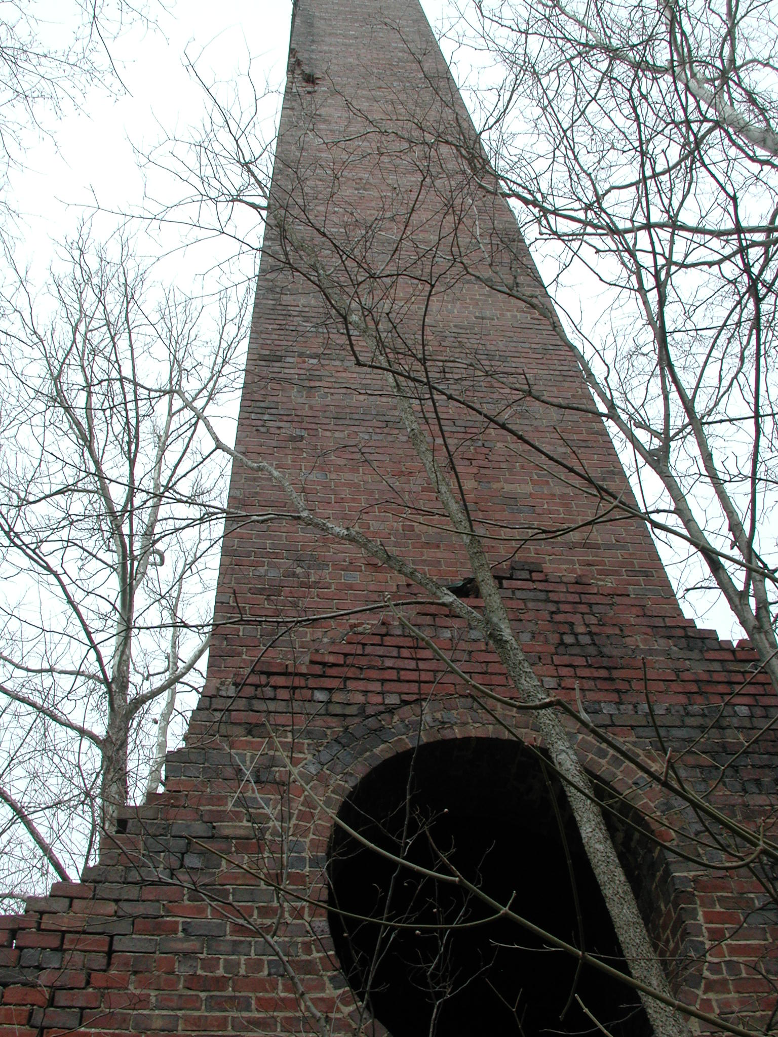
June 23, 1978 South of Athens on County Road 46
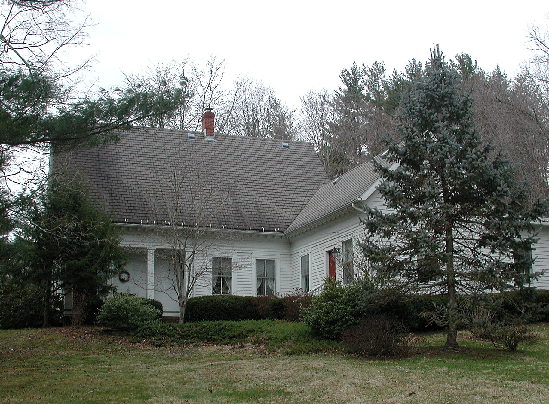
39°11′50″N 81°58′29″W / 39.197222°N 81.974722°WLodi Township Covered bridge on Blackwood Road (County Road 46) in southern Lodi Township, over the Shade River. 9 Joseph Clester House 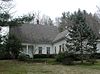
November 26, 1980 Southeast of Chauncey
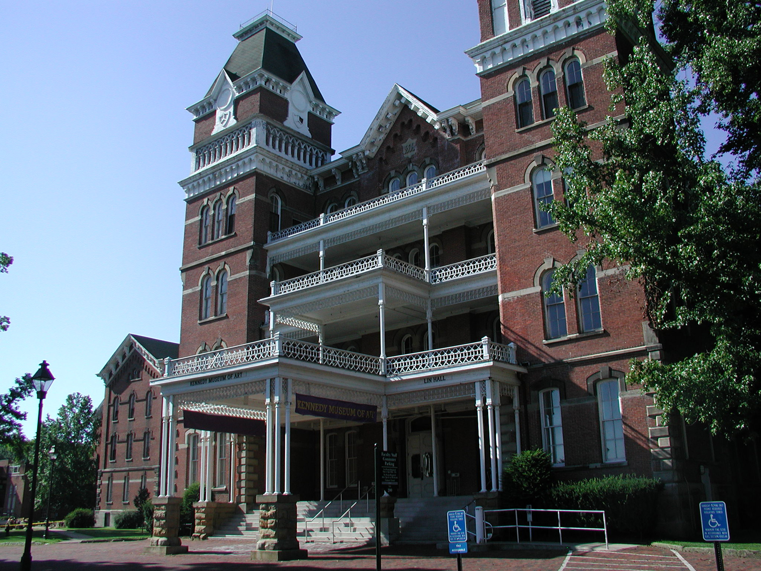
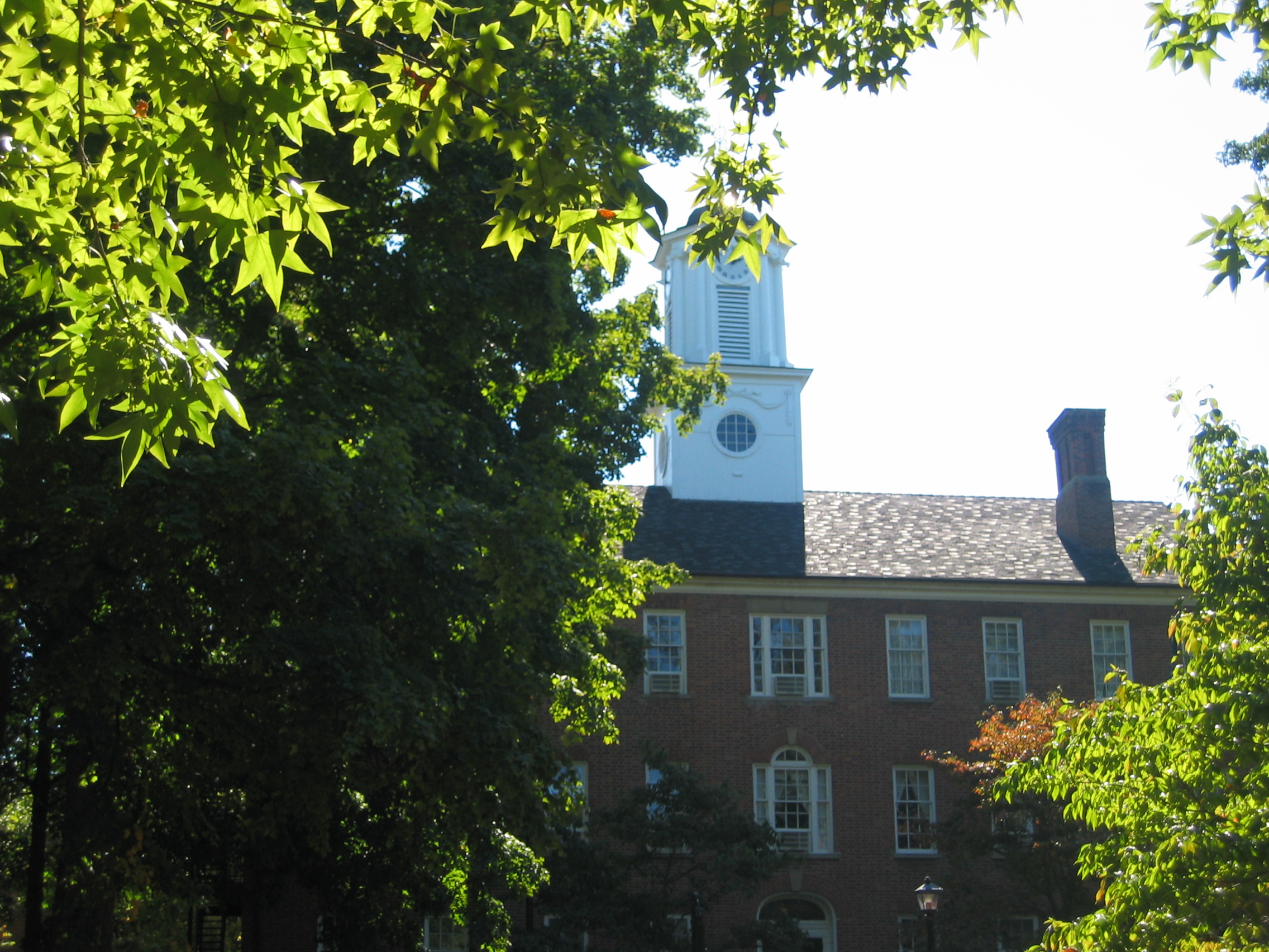
39°22′36″N 82°05′53″W / 39.376667°N 82.098056°WDover Township 10 Manasseh Cutler Hall, Ohio University 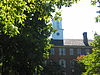
October 15, 1966 Ohio University campus
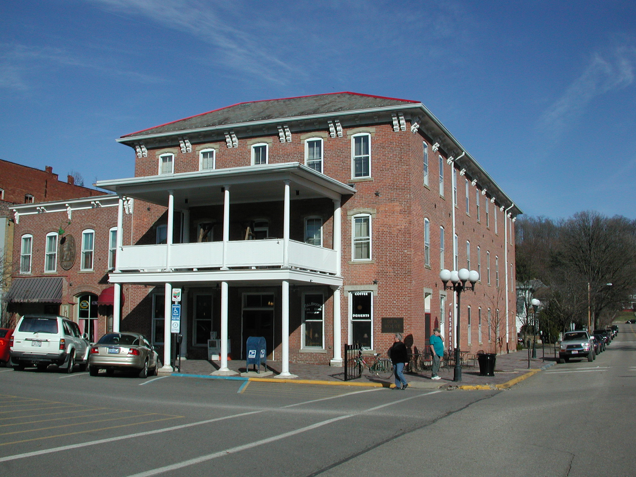
39°19′34″N 82°06′02″W / 39.326111°N 82.100556°WAthens The oldest building on the Ohio University campus; fronts on College Green 11 Dew House 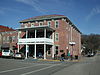
October 2, 1978 Public Square
39°27′36″N 82°13′56″W / 39.46°N 82.232222°WNelsonville 12 East State Street-Elmwood Place Historic District 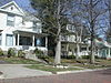
October 8, 2010 138-234 and 169-277 E. State St.; 5-73, 6-74 Elmwood Place
39°20′12″N 82°05′41″W / 39.336667°N 82.094722°WAthens 13 Federalton 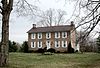
August 13, 1976 Northeast corner of Ohio State Route 329 and Zimmerman Hill Road in Stewart
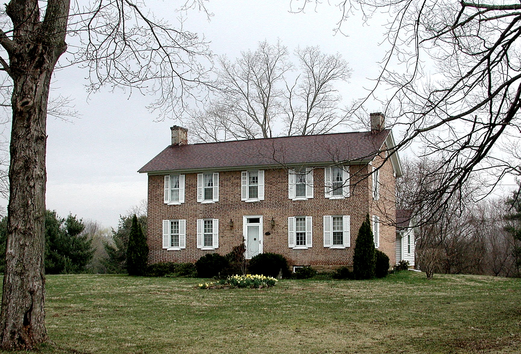
39°18′31″N 81°53′40″W / 39.308611°N 81.894444°WRome Township Built in 1817. Formerly 51 State Street. 14 Thomas Jefferson Herrold House and Store 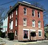
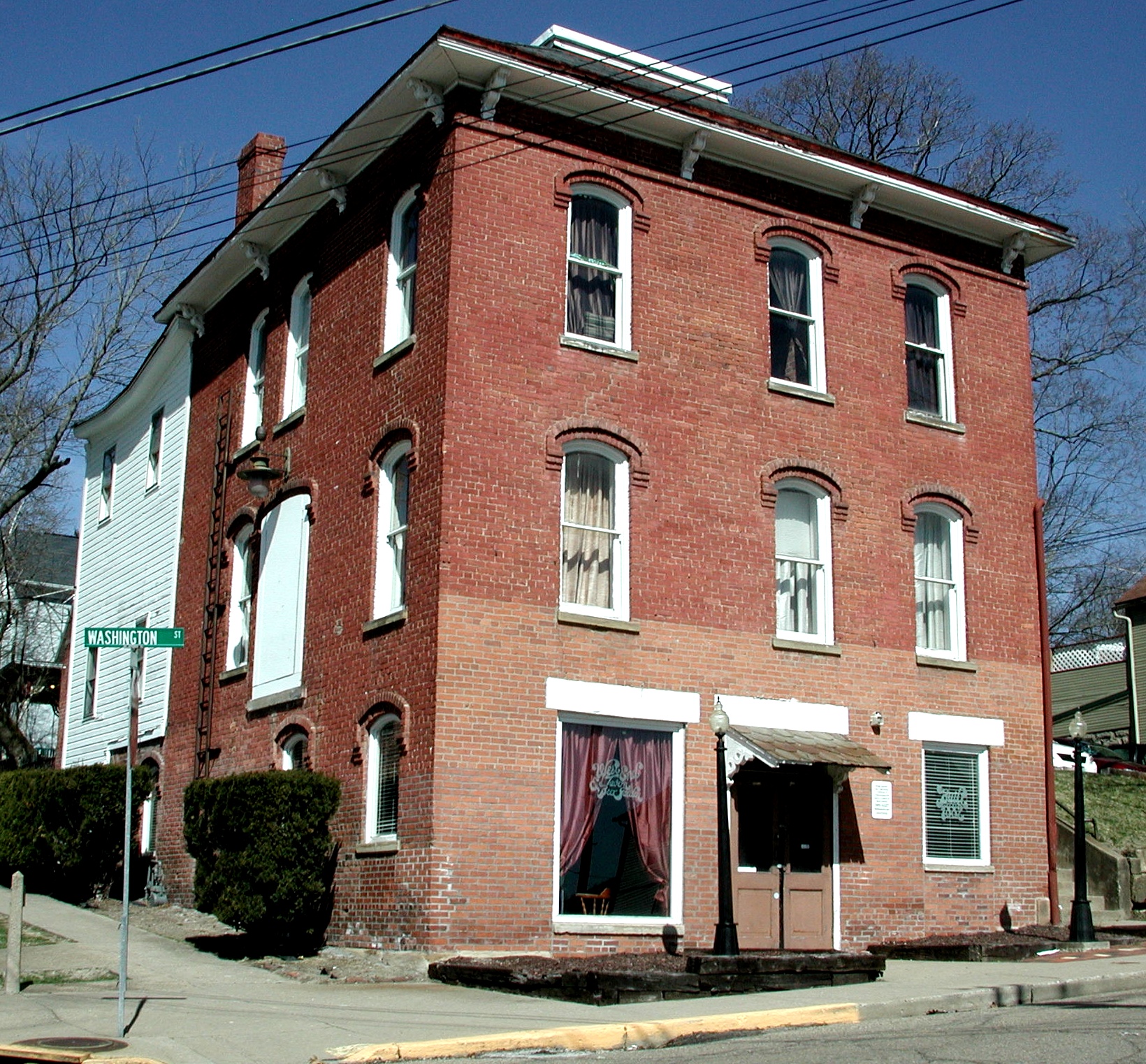
November 21, 1980 234 W. Washington St.
39°19′56″N 82°06′37″W / 39.332222°N 82.110278°WAthens On northeast corner of Washington Street and Shafer Street: When built, this section of Washington Street was Dean Street, and this section of Shafer Street was Cemetery Street. 15 Hocking Valley Coal Company Town Historic District 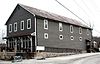
June 22, 2007 Jackson Dr. and Arbor Dr. in The Plains
39°21′51″N 82°07′04″W / 39.364133°N 82.117697°WAthens Township Today this is known as Eclipse Village and is used for offices, residences, and a gathering hall. The photograph is of the restored company store. 16 Hocking Valley Railway Historic District 
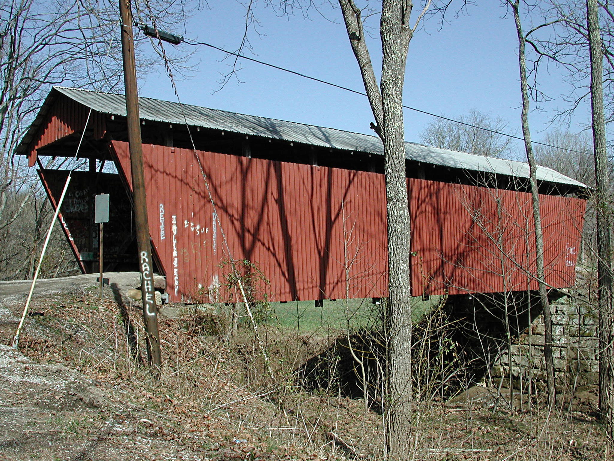
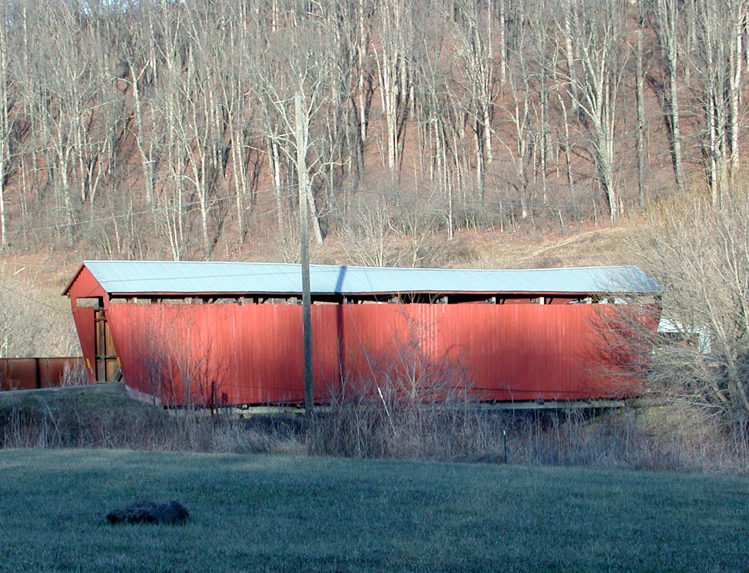
May 5, 1988 Roughly between Bridge #494 in Logan and Bridge #629 in Nelsonville Nelsonville and York Township Extends into Hocking County 17 Kidwell Covered Bridge 
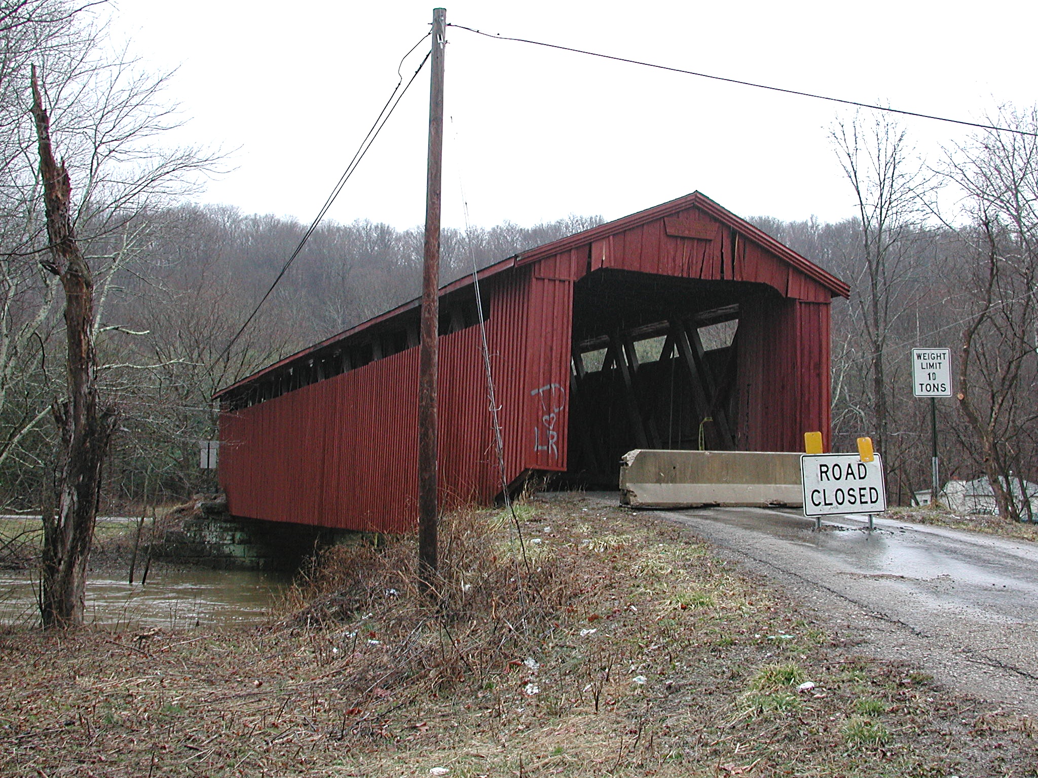
April 11, 1977 1 mile north of Truetown
39°27′21″N 82°06′13″W / 39.455833°N 82.103611°WDover Township On Monserat Ridge Road between Ohio State Route 685 and Ohio State Route 13. 18 Mount Zion Baptist Church 
October 3, 1980 Congress and Carpenter Sts.
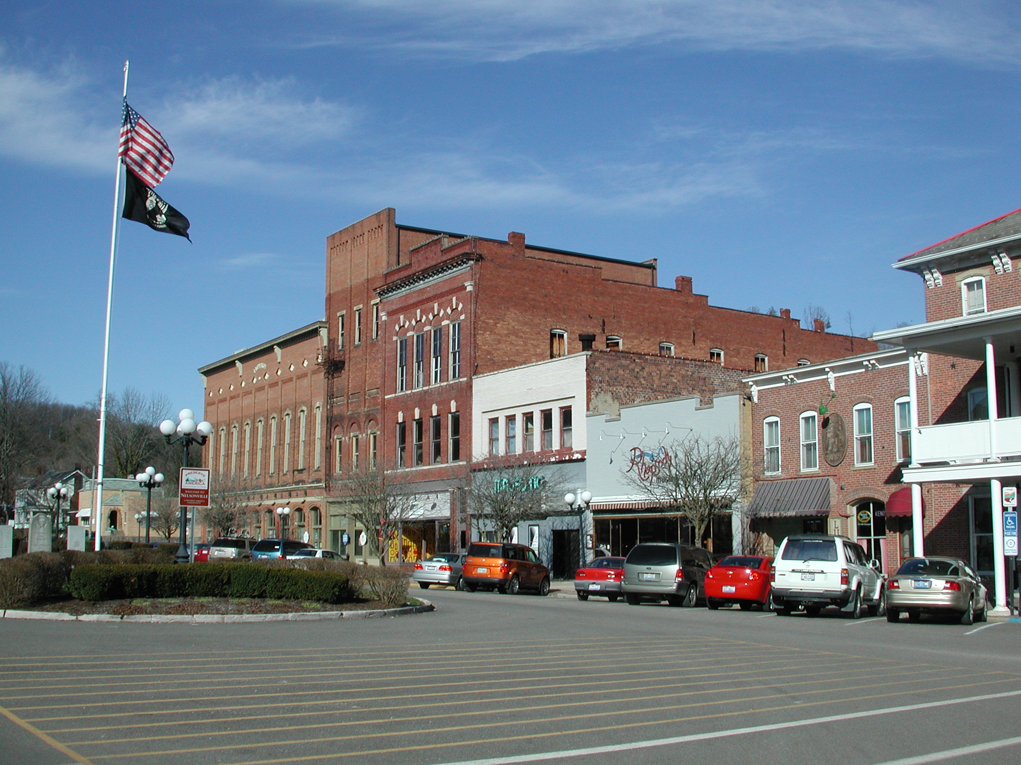
39°19′57″N 82°06′07″W / 39.3325°N 82.101944°WAthens A traditional black church on the northern fringe of downtown Athens 19 Nelsonville Historic District 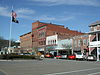
June 14, 1996 Roughly bounded by Canal, Jefferson, Scott, and Madison Sts.
39°27′42″N 82°13′57″W / 39.461667°N 82.2325°WNelsonville The central Nelsonville Business District; includes Stuart's Opera House 20 Ohio University Campus Green Historic District 
June 11, 1979 Ohio University campus
39°19′34″N 82°06′01″W / 39.326111°N 82.100278°WAthens The original area of Ohio University, used for over 200 years; fronted on by Cutler Hall 21 Palos Covered Bridge 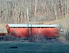
November 11, 1977 1 mile north of Gloucester off State Route 13
39°31′31″N 82°04′19″W / 39.525278°N 82.071944°WTrimble Township Over Sunday Creek 22 Savage-Stewart House 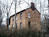
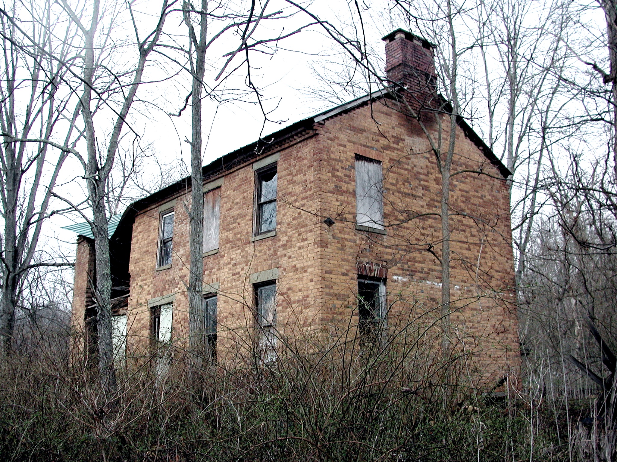
February 8, 1980 Southeast of Canaanville on Canaanville Road
39°18′43″N 81°58′33″W / 39.311944°N 81.975833°WCanaan Township An historic orange brick house, now in severe disrepair. 23 Sheltering Arms Hospital 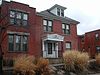
June 25, 1982 Clark St.
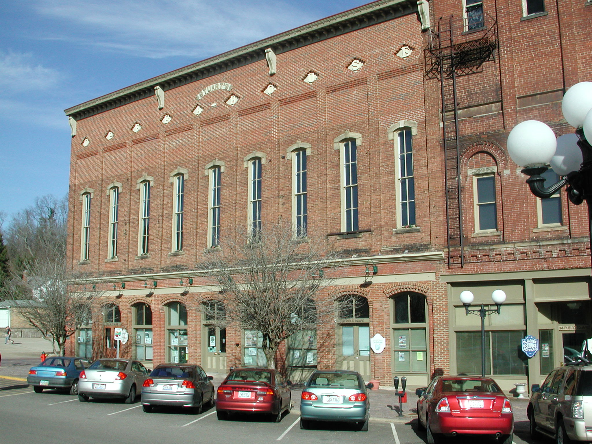
39°20′08″N 82°06′43″W / 39.335556°N 82.111944°WAthens A birthing center began in a private home at 19 Clark Street. This grew to include a neighboring house, with additional structures built on. Its successor is nearby O'Bleness Memorial Hospital. The Sheltering Arms structure today houses subsidized apartments. 24 Stuart's Opera House 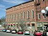
December 29, 1978 Public Sq. and Washington St.
39°27′39″N 82°13′55″W / 39.460833°N 82.231944°WNelsonville Renovated once, then burned, then renovated again and today used for plays, music events, and other activities. 25 Sunday Creek Coal Company Mine No. 6 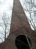
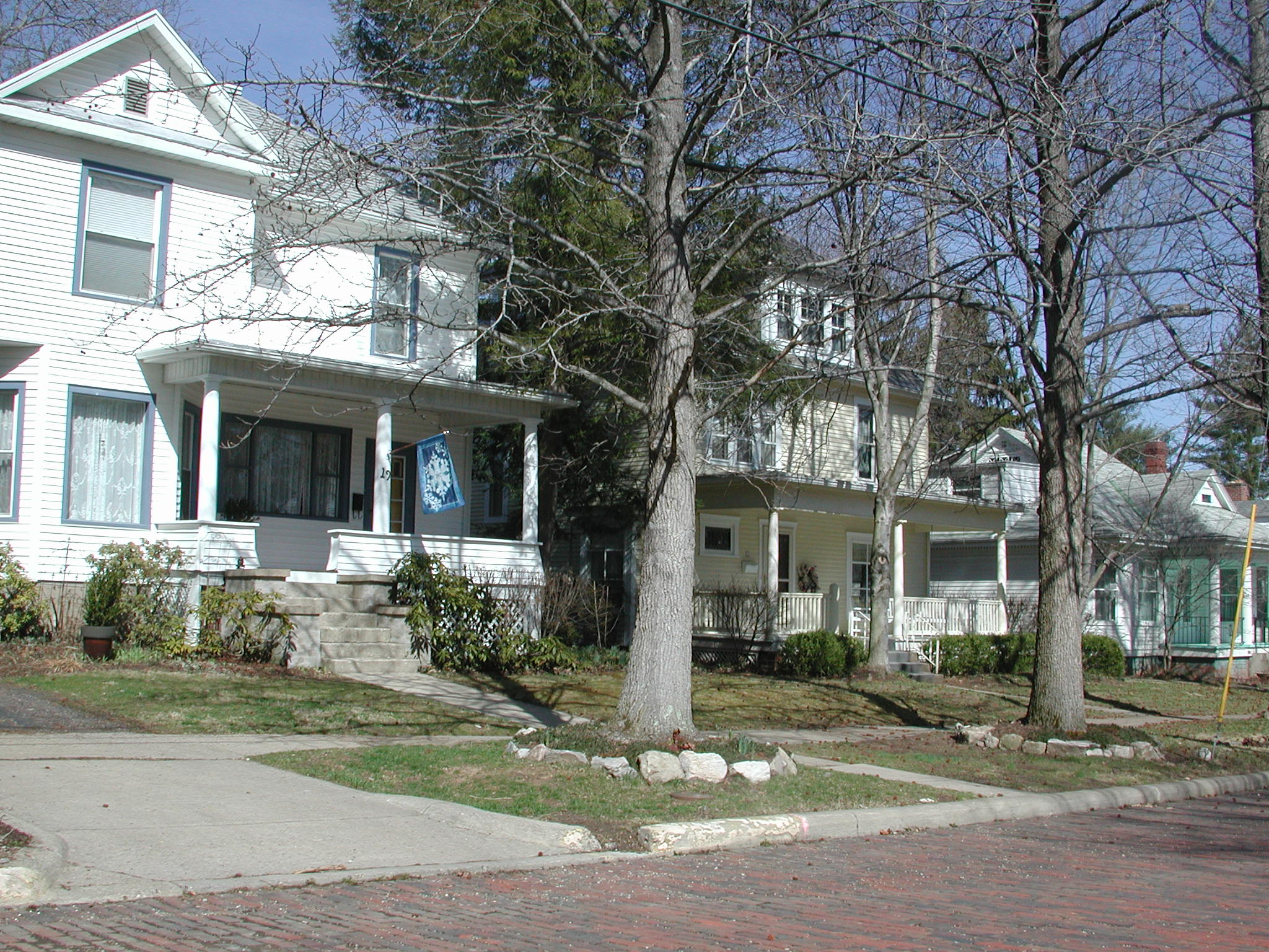
May 23, 1978 East of East Millfield
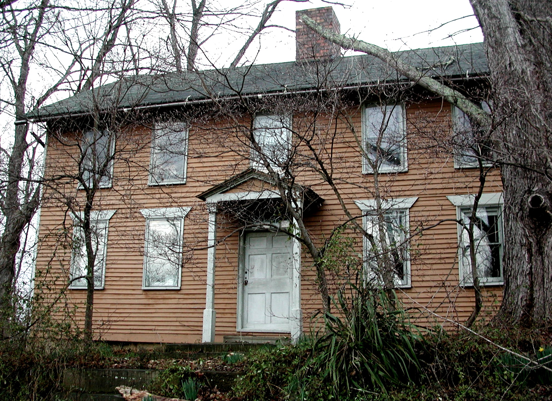
39°26′00″N 82°04′39″W / 39.433236°N 82.077614°WDover Township Site of the Millfield Mine disaster. 26 Weethee Historic District 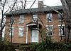
January 7, 1980 North of Millfield
39°27′10″N 82°05′41″W / 39.452778°N 82.094722°WDover Township This property, on the upper end of Bell Road (beyond this house), once housed a small college. 27 White's-Vale Mill 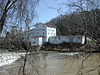
July 29, 1982 State Route 682
39°19′16″N 82°07′32″W / 39.321111°N 82.125556°WAthens Township This site today, known as White's Mill, houses a nursery and feed store. 28 Wolf Plains 
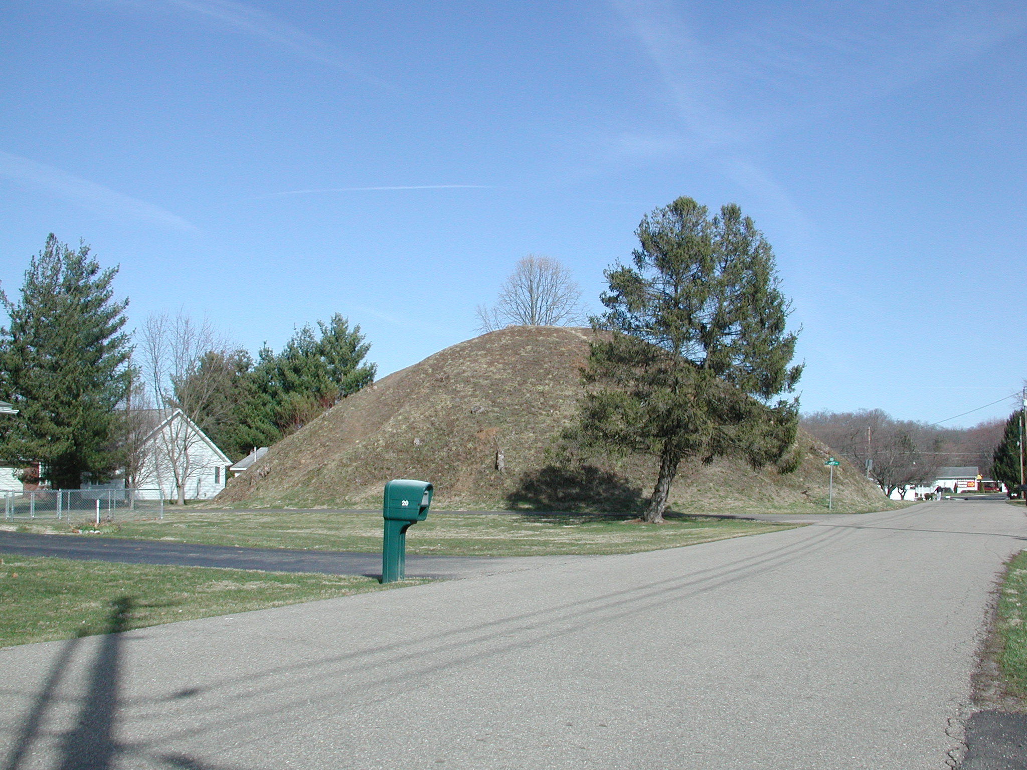
May 31, 1974 In the vicinity of The Plains
39°22′30″N 82°7′27″W / 39.375°N 82.12417°W[5]Athens Township A Late Adena culture group of 30 earthworks including 22 conical mounds and nine circular enclosures,[6] located a few miles to the northwest of Athens See also
References
- ^ The latitude and longitude information provided in this table was derived originally from the National Register Information System, which has been found to be fairly accurate for about 99% of listings. For about 1% of NRIS original coordinates, experience has shown that one or both coordinates are typos or otherwise extremely far off; some corrections may have been made. A more subtle problem causes many locations to be off by up to 150 yards, depending on location in the country: most NRIS coordinates were derived from tracing out latitude and longitudes off of USGS topographical quadrant maps created under North American Datum of 1927, which differs from the current, highly accurate GPS system used by Google maps. Chicago is about right, but NRIS longitudes in Washington are higher by about 4.5 seconds, and are lower by about 2.0 seconds in Maine. Latitudes differ by about 1.0 second in Florida. Some locations in this table may have been corrected to current GPS standards.
- ^ "National Register of Historic Places: Weekly List Actions". National Park Service, United States Department of the Interior. Retrieved on November 10, 2011.
- ^ Numbers represent an ordering by significant words. Various colorings, defined here, differentiate National Historic Landmark sites and National Register of Historic Places Districts from other NRHP buildings, structures, sites or objects.
- ^ "National Register Information System". National Register of Historic Places. National Park Service. . http://nrhp.focus.nps.gov/natreg/docs/All_Data.html.
- ^ Location derived from Mills, William C. Archeological Atlas of Ohio. Columbus: Ohio State Archeological and Historical Society, 1914, 1914, page 5 and plate 5. The NRIS lists the site as "Address Restricted".
- ^ "The Archaeological Conservancy-2008 Annual Report". http://www.americanarchaeology.com/Annual%20Report%202008.pdf. Retrieved 2010-02-03.
Municipalities and communities of Athens County, Ohio County seat: Athens Cities 
Villages Townships CDP Unincorporated
communitiesBurr Oak | Carbondale | Canaanville | Guysville | Hockingport | Millfield | Mineral | Modoc | New Marshfield | Redtown | Shade | Sharpsburg | Stewart
Footnotes ‡This populated place also has portions in an adjacent county or counties
Categories:- National Register of Historic Places in Ohio by county
- Athens County, Ohio
-


Wikimedia Foundation. 2010.