- National Register of Historic Places listings in Lorain County, Ohio
-
 Location of Lorain County in Ohio
This is a list of the National Register of Historic Places listings in Lorain County, Ohio.
This is intended to be a complete list of the properties and districts on the National Register of Historic Places in Lorain County, Ohio, United States. The locations of National Register properties and districts for which the latitude and longitude coordinates are included below, may be seen in a Google map.[1]
There are 124 properties and districts listed on the National Register in the county, including 3 National Historic Landmarks.
-
- This National Park Service list is complete through NPS recent listings posted November 10, 2011.[2]
Current listings
[3] Landmark name [4] Image Date listed Location City or town Summary 1 103rd Ohio Volunteer Infantry Association Barracks July 14, 1978 5501 E. Lake Rd.
41°30′01″N 82°04′10″W / 41.500278°N 82.069444°WSheffield Lake 2 Darlon Allen House 
June 15, 1979 South of Wellington on State Route 58
41°06′46″N 82°13′12″W / 41.112778°N 82.22°WHuntington Township 3 American Felsol Company Building June 15, 2011 200 W. 9th St.
41°27′47″N 82°10′26″W / 41.463056°N 82.173889°WLorain 1909 building originally built for the Independent Order of Odd Fellows; also known as the IOOF Building and the Lorain YWCA Building[5] 4 Amherst Town Hall 
May 29, 1975 206 S. Main St.
41°23′54″N 82°13′38″W / 41.398333°N 82.227222°WAmherst 5 Antlers Hotel November 30, 1982 Southwest Erie and Washington Aves.
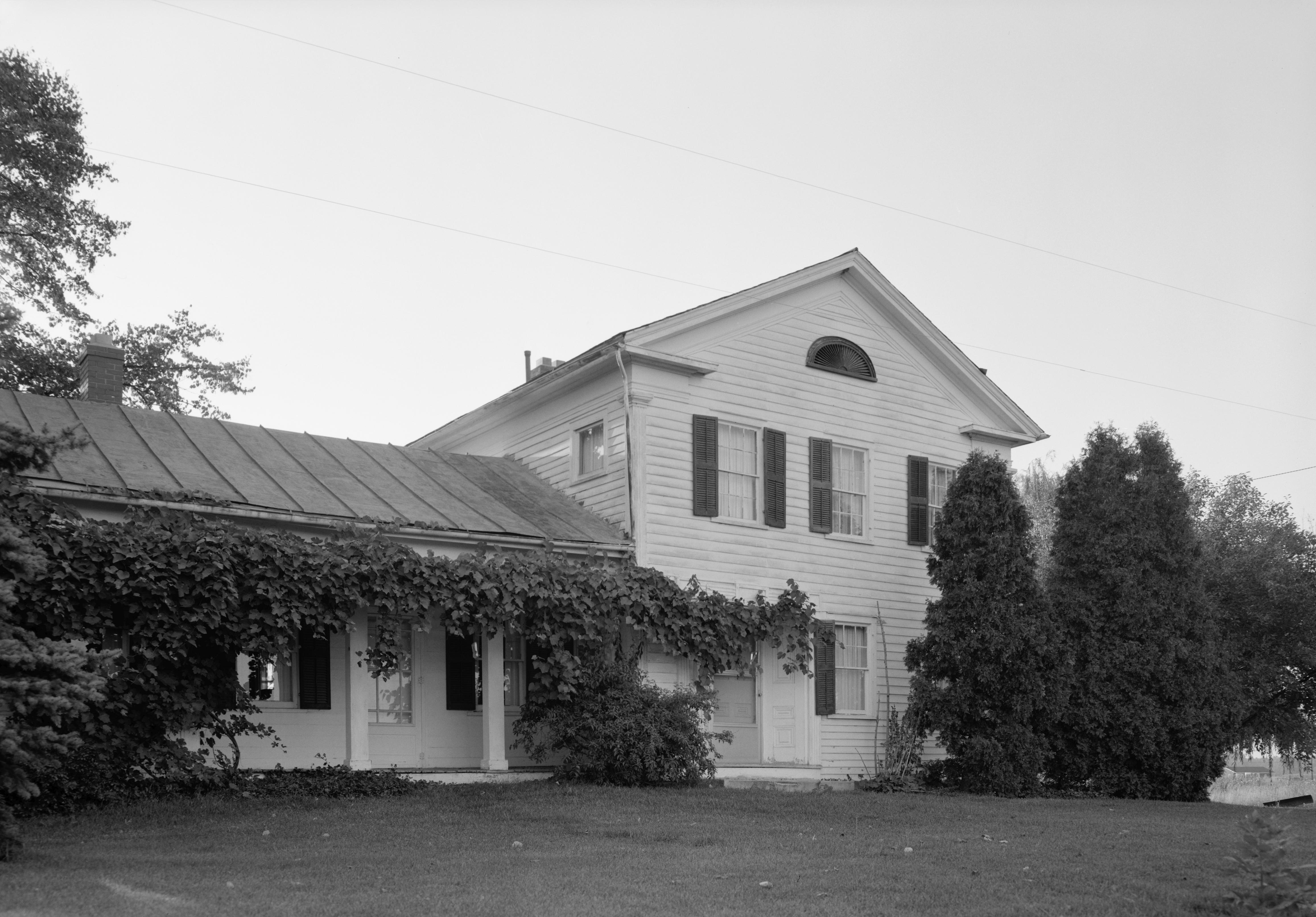
41°28′03″N 82°10′50″W / 41.4675°N 82.180556°WLorain 6 Carlos Avery House May 31, 1984 18797 State Route 58, north of Wellington
41°12′32″N 82°13′11″W / 41.208889°N 82.219722°WPittsfield Township 7 Avon Isle 
July 8, 2010 37080 Detroit Rd.
41°27′07″N 82°02′11″W / 41.451944°N 82.036389°WAvon 8 O.T. Baker House June 15, 1979 South of Wellington on State Route 58
41°06′26″N 82°14′43″W / 41.107222°N 82.245278°WHuntington Township 9 Henry Bradford Farm September 30, 1982 North of Rochester on State Route 511
41°08′12″N 82°18′26″W / 41.136667°N 82.307222°WRochester Township 10 Justin Breckenridge House November 29, 1978 37174 S. East Main St., southeast of Grafton
41°15′51″N 82°02′43″W / 41.264167°N 82.045278°WGrafton Township 11 Broadway Building 
November 14, 1985 Southeastern corner of W. Erie Ave. and Broadway
41°28′06″N 82°10′39″W / 41.468333°N 82.1775°WLorain 12 Brownhelm Historic District June 28, 1979 Along N. Ridge Rd. in Brownhelm
41°23′21″N 82°17′15″W / 41.389167°N 82.2875°WBrownhelm Township 13 George Bryant House August 13, 1979 333 3rd. St.
41°21′56″N 82°06′33″W / 41.365556°N 82.109167°WElyria 14 Burrell Fort April 4, 1978 Along French Creek, ¼ mile from the Black River
41°27′32″N 82°6′8″W / 41.45889°N 82.10222°W[6]Sheffield 15 Burrell Orchard Site September 15, 1977 On a ridge off East River Road
41°27′18″N 82°6′24.3″W / 41.455°N 82.10675°W[7]Sheffield 16 Jabez and Robbins Burrell House and Cheese Factory January 1, 1976 North of Lorain off State Route 301
41°27′17″N 82°06′20″W / 41.454722°N 82.105556°WSheffield 17 Burrell-King House March 7, 1979 317 E. College St.
41°17′27″N 82°12′21″W / 41.290833°N 82.205833°WOberlin 18 Samuel C. Cahoon House September 20, 1978 38369 Center Ridge Rd.
41°23′00″N 82°03′10″W / 41.383333°N 82.052778°WNorth Ridgeville 19 Wilbur Cahoon House 
April 6, 1978 2940 Stoney Ridge Rd.
41°26′50″N 82°01′58″W / 41.447222°N 82.032778°WAvon 20 Patrick Carlin House August 13, 1979 1182 W. River Rd., N.
41°23′19″N 82°06′18″W / 41.388611°N 82.105°WElyria 21 Central School November 19, 1987 474 Church St.
41°23′12″N 82°13′32″W / 41.386667°N 82.225556°WAmherst 22 Century Block August 13, 1979 Northeastern corner of Broad St. and Washington Ave. and northern side of Broad St.
41°22′04″N 82°06′22″W / 41.367778°N 82.106111°WElyria 23 John A. Chapman House June 15, 1979 South of Wellington on State Route 58
41°06′57″N 82°13′10″W / 41.115833°N 82.219444°WHuntington Township 24 Christ Episcopal Church November 30, 1978 156 S. Main St.
41°17′15″N 82°13′05″W / 41.2875°N 82.218056°WOberlin 25 Ansel Clark House June 15, 1979 South of Wellington on State Route 58
41°07′13″N 82°13′12″W / 41.120278°N 82.22°WHuntington Township 26 Whitney Clark House 
June 15, 1979 South of Wellington on State Route 58
41°06′59″N 82°13′12″W / 41.116389°N 82.22°WHuntington Township 27 Columbia Baptist Church July 12, 1976 25514 Royalton Rd.
41°18′47″N 81°55′32″W / 41.313056°N 81.925556°WColumbia Township 28 Columbia Town Hall March 17, 1976 25496 Royalton Rd.
41°18′46″N 81°55′30″W / 41.312778°N 81.925°WColumbia Township 29 Commercial Building August 13, 1979 Northeastern corner of 2nd St. and Middle Ave.
41°22′00″N 82°06′24″W / 41.366667°N 82.106667°WElyria 30 Congregational Church of Christ 
August 13, 1974 W. Lorain and N. Main Sts.
41°17′40″N 82°13′06″W / 41.294444°N 82.218333°WOberlin 31 Dean Road Bridge November 28, 1978 West of South Amherst at Dean Rd. and the Vermilion River
41°20′56″N 82°20′41″W / 41.348889°N 82.344722°WHenrietta Township Extends into Erie County 32 Downtown Oberlin Historic District May 1, 2003 Roughly includes W. and E. College St., within 1 block of S. Main and S. Main from College to approximately Vine St.
41°17′25″N 82°13′05″W / 41.290278°N 82.218056°WOberlin 33 Duane Block 
July 16, 1987 387-401 Broadway
41°28′03″N 82°10′37″W / 41.4675°N 82.176944°WLorain 34 Eagles Building 
April 24, 1986 575 Broadway
41°27′57″N 82°10′31″W / 41.465833°N 82.175278°WLorain Located on the east (right) side of Broadway, it has a tall-white facade. 35 Eiden Prehistoric District November 21, 1978 0.8 km north of the confluence of the Black River and French Creek
41°27′51.5″N 82°6′45″W / 41.464306°N 82.1125°W[8]Sheffield 36 Ely Block August 13, 1979 Northern side of Broad St. between Washington and East Ave.
41°22′04″N 82°06′26″W / 41.367778°N 82.107222°WElyria 37 Elyria Downtown-West Avenue Historic District January 16, 2001 Roughly bounded by Railroad, East Ave, 5th St., and West Ave.
41°21′55″N 82°06′26″W / 41.365278°N 82.107222°WElyria 38 Elyria Elks Club August 13, 1979 246 2nd St.
41°21′58″N 82°06′23″W / 41.366111°N 82.106389°WElyria 39 Elyria High School - Washington Building August 13, 1979 Southwestern corner of 6th St. and Middle Ave.
41°21′43″N 82°06′28″W / 41.361944°N 82.107778°WElyria 40 Wilson Bruce Evans House 
April 16, 1980 33 E. Vine St.
41°17′19″N 82°12′59″W / 41.288611°N 82.216389°WOberlin 41 First Church of Christ, Scientist July 18, 1975 309 East Ave.
41°21′54″N 82°06′15″W / 41.365°N 82.104167°WElyria 42 First National Bank Building August 13, 1979 Broad St.
41°22′04″N 82°06′19″W / 41.367778°N 82.105278°WElyria 43 First United Methodist Church August 13, 1979 312 3rd St.
41°21′54″N 82°06′28″W / 41.365°N 82.107778°WElyria 44 Halsey Garfield House May 22, 1978 4789 Detroit Rd.
41°25′19″N 82°05′35″W / 41.421944°N 82.093056°WSheffield 45 Milton Garfield House September 21, 1978 4921 Detroit Rd.
41°25′23″N 82°05′17″W / 41.423056°N 82.088056°WSheffield 46 Arthur L. Garford House December 30, 1974 509 Washington Ave.
41°21′55″N 82°06′21″W / 41.365278°N 82.105833°WElyria 47 Gould Block February 9, 2005 608-630 Broadway Ave.
41°27′55″N 82°10′32″W / 41.465278°N 82.175556°WLorain 48 Grafton School February 21, 2008 1111 Elm St.
41°16′33″N 82°03′03″W / 41.275833°N 82.050833°WGrafton 49 Gregg House June 15, 1979 South of Wellington on State Route 58
41°06′04″N 82°13′14″W / 41.101111°N 82.220556°WHuntington Township 50 Gunn House June 15, 1979 South of Wellington on State Route 58
41°08′27″N 82°13′08″W / 41.140833°N 82.218889°WWellington Township 51 Huntington Grange June 15, 1979 South of Wellington at the junction of State Routes 58 and 162
41°06′03″N 82°13′12″W / 41.100833°N 82.22°WHuntington Township 52 Huntington Public School June 15, 1979 South of Wellington at junction of State Routes 58 and 162
41°06′01″N 82°13′11″W / 41.100278°N 82.219722°WHuntington Township 53 Huntington Township Hall June 15, 1979 South of Wellington on State Route 58
41°05′59″N 82°13′12″W / 41.099722°N 82.22°WHuntington Township 54 William E. Hurst House 
September 11, 1974 33065 Detroit Ave.
41°27′12″N 81°59′07″W / 41.453333°N 81.985278°WAvon 55 Immaculate Conception Church March 16, 1976 708 Erie St.
41°16′37″N 82°03′36″W / 41.276944°N 82.06°WGrafton 56 Frank Jewett House July 24, 1979 73 S. Professor St.
41°17′24″N 82°13′10″W / 41.29°N 82.219444°WOberlin 57 Johnson Steel Street Railway Company General Offices Building July 16, 1992 1807 E. 28th St.
41°26′48″N 82°08′29″W / 41.446667°N 82.141389°WLorain 58 E.J. Johnson House August 13, 1979 Middle Ave. and 9th St.
41°21′35″N 82°06′25″W / 41.359722°N 82.106944°WElyria 59 John Mercer Langston House 
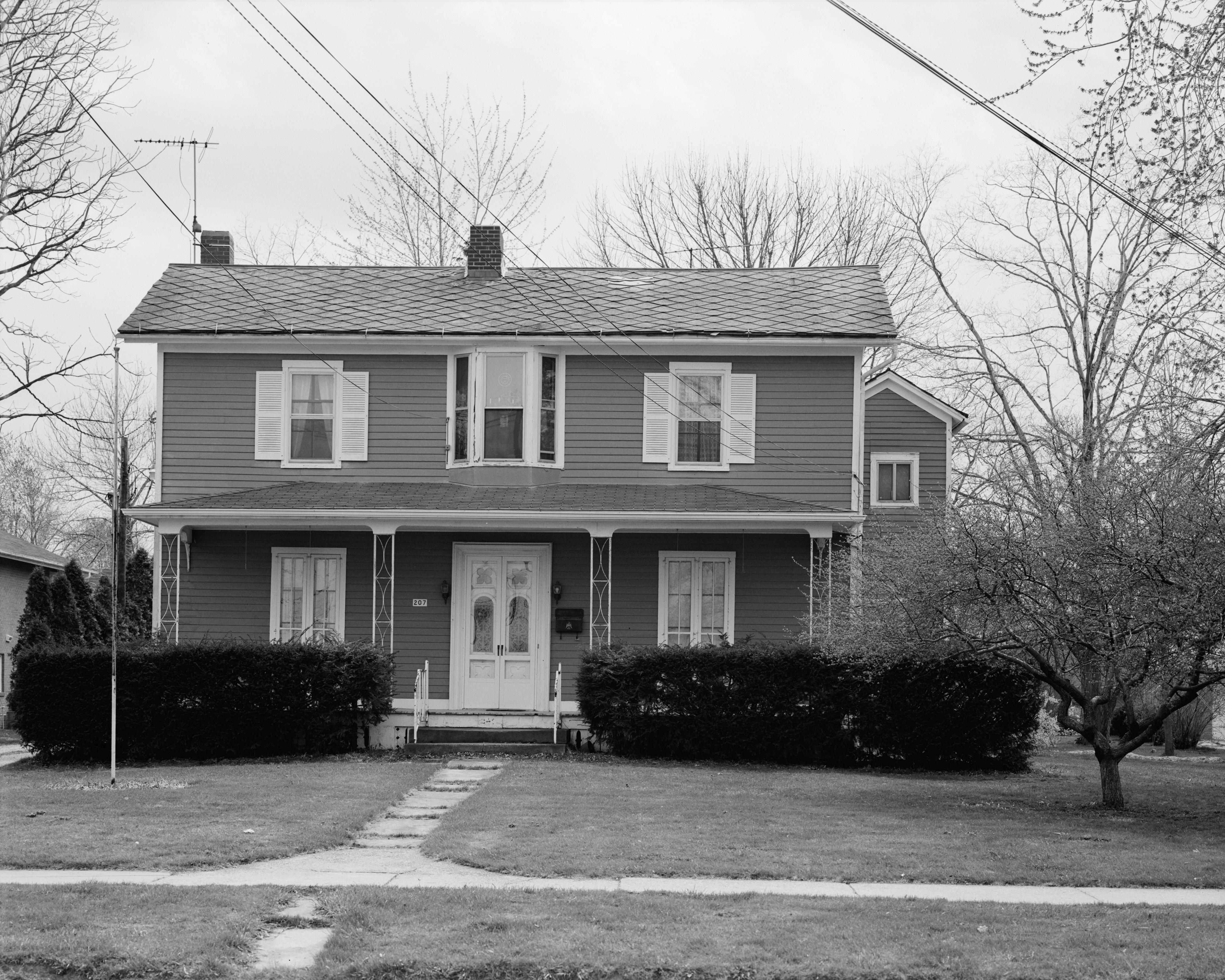
May 15, 1975 207 E. College St.
41°17′28″N 82°12′36″W / 41.291111°N 82.21°WOberlin 60 Thomas W. Laundon House October 21, 1975 307 West Ave.
41°21′54″N 82°06′39″W / 41.365°N 82.110833°WElyria 61 John Lersch House August 13, 1979 121 Harrison St.
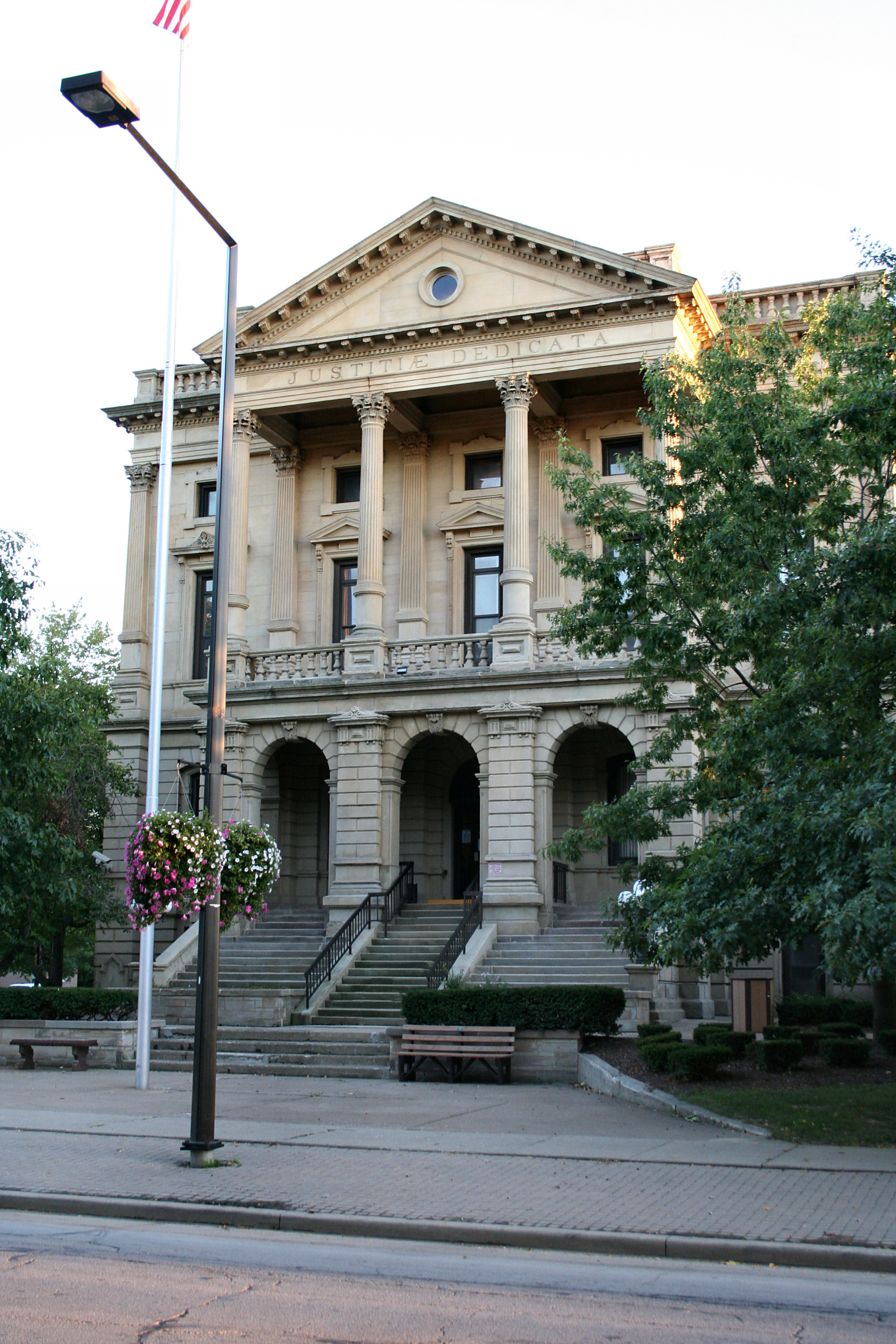
41°22′21″N 82°06′20″W / 41.3725°N 82.105556°WElyria 62 Lorain County Courthouse 
June 18, 1975 308 2nd St.
41°21′57″N 82°06′27″W / 41.365833°N 82.1075°WElyria 63 Lorain Fire Station No. 1 August 20, 1987 605 W. Fourth St.
41°28′02″N 82°10′48″W / 41.467222°N 82.18°WLorain 64 Lorain Lighthouse 
December 29, 1978 Lorain Harbor
41°28′38″N 82°11′25″W / 41.477222°N 82.190278°WLorain 65 Lorain YMCA Building July 16, 1992 Junction of E. 28th St. and Pearl Ave.
41°26′47″N 82°08′16″W / 41.446389°N 82.137778°WLorain 66 Addison Lord House December 9, 1999 315 West Ave.
41°21′53″N 82°06′39″W / 41.364722°N 82.110833°WElyria 67 The Mill Hollow House June 29, 1976 Southeast of Vermilion on N. Ridge Rd.
41°22′55″N 82°18′54″W / 41.381944°N 82.315°WBrownhelm Township 68 Peter Miller House August 25, 1978 33740 Lake Rd.
41°30′08″N 82°03′37″W / 41.502222°N 82.060278°WAvon Lake 69 Monteith Hall October 9, 1974 218 East Ave.
41°21′56″N 82°06′14″W / 41.365556°N 82.103889°WElyria 70 Leonard M. Moore House December 30, 1993 309 5th St.
41°27′57″N 82°10′41″W / 41.465833°N 82.178056°WLorain 71 Morris-Franks Site September 5, 1975 Southeast of Vermilion[9] Brownhelm Township 72 Mosher House 
June 15, 1979 South of Wellington on State Route 58
41°09′13″N 82°13′03″W / 41.153611°N 82.2175°WWellington Township 73 New York Central Freight House June 1, 1982 412 E. River St.
41°22′11″N 82°05′46″W / 41.369722°N 82.096111°WElyria 74 Walter Nichols House August 13, 1979 Southeastern corner of 4th St. and West Ave.
41°21′50″N 82°06′36″W / 41.363889°N 82.11°WElyria 75 Nimocks House June 15, 1979 South of Wellington on State Route 58
41°05′34″N 82°13′12″W / 41.092778°N 82.22°WHuntington Township 76 William Nooney House June 15, 1979 South of Wellington on State Route 58
41°06′28″N 82°14′38″W / 41.107778°N 82.243889°WHuntington Township 77 North Ridgeville City Hall December 30, 1974 U.S. Route 20
41°23′20″N 82°01′14″W / 41.388889°N 82.020556°WNorth Ridgeville 78 Oberlin College 
October 15, 1966 Tappan Sq.
41°17′34″N 82°13′08″W / 41.292778°N 82.218889°WOberlin 79 Oberlin Gas Lighting Company Gasholder House November 19, 1998 291 S. Main St.
41°17′04″N 82°12′57″W / 41.284444°N 82.215833°WOberlin 80 Oberlin Lake Shore And Michigan Southern Station March 2, 1979 Depot Park
41°17′04″N 82°13′08″W / 41.284444°N 82.218889°WOberlin 81 Old Amherst Freight Depot November 21, 1978 Franklin St.
41°23′42″N 82°13′08″W / 41.395°N 82.218889°WAmherst 82 Old Baptist Parsonage June 15, 1979 South of Wellington on State Route 58
41°06′12″N 82°14′38″W / 41.103333°N 82.243889°WHuntington Township 83 Old City Hall August 13, 1979 Court St. facing Elyria Square
41°22′00″N 82°06′30″W / 41.366667°N 82.108333°WElyria 84 Old District Nine Schoolhouse August 13, 1979 Chestnut St.
41°22′07″N 82°06′45″W / 41.368611°N 82.1125°WElyria 85 Old Elyria Water Tower August 13, 1979 Southern side of W. 15th St., 100 ft (30 m) west of Black River Bridge
41°21′09″N 82°06′54″W / 41.3525°N 82.115°WElyria 86 Old Huntington Inn June 15, 1979 South of Wellington at the junction of State Routes 58 and 162
41°06′04″N 82°13′14″W / 41.101111°N 82.220556°WHuntington Township 87 Old Methodist Parsonage June 15, 1979 South of Wellington on State Route 58
41°06′21″N 82°14′38″W / 41.105833°N 82.243889°WHuntington Township 88 Old Railroad Station August 13, 1979 49 East Ave.
41°22′06″N 82°06′13″W / 41.368333°N 82.103611°WElyria 89 Old St. John's Church August 13, 1979 600 W. Broad St.
41°22′03″N 82°06′38″W / 41.3675°N 82.110556°WElyria 90 Old St. Patrick's Church March 21, 1979 512 N. Main St.
41°10′27″N 82°13′00″W / 41.174167°N 82.216667°WWellington 91 Palace Theatre Building March 30, 1978 Broadway and 6th St.
41°27′56″N 82°10′29″W / 41.465556°N 82.174722°WLorain 92 Reamer Barn March 21, 1979 West of Oberlin[10] Oberlin 93 Redington Block August 13, 1979 Eastern side of Middle Ave. between Broad and 2nd Sts., second building from Ind. St.
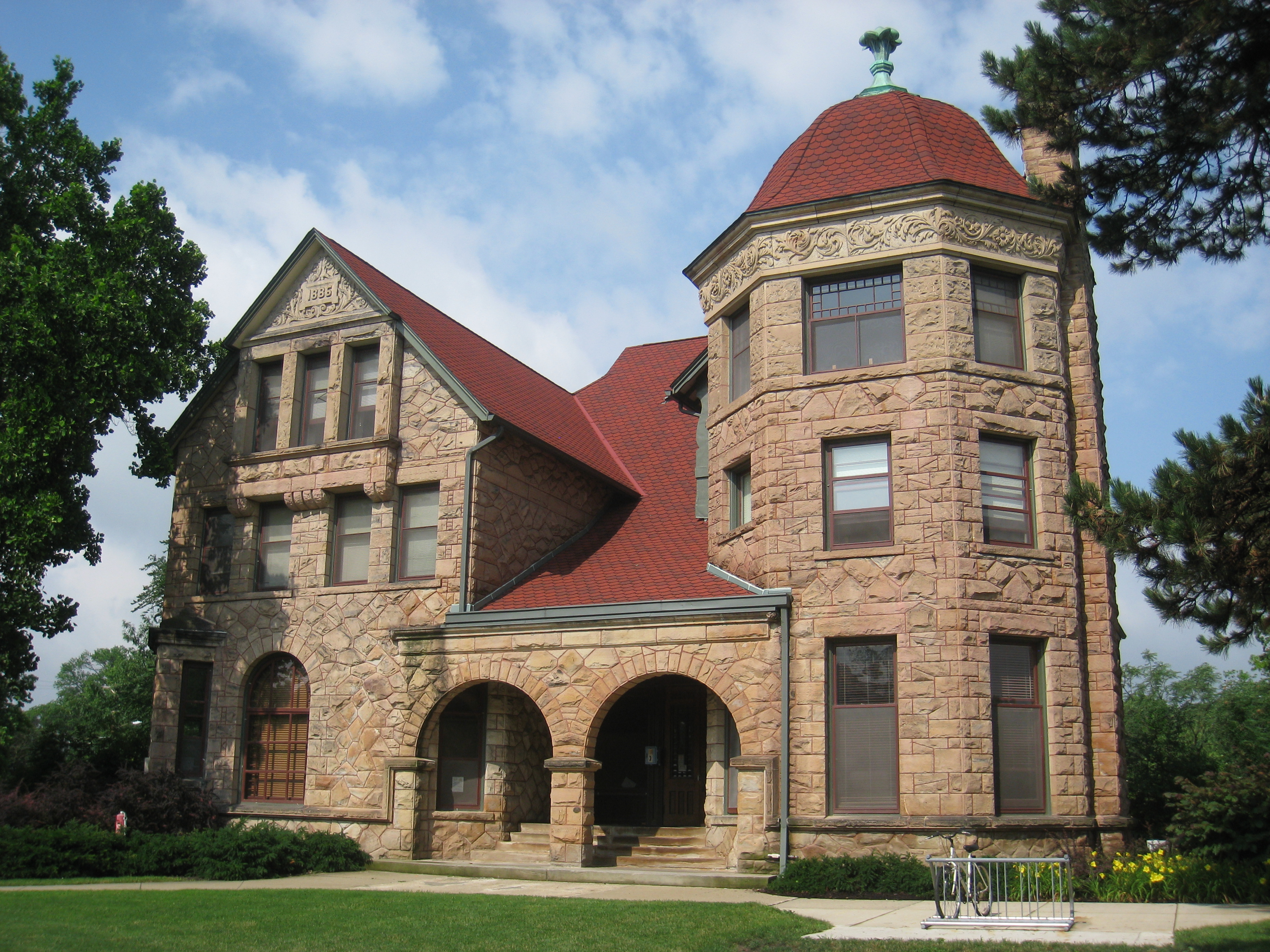
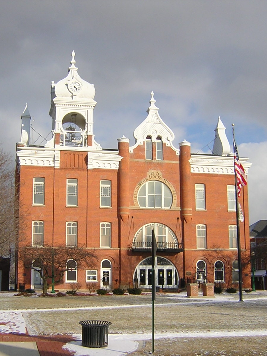
41°22′00″N 82°06′24″W / 41.366667°N 82.106667°WElyria 94 Frederick Reefy House August 13, 1979 3rd St. between West Ave. and Court St.
41°21′54″N 82°06′33″W / 41.365°N 82.109167°WElyria 95 William H. Root House September 20, 1978 3535 E. Erie Ave.
41°29′04″N 82°07′52″W / 41.484444°N 82.131111°WLorain 96 Sage House June 15, 1979 South of Wellington on State Route 58
41°06′23″N 82°13′12″W / 41.106389°N 82.22°WHuntington Township 97 St. Andrew's Episcopal Church August 13, 1979 300 3rd St.
41°21′54″N 82°06′26″W / 41.365°N 82.107222°WElyria 98 St. Ladislaus Roman Catholic Church April 1, 1982 2908 Wood Ave.
41°26′38″N 82°09′00″W / 41.443889°N 82.15°WLorain 99 St. Mary's Catholic School August 13, 1979 320 Middle Ave.
41°21′51″N 82°06′24″W / 41.364167°N 82.106667°WElyria 100 St. Mary's Roman Catholic Church August 13, 1979 320 Middle Ave.
41°21′51″N 82°06′24″W / 41.364167°N 82.106667°WElyria 101 William Seher House June 17, 1976 329 W. 9th St.
41°27′41″N 82°10′33″W / 41.461389°N 82.175833°WLorain 102 Sheffield Village Hall October 5, 1978 Detroit Rd.
41°25′17″N 82°05′34″W / 41.421389°N 82.092778°WSheffield 103 John J. Shipherd House August 13, 1979 Northwestern corner of East Ave. and 8th St.
41°21′35″N 82°06′16″W / 41.359722°N 82.104444°WElyria 104 Charles William and Anna Smith House January 25, 1997 651 W. Broad St.
41°22′05″N 82°06′43″W / 41.368056°N 82.111944°WElyria 105 Soldiers and Sailors Monument 
August 13, 1979 Elyria Square (Downtown)
41°22′03″N 82°06′27″W / 41.3675°N 82.1075°WElyria 106 South Ridge Schoolhouse August 8, 1985 State Route 113 and Bechtel Rd.
41°22′11″N 82°10′31″W / 41.369722°N 82.175278°WAmherst Township 107 Sprague House June 15, 1979 South of Wellington at the junction of State Route 58 and Jones Rd.
41°08′48″N 82°13′06″W / 41.146667°N 82.218333°WWellington Township 108 Horace C. Starr House and Carriage Barns April 3, 1979 276 Washington Ave.
41°22′16″N 82°06′25″W / 41.371111°N 82.106944°WElyria 109 U.S. Post Office August 13, 1979 Northeastern corner of Broad and East Sts.
41°22′04″N 82°06′13″W / 41.367778°N 82.103611°WElyria 110 U.S. Post Office 
December 9, 1982 9th St. and Broadway Ave.
41°27′48″N 82°10′22″W / 41.463333°N 82.172778°WLorain 111 Union Church March 15, 1982 511 Church St. in Kipton
41°15′56″N 82°18′15″W / 41.265556°N 82.304167°WCamden Township 112 United Church of Huntington June 15, 1979 South of Wellington on State Route 58
41°06′19″N 82°13′11″W / 41.105278°N 82.219722°WHuntington Township 113 Benjamin Wadsworth House June 15, 1979 South of Wellington on State Route 58
41°08′09″N 82°13′11″W / 41.135833°N 82.219722°WHuntington Township 114 Washington Avenue Historic District August 20, 1987 Roughly Ohio, Columbus, Harrison, and Saint Clair Sts. between Washington Ave. and Glenwood St.
41°21′22″N 82°06′17″W / 41.356111°N 82.104722°WElyria 115 Washington Terrace Apartments August 13, 1979 Washington Ave.
41°22′10″N 82°06′25″W / 41.369444°N 82.106944°WElyria 116 A.R. Webber House August 13, 1979 251 Washington Ave.
41°22′11″N 82°06′21″W / 41.369722°N 82.105833°WElyria 117 Wellington Center Historic District 
November 21, 1974 Main St. and Herrick Ave.
41°10′03″N 82°13′12″W / 41.1675°N 82.22°WWellington 118 Wellington Historic District May 30, 1979 Irregular pattern along Main St. from Kelley St. to the former Wheeling & Lake Erie railroad line
41°09′52″N 82°13′03″W / 41.164444°N 82.2175°WWellington 119 West House June 15, 1979 South of Wellington on State Route 58
41°05′13″N 82°13′14″W / 41.086944°N 82.220556°WHuntington Township 120 Westervelt Hall May 3, 1974 39 S. Main St.
41°17′26″N 82°13′01″W / 41.290556°N 82.216944°WOberlin 121 J.B. Wilber House June 15, 1979 South of Wellington on State Route 58
41°07′48″N 82°13′11″W / 41.13°N 82.219722°WHuntington Township 122 Henry Harrison Williams House 
July 12, 1978 37392 Detroit Rd.
41°26′58″N 82°02′18″W / 41.449444°N 82.038333°WAvon 123 Wilson-Falkner-Baldauf House 
May 21, 2010 3260 Center Rd.
41°26′26″N 82°01′11″W / 41.440436°N 82.019667°WAvon 124 Wooster Block August 13, 1979 Northern side of Broad St. between Lodi St. and Washington Ave.
41°22′04″N 82°06′33″W / 41.367778°N 82.109167°WElyria See also
References
- ^ The latitude and longitude information provided in this table was derived originally from the National Register Information System, which has been found to be fairly accurate for about 99% of listings. For about 1% of NRIS original coordinates, experience has shown that one or both coordinates are typos or otherwise extremely far off; some corrections may have been made. A more subtle problem causes many locations to be off by up to 150 yards, depending on location in the country: most NRIS coordinates were derived from tracing out latitude and longitudes off of USGS topographical quadrant maps created under North American Datum of 1927, which differs from the current, highly accurate GPS system used by Google maps. Chicago is about right, but NRIS longitudes in Washington are higher by about 4.5 seconds, and are lower by about 2.0 seconds in Maine. Latitudes differ by about 1.0 second in Florida. Some locations in this table may have been corrected to current GPS standards.
- ^ "National Register of Historic Places: Weekly List Actions". National Park Service, United States Department of the Interior. Retrieved on November 10, 2011.
- ^ Numbers represent an ordering by significant words. Various colorings, defined here, differentiate National Historic Landmark sites and National Register of Historic Places Districts from other NRHP buildings, structures, sites or objects.
- ^ "National Register Information System". National Register of Historic Places. National Park Service. . http://nrhp.focus.nps.gov/natreg/docs/All_Data.html.
- ^ "National Register of Historic Places Registration Form - American Felsol Company Building". April 2007. http://www.ohiohistory.org/resource/histpres/docs/nr/fel.pdf. Retrieved July 7, 2011.
- ^ Location derived from pages 226 and 229 of volume 44 of Ohio History; the NRIS lists the site as "Address Restricted".
- ^ Location derived from Anonymous. "Digging for answers in Sheffield", The Elyria Chronicle-Telegram, 2008-06-19. The NRIS lists the site as "Address Restricted"
- ^ Location derived from Lallo, John W. "Traumatic Lesions in Two Prehistoric Populations from Ohio", 161, accessed 2009-09-01. The NRIS lists the site as "Address Restricted". Coordinates are approximate.
- ^ Location derived from its Federal Register notice; the NRIS lists the site as "Address Restricted"
- ^ Location derived from its Federal Register notice; the NRIS lists the building as "Address Restricted"
Municipalities and communities of Lorain County, Ohio County seat: Elyria Cities Amherst | Avon | Avon Lake | Elyria | Lorain | North Ridgeville | Oberlin | Sheffield Lake | Vermilion‡

Villages Grafton | Kipton | LaGrange | Rochester | Sheffield | South Amherst | Wellington
Townships Amherst | Brighton | Brownhelm | Camden | Carlisle | Columbia | Eaton | Elyria | Grafton | Henrietta | Huntington | LaGrange | New Russia | Penfield | Pittsfield | Rochester | Sheffield | Wellington
CDP Unincorporated
communityFootnotes ‡This populated place also has portions in an adjacent county or counties
Categories:- National Register of Historic Places in Ohio by county
- Lorain County, Ohio
-


Wikimedia Foundation. 2010.