- National Register of Historic Places listings in Monroe County, Ohio
-
 Location of Monroe County in Ohio
This is a list of the National Register of Historic Places listings in Monroe County, Ohio.
This is intended to be a complete list of the properties on the National Register of Historic Places in Monroe County, Ohio, United States. The locations of National Register properties for which the latitude and longitude coordinates are included below, may be seen in a Google map.[1]
There are 10 properties listed on the National Register in the county.
-
- This National Park Service list is complete through NPS recent listings posted November 10, 2011.[2]
Current listings
[3] Landmark name [4] Image Date listed Location City or town Summary 1 First United Methodist Church 
August 9, 2006 136 N. Main St.
39°45′49″N 81°06′54″W / 39.763611°N 81.115°WWoodsfield 2 Foraker Bridge 
June 5, 1975 3 miles east of Graysville on Plainview Rd.
39°39′20″N 81°07′16″W / 39.655556°N 81.121111°WPerry Township 3 Hollister-Parry House 
April 16, 1980 217 Eastern Ave.
39°45′40″N 81°06′44″W / 39.761111°N 81.112222°WWoodsfield 4 Frederick Kindleberger Stone House and Barn 
February 8, 1980 Northwest of Clarington on State Route 25
39°49′50″N 80°54′21″W / 39.830556°N 80.905833°WSwitzerland Township 5 Knowlton Covered Bridge 
March 11, 1980 North of Rinard Mills on State Route 387-A
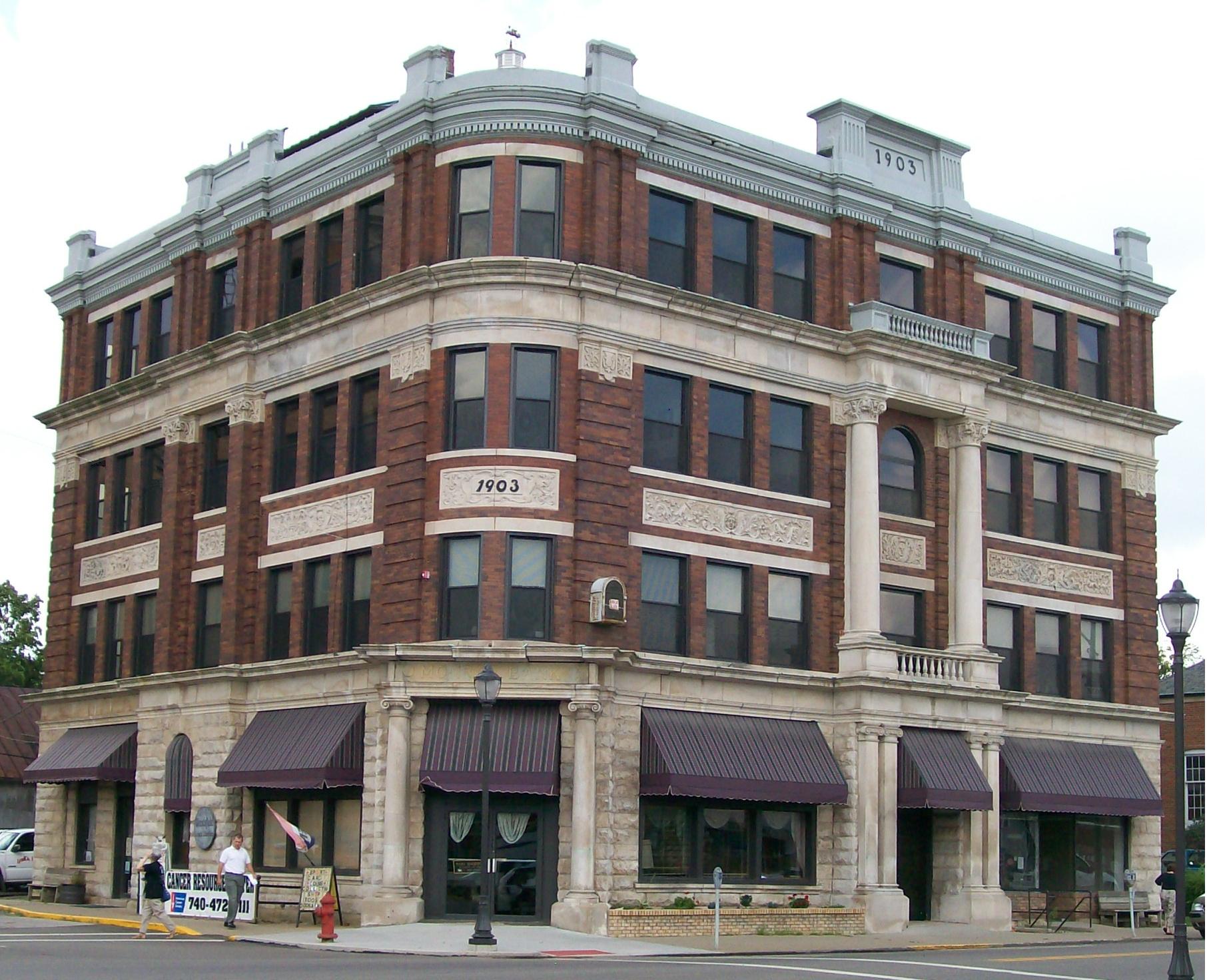
39°36′04″N 81°09′26″W / 39.601111°N 81.157222°WWashington Township 6 Monroe Bank 
March 11, 1980 117 Main St.
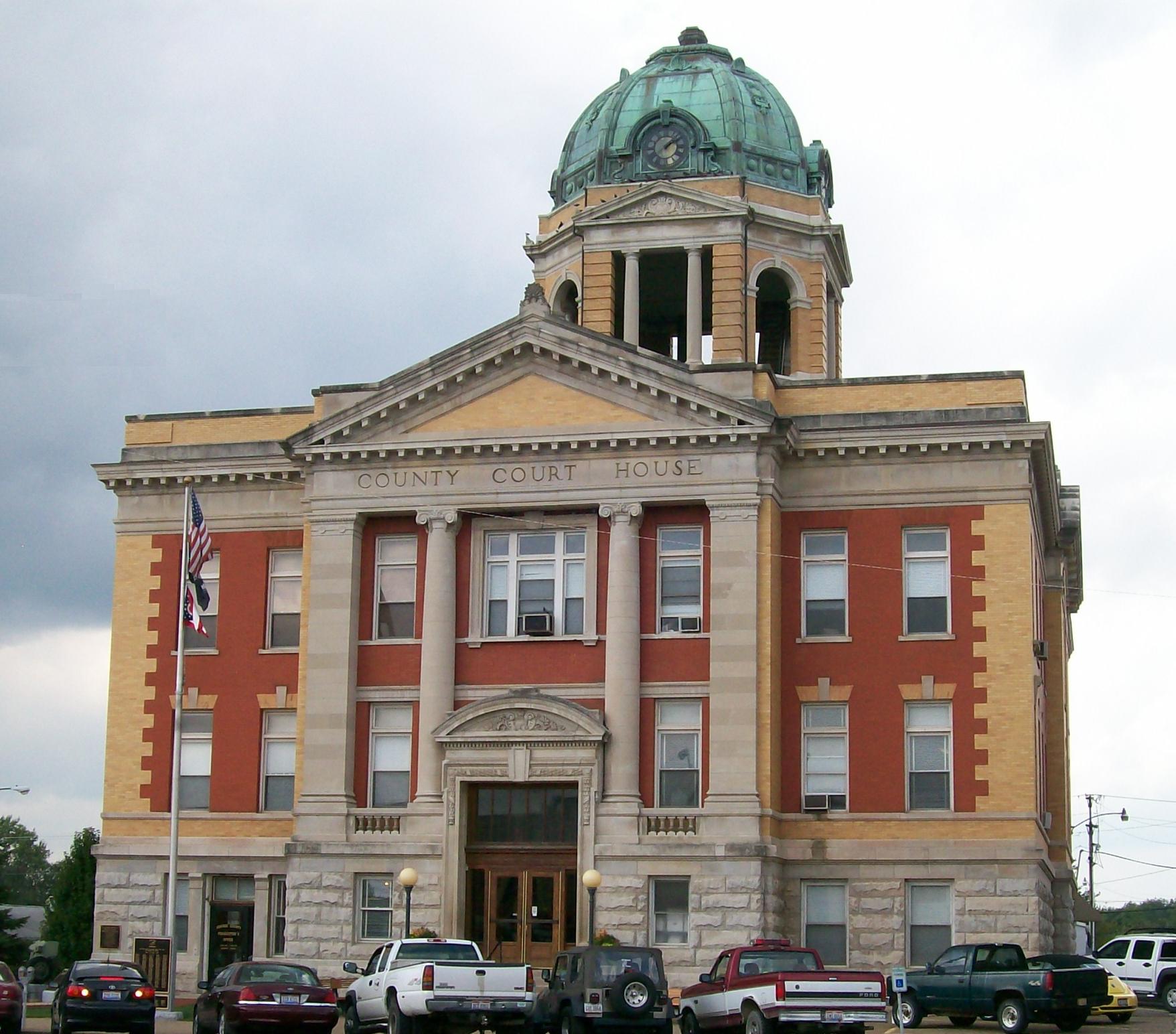
39°45′47″N 81°06′57″W / 39.763056°N 81.115833°WWoodsfield 7 Monroe County Courthouse 
July 21, 1980 Main St.
39°45′46″N 81°06′59″W / 39.762778°N 81.116389°WWoodsfield 8 William C. Mooney House 
March 15, 1982 122 N. Paul St.
39°45′50″N 81°06′46″W / 39.763889°N 81.112778°WWoodsfield 9 Walter Ring House and Mill Site 
November 28, 1980 Northern side of Township Road 575 at its crossing of the Little Muskingum River
39°36′26.244″N 81°7′19.416″W / 39.60729°N 81.12206°W[5]Benton Township 10 Salem Church 
August 18, 1992 48452 State Route 255, north of Sardis
39°39′57″N 80°57′00″W / 39.665833°N 80.95°WOhio Township See also
References
- ^ The latitude and longitude information provided in this table was derived originally from the National Register Information System, which has been found to be fairly accurate for about 99% of listings. For about 1% of NRIS original coordinates, experience has shown that one or both coordinates are typos or otherwise extremely far off; some corrections may have been made. A more subtle problem causes many locations to be off by up to 150 yards, depending on location in the country: most NRIS coordinates were derived from tracing out latitude and longitudes off of USGS topographical quadrant maps created under the North American Datum of 1927, which differs from the current, highly accurate WGS84 GPS system used by Google maps. Chicago is about right, but NRIS longitudes in Washington are higher by about 4.5 seconds, and are lower by about 2.0 seconds in Maine. Latitudes differ by about 1.0 second in Florida. Some locations in this table may have been corrected to current GPS standards.
- ^ "National Register of Historic Places: Weekly List Actions". National Park Service, United States Department of the Interior. Retrieved on November 10, 2011.
- ^ Numbers represent an ordering by significant words. Various colorings, defined here, differentiate National Historic Landmark sites and National Register of Historic Places Districts from other NRHP buildings, structures, sites or objects.
- ^ "National Register Information System". National Register of Historic Places. National Park Service. . http://nrhp.focus.nps.gov/natreg/docs/All_Data.html.
- ^ Location derived from its HABS entry; the NRIS lists it as "Address Restricted."
National Register of Historic Places in Ohio Lists by county Adams • Allen • Ashland • Ashtabula • Athens • Auglaize • Belmont • Brown • Butler • Carroll • Champaign • Clark • Clermont • Clinton • Columbiana • Coshocton • Crawford • Cuyahoga • Darke • Defiance • Delaware • Erie • Fairfield • Fayette • Franklin • Fulton • Gallia • Geauga • Greene • Guernsey • Hamilton • Hancock • Hardin • Harrison • Henry • Highland • Hocking • Holmes • Huron • Jackson • Jefferson • Knox • Lake • Lawrence • Licking • Logan • Lorain • Lucas • Madison • Mahoning • Marion • Medina • Meigs • Mercer • Miami • Monroe • Montgomery • Morgan • Morrow • Muskingum • Noble • Ottawa • Paulding • Perry • Pickaway • Pike • Portage • Preble • Putnam • Richland • Ross • Sandusky • Scioto • Seneca • Shelby • Stark • Summit • Trumbull • Tuscarawas • Union • Van Wert • Vinton • Warren • Washington • Wayne • Williams • Wood • Wyandot

Lists by city Other lists Municipalities and communities of Monroe County, Ohio Villages Antioch | Beallsville | Clarington | Graysville | Jerusalem | Lewisville | Miltonsburg | Stafford | Wilson‡ | Woodsfield

Townships Unincorporated
communitiesCameron | Hannibal | Laings | Malaga | Rinard Mills | Sardis | Sycamore Valley
Footnotes ‡This populated place also has portions in an adjacent county or counties
Categories:- National Register of Historic Places in Ohio by county
- Monroe County, Ohio
-


Wikimedia Foundation. 2010.