- Little Muskingum River
Infobox River
river_name = Little Muskingum River
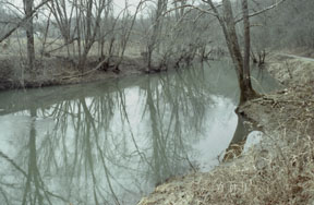
caption = The Little Muskingum River in theWayne National Forest
origin =Monroe County, Ohio
mouth =Ohio River nearReno, Ohio
basin_countries =USA
length = 65 mi (105 km)
elevation =
mouth_elevation = 582 ft (177 m) U.S. Geological Survey. Marietta quadrangle, Ohio. 1:24,000. 7.5 Minute Series. Washington D.C.: USGS, 1994.]
discharge =
watershed = 315 mi² (816 km²) [cite web| title = Map of Ohio watersheds | url = http://www.dnr.state.oh.us/water/watersheds/Basins72PDI_40x40_OnScreen.gif] The Little Muskingum River is a tributary of theOhio River , approximately 65 mi (105 km) long, in southeastOhio in theUnited States .It rises in the hill country of Monroe County, approximately 5 mi (8 km) northwest of the Ohio River and 8 mi (13 km) southeast of Woodsfield. It flows southwest, in a tight
meander ing course, roughly parallel to, and staying within 8 mi (13 km) of the Ohio. It passes Rinard Mills and Dart, and joins the Ohio approximately 5 mi (8 km) southeast ofMarietta, Ohio and the mouth of theMuskingum River , which enters the Ohio from the northwest. Duck Creek enters the Ohio between the mouth of the Muskingum and Little Muskingum.All except the last 2 mi (3.2 km) of the river are within
Wayne National Forest .ee also
*
List of Ohio rivers References
Wikimedia Foundation. 2010.