- Amherst, Ohio
Infobox Settlement
official_name = Amherst, Ohio
settlement_type =City
nickname =
motto =
imagesize =
image_caption =
image_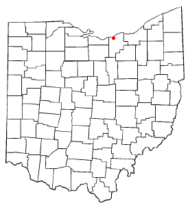
mapsize = 250x200px
map_caption = Location of Amherst, Ohio
mapsize1 =
map_caption1 =subdivision_type = Country
subdivision_name =United States
subdivision_type1 = State
subdivision_name1 =Ohio
subdivision_type2 = County
subdivision_name2 = Loraingovernment_footnotes =
government_type =
leader_title =Mayor
leader_name =David A. Taylor (R)
leader_title1 =
leader_name1 =
established_title =
established_date =unit_pref = Imperial
area_footnotes =
area_magnitude =
area_total_km2 = 18.6
area_land_km2 = 18.6
area_water_km2 = 0.0
area_total_sq_mi = 7.2
area_land_sq_mi = 7.2
area_water_sq_mi = 0.0population_as_of = 2000
population_footnotes =
population_total = 11797
population_density_km2 = 635.6
population_density_sq_mi = 1646.1timezone = Eastern (EST)
utc_offset = -5
timezone_DST = EDT
utc_offset_DST = -4
elevation_footnotes = GR|3
elevation_m = 210
elevation_ft = 689
latd = 41 |latm = 24 |lats = 0 |latNS = N
longd = 82 |longm = 13 |longs = 34 |longEW = Wpostal_code_type =
ZIP code
postal_code = 44001
area_code = 440
blank_name = FIPS code
blank_info = 39-01798GR|2
blank1_name = GNIS feature ID
blank1_info = 1064320GR|3
website = http://www.amherstohio.org/
footnotes =Amherst is a
city in theU.S. state ofOhio and is located in Lorain County. The population was 11,797 at the 2000 census.History
The town of Amherst was established by German immigrants between 1811 and 1816. Jacob Shupe was the founder of Amherst. He had the first sawmill, distillery, and gristmill in the Amherst area. Mr. Shupe actually started early industry in the Amherst area. He settled on a high hill near the Beaver Creek, close to the intersection of Cooper Foster Park Road and North Main Street. His house still stands today and is a part of the
New Indian Ridge Museum .Soon after being settled, Amherst acquired the title "Sandstone Center of the World". Many early buildings are constructed of native sandstone, and the quarries were also an important source of grindstones. There were nine
sandstone quarries in the area operating at the peak of production. Cleveland Quarries Company, established in1868 , still quarries Birmingham Buff Sandstone and Berea Sandstone in Amherst.Geography
Amherst, part of the
Greater Cleveland area, is located at coor dms|41|23|60|N|82|13|34|W|city (41.399993, -82.226201)GR|1. The elevation is 689ft above sea level. Amherst is located 2.5 miles south ofLake Erie . According to theUnited States Census Bureau , the city has a total area of 7.2square mile s (18.6km² ), of which, 7.2 square miles (18.6 km²) of it is land and 0.14% is water.Climate
Amherst possesses a
humid continental climate (Koppen climate classification "Dfa"), typical of much of the central United States, with very warm, humid summers and cold, snowy winters.Politics
Politics in Amherst have traditionally been balanced beteween the local Democratic and the Republican Parties.
The political makeup of the city is -
*Democrat: 56.1%
*Republican: 43.4% [ [http://realestate.yahoo.com/Ohio/Amherst/neighborhoods;_ylt=Ata3HPCoCYxLg9KH45R49PqkF7kF Amherst Profile] ]Since becoming a city in 1960, the political power was balanced until the late 1960s and early 1970s when the Republicans led by Mayor Anthony DePaola dominated until 1983 when Democrat John Jaworski was elected mayor.
The city's leadership currently includes:
[ [http://www.loraincounty.com/amherst/amherst.shtml Amherst, Ohio Government & Elected Officials – LorainCounty.com ] ]
Demographics
As of the
census GR|2 of 2000, there were 11,797 people, 4,459 households, and 3,388 families residing in the city. Thepopulation density was 1,646.1 people per square mile (635.3/km²). There were 4,603 housing units at an average density of 642.3/sq mi (247.9/km²). The racial makeup of the city was 96.84% White, 0.53% African American, 0.14% Native American, 0.73% Asian, 0.01% Pacific Islander, 0.78% from other races, and 0.98% from two or more races. Hispanic or Latino of any race were 2.93% of the population.There were 4,459 households out of which 34.4% had children under the age of 18 living with them, 65.6% were married couples living together, 7.9% had a female householder with no husband present, and 24.0% were non-families. Twenty-one.six percent of all households were made up of individuals, and 11.1% had someone living alone who was 65 years of age or older. The average household size was 2.61, and the average family size was 3.04.
In the city the population was spread out with 26.0% under the age of 18, 5.6% from 18 to 24, 27.3% from 25 to 44, 25.4% from 45 to 64, and 15.7% who were 65 years of age or older. The median age was 40 years. For every 100 females there were 92.2 males. For every 100 females age 18 and over, there were 87.9 males.
The median income for a household in the city was $53,516, and the median income for a family was $57,990. Males had a median income of $47,750 versus $27,880 for females. The
per capita income for the city was $25,565. About 1.2% of families and 2.1% of the population were below thepoverty line , including 0.3% of those under age 18 and 3.5% of those age 65 or over.Transportation
By far the most common mode of transportation to, from or within Amherst, Ohio is by car. However the downtown area is walkable. State Route 2 runs west to east through the northern portion of Amherst providing access to downtown Cleveland (25 minutes) its suburbs and Sandusky, Ohio. There are four exit/entrance ramps in the city (Baumhart Road, Oak Point Road, State Route 58, and Middle Ridge Road/Broadway). The
Ohio Turnpike also runs west to east along the City's southern border and there is one (exit/entrance) ramp in the city at State Route 58. Parts of the city are also served by the Lorain County Transit system. Cleveland Hopkins (CLE) is the nearest International airport; it is located approximately 25 minutes east of the city.Growth
Amherst and the surrounding area has been growing steadily since the early 1980's. The recent housing boom has created a demand for several new retail areas in Amherst. Later this year (2008) Key Bank, Goodyear Tire, Subway, Sally Beauty Supply, Great Clips, The Mattress Factory and others will join Target and Starbucks in The Shops at Deerfield (Ohio Route 2 at Oak Point). A new Lowe's and a branch of the Cleveland Clinic also recently opened nearby in the city of Lorain. Even quaint downtown Amherst has had many businesses expand or renovate their facilities.
References
External links
* [http://www.amherstohio.org/ Official City Website]
* [http://www.loraincounty.com/amherst/ City of Amherst]
* [http://www.amherst.k12.oh.us/ Amherst Schools]
Wikimedia Foundation. 2010.