- Middlesex County, New Jersey
-
Middlesex County, New Jersey 
Seal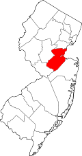
Location in the state of New Jersey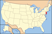
New Jersey's location in the U.S.Founded 1675 Seat New Brunswick Largest city Edison Area
- Total
- Land
- Water
323 sq mi (837 km²)
310 sq mi (803 km²)
13 sq mi (34 km²), 3.97%Population
- (2010)
- Density
809,858
2,612/sq mi (1,008.5/km²)Website www.co.middlesex.nj.us Middlesex County is a county located in Central New Jersey in the United States. As of the 2010 United States Census, its population was 809,858. The county is part of the New York City Metropolitan Area, and its county seat is New Brunswick.[1] The center of population of the state of New Jersey is located in Middlesex County, in the township of East Brunswick, just east of the New Jersey Turnpike.[2] The 2000 United States census showed that the county ranked 63rd in the United States among the highest-income counties by median household.[3]
Contents
Geography
According to the United States Census Bureau, the county has a total area of 323 square miles (840 km2), of which, 310 square miles (800 km2) of it is land and 13 square miles (34 km2) of it (3.97%) is water. The county is named after the historic English county of Middlesex.[4]
Bisected by the Raritan River, the county is topographically typical of Central Jersey in that it is largely flat, with minimal relief. The highest point is a hill scaled by Major Rd. near Route 1 in South Brunswick Township of approximately 300 feet (91.4 m) above sea level; the low elevation is sea level.
Adjacent counties
- Union County, New Jersey – north
- Monmouth County, New Jersey – southeast
- Mercer County, New Jersey – southwest
- Somerset County, New Jersey – northwest
- Richmond County, New York – northeast

Somerset County Union County Richmond County, New York 
Atlantic Ocean  Middlesex County, New Jersey

Mercer County Monmouth County Demographics
Historical populations Census Pop. %± 1790 15,956 — 1800 17,890 12.1% 1810 20,381 13.9% 1820 21,470 5.3% 1830 23,157 7.9% 1840 21,893 * −5.5% 1850 28,635 30.8% 1860 34,812 21.6% 1870 45,029 29.3% 1880 52,286 16.1% 1890 61,754 18.1% 1900 79,762 29.2% 1910 114,426 43.5% 1920 162,334 41.9% 1930 212,208 30.7% 1940 217,077 2.3% 1950 264,872 22.0% 1960 433,856 63.8% 1970 583,813 34.6% 1980 595,893 2.1% 1990 671,780 12.7% 2000 750,162 11.7% 2010 809,858 8.0% * lost territory
historical census data source:[5][6] [7]As of the census of 2000,[8] there were 750,162 people, 265,815 households, and 190,855 families residing in the county. The population density was 2,422 people per square mile (935/km²). There were 273,637 housing units at an average density of 884 per square mile (341/km²). The racial makeup of the county was 68.42% White, 9.13% Black or African American, 0.20% Native American, 13.89% Asian, 0.04% Pacific Islander, 5.71% from other races, and 2.60% from two or more races. 13.59% of the population were Hispanic or Latino of any race. 15.0% were of Italian, 9.8% Irish, 8.0% Polish and 6.2% German ancestry according to the 2000 Census.
As of the 2010 Census, there were 170,070 people of Asian descent in Middlesex county accounting for 21% of the county's total population. Asian Indians account for 61.57% of the county's Asian population or 12.93%(104,705 people) of the county's total population. The population of Asian Indians in Middlesex county is larger than that of all the other sub-groups combined [9]. Middlesex county has the largest population of Asian Indians of all the counties in New Jersey. In fact, only Santa Clara County, CA (117,596) and Queens County, NY (117,550) have a larger population of Asian Indians[10].
There were 265,815 households out of which 34.20% had children under the age of 18 living with them, 57.00% were married couples living together, 10.80% had a female householder with no husband present, and 28.20% were non-families. 22.40% of all households were made up of individuals and 8.70% had someone living alone who was 65 years of age or older. The average household size was 2.74 and the average family size was 3.23.
In the county the population was spread out with 23.70% under the age of 18, 9.50% from 18 to 24, 32.80% from 25 to 44, 21.70% from 45 to 64, and 12.30% who were 65 years of age or older. The median age was 36 years. For every 100 females there were 96.40 males. For every 100 females age 18 and over, there were 93.50 males.
The median income for a household in the county was $61,446, and the median income for a family was $70,749 (these figures had risen to $74,732 and $86,239 respectively as of a 2007 estimate[11]). Males had a median income of $49,683 versus $35,054 for females. The per capita income for the county was $26,535. About 4.20% of families and 6.60% of the population were below the poverty line, including 7.20% of those under age 18 and 6.00% of those age 65 or over.
Government
Middlesex County is governed by a seven-member Board of Chosen Freeholders. The Freeholders are elected at-large to staggered three-year terms in the November general election. In January of each year, the Board reorganizes, selecting one Freeholder to be Freeholder Director and another to be Freeholder Deputy Director. The Freeholder Director appoints Freeholders to serve as Chairpersons and members on the various committees which oversee county departments.
As of 2008[update], Middlesex County's Freeholders are:[12]
- Carol Barrett, Chairwoman, TBD (Selected on January 4, 2009 by Middlesex County Democrats to serve out the remainder of the term vacated by the death of late Freeholder David B. Crabiel.)
- Stephen J. "Pete" Dalina (Fords, Woodbridge) – Freeholder Director and Chairman, Committee of Parks and Recreation
- H. James Polos (Highland Park) – Chairman, Committee of Public Works
- Ronald Rios (Carteret) – Chairman, Committee of Public Health and Education
- Christopher D. Rafano (South River) – Chairman, Committee of Law and Public Safety
- Millie Scott (Piscataway) – Chairwoman, TBD
- Blanquita B. Valenti (New Brunswick) – Chairperson, Committee of Human Services and Aging
Politics
Middlesex County is a Democratic stronghold. In the 2004 U.S. Presidential election, John Kerry carried the county by a 13.6% margin over George W. Bush, with Kerry carrying the state by 6.7% over Bush.[13] In 2008, Barack Obama carried Middlesex by a 21.8% margin over John McCain, with Obama winning New Jersey by 15.5% over McCain.[14] However, in the 2009 Gubernatorial Election, Republican Chris Christie received 47% of the vote, defeating Democrat Jon Corzine, who received around 45%.
Transportation
Middlesex County hosts various county routes, state routes, US Routes, Interstates and toll highways.
County roads include County Route 501, County Route 514, County Route 516 (only in Old Bridge), County Route 520, County Route 522, County Route 527, County Route 529, County Route 531 and County Route 535. The state routes are: Route 18, Route 26 (only in North Brunswick – entirely concurrent with Livingston Avenue), Route 27, Route 28, Route 32, Route 33 (only in Monroe), Route 34 (only in Old Bridge), Route 35, Route 91 (concurrent with Jersey Avenue in North Brunswick and entering New Brunswick), Route 171, Route 172 (only in New Brunswick), Route 184 and Route 440.
US Routes include: U.S. Route 1, U.S. Route 9, U.S. Route 1/9 (only in Woodbridge), and U.S. Route 130.
Middlesex hosts a few highways/interstates as well. Middlesex County hosts the southern end of the Middlesex Freeway (Interstate 287) which then turns into Route 440 that connects to the Outerbridge Crossing. The Garden State Parkway passes through the eastern edge of the county, which features nine interchanges and the northern start/end of the split-roadways (Express & Local Lanes). The New Jersey Turnpike carries Interstate 95 through the center of the county. The Turnpike has five interchanges in Middlesex: Exit 12 in Carteret, Exit 11 in Woodbridge, Exit 10 in Edison, Exit 9 in East Brunswick and Exit 8A in Monroe. The turnpike also features the southern end of the "dual-dual" configuration (inner car lanes and outer truck lanes) which is one mile south of IC 8A at the border of Cranbury and Monroe.
The NJDOT is currently upgrading the Route 18 "avenue" to a freeway between the Route 1 interchange all the way up to the new 18 Extension in Piscataway.
The Turnpike Authority planned to build Route 92, which was to start near the intersection of Ridge Road & Route 1 in South Brunswick Township to Interchange 8A in Monroe Township. This plan was cancelled on December 1, 2006. Instead, the Turnpike Authority will extend the "dual-dual" from Monroe Township, south to the interchange with the Pennsylvania Extension (Exit 6) in Mansfield Township. This widening is anticipated to be finished by 2014.
Middlesex is also served by many county routes as well. See a full list here.
Public transportation
Middlesex County is served by New Jersey Transit for rail service and both New Jersey Transit and Coach USA for bus service. There are bus routes that serve all townships in the county. The main rail lines that serve Middlesex are: North Jersey Coast Line, Northeast Corridor Line, and Raritan Valley Line. The North Jersey Coast Line runs through the eastern part of the county. The Northeast Corridor Line runs through the northern and central part of the county. The Raritan Valley Line serves some communities along the county's northern border with Union County.
Intercity rail service is also provided by Amtrak. The routes that runs through Middlesex are the Acela Express, Keystone, Northeast Regional, and Vermonter services, although only the Keystone and Northeast Regional stop within Middlesex County, at either New Brunswick or Metropark.
Higher education
- Middlesex County College (Edison)
- Rutgers-New Brunswick (New Brunswick, Piscataway)
- University of Medicine and Dentistry of New Jersey (New Brunswick)
- Princeton University – Forrestal Campus (Plainsboro)[15]
- DeVry University (North Brunswick)
Healthcare
The county boasts capacity of more than 1,900 hospital beds among 5 major hospitals.[16]
- John F. Kennedy Medical Center
- Robert Wood Johnson University Hospital
- Raritan Bay Medical Center (Old Bridge)
- Raritan Bay Medical Center (Perth Amboy)
- St. Peter's University Hospital
Major employers
Major non-governmental employers in Middlesex County include the following, grouped by ranges of employees:[17]
- 9,010: Rutgers, The State University
- 3,500 – 3,749: Bristol-Myers Squibb
- 3,000 – 3,249: Merrill Lynch & Company
- 2,750 – 2,999: Johnson & Johnson, Prudential Insurance Company, Robert Wood Johnson University Hospital, Silverline Building Products, St. Peter's University Hospital, Telcordia Technologies
- 2,500 – 2,749: JFK Medical Center, Raritan Bay Medical Center
- 2,000 – 2,249: Pathmark
- 1,750 – 1,999: Home Depot, United Parcel Service
- 1,500 – 1,749: Amerada Hess Corporation, Dow Jones & Company, Siemens AG
- 1,250 – 1,499: AT&T, BASF (formerly Engelhard)
- 1,000 – 1,249: Aetna, Fujitsu
- ?????: Canon, Japanese company specializing in imaging products.
Municipalities

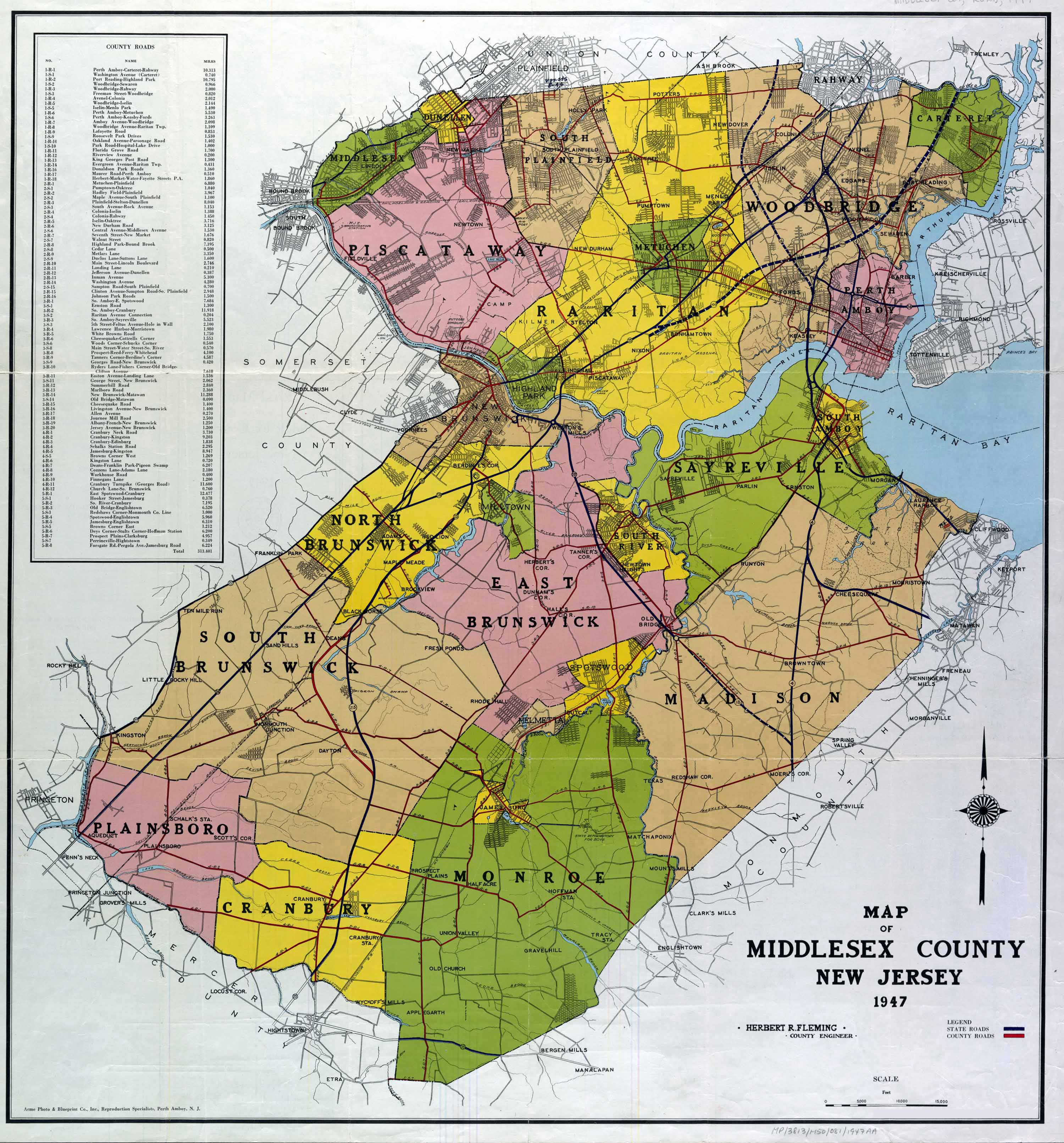
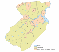 1947 road mapIndex map of Middlesex County municipalities (click to see index key)
The following is a list of the municipalities in Middlesex County. Other, unincorporated areas in the county are listed below their parent municipality (or municipalities, as the case may be). Most of these areas are census-designated places that have been created by the United States Census Bureau for enumeration purposes within a Township. Other communities and enclaves that exist within a municipality are marked as non-CDP next to the name.
- Carteret
- Cranbury Township
- Dunellen
- East Brunswick Township
- East Brunswick
- Edison
- Helmetta
- Highland Park
- Jamesburg
- Metuchen
- Middlesex
- Milltown
- Monroe Township
- New Brunswick
- North Brunswick Township
- Old Bridge Township
- Perth Amboy
- Piscataway Township
- Plainsboro Township
- Sayreville
- South Amboy
- South Brunswick Township
- South Plainfield
- South River
- Spotswood
- Woodbridge Township
- Avenel
- Colonia
- Fords
- Hopelawn non-CDP
- Iselin
- Keasbey non-CDP
- Menlo Park Terrace non-CDP
- Port Reading
- Sewaren
- Woodbridge
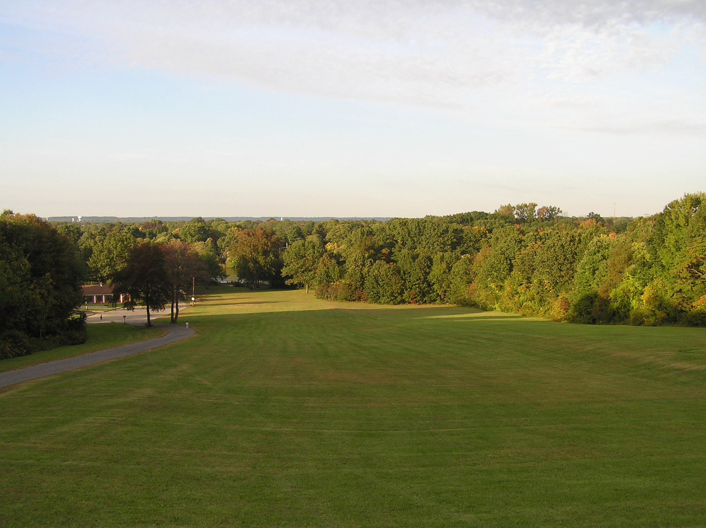
County Parks

- Donaldson Park
- Carteret Park
- Carteret Waterfront Park
- Edison Park
- Fords Park
- Johnson Park
- Medwick Park
- Merrill Park
- Raritan Bay Waterfront Park
- Roosevelt Park
- Spring Lake Park
- Thompson Park
- Warren Park
- Old Bridge Waterfront Walkway
- Alvin P. Williams Memorial Park
- Ambrose & Doty's Brooks Park
- Davidson's Mill Pond Park
- Ireland Brook Park
- Jamesburg Park Conservation Area
- John A. Phillips Open Space Preserve
- John A. Phillips Park
See also
References
- ^ "Find a County". National Association of Counties. http://www.naco.org/Counties/Pages/FindACounty.aspx. Retrieved 2011-06-07.
- ^ "Population and Population Centers by State: 2000". http://www.census.gov/geo/www/cenpop/statecenters.txt. Retrieved July 5, 2011. (see map of location)
- ^ "Census 2000 Demographic Profiles". http://censtats.census.gov/pub/Profiles.shtml. Retrieved July 5, 2011.
- ^ "Middlesex County". http://www.livingplaces.com/NJ/Middlesex_County.html. Retrieved 2011-07-05.
- ^ "New Jersey Resident Population by County: 1880 – 1930". http://www.wnjpin.net/OneStopCareerCenter/LaborMarketInformation/lmi01/poptrd5.htm.
- ^ "Geostat Center: Historical Census Browser". University of Virginia Library. http://fisher.lib.virginia.edu/collections/stats/histcensus/. Retrieved 2007-03-02.
- ^ "U.S. Census Bureau Delivers New Jersey's 2010 Census Population Totals". U.S. Census Bureau. 2011-02-03. http://www.census.gov/newsroom/releases/archives/2010_census/cb11-cn15.html. Retrieved 2011-02-05.
- ^ "American FactFinder". United States Census Bureau. http://factfinder.census.gov. Retrieved 2008-01-31.
- ^ http://www.northjersey.com/news/122790304_Census__Asian_Indians_a_growing_population_in_Bergen__Passaic_and_the_state.html
- ^ http://www.indiawest.com/readmore.aspx?id=3330&sid=1
- ^ http://factfinder.census.gov/servlet/ACSSAFFFacts?_event=Search&geo_id=05000US34021&_geoContext=01000US%7C04000US34%7C05000US34021&_street=&_county=middlesex&_cityTown=middlesex&_state=04000US34&_zip=&_lang=en&_sse=on&ActiveGeoDiv=geoSelect&_useEV=&pctxt=fph&pgsl=050&_submenuId=factsheet_1&ds_name=ACS_2007_3YR_SAFF&_ci_nbr=null&qr_name=null®=null%3Anull&_keyword=&_industry=
- ^ Elected County Officials, accessed February 21, 2007
- ^ New Jersey Presidential Election Returns by County 2004, Eagleton Institute of Politics at Rutgers University. Accessed August 31, 2008.
- ^ U.S. Election Atlas
- ^ Forrestal Campus, Princeton University. Accessed July 23, 2008.
- ^ "About Middlesex County". http://www.co.middlesex.nj.us/profile.asp. Retrieved July 6, 2011.
- ^ MAJOR EMPLOYERS LOCATED IN MIDDLESEX COUNTY, NEW JERSEY, Middlesex County Department of Economic Development, March 2006. Accessed July 5, 2007.
External links
- Middlesex County official website Retrieved July 1, 2008.
Municipalities and communities of Middlesex County, New Jersey Cities 
Boroughs Carteret | Dunellen | Helmetta | Highland Park | Jamesburg | Metuchen | Middlesex | Milltown | Sayreville | South Plainfield | South River | Spotswood
Townships Cranbury | East Brunswick | Edison | Monroe | North Brunswick | Old Bridge | Piscataway | Plainsboro | South Brunswick | Woodbridge
CDPs Avenel | Brownville | Clearbrook Park | Colonia | Concordia | Cranbury | Dayton | Fords | Heathcote | Iselin | Kendall Park | Kingston | Laurence Harbor | Madison Park | Monmouth Junction | Old Bridge | Plainsboro Center | Port Reading | Princeton Meadows | Rossmoor | Sewaren | Society Hill | Whittingham | Woodbridge
Communities Bonhamtown | Browntown | Deans | Franklin Park | Hopelawn | Keasbey | Menlo Park Terrace | Parlin | Raritan Landing
 State of New Jersey
Topics Regions - Atlantic Coastal Plain
- Central Jersey
- Delaware River Region
- Delaware Valley
- Gateway Region
- Gold Coast
- Highlands
- Jersey Shore
- Meadowlands
- New York metro area
- North Hudson
- North Jersey
- Pascack Valley
- Piedmont
- Pine Barrens
- Raritan Bayshore
- Ridge-and-Valley Appalachians
- Southern Shore Region
- Skylands Region
- South Jersey
- Tri‑State Region
- West Hudson
Counties Major cities Categories:- New Jersey counties
- Middlesex County, New Jersey
- Central Jersey


Wikimedia Foundation. 2010.