- Litchfield County, Connecticut
Infobox U.S. County
county = Litchfield County
state = Connecticut
map size = 250
founded = 1751
seat = none; Connecticut counties do not have a county government
area_total_sq_mi =945
area_land_sq_mi =920
area_water_sq_mi =25
area percentage = 2.61%
census yr = 2000
pop = 182193
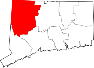
density_km2 =76Litchfield County is located in the northwestern corner of the
U.S. state ofConnecticut . As of 2004 the population was 189,246. This was an increase of 3.87% from the 2000 census. It is part of theNew York-Newark Bridgeport Combined Statistical Area .As is the case with all eight counties in Connecticut, there is no county government; there is no county seat: in Connecticut, each town is responsible for all local services such as schools, snow removal, sewers, fire department and police departments. However, in some cases in rural areas, adjoining towns may agree to jointly provide services or even establish a joint school system.
Geography
According to the U.S. Census Bureau, the county has a total area of 945
square mile s (2,446km² ), of which, 920 square miles (2,383 km²) of it is land and 25 square miles (64 km²) of it (2.61%) is water. Litchfield County is roughly contiguous with the portion of theAppalachian mountain range known as theLitchfield Hills which is a part of the Berkshire Mountians range of the appalachians.Adjacent counties
*
Berkshire County, Massachusetts (north)
*Hampden County, Massachusetts (northeast)
*Hartford County (east)
*New Haven County (southeast)
*Fairfield County (south)
*Dutchess County, New York (west)
*Columbia County, New York (northwest)Geographic Location
Centre = Litchfield County, Connecticut
North =Berkshire County, Massachusetts
Northeast =Hampden County, Massachusetts
East =Hartford County, Connecticut
Southeast =New Haven County, Connecticut
South =Fairfield County, Connecticut
Southwest =
West =Dutchess County, New York
Northwest =Columbia County, New York Demographics
As of the
census GR|2 of 2000, there were 182,193 people, 71,551 households, and 49,584 families residing in the county. Thepopulation density was 198 people per square mile (76/km²). There were 79,267 housing units at an average density of 86 per square mile (33/km²). The racial makeup of the county was 95.77% White, 1.10% Black or African American, 0.18% Native American, 1.17% Asian, 0.02% Pacific Islander, 0.68% from other races, and 1.09% from two or more races. 2.14% of the population were Hispanic or Latino of any race. 20.8% were of Italian, 14.8% Irish, 10.6% English, 9.2% German and 6.3% French ancestry according toCensus 2000 . 92.3% spoke English, 2.1% Spanish, 1.6% Italian and 1.2% French as their first language.There were 71,551 households out of which 32.10% had children under the age of 18 living with them, 57.20% were married couples living together, 8.60% had a female householder with no husband present, and 30.70% were non-families. 25.30% of all households were made up of individuals and 10.20% had someone living alone who was 65 years of age or older. The average household size was 2.51 and the average family size was 3.03.
In the county the population was spread out with 24.60% under the age of 18, 5.70% from 18 to 24, 29.80% from 25 to 44, 25.70% from 45 to 64, and 14.20% who were 65 years of age or older. The median age was 40 years. For every 100 females there were 95.60 males. For every 100 females age 18 and over, there were 92.50 males.
The median income for a household in the county was $56,273, and the median income for a family was $66,445. Males had a median income of $45,586 versus $31,870 for females. The
per capita income for the county was $28,408. About 2.70% of families and 4.50% of the population were below thepoverty line , including 4.30% of those under age 18 and 5.40% of those age 65 or over.Politics
Litchfield County is considered to be the most conservative county in the state. It has however been becoming more competitive with both Democrats and Republicans winning the county by slim margins. In 2000 Democrat Al Gore won 47% of the vote to Bush's 44%. In 2004 Bush won 51% to Kerry's 46%.
Cities, towns, boroughs, and villages*
*Barkhamsted (Town)
*Bethlehem (Town)
*Bridgewater (Town)
*Canaan (Town)
*Colebrook (Town)
*Cornwall (Town)
*Goshen (Town)
*Harwinton (Town)
*"-- Northwest Harwinton (a village of Harwinton)"
*Kent (Town)
*"--South Kent (a village of Kent)"
*Litchfield (Town) Former county seat
*"-- Bantam (a borough of Litchfield)"
*Morris (Town)
*New Hartford (Town)
*New Milford (Town)
*"--Gaylordsville (a village of New Milford)"
*Norfolk (Town)
*North Canaan (Town)
*Plymouth (Town)
*"-- Terryville (a village of Plymouth)"
*Roxbury (Town)
*Salisbury (Town)
*Sharon (Town)
*Thomaston (Town)
*Torrington (City)
*Warren (Town)
*Washington (Town)
*"-- New Preston (a village of Washington)"
*Watertown (Town)"
*"-- Oakville (a section of Watertown)"
*Winchester (Town)
*"-- Winsted (a city of Winchester)"
*Woodbury (Town)* "Borough s are incorporated portions of one or more towns with separate borough councils, zoning boards, and borough officials. Villages are named localities, but have no separate corporate existence from the towns they are in."ee also
* USS "Litchfield County" (LST-901)
References
External links
* [http://www.nationalregisterofhistoricplaces.com/CT/Litchfield/districts.html National Register of Historic Places listing for Litchfield Co., Connecticut]
* [http://www.artsnwct.org/ Northwest Connecticut Arts Council]
* [http://www.litchfieldhills.com/app/index.jsp Northwest Connecticut Convention and Visitors Bureau]
* [http://www.nwctc.commnet.edu/ Northwestern Connecticut Community College] in Winsted:"See also:" other
Litchfield s

Wikimedia Foundation. 2010.