- Winsted, Connecticut
-
Winsted, Connecticut — CDP — Nickname(s): Laurel City Location within the state of Connecticut
 Winsted, Connecticut
Coordinates: 41°55′21″N 73°4′11″W / 41.9225°N 73.06972°W Country United States State Connecticut County Litchfield Incorporated 1858 (borough)
1917 (city)Government – Type Council-manager – Town manager Wayne Dove – Mayor Althea Perez Area – Total 4.8 sq mi (12.5 km2) – Land 4.7 sq mi (12.1 km2) – Water 0.2 sq mi (0.4 km2) Elevation 709 ft (216 m) Population (2000) – Total 7,321 – Density 1,563.6/sq mi (603.7/km2) Time zone Eastern (EST) (UTC-5) – Summer (DST) EDT (UTC-4) ZIP codes 06063, 06094, 06098 Area code(s) 860 FIPS code 09-87350 GNIS feature ID 0212198 Website http://www.townofwinchester.org/ Winsted is a census-designated place and an incorporated city[1] in Litchfield County, Connecticut, United States. It is part of the town of Winchester, Connecticut. The population was 7,321 at the 2000 census.
Contents
History
 Winsted in 1836, a woodblock print drawn by John Warner Barber
Settled in 1750,[2] the city of Winsted was formed at the junction of the Mad River and Still River, and was one of the first mill towns in Connecticut. Manufactured products started with scythes at the Winsted Manufacturing Company in 1792. The city is within the town of Winchester, and its name derives from the fact that it is the business center for the towns of Winchester and Barkhamsted.
Winsted, along with New Haven, Connecticut, was a center for the production of mechanical clocks in the 1900s. The Gilbert Clock Company, located along the Still River north of town, was founded in 1871 by William L. Gilbert (1806‑1890) and became one of the largest clock companies in the world at the turn of the century.
The Gilbert School is a private secondary school that serves as the public high school for the towns of Winchester and Hartland.
In 1955, Hurricane Connie and Hurricane Diane passed over Connecticut within one week, flooding the Mad River and Still River through downtown. The Mad River, which parallels Main Street, caused flooding up to 10 feet deep through the center of town. This damaged the buildings between Main Street and the river such that all buildings on that side of Main Street through the center of town were subsequently removed and Main Street widened to 4 lanes. The buildings on the north side of Main Street for the most part survived and were repaired. Further downstream, the Still River flowed between the buildings of the Gilbert Clock Company. The flooding caused extensive damage to their buildings, and this was the final blow to a company which was already in poor financial condition.
The Northwestern Connecticut Community College was founded in 1965 by Winsted residents, including Ralph Nader's older brother, Shafeek. It occupies the original Gilbert School building. NCCC was one of the first four community colleges in Connecticut, and is accredited by both the Connecticut Board of Governors for Higher Education and by the New England Association of Schools and Colleges, Inc. The Northwestern Community College Foundation was incorporated in 1981 to support the mission of Northwestern Connecticut Community College to provide higher education to students pursuing post-secondary study. NCCF generates private funds for the purpose of benefiting the students attending NCCC and the community of Winsted.
Winsted UFO flap
Beginning in February 1967, a series of separate UFOs were reported, lasting until 1977. UFO researcher Ted Thoben has declared that the area of the town is one of two UFO windows in America, the other being the Michigan Rectangle.[3]
Pictures
-
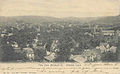
View from Hubbard Street, about 1906
-
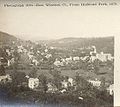
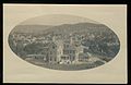
View from Highland Park, 1879
-
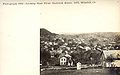
View east from Rockwell Street, 1876
-

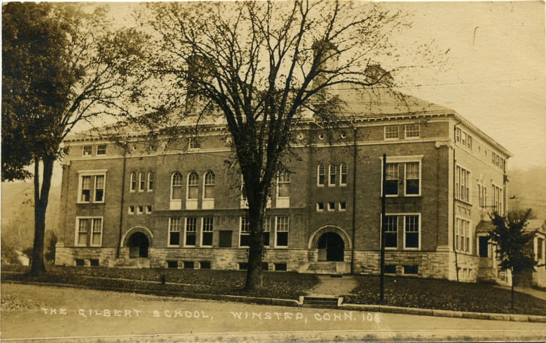
The Gilbert School, about 1921
-
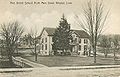
Litchfield County Hospital, about 1904
-
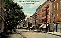
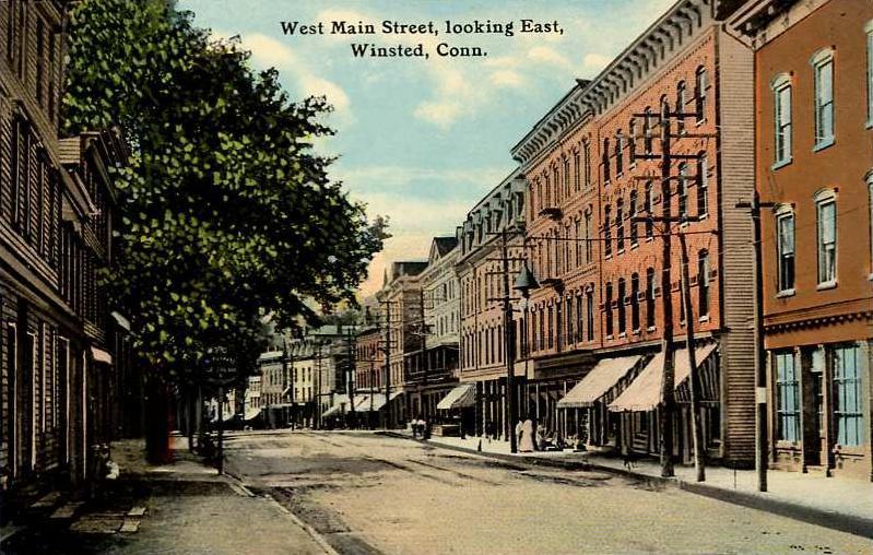
West Main Street, about 1912
-

Meadow Street, about 1906
-
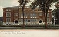
The Gilbert School, about 1910
-
First District School, about 1908
Geography
According to the United States Census Bureau, the CDP has a total area of 4.8 square miles (12 km2), of which, 4.7 square miles (12 km2) of it is land and 0.2 square miles (0.52 km2) of it (3.31%) is water. Winsted is at the confluence of the Still River and Mad River.
The city is crossed by U.S. Route 44, Connecticut Route 8, Connecticut Route 183 and Connecticut Route 263.
Demographics
As of the census[4] of 2000, there were 7,321 people, 3,072 households, and 1,889 families residing in the CDP. The population density was 1,563.6 people per square mile (604.0/km2). There were 3,370 housing units at an average density of 719.7 per square mile (278.0/km2). The racial makeup of the CDP was 93.28% White, 1.53% African American, 0.23% Native American, 1.12% Asian, 0.01% Pacific Islander, 2.20% from other races, and 1.63% from two or more races. Hispanic or Latino of any race were 4.02% of the population.
There are 3,072 households of which 27.6% have children under the age of 18 living with them, 44.9% were married couples living together, 12.0% had a female householder with no husband present, and 38.5% were non-families. 31.3% of all households were made up of individuals and 14.0% had someone living alone who was 65 years of age or older. The average household size was 2.36 and the average family size was 2.98.
In the CDP the population was spread out with 23.5% under the age of 18, 7.6% from 18 to 24, 29.0% from 25 to 44, 23.4% from 45 to 64, and 16.5% who were 65 years of age or older. The median age was 39 years. For every 100 females there were 90.0 males. For every 100 females age 18 and over, there were 86.7 males.
The median income for a household in the CDP was $40,202, and the median income for a family was $51,044. Males had a median income of $37,837 versus $25,990 for females. The per capita income for the CDP was $19,804. 7.3% of the population and 4.3% of families were below the poverty line. Of the total population, 9.2% of those under the age of 18 and 7.9% of those 65 and older were living below the poverty line.
Public transportation
The closest major airport is 'BDL', Bradley International Airport, outside of Hartford. Amtrak stations within a 30-mile radius include Windsor, CT WND, Hartford HFD, Berlin, CT BER, and Springfield, MA SPG. Greyhound Lines also has a bus station.
The Northwest Connecticut Transit District operates a weekday bus service and dial-a-ride service.
Notable residents
- Crane Brinton, historian
- James P. Glynn, congressman
- David Halberstam, journalist and author
- Arphaxed Loomis, congressman
- Ralph Nader, author and activist
- Rose Nader, activist
- Henry R. Pease, senator
- Charles H. Smith, historian of science
- James Wakefield, congressman
References
- ^ Although Winsted is recognized by the state as an incorporated city (it is listed as such in the State Register and Manual), it was removed from the rolls of Census-recognized incorporated cities sometime between 1970 and 1980. The Census Bureau decided to stop recognizing Winsted as an incorporated place because the city does not maintain a separate, active existence from the town of Winchester, and because the nature of its relationship with the town of Winchester makes it more of a special-purpose district than a general-purpose municipality.
- ^ 1911 Encyclopedia Britannica
- ^ "Through Earth's windows". The world's strangest mysteries. New York: Gallery Books. 1987. pp. 182–3. ISBN 0-8317-9678-2.
- ^ "American FactFinder". United States Census Bureau. http://factfinder.census.gov. Retrieved 2008-01-31.
External links
- Town of Winchester, Connecticut
- Beardsley & Memorial Library
- Winchester Historical Society & Museum
- Northwest Connecticut Convention & Visitors Bureau
- Winsted Area Ambulance Association
- Winsted Fire Department
- Gilbert School
 State of Connecticut
Topics - Index
- Culture
- Constitution
- Delegations
- Elections
- Geography
- Government
- History
- Images
- People
- Visitor Attractions
Regions Counties Cities Places Municipalities and communities of Litchfield County, Connecticut Consolidated city 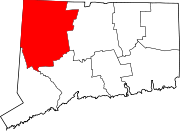
Non-consolidated city Winsted*
*Inactive city government
Boroughs Towns Barkhamsted | Bethlehem | Bridgewater | Canaan | Colebrook | Cornwall | Goshen | Harwinton | Kent | Litchfield | Morris | New Hartford | New Milford | Norfolk | North Canaan | Plymouth | Roxbury | Salisbury | Sharon | Thomaston | Warren | Washington | Watertown | Winchester | Woodbury
Unincorporated
communitiesCanaan Village | East Plymouth | Falls Village | Flanders | Gaylordsville | Hotchkissville | Lakeville | Lime Rock | Milton | New Preston | Northfield | Northwest Harwinton | Oakville | Pine Meadow | Riverton | Sharon Valley | South Kent | Terryville | Torringford | West Goshen
Categories:- Census-designated places in Litchfield County, Connecticut
- Populated places in Litchfield County, Connecticut
- Cities in Connecticut
- Winchester, Connecticut
-


Wikimedia Foundation. 2010.