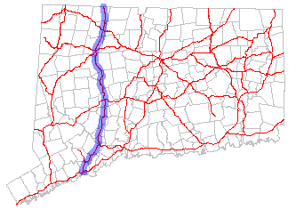
- Connecticut Route 8
-
Route 8

Route information Maintained by ConnDOT Length: 67.34 mi (108.37 km) Existed: 1922 – present Major junctions South end:  I-95 in Bridgeport
 Route 15 in Trumbull
 I-84 in Waterbury
North end:  Route 8 in Sandisfield, MA
Highway system Routes in Connecticut
Special Service Roads • State Roads←  US 7
US 7Route 9  →
→Route 8 is the portion of the multistate New England Route 8 within the state of Connecticut. It is a 67.34-mile (108.37 km) state highway running north–south from Bridgeport, through Waterbury, all the way to the Massachusetts state line where it continues as Route 8. Most of the highway is a 4-lane freeway but the northernmost 8.8 miles (14.2 km) is a 2-lane surface road.[1]
Contents
Route description
The southern terminus of Route 8 is at an interchange with Interstate 95 in Bridgeport. The first 3.75 miles (6.04 km) in Bridgeport is co-signed with the freeway portion of Route 25. Approaching the split between Routes 8 and 25, the road expands to 6, 8, and even 10 lanes. Route 8 continues into Trumbull where there is an interchange with the Merritt Parkway.
From Trumbull, it passes through the towns/cities of Stratford and Shelton. It then crosses the Housatonic River and continues through Derby, Ansonia, Seymour, Beacon Falls, Naugatuck, and Waterbury, following along the Naugatuck River (a tributary of the Housatonic River). There is an interchange with Interstate 84 in Waterbury, known locally as the "Mixmaster". Route 8 then continues north through Watertown, Thomaston, Litchfield, Harwinton, Torrington, and Winchester. U.S. Route 6 runs briefly on Route 8 in Thomaston (0.99 miles).
The freeway portion of Route 8 ends at U.S. Route 44 in Winchester. After a short (0.33 mile) overlap with US 44, Route 8 splits off and continues as a surface road into the rest of Winchester town and the mainly rural town of Colebrook. Route 8 continues as a rural minor arterial road into Massachusetts.
Special designations
The section from I-95 to the Route 25 split is also known as the Colonel Henry Mucci Highway (designation continues on Route 25). The section from Shelton to Beacon Falls is known as the General Samuel Jaskilka Highway. The section from Constitution Boulevard in Shelton to Route 334 at the Seymour/Ansonia town line is known as the Ansonia-Derby-Shelton Expressway. The section from Waterbury to the freeway end in Winchester is known as the James H. Darcey Memorial Highway.
History
Most of the alignment of Route 8 was part of an improved toll road known as the Waterbury River Turnpike, which ran from Naugatuck, via Torrington, Winchester Center and Colebrook Center, to the Massachusetts state line. The turnpike was chartered in 1801 and collected tolls until 1862. Two other sections of Route 8 were also old turnpikes: the portion north of Torrington was known as the Still River Turnpike chartered in 1815; the portion between Seymour and Naugatuck was known as the Humphreysville and Salem Turnpike chartered in 1825.
In 1922, the six New England states began a region-wide highway numbering system. The trunk highway from Stratford through Waterbury to the Massachusetts state line became part of the multi-state New England Route 8. Route 8 remained unchanged in the 1932 state highway renumbering. The main road connecting Bridgeport and Shelton (following Noble Avenue, Huntington Turnpike, Shelton Road, Bridgeport Avenue, and Center Street), which was designated as State Highway 316 in 1922, was renumbered as Route 65 in the 1932 renumbering.
In 1951, the Ansonia-Derby-Shelton Expressway portion between Constitution Boulevard in Shelton and Pershing Drive in Derby (including the Commodore Isaac Hull Memorial Bridge) opened to traffic. As part of the freeway upgrading of Route 8, the southern terminus was shifted west from Stratford to Bridgeport, taking over old Route 65. The original southern end of Route 8 was assigned to an extended Route 110. By 1957, the entire length of the Ansonia-Derby-Shelton Expressway portion is open with the extension from Pershing Drive to Route 334 at the Ansonia/Seymour town line complete.
In the 1960s and 1970s additional sections of the Route 8 freeway opened in stages: in 1960, the segment from Route 63 to South Main Street in Waterbury opens; in 1962, the section from Route 334 to Route 67, including the elevated highway portion through central Seymour, opens; in 1966, the Mixmaster interchange with I-84 is completed and the freeway was also extended to Route 262 in Watertown. An additional section from Route 118 in Litchfield to Kennedy Road in Torrington also opens. By 1970, the portion from Route 262 in Watertown to Route 118 in Litchfield opened. By 1972, the segment from I-95 to Route 108 in Trumbull, including the overlap with Route 25, was completed. The freeway was also extended from Kennedy Road in Torrington to its present terminus at Route 44 in Winsted. By 1975, the freeway was completed between Huntington Turnpike at the Trumbull/Shelton town line to Constitution Boulevard in Shelton.
The early 1980s saw the completion of the Route 8 freeway with the 4-lane surface route from Route 67 in Seymour to Route 63 in Naugatuck (originally built in the 1940s) upgraded to a freeway, including the portion that bypasses Beacon Falls. The last segment of freeway between Route 108 in Trumbull and Huntington Turnpike, including a new interchange with the Merritt Parkway was completed in 1982. The freeway from Bridgeport to Winchester is completed by this time, 35 years after construction began.
Exit list
Town # Mile Destinations Notes Bridgeport 0.2 I-95 – New Haven, Stamford1 0.4 Prospect Street – Downtown Bridgeport Southbound exit, northbound entrance 2 0.8 Fairfield Ave – Lafayette Square SR 700 3 1.4 Main Street, Washington Avenue Southbound exit, northbound entrance 4 2.1 Lindley Street Northbound exit, southbound entrance 5 2.8  US 1 (Boston Avenue, North Avenue)
Via Chopsey Hill Road (Split) 3.8  Route 25 north to Route 15 – Trumbull
North end of Route 25 overlap. Trumbull 7 4.2  Route 127 north (White Plains Road, East Main Street) to Route 25
Southbound exit, northbound entrance. 8 5.4  Route 108 (Nichols Ave.) to Route 15 north – Stratford
9 5.8  Route 15 north / Merritt Pkwy.
Northbound junction only 10 Route 15 south / Merritt Pkwy.Southbound junction only Stratford 11 7.1 Huntington Road / Bridgeport Avenue SR 714 Shelton 12 9.2 Old Stratford Road 13 11.4 Constitution Boulevard, Bridgeport Avenue SR 714 14 12.3  Route 110 (Howe Avenue) – Shelton
Commodore Hull Bridge (Housatonic River Crossing) Derby 15 12.8  Route 34 (Main Street) – Derby, New Haven
The Derby-Shelton (Metro-North station) can also be found at this interchange. 16 13.4 Pershing Drive – Ansonia Northbound exit, southbound entrance
SR 72717 13.7 Seymour Avenue 18 14.3 Division Street Northbound exit, southbound entrance Ansonia 19 15.8  Route 334 (Wakelee Avenue)
Southbound signed TO Route 334 Seymour 20 16.6 Lower Derby Road Southbound exit, northbound entrance 21 17.4  Derby Avenue to Route 67 – Oxford
Northbound exit, southbound entrance
SR 72822 18.5 Route 67 (Bank Street) – SeymourBeacon Falls 23 21.0  Route 42 – Beacon Falls, Oxford
Northbound exit, southbound entrance 24 22.1 To Route 42 – Beacon Falls, OxfordSouthbound exit, northbound entrance
SR 852Naugatuck 25 24.1 Cross Street 26 25.3  Route 63 (South Main Street) – Bethany
27 25.8 North Main Street, Maple Street SR 709 28 26.5  To Route 68 – Union City, Prospect
SR 710 29 27.3 South Main Street, Platts Mill Road – Waterbury SR 847 Waterbury 30 29.2/29.5 South Leonard Street, Washington Avenue 31 30.2 I-84 east – HartfordThe Mixmaster 32 Riverside Street – Downtown Waterbury 33 I-84 west – Danbury34 30.6 West Main St – Downtown Waterbury Southbound exit, northbound entrance 35 31.2  Route 73 – Oakville, Watertown
Norhtbound exit, southbound entrance 36 32.6 Huntingdon Avenue, Colonial Avenue Watertown 37 34.3  Route 262 – Watertown
Thomaston 38 38.3 

 US 6 west to Route 109 / Route 254 – Thomaston, Watertown
US 6 joins northbound and leaves southbound 39 39.7  US 6 east to Route 222 – Thomaston, Bristol
US 6 leaves northbound and joins southbound 40 40.3 Route 222 (North Main Street) – ThomastonLitchfield 41 44.1 Northfield, Campville Harwinton 42 46.8  Route 118 – Litchfield, Harwinton
Torrington 43 49.2 Harwinton Ave 44 49.9/50.0 
 US 202 / Route 4 – Downtown Torrington, Harwinton, Litchfield, Goshen
45 51.8 Winsted Rd, Kennedy Dr 46 55.5 Pinewoods Rd – Burrville Winchester 58.3 Junction  US 44 east – New Hartford
End of freeway; Exit ramp as main line
Route 8 joins US 44 northbound and leaves southbound58.8 US 44 west – CanaanRoute 8 leaves US 44 northbound and joins southbound
Route 8 uses North Main St and Colebrook River Rd60.7  Route 20 east – Riverton
Colebrook 67.3 Route 8Massachusetts state line See also
- Route 8 in New England
References
- ^ Connecticut Department of Transportation (2004), Connecticut State Highway Log, ct.gov, http://www.ct.gov/dot/LIB/dot/Documents/dpolicy/hwylog/hwylog.pdf
- Connecticut Department of Transportation Highway Log (2006)
- kurumi.com - CT Route 8
- nycroads.com - CT 8 Expressway
Coordinates: 41°33′41″N 73°03′27″W / 41.56139°N 73.057365°W
External Links
Categories:- State highways in Connecticut
- Transportation in Fairfield County, Connecticut
- Transportation in New Haven County, Connecticut
- Transportation in Litchfield County, Connecticut
- Bridgeport, Connecticut
- Waterbury, Connecticut

Wikimedia Foundation. 2010.