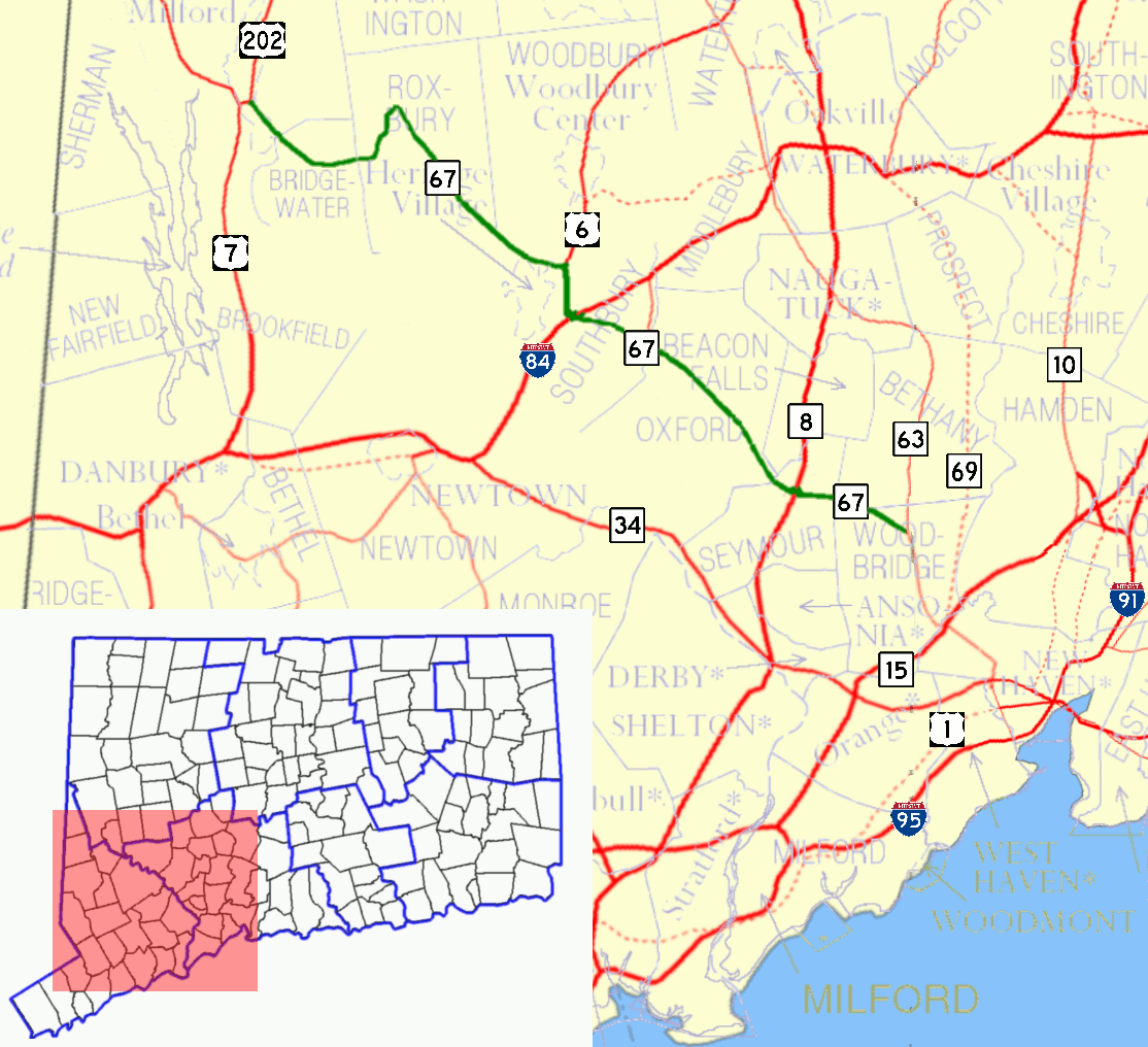
- Connecticut Route 67
-
Route 67

Route information Maintained by ConnDOT Length: 31.00 mi[1] (49.89 km) Existed: 1932 – present Major junctions West end: 
 US 7 / US 202 in New Milford
 I-84 in Southbury
 Route 8 in Seymour
East end:  Route 63 in Woodbridge
Highway system Routes in Connecticut
Special Service Roads • State Roads←  Route 66
Route 68  →
→Route 67 is a secondary state highway in the U.S. state of Connecticut, from the town of New Milford in the Greater Danbury area to the town of Woodbridge in the outskirts of New Haven. The route runs for 31.00 miles (49.89 km).
Contents
Route description
Route 67 is mostly a two-lane surface road, with a divided four-lane section in Southbury. It goes through the towns of New Milford, Bridgewater, Roxbury, Woodbury (for only 0.22 miles), Southbury, Oxford, Seymour, and Woodbridge. Rapid development on Route 67 between Route 8 and I-84 may require the eventual upgrading of this section to a four-lane arterial highway.[1][2]
Special designations
A 3.77-mile (6.07 km) section in the town of Roxbury, from the Bridgewater-Roxbury town line to 0.30 miles (0.48 km) east of Route 317, is a designated state scenic road.[3]
History
In the 19th century, part of Route 67 was a toll road known as the Oxford Turnpike that connected the towns of Seymour and Southbury via Oxford.[4] The Oxford Turnpike was chartered in May 1795 and was one of the two earliest private toll roads in Connecticut. In 1922, the road from Woodbridge to Southbury (the old Oxford Turnpike) was designated as State Highway 147 and the road from Southbury to New Milford (via Roxbury and Bridgewater) was designated as State Highway 125. Route 67 was established in the 1932 state highway renumbering from Bridgewater (beginning at modern Route 133, which was then part of an old alignment of Route 25) to New Haven (continuing past Woodbridge along current Route 63). When Route 25 was realigned in the mid 1940s, Route 67 took over the old Route 25 alignment to New Milford. In 1959, Route 67 was relocated to a new road (New Milford Road East) bypassing Bridgewater center, with the former alignment (Clapboard Road) becoming Route 67A. Route 67A was decommissioned, becoming unsigned SR 867, in 1964. Route 67 was truncated to its current eastern end at Route 63 in Woodbridge by 1964.[2]
Junction list
Location Mile[1] Destinations Notes New Milford 0.00 US 70.00–
0.50 US 202Bridgewater 3.58  Route 133
Roxbury 7.79  Route 199
8.69  Route 317
Southbury 13.37  Route 172
15.38  US 6
US 6Begin wrong-way overlap 15.43 I-8416.95 US 6End wrong-way overlap 19.64–
19.79 Route 188
Oxford 23.12  Route 42
Seymour 26.53  Route 313
26.65 Route 826.76  Route 115
Woodbridge 31.00 Route 631.000 mi = 1.609 km; 1.000 km = 0.621 mi References
Categories:- State highways in Connecticut
- Transportation in New Haven County, Connecticut
- Transportation in Litchfield County, Connecticut
- Transportation in Fairfield County, Connecticut

Wikimedia Foundation. 2010.