- Woodbury, Connecticut
Infobox Settlement
official_name = Woodbury, Connecticut
settlement_type = Town
imagesize =
image_caption =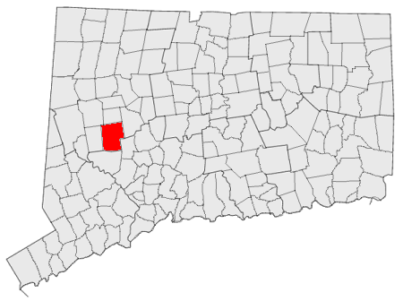
mapsize = 250px
map_caption = Location in Connecticut
mapsize1 =
map_caption1 =
subdivision_type =NECTA
subdivision_name = None
subdivision_type1 = Region
subdivision_name1 = Central Naugatuck Valley
subdivision_type2 =
subdivision_name2 =
government_type = Selectman-town meeting
leader_title = First selectman
leader_name = Paul Hinckley
established_title = Named
established_date = 1673
area_land_km2 = 94.4
area_water_km2 = 0.7
area_total_sq_mi = 36.7
area_magnitude =
area_total_km2 = 95.1
population_as_of = 2005
population_total = 9734
population_footnotes = [ [http://www.census.gov/popest/cities/files/SUB-EST2005_9.csv U.S. Census Bureau Population Estimates] ]
population_density_sq_mi = 267
population_density_km2 = 103
timezone = Eastern
utc_offset = -5
timezone_DST = Eastern
utc_offset_DST = -4
area_land_sq_mi = 36.5
area_water_sq_mi = 0.3
elevation_m = 74
elevation_ft = 243
latd = 41 |latm = 33 |lats = 43 |latNS = N
longd = 73 |longm = 12 |longs = 34 |longEW = W
postal_code_type = ZIP code
postal_code = 06798
region =
website = http://www.woodburyct.org/
area_code = 203
blank_name = FIPS code
blank_info = 09-87910
blank1_name = GNIS feature ID
blank1_info = 0213540
footnotes =Woodbury is a town in Litchfield County,
Connecticut ,United States . The population was 9,198 at the 2000 census. The town center is also designated by the U.S. Census Bureau as acensus-designated place (CDP). Woodbury was founded in 1672.The center of Woodbury is distinctive because, unlike many New England towns, it is not nucleated. In Woodbury, the older buildings are arrayed in linear fashion along both sides of a road that stretches for over a mile. The public buildings in the National Register Historic District include the First Congregational Church (1818,) the Old Town Hall (1846,) the United Methodist Church, the Episcopal Church (1785,) and the North Congregational Church (1816.) the most notable of the public buildings, however, is the Masonic Temple (1839.) It is a modest, clapboard, Greek Revival Temple, notable less for its architecture than for its dramatic location, situated atop a high cliff accessed by a long flight of steps (there is a modern road at the rear.) It is visible form a distance and is especially dramatic at night, when it is illuminated by spotlights. The Woodbury Temple echoes the many temples of the Greek world that were perched at the edge of high places from which they could be seen from miles around and from far out at sea.
Originally, the many historic houses on the street were residential. In the late twentieth century they were occupied by a series of antique shops.
Geography
According to the
United States Census Bureau , the town has a total area of 36.7square mile s (95.1km² ), of which, 36.5 square miles (94.5 km²) of it is land and 0.3 square miles (0.7 km²) of it (0.74%) is water. The CDP has a total area of 1.9 square miles (5.0 km²), all land.Principal communities
*Hotchkissville
*Minortown
*North Woodbury
*Pomperaug
*Woodbury centerDemographics
As of the
census GR|2 of 2000, there were 9,198 people, 3,715 households, and 2,574 families residing in the town. Thepopulation density was 252.2 people per square mile (97.4/km²). There were 3,869 housing units at an average density of 106.1/sq mi (41.0/km²). The racial makeup of the town was 97.25% White, 0.53% African American, 0.22% Native American, 1.15% Asian, 0.07% Pacific Islander, 0.22% from other races, and 0.57% from two or more races. Hispanic or Latino of any race were 1.65% of the population.There were 3,715 households out of which 31.4% had children under the age of 18 living with them, 58.9% were married couples living together, 8.0% had a female householder with no husband present, and 30.7% were non-families. 25.4% of all households were made up of individuals and 8.7% had someone living alone who was 65 years of age or older. The average household size was 2.48 and the average family size was 2.99.
In the town the population was spread out with 24.0% under the age of 18, 4.4% from 18 to 24, 29.3% from 25 to 44, 29.3% from 45 to 64, and 13.0% who were 65 years of age or older. The median age was 41 years. For every 100 females there were 95.3 males. For every 100 females age 18 and over, there were 91.8 males.
The median income for a household in the town was $68,322, and the median income for a family was $82,641. Males had a median income of $53,246 versus $35,298 for females. The
per capita income for the town was $37,903. About 2.3% of families and 4.5% of the population were below thepoverty line , including 4.9% of those under age 18 and 6.3% of those age 65 or over.CDP
As of the census of 2000, there were x people, 618 households, and 336 families residing in the CDP. The population density was 258.3/km² (668.8/sq mi). There were 644 housing units at an average density of 331.8/sq mi (128.2/km²). The racial makeup of the CDP was 98.07% White, 0.85% African American, 0.15% Native American, 0.39% Asian, 0.31% from other races, and 0.23% from two or more races. Hispanic or Latino of any race were 1.16% of the population.
There were 618 households out of which 25.1% had children under the age of 18 living with them, 41.9% were married couples living together, 9.5% had a female householder with no husband present, and 45.5% were non-families. 39.3% of all households were made up of individuals and 15.7% had someone living alone who was 65 years of age or older. The average household size was 2.10 and the average family size was 2.82.
In the CDP the population was spread out with 20.6% under the age of 18, 5.2% from 18 to 24, 30.2% from 25 to 44, 28.1% from 45 to 64, and 15.9% who were 65 years of age or older. The median age was 40 years. For every 100 females there were 85.4 males. For every 100 females age 18 and over, there were 79.1 males.
The median income for a household in the CDP was $51,136, and the median income for a family was $65,227. Males had a median income of $50,625 versus $40,729 for females. The per capita income for the CDP was $30,277. None of the families and 4.6% of the population were living below the poverty line, including no under eighteens and 8.9% of those over 64.
Transportation
Route 6 is the main thorougfare in the town. Route 64 is a main highway connecting the town directly to Waterbury. Other highways in the town include Route 47, Route 61, Route 132, and Route 317.
Notable people
Poet and critic
Hayden Carruth grew up in the town. It was also the residence of surrealist paintersKay Sage andYves Tanguy from 1946 until each one's death. The composerLeroy Anderson also lived in Woodbury on Grassy Hill Road from 1953 until he died in 1975, his wife Eleanor Anderson still lives in Woodbury today. Jazz guitarist Joe Beck also lived in Woodbury until his death in 2008.References
External links
* [http://www.woodburyct.org/ Official town government Web site]
* [http://pomperaughealthdistrict.org/ Pomperaug Health District] serves Woodbury and two other towns.
* [http://www.artsnwct.org/ Northwest Connecticut Arts Council]
* [http://www.litchfieldhills.com/app/index.jsp Northwest Connecticut Convention and Visitors Bureau]
* [http://www.nwctc.commnet.edu/ Northwestern Connecticut Community College] in Winstead
* [http://www.triburychamber.org/ Tribury Chamber of Commerce]
Wikimedia Foundation. 2010.