- Housatonic River
Geobox River
name = Housatonic River
native_name =
other_name =
other_name1 =
image_size = 300
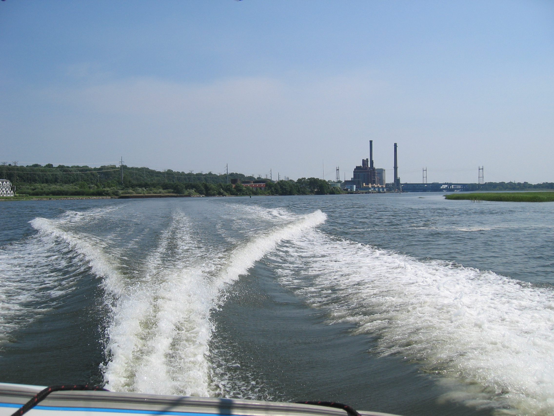
image_caption = Looking south down the Housatonic River toward the I-95 bridge in Milford, CT.
country =USA
country1 =
state =Connecticut
state1 =Massachusetts
region_type = Counties
region = Fairfield, CT
region1 = Litchfield, CT
region2 = Berkshire, MA
district =
district1 =
city = Pittsfield, MA
city1 =
length_imperial = 149
watershed_imperial = 1948
discharge_location = Stratford/Milford, CT
discharge_average_imperial = 4700
discharge_max_imperial = 48600
discharge_min_imperial = 54
discharge1_location = Great Barrington, MA
discharge1_average_imperial = 767
source_name = Muddy Pond
source_location = Washington
source_district =
source_region = Berkshire County
source_state = Massachusetts
source_country = USA
source_lat_d = 42
source_lat_m = 23
source_lat_s = 12
source_lat_NS = N
source_long_d = 73
source_long_m = 06
source_long_s = 45
source_long_EW = W
source_elevation_imperial = 1440
source_length_imperial =
mouth_name = Long Island Sound
mouth_location = Milford
mouth_district =
mouth_region = New Haven County
mouth_state = Connecticut
mouth_country = USA
mouth_lat_d = 41
mouth_lat_m = 10
mouth_lat_s = 08
mouth_lat_NS = N
mouth_long_d = 73
mouth_long_m = 06
mouth_long_s = 31
mouth_long_EW = W
mouth_elevation_imperial = 0
tributary_left =
tributary_left1 =
tributary_right =
tributary_right1 =
free_name =
free_value =
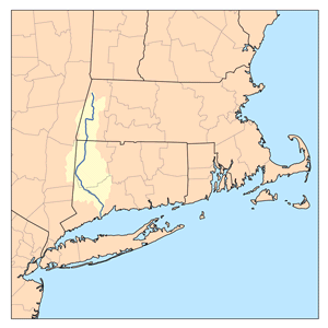
map_size = 300
map_caption = Housatonic River watershed The Housatonic River is a river, approximately 149 mi (240 km) long, in westernMassachusetts and westernConnecticut in theUnited States . It flows south to southeast, and drains about convert|1950|sqmi|km2 of southwesternNew England intoLong Island Sound . Its watershed is just to the west of the watershed of the lowerConnecticut River .Geography
The Housatonic rises from four sources in far western
Massachusetts in theBerkshire Mountains near the city of Pittsfield. It flows southward through western Massachusetts through the Berkshires and into westernConnecticut , and empties intoLong Island Sound between the towns of Stratford and Milford.The river's total fall is 1430 feet (959 feet from the confluence of its east and west branches). Its major tributaries are the Williams, Green and
Konkapot River s in Massachusetts, theTenmile River in New York, and the Shepaug, Pomperaug, Naugatuck, andStill River s in Connecticut. It receives theNaugatuck River atDerby, Connecticut , and the Still River south ofNew Milford, Connecticut .Five dams impounded the river in Connecticut to produce
hydroelectricity , the Falls Village, Bulls Bridge, Shepaug, Stevenson and Derby dams. The last three dams form a chain of lakes,Candlewood Lake , Lake Lillinonah, Lake Zoar and Lake Housatonic, from New Milford south to Shelton.History
The river's name comes from the
Mohican phrase "usi-a-di-en-uk", translated as "beyond the mountain place". [http://www.hvatoday.org/show.cfm?page=info/history.htm&folder=info History of the Housatonic River ] ]Inspired by the river during his honeymoon, the American classical music composer
Charles Ives wrote "The Housatonic at Stockbridge" as part of his composition "Three Places in New England" during the 1910s. The town of Stockbridge is located in southwestern Massachusetts. The river enters Stockbridge on the east side of town then turns south towards Connecticut.From about 1932 until 1977 the river received PCB
pollution from theGeneral Electric plant atPittsfield, Massachusetts . [http://www.epa.gov/NE/ge/sitehistory.html] Although the water quality has improved in recent decades, the river continues to be contaminated by PCBs. [http://www.epa.gov/boston/ge/thesite/restofriver/reports/200671.pdf]There is an American
Nuclear Test of the same name, although it is not known if the name came from the river or some other source.The United States Navy named a ship for the Housatonic river. The
USS Housatonic has the distinction of being the first ship in history to be sunk by a submarine, the confederate vessel CSSH.L. Hunley .Recreation
The Housatonic River is a popular whitewater paddling destination beginning at Weatogue, CT and continuing to Gaylordsville, CT. Most of the river is quickwater and Class I whitewater with long sections of Class II-III whitewater. A deadly and extreme Class VI resides at Great Falls (in Canaan (Falls Village), CT) and is most likely not able to be paddled. The most dangerous and difficult section that is navigable is by Bulls Bridge, CT with Class V whitewater.
The Housatonic River is also a popular fly fishing destination. Fly fishing on the Housatonic River has been compared with many western rivers and boasts some of the finest trophy trout fishing in the eastern United States. The most popular area for fly fishing is between the Falls Village Dam and the town of Cornwall Bridge in Litchfield County.
ee also
*
List of Connecticut rivers
*List of Massachusetts rivers
*List of crossings of the Housatonic River References
External links
* [http://www.hvatoday.org/ Housatonic Valley Association]
* [http://housatonic-river.com/index.php Housatonic River Initiativer-Riverkeeper]
* [http://www.restorehousatonic.com/housatonic_restore.html Housatonic River Restoration]
* [http://www.musicweb-international.com/Ives/WK_OS_1_Three_Places.htm Charles Ives' Three Places in New England]
* [http://www.hvatoday.org/show.cfm?page=info/watershedmap.htm&folder=info Watershed map]
* [http://www.ctxguide.com/ctxguide_095.htm Connecticut Explorer's Guide] Online paddling map of the Housatonic River
* [http://www.dryflies.com/ Housatonic River Fishing and River Reports]
Wikimedia Foundation. 2010.