- National Register of Historic Places listings in Litchfield County, Connecticut
-
 Location of Litchfield County in Connecticut
This is a list of the National Register of Historic Places listings in Litchfield County, Connecticut.
This is intended to be a complete list of the properties and districts on the National Register of Historic Places in Litchfield County, Connecticut, United States. The locations of National Register properties and districts for which the latitude and longitude coordinates are included below, may be seen in a Google map.[1]
There are 164 properties and districts listed on the National Register in the county, including 3 National Historic Landmarks.
Contents: Counties in Connecticut Fairfield (city of Bridgeport) (town of Greenwich) (city of Stamford) | Hartford (city of Hartford) (town of Southington) (town of West Hartford) (town of Windsor) | Litchfield | Middlesex (city of Middletown) | New Haven (city of New Haven) | New London | Tolland | Windham
-
- This National Park Service list is complete through NPS recent listings posted November 10, 2011.[2]
Current listings
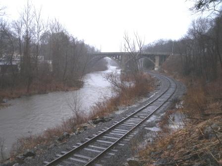
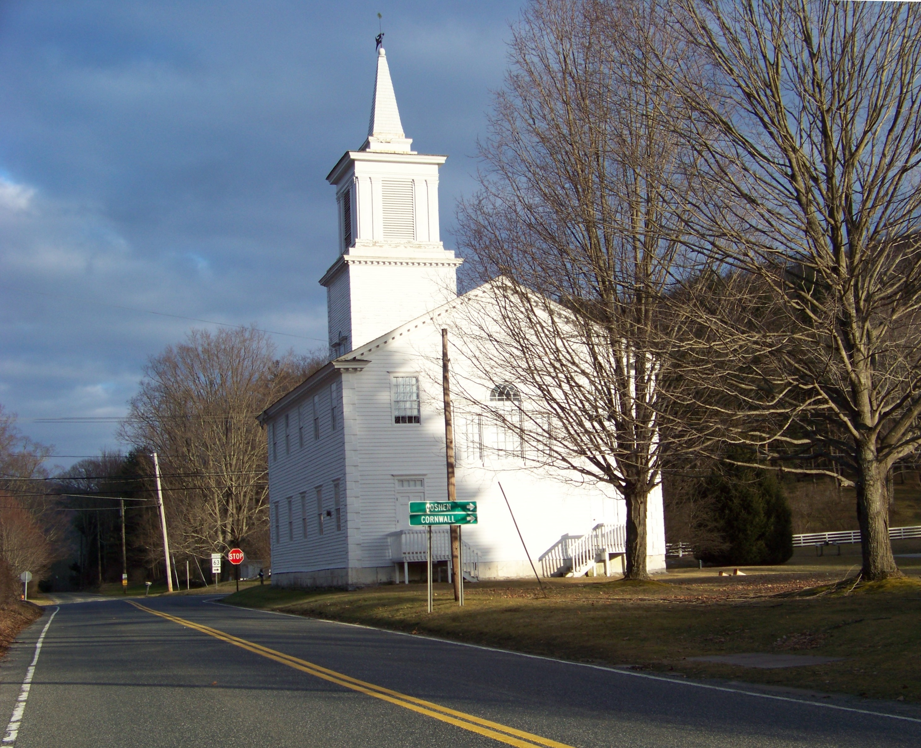
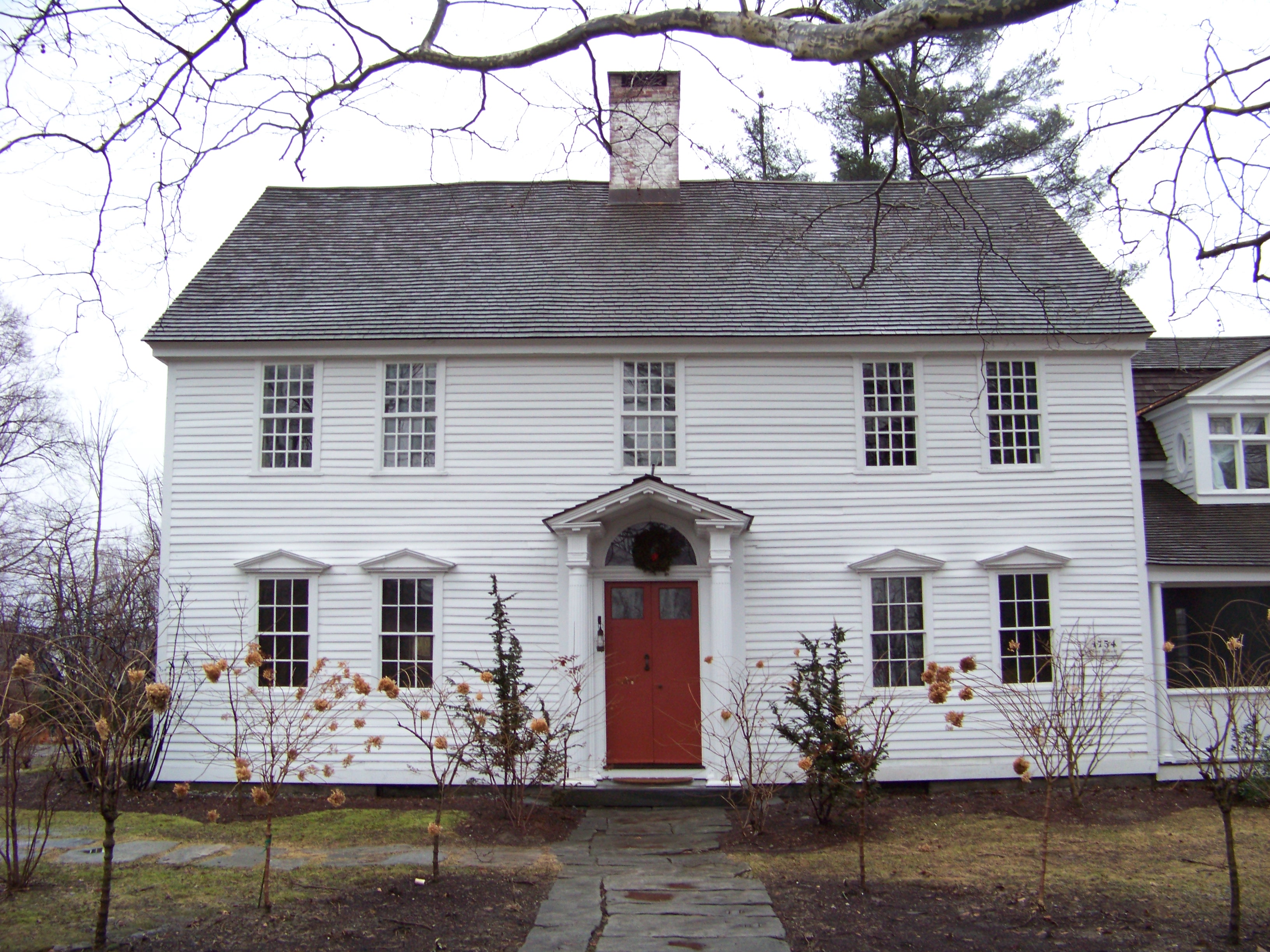
[3] Landmark name [4] Image Date listed Location City or town Summary 1 James Alldis House 
April 29, 1982 355 Prospect St.
41°48′16″N 73°07′24″W / 41.804444°N 73.123333°WTorrington Fine Queen Anne style house from 1895, built for supervisory of the largest industry in Torrington, the needle manufacturing plant which became the Torrington Company.[5] 2 American Legion Forest CCC Shelter September 4, 1986 Western side of West River Rd., American Legion State Forest
41°55′47″N 73°00′15″W / 41.929722°N 73.004167°WBarkhamsted 3 Jabez Bacon House April 16, 1971 Hollow Rd. near its junction with U.S. Route 6
41°32′17″N 73°12′32″W / 41.538056°N 73.208889°WWoodbury 4 Barkhamsted Center Historic District December 22, 1999 119, 131 Center Hill Rd. and 2, 5, 6, and 8 Old Town Hall Rd.
41°55′47″N 72°57′59″W / 41.929722°N 72.966389°WBarkhamsted 5 Capt. Philo Beardsley House July 3, 1979 Southeast of Kent on Beardsley Rd.
41°42′04″N 73°23′31″W / 41.701111°N 73.391944°WKent 6 Beaver Meadow Complex Prehistoric Archeological District 
September 21, 1988 Address Restricted Barkhamsted 7 Beckley Furnace February 14, 1978 Southeast of Canaan on Lower Rd.
42°00′39″N 73°17′34″W / 42.010833°N 73.292778°WNorth Canaan 8 Joseph Bellamy House 
April 12, 1982 N. Main and West Sts.
41°38′42″N 73°12′32″W / 41.645°N 73.208889°WBethlehem 9 Francis Benedict, Jr., House April 11, 2002 85 N. Colebrook Rd.
42°01′45″N 73°09′13″W / 42.029167°N 73.153611°WNorfolk 10 Bethlehem Green Historic District December 16, 1982 Parts of N. Main St., S. Main St., East St., West Rd., and Munger Lane
41°38′16″N 73°12′32″W / 41.637778°N 73.208889°WBethlehem 11 Henry B. Bissell House September 7, 1990 202 Maple St.
41°44′24″N 73°14′16″W / 41.74°N 73.237778°WLitchfield 12 Boardman's Bridge 
May 13, 1976 Boardman Rd. at the Housatonic River, northwest of New Milford
41°35′36″N 73°27′02″W / 41.593333°N 73.450556°WNew Milford 13 Braman Camp August 2, 1982 Doolittle Lake
42°00′53″N 73°09′18″W / 42.014722°N 73.155°WNorfolk 14 Bridge No. 2305 March 9, 2007 Main St. over Burton Brook
41°58′04″N 73°26′22″W / 41.967778°N 73.439444°WSalisbury 15 Bridge No. 560 September 29, 2004 CT 7 and Ct 4 over the Housatonic River
41°49′11″N 73°22′25″W / 41.819722°N 73.373611°WCornwall and Sharon Also known as Cornwall Bridge, crosses the Housatonic River and the Housatonic Railroad. Built in 1930 by C.W. Blakeslee and Sons for the Connecticut Highway Department, it is a fairly large example of concrete open-spandrel construction.[6] 16 Bridgewater Center Historic District July 19, 2000 Roughly along Main St., Warner Rd., Clapboard Rd. and Hat Shop Hill
41°32′09″N 73°22′07″W / 41.535833°N 73.368611°WBridgewater 17 Hervey Brooks Pottery Shop and Kiln Site December 10, 1993 Address Restricted Goshen 18 Roderick Bryan House December 28, 2000 867 Linkfield Rd.
41°38′45″N 73°07′58″W / 41.645833°N 73.132778°WWatertown 19 Bull's Bridge 
April 26, 1972 About 3 miles southwest of Kent on Bull's Bridge Rd, over the Housatonic River
41°40′32″N 73°30′35″W / 41.675556°N 73.509722°WKent 20 Capt. William Bull Tavern June 30, 1983 CT 202
41°46′52″N 73°09′43″W / 41.781111°N 73.161944°WLitchfield 21 Burlington-Harmony Hill Roads Historic District December 6, 1996 Harmony Hill, Locust Grove, and Burlington Rds.
41°46′33″N 73°02′56″W / 41.775833°N 73.048889°WHarwinton 22 Calhoun-Ives Historic District November 22, 1995 79-262 Calhoun St. and 11 and 12 Ives Rd.
41°39′34″N 73°19′58″W / 41.659444°N 73.332778°WWashington 23 Moses Camp House May 10, 1984 682 Main St.
41°55′21″N 73°04′31″W / 41.9225°N 73.075278°WWinchester* 24 Canaan Village Historic District December 13, 1990 Roughly bounded by W. Main, Bragg, and Orchard Sts. and Granite Ave.
42°01′44″N 73°19′52″W / 42.028889°N 73.331111°WNorth Canaan 25 J. Howard Catlin House August 6, 1993 14 Knife Shop Rd.
41°41′50″N 73°06′22″W / 41.697222°N 73.106111°WLitchfield 26 Philip Chapin House August 29, 1977 1 Church St.
41°52′30″N 72°58′08″W / 41.875°N 72.968889°WNew Hartford 27 Starling Childs Camp 
August 2, 1982 Doolittle Lake
42°00′40″N 73°09′23″W / 42.011111°N 73.156389°WNorfolk 28 John C. Coffing House December 18, 1990 U.S. Route 44 west of Lime Rock Rd.
41°58′38″N 73°25′34″W / 41.977222°N 73.426111°WSalisbury 29 Colebrook Center Historic District July 26, 1991 Roughly the junction of Rockwell, Colebrook, Schoolhouse and Smith Hill Rds. and CT 183
41°59′30″N 73°05′52″W / 41.991667°N 73.097778°WColebrook 30 Colebrook Store April 26, 1976 CT 183
41°59′22″N 73°05′48″W / 41.989444°N 73.096667°WColebrook 31 Cornwall Bridge Railroad Station April 26, 1972 Junction of Poppleswamp Brook Rd. and Kent Rd.
41°49′11″N 73°22′20″W / 41.819722°N 73.372222°WCornwall 32 Cream Hill Agricultural School March 26, 1976 Northeast of West Cornwall off CT 128 on Cream Hill Rd.
41°53′33″N 73°19′22″W / 41.8925°N 73.322778°WCornwall 33 Cream Hill Shelter September 4, 1986 Wickwire Rd.
41°54′43″N 73°19′39″W / 41.911944°N 73.3275°WSharon 34 Downtown Torrington Historic District 
December 22, 1988 Roughly bounded by Church and Alvord Sts., Center Cemetery, Willow St., E. Main St., Litchfield St., and Prospect St.
41°48′07″N 73°07′17″W / 41.801944°N 73.121389°WTorrington A historic district covering historic portion of commercial downtown area 35 East Plymouth Historic District February 21, 1985 E. Plymouth and Marsh Rd.
41°41′59″N 72°59′57″W / 41.699592°N 72.999097°WPlymouth 36 Esperanza April 11, 2002 511 Town Hill Rd.
41°51′25″N 73°00′14″W / 41.856944°N 73.003889°WNew Hartford 37 Falls Village District 
June 14, 1979 CT 126
41°57′23″N 73°21′49″W / 41.956389°N 73.363611°WCanaan Historic district including Greek Revival houses, churches, and the D.M. Hunt Library from 1891. 38 Farnum House August 2, 1982 Litchfield Rd.
41°58′59″N 73°12′06″W / 41.983056°N 73.201667°WNorfolk 39 Flanders Historic District April 13, 1979 U.S. Route 7, Cobble Rd., Cobble Lane, and Studio Hill Rd.
41°44′22″N 73°27′25″W / 41.739444°N 73.456944°WKent 40 Samuel Forbes Homestead November 25, 1992 89 Lower Rd.
42°00′46″N 73°19′08″W / 42.012778°N 73.318889°WNorth Canaan 41 Fyler-Hotchkiss Estate 
February 12, 1987 192 Main St.
41°48′15″N 73°07′19″W / 41.804167°N 73.121944°WTorrington 42 Ebenezer Gay House July 9, 1979 Main St.
41°52′37″N 73°28′37″W / 41.876944°N 73.476944°WSharon 43 George King House November 6, 2006 12 N. Main St.
41°52′57″N 73°28′26″W / 41.882611°N 73.473778°WSharon 44 Gilbert Clock Factory December 13, 1984 Wallens St.
41°55′49″N 73°03′29″W / 41.930278°N 73.058056°WWinchester* 45 Gillette's Grist Mill 
August 29, 1977 East of Torrington on Maple Hollow Rd.
41°50′18″N 73°01′29″W / 41.838333°N 73.024722°WNew Hartford 46 Glebe House March 11, 1971 Hollow Rd.
41°32′18″N 73°12′38″W / 41.538333°N 73.210556°WWoodbury 47 Goshen Historic District 
December 27, 1982 CT 63 and 4 and Gifford Rd.
41°49′50″N 73°13′25″W / 41.830556°N 73.223611°WGoshen 48 Gould House August 2, 1982 Golf Dr.
41°59′08″N 73°12′57″W / 41.985556°N 73.215833°WNorfolk 49 Gov. Smith Homestead March 25, 1982 South Main St.
41°52′09″N 73°28′32″W / 41.869167°N 73.475556°WSharon 50 J. S. Halpine Tobacco Warehouse December 16, 1982 West and Mill Sts.
41°34′21″N 73°24′40″W / 41.5725°N 73.411111°WNew Milford 51 Haystack Mountain Tower December 2, 1993 43 North St.
42°00′17″N 73°12′31″W / 42.004722°N 73.208611°WNorfolk 52 Hillside August 2, 1982 Litchfield Rd.
41°58′06″N 73°11′28″W / 41.968333°N 73.191111°WNorfolk 53 Hine-Buckingham Farms May 7, 2004 44, 46, and 48 Upland Rd. and 78, 81 Crossman Rd.
41°38′18″N 73°22′57″W / 41.638333°N 73.3825°WNew Milford 54 Holabird House June 28, 1982 Kellog Rd., corner of CT 126
41°57′14″N 73°20′48″W / 41.953889°N 73.346667°WCanaan 55 The Hollister Homestead June 15, 2010 294-300 Nettleton Hollow Rd.
41°37′05″N 73°16′14″W / 41.618061°N 73.270428°WWashington 56 Hose and Hook and Ladder Truck Building 
January 4, 1982 Main St.
41°40′22″N 73°04′33″W / 41.672778°N 73.075833°WThomaston 57 Hotchkissville Historic District December 6, 1996 Roughly bounded by W. Wood, Paper Mill, Weekeepeemee, Washington, and Jack's Bridge Rds.
41°33′46″N 73°13′08″W / 41.562778°N 73.218889°WWoodbury 58 Housatonic Railroad Station March 1, 1984 Railroad St.
41°34′35″N 73°24′46″W / 41.576389°N 73.412778°WNew Milford 59 Kent Iron Furnace October 5, 1977 North of Kent off U.S. Route 7
41°44′19″N 73°28′12″W / 41.738611°N 73.47°WKent 60 Lakeville Historic District August 1, 1996 Bounded by Millerton Rd., Sharon Rd., Allen St., and Holley St.
41°57′51″N 73°26′31″W / 41.964167°N 73.441944°WSalisbury 61 Isaac Lawrence House March 10, 1983 Elm St.
42°01′23″N 73°19′33″W / 42.023056°N 73.325833°WNorth Canaan 62 Lighthouse Archeological Site (5-37) April 25, 1991 Address Restricted Barkhamsted 63 Lime Rock Historic District July 5, 1984 Roughly White Hollow, Elm, Lime Rock, Norton Hill and Furnace Rds.
41°56′04″N 73°23′27″W / 41.934444°N 73.390833°WSalisbury 64 Lime Rock Park Race Track 
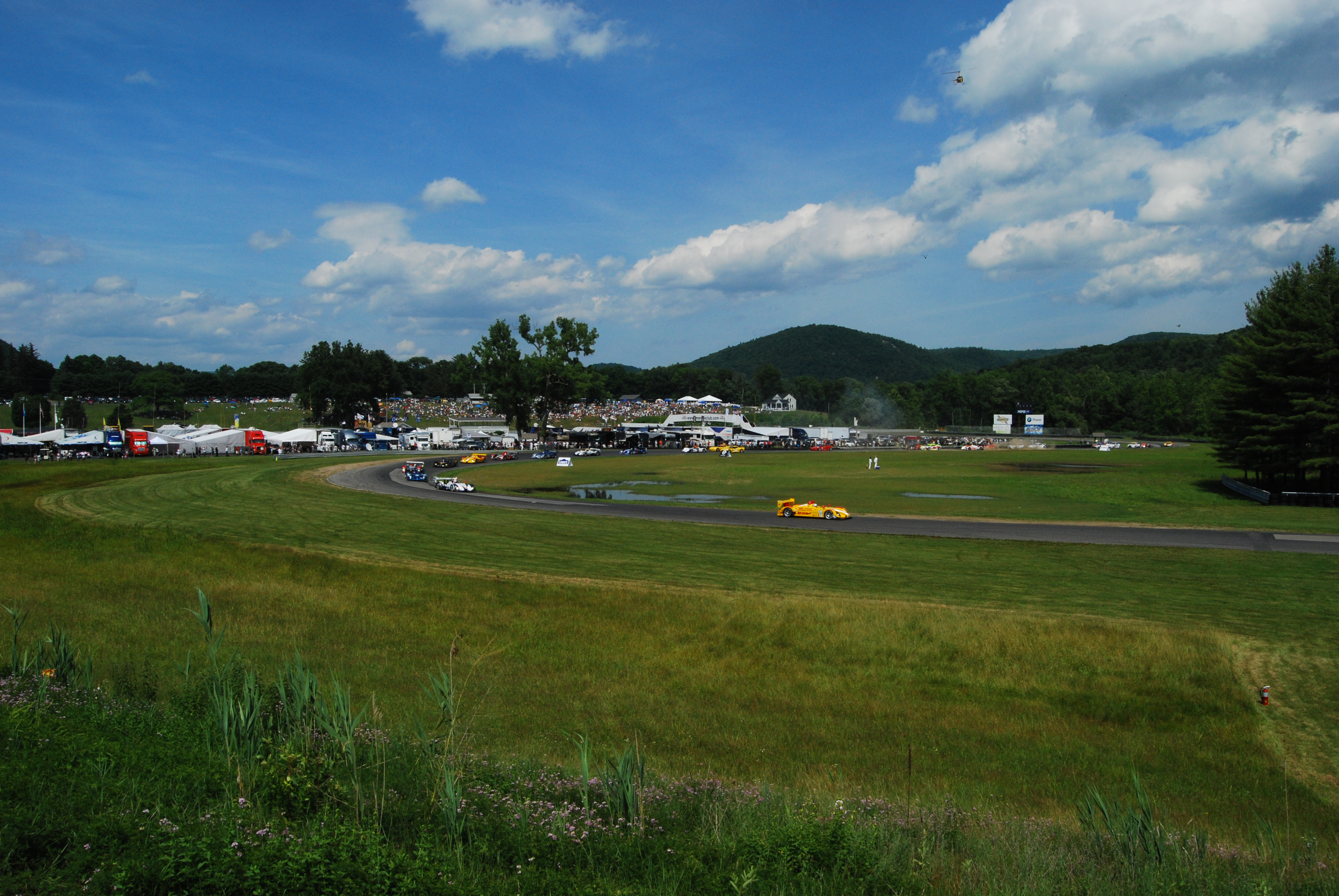
October 16, 2009 497 Lime Rock Rd.
41°55′40″N 73°23′01″W / 41.927689°N 73.3836°WSalisbury Unique race track, opened in 1959, has no stands, instead providing open fields for spectators. 65 Litchfield Historic District 
November 24, 1968 Roughly both sides of North and South Sts. between Gallows Lane and Prospect St.; also U.S. Route 202 and Route 63
41°44′40″N 73°11′24″W / 41.744444°N 73.19°WLitchfield Intact village of late 18th- and early 19th-century buildings was state's first historic district. 1978 expansion includes entire borough 66 Litchfield-South Roads Historic District December 6, 1996 Roughly Litchfield Rd. from Bridge Park to Harwinton Heights Rds. and South Rd. from Litchfield Rd. to South Cemetery
41°46′05″N 73°03′00″W / 41.768056°N 73.05°WHarwinton 67 Lover's Leap Bridge 
May 13, 1976 South of New Milford on Pumpkin Hill Rd.
41°32′39″N 73°24′26″W / 41.544167°N 73.407222°WNew Milford 68 Low House February 17, 1984 Highfield Rd.
41°59′06″N 73°11′08″W / 41.985°N 73.185556°WNorfolk 69 Caleb Martin House April 18, 1996 30 Mill Rd.
41°37′30″N 73°13′19″W / 41.625°N 73.221944°WBethlehem 70 Mead Camp August 2, 1982 Doolittle Lake
42°00′44″N 73°09′46″W / 42.012222°N 73.162778°WNorfolk 71 Merritt Beach & Son Building April 28, 1992 30 Bridge St.
41°34′35″N 73°24′43″W / 41.576389°N 73.411944°WNew Milford 72 Merryall Union Evangelical Society Chapel June 5, 1986 Chapel Hill Rd.
41°38′50″N 73°25′11″W / 41.647222°N 73.419722°WNew Milford 73 Merwinsville Hotel August 29, 1977 East of Gaylordsville on Brown's Forge Rd.
41°38′49″N 73°28′44″W / 41.646944°N 73.478889°WNew Milford 74 Migeon Avenue Historic District 
September 6, 2002 Roughly along Migeon Ave. and parts of Forest St.
41°48′31″N 73°07′47″W / 41.808597°N 73.129785°WTorrington District of 9 contributing buildings, the most salient being Laurelhurst, a Shingle Style architecture work[7] 75 Milton Center Historic District December 23, 1986 Roughly bounded by Milton, Shearshop, Headquarters, Sawmill, and Blue Swamp Rds.
41°46′03″N 73°16′22″W / 41.7675°N 73.272778°WLitchfield 76 Minortown Road Bridge August 17, 2001 Minortown Rd. over the Nonewaug River
41°34′36″N 73°10′34″W / 41.576667°N 73.176111°WWoodbury 77 William Moore, Jr., House April 14, 1999 5 Mountain Rd.
41°57′47″N 73°00′59″W / 41.963056°N 73.016389°WBarkhamsted 78 Moseley House-Farm 
February 17, 1984 Greenwoods Rd.
42°00′23″N 73°14′29″W / 42.006389°N 73.241389°WNorfolk Known as Blackberry River Inn; original part built in 1763; Colonial Revival expansion in 1920; now a bed-and-breakfast.[8] 79 Moss Hill August 2, 1982 Litchfield Rd.
41°58′40″N 73°11′57″W / 41.977778°N 73.199167°WNorfolk 80 Mount Riga Ironworks Site December 1, 1994 Address Restricted Salisbury 81 Mount Tom Tower December 2, 1993 Off U.S. Route 202 southeast of Woodville, Mount Tom State Park
41°41′39″N 73°16′30″W / 41.694167°N 73.275°WLitchfield, Morris, and Washington 82 Mulville House February 17, 1984 Mountain Rd.
41°59′15″N 73°12′32″W / 41.9875°N 73.208889°WNorfolk 83 Music Mountain December 18, 1987 Music Mountain Rd.
41°55′12″N 73°19′16″W / 41.92°N 73.321111°WCanaan 84 New Milford Center Historic District June 13, 1986 Bennett and Elm Sts., Center Cemetery, East, S. Main, Mill, and Railroad Sts.
41°34′40″N 73°24′35″W / 41.577778°N 73.409722°WNew Milford 85 New Preston Hill Historic District 
August 26, 1985 New Preston Hill, Findley, and Gunn Hill Rds.
41°40′28″N 73°22′17″W / 41.674444°N 73.371389°WWashington 86 Noble House February 17, 1984 Highfield Rd.
41°59′09″N 73°11′07″W / 41.985833°N 73.185278°WNorfolk 87 John Glover Noble House August 29, 1977 Address Restricted New Milford 88 Norfolk Country Club House August 2, 1982 Golf Dr.
41°58′58″N 73°11′32″W / 41.982778°N 73.192222°WNorfolk 89 Norfolk Downs Shelter February 22, 1984 Gold Rd.
41°58′52″N 73°12′58″W / 41.981111°N 73.216111°WNorfolk 90 Norfolk Historic District October 15, 1979 U.S. Route 44 and CT 272
41°59′20″N 73°12′16″W / 41.988889°N 73.204444°WNorfolk 91 Northfield Knife Company Site April 8, 1997 Address Restricted Litchfield 92 Old Riverton Inn July 24, 1992 436 E. River Rd.
41°57′46″N 73°01′07″W / 41.962778°N 73.018611°WBarkhamsted 93 James Pardee House August 28, 2003 129 N. Main St.
41°53′00″N 73°28′20″W / 41.883257°N 73.472137°WSharon 94 Paugnut Forest Administration Building September 5, 1986 385 Burr Mountain Rd.
41°52′13″N 73°05′34″W / 41.870278°N 73.092778°WTorrington 95 Peoples Forest Museum September 4, 1986 Greenwood Rd., Peoples State Forest
41°55′31″N 72°59′50″W / 41.925278°N 72.997222°WBarkhamsted 96 Phelps Farms Historic District August 18, 1983 CT 183
42°01′03″N 73°06′39″W / 42.0175°N 73.110833°WColebrook 97 Arah Phelps Inn August 5, 1971 Junction of Prock Hill Rd. and CT 183
42°01′03″N 73°06′54″W / 42.0175°N 73.115°WColebrook 98 Pine Meadow Historic District December 6, 1996 Roughly bounded by the Farmington River, Wicket, N. Ten, Church and Main Sts., in Pine Meadow
41°52′37″N 72°58′00″W / 41.876847°N 72.966536°WNew Hartford 99 Plymouth Center Historic District July 22, 1999 Roughly along Main, North, and South Sts., Cater, Hillside Ave., Ives Crossing, and Maple St.
41°40′18″N 73°03′15″W / 41.671667°N 73.054167°WPlymouth 100 Rectory and Church of the Immaculate Conception August 2, 1982 North St.
41°59′40″N 73°12′07″W / 41.994444°N 73.201944°WNorfolk 101 Red Mountain Shelter September 4, 1986 Northern side of CT 4 adjacent to the Appalachian Trail
41°50′50″N 73°17′18″W / 41.847222°N 73.288333°WCornwall 102 Tapping Reeve House and Law School 
October 15, 1966 South St.
41°44′38″N 73°11′20″W / 41.743889°N 73.188889°WLitchfield First law school in the United States separate from a college or university, its influential graduates included Aaron Burr, Jr., and John C. Calhoun. 103 Reynolds Bridge 
September 29, 2004 Waterbury Rd. at the Naugatuck River
41°39′11″N 73°04′39″W / 41.653056°N 73.0775°WThomaston An open-spandrel concrete arch bridge from 1928 104 Riverton Historic District 
May 15, 2007 Roughly bounded by the Still River and the Farmington River and E. River Rd.
41°57′46″N 73°01′00″W / 41.962881°N 73.016769°WBarkhamsted 105 Rock Hall July 22, 2010 19 Rock Hall Rd.
41°59′02″N 73°08′11″W / 41.983889°N 73.136389°WColebrook 106 Rockwell House 
August 2, 1982 Laurel Way, W.
41°59′36″N 73°11′33″W / 41.993333°N 73.1925°WNorfolk 107 Solomon Rockwell House July 15, 1977 226 Prospect St.
41°55′26″N 73°04′44″W / 41.923889°N 73.078889°WWinchester* 108 Roxbury Center July 28, 1983 CT 67, Weller's Bridge Rd., South and Church Sts.
41°33′20″N 73°18′28″W / 41.555556°N 73.307778°WRoxbury 109 Roxbury Iron Mine and Furnace Complex June 24, 1979 Address Restricted Roxbury 110 Rumsey Hall May 10, 1990 12 Bolton Hill Rd.
41°50′40″N 73°19′55″W / 41.844444°N 73.331944°WCornwall 111 Rye House August 10, 2000 122-132 Old Mount Tom Rd.
41°43′10″N 73°16′39″W / 41.719444°N 73.2775°WLitchfield 112 St. Andrew's Episcopal Church December 9, 1994 247 New Milford Turnpike, Marble Dale
41°39′46″N 73°22′10″W / 41.662778°N 73.369444°WWashington 113 Salisbury Center Historic District September 11, 1997 Roughly along Academy, E. Main, Factory, and Main Sts., and 15 Underwood Rd.
41°58′58″N 73°25′25″W / 41.982778°N 73.423611°WSalisbury 114 Frederick S. Sanford House January 19, 1989 Hat Shop Hill
41°32′07″N 73°22′24″W / 41.535278°N 73.373333°WBridgewater 115 Carl F. Schoverling Tobacco Warehouse April 12, 1982 1 Wellsville Ave.
41°34′50″N 73°25′00″W / 41.580556°N 73.416667°WNew Milford 116 Scoville Memorial Library April 29, 1982 Main St.
41°58′51″N 73°25′23″W / 41.980833°N 73.423056°WSalisbury 117 Scoville Powerhouse February 16, 1984 Twin Lakes and Beaver Dam Rds.
42°01′52″N 73°24′39″W / 42.031111°N 73.410833°WSalisbury 118 Maj. Gen. John Sedgwick House April 8, 1992 52 Hautboy Hill Rd.
41°53′55″N 73°16′27″W / 41.898611°N 73.274167°WCornwall 119 Sharon Historic District April 15, 1993 Roughly Main St. from Low Rd. to its junction with Mitchelltown, Amenia Union, and W. Woods Rds.
41°52′13″N 73°28′45″W / 41.870278°N 73.479167°WSharon 120 Sharon Valley Historic District 
September 9, 1982 Junction of Sharon Valley and Sharon Station Rds.
41°52′58″N 73°29′43″W / 41.882778°N 73.495278°WSharon Hamlet that grew up around 19th-century iron mining and refining operation; first industrial community in Sharon 121 John Shepard House August 2, 1982 Shepard Park Rd.
41°59′41″N 73°11′47″W / 41.994722°N 73.196389°WNorfolk 122 David Sherman House August 23, 2002 63 Middle Quarter Rd.
41°31′40″N 73°11′33″W / 41.527778°N 73.1925°WWoodbury 123 Skee's Diner 
September 6, 2002 589 Main St.
41°48′45″N 73°07′21″W / 41.8125°N 73.1225°WTorrington Barrel-roofed diner, prominently located at Main and Elm. Moved into place in 1944, escaping a war-time moratorium on new construction.[9] 124 Skilton Road Bridge December 10, 1991 Skilton Rd. over the Nonewaug River
41°37′45″N 73°09′33″W / 41.629167°N 73.159167°WWatertown 125 Jason Skinner House June 19, 1985 21 Wintergreen Circle
41°44′44″N 73°03′43″W / 41.745556°N 73.061944°WHarwinton 126 South Canaan Congregational Church 
March 16, 1983 CT 63 and Barnes Rd.
41°57′42″N 73°20′07″W / 41.961667°N 73.335278°WCanaan 127 South School 
March 27, 1986 362 S. Main St.
41°47′36″N 73°07′17″W / 41.793333°N 73.121389°WTorrington 1915 school designed by Wilson Potter, a New York City-based architect of schools throughout the northeast[10] 128 Southbury Training School May 1, 1992 1484 S. Britain Rd.
41°27′49″N 73°16′23″W / 41.463611°N 73.273056°WRoxbury (and Southbury in New Haven County, Connecticut 129 Sports Building February 22, 1984 Windrow Rd.
41°58′22″N 73°13′13″W / 41.972778°N 73.220278°WNorfolk 130 Robbins Stoeckel House August 2, 1982 Litchfield Rd.
41°59′10″N 73°12′04″W / 41.986111°N 73.201111°WNorfolk 131 Sun Terrace December 20, 1978 Southwest of New Hartford on CT 219
41°51′15″N 73°00′47″W / 41.854167°N 73.013056°WNew Hartford 132 Sunny Ridge Historic District November 22, 1995 2 and 20 Nettleton Hollow Rd., 145 Old Litchfield Rd., 6 Romford Rd., and 10-32 Sunny Ridge Rd.
41°39′27″N 73°16′36″W / 41.6575°N 73.276667°WWashington 133 Tamarack Lodge Bungalow September 16, 1977 South of Norfolk off CT 272 at Dennis Hill Park
41°56′55″N 73°11′58″W / 41.948611°N 73.199444°WNorfolk 134 Terryville Waterwheel January 4, 2002 262 Main St.
41°40′48″N 73°00′55″W / 41.68°N 73.015278°WPlymouth 135 Thomaston Opera House 
April 26, 1972 Main St.
41°40′23″N 73°04′32″W / 41.673056°N 73.075556°WThomaston Building from 1883 136 Tom Thumb House February 22, 1984 Windrow Rd.
41°58′14″N 73°13′10″W / 41.970556°N 73.219444°WNorfolk 137 Topsmead November 19, 1993 25 and 46 Chase Rd.
41°44′49″N 73°09′30″W / 41.746944°N 73.158333°WLitchfield 138 Torringford Street Historic District 
July 31, 1991 Torringford St. from Main St. north to W. Hill Rd.
41°50′45″N 73°04′27″W / 41.845833°N 73.074167°WTorrington 139 Torrington Fire Department Headquarters 
December 31, 1987 117 Water St.
41°48′07″N 73°08′35″W / 41.801944°N 73.143056°WTorrington 140 Town Hall and District School No. 6 November 30, 1987 12 South St.
41°40′57″N 73°11′59″W / 41.6825°N 73.199722°WMorris 141 Trinity Church (Milton) April 23, 1976 Milton Rd.
41°46′13″N 73°16′03″W / 41.770278°N 73.2675°WLitchfield 142 Trinity Church (Thomaston) 
August 1, 1984 Main St.
41°40′21″N 73°04′32″W / 41.6725°N 73.075556°WThomaston 143 Union Church/St. Paul's Church February 21, 1985 Riverton Rd.
41°57′44″N 73°01′13″W / 41.962222°N 73.020278°WBarkhamsted 144 Union Depot 
April 26, 1972 U.S. Route 44
42°01′34″N 73°19′48″W / 42.026111°N 73.33°WNorth Canaan 145 United Bank Building April 12, 1982 19-21 Main St.
41°34′38″N 73°24′42″W / 41.577222°N 73.411667°WNew Milford 146 Villa Friuli 
April 11, 1991 58 High St.
41°48′11″N 73°07′54″W / 41.803056°N 73.131667°WTorrington 147 Warner Theatre 
February 16, 1984 68-82 Main St.
41°48′06″N 73°07′17″W / 41.801667°N 73.121389°WTorrington 148 Warren Congregational Church November 29, 1991 4 Sackett Hill Rd.
41°44′37″N 73°20′58″W / 41.743611°N 73.349444°WWarren 149 Warrenton Woolen Mill 
February 12, 1987 839 Main St.
41°49′06″N 73°07′25″W / 41.818333°N 73.123611°WTorrington 150 Washington Green Historic District November 27, 1995 Roughly along Ferry Bridge, Green Hill, Kirby, Roxbury, Wykeham and Woodbury Rds., Parsonage Ln., and The Green
41°37′37″N 73°18′29″W / 41.626936°N 73.307937°WWashington 151 Water Street Historic District 
January 15, 2003 Roughly along Water St., from Church St. to Prospect St.
41°48′09″N 73°07′35″W / 41.8025°N 73.126389°WTorrington 152 Watertown Center Historic District April 12, 2001 Roughly along Deforest, Main, Woodruff, Woodbury, North, and Warren Sts.
41°36′14″N 73°07′11″W / 41.603889°N 73.119722°WWatertown 153 David Welch House February 16, 1984 Potash and Milton Rds.
41°46′13″N 73°15′59″W / 41.770278°N 73.266389°WLitchfield 154 West Cornwall Covered Bridge 
December 30, 1975 CT 128 at the Housatonic River
41°52′18″N 73°21′52″W / 41.871667°N 73.364444°WCornwall 155 West End Historic District August 3, 1990 Northern side of Main St. between Union and Elm Sts.
41°55′15″N 73°04′18″W / 41.920833°N 73.071667°WWinchester* 156 West Goshen Historic District October 23, 1987 Roughly bounded by CT 4, Beach, Mill and Milton Sts., and Thompson Rd.
41°49′32″N 73°15′16″W / 41.825556°N 73.254444°WGoshen 157 E. A. Wildman & Co. Tobacco Warehouse October 20, 1988 34 Bridge St.
41°34′35″N 73°24′43″W / 41.576389°N 73.411944°WNew Milford 158 Winchester Soldiers' Monument January 26, 1984 Crown St.
41°55′29″N 73°04′22″W / 41.924722°N 73.072778°WWinchester* 159 Winsted Green Historic District August 16, 1977 U.S. Route 44 and CT 8; also 86 Main St.
41°55′19″N 73°03′39″W / 41.921944°N 73.060833°WWinchester* Second address represents boundary increase added on April 29, 1982 160 Winsted Hosiery Mill February 21, 1985 Whiting at Holabird St., in Winsted neighborhood
41°55′24″N 73°03′32″W / 41.923333°N 73.058889°WWinchester* 161 Oliver Wolcott House 
November 11, 1971 South St.
41°44′38″N 73°11′09″W / 41.743889°N 73.185833°WLitchfield 1753-built home of Oliver Wolcott, Sr., the soldier and politician, a signer of the U.S. Declaration of Independence and the Articles of Confederation 162 Woodbury Historic District No. 1 March 11, 1971 Both sides of Main St. (U.S. Route 6) for 2 miles, and radiating roads
41°32′43″N 73°12′23″W / 41.545278°N 73.206389°WWoodbury 163 Woodbury Historic District No. 2 February 23, 1972 Both sides of Main St. from Woodbury-Southbury town line to Middle Quarter
41°30′56″N 73°12′17″W / 41.515556°N 73.204722°WWoodbury 164 World War I Memorial February 17, 1984 Greenwoods Rd. West and North Sts.
41°59′40″N 73°12′10″W / 41.994444°N 73.202778°WNorfolk - *Addresses of listed places in Winchester are "Winsted, CT"
See also
- List of National Historic Landmarks in Connecticut
- National Register of Historic Places listings in Connecticut
References
- ^ The latitude and longitude information provided in this table was derived originally from the National Register Information System, which has been found to be fairly accurate for about 99% of listings. For about 1% of NRIS original coordinates, experience has shown that one or both coordinates are typos or otherwise extremely far off; some corrections may have been made. A more subtle problem causes many locations to be off by up to 150 yards, depending on location in the country: most NRIS coordinates were derived from tracing out latitude and longitudes off of USGS topographical quadrant maps created under North American Datum of 1927, which differs from the current, highly accurate GPS system used by Google maps. Chicago is about right, but NRIS longitudes in Washington are higher by about 4.5 seconds, and are lower by about 2.0 seconds in Maine. Latitudes differ by about 1.0 second in Florida. Some locations in this table may have been corrected to current GPS standards.
- ^ "National Register of Historic Places: Weekly List Actions". National Park Service, United States Department of the Interior. Retrieved on November 10, 2011.
- ^ Numbers represent an ordering by significant words. Various colorings, defined here, differentiate National Historic Landmark sites and National Register of Historic Places Districts from other NRHP buildings, structures, sites or objects.
- ^ "National Register Information System". National Register of Historic Places. National Park Service. . http://nrhp.focus.nps.gov/natreg/docs/All_Data.html.
- ^ Ransom, David E. (March 30, 1980). "National Register of Historic Places Inventory-Nomination: James Alldis House". National Park Service. http://pdfhost.focus.nps.gov/docs/NRHP/Text/82004480.pdf. and Accompanying 9 photos, exterior and interior, from 1980
- ^ Clouette, Bruce (March 31, 2003). "National Register of Historic Places Registration: Bridge No. 560". National Park Service. http://pdfhost.focus.nps.gov/docs/NRHP/Text/04001090.pdf. and Accompanying eight photos, from 2003
- ^ Kate Ohno, with Carol Clapp and Cheryl Barb (March, 2001). "National Register of Historic Places Inventory-Nomination: Migeon Avenue Historic District". National Park Service. http://pdfhost.focus.nps.gov/docs/NRHP/Text/02000913.pdf. and Accompanying 10 photos, exterior and interior, from 2000 and other
- ^ "Blackberry River Inn". http://www.blackberryriverinn.com.
- ^ Susan Chandler, Mark McEachern, and Dan Zilka (March 21, 2002). "National Register of Historic Places Inventory-Nomination: Skee's Diner". National Park Service. http://pdfhost.focus.nps.gov/docs/NRHP/Text/02000912.pdf. and Accompanying four photos, exterior and interior, from 1984 and 2002 (captions at p. 15 in text document
- ^ Jack A. Gold and John Herzan (June, 1985). "National Register of Historic Places Inventory-Nomination: South School". National Park Service. http://pdfhost.focus.nps.gov/docs/NRHP/Text/86000522.pdf. and Accompanying 7 photos, from 1984
U.S. National Register of Historic Places in Connecticut Lists by county 
Lists by city Bridgeport • Greenwich • Hartford • Middletown • New Haven • Southington • Stamford • West Hartford • WindsorOther lists Keeper of the Register • History of the National Register of Historic Places • Property types • Historic district • Contributing property Municipalities and communities of Litchfield County, Connecticut Consolidated city 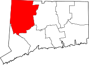
Non-consolidated city *Inactive city government
Boroughs Towns Barkhamsted | Bethlehem | Bridgewater | Canaan | Colebrook | Cornwall | Goshen | Harwinton | Kent | Litchfield | Morris | New Hartford | New Milford | Norfolk | North Canaan | Plymouth | Roxbury | Salisbury | Sharon | Thomaston | Warren | Washington | Watertown | Winchester | Woodbury
Unincorporated
communitiesCanaan Village | East Plymouth | Falls Village | Flanders | Gaylordsville | Hotchkissville | Lakeville | Lime Rock | Milton | New Preston | Northfield | Northwest Harwinton | Oakville | Pine Meadow | Riverton | Sharon Valley | South Kent | Terryville | Torringford | West Goshen
Categories:- Litchfield County, Connecticut
- National Register of Historic Places in Connecticut by county
-


Wikimedia Foundation. 2010.