- National Register of Historic Places listings in Meeker County, Minnesota
-
 Location of Meeker County in Minnesota
This is a list of the National Register of Historic Places listings in Meeker County, Minnesota.
This is intended to be a complete list of the properties and districts on the National Register of Historic Places in Meeker County, Minnesota, United States. The locations of National Register properties and districts for which the latitude and longitude coordinates are included below, may be seen in a Google map.[1]
There are 11 properties and districts listed on the National Register in the county.
-
- This National Park Service list is complete through NPS recent listings posted November 10, 2011.[2]
Current listings
[3] Landmark name Image Date listed Location City or town Summary 1 Henry Ames House 
August 9, 1984 Minnesota Highway 24
45°08′55″N 94°29′54″W / 45.148611°N 94.498333°WLitchfield 2 Bridge No. 5388 June 26, 1998 Minnesota Highway 24 over the North Fork of the Crow River
45°12′13″N 94°23′17″W / 45.203611°N 94.388056°WKingston 3 Bridge No. 90980 
January 9, 1997 County Road 190 over the North Fork of the Crow River
45°12′08″N 94°22′44″W / 45.202222°N 94.378889°WKingston Township 4 Brightwood Beach Cottage 
May 22, 1978 S. Ripley Dr.
45°05′54″N 94°32′20″W / 45.098333°N 94.538889°WLitchfield 5 District No. 48 School 
January 25, 1997 Off County Highway 6, approximately 1 mi (1.6 km) south of U.S. Route 12
45°03′54″N 94°15′39″W / 45.065°N 94.260833°WCollinwood Township 6 Grand Army of the Republic Hall 
May 21, 1975 370 N. Marshall St.
45°07′43″N 94°31′34″W / 45.128611°N 94.526111°WLitchfield 7 Litchfield Commercial Historic District 
March 1, 1996 N. Sibley Ave. between Depot and 3rd Sts.
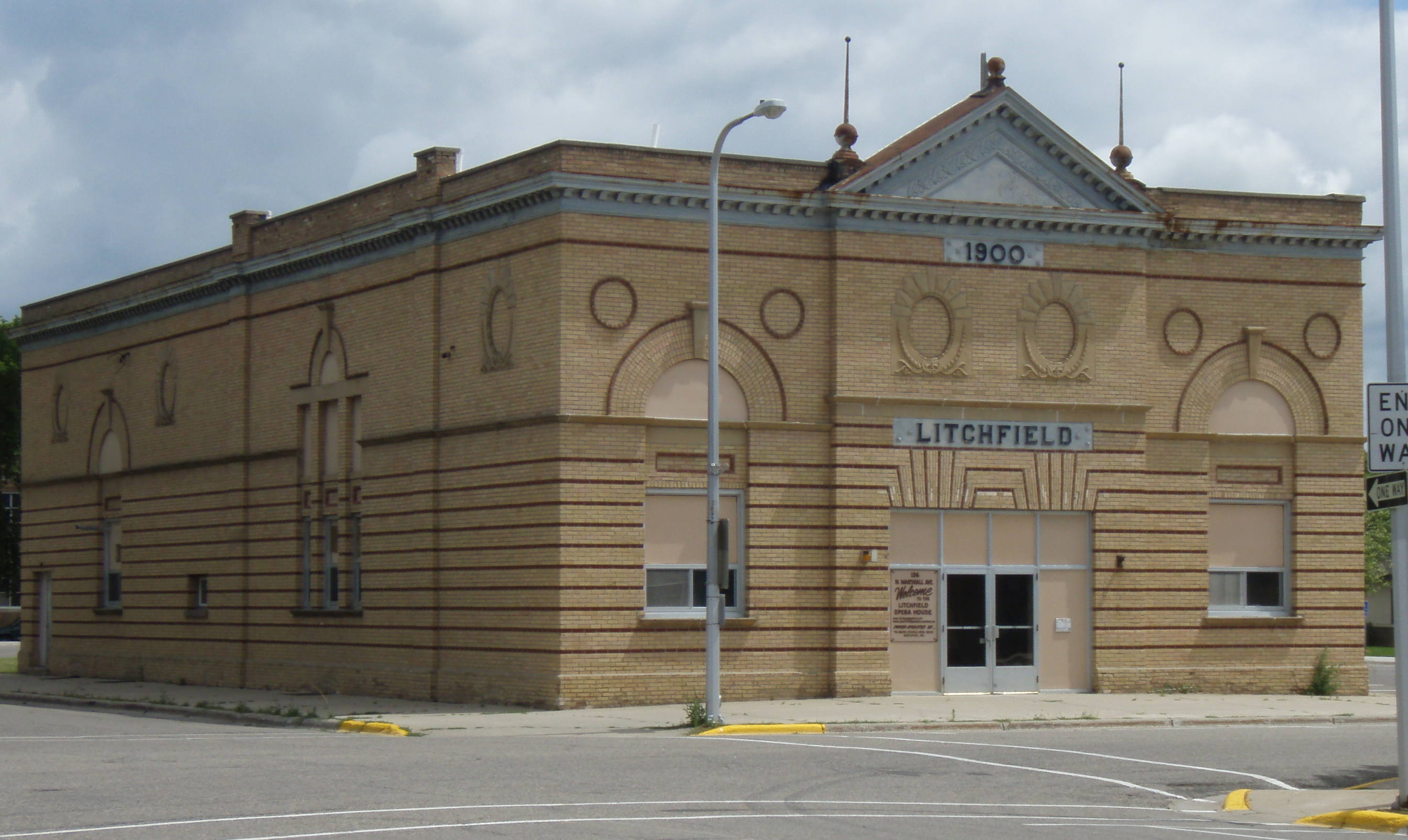
45°07′39″N 94°31′40″W / 45.1275°N 94.527778°WLitchfield 8 Litchfield Opera House 
October 4, 1984 126 N. Marshall Ave.
45°07′38″N 94°31′33″W / 45.127222°N 94.525833°WLitchfield 9 Pipe Lake Fort June 26, 2003 Address Restricted Cosmos 10 Trinity Episcopal Church 
June 20, 1975 400 N. Sibley Ave.
45°07′48″N 94°31′38″W / 45.13°N 94.527222°WLitchfield 11 Universal Laboratories Building 
March 1, 1996 901 1st St., N.
45°05′11″N 94°18′27″W / 45.086389°N 94.3075°WDassel See also
- List of National Historic Landmarks in Minnesota
- National Register of Historic Places listings in Minnesota
References
- ^ The latitude and longitude information provided in this table was derived originally from the National Register Information System, which has been found to be fairly accurate for about 99% of listings. For about 1% of NRIS original coordinates, experience has shown that one or both coordinates are typos or otherwise extremely far off; some corrections may have been made. A more subtle problem causes many locations to be off by up to 150 yards, depending on location in the country: most NRIS coordinates were derived from tracing out latitude and longitudes off of USGS topographical quadrant maps created under North American Datum of 1927, which differs from the current, highly accurate GPS system used by Google maps. Chicago is about right, but NRIS longitudes in Washington are higher by about 4.5 seconds, and are lower by about 2.0 seconds in Maine. Latitudes differ by about 1.0 second in Florida. Some locations in this table may have been corrected to current GPS standards.
- ^ "National Register of Historic Places: Weekly List Actions". National Park Service, United States Department of the Interior. Retrieved on November 10, 2011.
- ^ Numbers represent an ordering by significant words. Various colorings, defined here, differentiate National Historic Landmark sites and National Register of Historic Places Districts from other NRHP buildings, structures, sites or objects.
U.S. National Register of Historic Places Topics Lists by states Alabama • Alaska • Arizona • Arkansas • California • Colorado • Connecticut • Delaware • Florida • Georgia • Hawaii • Idaho • Illinois • Indiana • Iowa • Kansas • Kentucky • Louisiana • Maine • Maryland • Massachusetts • Michigan • Minnesota • Mississippi • Missouri • Montana • Nebraska • Nevada • New Hampshire • New Jersey • New Mexico • New York • North Carolina • North Dakota • Ohio • Oklahoma • Oregon • Pennsylvania • Rhode Island • South Carolina • South Dakota • Tennessee • Texas • Utah • Vermont • Virginia • Washington • West Virginia • Wisconsin • WyomingLists by territories Lists by associated states Other  Category:National Register of Historic Places •
  Portal:National Register of Historic Places
Municipalities and communities of Meeker County, Minnesota County seat: Litchfield Cities Cedar Mills | Cosmos | Darwin | Dassel | Eden Valley‡ | Grove City | Kingston | Litchfield | Watkins

Townships Acton | Cedar Mills | Collinwood | Cosmos | Danielson | Darwin | Dassel | Ellsworth | Forest City | Forest Prairie | Greenleaf | Harvey | Kingston | Litchfield | Manannah | Swede Grove | Union Grove
Unincorporated
communityFootnotes ‡This populated place also has portions in an adjacent county or counties
Categories:- National Register of Historic Places in Minnesota by county
- Meeker County, Minnesota
- Buildings and structures in Meeker County, Minnesota
-


Wikimedia Foundation. 2010.