- National Register of Historic Places listings in Winona County, Minnesota
-
This is a listing of entries on the National Register of Historic Places in Winona County, Minnesota.
[1] Landmark name Image Date listed Location City or town Summary 1 Anger's Block 
January 31, 1978 116-120 Walnut Street
44°03′08″N 91°38′00″W / 44.052222°N 91.633333°WWinona Also called Walnut Street Apartments 2 Bridge No. L1409 July 5, 1990 Hillsdale Township Road 62 over Garvin Brook
44°03′22″N 91°44′51″W / 44.056111°N 91.7475°WWinona Destroyed in 2007 Midwest flooding 3 Willard Bunnell House 
April 23, 1973 Homer and Matilde Streets
44°01′20″N 91°33′44″W / 44.022222°N 91.562222°WWinona 4 Choate Department Store 
June 3, 1976 51 East 3rd Street
44°03′09″N 91°38′09″W / 44.0525°N 91.635833°WWinona 5 Church of Saint Stanislaus-Catholic 
November 8, 1984 601 East 4th Street
44°02′49″N 91°37′20″W / 44.046944°N 91.622222°WWinona 6 Church of the Holy Trinity-Catholic 
August 9, 1984 Off Rollingstone Road
44°05′53″N 91°49′27″W / 44.098056°N 91.824167°WRollingstone 7 East Second Street Commercial Historic District January 25, 1991 66-78 Center, 54-78 E. 2nd, and 67-71 Lafayette Streets
44°03′11″N 91°38′06″W / 44.053056°N 91.635°WWinona 8 Benjamin Ellsworth House 
August 9, 1984 U.S. Highway 14
43°58′44″N 91°57′21″W / 43.978889°N 91.955833°WUtica 9 Dr. J. W. S. Gallagher House 
November 8, 1984 451 West Broadway
44°03′09″N 91°38′57″W / 44.0525°N 91.649167°WWinona 10 Grain and Lumber Exchange Building 
December 2, 1977 51 East 4th Street
44°03′03″N 91°38′12″W / 44.050833°N 91.636667°WWinona 11 William Hemmelberg House 
October 23, 1986 County Highways 26 and 37
44°05′20″N 91°59′29″W / 44.088889°N 91.991389°WElba 12 Abner F. Hodgins House 
November 8, 1984 275 Harriet Street
44°03′08″N 91°38′46″W / 44.052222°N 91.646111°WWinona 13 Huff-Lamberton House 
December 12, 1976 207 Huff Street
44°03′03″N 91°38′28″W / 44.050833°N 91.641111°WWinona 14 Kirch/Latch Building 
May 21, 1975 114-122 East 2nd Street
44°03′14″N 91°38′02″W / 44.053889°N 91.633889°WWinona 15 Nicholas Marnach House 
January 30, 1978 Off County Highway 26 in Whitewater Wildlife Management Area
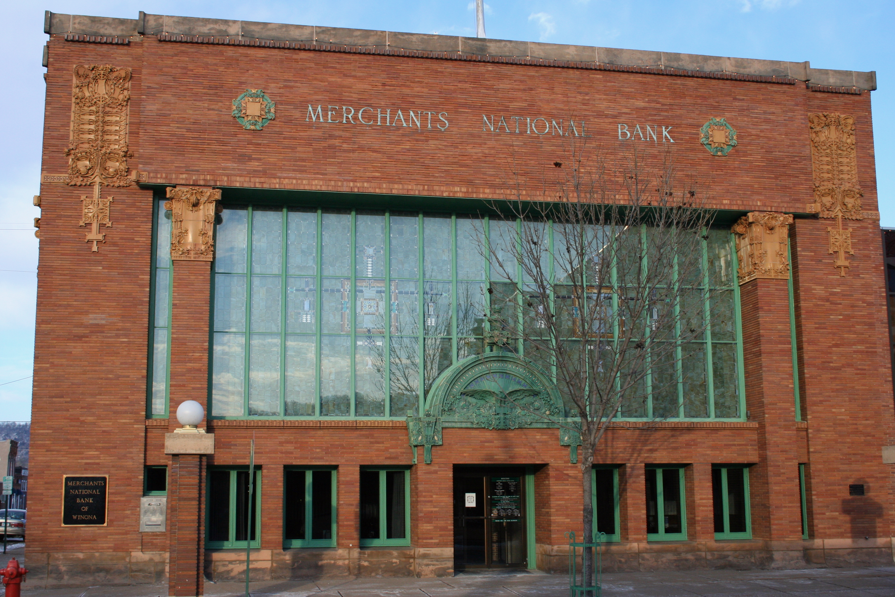
44°07′11″N 92°01′56″W / 44.119722°N 92.032222°WElba 16 Merchants National Bank 
October 16, 1974 102 East 3rd Street
44°03′07″N 91°37′58″W / 44.051944°N 91.632778°WWinona 17 Pickwick Mill 
September 22, 1970 County Highway 7
43°58′50″N 91°31′08″W / 43.980556°N 91.518889°WWinona 18 Schlitz Hotel 
August 26, 1982 129 West 3rd Street
44°03′11″N 91°38′21″W / 44.053056°N 91.639167°WWinona 19 Saint Charles City Bakery 
August 9, 1984 501 Whitewater Avenue
43°58′22″N 92°03′52″W / 43.972778°N 92.064444°WSt. Charles Also called Wilson's Garage and HCA Signs 20 Sugar Loaf 
August 3, 1990 Southwest of U.S. Highway 61 and Minnesota State Highway 43
44°01′44″N 91°37′37″W / 44.028889°N 91.626944°WWinona 21 Sugar Loaf Brewery 
March 31, 1978 Lake Boulevard and Sugar Loaf Road
44°01′44″N 91°37′27″W / 44.028889°N 91.624167°WWinona 22 Trinity Episcopal Church 
August 9, 1984 805 Saint Charles Avenue
43°58′12″N 92°03′58″W / 43.97°N 92.066111°WSt. Charles 23 Trinity Episcopal Church 
August 9, 1984 East Main Street and Broadway
44°01′54″N 91°46′17″W / 44.031667°N 91.771389°WStockton 24 J.R. Watkins Medical Company Complex 
December 4, 2004 150 Liberty Street
44°02′56″N 91°37′48″W / 44.048889°N 91.63°WWinona 25 Paul Watkins House 
November 8, 1984 175 East Wabasha Street
44°02′50″N 91°38′08″W / 44.047222°N 91.635556°WWinona 26 Whitewater Avenue Commercial Historic District 
August 9, 1984 900-1012 Whitewater Avenue
43°58′20″N 92°04′09″W / 43.972222°N 92.069167°WSt. Charles 27 Whitewater State Park CCC/WPA/Rustic Style Historic Resources 
October 25, 1989 Off Minnesota State Highway 74 south of Elba
44°02′50″N 92°02′55″W / 44.047222°N 92.048611°WElba 28 Winona and St. Peter Engine House 
January 12, 1984 75 Gould Street
44°03′27″N 91°40′06″W / 44.0575°N 91.668333°WWinona 29 Winona and St. Peter Railroad Freight House 
January 26, 1984 Front and Center Streets
44°03′14″N 91°38′06″W / 44.053889°N 91.635°WWinona 30 Winona City Hall 
July 8, 1999 207 Lafayette Street
44°03′03″N 91°38′09″W / 44.050833°N 91.635833°WWinona 31 Winona Commercial Historic District 
October 1, 1998 3rd Street between Franklin and Johnson Streets
44°03′06″N 91°38′04″W / 44.051667°N 91.634444°WWinona 32 Winona County Courthouse 
December 2, 1970 171 West 3rd Street
44°03′10″N 91°38′24″W / 44.052778°N 91.64°WWinona 33 Winona Free Public Library 
July 29, 1977 151 West 5th Street
44°03′04″N 91°38′26″W / 44.051111°N 91.640556°WWinona 34 Winona High School and Winona Junior High School 
January 2, 2004 166 and 218 West Broadway
44°03′04″N 91°38′23″W / 44.051111°N 91.639722°WWinona 35 Winona Hotel 
March 31, 1983 157 West 3rd Street
44°03′11″N 91°38′21″W / 44.053056°N 91.639167°WWinona 36 Winona Masonic Temple 
February 26, 1998 255 Main Street
44°03′03″N 91°38′20″W / 44.050833°N 91.638889°WWinona Also the Winona Senior Center 37 Winona Savings Bank Building 
September 15, 1977 204 Main Street
44°03′04″N 91°38′18″W / 44.051111°N 91.638333°WWinona See also
References
- ^ Numbers represent an ordering by significant words. Various colorings, defined here, differentiate National Historic Landmark sites and National Register of Historic Places Districts from other NRHP buildings, structures, sites or objects.
U.S. National Register of Historic Places Topics Lists by states Alabama • Alaska • Arizona • Arkansas • California • Colorado • Connecticut • Delaware • Florida • Georgia • Hawaii • Idaho • Illinois • Indiana • Iowa • Kansas • Kentucky • Louisiana • Maine • Maryland • Massachusetts • Michigan • Minnesota • Mississippi • Missouri • Montana • Nebraska • Nevada • New Hampshire • New Jersey • New Mexico • New York • North Carolina • North Dakota • Ohio • Oklahoma • Oregon • Pennsylvania • Rhode Island • South Carolina • South Dakota • Tennessee • Texas • Utah • Vermont • Virginia • Washington • West Virginia • Wisconsin • WyomingLists by territories Lists by associated states Other  Category:National Register of Historic Places •
  Portal:National Register of Historic PlacesCategories:
- Winona County, Minnesota
- National Register of Historic Places in Minnesota by county
- Buildings and structures in Winona County, Minnesota


Wikimedia Foundation. 2010.