- Brown County, Minnesota
-
Brown County, Minnesota 
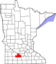
Location in the state of Minnesota
Minnesota's location in the U.S.Founded February 20, 1855 [1] Named for Joseph Renshaw Brown, a prominent pioneer, soldier, Indian trader, lumberman, speculator, founder of cities, legislator, politician, and editor. Seat New Ulm Largest city New Ulm Area
- Total
- Land
- Water
618.60 sq mi (1,602 km²)
610.86 sq mi (1,582 km²)
7.74 sq mi (20 km²), 1.25%Population
- (2010)
- Density
25,893
44/sq mi (17/km²)Time zone Central: UTC-6/-5 Website www.co.brown.mn.us Brown County is a county located in the U.S. state of Minnesota. As of 2010, the population was 25,893.[1] Its county seat is New Ulm[2].
Contents
Geography
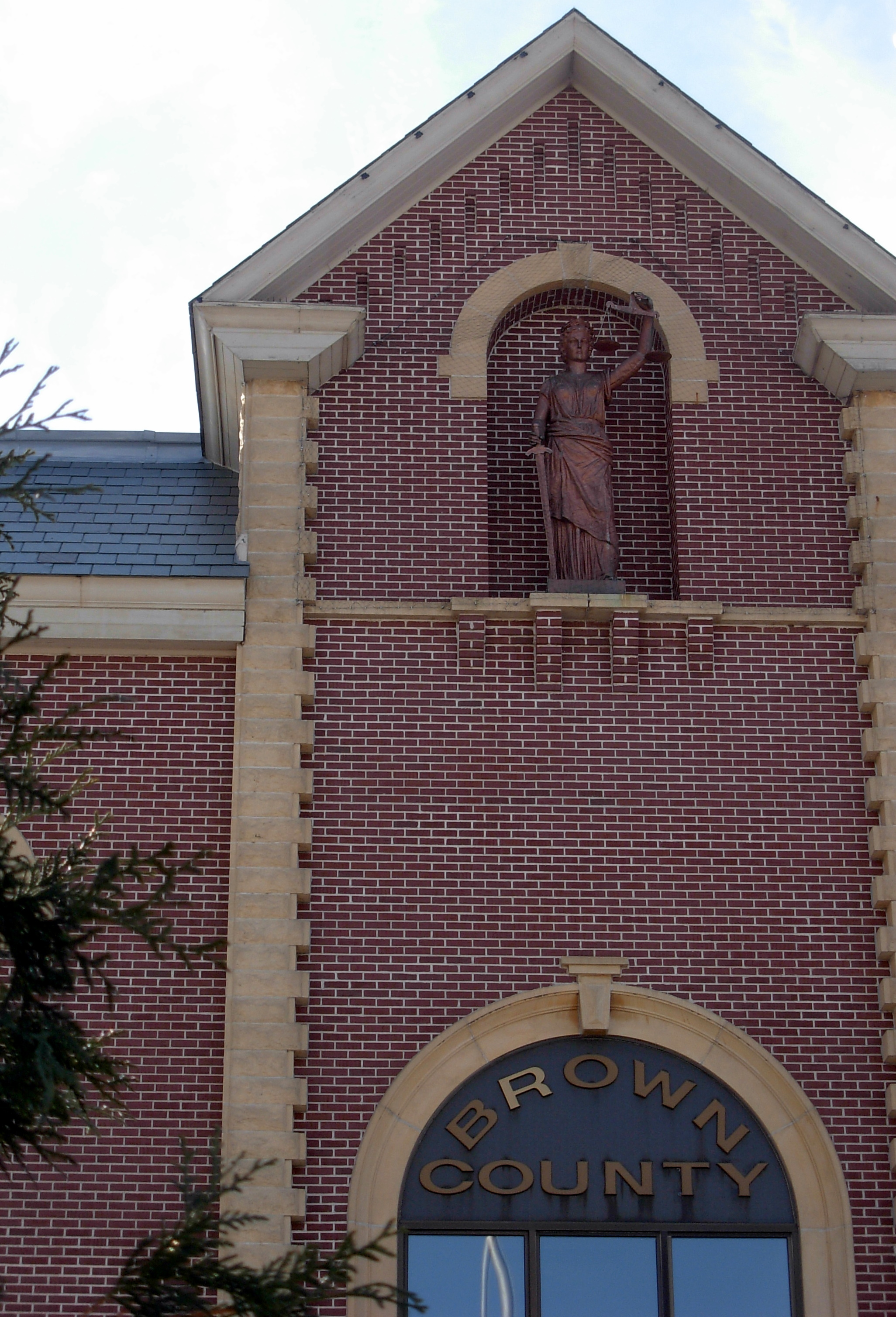
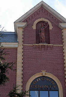 Brown County Courthouse
According to the 2000 census, the county has a total area of 618.60 square miles (1,602.2 km2), of which 610.86 square miles (1,582.1 km2) (or 98.75%) is land and 7.74 square miles (20.0 km2) (or 1.25%) is water.[3] The Minnesota River flows along the county's northern boundary; two of its tributaries, the Cottonwood and Little Cottonwood Rivers, flow eastwardly through the county.[4]
Lakes
- Altermatt Lake: almost entirely in Leavenworth Township, but the southern shore extends into Mulligan Township
- Bachelor Lake: in Stark Township
- Boise Lake: in Burnstown Township
- Clear Lake: in Sigel Township
- Gilman Lake: in Stark Township
- Horseshoe Lake: in Milford Township
- Juni Lake: in Sigel Township
- Lake Cottonwood: in Cottonwood Township
- Lake Hanska: eastern half is in Lake Hanska Township; western half is in Albin Township
- Linden Lake: in Linden Township
- Lone Tree Lake: in Eden Township
- Omsrud Lake: in Lake Hanska Township
- School Lake: in Sigel Township
- Sleepy Eye Lake: in Home Township
- Zanders Lake: mostly in Stark Township, but the eastern fifth is in Sigel Township
Major highways
Adjacent counties
- Nicollet County (northeast)
- Blue Earth County (southeast)
- Watonwan County (south)
- Cottonwood County (southwest)
- Redwood County (west)
- Renville County (northwest)
Demographics
Historical populations Census Pop. %± 1860 2,339 — 1870 6,396 173.5% 1880 12,018 87.9% 1890 15,817 31.6% 1900 19,787 25.1% 1910 20,134 1.8% 1920 22,421 11.4% 1930 23,428 4.5% 1940 25,544 9.0% 1950 25,895 1.4% 1960 27,676 6.9% 1970 28,887 4.4% 1980 28,645 −0.8% 1990 26,984 −5.8% 2000 26,911 −0.3% 2010 25,893 −3.8% U.S. Decennial Census  Age pyramid of county residents based on 2000 U.S. census data.
As of the census[5] of 2000, there were 26,911 people, 10,598 households, and 7,164 families residing in the county. The population density was 44 people per square mile (17/km²). There were 11,163 housing units at an average density of 18 per square mile (7/km²). The racial makeup of the county was 97.82% White, 0.10% Black or African American, 0.12% Native American, 0.41% Asian, 0.01% Pacific Islander, 0.91% from other races, and 0.63% from two or more races. 2.03% of the population were Hispanic or Latino of any race. 67.1% were of German and 9.6% Norwegian ancestry according to Census 2000.
There were 10,598 households out of which 31.50% had children under the age of 18 living with them, 57.30% were married couples living together, 6.90% had a female householder with no husband present, and 32.40% were non-families. 29.00% of all households were made up of individuals and 14.30% had someone living alone who was 65 years of age or older. The average household size was 2.43 and the average family size was 3.00.
In the county the population was spread out with 25.30% under the age of 18, 9.70% from 18 to 24, 25.60% from 25 to 44, 21.90% from 45 to 64, and 17.50% who were 65 years of age or older. The median age was 38 years. For every 100 females there were 98.20 males. For every 100 females age 18 and over, there were 95.90 males.
The median income for a household in the county was $39,800, and the median income for a family was $49,811. Males had a median income of $32,347 versus $23,918 for females. The per capita income for the county was $19,535. About 4.40% of families and 6.40% of the population were below the poverty line, including 7.00% of those under age 18 and 9.80% of those age 65 or over.
Cities and towns
Cities Townships Unincorporated - Essig
- Godahl
- Leavenworth
- Searles
† A small part of Comfrey extends into Cottonwood County.
Climate and weather
New Ulm, Minnesota Climate chart (explanation) J F M A M J J A S O N D 0.62460.729111.941232.958363.470494.87959483634.180613.272512.360381.642250.92710Average max. and min. temperatures in °F Precipitation totals in inches Source: The Weather Channel[6] Metric conversion J F M A M J J A S O N D 16-4-1417-2-12475-5731428721912226151012817104271682221157163416-422-3-12Average max. and min. temperatures in °C Precipitation totals in mm In recent years, average temperatures in the county seat of New Ulm have ranged from a low of 6 °F (−14 °C) in January to a high of 83 °F (28 °C) in July, although a record low of −37 °F (−38 °C) was recorded in January 1984 and a record high of 105 °F (41 °C) was recorded in July 1988. Average monthly precipitation ranged from 0.64 inches (16 mm) in January to 4.82 inches (122 mm) in June.[6]
See also
References
- ^ "2010 Census Redistricting Data (Public Law 94-171) Summary File". American FactFinder. United States Census Bureau. http://factfinder2.census.gov/faces/tableservices/jsf/pages/productview.xhtml?pid=DEC_10_PL_GCTPL2.ST05&prodType=table. Retrieved 25 April 2011.
- ^ "Find a County". National Association of Counties. http://www.naco.org/Counties/Pages/FindACounty.aspx. Retrieved 2011-06-07.
- ^ "Census 2000 U.S. Gazetteer Files: Counties". United States Census. http://www.census.gov/tiger/tms/gazetteer/county2k.txt. Retrieved 2011-02-13.
- ^ Minnesota Atlas & Gazetteer. Yarmouth, Me.: DeLorme. 1994. pp. 21–22, 30–31. ISBN 0-89933-222-6.
- ^ "American FactFinder". United States Census Bureau. http://factfinder.census.gov. Retrieved 2008-01-31.
- ^ a b "Monthly Averages for New Ulm, Minnesota". The Weather Channel. http://www.weather.com/weather/wxclimatology/monthly/graph/USMN0542. Retrieved 2011-11-06.
External links

Renville County Nicollet County Redwood County 
 Brown County, Minnesota

Cottonwood County Watonwan County Blue Earth County Municipalities and communities of Brown County, Minnesota Cities Cobden | Comfrey‡ | Evan | Hanska | New Ulm | Sleepy Eye | Springfield
Townships Albin | Bashaw | Burnstown | Cottonwood | Eden | Home | Lake Hanska | Leavenworth | Linden | Milford | Mulligan | North Star | Prairieville | Sigel | Stark | Stately
Unincorporated
communitiesEssig | Godahl‡ | Leavenworth | Searles
Footnotes ‡This populated place also has portions in an adjacent county or counties
Categories:- Minnesota counties
- Brown County, Minnesota


Wikimedia Foundation. 2010.