- Carver County, Minnesota
-
Carver County, Minnesota 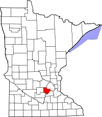
Location in the state of Minnesota
Minnesota's location in the U.S.Founded February 20, 1855 [1] Named for Jonathan Carver, an explorer in the area. Seat Chaska Largest city Chaska Area
- Total
- Land
- Water
376.15 sq mi (974 km²)
357.04 sq mi (925 km²)
19.11 sq mi (49 km²), 5.08%Population
- (2010)
- Density
91,042
197/sq mi (76/km²)Time zone Central: UTC-6/-5 Website www.co.carver.mn.us Carver County is a county located in the U.S. state of Minnesota. As of 2010, the population was 91,042.[2] Its county seat is Chaska.[3] Carver County is named after the explorer Jonathan Carver. Carver County is part of the Minneapolis-St. Paul Metropolitan Area.
Contents
Geography
According to the 2000 census, the county has a total area of 376.15 square miles (974.2 km2), of which 357.04 square miles (924.7 km2) (or 94.92%) is land and 19.11 square miles (49.5 km2) (or 5.08%) is water.[4]
Lakes
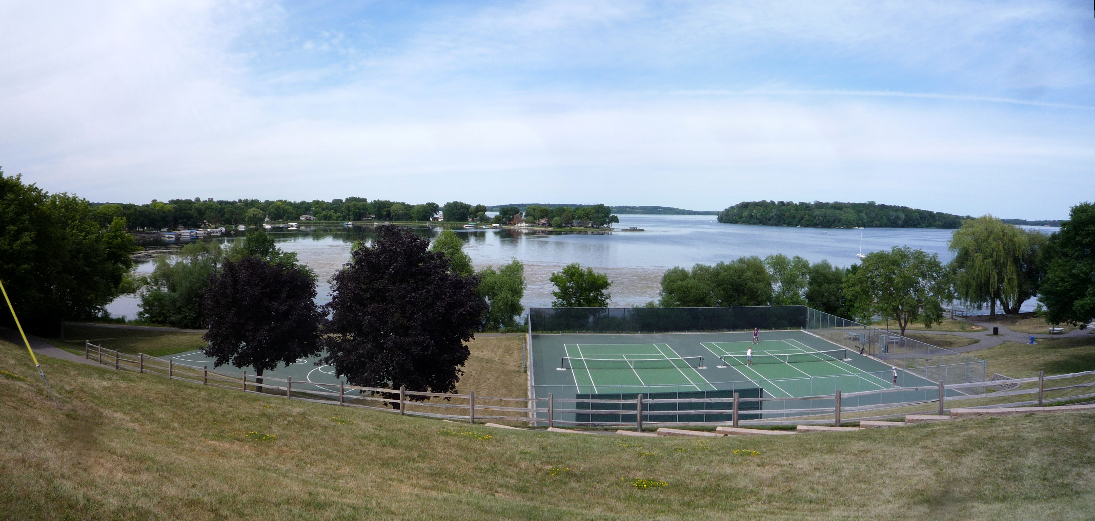
 Lake Waconia.
- Assumption Lake: in Hancock Township
- Aue Lake: in Dahlgren Township
- Barlous Lake: in Benton Township
- Barnes Lake: in Young America Township
- Benton Lake: in Benton Township
- Berliner Lake: in Camden Township
- Brand Lake: in Young America Township
- Braunworth Lake: in Young America Township
- Buck Lake: in Watertown Township
- Burandt Lake: in Waconia Township
- Carl Krey Lake: in Laketown Township
- Donders Lake: in Waconia Township
- Eagle Lake: in Camden Township
- Gaystock Lake: in Dahlgren Township
- Goose Lake: mostly in Waconia Township, but the northern fifth is in Watertown Township
- Hallquist Lake: in San Francisco Township
- Hydes Lake: in Waconia Township
- Kelly Lake: in San Francisco Township
- Lake Auburn: in Laketown Township
- Lake Minnewashta: in Waconia Township
- Lake Patterson: in Waconia Township
- Lake Virginia: in Laketown Township
- Lake Waconia: mostly in Waconia Township, but the eastern fifth is in Laketown Township
- Lake Zumbra: in Laketown Township
- Lippert Lake: western half is in Hollywood Township; eastern half is in Watertown Township
- Long Lake: in San Francisco Township
- Lunsten Lake: in Laketown Township
- Maria Lake: western half is in Benton Township; eastern half is in Dahlgren Township
- Marsh Lake: in Laketown Township
- Meuwissen Lake: in Benton Township
- Miller Lake: in Dahlgren Township
- Mud Lake: in Watertown Township
- Myers Lake: in Benton Township
- Oak Lake: in Watertown Township
- Parley Lake: in Laketown Township
- Piersons Lake: in Laketown Township
- Rice Lake: mostly in Benton Township, but the northern part extends into Waconia Township
- Rietz Lake: in Laketown Township
- Rutz Lake: in Waconia Township
- Schutz Lake: in Laketown Township
- Scott Lake: in San Francisco Township
- Smith Lake: in Camden Township
- Stieger Lake: in Laketown Township
- Stone Lake: in Laketown Township
- Sunny Lake: in Laketown Township
- Swan Lake: in Waconia Township
- Swede Lake: in Watertown Township
- Tiger Lake: in Young America Township
- Turbid Lake: in Laketown Township
- Wasserman Lake: in Laketown Township
- Winkler Lake: in Benton Township
- Young America Lake: in Young America Township
Major highways
 U.S. Highway 212
 Minnesota State Highway 5
 Minnesota State Highway 7
 Minnesota State Highway 25
Adjacent counties
- Wright County (north)
- Hennepin County (northeast)
- Scott County (southeast)
- Sibley County (southwest)
- McLeod County (west)
National protected area
Demographics
Historical populations Census Pop. %± 1860 5,106 — 1870 11,586 126.9% 1880 14,140 22.0% 1890 16,532 16.9% 1900 17,544 6.1% 1910 17,455 −0.5% 1920 16,946 −2.9% 1930 16,936 −0.1% 1940 17,606 4.0% 1950 18,155 3.1% 1960 21,358 17.6% 1970 28,331 32.6% 1980 37,046 30.8% 1990 47,915 29.3% 2000 70,205 46.5% 2010 91,042 29.7% U.S. Decennial Census
Minnesota Counties: 1900-1900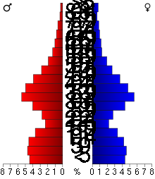 Age pyramid of county residents based on 2000 U.S. census data.
As of the census[5] of 2000, there were 70,205 people, 24,356 households, and 18,778 families residing in the county. The population density was 197 people per square mile (76/km²). There were 24,883 housing units at an average density of 70 per square mile (27/km²). The racial makeup of the county was 95.95% White, 0.59% Black or African American, 0.18% Native American, 1.56% Asian, 0.01% Pacific Islander, 0.87% from other races, and 0.82% from two or more races. 2.55% of the population were Hispanic or Latino of any race. 44.3% were of German, 12.1% Norwegian, 7.1% Irish and 6.2% Swedish ancestry according to Census 2000.
There were 24,356 households out of which 45.20% had children under the age of 18 living with them, 66.40% were married couples living together, 7.30% had a female householder with no husband present, and 22.90% were non-families. 18.10% of all households were made up of individuals and 6.10% had someone living alone who was 65 years of age or older. The average household size was 2.84 and the average family size was 3.26.
In the county the population was spread out with 31.50% under the age of 18, 6.90% from 18 to 24, 34.70% from 25 to 44, 19.50% from 45 to 64, and 7.50% who were 65 years of age or older. The median age was 34 years. For every 100 females there were 100.00 males. For every 100 females age 18 and over, there were 98.00 males.
The median income for a household in the county was $65,540, and the median income for a family was $73,577 (these figures had risen to $78,035 and $89,100 respectively as of a 2007 estimate[6]). Males had a median income of $47,271 versus $32,107 for females. The per capita income for the county was $28,486. About 2.30% of families and 3.50% of the population were below the poverty line, including 3.60% of those under age 18 and 6.90% of those age 65 or over.
Cities and towns
Cities Townships Unincorporated - Augusta
- San Francisco
- Bongards
- Assumption
Notable residents
- Abigail and Brittany Hensel
- Prince (musician)
- Wendelin Grimm
Climate and weather
Chaska, Minnesota Climate chart (explanation) J F M A M J J A S O N D 0.72240.72891.740212.557343.769464.678563.581605.178583.471492.558361.641231268Average max. and min. temperatures in °F Precipitation totals in inches Source: The Weather Channel[7] Metric conversion J F M A M J J A S O N D 19-6-1617-2-13444-66414194218118261389271612826148722963142425-524-3-13Average max. and min. temperatures in °C Precipitation totals in mm In recent years, average temperatures in the county seat of Chaska have ranged from a low of 4 °F (−16 °C) in January to a high of 81 °F (27 °C) in July, although a record low of −41 °F (−41 °C) was recorded in January 1970 and a record high of 105 °F (41 °C) was recorded in July 1988. Average monthly precipitation ranged from 0.66 inches (17 mm) in February to 5.05 inches (128 mm) in August.[7]
See also
References
- ^ "he late Senator Hubert Humphrey once quipped that contrary to what the rest of the country may believe". House.leg.state.mn.us. http://www.house.leg.state.mn.us/hinfo/govseries/No3.htm. Retrieved 2010-07-22.
- ^ "2010 Census Redistricting Data (Public Law 94-171) Summary File". American FactFinder. United States Census Bureau. http://factfinder2.census.gov/faces/tableservices/jsf/pages/productview.xhtml?pid=DEC_10_PL_GCTPL2.ST05&prodType=table. Retrieved 25 April 2011.
- ^ "Find a County". National Association of Counties. http://www.naco.org/Counties/Pages/FindACounty.aspx. Retrieved 2011-06-07.
- ^ "Census 2000 U.S. Gazetteer Files: Counties". United States Census. http://www.census.gov/tiger/tms/gazetteer/county2k.txt. Retrieved 2011-02-13.
- ^ "American FactFinder". United States Census Bureau. http://factfinder.census.gov. Retrieved 2008-01-31.
- ^ "Carver County, Minnesota - Fact Sheet - American FactFinder". Factfinder.census.gov. http://factfinder.census.gov/servlet/ACSSAFFFacts?_event=Search&geo_id=05000US27139&_geoContext=01000US%7C04000US27%7C05000US27139&_street=&_county=carver&_cityTown=carver&_state=04000US27&_zip=&_lang=en&_sse=on&ActiveGeoDiv=geoSelect&_useEV=&pctxt=fph&pgsl=050&_submenuId=factsheet_1&ds_name=ACS_2007_3YR_SAFF&_ci_nbr=null&qr_name=null®=null%3Anull&_keyword=&_industry=. Retrieved 2010-07-22.
- ^ a b "Monthly Averages for Chaska, Minnesota". The Weather Channel. http://www.weather.com/weather/wxclimatology/monthly/graph/USMN0136. Retrieved 2011-11-06.
External links

Wright County Hennepin County McLeod County 
 Carver County, Minnesota

Sibley County Scott County Municipalities and communities of Carver County, Minnesota Cities Carver | Chanhassen‡ | Chaska | Cologne | Hamburg | Mayer | New Germany | Norwood Young America | Victoria | Waconia | Watertown
Townships Benton | Camden | Dahlgren | Hancock | Hollywood | Laketown | San Francisco | Waconia | Watertown | Young America
Unincorporated
communityGotha
Ghost town Footnotes ‡This populated place also has portions in an adjacent county or counties
Categories:- Minnesota counties
- Carver County, Minnesota
- Minneapolis–Saint Paul


Wikimedia Foundation. 2010.