- Maplewood, Minnesota
-
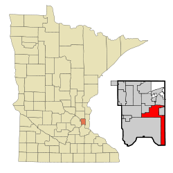
Maplewood, Minnesota — City — Location of Maplewood, Minnesota Coordinates: 44°59′34″N 93°1′26″W / 44.99278°N 93.02389°W Country United States State Minnesota County Ramsey Government - Mayor Will Rossbach Area - Total 18.0 sq mi (46.6 km2) - Land 17.3 sq mi (44.9 km2) - Water 0.7 sq mi (1.7 km2) Elevation 978 ft (298 m) Population (2010)[1] - Total 38,018 - Density 2,017.5/sq mi (779.0/km2) Time zone Central (CST) (UTC-6) - Summer (DST) CDT (UTC-5) ZIP codes 55106, 55109, 55117, 55119 Area code(s) 651 FIPS code 27-40382[2] GNIS feature ID 0647503[3] Website www.ci.maplewood.mn.us Maplewood, incorporated in 1957, is a city in Ramsey County, Minnesota, United States. The population was 38,018 at the 2010 census.[1] Maplewood is ten minutes from downtown St. Paul. Maplewood stretches along most of the northern and eastern borders of St. Paul.
Maplewood is home to the corporate headquarters and main campus of 3M Corporation. The city is also home to the Maplewood Mall and St. John's Hospital.
Contents
Geography
According to the United States Census Bureau, the city has a total area of 18.0 square miles (47 km2), of which, 17.3 square miles (45 km2) of it is land and 0.7 square miles (1.8 km2) of it (3.72%) is water.
U.S. Highway 61, Minnesota Highway 36, and Interstate Highways 35E, 94, and 694 are five of the main routes in the city.
Demographics
Historical populations Census Pop. %± 1960 18,519 — 1970 25,186 36.0% 1980 26,990 7.2% 1990 30,954 14.7% 2000 34,947 12.9% 2010 38,018 8.8% U.S. Decennial Census As of the census[2] of 2000, there were 34,947 people, 13,758 households, and 9,190 families residing in the city. The population density was 2,017.5 people per square mile (779.0/km²). There were 14,004 housing units at an average density of 808.5 per square mile (312.2/km²). The racial makeup of the city was 88.69% White, 3.54% African American, 0.55% Native American, 4.54% Asian, 0.07% Pacific Islander, 0.73% from other races, and 1.88% from two or more races. Hispanic or Latino of any race were 2.23% of the population.
There were 13,758 households out of which 31.6% had children under the age of 18 living with them, 52.8% were married couples living together, 10.5% had a female householder with no husband present, and 33.2% were non-families. 27.0% of all households were made up of individuals and 11.1% had someone living alone who was 65 years of age or older. The average household size was 2.48 and the average family size was 3.04.
In the city the population was spread out with 24.7% under the age of 18, 7.7% from 18 to 24, 30.0% from 25 to 44, 22.6% from 45 to 64, and 15.0% who were 65 years of age or older. The median age was 38 years. For every 100 females there were 91.5 males. For every 100 females age 18 and over, there were 87.8 males.
The median income for a household in the city was $51,596, and the median income for a family was $63,049. Males had a median income of $43,033 versus $30,557 for females. The per capita income for the city was $24,387. About 3.0% of families and 4.8% of the population were below the poverty line, including 4.9% of those under age 18 and 5.6% of those age 65 or over.
Politics
Maplewood's Mayor and four at-large City Council members are elected in odd numbered years.[4] The former Mayor (Diana Longrie) and former Council (Rebecca Cave, Erik Hjelle, Kathy Juenemann, and Will Rossbach) have garnered metro-area attention in recent years for a number of issues. Chief among these issues are the firings, resignations, and re-organizational plan that eliminated some positions.[5][6]
The current city council is made up of the following five members:
Office Member First elected District Mayor Will Rossbach 2005 At-large Council member Kathleen Juenemann 2001 At-large Council member John Nephew 2007 At-large Council member James Llanas 2009 At-large Council member Vacant (N/A) At-large Economy
According to the City's 2009 Comprehensive Annual Financial Report,[7] the top employers in the city are:
# Employer # of Employees 1 3M 10,000 2 St. John's Hospital 1,600 3 Independent School District 622 1,500 4 City of Maplewood 492 5 Maplewood Care Center 275 6 Ramsey County Care Center 250 7 Macy's 250 8 Sears 200 9 Cub Foods 185 10 Menards 160 References
- ^ a b "2010 Census Redistricting Data (Public Law 94-171) Summary File". American FactFinder. U.S. Census Bureau, 2010 Census. http://factfinder2.census.gov/faces/tableservices/jsf/pages/productview.xhtml?pid=DEC_10_PL_GCTPL2.ST13&prodType=table. Retrieved 23 April 2011.
- ^ a b "American FactFinder". United States Census Bureau. http://factfinder.census.gov. Retrieved 2008-01-31.
- ^ "US Board on Geographic Names". United States Geological Survey. 2007-10-25. http://geonames.usgs.gov. Retrieved 2008-01-31.
- ^ "Election Results from 2000 - Current". Ramsey County Elections. Retrieved 2009-09-16.
- ^ Demko, Paul (March 14, 2007). "Welcome to Maplewood". City Pages. Retrieved 2009-09-16.
- ^ Demko, Paul (February 19, 2008). "Maplewood Follies". City Pages. Retrieved 2009-09-16.
- ^ City of Fremont, California Comprehensive Annual Financial Report, for the Year ended June 30, 2009
Municipalities and communities of Ramsey County, Minnesota Cities Arden Hills | Blaine‡ | Falcon Heights | Gem Lake | Lauderdale | Little Canada | Maplewood | Mounds View | New Brighton | North Oaks | North St. Paul | Roseville | Shoreview | St. Anthony‡ | St. Paul | Spring Lake Park‡ | Vadnais Heights | White Bear Lake‡
Township Unincorporated
communitiesBellaire | Bald Eagle
Footnotes ‡This populated place also has portions in an adjacent county or counties
Coordinates: 44°57′11″N 92°59′43″W / 44.95306°N 92.99528°W
Categories:- Cities in Minnesota
- Populated places in Ramsey County, Minnesota
Wikimedia Foundation. 2010.


