- Scott County, Minnesota
-
Scott County, Minnesota 
Seal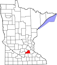
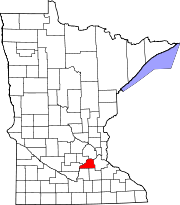
Location in the state of Minnesota
Minnesota's location in the U.S.Founded March 5, 1853 [1] Named for General Winfield Scott Seat Shakopee Largest city Shakopee Area
- Total
- Land
- Water
368.56 sq mi (955 km²)
356.68 sq mi (924 km²)
11.88 sq mi (31 km²), 3.22%Population
- (2010)
- Density
129,928
251/sq mi (97/km²)Time zone Central: UTC-6/-5 Website www.co.scott.mn.us Scott County is a county located in the U.S. state of Minnesota. It was organized in 1853 and named in honor of General Winfield Scott. As of 2010, the population was 129,928.[2] Its county seat is Shakopee[3]. The Shakopee-Mdewakanton Indian Reservation is located entirely within the county and within the cities of Prior Lake and Shakopee.
Scott County is a member of the Metropolitan Council, and shares many of the council's concerns about responsible growth management, advocating for progressive development concepts such as clustering, open-space design, and the preservation of open space and rural/agricultural land.
Scott County is a mixed rural/suburban county in the Twin Cities metropolitan area. The county consists of the cities of Belle Plaine, Jordan, Elko New Market, New Prague, Prior Lake, Savage and Shakopee and Belle Plaine, Blakeley, Cedar Lake, Credit River, Helena, Jackson, Louisville, New Market, St. Lawrence, Sand Creek, and Spring Lake townships. Scott County was one of the fastest growing counties in the state of Minnesota, having increased 55% since 1990. However according to US Census data released in 2011, Scott County saw the steepest drop in median income of all the populous counties in Minnesota.[4] Scott County is 365 square miles (950 km2) and is bounded on the west and north by the Minnesota River. The Minnesota River had supported the county's fur trading, lumbering, and farming industries in the 19th century. Today Scott County enjoys a growing mix of commercial, industrial, and housing development, but is still primarily rural. Scott County is the home to several historical, scenic, and entertainment destinations including Canterbury Park, The Landing, Elko Speedway, Mystic Lake Casino, the Renaissance Festival, and Valleyfair Amusement Park.
Contents
History
Scott County was first inhabited by two bands of the Santee Sioux (Dakota) Indians, the Mdewakanton and Wahpeton. They lived a semi-nomadic life that followed a seasonal cycle. They gathered food, hunted, fished, and planted corn. In the summer the Dakota villages were occupied but in the winter the groups separated for hunting. They had many permanent villages along the Minnesota River. They had many trails leading to these settlements and to the Red River Valley in the North, and the Prairie du Chien to the Southeast. These trails were later used by the fur traders and settlers, and were known as the "ox cart trails." The area of Scott County, as well as much of southern Minnesota, was opened for settlement by two treaties signed at Mendota and Traverse des Sioux, in 1851 and 1853. These treaties removed the Dakota Indians to reservations in upper Minnesota.
Scott County was established and organized by an Act passed in the legislature on March 5, 1853. The 369 square miles (960 km2) county was named after General Winfield Scott. Settlers started entering the area in the mid-1850s. The Minnesota River and the ox cart trails were the primary transportation routes. The first settlers were Yankees, followed by groups of Germans, Irish, Czechs, and Scandinavians. They each brought their own traditions and religions. Most of these settlers became farmers. Fur trading, lumbering, and farming were Minnesota's major industries all throughout the 19th century. With the fast-growing farms, sprang up towns. Shakopee, the County Seat, began in 1851 as a trading post by the Dakota Village of Chief Shakopee (or Shakpay). Other towns were established alongside transportation routes. When the railroads came to Minnesota they became the primary mode of transportation and eventually highways were developed along the ox cart trails between the communities.
Due to urban sprawl and suburbanization this rural county is changing dramatically. Cities are continually growing, causing an increase in population from 57,846 in 1990 to 89,498 today, making Scott County Minnesota's fastest growing county.
Presidential Election Results 2000-2008 Year Democrat Republican 2008 43.51% 29,208 54.70% 36,724 2004 39.51% 23,958 59.46% 36,055 2000 39.97% 17,503 54.70% 23,954 Geography
According to the 2000 census, the county has a total area of 368.56 square miles (954.6 km2), of which 356.68 square miles (923.8 km2) (or 96.78%) is land and 11.88 square miles (30.8 km2) (or 3.22%) is water.[5] The Minnesota River is the county's boundary in both the north and the west. The broad river valley juts through glacial sediment into some of the oldest rock known. Now mostly farmland, it was an oak savanna and a mixture of grass and clusters of trees that grew parallel to the river valley. The savanna bordered the "Big Woods", a hard wood forest that covered most of Minnesota before it was logged in the mid-19th century.
Lakes
- Ahlswede Lake: in St. Lawrence Township
- Blue Lake: in Jackson Township
- Browns Lake: in St. Lawrence Township
- Campbell Lake: in Spring Lake Township
- Cedar Lake: western two-thirds is in Helena Township; eastern third is in Cedar Lake Township
- Cedar Lake: there is a smaller Cedar Lake in the eastern part of Cedar Lake Township
- Clark Lake: in Blakely Township
- Cleary Lake: mostly in Credit River Township; the western part stretches into Spring Lake Township
- Crystal Lake: in Spring Lake Township
- Cynthia Lake: northern two thirds is in Spring Lake Township; the rest is in Cedar Township
- Deans Lake: in Jackson Township
- Fish Lake: in Spring Lake Township
- Fisher Lake: in Jackson Township
- Gifford Lake: in Jackson Township
- Hanrahan Lake: in Jackson Township
- Hickey Lake: eastern two thirds is in Helena Township; western third is in Cedar Lake Township
- Horseshoe Lake: in St. Lawrence Township
- Howard Lake: in Jackson Township
- Kane Lake: in Spring Lake Township
- Lennon Lake: in Cedar Lake Township
- Lower Prior Lake: in the city of Prior Lake
- Markley Lake: eastern half is in Credit River Township; the western half is in City of Prior Lake
- McMahon Lake: in Spring Lake Township
- Mud Lake: in Cedar Lake Township
- Murphy Lake: in Credit River Township
- O'Dowd Lake: western third is in Louisville Township; eastern two thirds is in Jackson Township
- Pike Lake: in Jackson Township
- Pleasant Lake: in Helena Township
- Rice Lake: west half is in Cedar Lake Township; east half is in Dakota County
- Rice Lake: there is another Rice Lake in Jackson Township
- Rice Lake: there is a third Rice Lake in Spring Lake Township
- Schneider Lake: in Louisville Township
- Spring Lake: in Spring Lake Township and Prior Lake
- St. Catherine Lake: in Cedar Lake Township
- Thole Lake: in Louisville Township
- Upper Prior Lake: in Prior Lake
Major highways
 Interstate 35
 U.S. Highway 169
 Minnesota State Highway 13
 Minnesota State Highway 19
Adjacent counties
- Hennepin County (north)
- Dakota County (east)
- Rice County (southeast)
- Le Sueur County (southwest)
- Sibley County (west)
- Carver County (northwest)
National protected area
Demographics
Historical populations Census Pop. %± 1860 4,595 — 1870 11,042 140.3% 1880 13,516 22.4% 1890 13,831 2.3% 1900 15,147 9.5% 1910 14,888 −1.7% 1920 14,245 −4.3% 1930 14,116 −0.9% 1940 15,585 10.4% 1950 16,486 5.8% 1960 21,909 32.9% 1970 32,423 48.0% 1980 43,784 35.0% 1990 57,846 32.1% 2000 89,498 54.7% 2010 129,928 45.2% U.S. Decennial Census
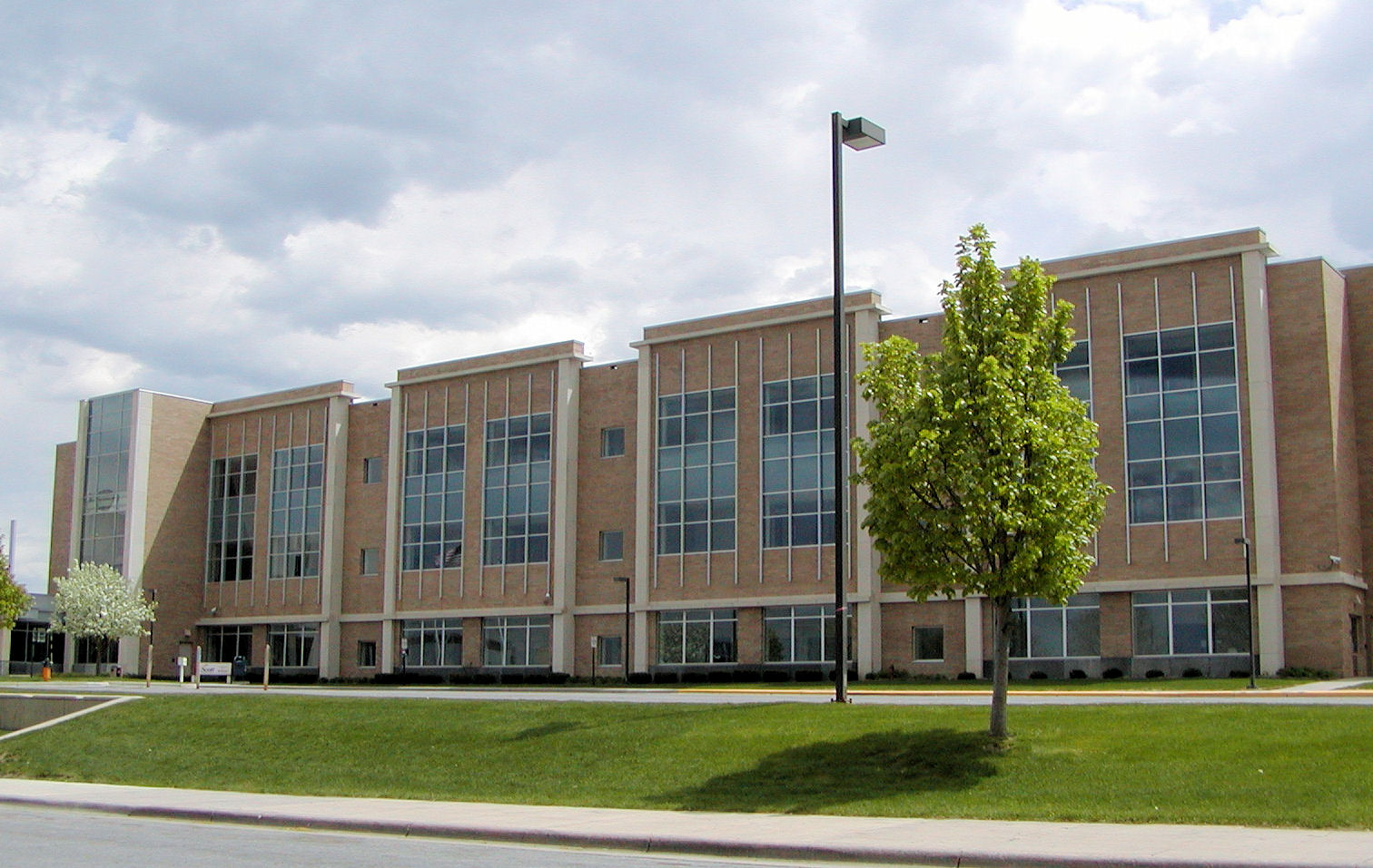
Minnesota Counties: 1900-1900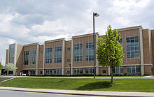 Scott County Government Center
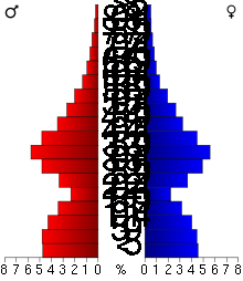 Age pyramid of county residents based on 2000 U.S. census data.
As of the census[6] of 2000, there were 89,498 people, 30,692 households, and 23,970 families residing in the county. The population density was 251 people per square mile (97/km²). There were 31,609 housing units at an average density of 89 per square mile (34/km²). The racial makeup of the county was 93.65% White, 0.92% Black or African American, 0.77% Native American, 2.17% Asian, 0.03% Pacific Islander, 1.24% from other races, and 1.21% from two or more races. 2.66% of the population were Hispanic or Latino of any race. 39.6% were of German, 12.6% Norwegian, 8.3% Irish and 5.1% Swedish ancestry according to Census 2000.
There were 30,692 households out of which 45.40% had children under the age of 18 living with them, 66.90% were married couples living together, 7.40% had a female householder with no husband present, and 21.90% were non-families. 16.00% of all households were made up of individuals and 4.50% had someone living alone who was 65 years of age or older. The average household size was 2.89 and the average family size was 3.25.
In the county the population was spread out with 31.20% under the age of 18, 6.70% from 18 to 24, 37.30% from 25 to 44, 18.60% from 45 to 64, and 6.20% who were 65 years of age or older. The median age was 33 years. For every 100 females there were 101.90 males. For every 100 females age 18 and over, there were 100.00 males.
The median income for a household in the county was $66,612, and the median income for a family was $72,212 (these figures had risen to $80,968 and $90,489 respectively as of a 2007 estimate[7]). Males had a median income of $46,593 versus $32,482 for females. The per capita income for the county was $26,418. About 2.00% of families and 3.40% of the population were below the poverty line, including 3.40% of those under age 18 and 7.50% of those age 65 or over. However in 2011, Scott County saw the steepest drop in median income of all the populous counties in Minnesota and household wealth fell by 10 percent. [4]
Cities and towns
Cities Townships Unincorporated - Union Hill
- Marystown
† Part of New Prague extends into Le Sueur County.
See also
References
- ^ "Minnesota Government Series, State Symbols". House.leg.state.mn.us. http://www.house.leg.state.mn.us/hinfo/govseries/No34.htm. Retrieved 2010-07-22.
- ^ "2010 Census Redistricting Data (Public Law 94-171) Summary File". American FactFinder. United States Census Bureau. http://factfinder2.census.gov/faces/tableservices/jsf/pages/productview.xhtml?pid=DEC_10_PL_GCTPL2.ST05&prodType=table. Retrieved 25 April 2011.
- ^ "Find a County". National Association of Counties. http://www.naco.org/Counties/Pages/FindACounty.aspx. Retrieved 2011-06-07.
- ^ a b "Scott County hit hardest by economic turbulence, data show". National Public Radio. http://minnesota.publicradio.org/display/web/2011/09/21/scott-county-hit-hardest-by-economic-turbulence-data-shows/. Retrieved 22 September 2011.
- ^ "Census 2000 U.S. Gazetteer Files: Counties". United States Census. http://www.census.gov/tiger/tms/gazetteer/county2k.txt. Retrieved 2011-02-13.
- ^ "American FactFinder". United States Census Bureau. http://factfinder.census.gov. Retrieved 2008-01-31.
- ^ "Scott County, Minnesota - Fact Sheet - American FactFinder". Factfinder.census.gov. http://factfinder.census.gov/servlet/ACSSAFFFacts?_event=Search&geo_id=05000US55079&_geoContext=01000US%7C04000US55%7C05000US55079&_street=&_county=scott&_cityTown=scott&_state=04000US27&_zip=&_lang=en&_sse=on&ActiveGeoDiv=geoSelect&_useEV=&pctxt=fph&pgsl=050&_submenuId=factsheet_1&ds_name=ACS_2007_3YR_SAFF&_ci_nbr=null&qr_name=null®=null%3Anull&_keyword=&_industry=. Retrieved 2010-07-22.
External links

Carver County Hennepin County Sibley County 
Dakota County  Scott County, Minnesota

Le Sueur County Rice County Municipalities and communities of Scott County, Minnesota Cities Belle Plaine | Elko New Market | Jordan | New Prague‡ | Prior Lake | Savage | Shakopee
Townships Belle Plaine | Blakeley | Cedar Lake | Credit River | Helena | Jackson | Louisville | New Market | Sand Creek | Spring Lake | St. Lawrence
Unincorporated
communitiesSpring Lake | Union Hill
Indian
reservationFootnotes ‡This populated place also has portions in an adjacent county or counties
Categories:- Minnesota counties
- Minneapolis–Saint Paul
- Scott County, Minnesota


Wikimedia Foundation. 2010.