- National Register of Historic Places listings in Scott County, Minnesota
-
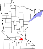
 Location of Scott County in Minnesota
This is a list of the National Register of Historic Places listings in Scott County, Minnesota.
This is intended to be a complete list of the properties and districts on the National Register of Historic Places in Scott County, Minnesota, United States. The locations of National Register properties and districts for which the latitude and longitude coordinates are included below, may be seen in a Google map.[1]
There are 18 properties and districts listed on the National Register in the county.
-
- This National Park Service list is complete through NPS recent listings posted November 10, 2011.[2]
Current listings
[3] Landmark name[4] Image Date listed[4] Location City or Town Summary 1 Abraham Bisson House 
April 17, 1980 County Road 57
44°39′29″N 93°42′30″W / 44.65806°N 93.70833°WJordan the home of Abraham Bisson (1827-1902) 2 Church of St. Wenceslaus 
February 19, 1982 East Main Street
44°32′39″N 93°34′27″W / 44.54417°N 93.57417°WNew Prague a Catholic Church attended by Czech immigrants 3 Julius A. Coller House 
April 17, 1980 434 South Lewis Street
44°48′11″N 93°31′28″W / 44.80306°N 93.52444°WShakopee the home of Julius A. Coller who served as Scott County attorney, bank president, and state senator (1899-1914). He facilitated getting the Women's Reformatory located in Shakopee. 4 Early Shakopee Houses 
April 17, 1980 411 and 419 East 2nd Avenue
44°47′55″N 93°31′17″W / 44.79861°N 93.52139°WShakopee two historic houses 5 Episcopal Church of the Transfiguration 
April 17, 1980 Walnut and Church Streets
44°37′28″N 93°45′47″W / 44.62444°N 93.76306°WBelle Plaine 1868 Prairie Gothic church 6 Foss and Wells House 
April 17, 1980 613 South Broadway Street
44°39′24″N 93°37′35″W / 44.65667°N 93.62639°WJordan the home of Foss and Wells, who operated a nearby flour and gristmill 7 Holmes Street Bridge July 6, 2010 Holmes Street over the Minnesota River
44°48′1″N 93°31′38″W / 44.80028°N 93.52722°WShakopee 8 Hooper-Bowler-Hillstrom House 
April 17, 1980 Court and Cedar Streets
44°37′36″N 93°45′55″W / 44.62667°N 93.76528°WBelle Plaine An 1871 home restored and furnished to represent the 1850s, 1860s, and 1900s periods 9 Inyan Ceyaka Otonwe February 12, 1999 Address Restricted Louisville Township a winter village of 325 Dakotah people 10 Jordan Brewery Ruins 
April 17, 1980 South Broadway Street
44°39′48″N 93°37′31″W / 44.66333°N 93.62528°WJordan a complex of limestone buildings built between 1861 and 1900 by brewer, Frank Nicolin 11 Jordan Historic District 
April 17, 1980 Water Street and South Broadway Street
44°39′55″N 93°37′32″W / 44.66528°N 93.62556°WJordan brick commercial and social buildings from the mid-to-late nineteenth century 12 Wencl Kajer Farmstead 
April 17, 1980 County Highway 2
44°34′29″N 93°23′31″W / 44.57472°N 93.39194°WNew Market 1920 brick farmhouse and a gambrel-roofed round barn, built in 1918 by Kajer 13 Maka Yusota 
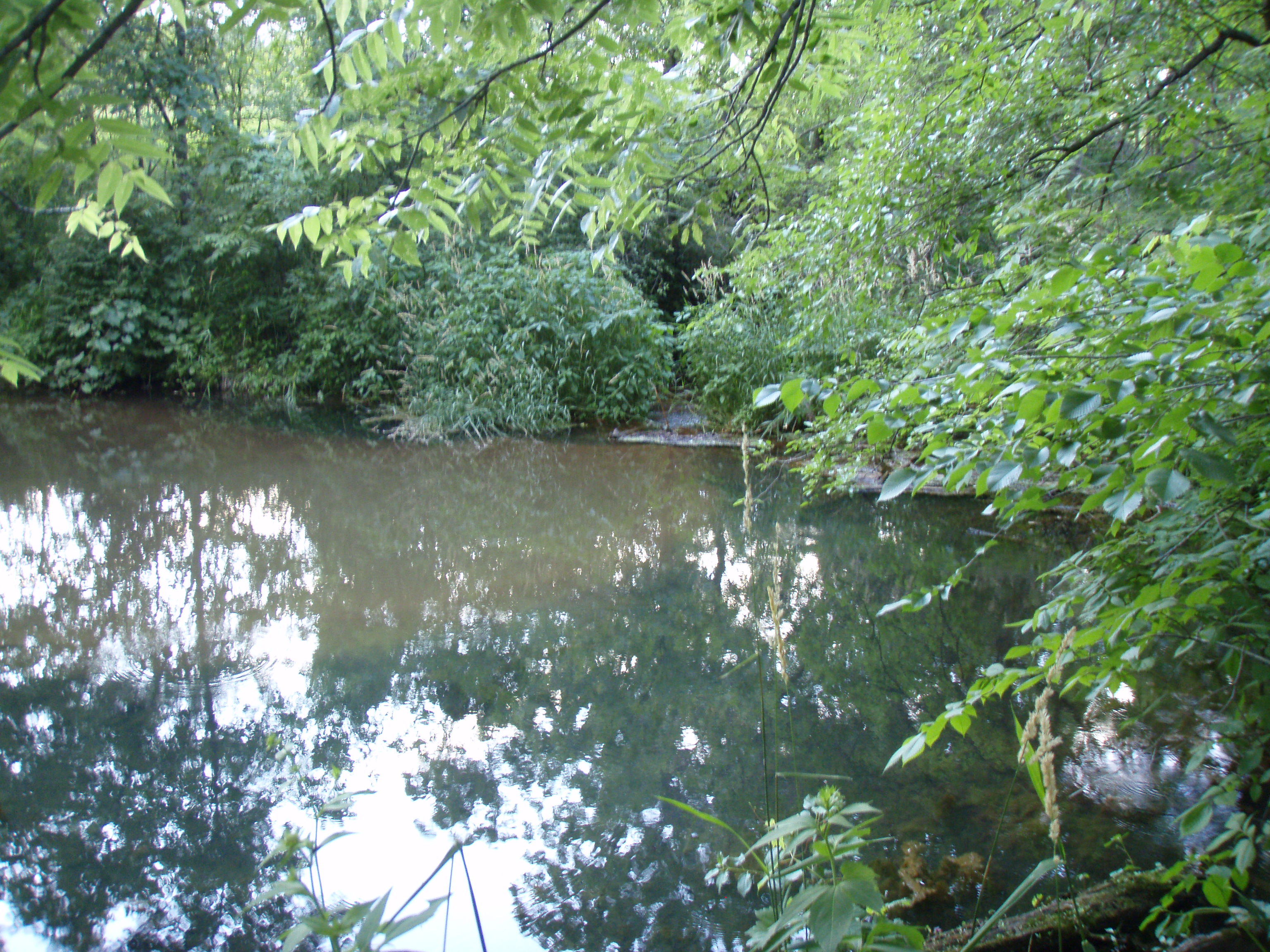
January 16, 2003 Address Restricted Savage a sacred site revered by the Dakotah community, featuring a pool of water over an artesian well that remains liquid year-round. A thick layer of fine sand sits on the bottom of the pool, which traps the spring water and releases it in bursts, creating an illusion of boiling water 14 Mudbaden Sulphur Springs Company 
April 17, 1980 17706 Valley View Drive
44°41′37″N 93°36′56″W / 44.69361°N 93.61556°WJordan A two-story brick Classical Revival spa building built near sulfur-rich springs which were advertised to be a cure for ailments including rheumatism, hypertension, liver disease, and gout. 15 New Market Hotel and Store 
April 17, 1980 Main Street
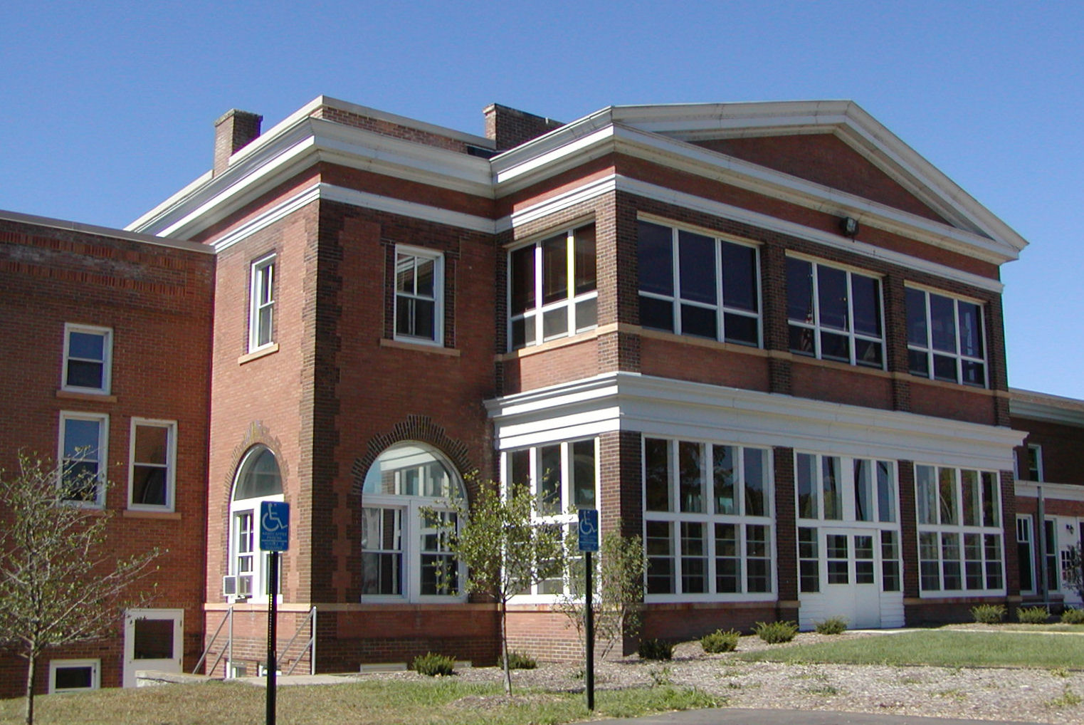
44°34′24″N 93°21′8″W / 44.57333°N 93.35222°WNew Market red brick hotel and storefront 16 Shakopee Historic District 
April 11, 1972 Minnesota Highway 101 Shakopee multiple features including burial mounds, a gristmill, an inn, and a ferry landing 17 Saint Mary's Church of the Purification 
April 17, 1980 15850 Marystown Road,
44°43′12″N 93°32′28″W / 44.72°N 93.54111°WShakopee Catholic Church 18 Strunk-Nyssen House 
April 17, 1980 Strunks Road
44°47′19″N 93°33′26″W / 44.78861°N 93.55722°WShakopee a 1856 home, hotel, brewery, and boarding house See also
- List of National Historic Landmarks in Minnesota
- National Register of Historic Places listings in Minnesota
References
- ^ The latitude and longitude information provided in this table was derived originally from the National Register Information System, which has been found to be fairly accurate for about 99% of listings. For about 1% of NRIS original coordinates, experience has shown that one or both coordinates are typos or otherwise extremely far off; some corrections may have been made. A more subtle problem causes many locations to be off by up to 150 yards, depending on location in the country: most NRIS coordinates were derived from tracing out latitude and longitudes off of USGS topographical quadrant maps created under the North American Datum of 1927, which differs from the current, highly accurate WGS84 GPS system used by Google maps. Chicago is about right, but NRIS longitudes in Washington are higher by about 4.5 seconds, and are lower by about 2.0 seconds in Maine. Latitudes differ by about 1.0 second in Florida. Some locations in this table may have been corrected to current GPS standards.
- ^ "National Register of Historic Places: Weekly List Actions". National Park Service, United States Department of the Interior. Retrieved on November 10, 2011.
- ^ Numbers represent an ordering by significant words. Various colorings, defined here, differentiate National Historic Landmark sites and National Register of Historic Places Districts from other NRHP buildings, structures, sites or objects.
- ^ a b "National Register Information System". National Register of Historic Places. National Park Service. 2008-04-24. http://nrhp.focus.nps.gov/natreg/docs/All_Data.html.
Further reading
- Nord, Mary Ann (2003). The National Register of Historic Places in Minnesota. Minnesota Historical Society. ISBN 0-87351-448-3.
U.S. National Register of Historic Places Topics Lists by states Alabama • Alaska • Arizona • Arkansas • California • Colorado • Connecticut • Delaware • Florida • Georgia • Hawaii • Idaho • Illinois • Indiana • Iowa • Kansas • Kentucky • Louisiana • Maine • Maryland • Massachusetts • Michigan • Minnesota • Mississippi • Missouri • Montana • Nebraska • Nevada • New Hampshire • New Jersey • New Mexico • New York • North Carolina • North Dakota • Ohio • Oklahoma • Oregon • Pennsylvania • Rhode Island • South Carolina • South Dakota • Tennessee • Texas • Utah • Vermont • Virginia • Washington • West Virginia • Wisconsin • WyomingLists by territories Lists by associated states Other Municipalities and communities of Scott County, Minnesota Cities Belle Plaine | Elko New Market | Jordan | New Prague‡ | Prior Lake | Savage | Shakopee
Townships Belle Plaine | Blakeley | Cedar Lake | Credit River | Helena | Jackson | Louisville | New Market | Sand Creek | Spring Lake | St. Lawrence
Unincorporated
communitiesSpring Lake | Union Hill
Indian
reservationFootnotes ‡This populated place also has portions in an adjacent county or counties
Categories:- National Register of Historic Places in Minnesota by county
- Scott County, Minnesota
- Buildings and structures in Scott County, Minnesota
-


Wikimedia Foundation. 2010.