- National Register of Historic Places listings in Rice County, Minnesota
-
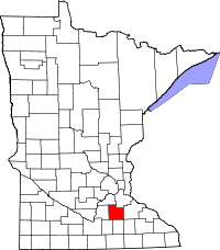 Location of Rice County in Minnesota
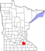
This is a list of the National Register of Historic Places listings in Rice County, Minnesota.
This is intended to be a complete list of the properties and districts on the National Register of Historic Places in Rice County, Minnesota, United States. Latitude and longitude coordinates are provided for many National Register properties and districts; these locations may be seen together in a Google map.[1]
There are 72 properties and districts listed on the National Register in the county, including 2 National Historic Landmarks.
-
- This National Park Service list is complete through NPS recent listings posted November 10, 2011.[2]
Contents
Current listings
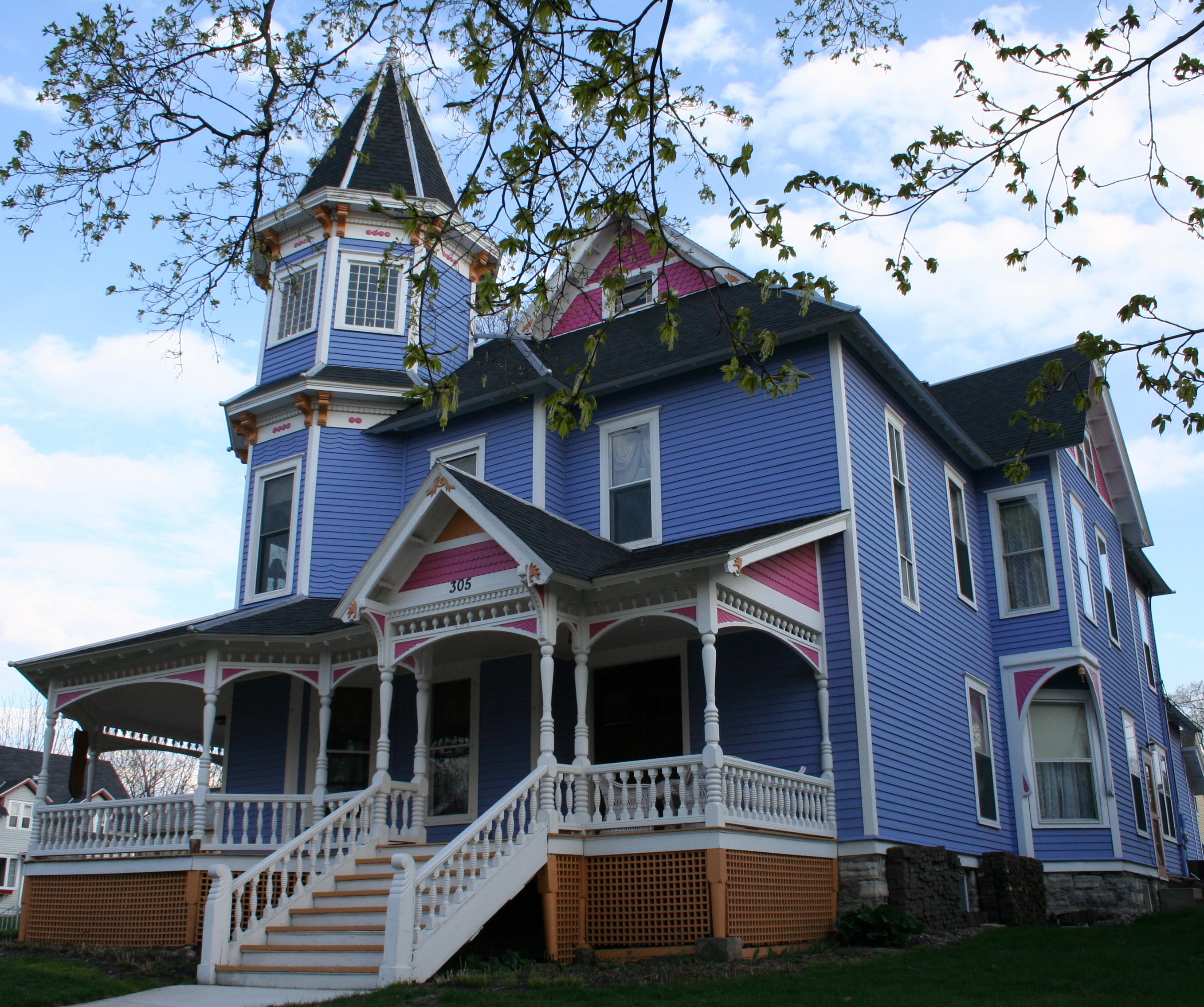
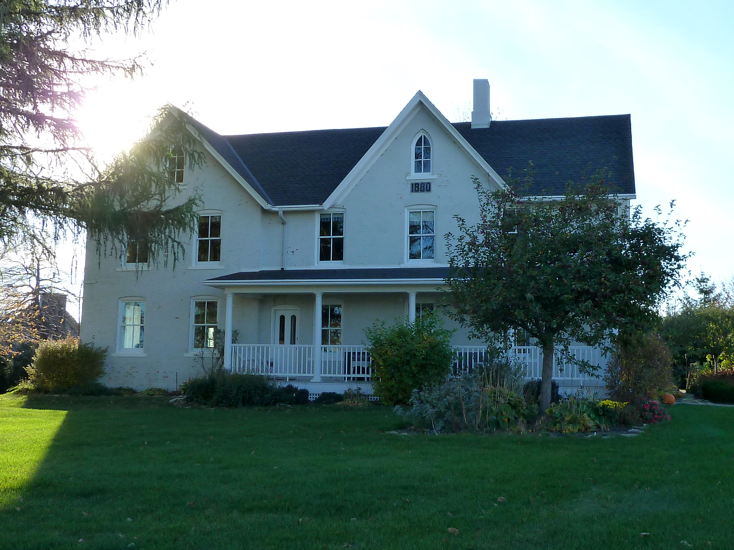
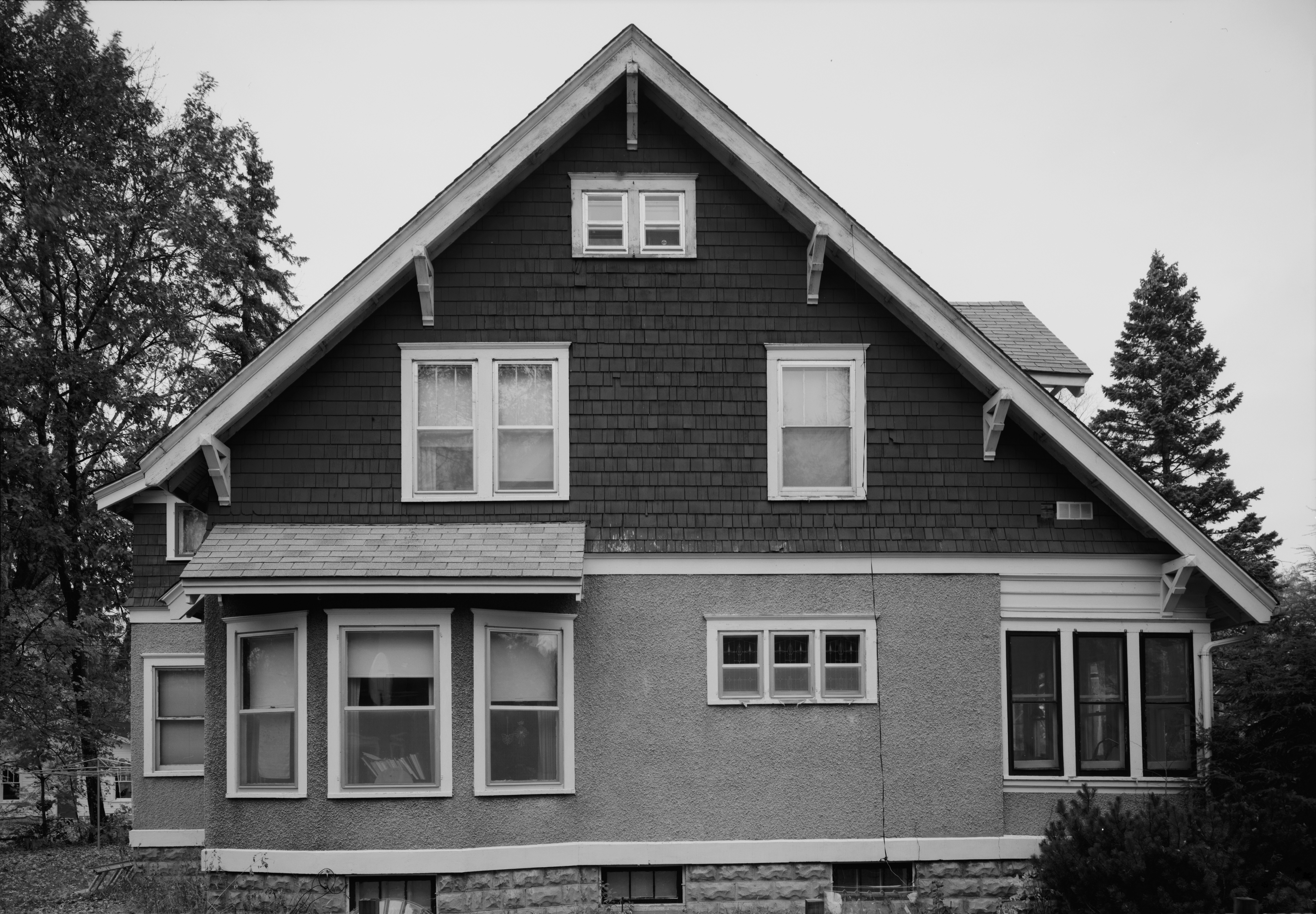
[3] Landmark name [4] Image Date listed Location City or town Summary 1 Administration Building-Girls' Dormitory, Minnesota School for the Deaf 
November 6, 1986 Minnesota Highway 299
44°18′23″N 93°15′34″W / 44.306389°N 93.259444°WFaribault Public residential school serving deaf children in Minnesota. 2 All Saints Church-Episcopal April 6, 1982 Washington and 5th Streets
44°27′19″N 93°09′29″W / 44.455278°N 93.158056°WNorthfield 3 W. Roby Allen Oral Home School 
July 12, 1990 525 5th Street NE
44°17′12″N 93°15′33″W / 44.286667°N 93.259167°WFaribault 4 Archibald Mill 
October 8, 1976 Railway Street
44°25′48″N 93°12′21″W / 44.43°N 93.205833°WDundas Derelict flour mill built by George and John Sidney Archibald on the east bank of the Cannon River in late 1857 5 Edward T. Archibald House 
June 17, 1976 Hamilton and 2nd Streets
44°25′34″N 93°12′15″W / 44.426111°N 93.204167°WDundas 6 Ault Store 
April 6, 1982 2nd Street
44°25′44″N 93°12′08″W / 44.428889°N 93.202222°WDundas Property submission to the NRHP 7 Laura Baker School 
March 29, 1978 211 Oak Street
44°27′26″N 93°08′49″W / 44.457222°N 93.146944°WNorthfield 8 Batchelder's Block 
July 12, 1990 120 Central Avenue North
44°17′30″N 93°16′07″W / 44.291667°N 93.268611°WFaribault 9 Frank A. and Elizabeth Berry House 
August 9, 1990 319 3rd Street NW
44°17′36″N 93°16′25″W / 44.293333°N 93.273611°WFaribault 10 Blind Department Building and Dow Hall, State School for the Blind 
July 25, 1990 400 6th Avenue SE
44°17′12″N 93°15′36″W / 44.286667°N 93.26°WFaribault Significant components of a system of state-administered special education for the physically and mentally handicapped segments of the population 11 Bonde Farmhouse 
April 6, 1982 County Road 27 and Minnesota Highway 246
44°21′09″N 93°04′46″W / 44.3525°N 93.079444°WWheeling Township 12 Bridge No. 8096 
June 26, 1998 Minnesota Highway 19 over Spring Creek
44°27′51″N 93°09′13″W / 44.464167°N 93.153611°WNorthfield 13 Cassius Buck House 
April 6, 1982 124 1st Avenue SW
44°17′19″N 93°16′12″W / 44.288611°N 93.27°WFaribault 14 Thomas Scott Buckham Memorial Library 
April 6, 1982 Central Avenue and Division Street
44°17′24″N 93°16′04″W / 44.29°N 93.267778°WFaribault Given to the city by Anna Buckham in memory of her husband 15 Louis Carufel and E. LaRose 
August 3, 1990 425 3rd Street SW
44°17′13″N 93°16′31″W / 44.286944°N 93.275278°WFaribault 16 Cathedral of Our Merciful Saviour 
August 10, 1979 515 2nd Avenue NW
44°17′49″N 93°16′16″W / 44.296944°N 93.271111°WFaribault Built 1862 - 1869, it is the oldest cathedral in Minnesota and the first church in the Episcopal Church in the United States of America designed as a cathedral 17 Chapel of the Good Sheperd 
April 4, 1975 At Shattuck School
44°18′05″N 93°15′39″W / 44.301389°N 93.260833°WFaribault 18 Church of the Annunciation-Catholic April 6, 1982 County Highway 46
44°30′56″N 93°17′12″W / 44.515556°N 93.286667°WNorthfield 19 Church of the Holy Cross-Episcopal 
April 6, 1982 2nd Street
44°25′33″N 93°12′13″W / 44.425833°N 93.203611°WDundas 20 Church of the Most Holy Trinity (Catholic) November 13, 1997 4938 North Washington Street
44°30′57″N 93°27′35″W / 44.515833°N 93.459722°WWheatland Township 21 Gordon Cole and Kate D. Turner House 
August 3, 1990 111 2nd Street NW
44°17′32″N 93°16′13″W / 44.292222°N 93.270278°WFaribault 22 Congregational Church of Faribault 
May 12, 1977 227 3rd Street NW
44°17′36″N 93°16′21″W / 44.293333°N 93.2725°WFaribault 23 John N. and Elizabeth Taylor Clinton Cottrell House 
August 3, 1990 127 1st Street NW
44°17′28″N 93°16′15″W / 44.291111°N 93.270833°WFaribault 24 Den Svenska Evangeliska Lutherska Christdala Forsamlingen May 18, 1995 4695 Millersburg Rd.
44°25′59″N 93°21′26″W / 44.433056°N 93.357222°WForest Township Property submission to the NRHP 25 Reverend James Dobbin House 
July 23, 1990 1800 14th Street NE
44°18′41″N 93°15′50″W / 44.311389°N 93.263889°WFaribault 26 Edwin S. Drake Farmhouse 
April 6, 1982 County Highway 22
44°25′31″N 93°09′43″W / 44.425278°N 93.161944°WBridgewater Township 27 Episcopal Rectory 
August 9, 1990 112 6th Street NW
44°17′50″N 93°16′13″W / 44.297222°N 93.270278°WFaribault 28 Faribault City Hall 
April 6, 1982 208 1st Avenue NW
44°17′34″N 93°16′13″W / 44.292778°N 93.270278°WFaribault 29 Faribault Historic Commercial District 
April 6, 1982 Central Avenue and 2nd and 3rd Streets
44°17′35″N 93°16′05″W / 44.293056°N 93.268056°WFaribault 30 Faribault Viaduct 
November 6, 1989 Division Street over the Straight River
44°17′27″N 93°16′00″W / 44.290833°N 93.266667°WFaribault 31 Faribault Water Works 
April 6, 1982 7th Street NW
44°17′54″N 93°16′55″W / 44.298333°N 93.281944°WFaribault 32 Alexander Faribault House 
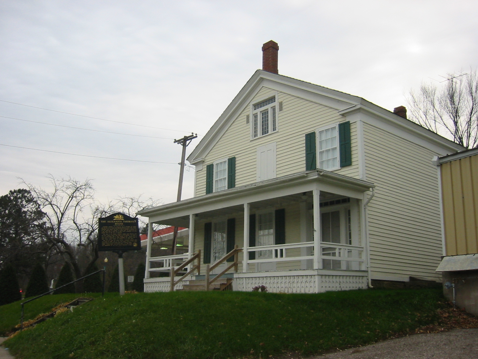
September 22, 1970 12 1st Avenue NE
44°17′27″N 93°16′00″W / 44.290833°N 93.266667°WFaribault The first wood-frame house built in Rice County 33 Farmer Seed and Nursery Company April 6, 1982 818 4th Street NW
44°17′41″N 93°16′53″W / 44.294722°N 93.281389°WFaribault 34 Goodsell Observatory 
May 12, 1975 Off 1st Street East
44°27′43″N 93°09′09″W / 44.461944°N 93.1525°WNorthfield Upon construction in 1887, it was the largest observatory in the state of Minnesota 35 M. P. Holman House 
August 3, 1990 107 3rd Avenue NW
44°17′29″N 93°16′21″W / 44.291389°N 93.2725°WFaribault 36 Hospital, State School for the Feeble Minded April 6, 1982 Off 6th Avenue SE
44°16′56″N 93°15′28″W / 44.282222°N 93.257778°WFaribault 37 John Hutchinson House 
April 6, 1982 305 2nd Street NW
44°17′31″N 93°20′09″W / 44.291944°N 93.335833°WFaribault 38 Johnston Hall-Seabury Divinity School 
March 21, 1975 1st and State Streets SE
44°17′20″N 93°15′25″W / 44.288889°N 93.256944°WFaribault 39 Vincent and Elizabeth Lieb House 
July 23, 1990 201 4th Avenue SW
44°17′17″N 93°16′27″W / 44.288056°N 93.274167°WFaribault 40 Lonsdale Public School August 30, 1979 3rd Avenue SW
44°28′43″N 93°25′49″W / 44.478611°N 93.430278°WLonsdale 41 Drew H. Lord House April 6, 1982 201 East 3rd
44°27′27″N 93°09′28″W / 44.4575°N 93.157778°WNorthfield 42 Wiliam Martin House 
April 6, 1982 Bridge and 1st Streets
44°25′41″N 93°12′14″W / 44.428056°N 93.203889°WDundas 43 Cormack McCall House 
August 3, 1990 817 Ravine Street NE
44°17′40″N 93°15′18″W / 44.294444°N 93.255°WFaribault 44 Thomas McCall House 
August 3, 1990 102 4th Avenue SW
44°17′21″N 93°16′28″W / 44.289167°N 93.274444°WFaribault 45 Timothy J. McCarthy Building 
August 3, 1990 24 3rd Street NW
44°17′38″N 93°16′09″W / 44.293889°N 93.269167°WFaribault 46 Thomas Bridget Shanahan McMahon House 
July 19, 1990 603 Division Street East
44°17′25″N 93°15′30″W / 44.290278°N 93.258333°WFaribault 47 Nerstrand City Hall 
April 6, 1982 Main St.
44°20′30″N 93°04′05″W / 44.341667°N 93.068056°WNerstrand 48 Northfield Commercial Historic District June 11, 1979 Roughly bounded by Water, Division, 3rd, and 5th Sts.
44°27′24″N 93°09′37″W / 44.456667°N 93.160278°WNorthfield 49 Noyes Hall, State School for the Deaf 
May 12, 1975 Off 6th Avenue NE
44°17′49″N 93°15′40″W / 44.296944°N 93.261111°WFaribault Public residential school serving deaf children in Minnesota 50 Jonathon L. and Elizabeth H. Wadsworth Noyes House 
August 9, 1990 105 1st Ave., NW.
44°17′30″N 93°16′10″W / 44.291667°N 93.269444°WFaribault 51 John C. Nutting House October 15, 1970 217 Union St.
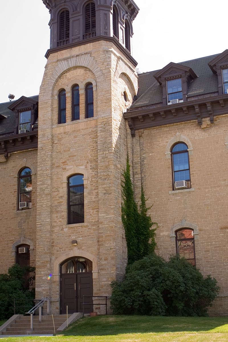
44°27′28″N 93°09′22″W / 44.457778°N 93.156111°WNorthfield 52 Old Main, Saint Olaf College 
June 3, 1976 St. Olaf College campus
44°27′35″N 93°10′48″W / 44.459722°N 93.18°WNorthfield designed by Long and Haglin 53 Osmund Osmundson House 
April 6, 1982 East Nerstrand and North Main Streets
44°20′38″N 93°03′53″W / 44.343889°N 93.064722°WNerstrand 54 John Gottlieb Pfeiffer House 
August 3, 1990 931 3rd Avenue NW
44°18′05″N 93°16′22″W / 44.301389°N 93.272778°WFaribault 55 Phelps Library, Shattuck School 
April 4, 1975 Off Shumway Avenue
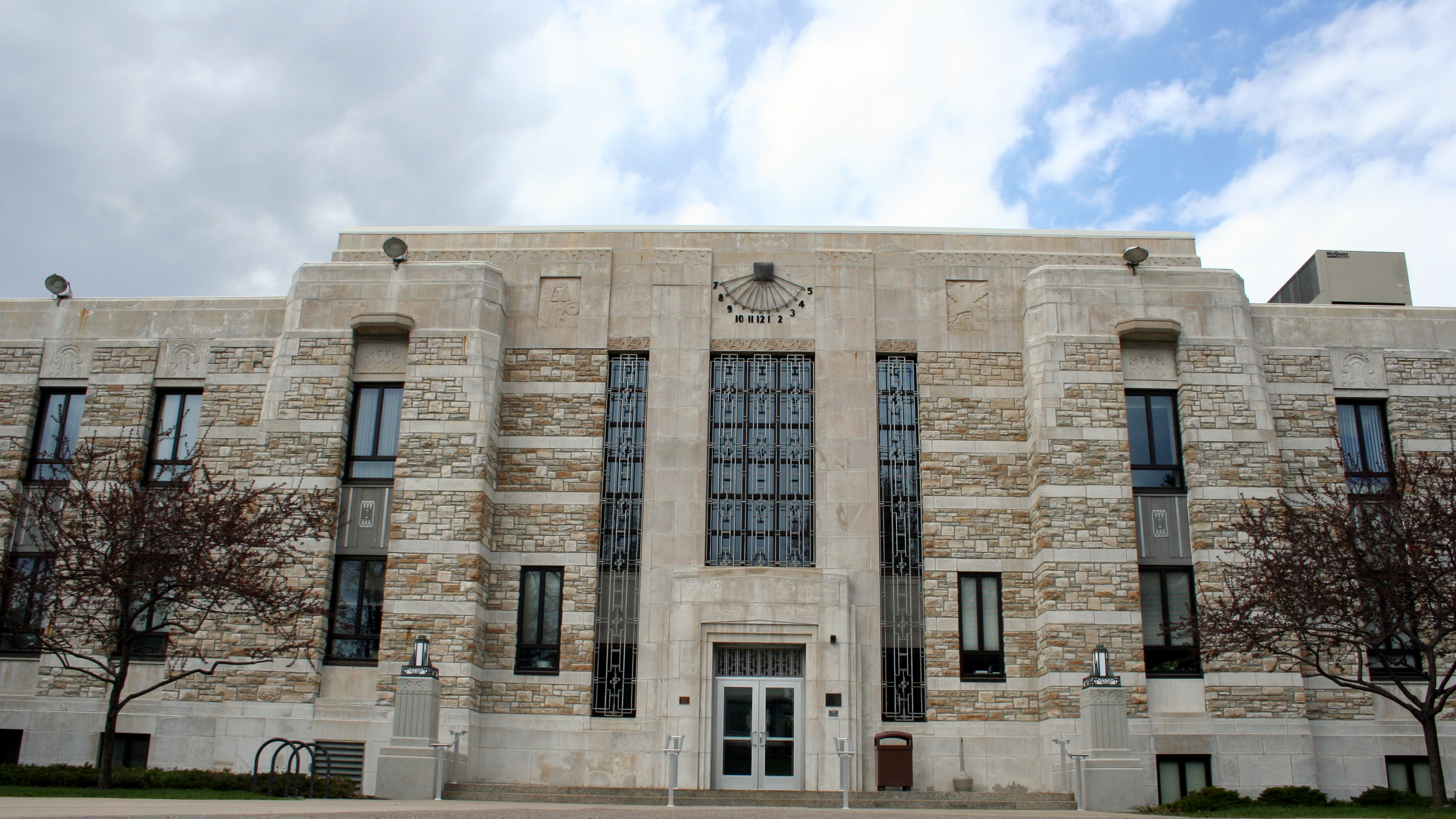
44°18′10″N 93°15′44″W / 44.302778°N 93.262222°WFaribault 56 Rice County Courthouse and Jail 
April 6, 1982 218 3rd St., NW.
44°17′38″N 93°16′17″W / 44.293889°N 93.271389°WFaribault Art Deco building constructed of natural-face Faribault stone horizontally banded at intervals with sawed-faced stone 57 Rock Island Depot 
April 6, 1982 3rd Street and 1st Avenue NE
44°17′39″N 93°15′54″W / 44.294167°N 93.265°WFaribault 58 O. E. Rolvaag House 
August 4, 1969 311 Manitou St.
44°27′48″N 93°10′20″W / 44.463333°N 93.172222°WNorthfield Home of Ole Edvart Rølvaag 59 Saint Mary's Hall 
April 6, 1982 4th Street NE and 4th Avenue NE
44°17′43″N 93°15′47″W / 44.295278°N 93.263056°WFaribault 60 Sciver Block Building 
May 5, 1978 Bridge Square and Division Street
44°27′22″N 93°09′37″W / 44.456111°N 93.160278°WNorthfield 61 Scoville Memorial Library April 6, 1982 1st Street East and College Street
44°27′36″N 93°09′20″W / 44.46°N 93.155556°WNorthfield 62 Shattuck Historic District 
April 6, 1982 Shumway Avenue
44°18′04″N 93°15′37″W / 44.301111°N 93.260278°WFaribault 63 Shumway Hall and Morgan Refectory-Shattuck School 
April 4, 1975 Off Shumway Avenue
44°18′09″N 93°15′36″W / 44.3025°N 93.26°WFaribault 64 Skinner Memorial Chapel 
April 6, 1982 1st, Winona, and College Streets
44°27′36″N 93°09′15″W / 44.46°N 93.154167°WNorthfield 65 Steensland Library-Saint Olaf College 
April 6, 1982 Off Saint Olaf Avenue
44°27′35″N 93°10′50″W / 44.459722°N 93.180556°WNorthfield designed by Omeyer & Thori 66 Theopold Mercantile Co. Wholesale Grocery Building April 6, 1982 1st Avenue and 3rd Street NE
44°17′38″N 93°15′58″W / 44.293889°N 93.266111°WFaribault 67 Trondhjem Norwegian Lutheran Church September 7, 2001 8501 Garfield Avenue
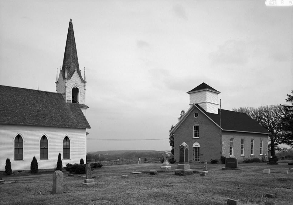
44°27′51″N 93°24′08″W / 44.464167°N 93.402222°WWebster 68 Valley Grove 
April 6, 1982 County Road 29 off Minnesota Highway 246
44°21′42″N 93°06′02″W / 44.361667°N 93.100556°WNerstrand Two religious buildings built on a grassy knoll by Norwegian immigrants 69 Thorstein Veblen Farmstead 
June 30, 1975 Northeast of Nerstrand off Minnesota Highway 246
44°20′54″N 93°02′47″W / 44.348333°N 93.046389°WNerstrand adolescent home of Thorstein B. Veblen 70 Adam Weyer Wagon Shop 
July 12, 1990 32 2nd Street NE
44°17′33″N 93°16′01″W / 44.2925°N 93.266944°WFaribault 71 Willis Hall 
June 13, 1975 College Street
44°27′38″N 93°09′21″W / 44.460556°N 93.155833°WNorthfield 72 Hudson Wilson House 
April 6, 1982 104 1st Avenue NW
44°17′29″N 93°16′12″W / 44.291389°N 93.27°WFaribault See also
- List of National Historic Landmarks in Minnesota
- National Register of Historic Places listings in Minnesota
References
- ^ The latitude and longitude information provided in this table was derived originally from the National Register Information System, which has been found to be fairly accurate for about 99% of listings. For about 1% of NRIS original coordinates, experience has shown that one or both coordinates are typos or otherwise extremely far off; some corrections may have been made. A more subtle problem causes many locations to be off by up to 150 yards, depending on location in the country: most NRIS coordinates were derived from tracing out latitude and longitudes off of USGS topographical quadrant maps created under the North American Datum of 1927, which differs from the current, highly accurate WGS84 GPS system used by Google maps. Chicago is about right, but NRIS longitudes in Washington are higher by about 4.5 seconds, and are lower by about 2.0 seconds in Maine. Latitudes differ by about 1.0 second in Florida. Some locations in this table may have been corrected to current GPS standards.
- ^ "National Register of Historic Places: Weekly List Actions". National Park Service, United States Department of the Interior. Retrieved on November 10, 2011.
- ^ Numbers represent an ordering by significant words. Various colorings, defined here, differentiate National Historic Landmark sites and National Register of Historic Places Districts from other NRHP buildings, structures, sites or objects.
- ^ "National Register Information System". National Register of Historic Places. National Park Service. . http://nrhp.focus.nps.gov/natreg/docs/All_Data.html.
Further reading
Nord, Mary Ann (2003). The National Register of Historic Places in Minnesota. Minnesota Historical Society. ISBN 0-87351-448-3.
External links
U.S. National Register of Historic Places Topics Lists by states Alabama • Alaska • Arizona • Arkansas • California • Colorado • Connecticut • Delaware • Florida • Georgia • Hawaii • Idaho • Illinois • Indiana • Iowa • Kansas • Kentucky • Louisiana • Maine • Maryland • Massachusetts • Michigan • Minnesota • Mississippi • Missouri • Montana • Nebraska • Nevada • New Hampshire • New Jersey • New Mexico • New York • North Carolina • North Dakota • Ohio • Oklahoma • Oregon • Pennsylvania • Rhode Island • South Carolina • South Dakota • Tennessee • Texas • Utah • Vermont • Virginia • Washington • West Virginia • Wisconsin • WyomingLists by territories Lists by associated states Other Municipalities and communities of Rice County, Minnesota Cities Dennison‡ | Dundas | Faribault | Lonsdale | Morristown | Nerstrand | Northfield‡
Townships Bridgewater | Cannon City | Erin | Forest | Morristown | Northfield | Richland | Shieldsville | Walcott | Warsaw | Webster | Wells | Wheatland | Wheeling
Unincorporated
communitiesCannon City | Little Chicago | Moland‡ | Ruskin | Warsaw
Footnotes ‡This populated place also has portions in an adjacent county or counties
Categories:- National Register of Historic Places in Minnesota by county
- Rice County, Minnesota
- Buildings and structures in Rice County, Minnesota
-


Wikimedia Foundation. 2010.