- Lonsdale, Minnesota
Infobox Settlement
official_name = City of Lonsdale, Minnesota
settlement_type =City
nickname =
motto = Preserving Our Heritage To Better Our Future
imagesize = 250px
image_caption =
image_
imagesize = 250px
image_caption =
image_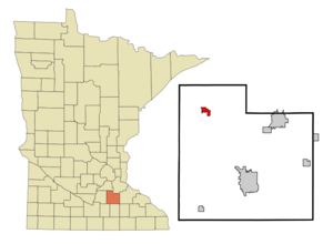
mapsize = 250px
map_caption = Location in the state of Minnesota, USA
mapsize1 =
map_caption1 =
subdivision_type = Country
subdivision_name =United States
subdivision_type1 = State
subdivision_name1 =Minnesota
subdivision_type2 = County
subdivision_name2 = Rice
government_type =
leader_title =Mayor
leader_name = Tim Rud
established_title = Incorporated
established_date = 1903
area_magnitude =
area_total_sq_mi = 1.3
area_total_km2 = 3.4
area_land_sq_mi = 1.3
area_land_km2 = 3.4
area_water_sq_mi = 0.0
area_water_km2 = 0.0
area_urban_sq_mi =
area_urban_km2 =
area_metro_sq_mi =
area_metro_km2 =
population_as_of = 2000
population_note =
population_total = 1491
population_metro =
population_urban =
population_density_km2 = 436.1
population_density_sq_mi = 1127.3
timezone = CST
utc_offset = -4
timezone_DST = CST
utc_offset_DST = -5
latd = 44 |latm = 28 |lats = 48 |latNS = N
longd = 93 |longm = 25 |longs = 50 |longEW = W
elevation_m = 333
elevation_ft = 1093
website = [http://www.lonsdale.govoffice.com www.lonsdale.govoffice.com]
postal_code_type =ZIP code
postal_code = 55046
area_code = 507
blank_name = FIPS code
blank_info = 27-38150GR|2
blank1_name = GNIS feature ID
blank1_info = 0647154GR|3
footnotes = Lonsdale is a city in Rice County,Minnesota ,United States . The population was 1,491 at the 2000 census. Lonsdale has a very controversial 10,000 gallon base charge water bill, in which they bill owners of property for using 10,000 gallons no matter how much water they actually use. This policy promotes the wasting of ground water supply, as citizens don’t feel the need to save water or fix leaking faucets.Geography
According to the
United States Census Bureau , the city has a total area of 1.3square mile s (3.4km² ), of which, 1.3 square miles (3.4 km²) of it is land and 0.75% is water.Minnesota State Highway 19 serves as a main route in the city.Lonsdale is six miles from
Interstate 35 .Demographics
As of the
census GR|2 of 2000, there were 1,491 people, 560 households, and 394 families residing in the city. Thepopulation density was 1,127.3 people per square mile (436.1/km²). There were 577 housing units at an average density of 436.2/sq mi (168.8/km²). The racial makeup of the city was 98.66% White, 0.20% African American, 0.40% Native American, 0.13% Asian, and 0.60% from two or more races. Hispanic or Latino of any race were 0.34% of the population.There were 560 households out of which 39.3% had children under the age of 18 living with them, 58.9% were married couples living together, 6.8% had a female householder with no husband present, and 29.5% were non-families. 23.9% of all households were made up of individuals and 9.6% had someone living alone who was 65 years of age or older. The average household size was 2.62 and the average family size was 3.12.
In the city the population was spread out with 28.4% under the age of 18, 9.5% from 18 to 24, 33.3% from 25 to 44, 16.6% from 45 to 64, and 12.3% who were 65 years of age or older. The median age was 32 years. For every 100 females there were 99.6 males. For every 100 females age 18 and over, there were 95.6 males.
The median income for a household in the city was $50,054, and the median income for a family was $58,676. Males had a median income of $37,800 versus $25,607 for females. The
per capita income for the city was $20,368. About 4.6% of families and 6.1% of the population were below thepoverty line , including 4.1% of those under age 18 and 18.8% of those age 65 or over.Education
Residents of the Lonsdale area are served by two
public school districts and onecatholic school they include:Montgomery - Lonsdale Public Schools - ISD # 394
*
Montgomery - Lonsdale High School
*Montgomery - Lonsdale Middle School
*Montgomery-Londale Elementary School East in LonsdaleNew Prague Public Schools - ISD # 721
*
New Prague High School
*New Prague Middle School
*Eagle View Elementary SchoolReferences
External links
* [http://www.lonsdale.govoffice.com City website]
Wikimedia Foundation. 2010.