- Nicollet County, Minnesota
-
Nicollet County, Minnesota 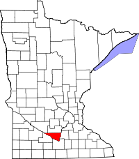
Location in the state of Minnesota
Minnesota's location in the U.S.Founded March 5, 1853 [1] Named for Joseph Nicolas Nicollet, a geographer-explorer Seat St. Peter Largest city North Mankato Area
- Total
- Land
- Water
466.95 sq mi (1,209 km²)
452.29 sq mi (1,171 km²)
14.65 sq mi (38 km²), 3.14%Population
- (2010)
- Density
32,727
66/sq mi (25/km²)Time zone Central: UTC-6/-5 Website www.co.nicollet.mn.us Nicollet County is a county located in the U.S. state of Minnesota. As of 2010, the population was 32,727.[1] Its county seat is St. Peter[2].
Nicollet County is part of the Mankato–North Mankato Metropolitan Statistical Area.
Contents
Geography
According to the 2000 census, the county has a total area of 466.95 square miles (1,209.4 km2), of which 452.29 square miles (1,171.4 km2) (or 96.86%) is land and 14.65 square miles (37.9 km2) (or 3.14%) is water.[3]
Lakes
- Annexstad Lake: in Lake Prairie Township
- Erickson Lake: in Traverse Township
- Middle Lake: the southwestern Middle Lake is in Granby Township; the northeastern Middle Lake is in Granby Township, Traverse Township, and Oshawa Township
- Oak Leaf Lake: in Oshawa Township
- Overson Lake: in Traverse Township
- Rice Lake: in New Sweden Township
- Sand Lake: in Lake Prairie Township
- Swan Lake: about a quarter of the northwest part of the lake is in Brighton Township; about three eighths of the southwest part is in Courtland Township; another three eighths is in Granby Township; a very small part of the southeast shore is in Nicollet Township
Major highways
 Minnesota State Highway 60
 Minnesota State Highway 99
 Minnesota State Highway 111
 Minnesota State Highway 295
 Minnesota State Highway 333
Adjacent counties
- Sibley County (north)
- Le Sueur County (east)
- Blue Earth County (southeast)
- Brown County (southwest)
- Renville County (northwest)
Demographics
Historical populations Census Pop. %± 1860 3,778 — 1870 8,362 121.3% 1880 12,333 47.5% 1890 13,382 8.5% 1900 14,774 10.4% 1910 14,125 −4.4% 1920 15,036 6.4% 1930 16,550 10.1% 1940 18,282 10.5% 1950 20,929 14.5% 1960 23,196 10.8% 1970 24,518 5.7% 1980 26,929 9.8% 1990 28,076 4.3% 2000 29,771 6.0% 2010 32,727 9.9% U.S. Decennial Census As of the census[4] of 2000, there were 29,771 people, 10,642 households, and 7,311 families residing in the county. The population density was 66 people per square mile (25/km²). There were 11,240 housing units at an average density of 25 per square mile (10/km²). The racial makeup of the county was 96.37% White, 0.80% Black or African American, 0.26% Native American, 1.14% Asian, 0.02% Pacific Islander, 0.65% from other races, and 0.75% from two or more races. 1.80% of the population were Hispanic or Latino of any race. 49.2% were of German, 13.3% Norwegian, 6.8% Swedish and 5.4% Irish ancestry according to Census 2000.
 Age pyramid of county residents based on 2000 U.S. census data.
There were 10,642 households out of which 35.30% had children under the age of 18 living with them, 57.50% were married couples living together, 7.90% had a female householder with no husband present, and 31.30% were non-families. 24.00% of all households were made up of individuals and 8.80% had someone living alone who was 65 years of age or older. The average household size was 2.56 and the average family size was 3.05.
In the county the population was spread out with 24.70% under the age of 18, 16.40% from 18 to 24, 26.90% from 25 to 44, 21.20% from 45 to 64, and 10.80% who were 65 years of age or older. The median age was 33 years. For every 100 females there were 99.30 males. For every 100 females age 18 and over, there were 96.90 males.
The median income for a household in the county was $46,170, and the median income for a family was $55,694. Males had a median income of $36,236 versus $25,344 for females. The per capita income for the county was $20,517. About 4.30% of families and 7.50% of the population were below the poverty line, including 6.70% of those under age 18 and 8.00% of those age 65 or over.
Cities and towns
Cities Townships Unincorporated - Klossner
- Norseland
- St. George
- West Newton
- Bernadotte
† Mankato is mainly in Blue Earth County but extends into Nicollet County.
‡ North Mankato is mainly in Nicollet County but extends into Blue Earth County.See also
References
- ^ "2010 Census Redistricting Data (Public Law 94-171) Summary File". American FactFinder. United States Census Bureau. http://factfinder2.census.gov/faces/tableservices/jsf/pages/productview.xhtml?pid=DEC_10_PL_GCTPL2.ST05&prodType=table. Retrieved 25 April 2011.
- ^ "Find a County". National Association of Counties. http://www.naco.org/Counties/Pages/FindACounty.aspx. Retrieved 2011-06-07.
- ^ "Census 2000 U.S. Gazetteer Files: Counties". United States Census. http://www.census.gov/tiger/tms/gazetteer/county2k.txt. Retrieved 2011-02-13.
- ^ "American FactFinder". United States Census Bureau. http://factfinder.census.gov. Retrieved 2008-01-31.
External links

Renville County Sibley County 
Le Sueur County  Nicollet County, Minnesota

Brown County Blue Earth County Municipalities and communities of Nicollet County, Minnesota County seat: St. Peter Cities 
Townships Belgrade | Bernadotte | Brighton | Courtland | Granby | Lafayette | Lake Prairie | New Sweden | Nicollet | Oshawa | Ridgely | Traverse | West Newton
Unincorporated
communitiesFootnotes ‡This populated place also has portions in an adjacent county or counties
Categories:- Minnesota counties
- Nicollet County, Minnesota
- Mankato – North Mankato metropolitan area


Wikimedia Foundation. 2010.