- Freeborn County, Minnesota
-
Freeborn County, Minnesota 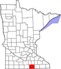
Location in the state of Minnesota
Minnesota's location in the U.S.Founded February 20, 1855 [1] Named for William Freeborn, a territorial settler Seat Albert Lea Largest city Albert Lea Area
- Total
- Land
- Water
722.63 sq mi (1,872 km²)
707.64 sq mi (1,833 km²)
14.99 sq mi (39 km²), 2.07%Population
- (2010)
- Density
31,255
46/sq mi (18/km²)Time zone Central: UTC-6/-5 Website www.co.freeborn.mn.us Freeborn County is a county located in the U.S. state of Minnesota. As of 2010, the population was 31,255.[1] Its county seat is Albert Lea[2].
Contents
Geography
According to the 2000 census, the county has a total area of 722.63 square miles (1,871.6 km2), of which 707.64 square miles (1,832.8 km2) (or 97.93%) is land and 14.99 square miles (38.8 km2) (or 2.07%) is water.[3] The Le Sueur River, a tributary of the Minnesota River, starts in the northern part of the county.
Lakes
Freeborn County has 16 lakes, mostly in the western half of the county.
- Albert Lea Lake: Albert Lea Township and Hayward Township
- Bear Lake: Nunda Township
- Church Lake: Pickerel Lake Township
- Fountain Lake: Abert Lea Township and Bancroft Township
- Freeborn Lake: Carlston Township and Freeborn Township
- Geneva Lake: Geneva Township and Bath Township
- Goose Lake: Albert Lea Township
- Halls Lake: Manchester Township
- Hickory Lake: Moscow Township
- Lower Twin Lake: Nunda Township
- Pickerel Lake: Albert Lea Township and Pickerel Township
- School Section Lake: Manchester Township
- State Line Lake: Nunda Township
- Sugar Lake: Manchester Township
- Upper Twin Lake: Pickerel Township and Nunda Township
- White Lake: Pickerel Lake Township and Albert Lea Township
Major highways
 Interstate 35
 Interstate 90
 U.S. Highway 65
 U.S. Highway 69
Adjacent counties
- Steele County (northeast)
- Mower County (east)
- Worth County, Iowa (south)
- Winnebago County, Iowa (southwest)
- Faribault County (west)
- Waseca County (northwest)
Demographics
Historical populations Census Pop. %± 1860 3,367 — 1870 10,578 214.2% 1880 16,069 51.9% 1890 17,962 11.8% 1900 21,838 21.6% 1910 22,282 2.0% 1920 24,692 10.8% 1930 28,741 16.4% 1940 31,780 10.6% 1950 34,517 8.6% 1960 37,891 9.8% 1970 38,064 0.5% 1980 36,329 −4.6% 1990 33,060 −9.0% 2000 32,584 −1.4% 2010 31,255 −4.1% U.S. Decennial Census 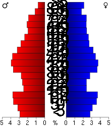 Age pyramid of county residents based on 2000 U.S. census data.
As of the census[4] of 2000, there were 32,584 people, 13,356 households, and 9,015 families residing in the county. The population density was 46 people per square mile (18/km²). There were 13,996 housing units at an average density of 20 per square mile (8/km²). The racial makeup of the county was 95.22% White, 0.24% Black or African American, 0.20% Native American, 0.55% Asian, 0.02% Pacific Islander, 2.92% from other races, and 0.85% from two or more races. 6.29% of the population were Hispanic or Latino of any race. 34.8% were of Norwegian, 26.2% German and 5.8% Danish ancestry according to Census 2000.
There were 13,356 households out of which 29.10% had children under the age of 18 living with them, 56.50% were married couples living together, 7.50% had a female householder with no husband present, and 32.50% were non-families. 28.20% of all households were made up of individuals and 14.00% had someone living alone who was 65 years of age or older. The average household size was 2.40 and the average family size was 2.92.
In the county the population was spread out with 24.00% under the age of 18, 7.50% from 18 to 24, 25.50% from 25 to 44, 24.10% from 45 to 64, and 18.90% who were 65 years of age or older. The median age was 40 years. For every 100 females there were 96.60 males. For every 100 females age 18 and over, there were 95.00 males.
The median income for a household in the county was $36,964, and the median income for a family was $45,142. Males had a median income of $31,491 versus $21,799 for females. The per capita income for the county was $18,325. About 5.60% of families and 8.40% of the population were below the poverty line, including 9.00% of those under age 18 and 9.10% of those age 65 or over.
Cities and towns
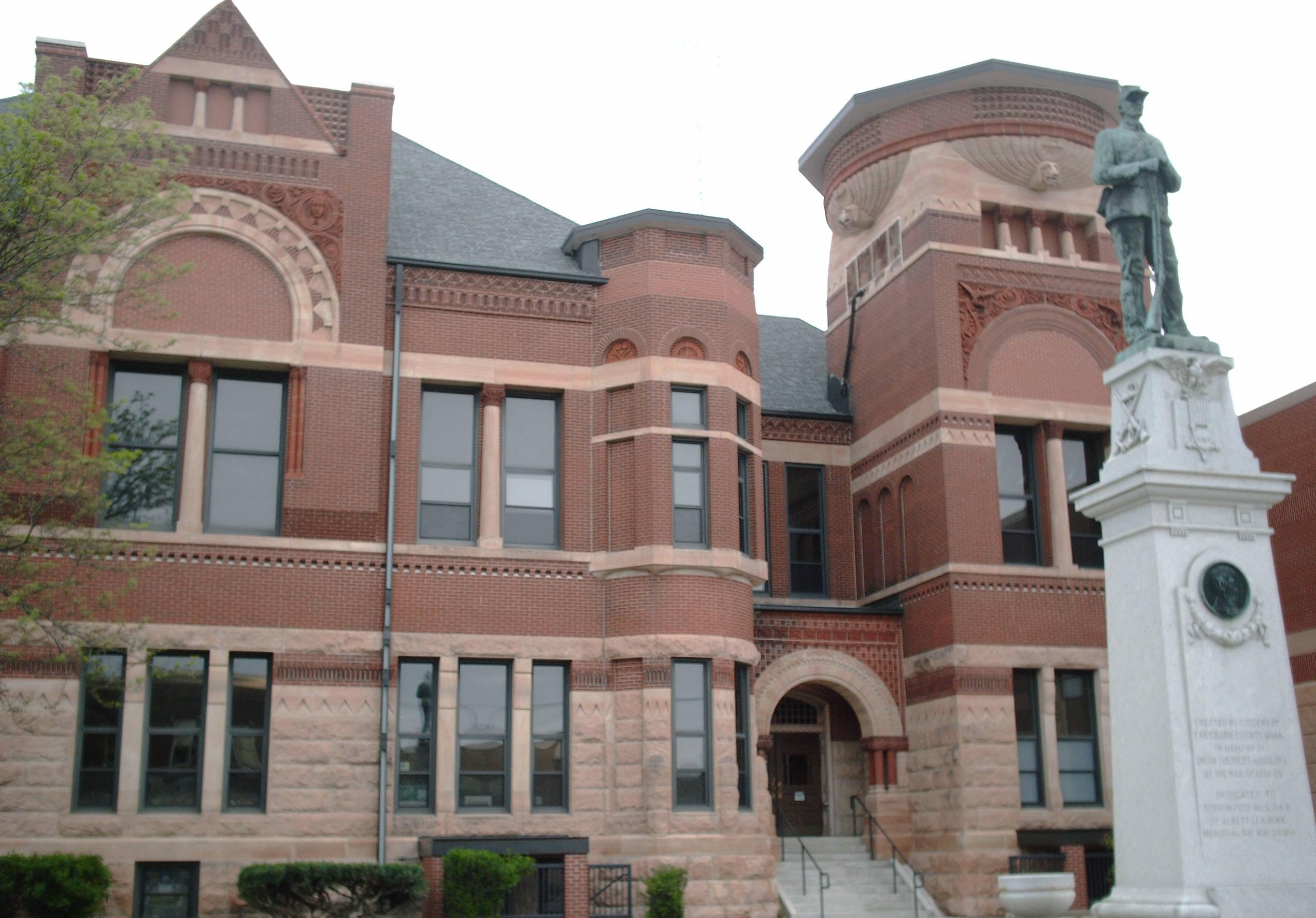
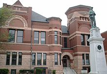 Freeborn County Courthouse.
Cities Townships - Albert Lea
- Alden
- Armstrong
- Clarks Grove
- Conger
- Emmons
- Freeborn
- Geneva
- Glenville
- Gordonsville
- Hartland
- Hayward
- Hollandale
- Manchester
- Mansfield
- Myrtle
- Oakland
- Petran
- Twin Lakes
See also
References
- ^ "2010 Census Redistricting Data (Public Law 94-171) Summary File". American FactFinder. United States Census Bureau. http://factfinder2.census.gov/faces/tableservices/jsf/pages/productview.xhtml?pid=DEC_10_PL_GCTPL2.ST05&prodType=table. Retrieved 25 April 2011.
- ^ "Find a County". National Association of Counties. http://www.naco.org/Counties/Pages/FindACounty.aspx. Retrieved 2011-06-07.
- ^ "Census 2000 U.S. Gazetteer Files: Counties". United States Census. http://www.census.gov/tiger/tms/gazetteer/county2k.txt. Retrieved 2011-02-13.
- ^ "American FactFinder". United States Census Bureau. http://factfinder.census.gov. Retrieved 2008-01-31.
External links

Waseca County Steele County Faribault County 
Mower County  Freeborn County, Minnesota

Winnebago County, Iowa Worth County, Iowa Municipalities and communities of Freeborn County, Minnesota Cities Albert Lea | Alden | Clarks Grove | Conger | Emmons | Freeborn | Geneva | Glenville | Hartland | Hayward | Hollandale | Manchester | Myrtle | Twin Lakes
Townships Albert Lea | Alden | Bancroft | Bath | Carlston | Freeborn | Freeman | Geneva | Hartland | Hayward | London | Manchester | Mansfield | Moscow | Newry | Nunda | Oakland | Pickerel Lake | Riceland | Shell Rock
Categories:- Minnesota counties
- Freeborn County, Minnesota


Wikimedia Foundation. 2010.