- Martin County, Minnesota
-
This article is about Martin County, Minnesota. See Martin County for uses in other states.
Martin County, Minnesota 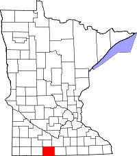
Location in the state of Minnesota
Minnesota's location in the U.S.Founded May 23, 1857 [1] Named for Henry Martin or Morgan Lewis Martin Seat Fairmont Largest city Fairmont Area
- Total
- Land
- Water
729.56 sq mi (1,890 km²)
709.34 sq mi (1,837 km²)
20.21 sq mi (52 km²), 2.77%Population
- (2010)
- Density
20,840
31/sq mi (12/km²)Time zone Central: UTC-6/-5 Website www.co.martin.mn.us Martin County is a county located in the U.S. state of Minnesota. As of 2010, the population was 20,840.[1] Its county seat is Fairmont.[2]
Contents
Geography
According to the 2000 census, the county has a total area of 729.56 square miles (1,889.6 km2), of which 709.34 square miles (1,837.2 km2) (or 97.23%) is land and 20.21 square miles (52.3 km2) (or 2.77%) is water.[3]
Lakes
- Amber Lake: in Fairmont Township
- Big Twin Lake: in Elm Creek Township
- Bright Lake: in Tenhassen Township
- Budd Lake: in Fairmont Township
- Buffalo Lake: Cedar Township
- Buffalo Lake: there is another Buffalo lake in Rutland Township
- Canright Lake: in Rutland Township
- Cedar Lake: western part of the northern lake is in Cedar Township; eastern part of the northern lake is in Galena Township; southern lake is mostly in Cedar Township with the southern tip extending into Elm Creek Township
- Clayton Lake: in Tenhassen Township
- Clear Lake: in Lake Belt Township
- Clam Lake: in Fox Lake Township
- Creek Lake: northern half is in Galena Township southern half is in Fox Lake Township
- Eagle Lake: in Fraser Township
- East Chain Lake: mostly in East Chain Township, but western side is in Silver Lake Township
- Fish Lake: in Cedar Township
- Fish Lake: there is another Fish Lake in Lake Belt Township
- Fox Lake: is mostly in Fox Lake Township, but it has a few miles of shoreline in Manyaska Township
- Hall Lake: in Fairmont Township
- High Lake: in Rutland Township
- Iowa Lake: northern part is in Silver Lake Township and it extends south into Emmet County, Iowa
- Kiester Lake: in Rutland Township
- Lake Charlotte: in Rutland Township
- Lake George: in Fairmont Township
- Lake Imogene: western part in Fairmont Township; eastern part in Pleasant Prairie Township
- Lake Seymour: is Fox Lake Township
- Little Hat Lake: in Fairmont Township
- Little Twin Lake: in Elm Creek Township
- Martin Lake: in Rutland Township
- Mud Lake: in Fairmont Township
- Murphy Lake: in Westford Township
- North Lake: Cedar Township
- North Silver Lake: in Silver Lake Township
- Okamanpeedan Lake: mostly in Tenhassen Township, but the southern part extends into Emmet County, Iowa
- Perch Lake: in Westford Township
- Pierce Lake: in Rolling Green Township
- Rose Lake: in Fairmont Township
- Round Lake: in Fox Lake Township
- Round Lake: there is another Round Lake in Waverly Township
- Sager Lake: northern lake in Fairmont Township; southern lake in Silver Lake Township
- Sisseton Lake: in Fairmont Township
- South Silver Lake: in Silver Lake Township
- Susan Lake: in Lake Belt Township
- Temperance Lake: in Manyaska Township
- Tuttle Lake: in Tenhassen Township
- Watkins Lake: in Elm Creek Township
- Wilmert Lake: in Silver Lake Township
Major highways
Adjacent counties
- Watonwan County (north)
- Blue Earth County (northeast)
- Faribault County (east)
- Kossuth County, Iowa (southeast)
- Emmet County, Iowa (southwest)
- Jackson County (west)
- Cottonwood County (northwest)
Demographics
Historical populations Census Pop. %± 1860 151 — 1870 3,867 2,460.9% 1880 5,249 35.7% 1890 9,408 79.2% 1900 16,936 80.0% 1910 17,518 3.4% 1920 21,085 20.4% 1930 22,401 6.2% 1940 24,656 10.1% 1950 25,655 4.1% 1960 26,986 5.2% 1970 24,316 −9.9% 1980 24,687 1.5% 1990 22,914 −7.2% 2000 21,802 −4.9% 2010 20,840 −4.4% U.S. Decennial Census  Age pyramid of county residents based on 2000 U.S. census data.
As of the census[4] of 2000, there were 21,802 people, 9,067 households, and 6,047 families residing in the county. The population density was 31 people per square mile (12/km²). There were 9,800 housing units at an average density of 14 per square mile (5/km²). The racial makeup of the county was 97.22% White, 0.25% Black or African American, 0.10% Native American, 0.42% Asian, 0.02% Pacific Islander, 1.26% from other races, and 0.73% from two or more races. 1.93% of the population were Hispanic or Latino of any race. 51.6% were of German, 11.9% Norwegian, 5.9% Swedish and 5.0% English ancestry according to Census 2000.
There were 9,067 households out of which 29.80% had children under the age of 18 living with them, 56.60% were married couples living together, 7.20% had a female householder with no husband present, and 33.30% were non-families. 30.00% of all households were made up of individuals and 15.20% had someone living alone who was 65 years of age or older. The average household size was 2.35 and the average family size was 2.92.
In the county the population was spread out with 24.80% under the age of 18, 6.40% from 18 to 24, 24.90% from 25 to 44, 24.00% from 45 to 64, and 19.90% who were 65 years of age or older. The median age was 42 years. For every 100 females there were 95.30 males. For every 100 females age 18 and over, there were 91.50 males.
The median income for a household in the county was $34,810, and the median income for a family was $44,541. Males had a median income of $30,467 versus $21,780 for females. The per capita income for the county was $18,529. About 7.10% of families and 10.50% of the population were below the poverty line, including 15.10% of those under age 18 and 9.00% of those age 65 or over.
Cities and towns
Cities Townships Ghost town - Imogene
† Ormsby is in both Watonwan and Martin counties
See also
References
- ^ "2010 Census Redistricting Data (Public Law 94-171) Summary File". American FactFinder. United States Census Bureau. http://factfinder2.census.gov/faces/tableservices/jsf/pages/productview.xhtml?pid=DEC_10_PL_GCTPL2.ST05&prodType=table. Retrieved 25 April 2011.
- ^ "Find a County". National Association of Counties. http://www.naco.org/Counties/Pages/FindACounty.aspx. Retrieved 2011-06-07.
- ^ "Census 2000 U.S. Gazetteer Files: Counties". United States Census. http://www.census.gov/tiger/tms/gazetteer/county2k.txt. Retrieved 2011-02-13.
- ^ "American FactFinder". United States Census Bureau. http://factfinder.census.gov. Retrieved 2008-01-31.
External links

Cottonwood County Watonwan County Blue Earth County Jackson County 
Faribault County  Martin County, Minnesota

Emmet County, Iowa Kossuth County, Iowa Municipalities and communities of Martin County, Minnesota Cities 
Townships Cedar | Center Creek | East Chain | Elm Creek | Fairmont | Fox Lake | Fraser | Galena | Jay | Lake Belt | Lake Fremont | Manyaska | Nashville | Pleasant Prairie | Rolling Green | Rutland | Silver Lake | Tenhassen | Waverly | Westford
Ghost town Imogene
Footnotes ‡This populated place also has portions in an adjacent county or counties
Categories:- Minnesota counties
- Martin County, Minnesota


Wikimedia Foundation. 2010.