- Dakota County, Minnesota
-
Dakota County, Minnesota 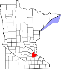
Location in the state of Minnesota
Minnesota's location in the U.S.Founded October 27, 1849 [1] Named for Named after the Dakota people. Seat Hastings Largest city Eagan Area
- Total
- Land
- Water
586.33 sq mi (1,519 km²)
569.58 sq mi (1,475 km²)
16.75 sq mi (43 km²), 2.86%Population
- (2010)
- Density
398,552
625/sq mi (241/km²)Time zone Central: UTC-6/-5 Website www.dakotacounty.us Dakota County is the third most populous county in the U.S. state of Minnesota. The county is bordered by the Minnesota and Mississippi Rivers on the north, and the state of Wisconsin on the east. Dakota County comprises the southeast portion of seven-county Minneapolis-St. Paul, the thirteenth largest metropolitan area in the United States with about 3.2 million residents. As of 2010, the population was 398,552.[1] The county seat is Hastings.[2]
The county was the site of historical events at Mendota that defined the state's future, including providing materials for the construction of Fort Snelling across the river and the signing of the Treaty of Traverse des Sioux which ceded land from the native Dakota nation for the Minnesota Territory. The county's history was initially tied to the confluence of the Mississippi and Minnesota Rivers, both strategically important for United States expansion and as the convergence of the Dakota and Ojibwe nations who regarded the site as sacred. Influence shifted westward during the post-World War II settlement boom when Interstate 35 connected the western half of the county to Minneapolis and Saint Paul and bedroom communities grew. Today, Dakota County has a population that exceeds Minneapolis's. Most work outside the county but like many metro counties, Dakota continues to absorb industry and jobs from the core cities.[3][4]
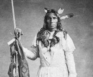
Dakota County is named after the Dakota Sioux tribal bands who settled in the area.[3] The name is recorded as "Dahkotah" in U.S. Census records until 1851.[5]
Contents
History
In the 1600s, Mdewakanton Dakota fled their ancestral home of Mille Lacs Lake in northern Minnesota in response to westward expansion of the Ojibway nation.[7] According to Dakota tradition, their ancestors pushed out the Iowa who were found settled at the mouth of the Minnesota River.[8] Later in 1680, the Mdewakanton Dakota were contacted by French explorer Daniel Greysolon, Sieur du Lhut and the Mendota (mdo-TE) band of the Mdewakanton south of the Minnesota River were contacted later by Joseph Nicollet in the 18th century.[9] While Taoyateduta (a.k.a. Little Crow) led the Mendota in northern Dakota County, upstream to the southwest, Chief Black Dog established his village of 600 people around 1750 at the isthmus between Black Dog Lake (from which is named after him) and the Minnesota River, near the present site of the Black Dog Power Plant.[7][10]

Following the published expeditions of explorers, in 1805, Zebulon Pike negotiated for military territory with the Mendota band which included land in Dakota County at the Mississippi River confluences with the Minnesota and St. Croix Rivers.[11] In 1819, on what is now Picnic Island on the south bank of the Minnesota River, Colonel Henry Leavenworth built a stockade fort called "St. Peter's Cantonment" or "New Hope," where materials were assembled for the construction of Fort Snelling to be built on the bluff on the north bank.[12] Permanent settlement on the island was impossible due to annual flooding. Alexis Bailey built some log buildings nearby to trade in furs in 1826. Henry Hastings Sibley later built the first stone house in Minnesota in 1836, overlooking Fort Snelling. Sibley was a partner in the American Fur Company, and considerable fur trade occurred at Mendota due to the accessibility of the confluence.
On-going United States expansion into the then "Northwest Territory" led to government purchase of land from the Dakota people (the Mdewakanton, Wahpekute, Wahpeton, and Sisseton bands) via the Treaty of St. Peters and the Treaty of Traverse des Sioux in 1851.[13][14] and the Treaty of Mendota.[15] After the establishment of the Minnesota Territory in 1849, Dakotah County (later Dakota County) spanned from the Mississippi River to the Missouri River.[16] By the time Minnesota achieved statehood in 1858, power and influence had shifted from Mendota, across the rivers to Saint Paul and Minneapolis.
Hastings and South Saint Paul
Continuing into the 20th century, the hub of activity in the county was in Hastings, the county seat, and a focal point of transportation, communication, and commerce. St. Peter's, now Mendota, had lost out to Fort Snelling. Hastings is critically located on the Mississippi River at the confluence of the St. Croix River and on the Vermillion River, which provided ample water power. Commercial interests built substantial wealth among the businessmen who dealt in lumber, milling, and railroads as the county residents depended on them to sell their agricultural products and to provide the goods needed for a growing economy and rising standard of living.
During this time, the stockyards and meat-packing plants in South Saint Paul became historically significant as the largest stockyards in the world.[17] Ranchers in the vast countryside to the west brought their livestock for shipping to the hungry populations of St. Louis, Memphis, and New Orleans, downstream.[18] These plants were worked by new immigrants from Romania, Serbia, and other Eastern European countries.[19] The rest of the county remained agricultural during the boom of milling activity north of the Minnesota River due to lack of bridge connections. Rail access came in 1846 via the Chicago, St. Paul, Minneapolis, and Omaha Railroad which shipped grain to millers.[20] The Minneapolis St. Paul Rochester and Dubuque Electric Traction Company line in 1905 (now the Dan Patch Corridor), was primary for passengers going to entertainment parks and resorts in Burnsville and Lakeville.[21]
Suburban growth
Beginning in the 1950s, population and household growth shifted to the western portion of the county. This area of Dakota County had been predominantly Irish and Scottish extending southward toward the Scandinavians of Southern Minnesota.[22][23] As population pressures expanded south from Minneapolis and Bloomington, the completion of Interstate 35W and 35E brought about major construction in the post-World War II period, turning villages into cities over the period of 20 years. Burnsville, Apple Valley, Eagan, and Lakeville brought over 200,000 people into the county by the end of the century. The Western and Northern Service Centers were constructed in the early 1990s each with an additional courthouse location. License centers were subsequently setup in Burnsville and Lakeville. Though pressure remained since the postwar boom to move the county seat to one of the larger communities in the county, the Dakota County Board maintained the seat in Hastings, while providing government services across the county.[24]
Historic sites
The history of the county is well-illustrated by the Registered Historic Places in the county, including the settlement at Mendota, the homes of well-heeled residents of Hastings, the ethnic gathering places in South Saint Paul, and other sites related to life on the prairie, including religion, education, transportation, commerce, and farm life.
Law and government
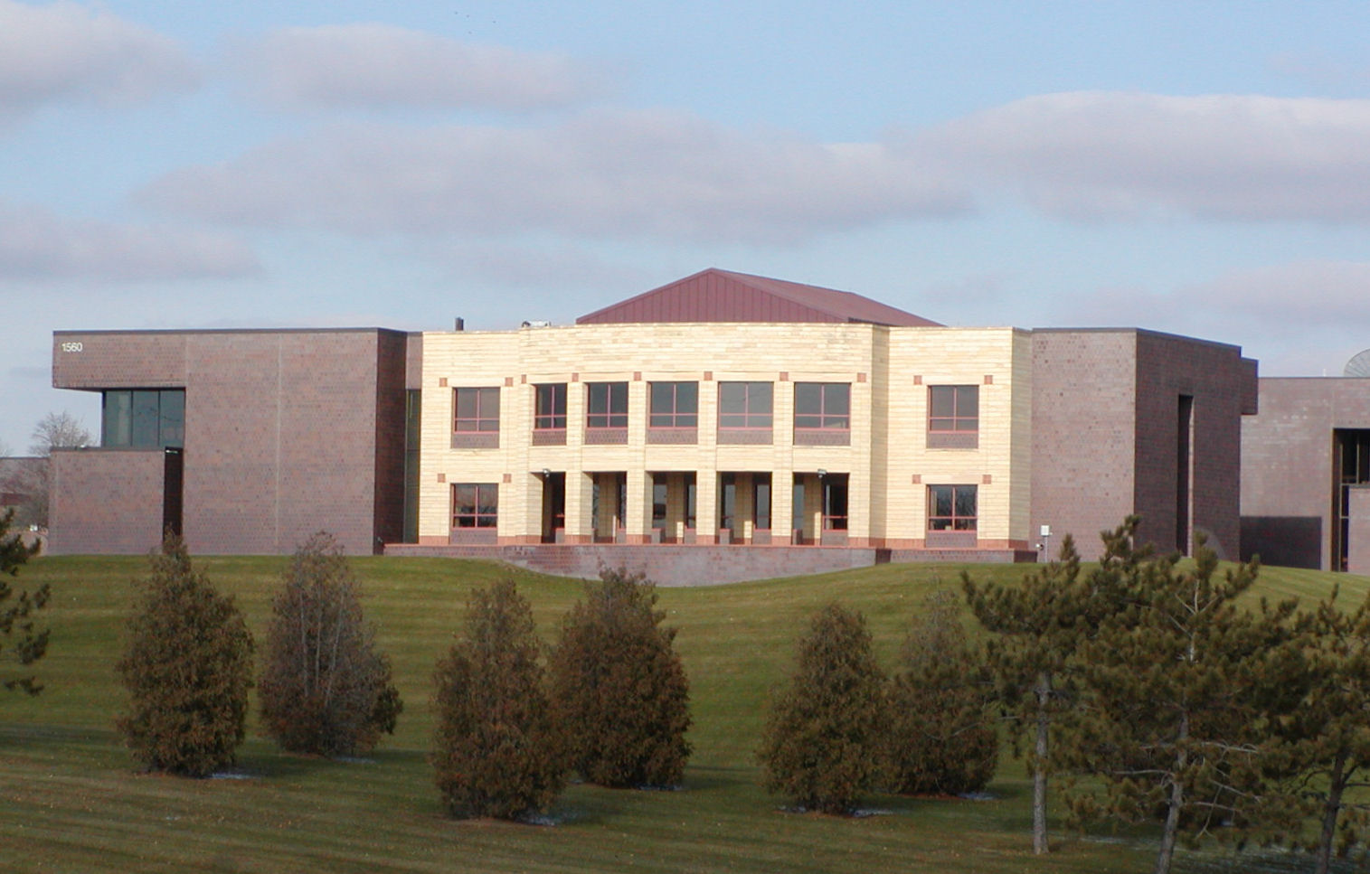
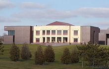 Dakota County government building
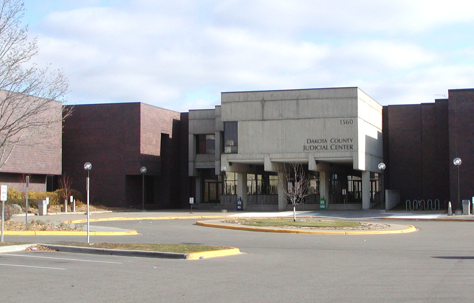
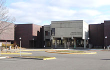 Dakota County courthouse
Dakota County is governed by the Board of Commissioners. The members of the Board as of 2011 are:
- Joseph Harris, District 1
- Kathleen Gaylord, District 2
- Thomas Egan, District 3
- Nancy Schouweiler, District 4
- Liz Workman, District 5
- Paul Krause, District 6
- Willis Braning, District 7
Dakota County also has an elected Sheriff (Dave Bellows) and an elected County Attorney (James Backstrom). Additionally there are appointed boards for the library system, community development agency, and several advisory boards. Dakota County is also served by an elected board of their Soil and Water Conservation District.
Principal employees of Dakota County include (but are not limited to) County Administrator Brandt Richardson, Community Services Director Dave Rooney, Parks Director Steve Sullivan, and Court Administrator Van Bostrom.
Geography
According to the 2000 census, the county has a total area of 586.33 square miles (1,518.6 km2), of which 569.58 square miles (1,475.2 km2) (or 97.14%) is land and 16.75 square miles (43.4 km2) (or 2.86%) is water.[25]
Lakes and rivers
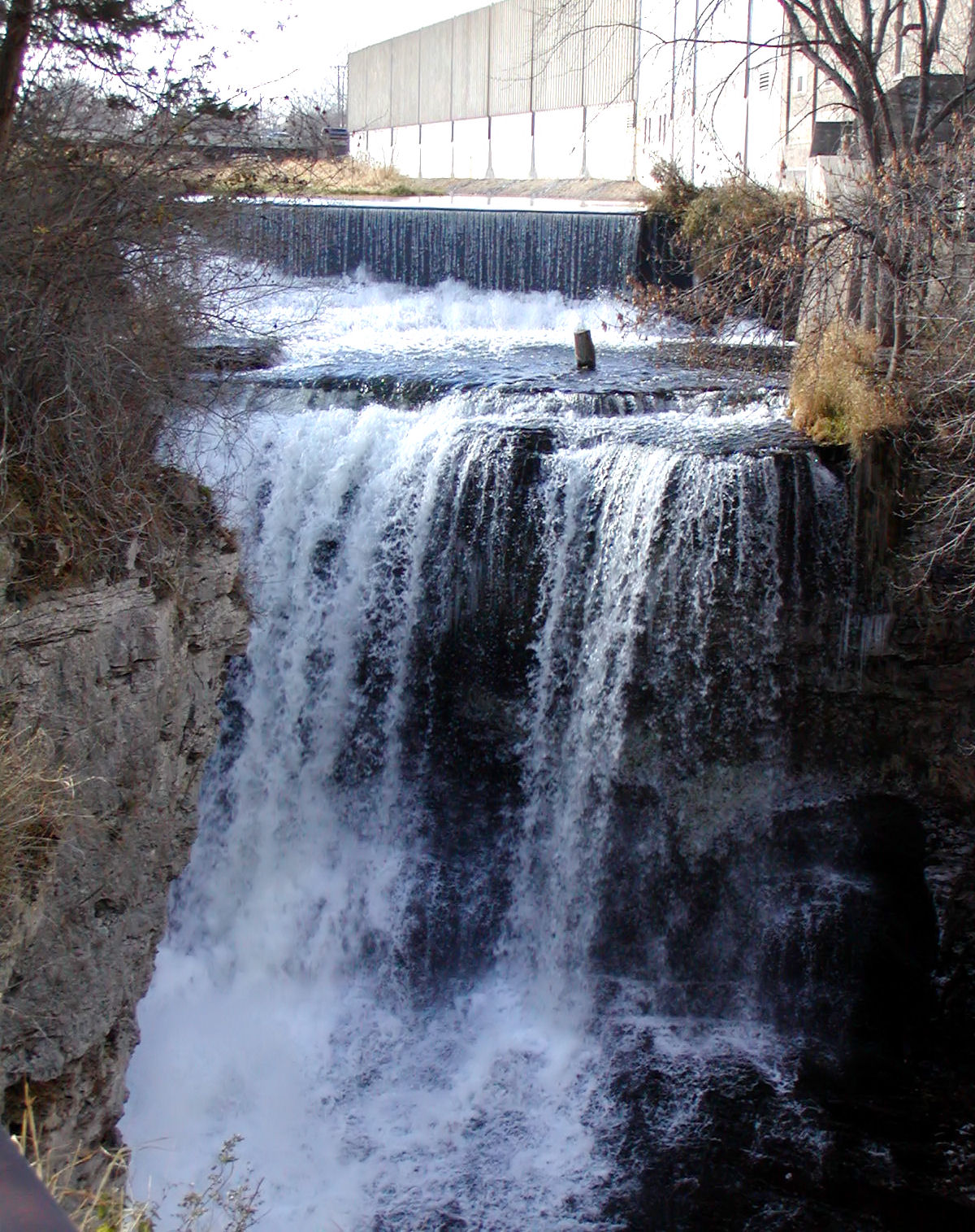
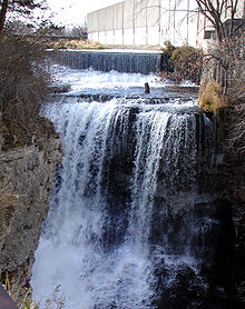 Vermillion Falls in Hastings
The northern and eastern border of Dakota County is marked by the Minnesota and Mississippi Rivers. Management and jurisdiction of the rivers falls into multiple local, State and Federal agencies. Most of the Minnesota River bank is under the Minnesota Valley National Wildlife Refuge with fish, wildlife, and parkland managed collectively by the U.S. Fish and Wildlife Service and the Minnesota Department of Natural Resources. The Dakota County Soil and Water Conservation District assists the county's six watershed management organizations (WMO) which include the Black Dog WMO, Gun Club Lake WMO, Lower Minnesota River Watershed District, Lower Mississippi WMO, North Cannon River WMO, and the Vermillion River Watershed Joint Powers Organization.[26][27] [28]
- Mississippi River: Adjacent to Mendota Heights, Lilydale, South St. Paul, Inver Grove Heights, Rosemount, and Hastings.
- Minnesota River: Adjacent to Burnsville, Eagan, Mendota Heights, and Mendota.
- Vermillion River: From Farmington through Eureka Township to Hastings.
Burnsville
Eagan
- Blackhawk Lake
- Fish Lake
- Holland Lake
- Jensen Lake
- Thomas Lake
Eureka Township
- Chub Lake
Hastings
- Lake Rebecca
- Lake Isabelle
- Spring Lake
- Bullfrog Pond
Lakeville
- Lake Marion
Lilydale
- Pickerel Lake
Ravenna Township
- Mud Hen Lakes
Randolph Township
- Lake Byllesby
West Saint Paul
- Thompson Lake
Rosemount
- Keegan Lake
Major highways
 Interstate 494
 U.S. Highway 52
 U.S. Highway 61
Adjacent counties
- Ramsey County (north)
- Washington County (northeast)
- Pierce County, Wisconsin (east, across the Mississippi River)
- Goodhue County (southeast)
- Rice County (southwest)
- Scott County (west)
- Hennepin County (northwest)
National protected areas
- Minnesota Valley National Wildlife Refuge (part)
- Mississippi National River and Recreation Area (part)
Economy
Since the county grew as a bedroom community of Minneapolis and St. Paul, just over half of the residents (54%) work outside the county.[4]
Demographics
Historical populations Year Pop. ±% 1850 584 — 1860 9,093 +1457.0% 1870 16,312 +79.4% 1880 17,391 +6.6% 1890 20,240 +16.4% 1900 21,733 +7.4% 1910 25,171 +15.8% 1920 28,967 +15.1% 1930 34,592 +19.4% 1940 39,660 +14.7% 1950 49,019 +23.6% 1960 78,303 +59.7% 1970 139,808 +78.5% 1980 194,279 +39.0% 1990 275,227 +41.7% 2000 355,904 +29.3% 2010 398,552 +12.0% Source: "American FactFinder". United States Census Bureau, Counties by Decennial Census. http://factfinder.census.gov. According to the 2010 U.S. Census, Dakota County had a population of 398,552, of which 195,661 (49.1%) were male and 202,891 (50.9%) were female. In terms of age, 76.7% of the population were 16 years and over, 73.6% were 18 years and over, 70.5% were 21 years and over, 12.8% were 62 years and over, and 10.0% were 65 years and over. The median age was 36.8 years. The median age for males was 35.7; the median age for females was 37.9.
In terms of race and ethnicity, the county was 85.2% White (82.3% Non-Hispanic White Alone), 4.7% Black or African American, 0.4% American Indian and Alaska Native, 4.4% Asian, 0.1% Native Hawaiian and Other Pacific Islander, 2.4% from Some Other Race, and 2.9% from Two or More Races. Hispanics and Latinos of any race make up 6.0% of the population.
In terms of households, 69.5% were family households and 30.5% were non-family households. Approximately 55.2% were husband-wife family households; 26% had children under 18 years of age. Approximately 36.6% of households had children under 18 years of age living in them; 18.6% had people over the age of 65 living in them. The average household size is 2.60 and the average family size is 3.12. In terms of housing occupancy, 95.3% of households were occupied and 4.7% were vacant. Of the vacant housing units, 2.0% were for rent, 0.1% were rented but not occupied, 1.2% were for sale only, 0.2% were sold but not occupied, 0.5% were for seasonal, recreational, or occasional use, and 0.8% were all other vacants. The homeowner vacancy rate was 1.7% and the rental vacancy rate was 8.1%. Of all occupied housing units, 76.5% were owner-occupied and 23.5% were renter-occupied. The population in owner-occupied units was 314,833; the average household size was 2.71. The population in renter-occupied units was 80,866; the average household size was 2.26. [29]
Cities and towns
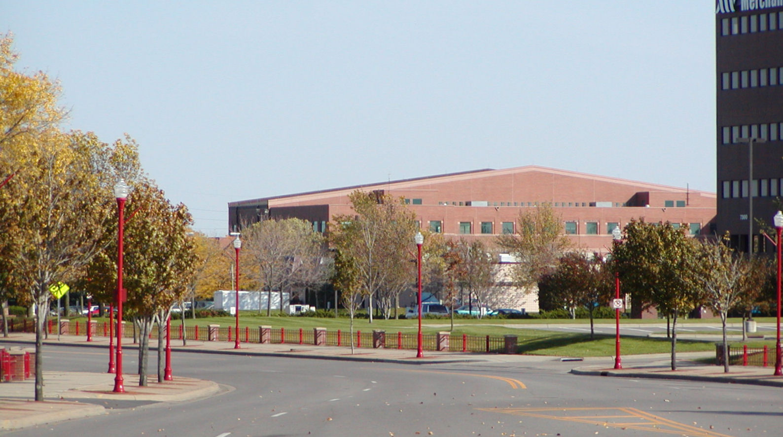
 Street in downtown Apple Valley with signature red lamp posts. In the background is the Western Service Center.
Dakota County is home to sites significant in the state's early history. At Mendota, the Treaty of Mendota was signed, opening much of Southern Minnesota to settlement, and there prominent Saint Paul businessmen built their grand mansions. Though linked with the state's capital for much of history via rail, Dakota County owes much of its current growth to the expansion of Minneapolis' population which accelerated during the post-World War II boom era of the 1960s. This demand for housing along with two major interstate highways linking Minneapolis (I-35W) and St. Paul (I-35E) to the county concentrated major growth and demand along the northern end. Today, the cities of Burnsville, Eagan, Apple Valley, Lakeville, Rosemount, Hastings, Inver Grove Heights, Mendota Heights, West St. Paul, and South St. Paul are synonymous with the Twin Cities, as being part of "the Cities." Both Burnsville and Eagan are nearly developed and have become more like independent cities attracting major development than just residential bedroom suburbs.[30][31]
 Lakeville's downtown began in the early 20th century, contrasting its modern suburban development.
In contrast, the southern end of Dakota County reflects the rural past with small towns such as Farmington, Coates, Vermilion, Hampton, Rudolph, and Miesville where street grids and housing dating from the early 20th century can be found. Much of the county is self-contained except for two examples. The City of Hastings, the county seat, lies on both banks of the Mississippi River and was heavily linked historically and physically by rail to the early growing influence of the state's capital, Saint Paul. On the south border, the City of Northfield, technically in Rice County, has slightly expanded north into Dakota however the city itself is allowed into the municipal sewer boundary.
Though all of Dakota County is considered part of the metropolitan area and open to major development, the county government has steadily preserved farmland and continues to acquire new permanent natural lands in the southern townships.[32] This has further defined the boundaries between urbanized and rural which is starkly visible in the outskirts of the developed cities. While the center of population still lies north with more cosmopolitan residents, culturally Dakota County is a rural community and the Dakota County Fair is still a largely agricultural event and held in Farmington.
Most of northern Dakota County is frequently referred to as "South of the River" for its location being south of the Minnesota River.[33][34][35][36]
Cities Townships Unincorporated Communities Ghost Town - Castle Rock
- Eureka Center
- Waterford
† Hastings is in Dakota County; a part of the city extends into Washington County.
‡ Northfield is mainly in Rice County; a part of the city extends into Dakota County.Education
Dakota County is home to the state's largest school districts and some of the highest paid Superintendents.[37] Nationally recognized Independent School District 196 (Rosemount-Apple Valley-Eagan) houses 28,000 and is the fourth largest school district in the state.[38][39] Other districts include Independent School District 191 (Burnsville-Eagan-Savage School District), Independent School District 194 (Lakeville-Elko-New Market), Independent School District 197 (West St. Paul-Mendota Heights-Eagan) and Independent School District 200 (Hastings).
Schools
- Burnsville Senior High School (ISD 191)
- John Metcalf Junior High School (ISD 191)
- Joseph Nicollet Junior High School (ISD 191)
- Edward D. Neill Elementary (ISD 191)
- Gideon Pond Elementary (ISD 191)
- Rahn Elementary (ISD 191)
- Sioux Trail Elementary (ISD 191)
- Sky Oaks Elementary (ISD 191)
- Vista View Elementary (ISD 191)
- William Byrne Elementary (ISD 191)
- North Trail Elementary (ISD 192)
- Meadowview Elementary (ISD 192)
- Akin Road Elementary (ISD 192)
- Farmington Elementary (ISD 192)
- Riverview Elementary (ISD 192)
- Robert Boeckman Middle School (ISD 192)
- Levi P. Dodge Middle School (ISD 192)
- Farmington Senior High School (ISD 192)
- Oak Ridge Elementary (ISD 196)
- Red Pine Elementary (ISD 196)
- Rosemount Elementary (ISD 196)
- Thomas Lake Elementary (ISD 196)
- Dakota Hills Middle (ISD 196)
- Black Hawk Middle School (ISD 196)
- Rosemount Middle School (ISD 196)
- Scott Highlands Middle School (ISD 196)
- Valley Middle School (ISD 196)
- Saint Joseph Catholic School
- Rosemount High School (ISD 196)
- Eagan High School (ISD 196)
- Eastview High School (ISD 196)
- Simley High School (ISD 199)
- South Saint Paul High School (SSD 6)
Colleges and universities
- Dakota County Technical College
- Inver Hills Community College
Libraries
- Burnhaven Library in Burnsville
- Farmington Library in Farmington
- Galaxie Library in Apple Valley
- Heritage Library in Lakeville
- Inver Glen Library in Inver Grove Heights
- Pleasant Hill Library in Hastings
- Robert Trail Library in Rosemount
- City of South St. Paul Library in South St. Paul
- Wentworth Library in West St. Paul
- Wescott Library in Eagan
Recreation
Parks
- Big Rivers Regional Trail in Mendota Heights
- Lake Byllesby Regional Park in Cannon Falls
- Lebanon Hills Regional Park in Eagan/Apple Valley
- Miesville Ravine Park Reserve in Miesville
- Dakota Woods Dog Park in Empire Township
- Spring Lake Park Reserve in Hastings/Rosemount
- Thompson County Park in West St. Paul
- Dakota County Bikeway System
Notable people
- Pierce Butler, U.S. Supreme Court justice
- Harold Stassen (R), Former Governor of Minnesota, Aide to Adm. Bull Halsey, Aide to President Dwight Eisenhower, Participant/Drafter of the United Nations Charter
- Ignatius Donnelly, Politician
- Henry Hastings Sibley, Politician, Indian agent
See also
Notes
- ^ "2010 Census Redistricting Data (Public Law 94-171) Summary File". American FactFinder. United States Census Bureau. http://factfinder2.census.gov/faces/tableservices/jsf/pages/productview.xhtml?pid=DEC_10_PL_GCTPL2.ST05&prodType=table. Retrieved 25 April 2011.
- ^ "Find a County". National Association of Counties. http://www.naco.org/Counties/Pages/FindACounty.aspx. Retrieved 2011-06-07.
- ^ a b "County Origin". Dakota County Historical Society. 2005. http://www.dakotahistory.org/county/origin.asp.
- ^ a b Kevin Monroe, Dawn Thongsavath, Heidi Welsch (May 2006). "Public Assistance Caseload, Increase Analysis" (PDF). Dakota County Employment and Economic Assistance. http://www.co.dakota.mn.us/NR/rdonlyres/00000519/ibzkmqzmkyilpjfjtgytyocqfauykfmo/06PublicAssistCaseGrowthAnalysisFinalReportII.pdf. Retrieved 2007-09-12.
- ^ Charles Dosh (2003-2007). "Dakota County Genealogy". MN Gen Web. http://www.tc.umn.edu/~bluhm002/Dakota/public_html/index.html.
- ^ Kappler, Charles J., Washington: Government Printing Office, ed (1904). Indian Affairs: Laws and Treaties. II (Treaties, 1778-1883). Oklahoma State University Library.. and "Treaty with the Sioux". 1837-09-29. http://digital.library.okstate.edu/kappler/Vol2/treaties/sio0493.htm#mn1. and "Treaty with the Sioux—Sisseton and Wahpeton Bands". 1851-07-23. http://digital.library.okstate.edu/kappler/Vol2/treaties/sio0588.htm. and "Treaty With the Sioux—Mdewakanton and Wapahkoota Bands". 1851-08-05. http://digital.library.okstate.edu/kappler/Vol2/treaties/sio0591.htm. Retrieved 2007-06-26.
- ^ a b Mark Morrison (2008). "Dakota Life". City of Bloomington. http://www.ci.bloomington.mn.us/main_top/2_facilities/rec_facility/pond/signs/dakota_life/dakota_life.htm.
- ^ Handbook of American Indians, 1906 (2008). "Iowa Indian Tribe History". Access Genealogy. http://www.accessgenealogy.com/native/tribes/iowa/iowahist.htm.
- ^ "Who We Are". Mendota Mdewakanton Dakota Community. 2007. http://mendotadakota.com/mn/who/.
- ^ Dakota County Historical Society (2005). "Historic Sites: Burnsville". http://www.dakotahistory.org/county/burnsville.asp.
- ^ "The Treaty Story". Minnesota History Center. 1999. http://www.minnesotahistorycenter.org/exhibits/territory/territory/treaty/treaty4.html.
- ^ "Historic Sites:Mendota Heights". Dakota County Historical Society. 2005. http://www.dakotahistory.org/county/mendotaheights.asp. Retrieved 2008-02-28.
- ^ Carley, Kenneth (1976). The Sioux Uprising of 1862. Minnesota Historical Society. ISBN 0-87351-103-4. OCLC 2225048.
- ^ Lass, William (1977, 1998). Minnesota: A History. New York, New York: W. W. Norton & Company. ISBN 0-393-04628-1. OCLC 37527613.
- ^ Meyer, Roy Willard (1993). History of the Santee Sioux: United States Indian Policy on Trial. Lincoln, Nebraska: University of Nebraska Press.
- ^ Dosh, Charles. "Welcome To Dakota County, Minnesota - MNGenWeb". MN Genweb. http://www.tc.umn.edu/~bluhm002/Dakota/public_html/index.html. Retrieved 2008-03-02.
- ^ "South St. Paul Riverfront Trail". Mississippi National River and Recreation area. http://www.nps.gov/archive/miss/tug/segments/seg16.html. Retrieved 2007-03-19.
- ^ "County Origin". Dakota County Historical Society. 2005. http://www.dakotahistory.org/county/origin.asp. Retrieved 2008-02-28.
- ^ "Historic Sites:South St. Paul". Dakota County Historical Society. http://www.dakotahistory.org/county/ssp.asp. Retrieved 2007-03-19.
- ^ ED Neill (1881). "History of Dakota County 1881". Burnsville Heritage Committee. Archived from the original on 2009-10-25. http://www.webcitation.org/query?url=http://www.geocities.com/Heartland/Acres/6038/History_of_Dakota_County_1881.html&date=2009-10-25+07:31:26.
- ^ "The Dan Patch railway". St. Louis Park Historical Society. http://www.slphistory.org/history/danpatch.asp.
- ^ Kevin Gerahty (2006-03). "Histories of the Dakota County Irish". Friends of the Highland Cemetery. http://freepages.genealogy.rootsweb.ancestry.com/~friendsofthehighlandcemetery/.
- ^ Karen Miller (1896). The diary of Karen Miller. s.n.. http://books.google.com/?id=FyL6GgAACAAJ.
- ^ Dan Gearino (2000-08-11). "County breaks ground on $36.5 million Northern Service Center in West St. Paul". Thisweek Newspapers. http://www.thisweek-online.com/2000/august/11nsc.html. Retrieved 2008-05-10.
- ^ "Census 2000 U.S. Gazetteer Files: Counties". United States Census. http://www.census.gov/tiger/tms/gazetteer/county2k.txt. Retrieved 2011-02-13.
- ^ Home - Dakota County Soil and Water Conservation District
- ^ Mississippi River Critical Area Program - Division of Waters: Minnesota DNR
- ^ Lower Minnesota River Watershed District
- ^ http://factfinder2.census.gov/faces/tableservices/jsf/pages/productview.xhtml?pid=DEC_10_DP_DPDP1&prodType=table
- ^ Burnsville 'in great shape,' mayor says
- ^ U.S. Postal Service studies Eagan site for possible relocation of 3 metro post offices
- ^ Dakota County News and Program Updates
- ^ South of the River Music
- ^ South of the River 7 on 7 Passing League
- ^ South of the River Band
- ^ Dirk Deyoung (1998-04-24). "South of the river draws big players". Minneapolis / St. Paul Business Journal. http://twincities.bizjournals.com/twincities/stories/1998/04/27/focus3.html?q=%20South%20of%20the%20River%20%20Burnsville. Retrieved 2008-06-05.
- ^ State Auditor Awada says some Minnesota school boards mask superintendent pay
- ^ School District 196 Public Relations and Communications
- ^ About School District 196
External links
- Dakota County Historical Society
- Dakota County government's website
- Dakota County Library's website
- Park maps
- Dakota County Community Development Agency
- Dakota County Biographies from 1881

Hennepin County Ramsey County Washington County Scott County 
Pierce County, Wisconsin  Dakota County, Minnesota

Rice County Goodhue County  State of Minnesota
Topics - Index
- Cities
- Climate
- Colleges and universities
- Congressional districts
- Demographics
- Ecology
- Economy
- Geography
- Geology
- Governors
- High schools
- Historical Congressional delegations
- Historical Landmarks
- History
- Lakes
- Movies and television
- Music
- People
- Political parties
- Rivers
- School districts
- Scouting
- Sports
- State fair
- State parks
- Territory
- Townships
- Transportation
- Visitor Attractions
Regions Larger cities
pop. over 60,000Smaller cities
pop. over 10,000- Albert Lea
- Alexandria
- Andover
- Anoka
- Apple Valley
- Austin
- Bemidji
- Big Lake
- Blaine
- Brainerd
- Brooklyn Center
- Buffalo
- Champlin
- Chanhassen
- Chaska
- Cloquet
- Columbia Heights
- Cottage Grove
- Crystal
- East Bethel
- Edina
- Elk River
- Fairmont
- Faribault
- Farmington
- Fergus Falls
- Forest Lake
- Fridley
- Golden Valley
- Grand Rapids
- Ham Lake
- Hastings
- Hibbing
- Hopkins
- Hugo
- Hutchinson
- Inver Grove Heights
- Lakeville
- Lino Lakes
- Mankato
- Maplewood
- Marshall
- Mendota Heights
- Minnetonka
- Monticello
- Moorhead
- Mounds View
- New Brighton
- New Hope
- New Ulm
- North Branch
- North Mankato
- North St. Paul
- Northfield
- Oakdale
- Otsego
- Owatonna
- Prior Lake
- Ramsey
- Red Wing
- Richfield
- Robbinsdale
- Rosemount
- Roseville
- Sartell
- Sauk Rapids
- Savage
- Shakopee
- Shoreview
- South St. Paul
- St. Louis Park
- St. Michael
- St. Peter
- Stillwater
- Vadnais Heights
- Waconia
- West St. Paul
- White Bear Lake
- Willmar
- Winona
- Worthington
Counties - Aitkin
- Anoka
- Becker
- Beltrami
- Benton
- Big Stone
- Blue Earth
- Brown
- Carlton
- Carver
- Cass
- Chippewa
- Chisago
- Clay
- Clearwater
- Cook
- Cottonwood
- Crow Wing
- Dakota
- Dodge
- Douglas
- Faribault
- Fillmore
- Freeborn
- Goodhue
- Grant
- Hennepin
- Houston
- Hubbard
- Isanti
- Itasca
- Jackson
- Kanabec
- Kandiyohi
- Kittson
- Koochiching
- Lac qui Parle
- Lake
- Lake of the Woods
- Le Sueur
- Lincoln
- Lyon
- Mahnomen
- Marshall
- Martin
- McLeod
- Meeker
- Mille Lacs
- Morrison
- Mower
- Murray
- Nicollet
- Nobles
- Norman
- Olmsted
- Otter Tail
- Pennington
- Pine
- Pipestone
- Polk
- Pope
- Ramsey
- Red Lake
- Redwood
- Renville
- Rice
- Rock
- Roseau
- St. Louis
- Scott
- Sherburne
- Sibley
- Stearns
- Steele
- Stevens
- Swift
- Todd
- Traverse
- Wabasha
- Wadena
- Waseca
- Washington
- Watonwan
- Wilkin
- Winona
- Wright
- Yellow Medicine
Categories:- Minnesota counties
- Dakota County, Minnesota
- Minneapolis–Saint Paul
- Minnesota counties on the Mississippi River


Wikimedia Foundation. 2010.