- Redwood County, Minnesota
-
Redwood County, Minnesota 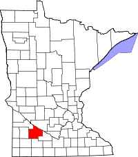
Location in the state of Minnesota
Minnesota's location in the U.S.Founded February 6, 1862 [1] Named for juniper (known locally as redcedar) and willow trees in the area Seat Redwood Falls Largest city Redwood Falls Area
- Total
- Land
- Water
881.24 sq mi (2,282 km²)
879.73 sq mi (2,278 km²)
1.51 sq mi (4 km²), 0.17%Population
- (2010)
- Density
16,059
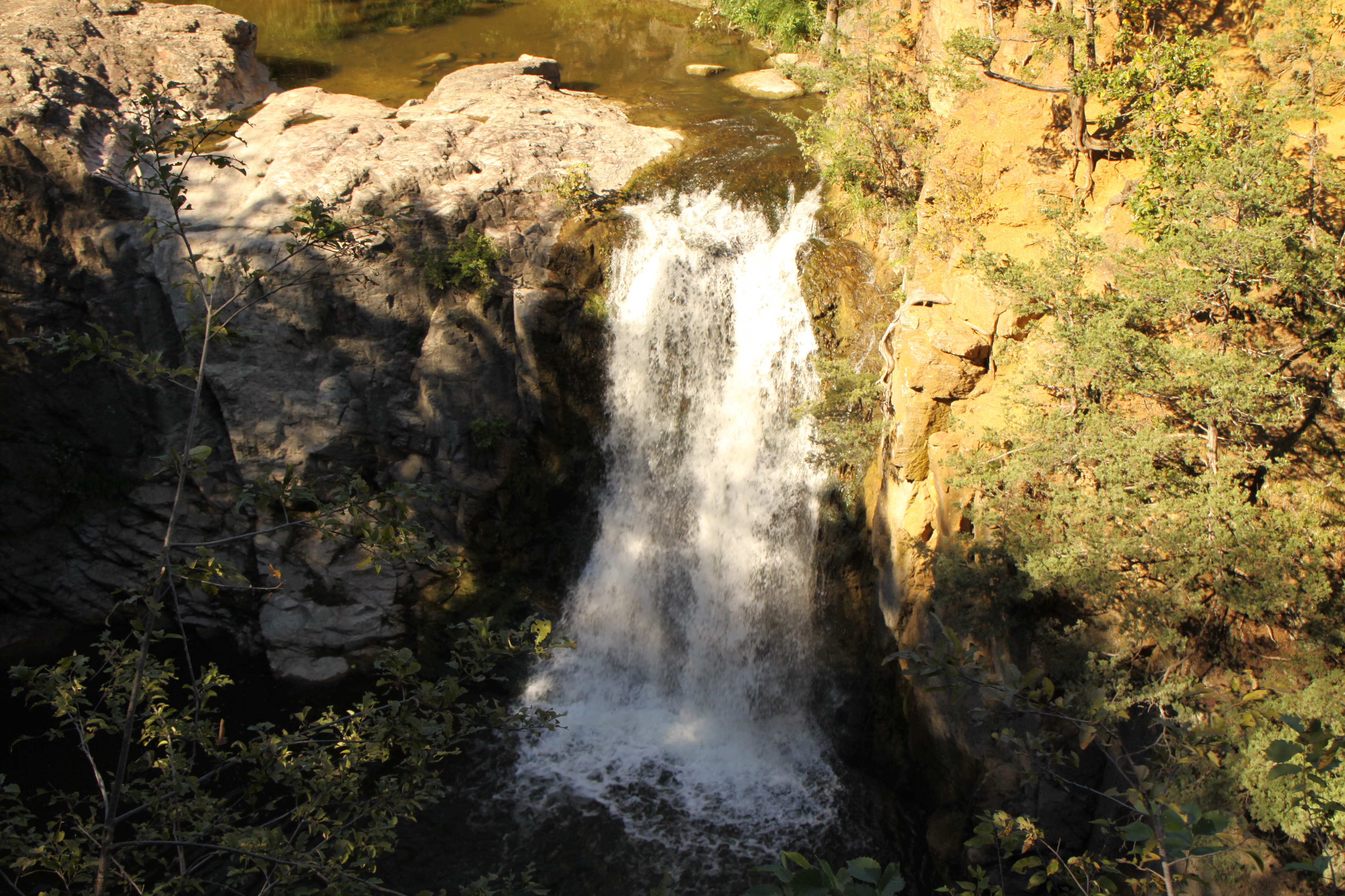
19/sq mi (7/km²)Time zone Central: UTC-6/-5 Website www.co.redwood.mn.us 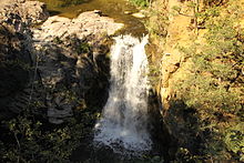 Ramsey Falls
Redwood County is a county located in the U.S. state of Minnesota. As of 2010, the population was 16,059.[1] Its county seat is Redwood Falls[2]. The Lower Sioux Indian Reservation is entirely within the county.
Contents
Geography
According to the 2000 census, the county has a total area of 881.24 square miles (2,282.4 km2), of which 879.73 square miles (2,278.5 km2) (or 99.83%) is land and 1.51 square miles (3.9 km2) (or 0.17%) is water.[3] The Redwood River flows through the county to the Minnesota River.
Lakes
- Daubs Lake: in Vail Township
- Gales Lake: mostly in Gales Township, but the northern part is in Westline Township
- Long Lake: in Swedes Forest Township
- Three Lakes: in Three Lakes Township
- Tiger Lake: in Honner Township
- Lake Redwood: in Redwood Falls, Redwood Township, Minnesota
Major highways
 U.S. Highway 14
 U.S. Highway 71
 Minnesota State Highway 19
 Minnesota State Highway 67
 Minnesota State Highway 68
 Minnesota State Highway 330
Adjacent counties
- Renville County (northeast)
- Brown County (east)
- Cottonwood County (south)
- Murray County (southwest)
- Lyon County (west)
- Yellow Medicine County (northwest)
Demographics
Historical populations Census Pop. %± 1870 1,829 — 1880 5,375 193.9% 1890 9,886 83.9% 1900 17,261 74.6% 1910 18,425 6.7% 1920 20,908 13.5% 1930 20,620 −1.4% 1940 22,290 8.1% 1950 22,127 −0.7% 1960 21,718 −1.8% 1970 20,024 −7.8% 1980 19,341 −3.4% 1990 17,254 −10.8% 2000 16,815 −2.5% 2010 16,059 −4.5% U.S. Decennial Census 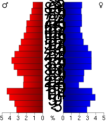 Age pyramid of county residents based on 2000 U.S. census data.
As of the census[4] of 2000, there were 16,815 people, 6,674 households, and 4,524 families residing in the county. The population density was 19 people per square mile (7/km²). There were 7,230 housing units at an average density of 8 per square mile (3/km²). The racial makeup of the county was 94.97% White, 0.13% Black or African American, 3.24% Native American, 0.32% Asian, 0.07% Pacific Islander, 0.43% from other races, and 0.85% from two or more races. 1.14% of the population were Hispanic or Latino of any race. 55.8% were of German and 13.7% Norwegian ancestry according to Census 2000.
There were 6,674 households out of which 31.50% had children under the age of 18 living with them, 57.30% were married couples living together, 7.10% had a female householder with no husband present, and 32.20% were non-families. 28.80% of all households were made up of individuals and 14.70% had someone living alone who was 65 years of age or older. The average household size was 2.44 and the average family size was 3.02.
In the county the population was spread out with 26.50% under the age of 18, 6.60% from 18 to 24, 24.80% from 25 to 44, 22.70% from 45 to 64, and 19.30% who were 65 years of age or older. The median age was 40 years. For every 100 females there were 99.70 males. For every 100 females age 18 and over, there were 96.50 males.
The median income for a household in the county was $37,352, and the median income for a family was $46,250. Males had a median income of $30,251 versus $21,481 for females. The per capita income for the county was $18,903. About 5.50% of families and 7.70% of the population were below the poverty line, including 8.30% of those under age 18 and 8.80% of those age 65 or over.
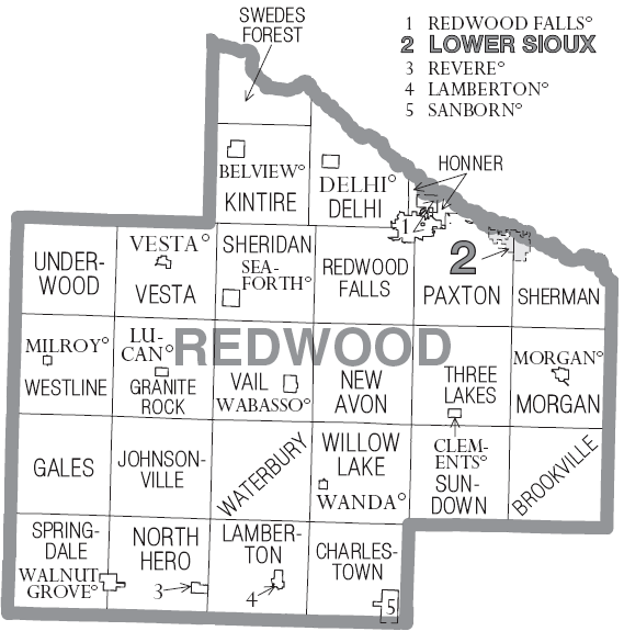
Cities and towns
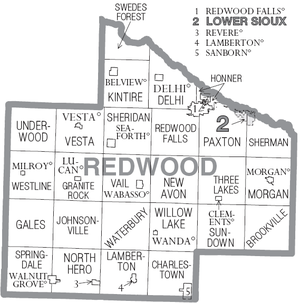 Cities and townships of Redwood County.
Cities Townships † A small section of Redwood Falls extends into Renville County
See also
References
- ^ "2010 Census Redistricting Data (Public Law 94-171) Summary File". American FactFinder. United States Census Bureau. http://factfinder2.census.gov/faces/tableservices/jsf/pages/productview.xhtml?pid=DEC_10_PL_GCTPL2.ST05&prodType=table. Retrieved 25 April 2011.
- ^ "Find a County". National Association of Counties. http://www.naco.org/Counties/Pages/FindACounty.aspx. Retrieved 2011-06-07.
- ^ "Census 2000 U.S. Gazetteer Files: Counties". United States Census. http://www.census.gov/tiger/tms/gazetteer/county2k.txt. Retrieved 2011-02-13.
- ^ "American FactFinder". United States Census Bureau. http://factfinder.census.gov. Retrieved 2008-01-31.
External links

Yellow Medicine County Renville County Lyon County 
Brown County  Redwood County, Minnesota

Murray County Cottonwood County Municipalities and communities of Redwood County, Minnesota Cities 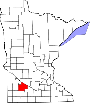
Townships Brookville | Charlestown | Delhi | Gales | Granite Rock | Honner | Johnsonville | Kintire | Lamberton | Morgan | New Avon | North Hero | Paxton | Redwood Falls | Sheridan | Sherman | Springdale | Sundown | Swedes Forest | Three Lakes | Underwood | Vail | Vesta | Waterbury | Westline | Willow Lake
Indian
reservationFootnotes ‡This populated place also has portions in an adjacent county or counties
Categories:- Minnesota counties
- Redwood County, Minnesota


Wikimedia Foundation. 2010.