- Sanborn, Minnesota
Infobox Settlement
official_name = Sanborn, Minnesota
settlement_type =City
nickname =
motto =
imagesize =
image_caption =
image_
imagesize =
image_caption =
image_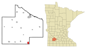
mapsize = 250x200px
map_caption = Cities and townships of Redwood County.
mapsize1 =
map_caption1 =subdivision_type = Country
subdivision_name =United States
subdivision_type1 = State
subdivision_name1 =Minnesota
subdivision_type2 = County
subdivision_name2 = Redwoodgovernment_footnotes =
government_type =
leader_title =
leader_name =
leader_title1 =
leader_name1 =
established_title =
established_date =unit_pref = Imperial
area_footnotes =area_magnitude =
area_total_km2 = 5.5
area_land_km2 = 5.5
area_water_km2 = 0.0
area_total_sq_mi = 2.1
area_land_sq_mi = 2.1
area_water_sq_mi = 0.0population_as_of = 2000
population_footnotes =
population_total = 434
population_density_km2 = 78.7
population_density_sq_mi = 203.8timezone = Central (CST)
utc_offset = -6
timezone_DST = CDT
utc_offset_DST = -5
elevation_footnotes =
elevation_m = 335
elevation_ft = 1099
latd = 44 |latm = 12 |lats = 33 |latNS = N
longd = 95 |longm = 7 |longs = 44 |longEW = Wpostal_code_type =
ZIP code
postal_code = 56083
area_code = 507
blank_name = FIPS code
blank_info = 27-58306GR|2
blank1_name = GNIS feature ID
blank1_info = 0651130GR|3
website =
footnotes =Sanborn is a city in Redwood County,
Minnesota ,United States . The population was 434 at the 2000 census.Geography
According to the
United States Census Bureau , the city has a total area of 2.1square mile s (5.5km² ), all of it land. The Cottonwood River flows through the city.cite book| title= Minnesota Atlas & Gazetteer |year=1994 |publisher=DeLorme |location=Yarmouth, Me. |isbn= 0-89933-222-6 |pages= p. 30]U.S. Highway 71 runs along the eastern edge of Sanborn, a short distance south of its intersection with U.S. Highway 14.
Demographics
As of the
census GR|2 of 2000, there were 434 people, 179 households, and 127 families residing in the city. Thepopulation density was 203.8 people per square mile (78.7/km²). There were 199 housing units at an average density of 93.4/sq mi (36.1/km²). The racial makeup of the city was 99.08% White and 0.92% Native American. Hispanic or Latino of any race were 0.69% of the population.There were 179 households out of which 31.8% had children under the age of 18 living with them, 60.9% were married couples living together, 6.1% had a female householder with no husband present, and 28.5% were non-families. 27.4% of all households were made up of individuals and 16.8% had someone living alone who was 65 years of age or older. The average household size was 2.42 and the average family size was 2.93.
In the city the population was spread out with 26.3% under the age of 18, 8.3% from 18 to 24, 21.2% from 25 to 44, 22.6% from 45 to 64, and 21.7% who were 65 years of age or older. The median age was 40 years. For every 100 females there were 100.0 males. For every 100 females age 18 and over, there were 102.5 males.
The median income for a household in the city was $36,375, and the median income for a family was $47,813. Males had a median income of $25,682 versus $21,016 for females. The
per capita income for the city was $19,809. About 3.0% of families and 6.5% of the population were below thepoverty line , including 4.2% of those under age 18 and 3.8% of those age 65 or over.History
Sanborn was
plat ted in 1881 and incorporated November 17, 1891. It was named in honor of Sherburn Sanborn, who for many years was an officer of the Chicago and Northwestern railway company. [Upham, Warren (1969 reprint) "Minnesota Geographic Names", p. 452. St Paul, Minnesota: Minnesota Historical Society, ISBN 87351-051-8.] Sanbornpost office was established May 17, 1880. [Patera, Alan H. and Gallagher, John S. (1978) "The Post Offices of Minnesota", p. 154. Burtonsville, Maryland: The Depot.]References
External links
* [http://www.rrcnet.org/~sanborn/ Town website]
Wikimedia Foundation. 2010.