- Redwood River
Geobox River
name = Redwood River
native_name =
other_name =
other_name1 =
image_size = 290
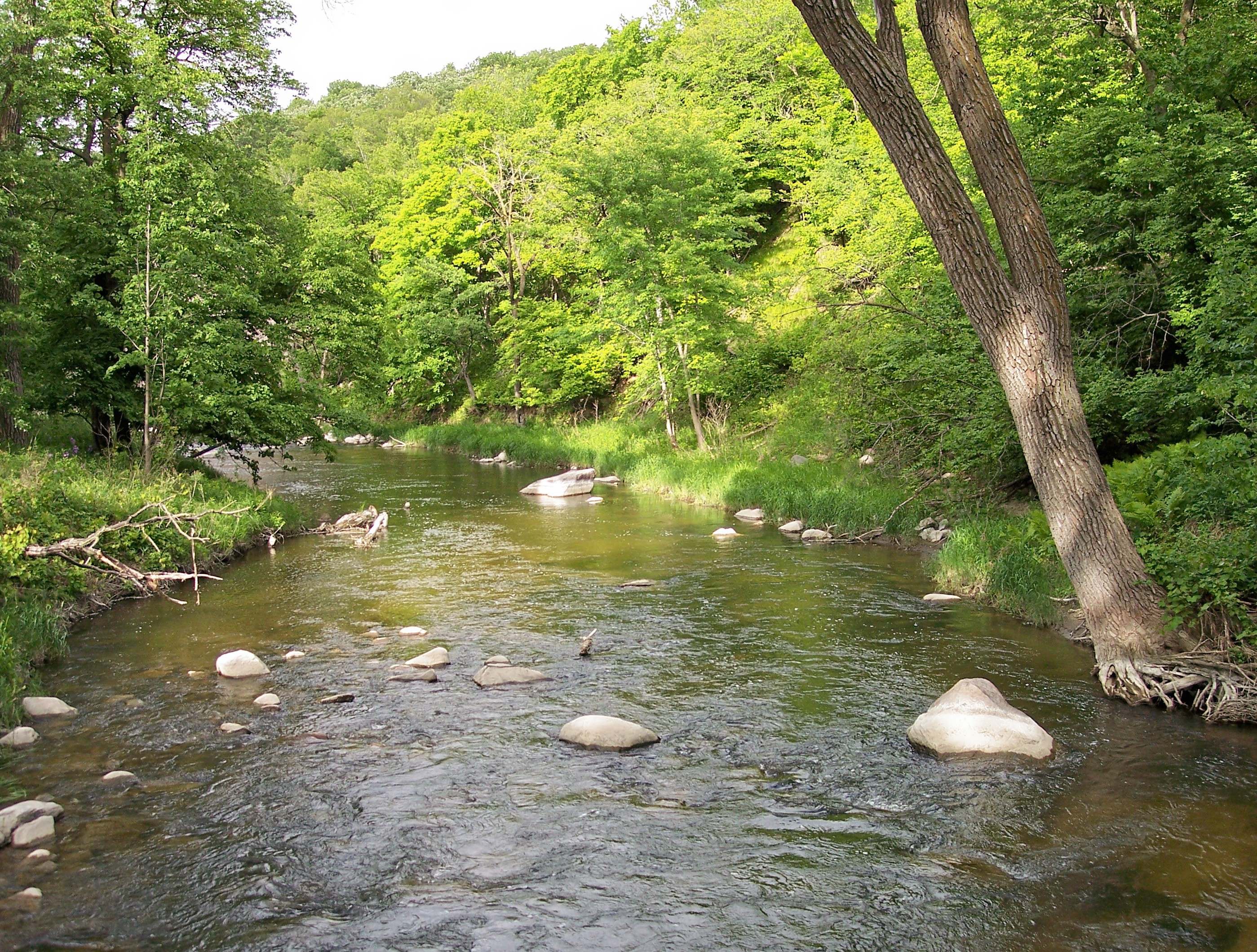
image_caption = The Redwood River inCamden State Park in 2007
country = United States
state = Minnesota
region =
region1 =
district =
district1 =
city =
city1 =
length_imperial = 127.1
length_note = cite web |url= http://mrbdc.mnsu.edu/major/redwood/desc27.html |title= Redwood River Major Watershed. |pages= [http://mrbdc.mnsu.edu/major/redwood/descstream27.html Streams within the Redwood River Major Watershed] |publisher= Minnesota River Basin Data Center.Minnesota State University, Mankato |date= 2000-06-06 |accessdate= 2007-06-03]
watershed_imperial = 705
watershed_note = [cite web |url= http://mrbdc.mnsu.edu/major/redwood/desc27.html |title= Redwood River Major Watershed. |pages= [http://mrbdc.mnsu.edu/major/cottonwd/descgen29.html General Description] |publisher= Minnesota River Basin Data Center.Minnesota State University, Mankato |date= 2000-06-06 |accessdate= 2007-06-03]
discharge_location = near Redwood Falls
discharge_imperial = 153
discharge_max_imperial = 19700
discharge_min_imperial = 0
discharge_note = cite web |url=http://pubs.usgs.gov/wdr/2005/wdr-mn-05-1/ |pages = [http://pubs.usgs.gov/wdr/2005/wdr-mn-05-1/05316500.2005.sw.pdf Redwood River near Redwood Falls, MN] |title=Water Resources Data in Minnesota, Water Year 2005 Annual Report. |first= G. B. |last=Mitton |coauthors=K. G. Guttormson, G. W. Stratton, E. S. Wakeman |publisher=United States Geological Survey |accessdate=2007-06-03]
discharge1_location = near Marshall
discharge1_imperial = 69.5
discharge1_note = cite web |url=http://pubs.usgs.gov/wdr/2005/wdr-mn-05-1/ |pages = [http://pubs.usgs.gov/wdr/2005/wdr-mn-05-1/05315000.2005.sw.pdf Redwood River near Marshall, MN] |title=Water Resources Data in Minnesota, Water Year 2005 Annual Report. |first= G. B. |last=Mitton |coauthors=K. G. Guttormson, G. W. Stratton, E. S. Wakeman |publisher=United States Geological Survey |accessdate=2007-06-03]
source_name =
source_location = Aetna Township
source_district = Pipestone County
source_region =
source_lat_d = 44
source_lat_m = 10
source_lat_s = 03
source_lat_NS = N
source_long_d = 96
source_long_m = 10
source_long_s = 18
source_long_EW = W
source_coordinates_note = cite web |url=Gnis3|658010 |title=Geographic Names Information System entry for Redwood River (Feature ID #658010) |publisher=Geographic Names Information System |accessdate=2007-06-03]
source_elevation_imperial = 1909
source_elevation_note =Google Earth elevation forGNIS coordinates. Retrieved on2007-06-03 .]
source_length_imperial =
mouth_name = Minnesota River
mouth_location = near Redwood Falls
mouth_district = Redwood County
mouth_region =
mouth_lat_d = 44
mouth_lat_m = 34
mouth_lat_s = 16
mouth_lat_NS = N
mouth_long_d = 95
mouth_long_m = 05
mouth_long_s = 18
mouth_long_EW = W
mouth_coordinates_note =
mouth_elevation_imperial = 827
mouth_elevation_note =
tributary_left =
tributary_left1 =
tributary_right =
tributary_right1 =
free_name =
free_value =

map_size = 225
map_caption =The Redwood River is a
tributary of theMinnesota River , 127 miles (205 km) long, in southwesternMinnesota in theUnited States . Via the Minnesota River, it is part of the watershed of theMississippi River , draining an area of 705 square miles (1,826 km²) in an agricultural region. The river's name is believed to refer to the reddish bark ofdogwood growing along streams in the region.cite book| last= Waters |first= Thomas F. | title= The Streams and Rivers of Minnesota |year= 2006 |publisher=University of Minnesota Press |location=Minneapolis |isbn= 0-8166-0960-8 |pages= pp. 288-303 |chapter= The Southwest: Rivers of the Coteau des Prairies]The source of the Redwood River is in Aetna Township in northeastern Pipestone County, approximately four miles (6 km) west of Ruthton, on the
Coteau des Prairies , a morainicplateau dividing the Mississippi andMissouri River watersheds. It flows initially eastwardly as an intermittent stream, through Ruthton and into northwestern Murray County, then northwardly into Lyon County, where it turns northeastward and flows through Russell, Lynd, and Marshall. Between Russell and Marshall, the river flows off the Coteau in a wooded valley, dropping 300 feet (90 m) in 15 miles (24 km);Camden State Park is located along this stretch of the river.Downstream of Marshall the Redwood flows through a flat
till plain and turns eastward into Redwood County, passing Vesta and Seaforth; sections of the river in this stretch have been straightened to form agriculturalditch es. In Redwood Falls the river enters the wooded valley of the Minnesota River, falling 100 feet (30 m) in one mile (2 km) over granite ledges in Alexander Ramsey City Park; it flows into the Minnesota shortly downstream of the city. A dam forming Redwood Lake in Redwood Falls was formerly used forhydroelectricity generation and is presently maintained for recreational use.cite book| title= Minnesota Atlas & Gazetteer |year=1994 |publisher=DeLorme |location=Yarmouth, Me. |isbn= 0-89933-222-6 |pages= pp. 28-30] cite web |url= http://www.pca.state.mn.us/water/basins/mnriver/watersheds.html |title= Watersheds of the Minnesota River Basin. |pages= [http://www.pca.state.mn.us/water/basins/mnriver/watershed-redwood.pdf Minnesota River Basin: Redwood River Watershed] |publisher= Minnesota Pollution Control Agency |date= 2005-12-01 |accessdate= 2007-06-03]Principal tributaries of the Redwood River include Coon Creek, 37 miles (60 km) long, which flows from Lake Benton in Lincoln County westwardly to Russell in Lyon County; Three Mile Creek, 50 miles (81 km) long, which rises in Lincoln County and flows northeastwardly and southeastwardly through Lyon County, joining the Redwood downstream of Marshall; and Ramsey Creek, 10 miles (16 km) long, which flows over a waterfall in Ramsey City Park in Redwood Falls.
Approximately 82% of the land in the Redwood River watershed is used for agriculture, primarily for the cultivation of corn and
soybean s. Hundreds of miles of streams in the watershed have been converted to agricultural ditches.Flow rate
At the
United States Geological Survey 'sstream gauge near Redwood Falls, 8.5 miles (13.7 km) upstream from the river's mouth, the annual mean flow of the river between 1909 and 2005 was 153cubic feet per second (4 m³/s). The highest recorded flow during the period was 19,700 ft³/s (558 m³/s) onJune 18 ,1957 . Readings of zero were recorded on numerous days in 1940 and 1959.At an upstream gauge near Marshall, the annual mean flow between 1940 and 2005 was 69.5 ft³/s (2 m³/s). The highest recorded flow during the period was 6,380 ft³/s (181 m³/s) on
May 9 ,1993 . Readings of zero were recorded on numerous days during several years.ee also
*
List of rivers in Minnesota References
Wikimedia Foundation. 2010.