- Le Sueur County, Minnesota
-
Le Sueur County, Minnesota 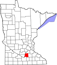
Location in the state of Minnesota
Minnesota's location in the U.S.Founded March 5, 1853 [1] Named for Pierre-Charles Le Sueur, a French-Canadian trader and explorer. Seat Le Center Largest city Mankato Area
- Total
- Land
- Water
473.86 sq mi (1,227 km²)
448.50 sq mi (1,162 km²)
25.36 sq mi (66 km²), 5.35%Population
- (2010)
- Density
27,703
57/sq mi (22/km²)Time zone Central: UTC-6/-5 Website www.co.le-sueur.mn.us Le Sueur County is a county located in the U.S. state of Minnesota. As of 2010, the population was 27,703.[1] Its county seat is Le Center.[2] The county is named for the French explorer Pierre-Charles Le Sueur who visited the area in 1700.[3]
Contents
Geography
According to the 2000 census, the county has a total area of 473.86 square miles (1,227.3 km2), of which 448.50 square miles (1,161.6 km2) (or 94.65%) is land and 25.36 square miles (65.7 km2) (or 5.35%) is water.[4]
Lakes
- Borer Lake: in Montgomery Township
- Bossuot Lake: in Cordova Township
- Clear Lake: in Lexington Township
- Diamond Lake: in Kilkenny Township
- Dietz Lake: in Lanesburgh Township
- Dog Lake: in Cleveland Township
- Dora Lake: in Kilkenny Township
- Eggert Lake: in Lanesburgh Township
- Ely Lake: in Sharon Township
- Emily Lake: mostly in Cleveland Township, but the southern fifth is in Washington Township
- Fish Lake: in Elysian Township
- German Lake: mostly in Elysian Township, but the northern shore extends into Cordova Township
- Goldsmith Lake: in Cleveland Township
- Goose Lake: in Cordova Township
- Goose Lake: there is another Goose Lake in Waterville Township
- Gorman Lake: in Cordova Township
- Greenleaf Lake: in Montgomery Township
- Harkridge Lake: in Lexington Township
- Huoy Lake: in Cleveland Township
- Horseshoe Lake: western two thirds is in Waterville Township; the eastern two thirds is in Rice County
- Lake Emily: in Kasota Township
- Lake Frances: in Elysian Township
- Lake Henry: in Cleveland Township
- Lake Jefferson: the southwestern part is in Washington Township; the northwestern part is in Cleveland Township; the eastern part is in Elysian Township and the extreme northeastern part just barely reaches into in Cordova Township
- Lake Mabel: in Kilkenny Township
- Lake Pepin: in Lanesburgh Township
- Lake Tustin: in Elysian Township
- Lake Volney: mostly in Kilkenny Township, but the northern part is in Montgomery Township, the northwestern part is in Lexington Township, and the southwestern part is in Cordova Township
- Lake Washington: the northeastern two thirds is in Washington Township and the southwestern third is in Kasota Township
- Mareks Lake: in Lexington Township
- Mary Lake: in Lexington Township
- Mud Lake: in Cordova Township
- Mud Lake: there is another Mud Lake in Lanesburgh Township
- Mud Lake: there is a third Mud Lake in Lexington Township
- North Goldsmith Lake: in Cleveland Township
- Perch Lake: in Elysian Township
- Rays Lake: in Elysian Township
- Rice Lake: in Montgomery Township
- Roemhildts Lake: in Elysian Township
- Round Lake: in Elysian Township
- Sabre Lake: in Kilkenny Township
- Sakatah Lake: western half is in Waterville Township; the eastern half is in Rice County
- Sanborn Lake: in Lanesburgh Township
- Sasse Lake: in Elysian Township
- Savidge Lake: in Cleveland Township
- Scotch Lake: in Cleveland Township
- Shanghai Lake: in Cordova Township
- Sheas Lake: in Derrynane Township
- Silver Lake: in Cleveland Township
- Silver Lake: there is another Silver Lake in Elysian Township
- Sleepy Eye Lake: in Cordova Township
- Steele Lake: in Elysian Township
- Sunfish Lake" almost entirely in Kilkenny Township, but the southern tip extends into Waterville Township
- Tetonka Lake (start of Cannon River): in Waterville Township
- Thomas Lake: in Derrynane Township
- Tyler Lake: in Lexington Township
Major highways
Adjacent counties
- Scott County (north)
- Rice County (east)
- Waseca County (south)
- Blue Earth County (southwest)
- Nicollet County (west)
- Sibley County (northwest)
Demographics
 Age pyramid of county residents based on 2000 U.S. census data.
Historical populations Census Pop. %± 1860 5,318 — 1870 11,607 118.3% 1880 16,303 40.5% 1890 19,057 16.9% 1900 20,234 6.2% 1910 18,609 −8.0% 1920 17,870 −4.0% 1930 17,990 0.7% 1940 19,227 6.9% 1950 19,088 −0.7% 1960 19,906 4.3% 1970 21,331 7.2% 1980 23,434 9.9% 1990 23,929 2.1% 2000 25,426 6.3% 2010 27,703 9.0% U.S. Decennial Census As of the census[5] of 2000, there were 25,426 people, 9,630 households, and 6,923 families residing in the county. The population density was 57 people per square mile (22/km²). There were 10,858 housing units at an average density of 24 per square mile (9/km²). The racial makeup of the county was 96.56% White, 0.15% Black or African American, 0.26% Native American, 0.30% Asian, 0.04% Pacific Islander, 2.02% from other races, and 0.67% from two or more races. 3.92% of the population were Hispanic or Latino of any race. 44.9% were of German, 9.0% Czech, 9.0% Norwegian and 8.2% Irish ancestry according to Census 2000. 94.0% spoke English, 3.5% Spanish and 1.7% Czech as their first language.
There were 9,630 households out of which 34.40% had children under the age of 18 living with them, 61.40% were married couples living together, 6.80% had a female householder with no husband present, and 28.10% were non-families. 23.70% of all households were made up of individuals and 10.90% had someone living alone who was 65 years of age or older. The average household size was 2.61 and the average family size was 3.10.
In the county the population was spread out with 27.40% under the age of 18, 7.50% from 18 to 24, 27.80% from 25 to 44, 23.20% from 45 to 64, and 14.10% who were 65 years of age or older. The median age was 37 years. For every 100 females there were 100.30 males. For every 100 females age 18 and over, there were 99.70 males.
The median income for a household in the county was $45,933, and the median income for a family was $53,000. Males had a median income of $34,196 versus $24,214 for females. The per capita income for the county was $20,151. About 4.80% of families and 6.90% of the population were below the poverty line, including 7.50% of those under age 18 and 10.40% of those age 65 or over.
Cities and towns
Cities Townships Unincorporated Village - Cleveland
- Elysian †
- Heidelberg
- Kasota
- Le Center
- Le Sueur †
- Kilkenny
- Mankato (very small portion) †
- Montgomery
- New Prague †
- Waterville
- Henderson Station
- Lexington
- Marysburg †
- Union Hill †
† Small parts of these ccommunities extend into another county.
See also
References
- ^ "2010 Census Redistricting Data (Public Law 94-171) Summary File". American FactFinder. United States Census Bureau. http://factfinder2.census.gov/faces/tableservices/jsf/pages/productview.xhtml?pid=DEC_10_PL_GCTPL2.ST05&prodType=table. Retrieved 25 April 2011.
- ^ "Find a County". National Association of Counties. http://www.naco.org/Counties/Pages/FindACounty.aspx. Retrieved 2011-06-07.
- ^ http://www.co.le-sueur.mn.us/CountyHistory.html
- ^ "Census 2000 U.S. Gazetteer Files: Counties". United States Census. http://www.census.gov/tiger/tms/gazetteer/county2k.txt. Retrieved 2011-02-13.
- ^ "American FactFinder". United States Census Bureau. http://factfinder.census.gov. Retrieved 2008-01-31.
External links

Sibley County Scott County Nicollet County 
Rice County  Le Sueur County, Minnesota

Blue Earth County Waseca County Municipalities and communities of Le Sueur County, Minnesota Cities Cleveland | Elysian‡ | Heidelberg | Kasota | Le Center | Le Sueur‡ | Kilkenny | Mankato‡ | Montgomery | New Prague‡ | Waterville

Townships Cleveland | Cordova | Derrynane | Elysian | Kasota | Kilkenny | Lanesburgh | Lexington | Montgomery | Ottawa | Sharon | Tyrone | Washington | Waterville
Unincorporated
communityCordova | Greenland | Lexington | Ottawa | St. Henry | St. Thomas | Union Hill‡
Footnotes ‡This populated place also has portions in an adjacent county or counties
Categories:- Minnesota counties
- Le Sueur County, Minnesota


Wikimedia Foundation. 2010.