- National Register of Historic Places listings in Le Sueur County, Minnesota
-
List of NRHP listings in Le Sueur County, Minnesota. See List of RHPs in MN.
Current listings
[1] Landmark name Image Date listed Location City or town Summary 1 John R. Andrews House October 10, 1978 County Highway 19
44°17′07″N 93°54′33″W / 44.285278°N 93.909167°WKasota 2 Bridge No. 4846 (1) February 17, 1981 County Highway 102 over Minnesota Highway 22
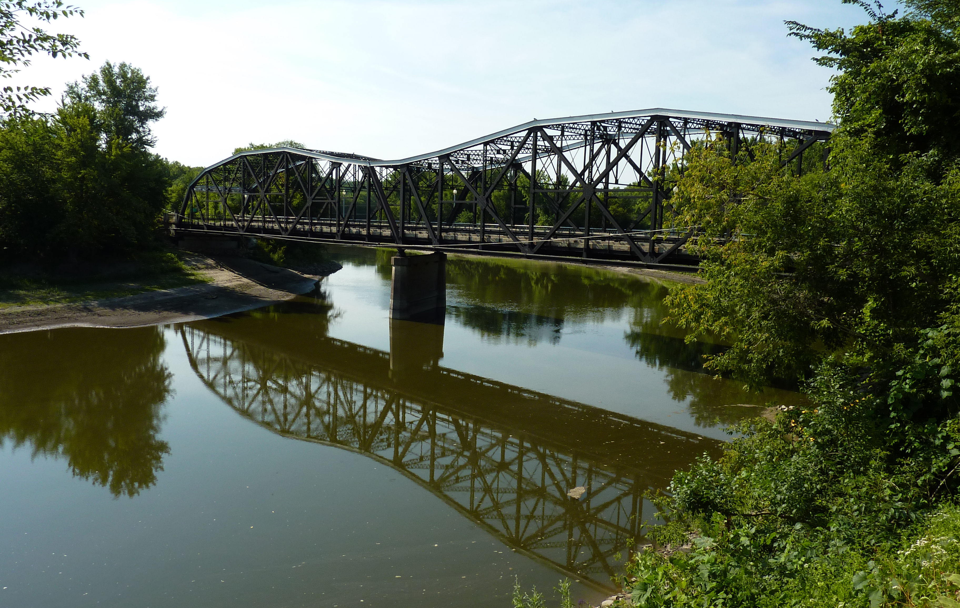
44°18′24″N 93°57′31″W / 44.306667°N 93.958611°WKasota 3 Broadway Bridge 
August 5, 1999 Minnesota Highway 99 over the Minnesota River
44°19′29″N 93°57′10″W / 44.324722°N 93.952778°WOttawa Township Listed for both Le Sueur and Nicollet Counties. 4 Carson H. Cosgrove House 
March 15, 1982 228 S. 2nd
44°27′32″N 93°54′57″W / 44.458889°N 93.915833°WLe Sueur 5 Arthur Dehn House November 19, 1982 Herbert St.
44°13′26″N 93°34′29″W / 44.223889°N 93.574722°WWaterville 6 Dodd Road Discontiguous District 
June 12, 2003 Roughly County Road 1 to Minnesota Highway 21, County Road 136 west of Kilkenny, continuing northwest to County Road 2, and County Road 148 west of Cleveland.
44°21′22″N 93°34′18″W / 44.356111°N 93.571667°WForest 7 Elysian Public School 
February 17, 1981 4th and Frank Sts.
44°12′04″N 93°40′26″W / 44.201111°N 93.673889°WElysian 8 First National Bank 
March 15, 1982 112 E. Main
44°32′35″N 93°34′35″W / 44.543056°N 93.576389°WNew Prague 9 Geldner Sawmill 
June 11, 1975 County Highway 13
44°16′31″N 93°44′53″W / 44.275278°N 93.748056°WCleveland 10 German Evangelical Salem Church March 15, 1982 County Road 156
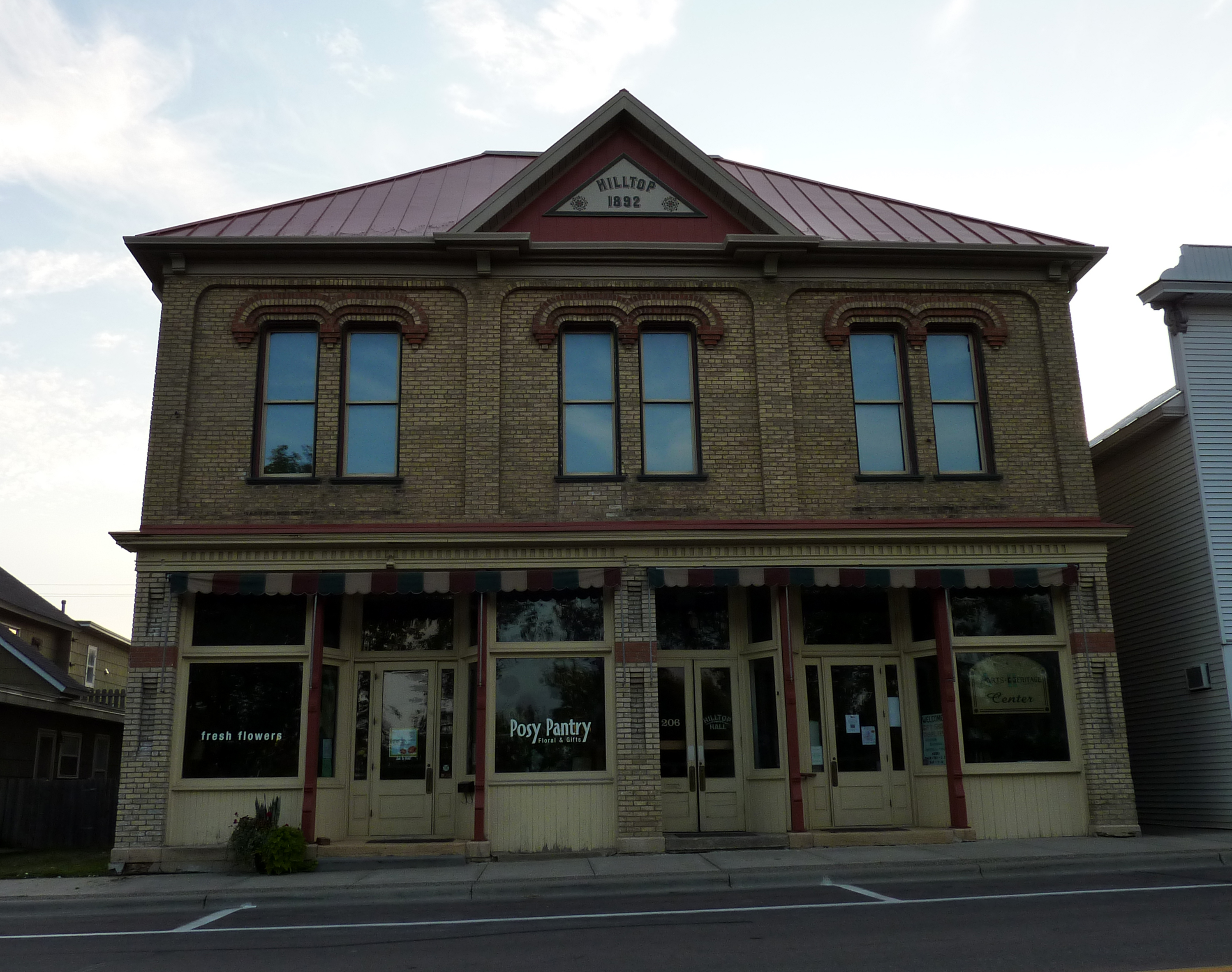
44°29′08″N 93°47′16″W / 44.485556°N 93.787778°WLe Sueur 11 Hilltop Hall 
March 15, 1982 206 N. 1st St.
44°26′25″N 93°34′52″W / 44.440278°N 93.581111°WMontgomery 12 Hotel Broz 
March 15, 1982 212 W. Main
44°32′35″N 93°34′47″W / 44.543056°N 93.579722°WNew Prague 13 Kasota Township Hall 
February 17, 1981 Hill and Rice Sts.
44°17′33″N 93°57′54″W / 44.2925°N 93.965°WKasota 14 Kasota Village Hall 
February 17, 1981 Cherry and Webster Sts.
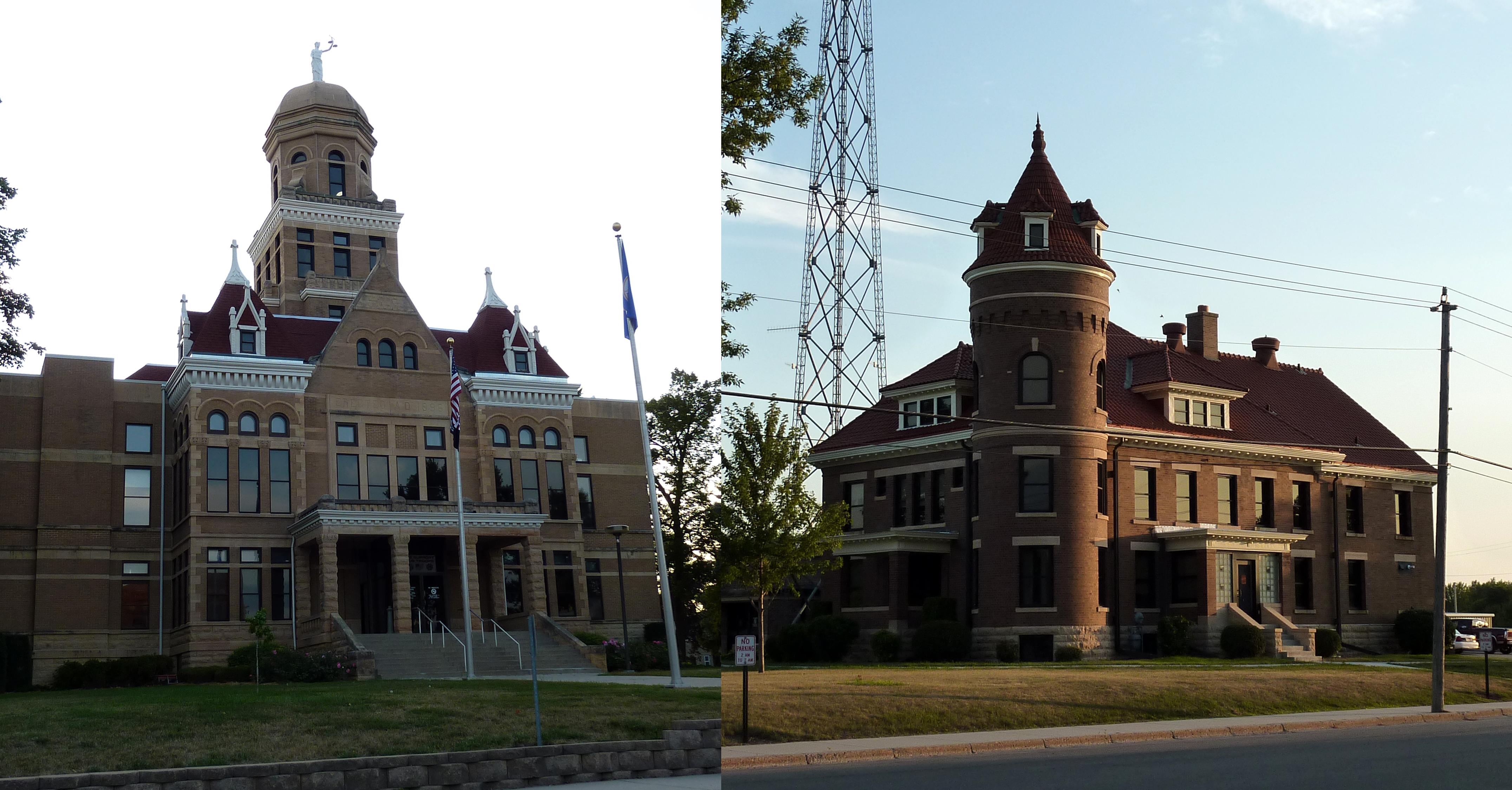
44°17′29″N 93°58′00″W / 44.291389°N 93.966667°WKasota 15 Le Sueur County Courthouse and Jail 
February 17, 1981 88 S. Park Ave. and 130 S. Park Ave.
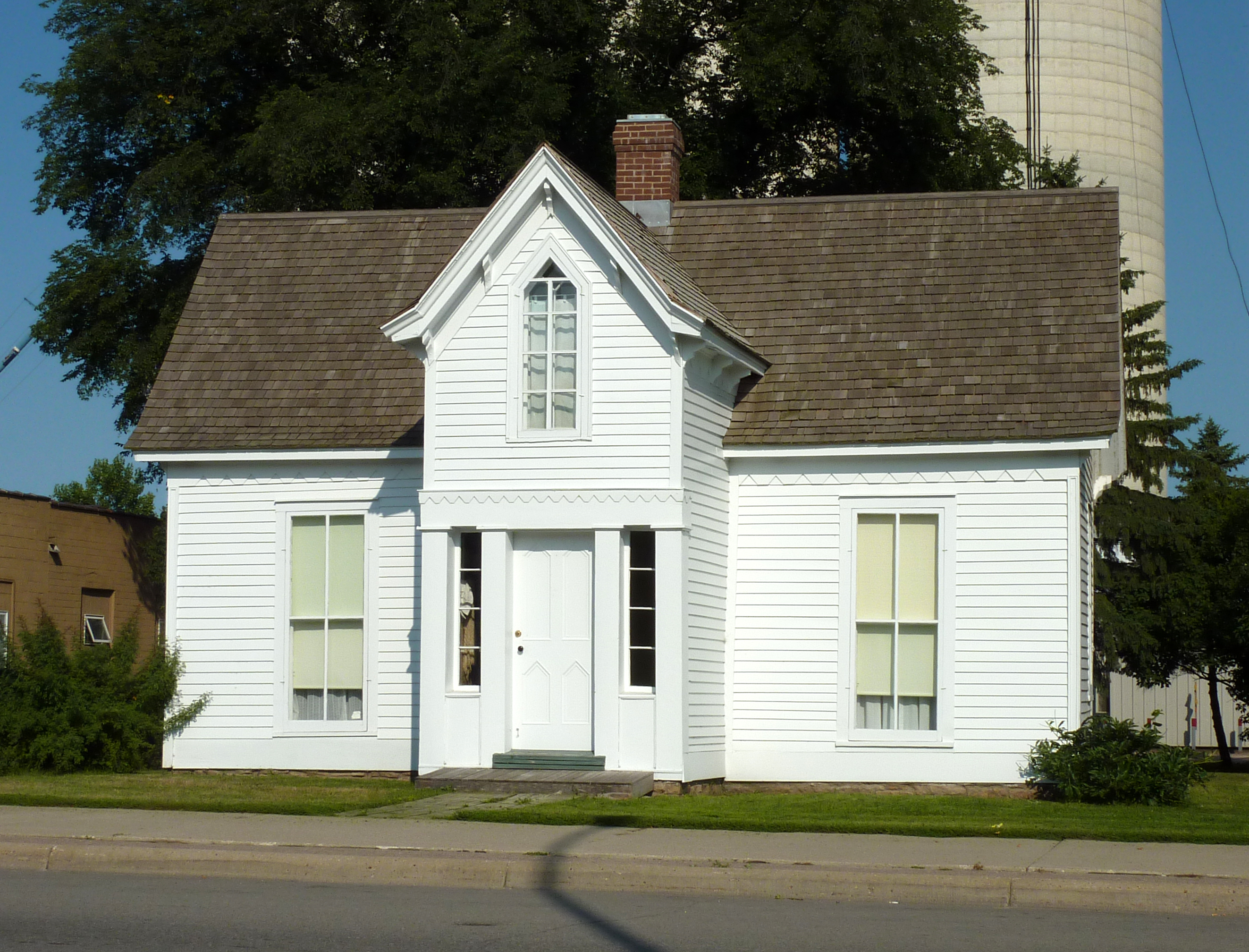
44°23′18″N 93°43′55″W / 44.388333°N 93.731944°WLe Center 16 Dr. William W. Mayo House 
November 25, 1969 118 N. Main St.
44°27′44″N 93°54′53″W / 44.462222°N 93.914722°WLe Sueur 17 Methodist Episcopal Church 
March 15, 1982 Liberty and Whittier St.
44°23′03″N 93°56′52″W / 44.384167°N 93.947778°WOttawa Now referred to as the "Little Stone Church". 18 Needham-Hayes House 
March 15, 1982 Off Railroad St.
44°22′57″N 93°56′37″W / 44.3825°N 93.943611°WLe Sueur 19 Ottawa Township Hall 
March 15, 1982 Buchanan and Bryant Sts.
44°23′00″N 93°56′46″W / 44.383333°N 93.946111°WOttawa 20 John Rinshed House 
March 15, 1982 Sumner and Whittier Sts.
44°22′56″N 93°56′52″W / 44.382222°N 93.947778°WOttawa 21 Charles Schwartz House and Barn 
March 15, 1982 Off County Highway 23
44°23′36″N 93°56′52″W / 44.393333°N 93.947778°WOttawa 22 Smith-Cosgrove House 
March 15, 1982 228 S. Main St.
44°27′34″N 93°55′01″W / 44.459444°N 93.916944°WLe Sueur 23 George W. Taylor House 
September 5, 1975 103 S. 2nd St.
44°27′38″N 93°54′49″W / 44.460556°N 93.913611°WLe Sueur 24 Trinity Chapel-Episcopal 
March 15, 1982 Sumner and Exchange Sts.
44°22′56″N 93°56′52″W / 44.382222°N 93.947778°WOttawa 25 Union Hotel 
March 15, 1982 201 Paquin St., E.
44°13′05″N 93°34′02″W / 44.218056°N 93.567222°WWaterville 26 Westerman Lumber Office and House 
March 15, 1982 201 S. 1st St.
44°26′16″N 93°34′50″W / 44.437778°N 93.580556°WMontgomery References
- ^ Numbers represent an ordering by significant words. Various colorings, defined here, differentiate National Historic Landmark sites and National Register of Historic Places Districts from other NRHP buildings, structures, sites or objects.
U.S. National Register of Historic Places Topics Lists by states Alabama • Alaska • Arizona • Arkansas • California • Colorado • Connecticut • Delaware • Florida • Georgia • Hawaii • Idaho • Illinois • Indiana • Iowa • Kansas • Kentucky • Louisiana • Maine • Maryland • Massachusetts • Michigan • Minnesota • Mississippi • Missouri • Montana • Nebraska • Nevada • New Hampshire • New Jersey • New Mexico • New York • North Carolina • North Dakota • Ohio • Oklahoma • Oregon • Pennsylvania • Rhode Island • South Carolina • South Dakota • Tennessee • Texas • Utah • Vermont • Virginia • Washington • West Virginia • Wisconsin • WyomingLists by territories Lists by associated states Other Categories:- National Register of Historic Places in Minnesota by county
- Le Sueur County, Minnesota
- Buildings and structures in Le Sueur County, Minnesota


Wikimedia Foundation. 2010.