- North Oaks, Minnesota
-
"North Oaks" redirects here. For the small community in Indiana, see North Oaks, Indiana.
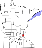
North Oaks, Minnesota — City — The remaining buildings of North Oaks Farm are preserved with the city. Location of North Oaks, Minnesota
Coordinates: 45°5′29″N 93°5′26″W / 45.09139°N 93.09056°W Country United States State Minnesota County Ramsey Area – Total 8.7 sq mi (22.4 km2) – Land 7.3 sq mi (18.9 km2) – Water 1.3 sq mi (3.5 km2) Elevation 938 ft (286 m) Population (2010)[1] – Total 4,469 – Density 531.0/sq mi (205.0/km2) Time zone Central (CST) (UTC-6) – Summer (DST) CDT (UTC-5) ZIP codes 55126, 55127 Area code(s) 651 FIPS code 27-47104[2] GNIS feature ID 0648674[3] North Oaks is a suburb 10 miles (16 km) north of Saint Paul in Ramsey County in the U.S. state of Minnesota. The population was 4,469 at the 2010 census.[1]
Formerly a gated community that now posts private access signage, all land is owned by homeowners with the North Oaks Home Owners Association maintaining all roads, plowing, parks, facilities, and recreation trails. Each homeowner's property extends halfway into the street. There is also a city government with a Mayor and City Council that administers basic services such as fire, police, planning, and licensing. The City owns no property. As such the Metropolitan Council has no jurisdiction over the city's comprehensive plan within Minneapolis-Saint Paul the sixteenth largest metropolitan area in the United States.
Contents
History
Structured around Pleasant Lake, the area began as a water source for the Saint Paul municipal water system, which still maintains water access rights today. The land was later purchased by Saint Paul magnate James J. Hill in 1883 and expanded into a 5,000-acre (20 km2) breeding and hobby farm.
His son Louis Hill later owned North Oaks Farm until death in 1950. Ownership passed to Louis' children who decided to develop the land into a model residential community. They incorporated the North Oaks Company with a mission to build with respect for the natural environment, having witnessed metropolitan sprawl during this time. To ensure their mission would be fulfilled, land was subdivided and sold with a warranty deed that created the North Oaks Home Owners’ Association (NOHOA) to be responsible for roads and recreation. Each deed placed each home's property line half way into the street, placing all roads into private ownership.
Remaining land in the city is owned by the North Oaks Company. The original farm buildings have been restored and are viewable to the public along with informational displays; tours are also available. Two of the remaining structures, the Blacksmith Shop and Machine Shop and Dairy Building, are listed on the National Register of Historic Places.
In May 2008, NOHOA sent a letter to internet search company Google, stating that its Street View software contained images that violated their trespassing ordinance, and requested their removal.[4]
Geography
According to the United States Census Bureau, the city has a total area of 8.7 square miles (23 km2), of which, 7.3 square miles (19 km2) of it is land and 1.4 square miles (3.6 km2) of it (15.59%) is water. County Road 96 serves as a main route.
Demographics
As of the census[2] of 2000, there were 3,883 people, 1,300 households, and 1,177 families residing in the city. The population density was 531.0 people per square mile (205.1/km²). There were 1,332 housing units at an average density of 182.1 per square mile (70.4/km²). The racial makeup of the city was 93.33% White, 0.31% African American, 0.15% Native American, 4.61% Asian, 0.03% Pacific Islander, 0.57% from other races, and 1.00% from two or more races. Hispanic or Latino of any race were 1.21% of the population.
There were 1,300 households out of which 41.5% had children under the age of 18 living with them, 86.5% were married couples living together, 2.6% had a female householder with no husband present, and 9.4% were non-families. 7.6% of all households were made up of individuals and 3.2% had someone living alone who was 65 years of age or older. The average household size was 2.92 and the average family size was 3.08.
In the city the population was spread out with 27.6% under the age of 18, 4.7% from 18 to 24, 17.6% from 25 to 44, 38.5% from 45 to 64, and 11.6% who were 65 years of age or older. The median age was 45 years. For every 100 females there were 99.2 males. For every 100 females age 18 and over, there were 96.0 males.
The median income for a household in the city was $149,158, and the median income for a family was $152,380. Males had a median income of $100,000 versus $47,019 for females. The per capita income for the city was $72,686. None of the families and 1.9% of the population were living below the poverty line, including no under-eighteens and 9.6% of those over 64. North Oaks is listed among the highest-income places in the United States.
Transportation
The city government does not own any property. Each lot of private property owns half of the road in front of it.[5][6]
References
- ^ a b "2010 Census Redistricting Data (Public Law 94-171) Summary File". American FactFinder. U.S. Census Bureau, 2010 Census. http://factfinder2.census.gov/faces/tableservices/jsf/pages/productview.xhtml?pid=DEC_10_PL_GCTPL2.ST13&prodType=table. Retrieved 23 April 2011.
- ^ a b "American FactFinder". United States Census Bureau. http://factfinder.census.gov. Retrieved 2008-01-31.
- ^ "US Board on Geographic Names". United States Geological Survey. 2007-10-25. http://geonames.usgs.gov. Retrieved 2008-01-31.
- ^ Pabst, Lora (May 31, 2008). "North Oaks tells Google Maps: Keep out - we mean it". Minneapolis Star-Tribune. http://www.startribune.com/lifestyle/19416279.html. Retrieved 2009-04-01.
- ^ "City of North Oaks". http://www.cityofnorthoaks.com/. Retrieved 30 March 2011.
- ^ Frazier, Bart (31 December 2008). "Private Roads Work". Freedom Daily. The Future of Freedom Foundation. http://www.fff.org/freedom/fd0809d.asp. Retrieved 30 March 2011.
Municipalities and communities of Ramsey County, Minnesota Cities Arden Hills | Blaine‡ | Falcon Heights | Gem Lake | Lauderdale | Little Canada | Maplewood | Mounds View | New Brighton | North Oaks | North St. Paul | Roseville | Shoreview | St. Anthony‡ | St. Paul | Spring Lake Park‡ | Vadnais Heights | White Bear Lake‡
Township Unincorporated
communitiesBellaire | Bald Eagle
Footnotes ‡This populated place also has portions in an adjacent county or counties
Coordinates: 45°06′10″N 93°04′45″W / 45.10278°N 93.07917°W
Categories:- Cities in Minnesota
- Populated places in Ramsey County, Minnesota


Wikimedia Foundation. 2010.