- National Register of Historic Places listings in Bridgeport, Connecticut
-
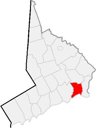
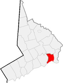 Location of Bridgeport in Fairfield County, Connecticut
This is a list of the National Register of Historic Places listings in Bridgeport, Connecticut.
This is intended to be a complete list of the properties and districts on the National Register of Historic Places in Bridgeport, Connecticut, United States. The locations of National Register properties and districts for which the latitude and longitude coordinates are included below, may be seen in a Google map.[1]
There are 276 properties and districts listed on the National Register in Fairfield County, including 9 National Historic Landmarks. The city of Bridgeport is the location of 55 of these properties and districts; they are listed here, while the 221 properties and districts in the remaining parts of the county, including all of the National Historic Landmarks, are listed separately.
Contents: Counties in Connecticut Fairfield (city of Bridgeport) (town of Greenwich) (city of Stamford) | Hartford (city of Hartford) (town of Southington) (town of West Hartford) (town of Windsor) | Litchfield | Middlesex (city of Middletown) | New Haven (city of New Haven) | New London | Tolland | Windham
-
- This National Park Service list is complete through NPS recent listings posted November 10, 2011.[2]
Current listings
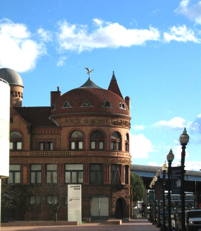
[3] Landmark name[4] Image Date listed Location Neighborhood Summary 1 Barnum Museum 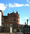
November 7, 1972 805 Main St.
41°10′32″N 73°11′18″W / 41.17556°N 73.18833°WDowntown 2 Barnum/Palliser Historic District December 16, 1982 Roughly bounded by Myrtle and Park Aves., Atlantic and Austin Sts. (both sides)
41°10′4″N 73°11′3″W / 41.16778°N 73.18417°WSouth End 3 Bassickville Historic District September 8, 1987 20-122 Bassick, 667-777 Howard, and 1521-1523 Fairview Aves., and 50-1380 State St.
41°10′16″N 73°12′40″W / 41.17111°N 73.21111°WWest End - West Side 4 Beardsley Park 
March 18, 1999 1875 Noble Ave.
41°12′45″N 73°10′56″W / 41.2125°N 73.18222°WNorth Bridgeport 5 BERKSHIRE NO. 7 December 21, 1978 Bridgeport Harbor
41°10′42″N 73°11′14″W / 41.17833°N 73.18722°WDowntown 6 Bikur Cholim Synagogue November 27, 1995 1545 Iranistan Ave.
41°10′49″N 73°12′22″W / 41.18028°N 73.20611°WWest End - West Side 7 Peyton Randolph Bishop House August 25, 1987 135 Washington Ave.
41°10′38″N 73°11′54″W / 41.17722°N 73.19833°WThe Hollow 8 William D. Bishop Cottage Development Historic District June 28, 1982 Cottage Pl. and Atlantic, Broad, Main and Whiting Sts.
41°10′5″N 73°11′14″W / 41.16806°N 73.18722°WSouth End 9 Black Rock Gardens Historic District September 26, 1990 Bounded by Fairfield St., Brewster St. and Nash Ln., including Rowsley and Haddon Sts.
41°9′27″N 73°13′30″W / 41.1575°N 73.225°WBlack Rock 10 Black Rock Historic District March 15, 1979 Roughly bounded by Black Rock Harbor, Grovers Ave., Beacon and Prescott Sts.
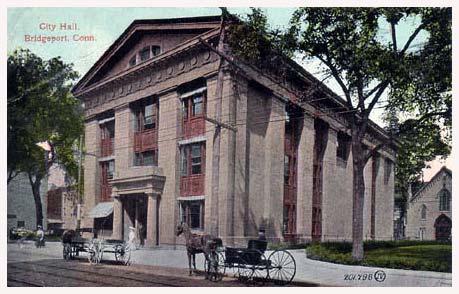
41°9′11″N 73°13′17″W / 41.15306°N 73.22139°WBlack Rock 11 Bridgeport City Hall 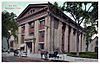
September 19, 1977 202 State St.
41°10′36″N 73°11′27″W / 41.17667°N 73.19083°WDowntown 12 Bridgeport Downtown North Historic District November 2, 1987 Roughly bounded by Congress, Water, Fairfield Ave., Elm, Golden Hill & Chapel Sts.
41°10′49″N 73°11′25″W / 41.18028°N 73.19028°WDowntown 13 Bridgeport Downtown South Historic District September 3, 1987 Roughly bounded by Elm, Cannon, Main, Gilbert, and Broad Sts.
41°10′37″N 73°11′30″W / 41.17694°N 73.19167°WDowntown 14 Cassidy House October 19, 2011 691 Ellsworth St.
41°9′48″N 73°13′26″W / 41.16333°N 73.22389°WBlack Rock 15 Connecticut Railway and Lighting Company Car Barn December 3, 1987 55 Congress St.
41°10′56″N 73°11′17″W / 41.18222°N 73.18806°WDowntown 16 Deacon's Point Historic District August 21, 1992 Roughly bounded by Seaview Ave. and Williston, Bunnell and Deacon Sts.
41°10′59″N 73°10′13″W / 41.18306°N 73.17028°WEast End 17 Division Street Historic District June 3, 1982 Roughly bounded by State St., Iranistan, Black Rock and West Aves.
41°10′19″N 73°15′0″W / 41.17194°N 73.25°WDowntown and West End - West Side 18 Eagle's Nest March 5, 1979 282-284 Logan St.
41°10′43″N 73°9′37″W / 41.17861°N 73.16028°WEast End 19 East Bridgeport Historic District April 25, 1979 Roughly bounded by RR tracks, Beach, Arctic, and Knowlton Sts.
41°11′14″N 73°11′9″W / 41.18722°N 73.18583°WEast Side 20 East Main Street Historic District February 21, 1985 Bounded by Walters and Nichols Sts. from 371-377, 741-747, 388-394 and to 744 East Main Sts.
41°10′57″N 73°10′51″W / 41.1825°N 73.18083°WEast Side 21 Ein Jacob (Ayn Yacob) Synagogue November 27, 1995 746 (aka 748) Connecticut Ave.
41°10′50″N 73°9′51″W / 41.18056°N 73.16417°WEast End 22 ELMER S. DAILEY December 21, 1978 Bridgeport Harbor
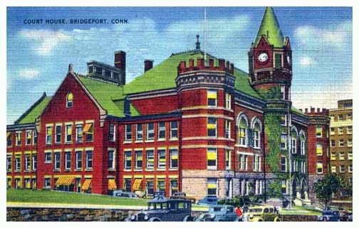
41°10′43″N 73°11′14″W / 41.17861°N 73.18722°WDowntown 23 Fairfield County Courthouse 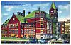
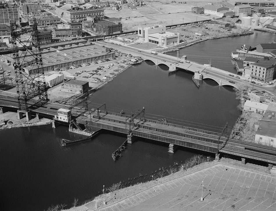
January 21, 1982 172 Golden Hill St.
41°10′50″N 73°11′28″W / 41.18056°N 73.19111°WDowntown 24 Fairfield County Jail April 18, 1985 1106 North Ave.
41°11′25″N 73°12′7″W / 41.19028°N 73.20194°WBrooklawn - St. Vincent 25 First Baptist Church February 22, 1990 126 Washington Ave.
41°10′35″N 73°11′53″W / 41.17639°N 73.19806°WDowntown 26 Mary and Eliza Freeman Houses February 22, 1999 352-4 and 358-60 Main St.
41°10′11″N 73°11′12″W / 41.16972°N 73.18667°WSouth End 27 Gateway Village Historic District September 26, 1990 Roughly bounded by Waterman St., Connecticut Ave. and Alanson Ave.
41°9′27″N 73°13′30″W / 41.1575°N 73.225°WEast End 28 Golden Hill Historic District September 3, 1987 Roughly bounded by Congress St., Lyon Terr., Elm, and Harrison Sts.
41°10′52″N 73°11′36″W / 41.18111°N 73.19333°WDowntown 29 Hotel Beach December 14, 1978 140 Fairfield Ave.
41°10′45″N 73°11′26″W / 41.17917°N 73.19056°WDowntown 30 Lakeview Village Historic District September 26, 1990 Roughly bounded by Essex St., Boston Ave., Colony St., Plymouth St. and Asylum St.
41°9′27″N 73°13′30″W / 41.1575°N 73.225°WNorth Bridgeport 31 Maplewood School February 21, 1990 434 Maplewood Ave.
41°10′42″N 73°12′35″W / 41.17833°N 73.20972°WWest End - West Side 32 Marina Park Historic District April 27, 1982 Marina Park, Park and Waldemere Aves.
41°9′52″N 73°11′30″W / 41.16444°N 73.19167°WSouth End 33 Nathaniel Wheeler Memorial Fountain 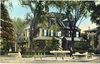
April 4, 1985 Park and Fairfield Aves.
41°10′29″N 73°11′55″W / 41.1747°N 73.1987°WWest End - West Side Built in 1912--1913, the fountain consists of four elements: a central bronze figure of a mermaid holding aloft a lamp and rising out of a polished granite pool and three individually ornamented polished granite watering troughs at the angles of the triangular parcel of land raised above the street. The fountain was a mid-career work of maverick American sculptor Gutzon Borglum.[5] 34 Palace and Majestic Theaters December 14, 1979 1315-1357 Main St.
41°10′56″N 73°11′28″W / 41.18222°N 73.19111°WDowntown 35 Park Apartments September 26, 1990 59 Rennell St.
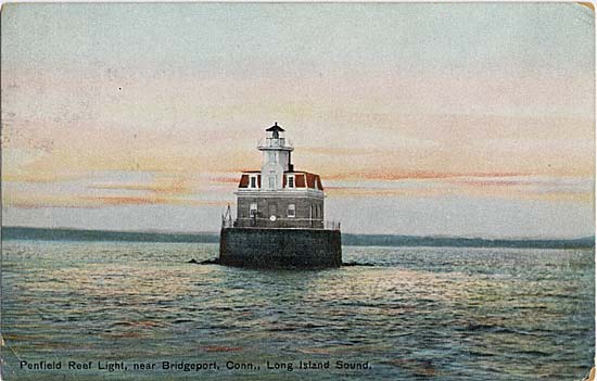
41°9′39″N 73°11′40″W / 41.16083°N 73.19444°WSouth End 36 Penfield Reef Lighthouse 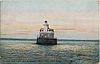
September 27, 1990 Long Island Sound off Shoal Point
41°7′0″N 73°13′18″W / 41.116667°N 73.22167°WLong Island Sound 37 Pequonnock River Railroad Bridge 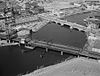
June 12, 1987 AMTRAK Right-of-way at Pequonnock River
41°10′59″N 73°11′11″W / 41.18306°N 73.18639°WDowntown and East Side 38 David Perry House March 22, 1984 531 Lafayette St.
41°10′13″N 73°11′25″W / 41.17028°N 73.19028°WDowntown 39 PRISCILLA DAILEY December 21, 1978 Bridgeport Harbor
41°10′43″N 73°11′14″W / 41.17861°N 73.18722°WDowntown 40 Railroad Avenue Industrial District September 30, 1985 Roughly bounded by State and Cherry Sts., Fairfield and Wordin Aves.
41°4′40″N 73°12′49″W / 41.07778°N 73.21361°WWest End - West Side 41 Remington City Historic District September 26, 1990 Roughly, Bond, Dover, and Remington Sts. and Palisade Ave., between Stewart and Tudor Sts.
41°11′53″N 73°9′56″W / 41.19806°N 73.16556°WBoston Avenue - Mill Hill 42 Remington Village Historic District September 26, 1990 Roughly, Willow and East Aves. between Boston and Barnum Aves.
41°11′38″N 73°9′36″W / 41.19389°N 73.16°WBoston Avenue - Mill Hill 43 St. John's Episcopal Church August 2, 1984 768 Fairfield Ave.
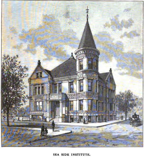
41°10′31″N 73°11′59″W / 41.17528°N 73.19972°WWest End - West Side 44 Seaside Institute 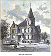
June 14, 1982 299 Lafayette Ave.
41°10′03″N 73°11′18″W / 41.1675°N 73.1883°WSouth End A Richardsonian Romanesque rock-faced granite, brick, brownstone and terracotta building designed by Warren R. Briggs and completed in 1887, it was originally built for the use and benefit of the female employees of the Warner Brothers corset manufacturers (now Warnaco).[6] 45 Seaside Park 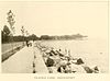
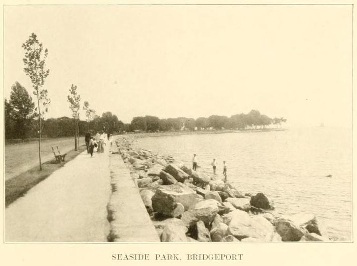
July 1, 1982 Long Island Sound
41°09′32″N 73°12′07″W / 41.159°N 73.202°WSouth End 46 Seaside Village Historic District September 26, 1990 E. side of Iranistan Ave. between South St. and Burnham St.
41°9′59″N 73°11′56″W / 41.16639°N 73.19889°WSouth End 47 Sterling Block-Bishop Arcade December 20, 1978 993-1005 Main St.
41°10′41″N 73°11′24″W / 41.17806°N 73.19°WDowntown 48 Sterling Hill Historic District April 2, 1992 Roughly bounded by Pequonnock St., Harral Ave., James St. and Washington Ave.
41°10′51″N 73°10′44″W / 41.18083°N 73.17889°WThe Hollow 49 Stratfield Historic District June 23, 1980 CT 59 and U.S. 1
41°10′40″N 73°12′49″W / 41.17778°N 73.21361°WBrooklawn - St. Vincent and West End - West Side 50 Tongue Point Lighthouse 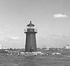
May 29, 1990 Western side of Bridgeport Harbor at Tongue Point
41°9′58″N 73°10′42″W / 41.16611°N 73.17833°WSouth End 51 United Congregational Church July 19, 1984 877 Park Ave.
41°10′30″N 73°12′0″W / 41.175°N 73.2°WWest End - West Side 52 United Illuminating Company Building February 21, 1985 1115-1119 Broad St.
41°10′41″N 73°11′31″W / 41.17806°N 73.19194°WDowntown 53 US Post Office-Bridgeport Main March 17, 1986 120 Middle St.
41°10′50″N 73°11′20″W / 41.18056°N 73.18889°WDowntown 54 West End Congregation--Achavath Achim Synagogue May 11, 1995 725 Hancock Ave.
41°10′12″N 73°12′44″W / 41.17°N 73.21222°WWest End - West Side 55 Wilmot Apartments Historic District September 26, 1990 Junction of Connecticut and Wilmot Aves.
41°10′58″N 73°9′44″W / 41.18278°N 73.16222°WEast End See also
- History of Bridgeport, Connecticut
- National Register of Historic Places listings in Fairfield County, Connecticut
- National Register of Historic Places listings in Stamford, Connecticut
- National Register of Historic Places listings in Greenwich, Connecticut
References
- ^ The latitude and longitude information provided in this table was derived originally from the National Register Information System, which has been found to be fairly accurate for about 99% of listings. For about 1% of NRIS original coordinates, experience has shown that one or both coordinates are typos or otherwise extremely far off; some corrections may have been made. A more subtle problem causes many locations to be off by up to 150 yards, depending on location in the country: most NRIS coordinates were derived from tracing out latitude and longitudes off of USGS topographical quadrant maps created under North American Datum of 1927, which differs from the current, highly accurate GPS system used by Google maps. Chicago is about right, but NRIS longitudes in Washington are higher by about 4.5 seconds, and are lower by about 2.0 seconds in Maine. Latitudes differ by about 1.0 second in Florida. Some locations in this table may have been corrected to current GPS standards.
- ^ "National Register of Historic Places: Weekly List Actions". National Park Service, United States Department of the Interior. Retrieved on November 10, 2011.
- ^ Numbers represent an ordering by significant words. Various colorings, defined here, differentiate National Historic Landmark sites and National Register of Historic Places Districts from other NRHP buildings, structures, sites or objects.
- ^ "National Register Information System". National Register of Historic Places. National Park Service. 2009-03-13. http://nrhp.focus.nps.gov/natreg/docs/All_Data.html.
- ^ Kate Ohno (1984). "National Register of Historic Places Inventory--Nomination Form: Nathaniel Wheeler Memorial Fountain" (pdf). National Park Service. http://pdfhost.focus.nps.gov/docs/NRHP/Text/85000706.pdf. Retrieved 2010-08-15. and 5 accompanying photographs.
- ^ Dale S. Plummer (September 8, 1980). "National Register of Historic Places Inventory-Nomination: Seaside Institute" (pdf). National Park Service. http://pdfhost.focus.nps.gov/docs/NRHP/Text/82004374.pdf.
U.S. National Register of Historic Places Topics Lists by states Alabama • Alaska • Arizona • Arkansas • California • Colorado • Connecticut • Delaware • Florida • Georgia • Hawaii • Idaho • Illinois • Indiana • Iowa • Kansas • Kentucky • Louisiana • Maine • Maryland • Massachusetts • Michigan • Minnesota • Mississippi • Missouri • Montana • Nebraska • Nevada • New Hampshire • New Jersey • New Mexico • New York • North Carolina • North Dakota • Ohio • Oklahoma • Oregon • Pennsylvania • Rhode Island • South Carolina • South Dakota • Tennessee • Texas • Utah • Vermont • Virginia • Washington • West Virginia • Wisconsin • WyomingLists by territories Lists by associated states Other  Category:National Register of Historic Places •
  Portal:National Register of Historic PlacesCategories:
- National Register of Historic Places in Connecticut
- Bridgeport, Connecticut
-


Wikimedia Foundation. 2010.