- National Register of Historic Places listings in West Hartford, Connecticut
-
 Location of Southington in Connecticut
This is a list of the National Register of Historic Places listings in West Hartford, Connecticut.
This is intended to be a complete list of the properties and districts on the National Register of Historic Places in West Hartford, Connecticut, United States. The locations of National Register properties and districts for which the latitude and longitude coordinates are included below, may be seen in various online maps.[1]
There are 411 properties and districts listed on the National Register in Hartford County, including 20 National Historic Landmarks. The 32 properties and districts located in the town of Southington include two National Historic Landmarks and are listed below. The 379 properties and districts in the remaining parts of the county are listed separately. Six properties and districts straddle the border between West Hartford and Hartford and appear in both lists.
Contents: Counties in Connecticut Fairfield (city of Bridgeport) (town of Greenwich) (city of Stamford) | Hartford (city of Hartford) (town of Southington) (town of West Hartford) (town of Windsor) | Litchfield | Middlesex (city of Middletown) | New Haven (city of New Haven) | New London | Tolland | Windham
-
- This National Park Service list is complete through NPS recent listings posted November 10, 2011.[2]
Current listings
[3] Landmark name[4] Image Date listed Location Summary 1 Charles E. Beach House 
August 23, 1990 18 Brightwood Ln.
41°43′57″N 72°44′35″W / 41.7325°N 72.74306°W2 Beardsley-Mix House 
September 10, 1986 81 Rockledge Dr.
41°49′31″N 72°44′30″W / 41.82528°N 72.74167°W3 Moses Brace-Uriah Cadwell House 
September 10, 1986 11 Flagg Rd.
41°47′6″N 72°45′0″W / 41.785°N 72.75°W4 James Butler House 
September 10, 1986 239 N. Main St.
41°46′40″N 72°44′48″W / 41.77778°N 72.74667°W5 Benjamin Colton House 
September 10, 1986 25 Sedgewick Rd.
41°45′4″N 72°44′46″W / 41.75111°N 72.74611°W6 Elizabeth Park 
March 10, 1983 Asylum Ave.
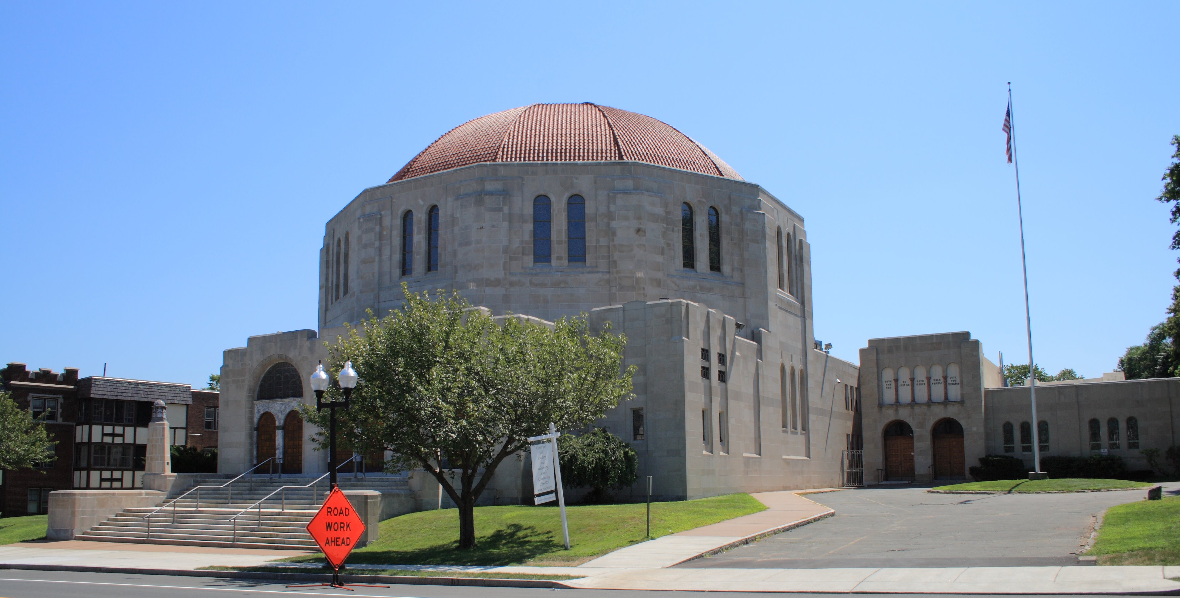
41°46′20″N 72°43′4″W / 41.77222°N 72.71778°WExtends into Hartford 7 Samuel Farnsworth House 
September 10, 1986 537 Mountain Rd.
41°46′50″N 72°45′59″W / 41.78056°N 72.76639°W8 Asa Gillett House 
September 10, 1986 202 S. Main St.
41°44′55″N 72°44′48″W / 41.74861°N 72.74667°W9 Timothy Goodman House 
September 10, 1986 567 Quaker Ln., S.
41°44′42″N 72°43′50″W / 41.745°N 72.73056°W10 Hartford Golf Club Historic District 
June 26, 1986 Roughly bounded by Simsbury Rd. and Bloomfield Ave., Northmoor Rd., Albany Ave., and Mohegan Dr.
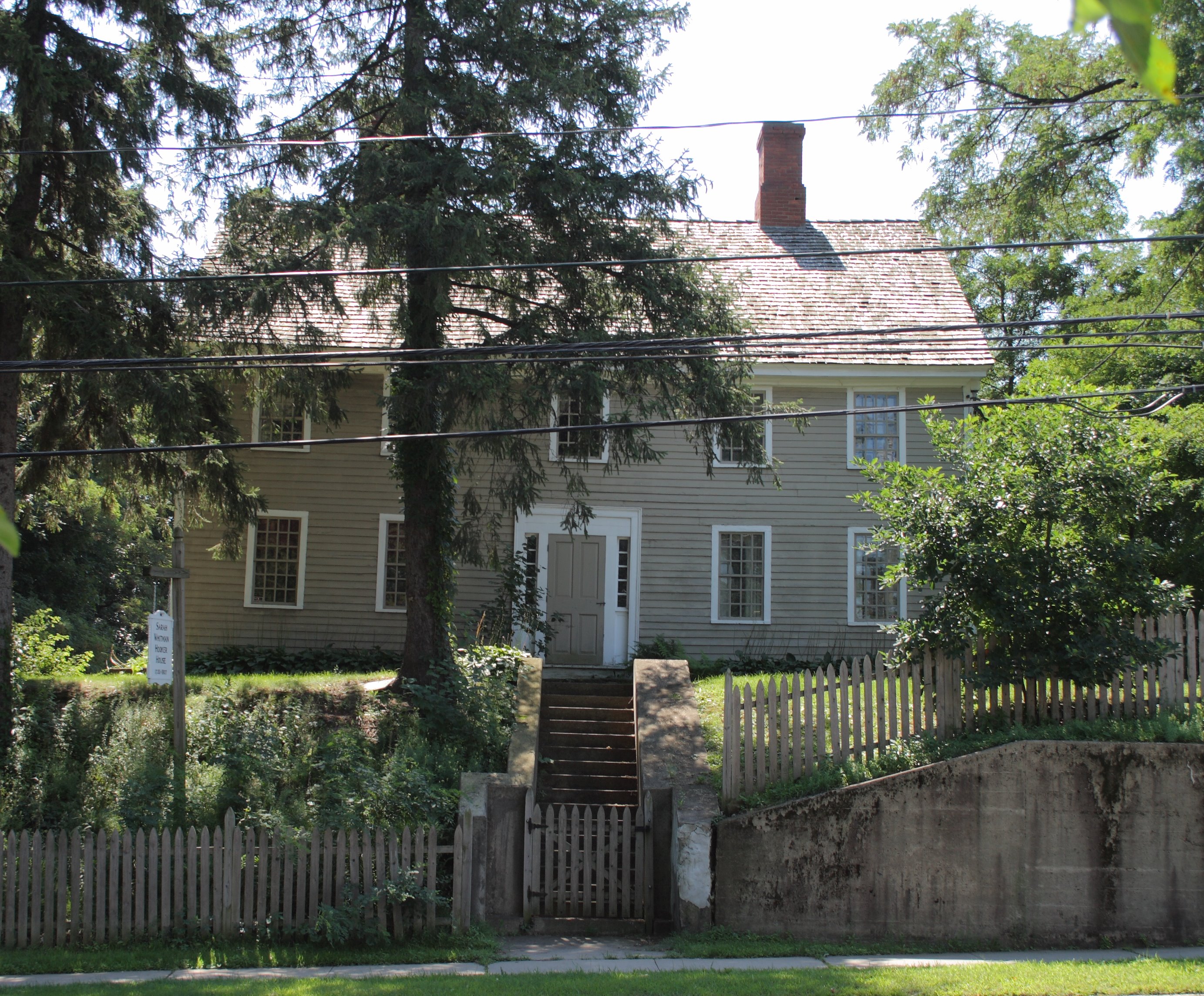
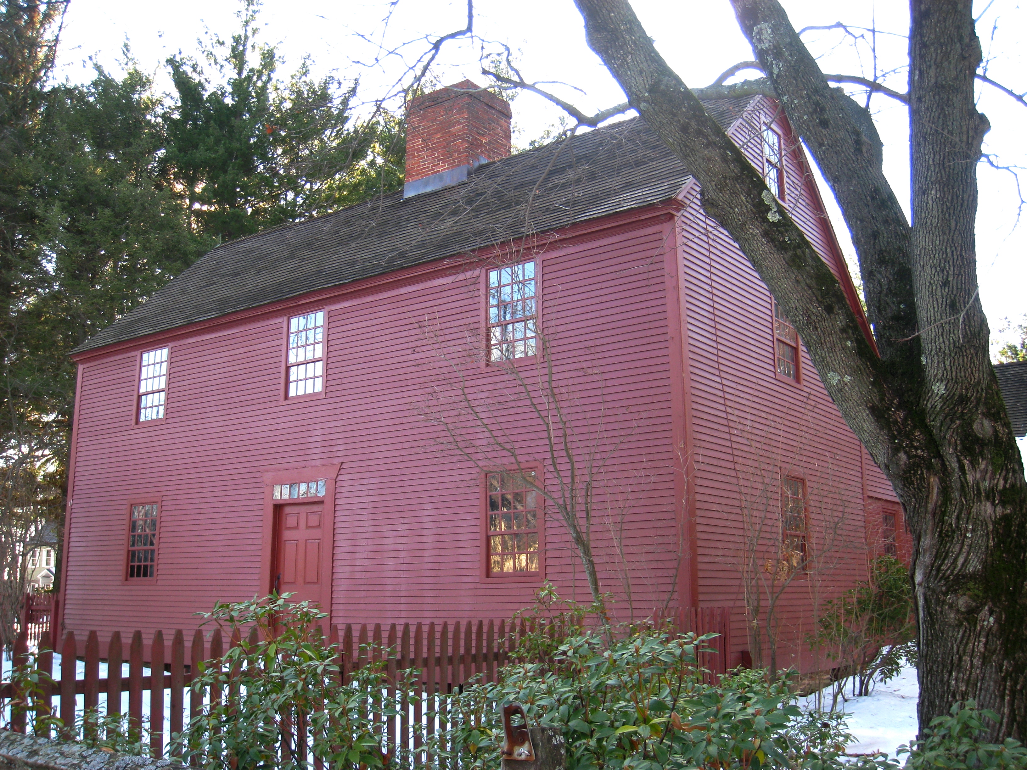
41°47′33″N 72°43′31″W / 41.7925°N 72.72528°WExtends into Hartford 11 Sarah Whitman Hooker House 
November 1, 1979 1237 New Britain Ave.
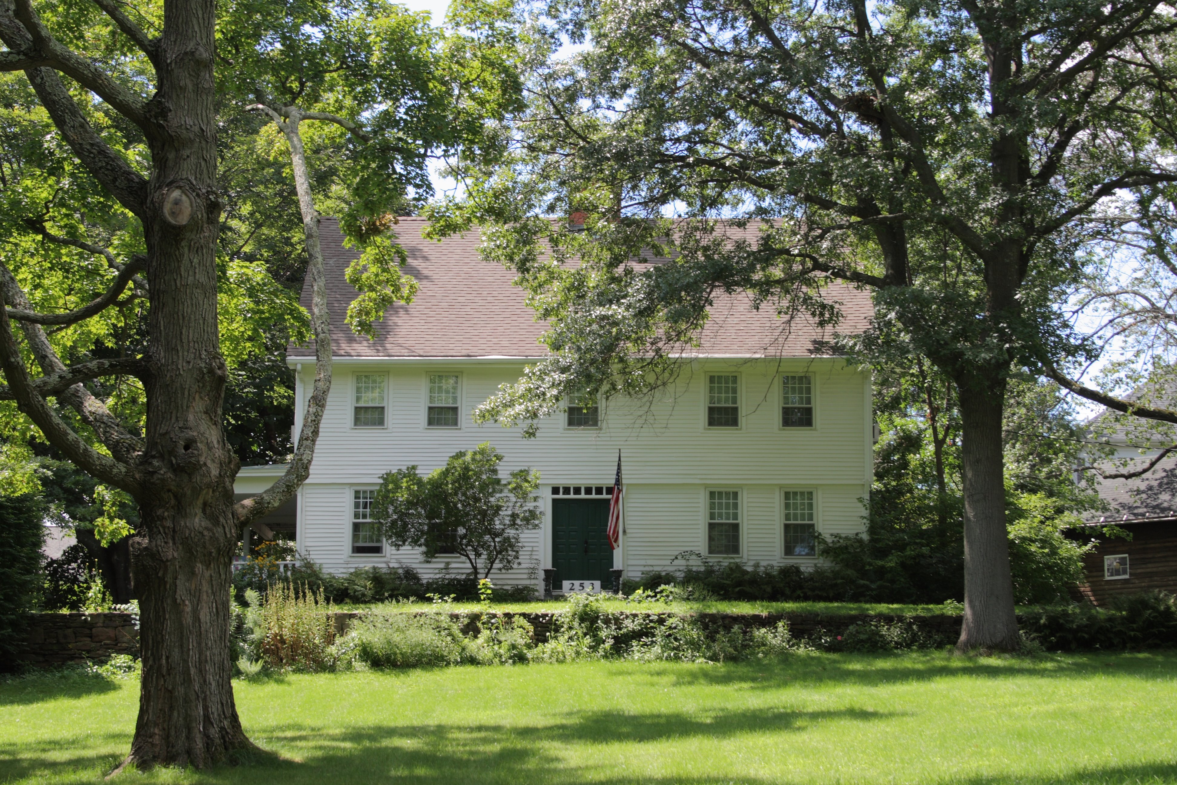
41°43′53″N 72°44′35″W / 41.73139°N 72.74306°W12 Daniel Hosmer House 
September 10, 1986 253 N. Main St.
41°46′44″N 72°44′50″W / 41.77889°N 72.74722°W13 House at 847 Main Street, North 
September 10, 1986 847 Main St., N.
41°47′26″N 72°44′52″W / 41.79056°N 72.74778°W14 Edward W. Morley House 
May 15, 1975 26 Westland Ave.
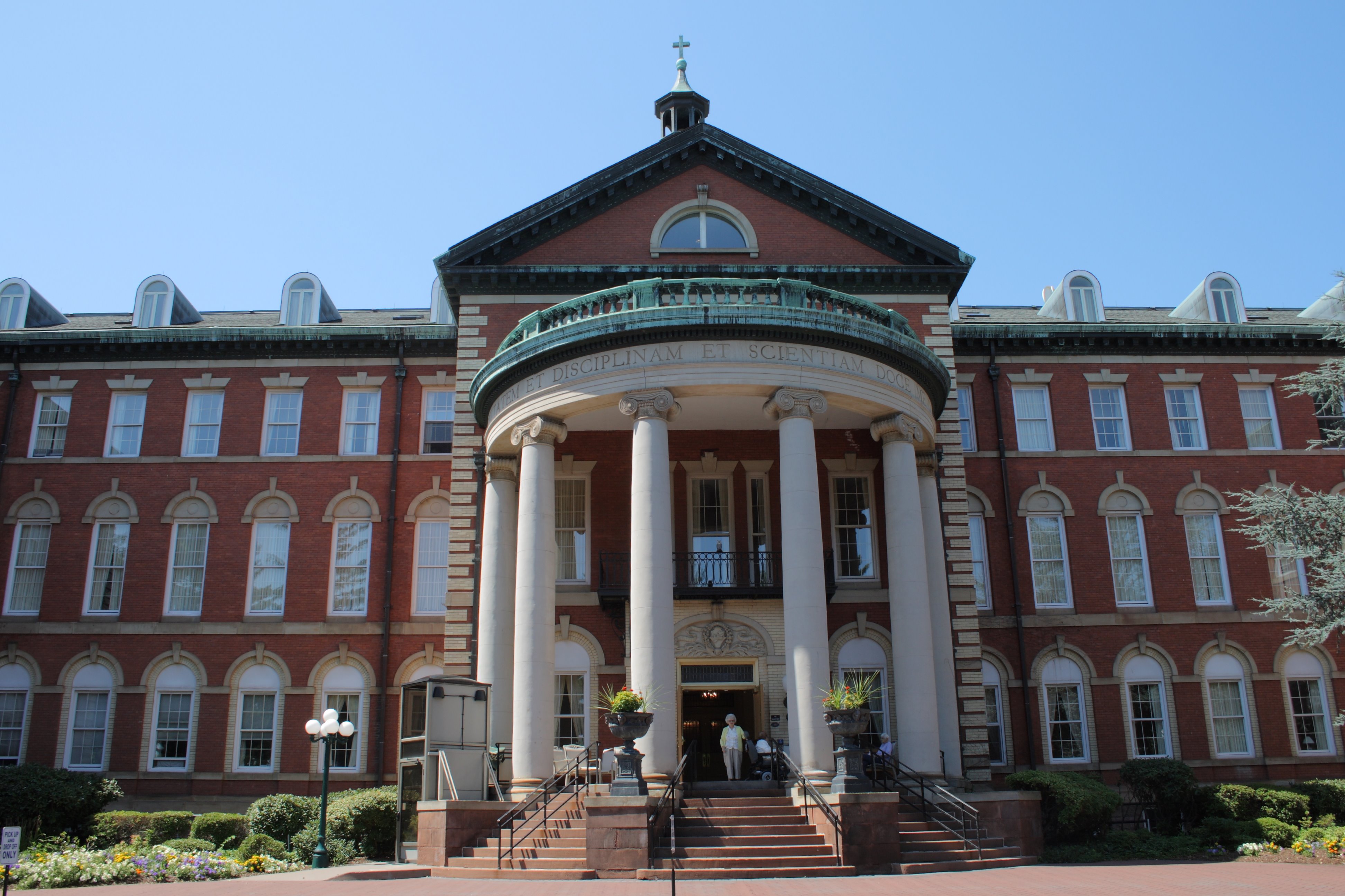
41°45′21″N 72°45′36″W / 41.75583°N 72.76°WHome of the scientist known for the Michelson-Morley experiment and for his work on the atomic weights of hydrogen and oxygen. 15 Mount St. Joseph Academy 
December 22, 1983 235 Fern St.
41°46′5″N 72°43′26″W / 41.76806°N 72.72389°W16 Old Center Burying Yard 
May 3, 2002 30 N. Main St.
41°45′58″N 72°44′30″W / 41.76611°N 72.74167°W17 Prospect Avenue Historic District 
August 29, 1985 Roughly bounded by Albany Ave., N. Branch Park River, Elizabeth and Fern Sts., Prospect and Asylum Aves., and Sycamore Rd.
41°46′43″N 72°42′38″W / 41.77861°N 72.71056°WExtends into Hartford 18 Revolutionary War Campsite 
April 24, 1986 Address Restricted A campsite and hospital of the French general Jean-Baptiste Donatien de Vimeur, comte de Rochambeau 19 Elisha Seymour, Jr. House 
September 10, 1986 410 and 412 Park Rd.
41°45′19″N 72°44′0″W / 41.75528°N 72.733333°W20 The Spanish House 
June 14, 1979 46 Fernwood Rd.
41°46′16″N 72°43′28″W / 41.77111°N 72.72444°W21 Stanley-Woodruff-Allen House 
September 10, 1986 37 Buena Vista Rd.
41°44′58″N 72°46′0″W / 41.74944°N 72.766667°W22 Allyn Steele House 
September 10, 1986 114 N. Main St.
41°46′11″N 72°44′37″W / 41.76972°N 72.74361°W23 Temple Beth Israel 
November 27, 1995 701 Farmington Ave.
41°45′53″N 72°43′12″W / 41.76472°N 72.72°W24 Watkinson Juvenile Asylum and Farm School 
March 23, 1995 140, 180 and 190 Bloomfield Ave.
41°47′24″N 72°42′45″W / 41.79°N 72.7125°WExtends into Hartford 25 Noah Webster Birthplace 
October 15, 1966 227 S. Main St.
41°44′46″N 72°44′47″W / 41.74611°N 72.74639°WHome of the American lexicographer. 26 Noah Webster Memorial Library 
July 30, 1981 7 N. Main St.
41°45′41″N 72°43′7″W / 41.76139°N 72.71861°W27 John Wells, Jr. House 
September 10, 1986 505 Mountain Rd.
41°46′42″N 72°45′59″W / 41.77833°N 72.76639°W28 West End North Historic District 
July 25, 1985 Roughly bounded by Farmington Ave., Lorraine, Elizabeth, and Highland Sts.
41°46′9″N 72°42′44″W / 41.76917°N 72.71222°WExtends into Hartford 29 West End South Historic District 
April 11, 1985 Roughly bounded by Farmington Ave., Whitney and S. Whitney Sts., West Boulevard, and Prospect Ave.
41°45′47″N 72°42′52″W / 41.76306°N 72.71444°WExtends into Hartford 30 West Hill Historic District 
November 29, 1996 West Hill Dr. bounded by Farmington Ave.
41°45′59″N 72°43′28″W / 41.76639°N 72.72444°W31 Whiting Homestead 
August 3, 1987 291 N. Main St.
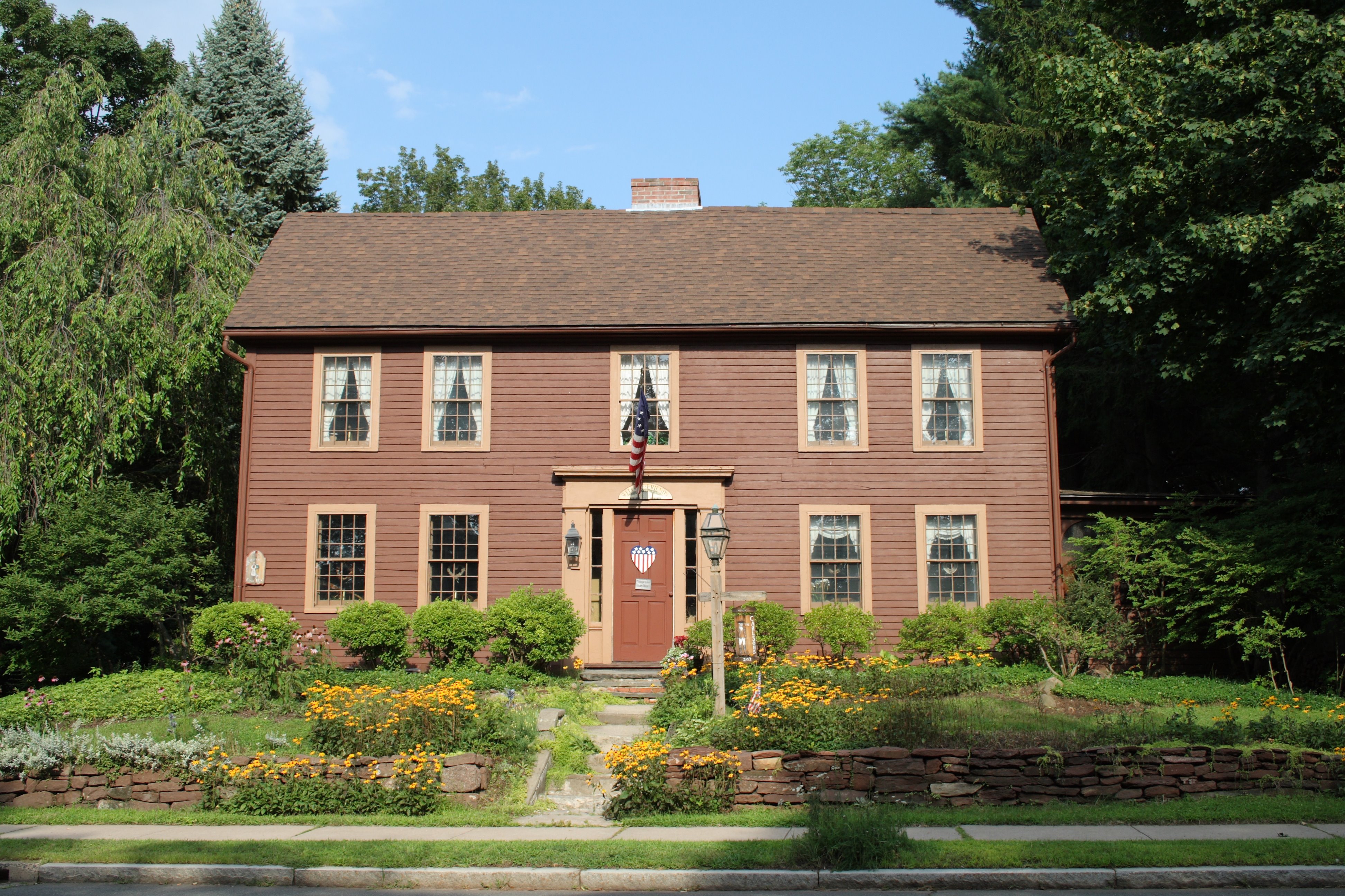
41°46′50″N 72°44′50″W / 41.78056°N 72.74722°W32 Whitman House 
September 10, 1986 208 N. Main St.
41°46′33″N 72°44′43″W / 41.77583°N 72.74528°WSee also
- List of National Historic Landmarks in Connecticut
- National Register of Historic Places listings in Connecticut
References
- ^ The latitude and longitude information provided in this table was derived originally from the National Register Information System, which has been found to be fairly accurate for about 99% of listings. For about 1% of NRIS original coordinates, experience has shown that one or both coordinates are typos or otherwise extremely far off; some corrections may have been made. A more subtle problem causes many locations to be off by up to 150 yards, depending on location in the country: most NRIS coordinates were derived from tracing out latitude and longitudes off of USGS topographical quadrant maps created under North American Datum of 1927, which differs from the current, highly accurate GPS system used by Google maps. Chicago is about right, but NRIS longitudes in Washington are higher by about 4.5 seconds, and are lower by about 2.0 seconds in Maine. Latitudes differ by about 1.0 second in Florida. Some locations in this table may have been corrected to current GPS standards.
- ^ "National Register of Historic Places: Weekly List Actions". National Park Service, United States Department of the Interior. Retrieved on November 10, 2011.
- ^ Numbers represent an ordering by significant words. Various colorings, defined here, differentiate National Historic Landmark sites and National Register of Historic Places Districts from other NRHP buildings, structures, sites or objects.
- ^ "National Register Information System". National Register of Historic Places. National Park Service. 2009-03-13. http://nrhp.focus.nps.gov/natreg/docs/All_Data.html.
U.S. National Register of Historic Places Topics Lists by states Alabama • Alaska • Arizona • Arkansas • California • Colorado • Connecticut • Delaware • Florida • Georgia • Hawaii • Idaho • Illinois • Indiana • Iowa • Kansas • Kentucky • Louisiana • Maine • Maryland • Massachusetts • Michigan • Minnesota • Mississippi • Missouri • Montana • Nebraska • Nevada • New Hampshire • New Jersey • New Mexico • New York • North Carolina • North Dakota • Ohio • Oklahoma • Oregon • Pennsylvania • Rhode Island • South Carolina • South Dakota • Tennessee • Texas • Utah • Vermont • Virginia • Washington • West Virginia • Wisconsin • WyomingLists by territories Lists by associated states Other  Category:National Register of Historic Places •
  Portal:National Register of Historic PlacesCategories:
- National Register of Historic Places in Connecticut
- West Hartford, Connecticut
-


Wikimedia Foundation. 2010.