- National Register of Historic Places listings in West Philadelphia
-
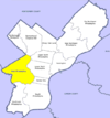
 Location of West Philadelphia in Philadelphia
This is a list of the National Register of Historic Places listings in West Philadelphia.
This is intended to be a complete list of the properties and districts on the National Register of Historic Places in West Philadelphia, Pennsylvania, United States. The locations of National Register properties and districts for which the latitude and longitude coordinates are included below, may be seen in a Google map.[1]
There are 532 properties and districts listed on the National Register in Philadelphia, including 67 National Historic Landmarks. West Philadelphia includes 61 of these properties and districts, including 5 National Historic Landmarks; the city's remaining properties and districts are listed elsewhere. Two sites are split between West Philadelphia and other parts of the city, and are thus included on multiple lists.
Current listings
[2] Landmark name[3] Image Date listed Location Neighborhood[4] Summary 1 32nd St. and Lancaster Ave. Philadelphia Armory 
November 14, 1991 Junction of 32nd Street and Lancaster Avenue
39°57′23″N 75°11′19″W / 39.95639°N 75.18861°WUniversity City 2 Dimner Beeber Junior High School 
November 18, 1988 5901 Malvern Avenue
39°59′11″N 75°14′34″W / 39.98639°N 75.24278°WWest Parkside 3 Bell Telephone Exchange Building 
March 20, 2002 8–12 North Preston Street
39°57′28″N 75°12′15″W / 39.95778°N 75.20417°WPowelton Village Telephone switching station from about 1900 to 1928 4 Belmont Avenue Bridge in Philadelphia 
June 22, 1988 Belmont Avenue over Ramp B
39°59′37″N 75°13′4.3″W / 39.99361°N 75.217861°WFairmount Park 5 Belmont School 
November 18, 1988 4030–4060 Brown Street
39°58′0″N 75°12′18″W / 39.966667°N 75.205°WBelmont 6 Rudolph Blankenburg School 
November 18, 1988 4600 Girard Avenue
39°58′21″N 75°12′55″W / 39.9725°N 75.21528°WMill Creek 7 Breslyn Apartments 
November 14, 1982 4624–4642 Walnut Street, 201–213 South 47th Street
39°57′20″N 75°12′55″W / 39.95556°N 75.21528°WSpruce Hill 8 George L. Brooks School 
December 4, 1986 5629–5643 Haverford Avenue
39°58′6″N 75°14′0″W / 39.96833°N 75.233333°WHaddington 9 Lewis C. Cassidy School 
November 18, 1988 6523–6543 Lansdowne Avenue
39°58′30″N 75°15′3″W / 39.975°N 75.25083°WMorris Park 10 Centennial National Bank 
March 11, 1971 32nd and Market Streets
39°57′18″N 75°11′13″W / 39.955°N 75.18694°WUniversity City Frank Furness, architect (1875–76). 11 Chamounix 
April 26, 1972 West Fairmount Park on Chamounix Drive
40°0′13.5″N 75°11′46.5″W / 40.00375°N 75.19625°WFairmount Park 12 City Line Avenue Bridge 
June 22, 1988 City Avenue over eastern branch of Indian Creek
39°58′29″N 75°16′50″W / 39.97472°N 75.28056°WOverbrook Farms 13 Cobbs Creek Automobile Suburb Historic District 
November 12, 1998 Roughly bounded by Cobbs Creek Parkway, Spruce Street, 62nd Street, and Angora Street
39°57′1″N 75°14′50″W / 39.95028°N 75.24722°WCobbs Creek 14 College Hall, University of Pennsylvania 
February 14, 1978 Bounded by Walnut, Spruce, 34th, and 36th Streets
39°57′5″N 75°11′38″W / 39.95139°N 75.19389°WUniversity City Thomas W. Richards, architect (1870–72). 15 Drexel Development Historic District 
November 14, 1982 Roughly bounded by Pine, Delancey, 39th and 40th Streets
39°57′3″N 75°12′9″W / 39.95083°N 75.2025°WUniversity City 16 Thomas Dunlap School 
December 4, 1986 5031 Race Street
39°57′47″N 75°13′18″W / 39.96306°N 75.22167°WHaddington 17 Fairmount Park 
February 7, 1972 Both banks of the Schuylkill River and the Wissahickon Creek, from Spring Garden Street to Northwestern Avenue
39°59′33″N 75°12′19″W / 39.9925°N 75.20528°WFairmount Park Extends into North and Northwest Philadelphia 18 Furness Library 
May 19, 1972 34th Street below Walnut on the University of Pennsylvania campus
39°57′6″N 75°11′34″W / 39.95167°N 75.19278°WWest Philadelphia Frank Furness, architect (1888–91). 19 Garden Court Historic District 
July 5, 1984 Roughly bounded by Larchwood Avenue, 46th, 50th, and Pine Streets; also 4526–4534 and 4537–4539 Osage Avenue
39°57′6.5″N 75°13′7″W / 39.951806°N 75.21861°WGarden Court 20 Haddington Historic District 
September 29, 1988 6000 blocks of Market, Ludlow and Chestnut Streets
39°57′41″N 75°14′31″W / 39.96139°N 75.24194°WHaddington 21 Hanson Haines House 
January 29, 1985 4801 Springfield Avenue
39°56′46″N 75°13′1″W / 39.94611°N 75.21694°WSpruce Hill 22 Hajoca Corporation Headquarters and Showroom 
February 27, 2003 3025 Walnut Street
39°57′7.5″N 75°11′6.5″W / 39.952083°N 75.185139°WUniversity City 23 Hamilton Family Estate 
June 22, 1979 4039–4041 Baltimore Avenue and 4000–4018 Pine Street
39°57′0″N 75°12′18″W / 39.95°N 75.205°WSpruce Hill 24 William B. Hanna School 
December 4, 1986 5720–5738 Media Street
39°58′28″N 75°14′10″W / 39.97444°N 75.23611°WCarroll Park 25 Holmes Junior High School 
November 18, 1988 5429–5455 Chestnut Street
39°57′34.5″N 75°13′50.5″W / 39.959583°N 75.230694°WCobbs Creek 26 Institute of the Pennsylvania Hospital 
October 15, 1966 111 North 49th Street
39°57′42″N 75°13′2″W / 39.96167°N 75.21722°WMill Creek Samuel Sloan, architect (1856–59). 27 La Blanche Apartments 
March 7, 1985 5100 Walnut Street
39°57′23″N 75°13′25″W / 39.95639°N 75.22361°WWalnut Hill 28 Henry C. Lea School of Practice 
November 18, 1988 242 South 47th Street
39°57′16″N 75°12′59″W / 39.95444°N 75.21639°WWalnut Hill 29 William Mann School 
November 18, 1988 1835–1869 North 54th Street
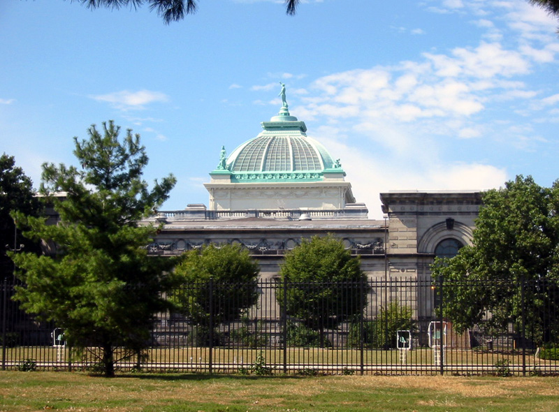
39°59′8″N 75°13′53″W / 39.98556°N 75.23139°WWynnefield 30 Memorial Hall 
December 8, 1976 North Concourse Drive
39°58′46″N 75°12′35″W / 39.97944°N 75.20972°WFairmount Park Herman J. Schwarzmann, architect (1874–76). 31 Monte Vista 
March 3, 1983 917–931 North 63rd Street, 6154–6160 Oxford Street, 6151–6157 Nassau Street
39°58′46″N 75°14′44″W / 39.97944°N 75.24556°WOverbrook 32 Overbrook Farms 
March 21, 1985 Roughly bounded by City Line Avenue, 58th Street, Woodbine Avenue and 64th Street
39°59′17″N 75°14′55″W / 39.98806°N 75.24861°WOverbrook Farms 33 Overbrook High School 
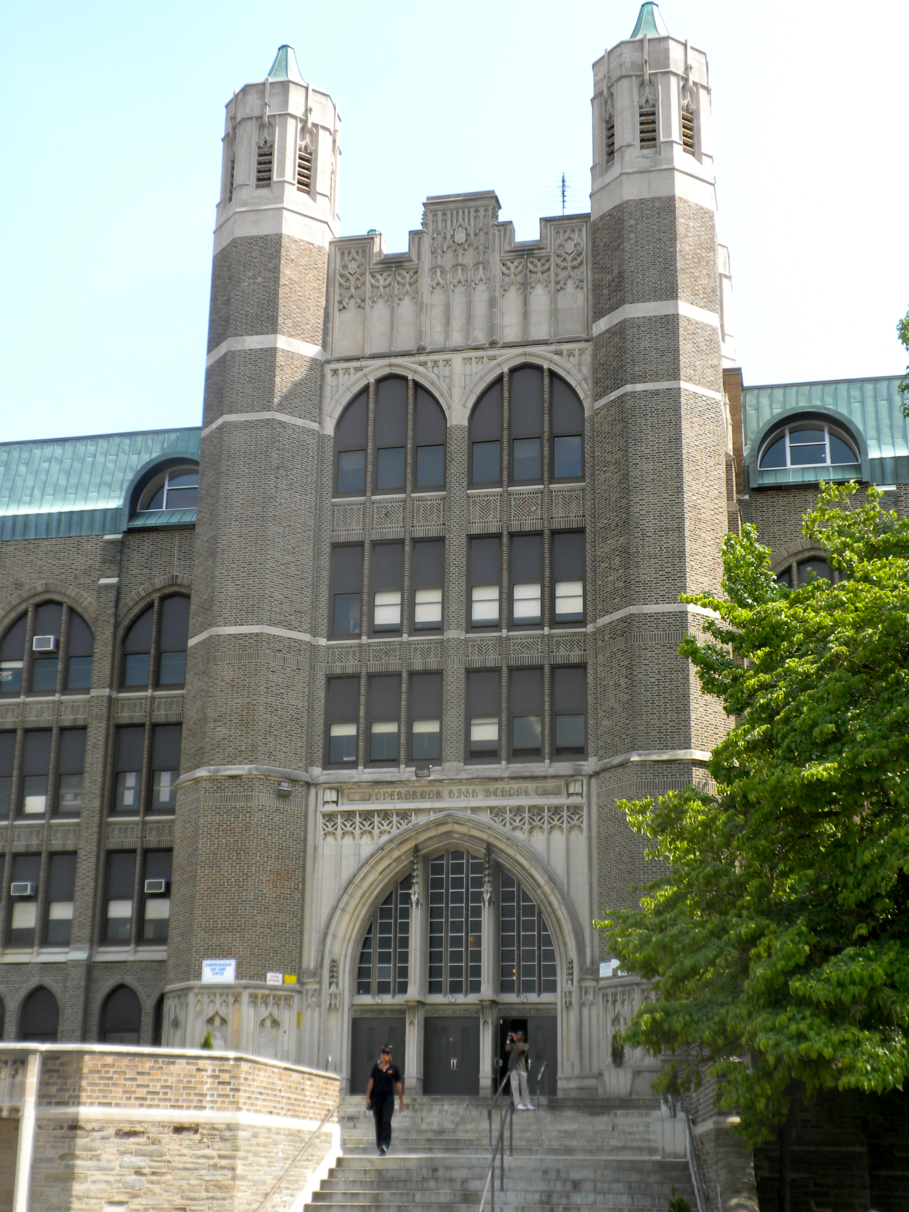
December 4, 1986 59th and Lancaster Ave.
39°58′51.5″N 75°14′18.5″W / 39.980972°N 75.238472°WOverbrook 34 Overbrook School 
November 18, 1988 6201–6231 Lebanon Avenue
39°58′55″N 75°14′44″W / 39.98194°N 75.24556°WOverbrook 35 Parkside Historic District 
November 17, 1983 Bounded by Penn Central railroad tracks, 38th Street, Girard, Parkside and Belmont Avenues
39°58′24″N 75°12′23″W / 39.97333°N 75.20639°WParkside 36 Pennsylvania Railroad Freight Building 
October 28, 1999 3118–3198 Chestnut Street
39°57′12.5″N 75°11′13″W / 39.953472°N 75.18694°WUniversity City 37 Pennsylvania Railroad Office Building 
February 27, 2003 3175 John F. Kennedy Blvd.
39°57′22″N 75°11′15″W / 39.95611°N 75.1875°WUniversity City 38 Pinehurst Apartments 
January 6, 1987 4511–4523 Pine and 324–334 South 45th Streets
39°57′7″N 75°12′46.5″W / 39.95194°N 75.212917°WSpruce Hill 39 Poth and Schmidt Development Houses 
April 21, 1983 3306–3316 Arch Street
39°57′27″N 75°11′24″W / 39.9575°N 75.19°WUniversity City 40 Frederick A. Poth Houses 
April 19, 1979 3301–3311, 3315 Powelton Avenue
39°57′37″N 75°11′25″W / 39.96028°N 75.19028°WPowelton Village 41 Powelton Historic District 
May 9, 1985 Roughly bounded by Brandywine Street, 32nd to 39th Streets and Lancaster Avenue
39°57′41″N 75°11′32″W / 39.96139°N 75.19222°WPowelton Village 42 The Powelton 
December 13, 1978 3500–3520 Powelton Avenue, 214–218 35th Street, and 215–221 36th Street
39°57′35″N 75°11′25″W / 39.95972°N 75.19028°WPowelton Village 43 Protestant Episcopal Church of the Saviour 
August 1, 1979 Ludlow Street and 3723–3725 Chestnut Street
39°57′20.5″N 75°11′52.5″W / 39.955694°N 75.197917°WUniversity City Charles M. Burns, architect (1889, rebuilt after 1902 fire). 44 Richards and Goddard Buildings 
January 16, 2009 3700–3710 Hamilton Walk
39°56′59″N 75°11′53″W / 39.94972°N 75.19806°WUniversity City On the University of Pennsylvania campus; Louis Kahn, architect (1957–61). 45 Paul Robeson House 
November 22, 2000 4951 Walnut Street
39°57′29″N 75°13′17″W / 39.95806°N 75.22139°WSpruce Hill 46 St. Anthony Hall House 
February 15, 2005 3637 Locust Walk, University of Pennsylvania
39°57′8.5″N 75°11′47″W / 39.952361°N 75.19639°WUniversity City 47 Sansom Row 
December 27, 1977 3402–3436 Sansom St.
39°57′13″N 75°11′34″W / 39.95361°N 75.19278°WUniversity City 48 John Shedwick Development Houses 
March 10, 1982 3433–3439 Lancaster Avenue
39°57′28.5″N 75°11′31″W / 39.957917°N 75.19194°WPowelton Village 49 William Shoemaker Junior High School 
December 4, 1986 1464–1488 North 53rd Street
39°58′34″N 75°13′42″W / 39.97611°N 75.22833°WCarroll Park 50 Mayer Sulzberger Junior High School 
November 18, 1988 701–741 North 48th Street
39°57′53″N 75°12′58″W / 39.96472°N 75.21611°WMill Creek 51 Thirtieth Street Station 
June 7, 1978 West River Drive, Market Street, 30th, and Arch Streets
39°57′20″N 75°10′55″W / 39.95556°N 75.18194°WUniversity City Graham, Anderson, Probst & White, architects (1929–34). 52 United States Post Office-Main Branch 
September 5, 2006 2970 Market Street
39°57′14″N 75°10′57.5″W / 39.95389°N 75.182639°WUniversity City 53 University Avenue Bridge 
May 26, 1994 South University Avenue over the Schuylkill River
39°56′34″N 75°11′49″W / 39.94278°N 75.19694°WUniversity City Extends into South Philadelphia 54 University of Pennsylvania Campus Historic District 
December 28, 1978 Roughly bounded by Hamilton Walk, South, 32nd, Walnut, 36th, Spruce, and 39th Streets
39°57′8″N 75°11′40″W / 39.95222°N 75.19444°WUniversity City 55 Walnut Park Plaza Hotel 
May 10, 2005 6232–6250 Walnut Street
39°57′33.5″N 75°14′49″W / 39.959306°N 75.24694°WCobbs Creek 56 West Philadelphia High School 
December 4, 1986 4700 Walnut St.
39°57′19″N 75°13′1″W / 39.95528°N 75.21694°WSpruce Hill 57 West Philadelphia Streetcar Suburb Historic District 
February 5, 1998 Roughly bounded by the University of Pennsylvania campus, Woodlands Cemetery, Poweltown Avenue, 52nd Street, and Woodland Avenue
39°57′1″N 75°12′45″W / 39.95028°N 75.2125°WSpruce Hill 58 WFIL Studio 
July 28, 1986 4548 Market Street
39°57′29.5″N 75°12′45″W / 39.958194°N 75.2125°WSpruce Hill 59 Woodland Terrace 
March 16, 1972 501–519, 500–520 Woodland Terrace
39°56′58″N 75°12′16.5″W / 39.94944°N 75.204583°WUniversity City Samuel Sloan, architect. 60 The Woodlands 
December 24, 1967 40th Street and Woodland Avenue
39°56′50″N 75°12′10″W / 39.94722°N 75.20278°WUniversity City Built ca. 1742, expanded 1787-90. 61 Wynnestay 
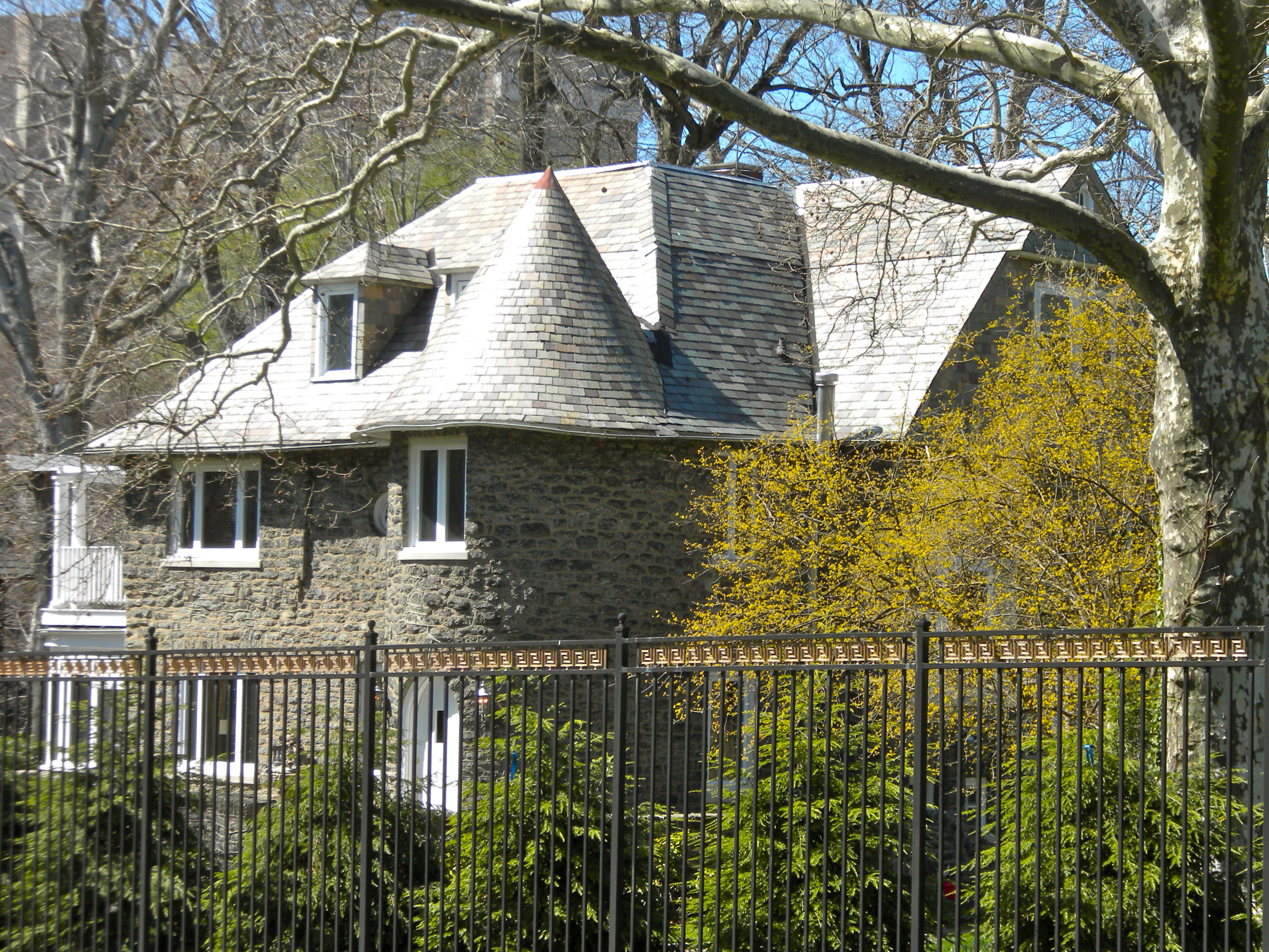
December 30, 2008 5125 Woodbine Avenue
39°59′38.5″N 75°13′49.5″W / 39.994028°N 75.230417°WWynnefield Built 1689, expanded 1700. See also
- List of National Historic Landmarks in Philadelphia
- National Register of Historic Places listings in Philadelphia, Pennsylvania
References
- ^ The latitude and longitude information provided in this table was derived originally from the National Register Information System, which has been found to be fairly accurate for about 99% of listings. For about 1% of NRIS original coordinates, experience has shown that one or both coordinates are typos or otherwise extremely far off; some corrections may have been made. A more subtle problem causes many locations to be off by up to 150 yards, depending on location in the country: most NRIS coordinates were derived from tracing out latitude and longitudes off of USGS topographical quadrant maps created under the North American Datum of 1927, which differs from the current, highly accurate WGS84 GPS system used by Google maps. Chicago is about right, but NRIS longitudes in Washington are higher by about 4.5 seconds, and are lower by about 2.0 seconds in Maine. Latitudes differ by about 1.0 second in Florida. Some locations in this table may have been corrected to current GPS standards.
- ^ Numbers represent an ordering by significant words. Various colorings, defined here, differentiate National Historic Landmark sites and National Register of Historic Places Districts from other NRHP buildings, structures, sites or objects.
- ^ "NPS Focus". National Register of Historic Places. National Park Service. http://nrhp.focus.nps.gov. Retrieved November 20, 2009.
- ^ "The Political and Community Service Boundaries of Philadelphia" (PDF). Philadelphia City Planning Commission. June 2004. http://www.philaplanning.org/data/boundaries.pdf.
Neighborhoods of the West Philadelphia section of Philadelphia, Pennsylvania Belmont • Belmont Village • Carroll Park • Cathedral Park • Cedar Park • Cobbs Creek • Dunlap • Garden Court • Haddington • Haverford North • Mantua • Mill Creek • Overbrook • Overbrook Farms • Overbrook Park • Parkside • Powelton Village • Saunders Park • Spruce Hill • Squirrel Hill • University City • Walnut Hill • Woodland Terrace • Wynnefield • Wynnefield Heights
 Categories:
- Buildings and structures in Philadelphia, Pennsylvania
- National Register of Historic Places in Philadelphia, Pennsylvania


Wikimedia Foundation. 2010.