- National Register of Historic Places listings in Dauphin County, Pennsylvania
-
 Location of Dauphin County in Pennsylvania
This is a list of the National Register of Historic Places listings in Dauphin County, Pennsylvania.
This is intended to be a complete list of the properties and districts on the National Register of Historic Places in Dauphin County, Pennsylvania, United States. The locations of National Register properties and districts for which the latitude and longitude coordinates are included below, may be seen in a Google map.[1]
There are 69 properties and districts listed on the National Register in the county. Four sites are further designated as National Historic Landmarks.
-
- This National Park Service list is complete through NPS recent listings posted November 10, 2011.[2]
Current listings
[3] Landmark name[4] Image Date listed Location City or Town Summary 1 John Ayres House September 7, 1979 1801 Peter's Mountain Rd.; Northwest of Dauphin on PA 325
40°23′54″N 76°56′52″W / 40.39833°N 76.94778°WMiddle Paxton Township 2 B'Nai Jacob Synagogue September 19, 1985 Nissley and Water Streets
40°11′48″N 76°44′5″W / 40.19667°N 76.73472°WMiddletown 3 Bridge in Lykens Township No. 1 
June 22, 1988 Legislative Route 22001 over Pine Creek
40°38′38″N 76°41′34″W / 40.64389°N 76.69278°WLykens Township Highway Bridges Owned by the Commonwealth of Pennsylvania, Department of Transportation TR 4 Bridge in Lykens Township No. 2 
June 22, 1988 Legislative Route 22033 over a tributary of Pine Creek
40°37′58″N 76°39′52″W / 40.63278°N 76.66444°WLykens Township Highway Bridges Owned by the Commonwealth of Pennsylvania, Department of Transportation TR 5 Bridge in Reed Township 
June 22, 1988 Legislative Route 1/Township Route 147 over Powell's Creek near Inglenook
40°24′35″N 76°59′6″W / 40.40972°N 76.985°WReed Township Highway Bridges Owned by the Commonwealth of Pennsylvania, Department of Transportation TR 6 Broad Street Market 
December 27, 1974 Verbeke Street between 3rd and 6th Streets
40°16′12″N 76°53′17″W / 40.27°N 76.88806°WHarrisburg 7 Calver Island January 17, 2007 In the Susquehanna River, southeast of Harrisburg
40°12′20″N 76°48′24″W / 40.20556°N 76.80667°W[5]Swatara Township 8 Simon Cameron House and Bank 
November 21, 1976 28 and 30 East Main Street
40°11′59″N 76°43′51″W / 40.19972°N 76.73083°WMiddletown 9 Simon Cameron School April 24, 1986 1839 Green Street
40°16′32″N 76°53′41″W / 40.27556°N 76.89472°WHarrisburg 10 Camp Curtin Fire Station August 11, 1981 2504 North 6th Street
40°17′13″N 76°53′39″W / 40.28694°N 76.89417°WHarrisburg 11 Camp Curtin Memorial Methodist Episcopal Church August 5, 2010 2221 North 6th Street
40°16′57″N 76°53′28.5″W / 40.2825°N 76.89125°WHarrisburg 12 Clemson Island Prehistoric District September 17, 1981 Southern portion of Clemson Island in the Susquehanna River
40°27′54.5″N 76°56′44.4″W / 40.465139°N 76.945667°W[6]Halifax Township 13 Colonial Theatre 
November 9, 1982 3rd and Market Streets
40°15′38″N 76°52′52″W / 40.26056°N 76.88111°WHarrisburg 14 Conrad and Margaret Allerman House September 8, 2011 1412 Farmhouse Lane
40°14′12″N 76°45′50″W / 40.23667°N 76.76389°WLower Swatara Township 15 Dauphin County Bridge No. 27 August 2, 1993 Deibler's Dam Road (Mahantango Creek Road) across Mahantango Creek
40°38′5″N 76°51′23″W / 40.63472°N 76.85639°WMifflin Township Extends into Lower Mahanoy Township in Northumberland County 16 Dauphin County Courthouse 
August 2, 1993 Junction of Front and Market Streets
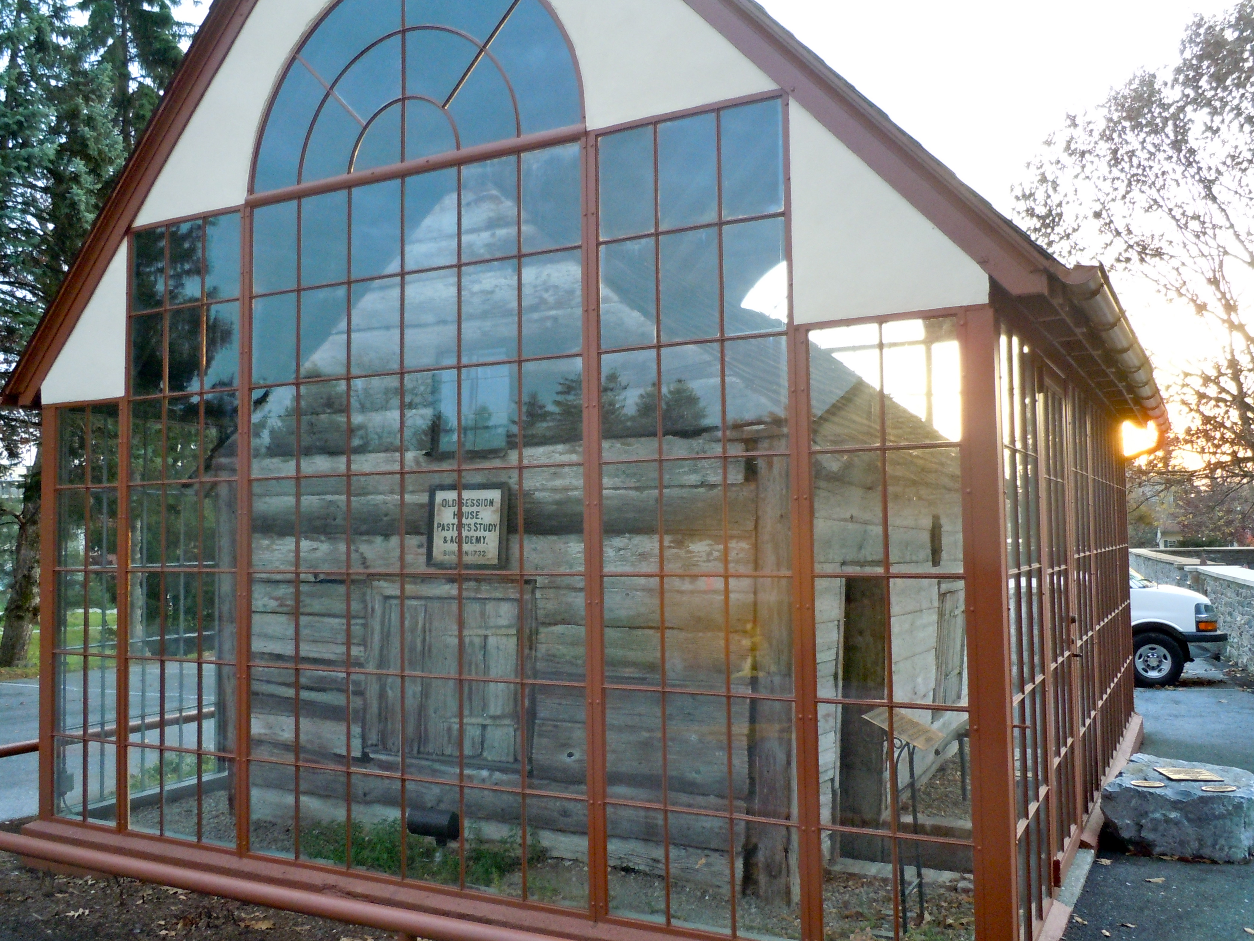
40°15′30″N 76°52′57″W / 40.25833°N 76.8825°WHarrisburg 17 Derry Session House and Enclosure 
November 21, 2006 248 East Derry Road
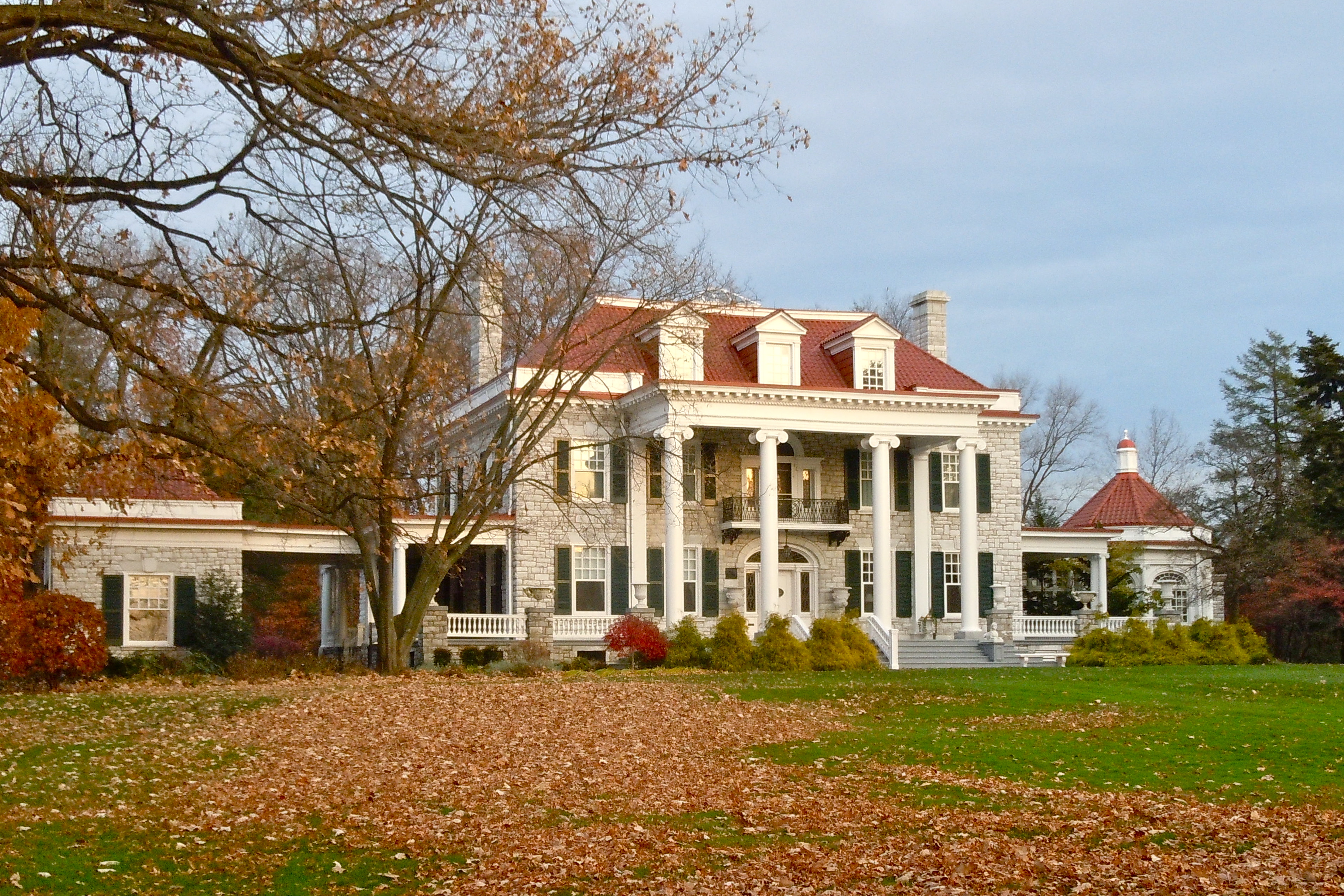
40°17′37″N 76°38′44″W / 40.29361°N 76.64556°WDerry Township 18 William Donaldson House April 26, 1990 2005 North 3rd Street
40°16′41″N 76°53′42″W / 40.27806°N 76.895°WHarrisburg 19 Fort Hunter Historic District August 17, 1979 U.S. 22
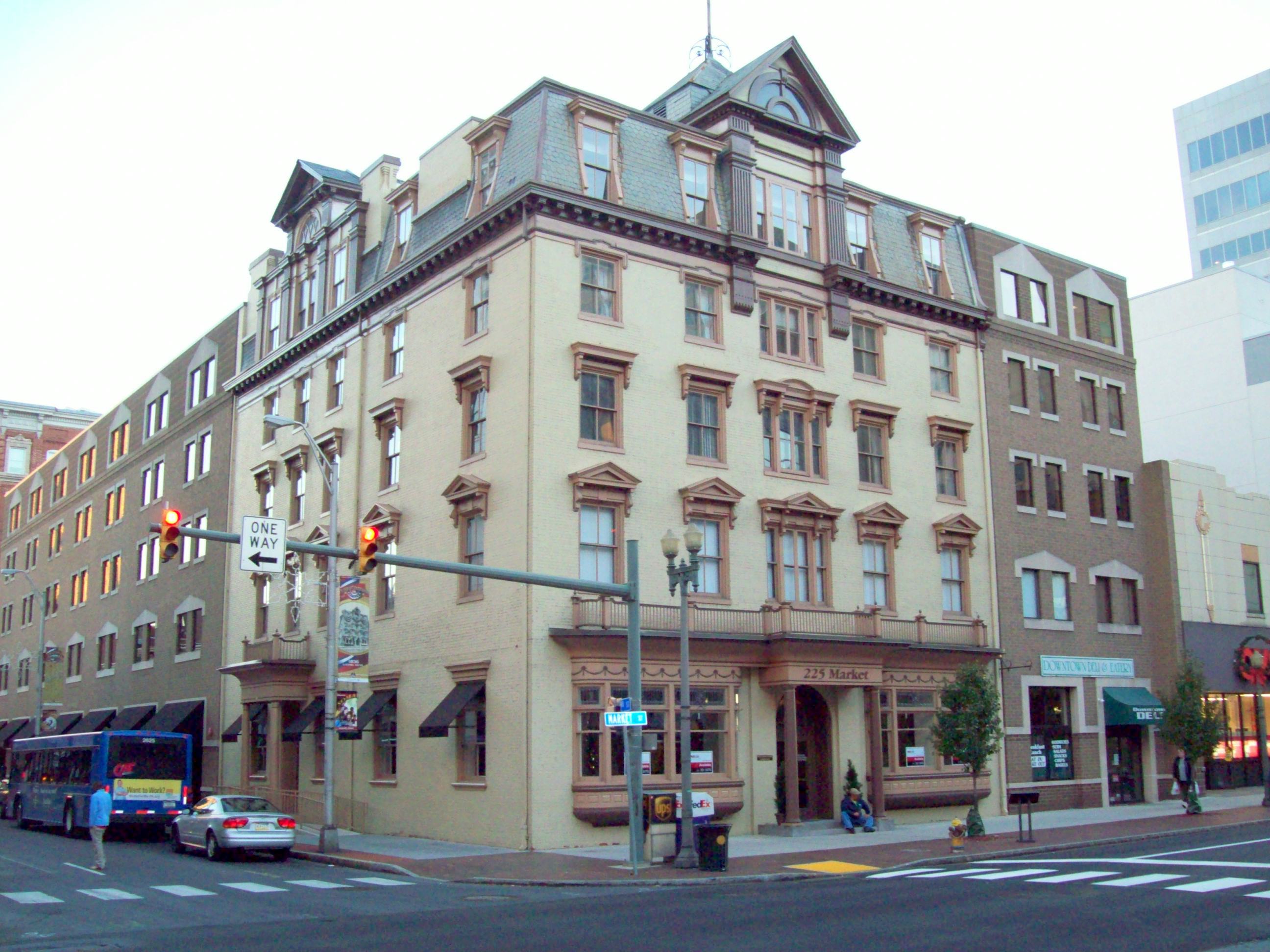
40°20′29″N 76°54′30″W / 40.34139°N 76.90833°WFort Hunter 20 GAR Building November 5, 1986 626–628 North Second Street
40°34′4″N 76°42′1″W / 40.56778°N 76.70028°WLykens 21 German Evangelical Zion Lutheran Church 
November 12, 1975 Capital and Herr Streets
40°16′3″N 76°53′9″W / 40.2675°N 76.88583°WHarrisburg 22 William R. Griffith House 
October 21, 1976 215 North Front Street
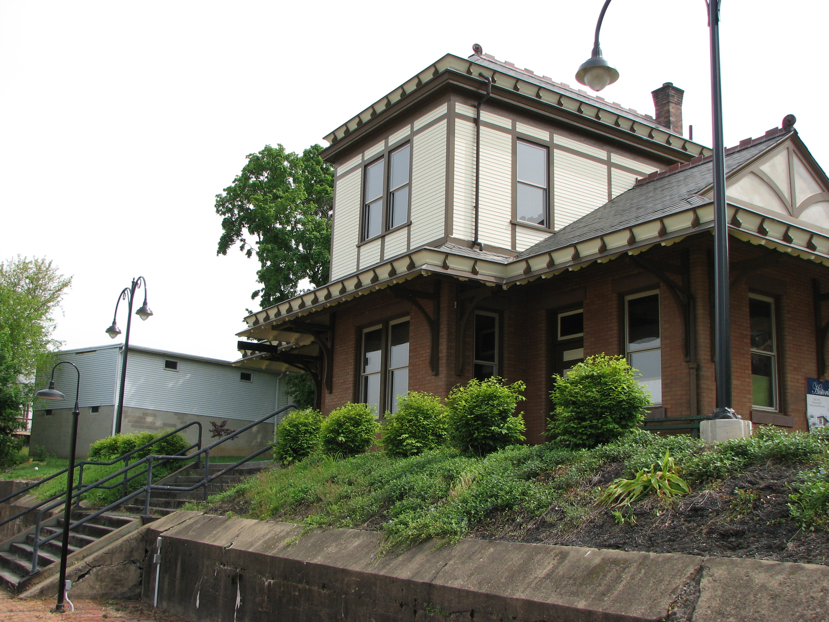
40°15′38″N 76°53′9″W / 40.26056°N 76.88583°WHarrisburg 23 Harris Switch Tower, Pennsylvania Railroad 
August 30, 1994 637 Walnut Street
40°15′54.3″N 76°52′44.3″W / 40.265083°N 76.878972°WHarrisburg 24 John Harris Mansion 
September 20, 1973 219 South Front Street
40°15′24″N 76°52′44″W / 40.25667°N 76.87889°WHarrisburg 25 Harrisburg 19th Street Armory November 14, 1991 1313 South 19th Street
40°15′2″N 76°51′9″W / 40.25056°N 76.8525°WHarrisburg Pennsylvania National Guard Armories MPS 26 Harrisburg Cemetery March 7, 1985 13th and Liberty Streets
40°16′19″N 76°51′51″W / 40.27194°N 76.86417°WHarrisburg 27 Harrisburg Central Railroad Station and Trainshed 
June 11, 1975 Aberdeen Street
40°15′43″N 76°52′40″W / 40.26194°N 76.87778°WHarrisburg 28 Harrisburg Historic District January 19, 1976 Bounded roughly by Forster, 3rd, Hanna Streets and the Susquehanna River
40°15′33″N 76°52′55″W / 40.25917°N 76.88194°WHarrisburg 29 Harrisburg Military Post November 29, 1991 Junction of 14th and Calder Streets
40°16′44″N 76°52′30″W / 40.27889°N 76.875°WHarrisburg Pennsylvania National Guard Armories MPS 30 Harrisburg Polyclinic Hospital November 12, 2004 2601 North 3rd Street
40°17′15″N 76°53′55″W / 40.2875°N 76.89861°WHarrisburg 31 Harrisburg Technical High School 
December 7, 1982 423 Walnut Street
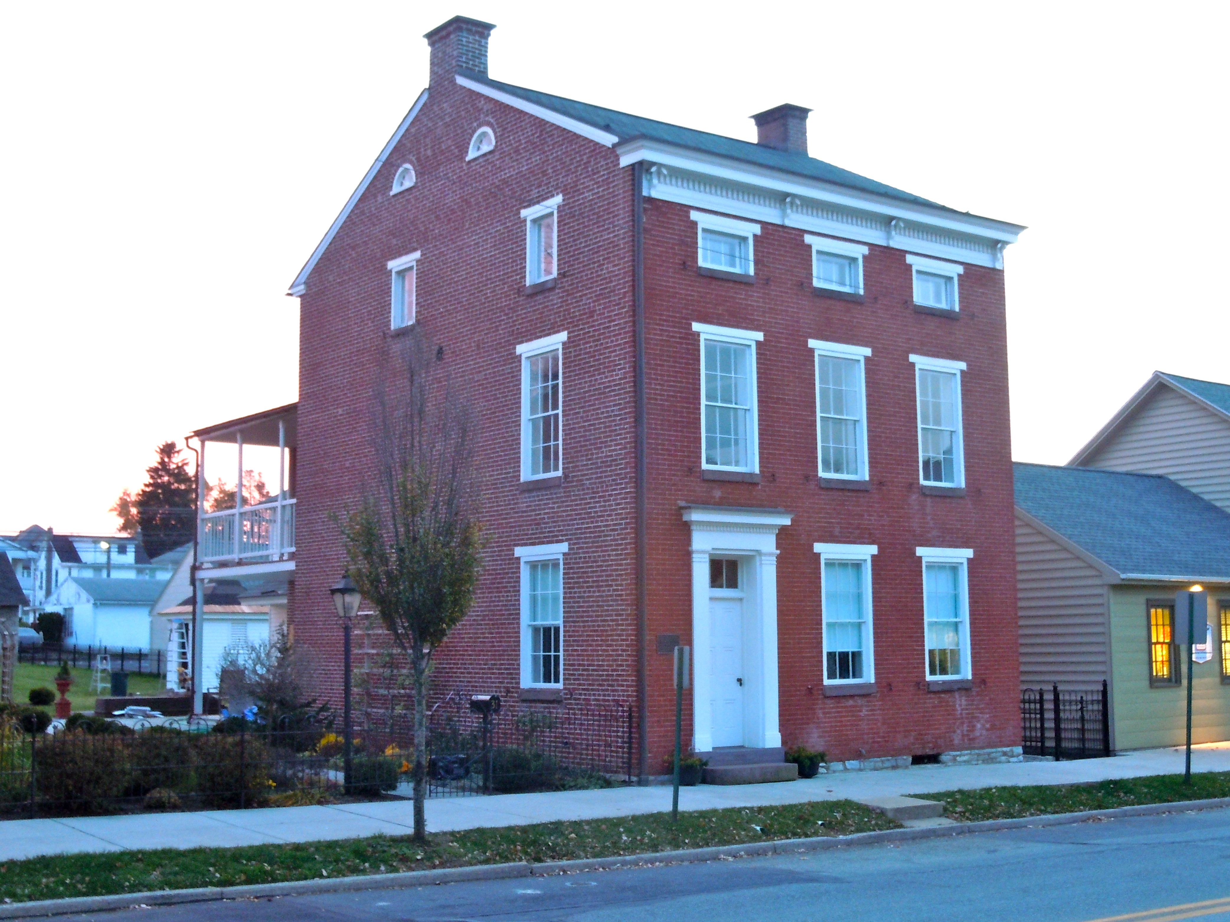
40°15′47″N 76°52′50″W / 40.26306°N 76.88056°WHarrisburg 32 Dr. William Henderson House 
May 14, 1979 31 East Main Street
40°15′54″N 76°42′26″W / 40.265°N 76.70722°WHummelstown 33 Henniger Farm Covered Bridge December 18, 1978 Northeast of Elizabethville
40°34′38″N 76°47′3″W / 40.57722°N 76.78417°WWashington Township 34 Hershey Community Center Building 
October 15, 1980 2 Chocolate Avenue
40°17′7″N 76°38′56″W / 40.28528°N 76.64889°WHershey 35 Milton S. Hershey Mansion 
February 7, 1978 Mansion Road
40°17′25″N 76°38′39″W / 40.29028°N 76.64417°WHershey 36 Highspire High School April 26, 1990 221 Penn Street
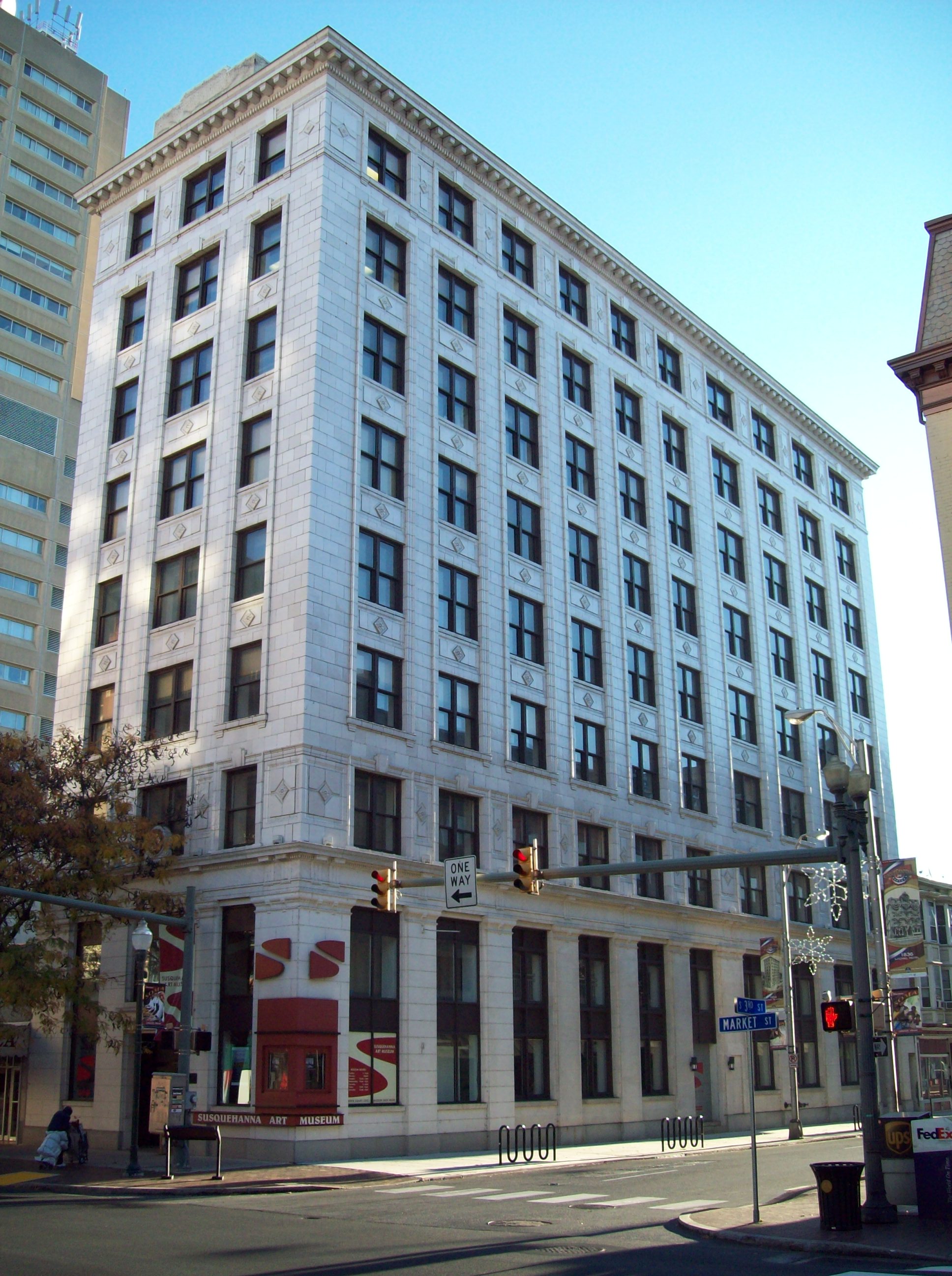
40°12′36″N 76°47′27″W / 40.21°N 76.79083°WHighspire 37 Keystone Building 
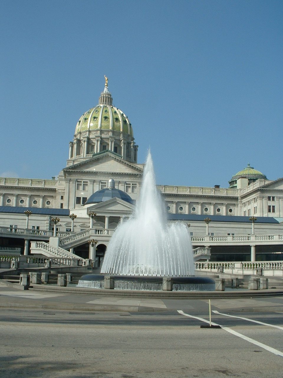
September 7, 1979 18–22 South 3rd Street
40°15′37″N 76°52′49″W / 40.26028°N 76.88028°WHarrisburg 38 Keystone Hotel 
May 9, 1985 40 East Main Street
40°15′57″N 76°42′21″W / 40.26583°N 76.70583°WHummelstown 39 Kunkel Building 
November 9, 1982 301 Market Street
40°15′39″N 76°52′51″W / 40.26083°N 76.88083°WHarrisburg 40 Legislative Route 1 Sycamore Allee February 7, 2007 Legislative Route 1, approximately 1 mile (1.6 km) north and south of Halifax
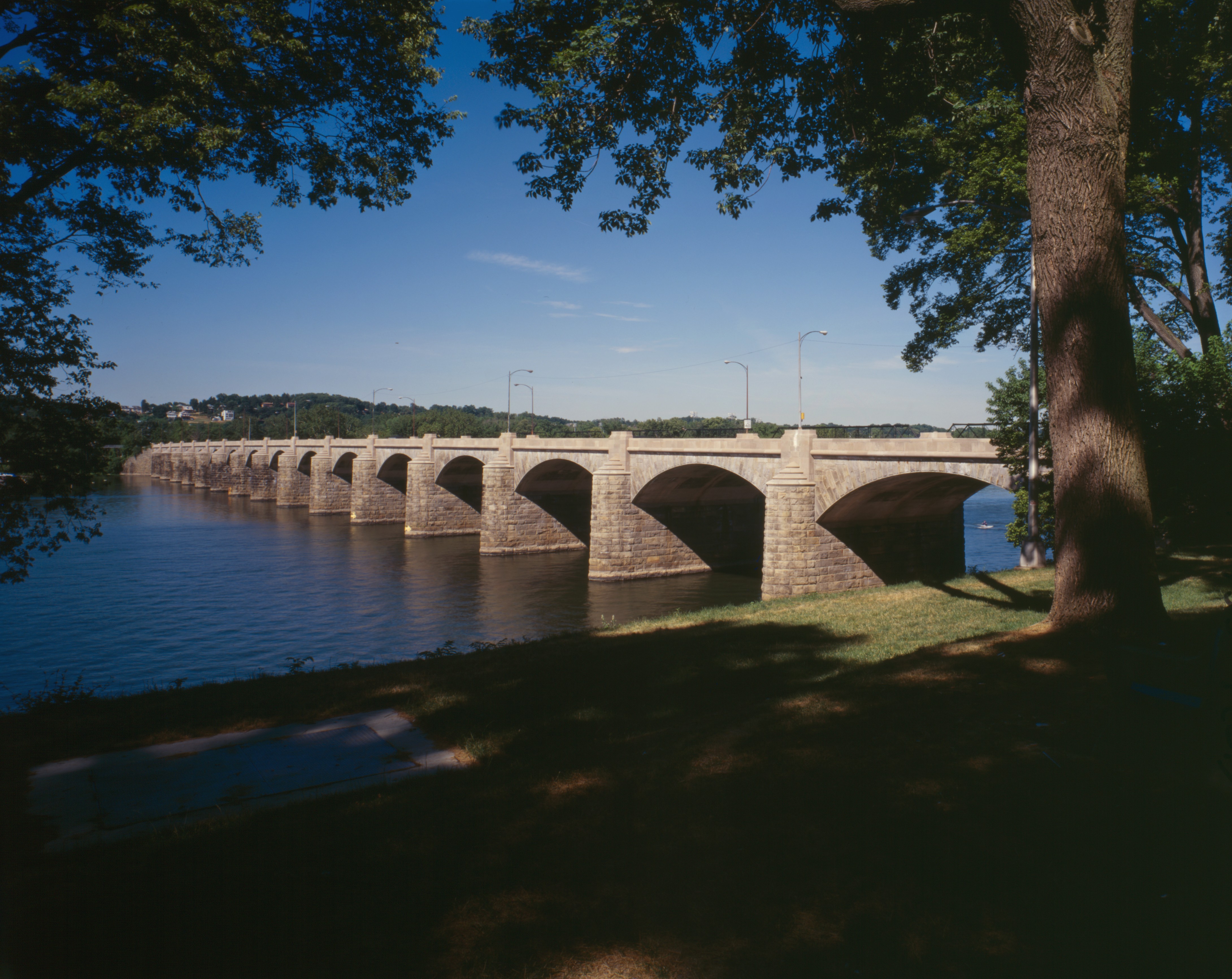
40°28′3″N 76°55′52″W / 40.4675°N 76.93111°WHalifax and Reed Townships 41 Market Street Bridge 
June 22, 1988 Market Street/Legislative Route 34 over the Susquehanna River
40°15′27″N 76°53′0″W / 40.2575°N 76.883333°WHarrisburg Extends into Cumberland County; Highway Bridges Owned by the Commonwealth of Pennsylvania, Department of Transportation TR 42 Enoch Matlack House June 22, 1979 250 East Main Street
40°15′57″N 76°42′8″W / 40.26583°N 76.70222°WHummelstown 43 Archibald McAllister House June 7, 1976 5300 North Front Street
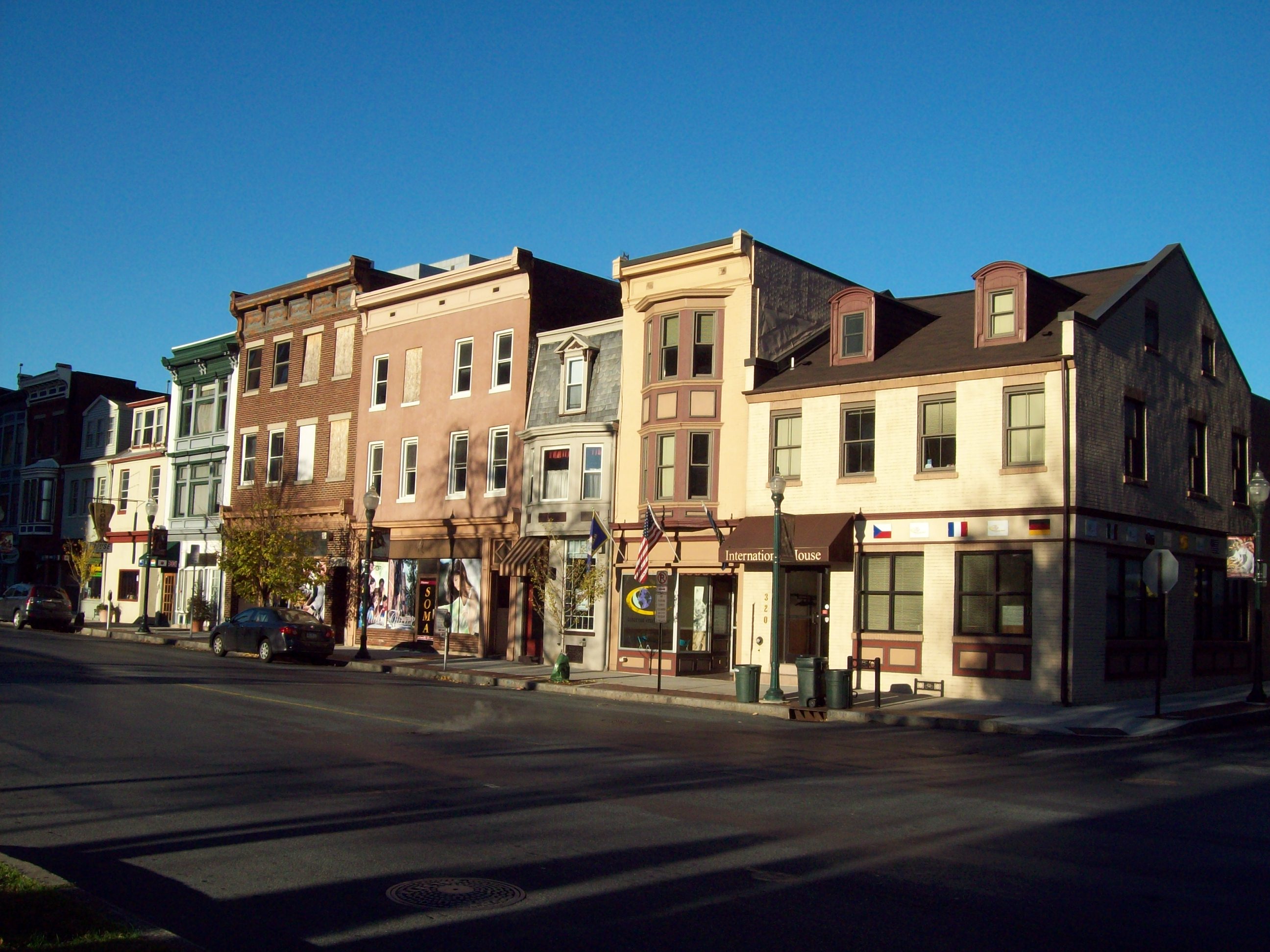
40°20′34″N 76°54′37″W / 40.34278°N 76.91028°WHarrisburg 44 Midtown Harrisburg Historic District April 21, 1983 Roughly bounded by the Susquehanna River and Forster, Verbeke, and 3rd Streets
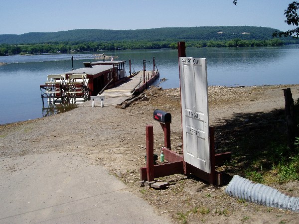
40°16′2″N 76°53′26″W / 40.26722°N 76.89056°WHarrisburg 45 Millersburg Ferry 
August 2, 2006 Over the Susquehanna River between Millersburg and Buffalo Township
40°32′39″N 76°58′25″W / 40.54417°N 76.97361°WMillersburg Extends into Buffalo Township in Perry County 46 Millersburg Passenger Rail Station 
November 27, 2002 127 West Center Street
40°32′25″N 76°57′48″W / 40.54028°N 76.96333°WMillersburg 47 Mount Pleasant Historic District January 11, 1985 Sylvan Terrace to 19th Street, Market to Brookwood Streets
40°15′44″N 76°51′56″W / 40.26222°N 76.86556°WHarrisburg 48 Old Downtown Harrisburg Commercial Historic District 
July 14, 1983 Dewberry, Chestnut, Blackberry, and South 3rd Streets
40°15′37″N 76°52′47″W / 40.26028°N 76.87972°WHarrisburg 49 Old Uptown Harrisburg Historic District January 4, 1990 Roughly bounded by McClay, North 3rd, Reily, North 2nd, and Calder
40°16′26″N 76°53′43″W / 40.27389°N 76.89528°WHarrisburg 50 Pennsylvania Railroad GG1 Streamlined Electric Locomotive #4859 
May 5, 2004 Track 5, Harrisburg Transportation Center, Aberdeen Street
40°15′45″N 76°52′40″W / 40.2625°N 76.87778°WHarrisburg 51 Pennsylvania State Lunatic Hospital January 8, 1986 Cameron Street
40°16′59″N 76°52′24″W / 40.28306°N 76.87333°WHarrisburg 52 Quarries of the Hummelstown Brownstone Company February 27, 2003 Roughly north of Brookline Drive, Amber Drive
40°13′48″N 76°41′30″W / 40.23°N 76.69167°WDerry Township 53 Charles and Joseph Raymond Houses August 1, 1979 38 and 37 North Union Street
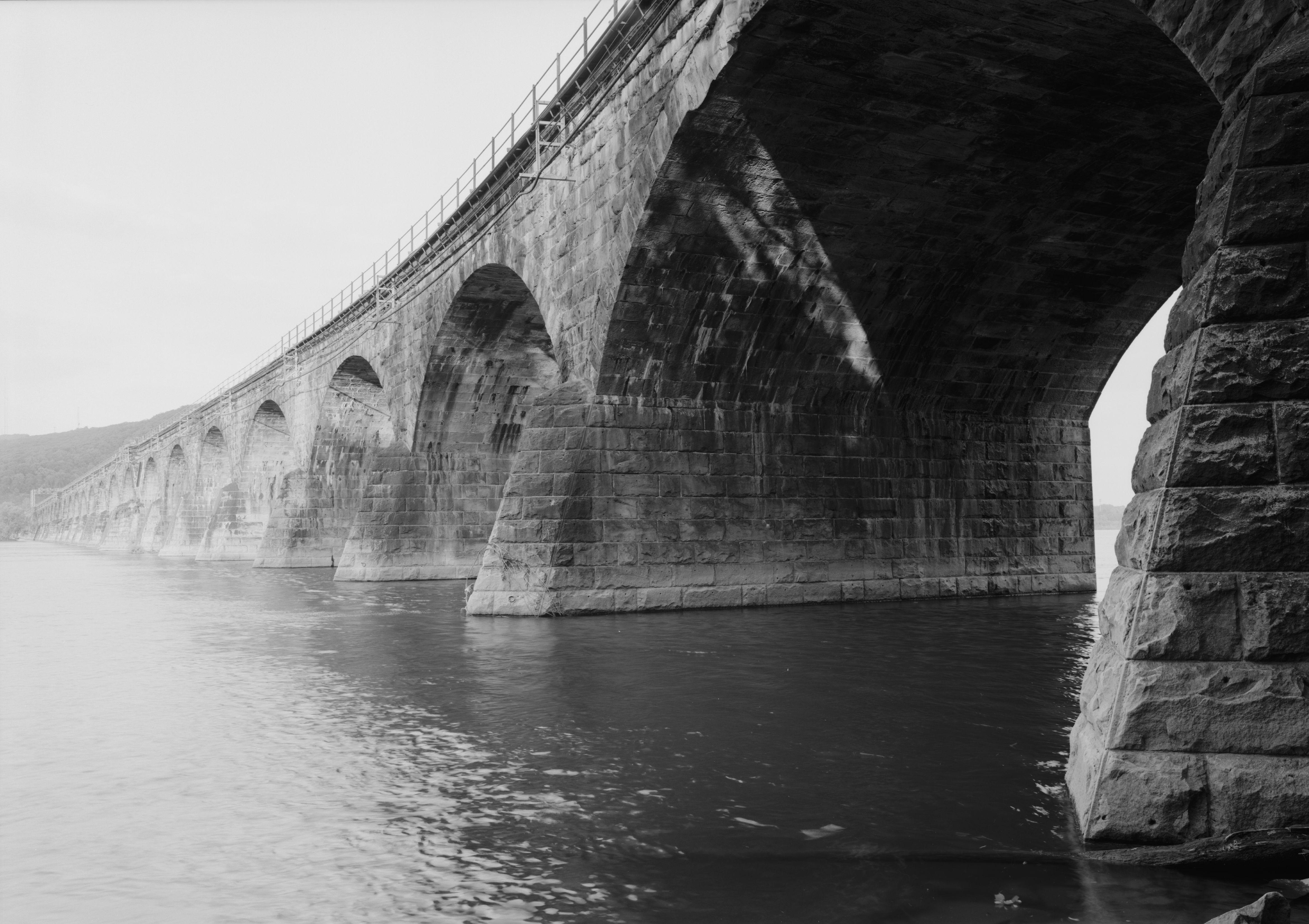
40°11′43″N 76°43′52″W / 40.19528°N 76.73111°WMiddletown 54 Rockville Bridge 
August 15, 1975 0.5 miles (0.80 km) south of Marysville over the Susquehanna River
40°19′59″N 76°54′42″W / 40.33306°N 76.91167°WSusquehanna Township Extends into Perry County 55 Romberger-Stover House August 29, 1980 Market Street
40°36′9″N 76°48′42″W / 40.6025°N 76.81167°WBerrysburg 56 St. Peter's Kierch 
June 18, 1973 31 West High Street
40°12′4″N 76°43′56″W / 40.20111°N 76.73222°WMiddletown 57 Salem United Church of Christ 
April 23, 1975 231 Chestnut Street
40°15′34″N 76°52′45″W / 40.25944°N 76.87917°WHarrisburg 58 William Seel Building 
December 3, 1980 319 Market Street
40°15′41″N 76°52′48″W / 40.26139°N 76.88°WHarrisburg 59 Sheffield Apartments April 26, 1990 2003 North 3rd Street
40°16′40″N 76°53′42″W / 40.27778°N 76.895°WHarrisburg 60 Shoop Site (36DA20) February 13, 1986 East of Enders
40°29′14″N 76°49′12″W / 40.48722°N 76.82°W[7]Jackson Township and Wayne Township 61 Henry Smith Farm December 22, 1988 950 Swatara Creek Road
40°12′46″N 76°42′56″W / 40.21278°N 76.71556°WMiddletown 62 Soldiers and Sailors Memorial Bridge 
June 22, 1988 Legislative Route 140/State Street over Legislative Route 130 Spur and Paxton Creek
40°16′2″N 76°52′43″W / 40.26722°N 76.87861°WHarrisburg Highway Bridges Owned by the Commonwealth of Pennsylvania, Department of Transportation TR 63 Star Barn Complex July 27, 2000 Nissley Drive at Pennsylvania Route 283
40°13′25″N 76°46′17″W / 40.22361°N 76.77139°WLower Swatara Township 64 State Capitol Building, Pennsylvania 
September 14, 1977 3rd, Walnut, Commonwealth, and North Streets
40°15′52″N 76°53′2″W / 40.26444°N 76.88389°WHarrisburg 65 Steelton High School September 8, 2011 100 South 4th Street
40°14′6.3″N 76°50′12″W / 40.235083°N 76.83667°WSteelton Educational Resources of Pennsylvania MPS 66 Swatara Ferry House September 27, 1976 400 Swatara Street
40°11′29″N 76°43′57″W / 40.19139°N 76.7325°WMiddletown 67 John Todd House November 3, 1988 South Meadow Lane
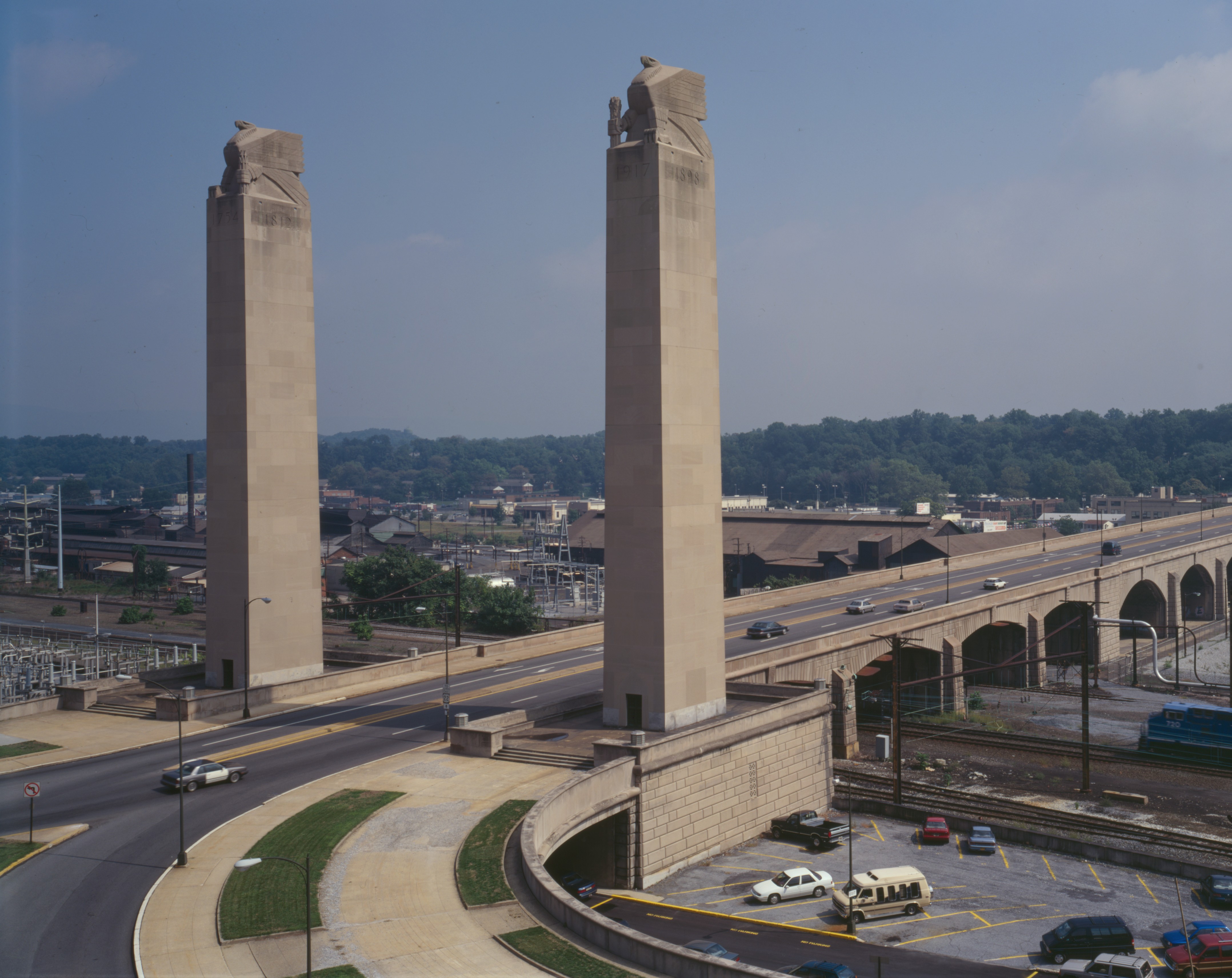
40°21′7″N 76°40′15″W / 40.35194°N 76.67083°WEast Hanover Township 68 Walnut Street Bridge 
June 5, 1972 Walnut Street over the Susquehanna River
40°15′18″N 76°53′19″W / 40.255°N 76.88861°WHarrisburg 69 Zion Lutheran Church and Graveyard 
March 29, 1979 Rosanna Street
40°15′58″N 76°42′39″W / 40.26611°N 76.71083°WHummelstown Former listings
[3] Landmark name[4] Image Date delisted Location City or Town Summary 1 Greenawalt Building March 10, 1998 118–120 Market Street Harrisburg 2 Telegraph Building June 27, 1986 214–216 Locust Street Harrisburg Listed on March 3, 1978 See also
- List of National Historic Landmarks in Pennsylvania
- National Register of Historic Places listings in Pennsylvania
- List of Pennsylvania state historical markers in Dauphin County
References
- ^ The latitude and longitude information provided in this table was derived originally from the National Register Information System, which has been found to be fairly accurate for about 99% of listings. For about 1% of NRIS original coordinates, experience has shown that one or both coordinates are typos or otherwise extremely far off; some corrections may have been made. A more subtle problem causes many locations to be off by up to 150 yards, depending on location in the country: most NRIS coordinates were derived from tracing out latitude and longitudes off of USGS topographical quadrant maps created under the North American Datum of 1927, which differs from the current, highly accurate WGS84 GPS system used by Google maps. Chicago is about right, but NRIS longitudes in Washington are higher by about 4.5 seconds, and are lower by about 2.0 seconds in Maine. Latitudes differ by about 1.0 second in Florida. Some locations in this table may have been corrected to current GPS standards.
- ^ "National Register of Historic Places: Weekly List Actions". National Park Service, United States Department of the Interior. Retrieved on November 10, 2011.
- ^ a b Numbers represent an ordering by significant words. Various colorings, defined here, differentiate National Historic Landmark sites and National Register of Historic Places Districts from other NRHP buildings, structures, sites or objects.
- ^ a b "NPS Focus". National Register of Historic Places. National Park Service. http://nrhp.focus.nps.gov. Retrieved November 20, 2009.
- ^ Location derived from its GNIS feature record; the NRIS lists the site as "Address Restricted
- ^ Location derived from its NRHP nomination form; the NRIS lists the site as "Address Restricted"
- ^ Location derived from its NRHP nomination form; the NRIS lists the site as "Address Restricted"
Municipalities and communities of Dauphin County, Pennsylvania City 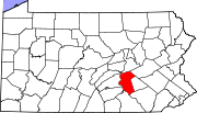
Boroughs Berrysburg | Dauphin | Elizabethville | Gratz | Halifax | Highspire | Hummelstown | Lykens | Middletown | Millersburg | Paxtang | Penbrook | Pillow | Royalton | Steelton | Williamstown
Townships Conewago | Derry | East Hanover | Halifax | Jackson | Jefferson | Londonderry | Lower Paxton | Lower Swatara | Lykens | Middle Paxton | Mifflin | Reed | Rush | South Hanover | Susquehanna | Swatara | Upper Paxton | Washington | Wayne | West Hanover | Wiconisco | Williams
CDPs Unincorporated
communitiesBachmanville | Beaufort Farms | Dietrich | Deodate | Carsonville | Catalina | Ebenezer | Edgemont | Ellendale Forge | Enders | Enterline | Estherton | Fort Hunter | Grantville | Hanoverdale | Hanover Heights | Heckton | Hillside Village | Hockersville | Hoernerstown | Inglenook | Jednota | Killinger | Loyalton | Lucknow | Manada Gap | Manada Hill | Matamoras | Montrose Park | Oakleigh | Oakmont | Oberlin Gardens | Paxtang Manor | Palmdale | Piketown | Powells Valley | Ridgeview | Ritzie Village | Rockville | Sand Beach | Shellsville | Singersville | Swatara | Vaughn | Union Deposit | Waynesville | Windsor Farms
Categories:- Dauphin County, Pennsylvania
- National Register of Historic Places in Pennsylvania by county
-


Wikimedia Foundation. 2010.