- U.S. Route 22
-
U.S. Route 22

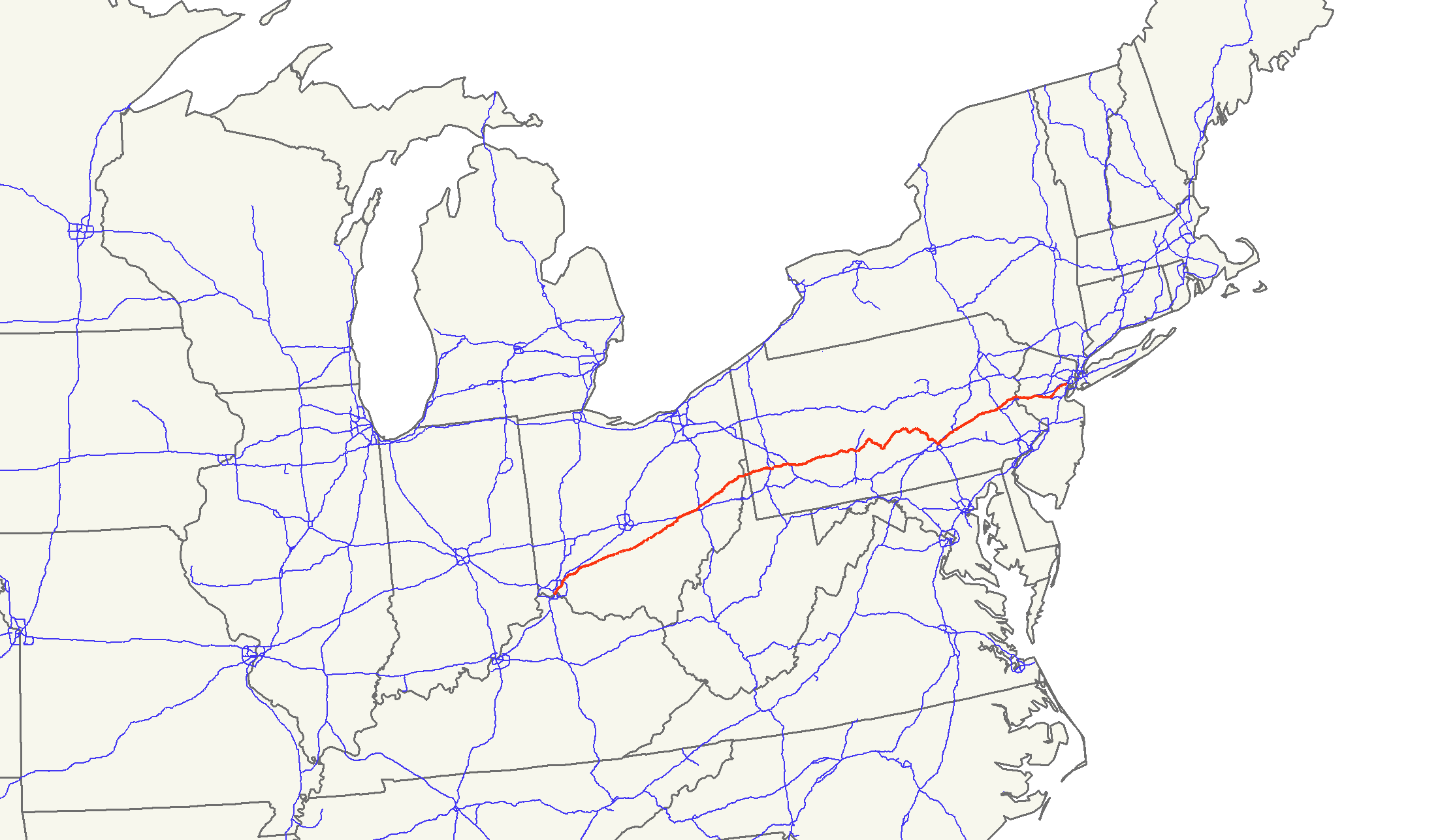
Route information Length: 647.45 mi[1][2] (1,041.97 km) Existed: 1926 – present Major junctions West end: 


 US 27 / US 42 / US 52 / US 127 / OH 3 / OH 264 in Cincinnati
 I-70 near Zanesville, OH
 I-77 near Cambridge, OH
 I-79 near Pittsburgh, PA

 I-76 / Penna. Tpk. in Monroeville, PA
 US 119 from New Alexandria, PA to Blairsville, PA
 US 219 in Ebensburg, PA

 I-99 / US 220 near Altoona, PA
 US 522 from Mount Union, PA to Lewistown, PA
 US 322 from Lewistown, PA to Harrisburg, PA

 US 11 / US 15 in Duncannon, PA

 I-81 / I-83 near Harrisburg, PA
 I-78 in Lebanon County, PA
 I-476 near Allentown, PA
 I-287 in Bridgewater, NJ
East end: 
 I-78 / US 1-9 / Route 21 in Newark, NJ
Highway system United States Numbered Highways
List • Bannered • Divided • ReplacedU.S. Route 22 (US 22) is a west–east route and is one of the original United States highways of 1926, running from Cincinnati, Ohio, at US 27, US 42, US 127, and US 52 to Newark, New Jersey, at U.S. Route 1/9 near the Newark Liberty International Airport.[3] US 22 also carries the names of the William Penn Highway throughout most of Pennsylvania. In southwest Ohio, it overlaps with Ohio State Route 3 and is familiarly known as the 3C Highway, "22 and 3", and Montgomery Road.
A section of US 22 between New Alexandria at U.S. Route 119 and Harrisburg at Interstate 81 has been designated a part of Corridor M of the Appalachian Development Highway System.
Contents
Route description
Ohio
Lengths mi[1] km OH 243.35 391.63 WV 5.97 9.60 PA 337.60 543.31 NJ[2] 60.53 97.41 Total 647.45 1041.97 In Ohio, US 22 between Zanesville and Lancaster roughly follows the route of Zane's Trace, an early pioneer road blazed by Colonel Ebenezer Zane beginning in 1796. From Cincinnati to Washington Court House, US 22 roughly follows the historic 3C Highway which connected Cincinnati, Columbus, and Cleveland. This section is also contiguous with Ohio State Route 3. Both US 22 and State Route 3 end in downtown Cincinnati; officially, US 22 Eastbound begins on Central Avenue (U.S. Routes 27 Northbound/52 Westbound/127 Northbound) at 5th Street, then proceeds north, turning east onto 7th Street, while U.S. 22 Westbound follows 9th Street and ends at Central Avenue[4] (signage designating the end occurs much sooner, approaching Elm Street, U.S. Route 42 Northbound[5]).
West Virginia
Known as the Robert C. Byrd Expressway, the expressway passes for approximately five miles within the state of West Virginia, through or bordering the city of Weirton for its entire length, from the Pennsylvania state line on the east to the Ohio River and Steubenville, Ohio on the west.
Before the Byrd Expressway, West Virginia's segment of U.S. 22 ran from Pennsylvania Ave. at the PA/WV state line to Main St., then left on Main St. through downtown Weirton (aligning U.S. 22 with West Virginia Route 2), and right on Freedom Way to the Fort Steuben Bridge and Ohio River to Steubenville, Ohio. An "Alternate U.S. 22" route ran along Cove Rd. from Pennsylvania Ave. to the intersection of Harmon Creek Rd. (left turn) and the continuation of Cove Rd. (right turn).
With the opening of the first segment of the Byrd Expressway in the mid-70s, U.S. 22 was reassigned, starting on the new road from the PA/WV state line, continuing on Cove Rd. where the expressway ended and joining the remainder of the original route at Main St. The Pennsylvania Ave. segment of U.S. 22 from Colliers Way to Main St. was reassigned as WV Route 105 and Alt. U.S. 22 was reassigned as WV Route 507. In 2003, WV 507 was extended along the previous U.S. 22 alignment from Cove Rd. to the Fort Steuben Bridge and was reassigned as County Route 507. The Fort Steuben Bridge, which originally carried U.S. 22 across the Ohio River until the construction of the Veterans Memorial Bridge, was permanently closed on January 8, 2009.[6]
Pennsylvania
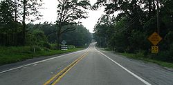 Parts of U.S. 22 are still 2 lanes, such at this one just west of Nanty-Glo, Pennsylvania.
US 22 enters Pennsylvania as a limited-access highway connecting Weirton, WV and Steubenville, OH with Pittsburgh. Through much of the Pittsburgh area, it multiplexes with Interstate 376 and US 30. US 30 merges with US 22 near Imperial and Pittsburgh International Airport, and both highways then merge with Interstate 376 in Robinson Township. Together, these three highways form a busy, limited-access multiplex through the city of Pittsburgh. US 30 then splits from Interstate 376 and US 22 in North Braddock, and Interstate 376 ends at the Pennsylvania Turnpike (Interstate 76) in Monroeville. East of the Pennsylvania Turnpike, US 22 continues east as a primary arterial highway with at-grade crossings, but remains a major thoroughfare between Pittsburgh and major population centers in central Pennsylvania, such as Johnstown, Altoona, State College and Huntingdon.
US 22 between eight miles (13 km) east of Interstate 81 to Allentown is concurrent with Interstate 78. Former highway alignments of US 22 that parallel this section are collectively known as the "Hex Highway", so called because of the Berks County-based Pennsylvania Dutch families that hang hex signs on their barns.
US 22 in eastern Pennsylvania is a four lane limited-access expressway between Easton and Interstate 78 to the west; it is dually designated with the Lehigh Valley Thruway in Allentown. The original designation for this expressway was to be Interstate 78, but local opposition to a freeway in Phillipsburg, along with substandard conditions at Easton, forced federal highway officials to relocate Interstate 78 south of Allentown, Bethlehem, Easton, and Phillipsburg. U.S. 22 then crosses the Delaware River on the Easton-Phillipsburg Toll Bridge.
New Jersey
U.S. Route 22 in New Jersey predates, and was largely replaced by, Interstate 78 as it was built between 1956 and 1989,[7] and shares designation with I-78 from exit 3 to exit 18. US 22 was an expressway in some segments, including the area around Perryville and Clinton. It connects Phillipsburg with Newark in New Jersey.
US 22 has one major interchange besides I-78, that being Interstate 287, although it is not a full interchange, with two missing movements, US 22 eastbound to I-287 northbound and I-287 southbound to US 22 westbound.
The only level crossing of the highway happens in Union County in the Union Township section of the highway. It once belonged to the Rahway Valley Railroad; the crossing was closed in 1992 when service on the railroad was ended.
History
US 22 is one of the original U.S. Routes, though in the 1925 plan it was to terminate in Cleveland, Ohio, entering Ohio on modern U.S. Route 422. In the finalized 1926 plan, it followed the current course to U.S. Route 40, where it ended. In 1932, it had been extended to Cincinnati as it is currently, replacing Ohio State Route 10 and following preexisting State Route 3.[8][9]
See also
Related U.S. Routes
- U.S. Route 122
- U.S. Route 222
- U.S. Route 322
- U.S. Route 422
- U.S. Route 522
- U.S. Route 622
References
- ^ a b DeLorme Street Atlas USA 2007 software, Driving Directions
- ^ a b "US 22 Straight Line Diagram" (PDF). New Jersey Department of Transportation. http://www.state.nj.us/transportation/refdata/sldiag/00000022__-.pdf. Retrieved 2007-07-20.
- ^ Mapguy. "Endpoints of US highways." 12 Oct. 2006. 21 Oct. 2006 [1].
- ^ Straight Line Diagrams (US 22 Hamilton County). Ohio Department of Transportation.
- ^ 104 W 9th St, Cincinnati, Ohio, United States. Google Street View
- ^ Gossett, Dave (2009-01-15). "Fort Steuben Bridge permanently closed". Weirton Daily Times. Archived from the original on 2009-02-02. http://www.webcitation.org/5eI7HnDFb. Retrieved 2009-02-02.
- ^ "Interstate 78 (New Jersey)". nycroads.com. http://www.nycroads.com/roads/I-78_NJ/.
- ^ "U.S. 22: The William Penn Highway". Federal Highway Administration. http://www.fhwa.dot.gov/infrastructure/us22.cfm. Retrieved 2009-04-24.
- ^ Official Transportation Map archive. Ohio Department of Transportation.
External links
 Main U.S. Routes
1 2 3 4 5 6 7 8 9 10 11 12 13 14 15 16 17 18 19 20 21 22 23 24 25 26 27 28 29 30 31 32 33 34 35 36 37 38 40 41 42 43 44 45 46 48 49 50 51 52 53 54 55 56 57 58 59 60 61 62 63 64 65 66 67 68 69 70 71 72 73 74 75 76 77 78 79 80 81 82 83 84 85 87 89 90 91 92 93 94 95 96 97 98 99 101 163 400 412 425 Lists U.S. Routes • Bannered • Divided • Bypassed Browse numbered routes ←  SR 21
SR 21OH US 23  →
→←  PA 21
PA 21PA PA 23  →
→← Route 21NJ Route 23  →
→Transportation infrastructure of the Lehigh Valley Interstates U.S. Routes Pennsylvania Routes New Jersey Routes County Routes Named roads/streets Bridges Albertus L. Meyers Bridge · Hill to Hill Bridge · Philip J. Fahy Memorial Bridge · Minsi Trail Bridge · Easton–Phillipsburg Toll Bridge · Northampton Street Bridge · Interstate 78 Toll Bridge
Tunnels Public transportation Lehigh and Northampton Transportation Authority (Bethlehem Loop) · Trans-Bridge Lines · NJ Transit
Airports Waterways Rail Categories:- U.S. Route 22
- Roads in the Harrisburg, Pennsylvania area
- U.S. Highways in Ohio
- U.S. Highways in West Virginia
- U.S. Highway System
- Transportation in Cincinnati, Ohio

Wikimedia Foundation. 2010.