- U.S. Route 34
-
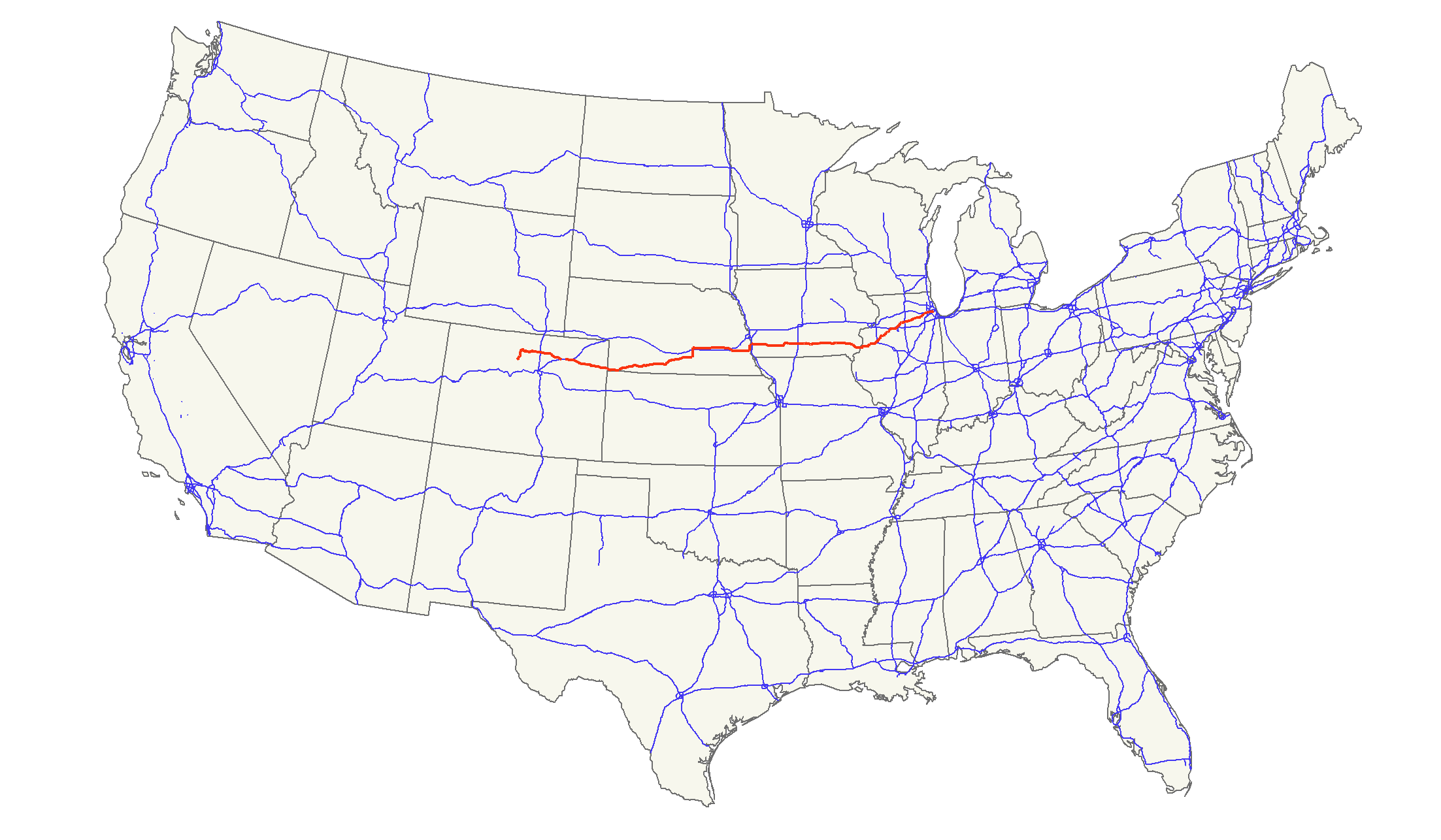
U.S. Route 34
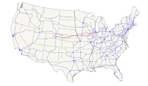
Route information Length: 1,122 mi[1] (1,806 km) Existed: 1926[1] – present Major junctions West end:  US 40 at Granby, CO
 I-25 / US 87 near Loveland, CO
 I-80 at Lincoln, NE
 I-29 near Glenwood, IA
 I-35 near Osceola, IA
 I-74 near Galesburg, IL

 I-39 / US 51 near Mendota, IL
 I-294 at Western Springs, IL
East end: 
 IL-43 / Historic US 66 at Berwyn, IL
Highway system United States Numbered Highways
List • Bannered • Divided • ReplacedU.S. Route 34 is an east–west United States highway that runs for 1,122 miles (1,806 km) from north-central Colorado to the western suburbs of Chicago. Through Rocky Mountain National Park it is known as the Trail Ridge Road where it reaches 12,183 ft (3,713 m), making it the highest paved through highway in the United States. The highway's western terminus is Granby, Colorado at U.S. Route 40. Its eastern terminus is in Berwyn, Illinois at Illinois Route 43 and Historic US 66.
U.S. Route 34 becomes a toll road for a short distance in Colorado, where it passes through Rocky Mountain National Park.
Contents
Route description
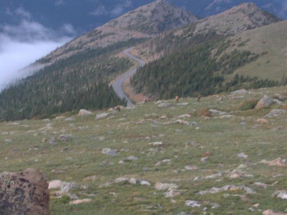
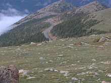 View of US 34 in Rocky Mountain National Park, at an elevation above 11,000 feet
Colorado
Main article: U.S. Route 34 in ColoradoIn the state of Colorado, U.S. Route 34 runs north from Granby through Rocky Mountain National Park. It passes through Estes Park, Loveland, and Greeley before entering Nebraska east of Wray.
Within Rocky Mountain National Park US 34 is known as Trail Ridge Road. Due to its high elevation through the park and over the Continental Divide, Route 34 closes entirely in winter from the Colorado River Trailhead on the west (10 miles north of the Grand Lake entrance) to Many Parks Curve on the east (8 miles from the Estes Park entrance.) Closure runs roughly from mid-October to Memorial Day weekend in May, and can occur at any time in summer due to high alpine snow storms. Call 970-586-1222 for up to date closure status.[2]
Route 34 transverses Fall River Pass and Milner Pass in the Front Range of Colorado.
Nebraska
Main article: U.S. Route 34 in NebraskaIn the state of Nebraska, U.S. Route 34 is a major east–west arterial surface road along the southern portion of Nebraska. It enters Nebraska west of Haigler and overlaps other routes for the majority of its routing. U.S. 34 passes through Hastings, Grand Island, and Lincoln before entering Iowa east of Plattsmouth over the Plattsmouth Bridge.
U.S. Route 34 from between Hastings and Grand Island is known as the Tom Osborne Expressway, which is named for the former Hastings resident, Nebraska Cornhusker football coach, and Congressman. Also, the segment from the Lancaster County/Cass County border to Nebraska Highway 1 south of Elmwood is the Bess Streeter Aldrich Memorial Highway, after the former author and Elmwood resident.
Iowa
In the state of Iowa, U.S. Route 34 is a major east–west arterial surface road across southern Iowa. It enters Iowa west of Pacific Junction and is briefly concurrent with Interstate 29. U.S. 34 then passes through Glenwood, Red Oak, and Creston before intersecting Interstate 35 at Osceola. East of Osceola, it continues through Chariton and Georgetown then onto Albia before meeting U.S. Route 63 at a traffic circle in Ottumwa.
East of Ottumwa to Burlington, the highway overlaps Iowa Highway 163. This segment of highway is an expressway with some freeway segments. As of November 12, 2008, it bypasses Fairfield and then bypasses Mt. Pleasant, with a portion of this also concurrent with U.S. Route 218, which is also the Iowa route for the Avenue of the Saints. It then continues southeast towards Burlington bypassing New London and then Danville and Middletown. The freeway segment through Burlington was completed in the 1970s. It then crosses the Mississippi River on the Great River Bridge into Illinois which was completed in the early 1990s.
Much of this route was originally known as the Bluegrass Highway and parallels tracks of what was originally the Burlington and Missouri River Railroad and is now the BNSF. Amtrak's California Zephyr passenger rail service also parallels this route.
U.S. 34 in the state of Iowa is officially designated the Red Bull Highway in honor of the 34th Infantry (Red Bull) Division.
Illinois
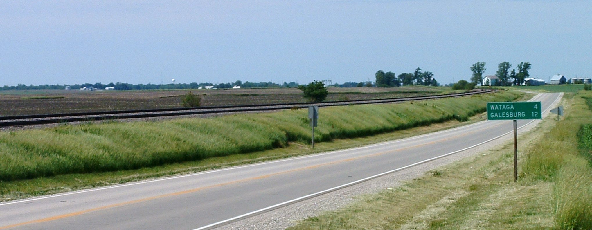
Main article: U.S. Route 34 in Illinois U.S. 34 in western Illinois
In the state of Illinois, U.S. Route 34 enters from the Mississippi River across from Burlington, Iowa. It passes through or around the cities of Monmouth, Galesburg, Princeton, Mendota, Oswego, Aurora, Naperville, Lisle, Downers Grove, Hinsdale, and Western Springs and continues in a largely southwest-northeast direction to its eastern terminus at Illinois Route 43 and Historic US 66 in Berwyn.[3] Through much of the Chicago area, the highway is known as "Ogden Avenue", after William Butler Ogden, Chicago's first mayor.
Future
Nebraska and Iowa are planning a new U.S. Route 34 bridge which would reroute U.S. 34 north of the Platte River concurrent with U.S. 75, then turn east to cross the Missouri River south of Bellevue, Nebraska.[4] It would then align with the current U.S. 34 alignment near Glenwood, Iowa.
Major intersections
- I-25 in Loveland, Colorado
- I-76 from Brush, Colorado to Wiggins, Colorado - concurrency 9 miles (14 km)
- I-80 near Grand Island, Nebraska
- I-80 in Lincoln, Nebraska
- I-29 from near Pacific Junction, Iowa to near Glenwood, Iowa - concurrency 3 miles (4.8 km)
- I-35 in Osceola, Iowa
- US 67 in Monmouth, Illinois
- I-74 near Galesburg, Illinois
- I-80 in Princeton, Illinois
- I-39 in Meriden, Illinois
- I-355 in Lisle, Illinois
- I-294 in Hinsdale, Illinois
See also
Bannered routes
- U.S. Route 34 Business - Chariton, Iowa
- U.S. Route 34 Business - Ottumwa, Iowa
- U.S. Route 34 Business - Fairfield, Iowa
- U.S. Route 34 Business - Mount Pleasant, Iowa
References
External links
- Ogden Avenue history and photography at Forgotten Chicago.
 Main U.S. Routes
1 2 3 4 5 6 7 8 9 10 11 12 13 14 15 16 17 18 19 20 21 22 23 24 25 26 27 28 29 30 31 32 33 34 35 36 37 38 40 41 42 43 44 45 46 48 49 50 51 52 53 54 55 56 57 58 59 60 61 62 63 64 65 66 67 68 69 70 71 72 73 74 75 76 77 78 79 80 81 82 83 84 85 87 89 90 91 92 93 94 95 96 97 98 99 101 163 400 412 425 Lists U.S. Routes • Bannered • Divided • Bypassed Browse numbered routes ←  SH 30
SH 30CO SH 35  →
→←  N-33
N-33NE N-35  →
→←  Iowa 31
IA I-35 →←  IL 33
IL 33IL IL 34  →Categories:
- U.S. Highway System
- U.S. Highways in Nebraska
- U.S. Highways in Iowa
- U.S. Highways in Colorado
- Ronald Reagan Trail
- U.S. Route 34

Wikimedia Foundation. 2010.