- U.S. Route 412
Infobox U.S. Route
article_route=412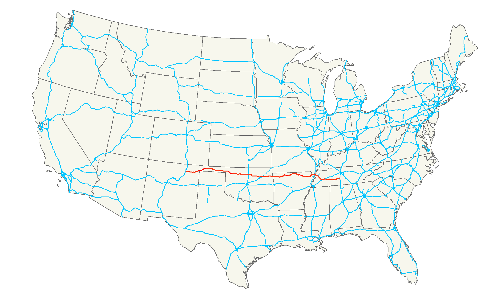
length_mi=1,130Droz, Robert V. [http://www.us-highways.com/usbt.htm U.S. Highways : From US 1 to (US 830)] . URL accessed 22:46, 20 February 2006 (UTC).]
length_km=1,818.6
yrcom=1982 (extended east in 1984, 1989, west in 1989, 1994)mapguy, [http://www.geocities.com/usend1019/End412/end412.htm End of U.S. Highway 412] (with maps of U.S. 412 and related routes). URL accessed 19:45, 25 March 2006 (UTC).]
direction_a=West
direction_b=East
from=Jct|state=NM|BL|25|US|56|NM|21|dab1=Springer at Springer, NM
junction=Jct|state=OK|I|35 near Enid, OK
Jct|state=OK|I|44 at Tulsa, OK
Jct|state=AR|I|540 at Springdale, AR
Jct|state=MO|I|55 at Caruthersville, MO
Jct|state=TN|I|155|US|51 at Dyersburg, TN
Jct|state=TN|I|40 at Jackson, TN
to=Jct|state=TN|I|65|TN|99 at Columbia, TNU.S. Route 412 is an east-west
United States highway , first commissioned in 1982. Its route number is a "violation" of the usual AASHTO numbering scheme, as it comes nowhere near its implied "parent", US 12. U.S. 412 overlaps expressway-gradeCimarron Turnpike from Tulsa west toInterstate 35 and theCherokee Turnpike from 5 miles west ofChouteau, Oklahoma , to 8 miles west of the Arkansas state line. U.S. 412 has a bannered route in eastern Oklahoma named Scenic US 412, one of only two such routes in the country. Another curiosity of this highway is that it runs the entire length of theOklahoma Panhandle and traverses theMissouri Bootheel .As of 2004 , the highway's eastern terminus is inColumbia, Tennessee at an intersection withInterstate 65 , where it continues east as State Route 99. Its western terminus is inSpringer, New Mexico at an intersection withInterstate 25 .Route description
U.S. 412 overlaps with
U.S. 43 , U.S. 56,U.S. 60 ,U.S. 62 ,U.S. 63 ,U.S. 64 , I-155, and U.S. 270, runs parallel toU.S. 62 andU.S. 64 in various places and intersects U.S. 70. mapguy, [http://www.geocities.com/mapguy_annex/HwyEnds/Charts/violations.htm US route numbering curiosities and violations] (with maps of U.S. 412 and related routes). URL accessed 20:10, 25 March 2006 (UTC).]New Mexico
Oklahoma
Arkansas
The Arkansas section runs thourgh the scenic Ozark Mountains starting at the Oklahoma line and runs through the northern part of Arkansas exiting the state at the Missouri bootheel. Cities along the route include Springdale, Harrison, Mountain Home, Walnut Ridge, and Paragould. At Mountain Home, the highway crosses Lake Norfork, which at one time had to be crossed by ferry.
Missouri
Tennessee
The section from I-65 near Columbia westbound is overlapped with unsigned
Tennessee State Route 99 . East of I-65 at the eastern terminus of US 412, the route remains Tennessee 99.See also
*
U.S. Route 400
*U.S. Route 425 Bannered and suffixed routes
* U.S. Route 412 Business in
Hindsville, Arkansas
* U.S. Route 412 Business inHuntsville, Arkansas
* U.S. Route 412 Business inJackson, Tennessee
* U.S. Route 412 Business inColumbia, Tennessee
*U.S. Route 412 Alternate
*U.S. Route 412 Scenic inOklahoma References
###@@@KEYEND@@@###
you can access US 412 from Jonesborough, Arkansas to I-55. It is roughly thirty five miles.
Wikimedia Foundation. 2010.