- Dyersburg, Tennessee
-
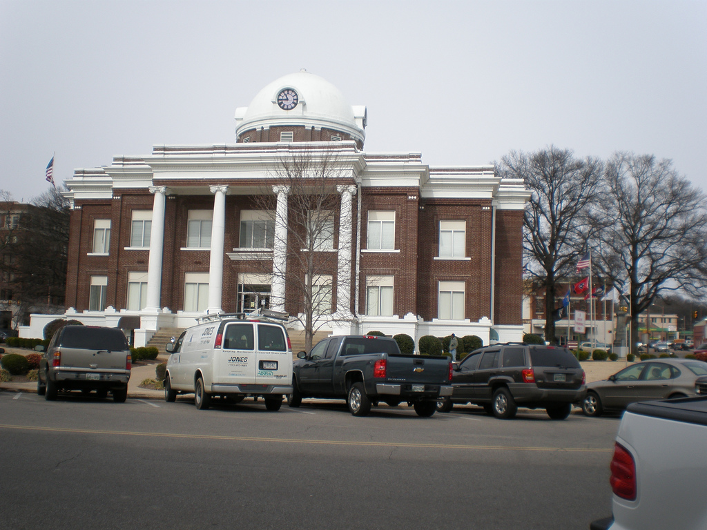
Dyersburg, Tennessee — City — Dyer County Courthouse in Dyersburg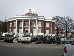

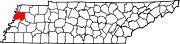
SealLocation within the U.S. State of Tennessee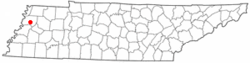
Coordinates: 36°2′22″N 89°22′58″W / 36.03944°N 89.38278°WCoordinates: 36°2′22″N 89°22′58″W / 36.03944°N 89.38278°W Country United States State Tennessee County Dyer Government - Mayor John Holden Area - Total 15.1 sq mi (39.2 km2) - Land 15.1 sq mi (39.0 km2) - Water 0.1 sq mi (0.2 km2) Elevation 292 ft (89 m) Population (2010) - Total 17,145 - Density 1,132.8/sq mi (437.4/km2) Time zone CST (UTC-6) - Summer (DST) CDT (UTC-5) ZIP codes 38024-38025 Area code(s) 731 FIPS code 47-22200[1] GNIS feature ID 1283267[2] Website www.dyersburgtn.gov Dyersburg is a city in and the county seat of Dyer County, Tennessee, United States,[3] 77 miles (124 km) north-northeast of Memphis on the Forked Deer River. The population was 17,145 at the 2010 census.
Contents
Geography
Dyersburg is located at 36°2′22″N 89°22′58″W / 36.03944°N 89.38278°W (36.039440, -89.382766).[4] The city's proximity to the New Madrid Fault Zone makes it a place at risk for future earthquakes.
According to the United States Census Bureau, the city has a total area of 15.1 square miles (39 km2), of which, 15.1 square miles (39 km2) of it is land and 0.1 square miles (0.26 km2) of it (0.53%) is water.
Demographics
As of the census[1] of 2000, there were 17,452 people, 7,036 households, and 4,517 families residing in the city. The population density was 1,158.7 people per square mile (447.4/km²). There were 7,885 housing units at an average density of 523.5 per square mile (202.2/km²). The racial makeup of the city was 75.68% White, 22.02% African American, 0.21% Native American, 0.54% Asian, 0.02% Pacific Islander, 0.53% from other races, and 0.99% from two or more races. Hispanic or Latino of any race were 1.36% of the population.
There were 7,036 households out of which 31.5% had children under the age of 18 living with them, 42.4% were married couples living together, 17.9% had a female householder with no husband present, and 35.8% were non-families. 30.9% of all households were made up of individuals and 13.1% had someone living alone who was 65 years of age or older. The average household size was 2.39 and the average family size was 2.99.
In the city the population was spread out with 26.3% under the age of 18, 9.6% from 18 to 24, 27.6% from 25 to 44, 21.4% from 45 to 64, and 15.0% who were 65 years of age or older. The median age was 36 years. For every 100 females there were 86.5 males. For every 100 females age 18 and over, there were 82.3 males.
The median income for a household in the city was $28,232, and the median income for a family was $34,754. Males had a median income of $30,898 versus $21,337 for females. The per capita income for the city was $16,388. About 17.4% of families and 20.5% of the population were below the poverty line, including 29.5% of those under age 18 and 19.0% of those age 65 or over.
Newspapers
- State Gazette - 6 days/week (Sunday-Friday); general news. The paper has served Dyersburg and Northwest Tennessee since 1865.
History
19th century
Historical populations Year Pop. 1890 2,009 1900 3,647 1910 4,149 1940 10,034 2000 17,452 The lands that make up Dyer County once belonged to the Chickasaw tribe. The final treaty by which they relinquished all of West Tennessee was signed in 1818.
In 1823[5] the General Assembly of Tennessee passed an act to establish two new counties immediately west of the Tennessee River, Dyer County being one of them. John McIver and Joel H. Dyer donated 60 acres (240,000 m2) for the new county seat, named Dyersburg, at a central location within the county known as McIver's Bluff. In 1825,[5] Dyer surveyed the town site into eighty-six lots. The first courthouse was built on the square in 1827. The current Classical Revival-style courthouse, designed by Asa Biggs in 1911, centers a downtown historic district listed in the National Register of Historic Places.
Situated as the hub of steamboat navigation on the Forked Deer River, Dyersburg grew as a river town, especially once the Grey Eagle made the first successful steamboat trip in 1836. The county's first industrial boom dates to 1879, when the steamboat Alf Stevens shipped timber from A. M. Stevens Lumber Company of Dyersburg to St. Louis markets. The Stevens company established a large sawmill in 1880 and opened a planing mill in 1885. The Bank of Dyersburg opened in 1880, while another timber industry, Nichols & Co. Wooden Bowl Factory, began operations in 1881.
The arrival of the Newport News and Mississippi Valley Railroad in 1884 further expanded market possibilities; a branch line, the Dyersburg Northern, soon linked the county seat to Tiptonville. The new railroad links encouraged the creation of new industries and businesses. In 1884, for example, investors established the Dyersburg Oil Company, a cottonseed factory. This company remained locally important through the twentieth century.
20th century
Between 1909 and 1914, Dyersburg emerged as a regional railroad hub as it became the junction point for three different lines, led by the Illinois Central Railroad.
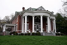 The Edward Moody King House is on the National Register of Historic Places
During World War II, an emergency landing strip was built in Dyersburg. Industry continued to expand and Dyer County became a regional medical, educational, retail and distribution center. The establishment of Dyersburg State Community College in 1969 enhanced educational and cultural opportunities in the county. In the last two decades, two major projects have modernized the city's transportation system: Interstate 155 links Dyersburg with Missouri, via the only highway bridge over the Mississippi River between Cairo, Illinois, and Memphis, and the four-lane expansion of U.S. 412 connects Dyersburg to I-40 at Jackson. On March 5, 1963 a Piper Comanche plane carrying country singers Patsy Cline, Hawkshaw Hawkins, Cowboy Copas, pilot and Miss Cline's manager Randy Hughes stopped for gas. The plane crashed just 20 minutes later in inclement weather near Camden, Tennessee.
Recent history
On September 17, 2003, Harold Kilpatrick Jr. took 18 people hostage in a classroom at Dyersburg State Community College. He wrote a note saying he "wanted to kill some people and die today" and claimed to be a part of al-Qaeda. Kilpatrick suffered from a severe case of schizophrenia and paranoia. Since he had been without health insurance for some time, he was not on the appropriate medications and his mental disabilities are believed to be the cause of his actions. Upon locking himself and his hostages in an upper story classroom, his only demands were a pizza and some water. Police would not let any of his family members near the facility, though his sister tried desperately to convince the police that she could help and that her brother needed mental medical attention urgently. After nine hours or more, a single gunshot sounded from inside the classroom, which caused the Dyersburg police to take action. They forcibly entered the room and opened fire, killing Kilpatrick and wounding two students. Hostages from that day have described Kilpatrick as being rather friendly, though nervous, and that he had dropped his gun causing an accidental discharge (the shot the police heard).
Home of former Murray State and NBA player, Popeye Jones. Jones dominated the Ohio Valley Conference and was drafted by the Dallas Mavericks and played for many NBA teams. He is currently an assistant coach with the Mavericks organization.
Notable natives
- Emmett Kelly, Jr. - "The World's Most Famous Clown"
- George "Two Ton" Harris - professional wrestler NWA
- Robert Fuller - professional wrestler; better known as a manager in WCW and WWF.
- Ed Wright - Major League Baseball pitcher, 1945–48, 1952.
- Jerry Woods - National Football League defensive back, 1989-1990.
References
- ^ a b "American FactFinder". United States Census Bureau. http://factfinder.census.gov. Retrieved 2008-01-31.
- ^ "US Board on Geographic Names". United States Geological Survey. 2007-10-25. http://geonames.usgs.gov. Retrieved 2008-01-31.
- ^ "Find a County". National Association of Counties. http://www.naco.org/Counties/Pages/FindACounty.aspx. Retrieved 2011-06-07.
- ^ "US Gazetteer files: 2010, 2000, and 1990". United States Census Bureau. 2011-02-12. http://www.census.gov/geo/www/gazetteer/gazette.html. Retrieved 2011-04-23.
- ^ a b DYER COUNTY
External links
Municipalities and communities of Dyer County, Tennessee City Dyersburg
Towns Unincorporated
communityBogota | Finley | Fowlkes
Footnotes ‡This populated place also has portions in an adjacent county or counties
Categories:- Cities in Tennessee
- Populated places in Dyer County, Tennessee
- County seats in Tennessee


Wikimedia Foundation. 2010.