- List of counties in Tennessee
-

This is a list of the 95 counties in the State of Tennessee. A county is a local level of government smaller than a state and typically larger than a city or town, in a U.S. state or territory.
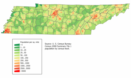
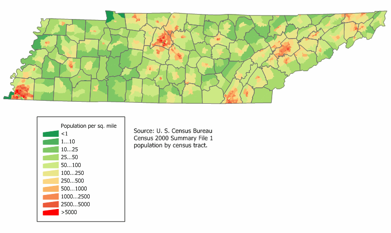
As of 2000, Shelby County was both Tennessee's most populous county, with 897,472 residents, and the largest county in area, covering an area of 755 sq mi (1,955 km2). The least populous county was Pickett County (4,945) and the smallest in area was Trousdale County, covering 114 sq mi (295 km2). As of the same year, Davidson County, in which the capital Nashville is located, covers 502 sq mi (1,300 km2) with a population of 569,891. The population of the state of Tennessee as of the 2000 census was 5,689,283 in an area of 42,169 sq mi (109,217 km2).[1][2][3] The oldest county is Washington County, founded in 1777. The most recently formed county is Chester County (1879).[1]
According to the 2000 census, the center of population for Tennessee was located at 35°47′45″N 86°23′52″W / 35.795862°N 86.397772°W, 2.5 mi (4.0 km) south of Murfreesboro in Rutherford County.[4] The center of population pinpoints the location at which the population of the state, as placed on a map of the state where they reside, would balance out the map. The geographic center, the point where the map of Tennessee would balance without the population, is located 5 mi (8 km) northeast of Murfreesboro. In 1976, the Rutherford County Historical Society marked the geographic center of Tennessee with an obelisk.[5]
Some of the counties were formed in part or completely from lands previously controlled by Native Americans. The "Indian lands" were territories that Native Americans had occupied from pre-Columbian times and to which they were granted the legal right of occupancy in an act of the United States government. In cases where counties had been formed from that territory, the legal right of Native American occupancy was revoked in a federal act prior to the formal establishment of the county.[6] For Tennessee, ten treaties were negotiated between 1770 and 1835, defining the areas assigned to European settlers and to Native Americans, regulating the right of occupancy regarding the lands. The remaining native population was eventually removed from Tennessee to what became the state of Oklahoma.[7]
The Federal Information Processing Standard (FIPS) code, which is used by the United States government to uniquely identify counties, is provided with each entry. FIPS codes are five digit numbers, for Tennessee the codes start with 47 and are completed with the three digit county code. The FIPS code for each county in the table links to census data for that county.[8]
Contents
Alphabetical list
Click on the double triangles at the top of a column to sort the table by that column.
County FIPS Code
[8]County Seat
[1][3]Founded
[1]Formed from
[9]Named for[9] Population
(2000)
[1][3][10]Area
[1][2][3]Map Anderson County 001 Clinton 1801 Knox and Grainger Counties Joseph Anderson (1757–1837), U.S. Senator from Tennessee and first Comptroller of the U.S. Treasury. 71,330 338 sq mi
(875 km2)
Bedford County 003 Shelbyville 1807 Rutherford County Revolutionary War officer Thomas Bedford, a large landowner in the area 37,586 474 sq mi
(1,228 km2)
Benton County 005 Camden 1835 Humphreys County Creek War veteran David Benton (1779–1860), an early settler in the county. 16,537 394 sq mi
(1,020 km2)
Bledsoe County 007 Pikeville 1807 Roane County and Indian lands Anthony Bledsoe, Revolutionary War soldier, surveyor, and early settler in Sumner County 12,367 406 sq mi
(1,052 km2)
Blount County 009 Maryville 1795 Knox County William Blount (1749–1800), governor of the Southwest Territory and later U.S. Senator 105,823 559 sq mi
(1,448 km2)
Bradley County 011 Cleveland 1836 Indian lands Tennessee state legislator Edward Bradley. 87,965 329 sq mi
(852 km2)
Campbell County 013 Jacksboro 1806 Anderson and Claiborne counties Virginia House of Burgesses member Arthur Campbell (1743–1811), who was a negotiator of Indian treaties. 39,854 480 sq mi
(1,243 km2)
Cannon County 015 Woodbury 1836 Rutherford, Smith and Warren counties Governor of Tennessee Newton Cannon (1781–1841). 12,826 266 sq mi
(689 km2)
Carroll County 017 Huntingdon 1821 Indian lands Governor of Tennessee William Carroll (1788–1844). 29,475 599 sq mi
(1,551 km2)
Carter County 019 Elizabethton 1796 Washington County Speaker of the State of Franklin senate Landon Carter (1710–1778). 56,742 341 sq mi
(883 km2)
Cheatham County 021 Ashland City 1856 Davidson, Dickson, Montgomery and Robertson counties Tennessee state legislator Edward Cheatham. 35,912 303 sq mi
(785 km2)
Chester County 023 Henderson 1879 Hardeman, Henderson, McNairy and Madison counties Tennessee state legislator Robert I. Chester. 15,540 289 sq mi
(749 km2)
Claiborne County 025 Tazewell 1801 Grainger and Hawkins counties Governor of Louisiana and Governor of Mississippi Territory William C. C. Claiborne (1775–1817). 29,862 434 sq mi
(1,124 km2)
Clay County 027 Celina 1870 Jackson and Overton counties U.S. Speaker of the House and Secretary of State Henry Clay (1777–1852). 7,976 236 sq mi
(611 km2)
Cocke County 029 Newport 1797 Jefferson County William Cocke (1747–1828), one of Tennessee's first U.S. Senators. 33,565 434 sq mi
(1,124 km2)
Coffee County 031 Manchester 1836 Bedford, Warren and Franklin counties John Coffee (1772–1833), frontiersman, planter, and veteran of Creek War and War of 1812. 48,014 429 sq mi
(1,111 km2)
Crockett County 033 Alamo 1871 Haywood, Madison, Dyer and Gibson counties Davy Crockett (1786–1836), frontier humorist, Congressman, and defender of the Alamo. 14,532 265 sq mi
(686 km2)
Cumberland County 035 Crossville 1855 White, Bledsoe, Rhea, Morgan, Fentress and Putnam counties The Cumberland Mountains. 46,802 682 sq mi
(1,766 km2)
Davidson County 037 Nashville 1783 Part of North Carolina William Lee Davidson (1746–1781), a Brigadier General who died at the Revolutionary War Battle of Cowan's Ford. 569,891 502 sq mi
(1,300 km2)
Decatur County 039 Decaturville 1845 Perry County U.S. naval officer and War of 1812 hero Stephen Decatur (1779–1820). 11,731 333 sq mi
(862 km2)
DeKalb County 041 Smithville 1837 Franklin, Cannon, Jackson and White counties Johann de Kalb (1721–1780), a German-born baron who assisted the Continentals during the American Revolutionary War. 17,423 304 sq mi
(787 km2)
Dickson County 043 Charlotte 1803 Montgomery and Robertson counties U.S. Representative William Dickson (1770–1816). 43,156 490 sq mi
(1,269 km2)
Dyer County 045 Dyersburg 1823 Indian lands Tennessee state legislator Robert Henry Dyer. 37,279 510 sq mi
(1,321 km2)
Fayette County 047 Somerville 1824 Indian lands Gilbert du Motier, marquis de La Fayette (1757–1834), a French-born general in the American Revolutionary War. 28,796 705 sq mi
(1,826 km2)
Fentress County 049 Jamestown 1823 Morgan, Overton and White counties Tennessee state legislator James Fentress. 16,625 499 sq mi
(1,292 km2)
Franklin County 051 Winchester 1807 Rutherford County and Indian lands Publisher, scholar, orator, and Founding Father Benjamin Franklin (1706–1790). 39,270 553 sq mi
(1,432 km2)
Gibson County 053 Trenton 1823 Indian lands John H. Gibson, a soldier of the Natchez Expedition and the Creek War. 48,154 603 sq mi
(1,562 km2)
Giles County 055 Pulaski 1809 Indian lands U.S. Senator and Governor of Virginia William B. Giles (1762–1830). 29,447 611 sq mi
(1,582 km2)
Grainger County 057 Rutledge 1796 Hawkins and Knox counties Mary Grainger Blount, wife of William Blount and "first lady" of the Southwest Territory, which later became Tennessee. 20,659 280 sq mi
(725 km2)
Greene County 059 Greeneville 1783 Washington County American Revolutionary War general Nathanael Greene (1742–1786). 62,909 622 sq mi
(1,611 km2)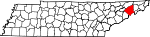
Grundy County 061 Altamont 1844 Coffee, Warren and Franklin counties U.S. Attorney General Felix Grundy (1777–1840). 14,332 361 sq mi
(935 km2)
Hamblen County 063 Morristown 1870 Jefferson, Grainger and Greene counties Early settler Hezekiah Hamblen. 58,128 161 sq mi
(417 km2)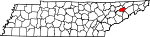
Hamilton County 065 Chattanooga 1819 Rhea County and Indian lands First U.S. Secretary of the Treasury and Founding Father Alexander Hamilton (1755 or 1757–1804). 307,896 543 sq mi
(1,406 km2)
Hancock County 067 Sneedville 1844 Hawkins and Claiborne counties President of the Continental Congress John Hancock (1737–1793). 6,780 222 sq mi
(575 km2)
Hardeman County 069 Bolivar 1823 Hardin County and Indian lands Thomas Jones Hardeman, Creek War and War of 1812 soldier, later a member of the Republic of Texas legislature. 28,105 668 sq mi
(1,730 km2)
Hardin County 071 Savannah 1819 Indian lands Joseph Hardin, legislator of the Southwest Territory and State of Franklin. 25,578 578 sq mi
(1,497 km2)
Hawkins County 073 Rogersville 1786 Sullivan County U.S. Senator Benjamin Hawkins (1754–1816). 53,563 487 sq mi
(1,261 km2)
Haywood County 075 Brownsville 1823 Indian lands Judge John Haywood (1762–1826), called "the father of Tennessee history." 19,797 533 sq mi
(1,380 km2)
Henderson County 077 Lexington 1821 Indian lands James Henderson, an officer of the War of 1812. 25,522 520 sq mi
(1,347 km2)
Henry County 079 Paris 1821 Indian lands Revolutionary-era orator and Virginia legislator Patrick Henry (1736–1799). 31,115 562 sq mi
(1,456 km2)
Hickman County 081 Centerville 1807 Dickson County Edwin Hickman, a longhunter killed by Native Americans near the present-day site of Centerville. 22,295 613 sq mi
(1,588 km2)
Houston County 083 Erin 1871 Dickson, Humphreys, Montgomery and Stewart counties Sam Houston (1793–1863), Tennessee governor and congressman, president of the Republic of Texas, U.S. Senator from Texas, and Texas governor. 8,088 200 sq mi
(518 km2)
Humphreys County 085 Waverly 1809 Stewart County U.S. Representative Parry Wayne Humphreys (1778–1839). 17,929 532 sq mi
(1,378 km2)
Jackson County 087 Gainesboro 1801 Smith County and Indian lands U.S. President Andrew Jackson (1767–1845). 10,984 309 sq mi
(800 km2)
Jefferson County 089 Dandridge 1792 Greene and Hawkins counties U.S. President and Founding Father Thomas Jefferson (1743–1826). 44,294 274 sq mi
(710 km2)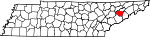
Johnson County 091 Mountain City 1836 Carter County Thomas Johnson, an early settler of Carter County along the Doe River. 17,499 299 sq mi
(774 km2)
Knox County 093 Knoxville 1792 Greene and Hawkins counties Henry Knox (1750–1806), the first U.S. Secretary of War. 382,032 509 sq mi
(1,318 km2)
Lake County 095 Tiptonville 1870 Obion County Reelfoot Lake 7,954 163 sq mi
(422 km2)
Lauderdale County 097 Ripley 1835 Haywood, Dyer and Tipton counties James Lauderdale, who was killed in the War of 1812. 27,101 470 sq mi
(1,217 km2)
Lawrence County 099 Lawrenceburg 1817 Hickman County and Indian lands U.S. naval officer and War of 1812 hero James Lawrence (1781–1813). 39,926 617 sq mi
(1,598 km2)
Lewis County 101 Hohenwald 1843 Hickman, Lawrence, Maury and Wayne counties Meriwether Lewis (1774–1809), explorer of the American West. 11,367 282 sq mi
(730 km2)
Lincoln County 103 Fayetteville 1809 Bedford County U.S. Secretary of War Benjamin Lincoln (1733–1810). 31,340 570 sq mi
(1,476 km2)
Loudon County 105 Loudon 1870 Roane, Monroe, Blount and McMinn counties Fort Loudoun, which was named for John Campbell, 4th Earl of Loudoun, who led British and American forces during the French and Indian War. 39,086 229 sq mi
(593 km2)
Macon County 111 Lafayette 1842 Smith and Sumner counties U.S. Senator Nathaniel Macon (1758–1837). 20,386 307 sq mi
(795 km2)
Madison County 113 Jackson 1821 Indian lands U.S. President James Madison (1758–1836). 91,837 557 sq mi
(1,443 km2)
Marion County 115 Jasper 1817 Indian lands Francis Marion (1732–1795), the "Swamp Fox" of the American Revolutionary War. 27,776 500 sq mi
(1,295 km2)
Marshall County 117 Lewisburg 1836 Giles, Bedford, Lincoln and Maury counties U.S. Chief Justice John Marshall (1755–1835). 26,767 375 sq mi
(971 km2)
Maury County 119 Columbia 1807 Williamson County and Indian lands Tennessee state legislator Abram Poindexter Maury (1801–1848). 69,498 613 sq mi
(1,588 km2)
McMinn County 107 Athens 1819 Indian lands Governor of Tennessee Joseph McMinn (1758–1824). 49,015 430 sq mi
(1,114 km2)
McNairy County 109 Selmer 1823 Hardin County John McNairy, judge of the U.S. District Court for the District of Tennessee. 24,653 560 sq mi
(1,450 km2)
Meigs County 121 Decatur 1836 Rhea County Return Jonathan Meigs (1740–1823), an officer in the Continental Army who was for many years a federal Indian and military agent in Tennessee. 11,086 195 sq mi
(505 km2)
Monroe County 123 Madisonville 1819 Indian lands U.S. President James Monroe (1758–1831). 38,961 635 sq mi
(1,645 km2)
Montgomery County 125 Clarksville 1796 Tennessee County John Montgomery (c. 1750–1794), leader of the Nickajack Expedition. 134,768 539 sq mi
(1,396 km2)
Moore County 127 Lynchburg 1871 Bedford, Lincoln and Franklin counties Tennessee state legislator William Moore. 5,740 129 sq mi
(334 km2)
Morgan County 129 Wartburg 1817 Anderson and Roane counties American Revolutionary War officer Daniel Morgan (1736–1802). 19,757 522 sq mi
(1,352 km2)
Obion County 131 Union City 1823 Indian lands The Obion River. 32,450 545 sq mi
(1,412 km2)
Overton County 133 Livingston 1806 Jackson County and Indian lands John Overton (1766–1833), one of the cofounders of Memphis, Tennessee. 20,118 433 sq mi
(1,121 km2)
Perry County 135 Linden 1819 Humphreys and Hickman counties U.S. naval officer and War of 1812 hero Oliver Hazard Perry (1785–1819). 7,631 415 sq mi
(1,075 km2)
Pickett County 137 Byrdstown 1879 Fentress and Overton counties Tennessee state legislator Howell L. Pickett. 4,945 163 sq mi
(422 km2)
Polk County 139 Benton 1839 McMinn and Bradley counties U.S. President James K. Polk (1795–1849). 16,050 435 sq mi
(1,127 km2)
Putnam County 141 Cookeville 1854 Fentress, Jackson, Smith, White and Overton counties American Revolutionary War officer Israel Putnam (1718–1790). 62,315 401 sq mi
(1,039 km2)
Rhea County 143 Dayton 1807 Roane County U.S. Representative John Rhea (1753–1832). 28,400 316 sq mi
(818 km2)
Roane County 145 Kingston 1801 Knox County and Indian lands Governor of Tennessee Archibald Roane (1759 or 1760–1819). 51,910 361 sq mi
(935 km2)
Robertson County 147 Springfield 1796 Tennessee and Sumner counties James Robertson (1742–1814), Tennessee state legislator and founder of the Watauga Settlements. 54,433 477 sq mi
(1,235 km2)
Rutherford County 149 Murfreesboro 1803 Davidson, Williamson and Wilson counties Griffin Rutherford, chairman of the legislature of the Southwest Territory. 182,023 619 sq mi
(1,603 km2)
Scott County 151 Huntsville 1849 Anderson, Campbell, Fentress and Morgan counties US. Army general and hero of the Mexican-American War Winfield Scott (1786–1866). 21,127 532 sq mi
(1,378 km2)
Sequatchie County 153 Dunlap 1857 Hamilton, Marion and Warren counties Cherokee word believed to mean, opossum, he grins or runs. 11,370 266 sq mi
(689 km2)
Sevier County 155 Sevierville 1794 Jefferson County John Sevier (1745–1815), governor of the State of Franklin and first Governor of Tennessee. 71,170 592 sq mi
(1,533 km2)
Shelby County 157 Memphis 1819 Chickasaw Nation lands acquired through the Jackson Purchase.[11] Isaac Shelby (1750–1826), commander at Kings Mountain, first governor of Kentucky, and negotiator of the purchase of the western district from the Chickasaws. 897,472 755 sq mi
(1,955 km2)
Smith County 159 Carthage 1799 Sumner County and Indian lands American Revolutionary War officer and U.S. Senator Daniel Smith (1748–1818). 17,712 314 sq mi
(813 km2)
Stewart County 161 Dover 1803 Montgomery County Duncan Stewart, Tennessee state legislator and lieutenant governor of Mississippi Territory. 12,370 458 sq mi
(1,186 km2)
Sullivan County 163 Blountville 1779 Washington County Governor of New Hampshire John Sullivan (1740–1795). 153,048 413 sq mi
(1,070 km2)
Sumner County 165 Gallatin 1786 Davidson County Jethro Sumner (1733–1785), an American colonist who defended North Carolina against the British in 1780. 130,449 529 sq mi
(1,370 km2)
Tipton County 167 Covington 1823 Shelby County (previously Chickasaw lands)[11] Jacob Tipton, father of Armistead Blevins, who supervised the organization of Shelby County; Tipton was killed by Native Americans in 1791 in a conflict over the Northwest Territory.[11] 51,271 459 sq mi
(1,189 km2)
Trousdale County 169 Hartsville 1870 Wilson, Macon, Smith and Sumner counties William Trousdale (1790–1872), Creek and Mexican-American War soldier and officer, state senator and Governor of Tennessee. 7,259 114 sq mi
(295 km2)
Unicoi County 171 Erwin 1875 Washington and Carter County Native American word for the southern Appalachian Mountains, probably meaning white or fog-draped 17,667 186 sq mi
(482 km2)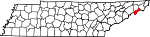
Union County 173 Maynardville 1850 Grainger, Claiborne, Campbell, Anderson and Knox counties Either for its creation from parts of five counties or to memorialize East Tennessee's support for preservation of the Union 17,808 224 sq mi
(580 km2)
Van Buren County 175 Spencer 1840 Warren and White counties U.S. President Martin Van Buren (1782–1862) 5,508 247 sq mi
(640 km2)
Warren County 177 McMinnville 1807 White, Jackson, Smith counties and Indian lands American Revolutionary War officer Joseph Warren (1741–1775), who sent Paul Revere on his famous midnight ride 38,276 433 sq mi
(1,121 km2)
Washington County 179 Jonesborough 1777 Part of North Carolina U.S. President George Washington (1732–1799) 107,198 326 sq mi
(844 km2)
Wayne County 181 Waynesboro 1817 Hickman County American Revolutionary War General "Mad" Anthony Wayne (1745–1796) 16,842 734 sq mi
(1,901 km2)
Weakley County 183 Dresden 1823 Indian lands U.S. Representative Robert Weakley (1764–1845). 34,895 580 sq mi
(1,502 km2)
White County 185 Sparta 1806 Jackson and Smith counties John White, Revolutionary War soldier and the first European-American settler in the county 23,102 377 sq mi
(976 km2)
Williamson County 187 Franklin 1799 Davidson County U.S. Representative Hugh Williamson (1735–1819). 126,638 582 sq mi
(1,507 km2)
Wilson County 189 Lebanon 1799 Sumner County David Wilson, a member of the legislatures of North Carolina and the Southwest Territory. 88,808 571 sq mi
(1,479 km2)
Defunct counties
There are two defunct counties in Tennessee:
- James County, Tennessee (1870–1919) - Now part of Hamilton County. The county seat was Ooltewah.
- Tennessee County, Tennessee (1788–1796) - When Tennessee achieved statehood, the previous Tennessee County in North Carolina became Tennessee County, Tennessee, and was divided into Montgomery and Robertson Counties.
Consolidated counties
Three Tennessee counties operate under consolidated city-county governments, a city and county that have been merged into one jurisdiction. As such, these governments are simultaneously a city, which is a municipal corporation, and a county, which is an administrative division of a state.
- City of Nashville and Davidson County
- City of Lynchburg and Moore County
- City of Hartsville and Trousdale County
See also
References
- ^ a b c d e f "About Counties - Tennessee". NACO.org. National Association of Counties. Archived from the original on 2007-10-24. http://web.archive.org/web/20071024144033/http://www.naco.org/Template.cfm?Section=Find_a_County&Template=/cffiles/counties/state.cfm&state.cfm&statecode=TN. Retrieved 2007-11-28.
- ^ a b "Tennessee QuickFacts". U.S. Census Bureau. http://quickfacts.census.gov/qfd/maps/tennessee_map.html. Retrieved 2007-11-28. (2000 Census)
- ^ a b c d State, County, and Municipal Data Tennessee Blue Book 2005-2006, pages 616-626
- ^ "Population centers of each U.S. state, 2000". census.gov. United States Census Bureau. http://www.census.gov/geo/www/cenpop/statecenters.txt. Retrieved 2008-01-01.
- ^ "Geographic Center of Tennessee". rutherfordchamber.org. Rutherford County - Chamber of Commerce. Archived from the original on 2007-12-13. http://web.archive.org/web/20071213222800/http://www.rutherfordchamber.org/cvb/visitors/what-to-see/what-to-see-detail.php?PRKey=14. Retrieved 2008-01-01.
- ^ "Indian Lands". FindLaw.com. http://library.findlaw.com/1999/Jan/1/241490.html. Retrieved 2008-01-20.
- ^ "Tennessee Encyclopedia: Treaties". TennesseeEncyclopedia.net. The Tennessee Encyclopedia of History and Culture. http://tennesseeencyclopedia.net/imagegallery.php?EntryID=T111. Retrieved 2008-01-20.
- ^ a b "EPA County FIPS Code Listing". EPA.gov. http://www.epa.gov/enviro/html/codes/tn.html. Retrieved 2007-11-28.
- ^ a b Origins Of Tennessee County Names, Tennessee Blue Book 2005-2006, pages 508-513
- ^ "US Census Bureau". Geographic Comparison Table. http://factfinder.census.gov/servlet/GCTTable?_bm=y&-ds_name=DEC_2000_PL_U&-CONTEXT=gct&-mt_name=DEC_2000_PL_U_GCTPL_ST2&-redoLog=false&-_caller=geoselect&-geo_id=04000US47&-format=ST-2&-_lang=en. Retrieved 2007-12-31.
- ^ a b c Tipton County in the Tennessee Encyclopedia of History and Culture
External links
- Tennessee Counties at the Open Directory Project
- Tennessee Counties official websites at County State Info
- County Technical Assistance Service at the University of Tennessee
- Tennessee County Landforms at the University of Tennessee
List of U.S. counties and county-equivalents
by political division (state / federal district)- Alabama
- Alaska
- Arizona
- Arkansas
- California
- Colorado
- Connecticut
- Delaware
- District of Columbia
- Florida
- Georgia
- Hawaii
- Idaho
- Illinois
- Indiana
- Iowa
- Kansas
- Kentucky
- Louisiana
- Maine
- Maryland
- Massachusetts
- Michigan
- Minnesota
- Mississippi
- Missouri
- Montana
- Nebraska
- Nevada
- New Hampshire
- New Jersey
- New Mexico
- New York
- North Carolina
- North Dakota
- Ohio
- Oklahoma
- Oregon
- Pennsylvania
- Rhode Island
- South Carolina
- South Dakota
- Tennessee
- Texas
- Utah
- Vermont
- Virginia
- Washington
- West Virginia
- Wisconsin
- Wyoming
Categories:- County seats in Tennessee
- Lists of U.S. counties by state
- Tennessee counties
- U.S. county name etymologies
- Tennessee-related lists
Wikimedia Foundation. 2010.