- Dandridge, Tennessee
-
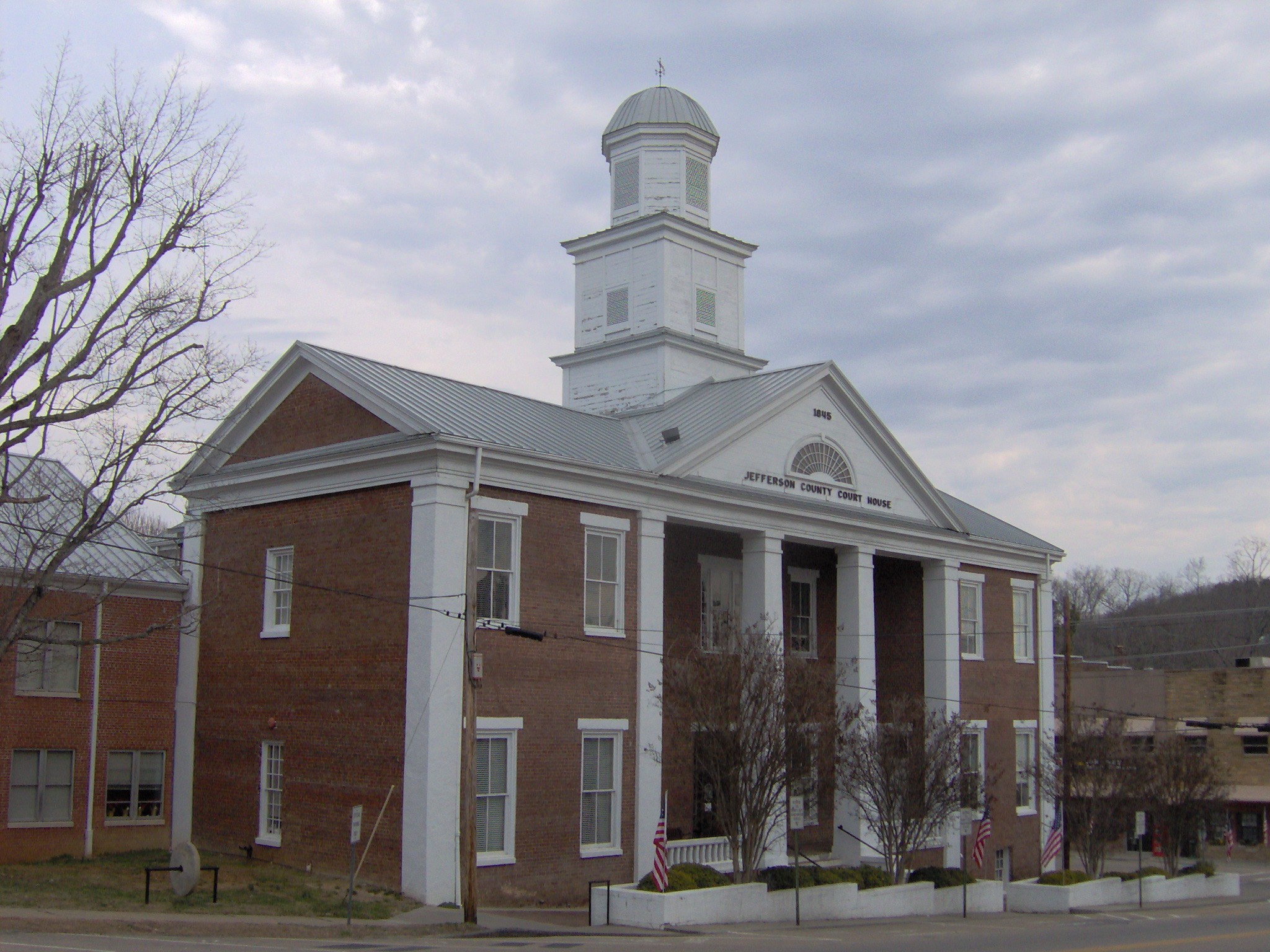
Dandridge, Tennessee — Town — Jefferson County Courthouse in Dandridge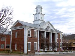 Location of Dandridge, Tennessee
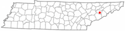
Coordinates: 36°1′43″N 83°25′26″W / 36.02861°N 83.42389°WCoordinates: 36°1′43″N 83°25′26″W / 36.02861°N 83.42389°W Country United States State Tennessee County Jefferson Area - Total 5.4 sq mi (13.9 km2) - Land 5.4 sq mi (13.9 km2) - Water 0.0 sq mi (0.0 km2) Elevation 997 ft (304 m) Population (2010) - Total 2,721 - Density 509/sq mi (196.5/km2) Time zone Eastern (EST) (UTC-5) - Summer (DST) EDT (UTC-4) ZIP code 37725 Area code(s) 865 FIPS code 47-19380[1] GNIS feature ID 1282016[2] Dandridge is a town in Jefferson County, Tennessee, United States. It is the county seat of Jefferson County[3]. It is part of the Morristown, Tennessee Metropolitan Statistical Area.
Dandridge is the second oldest city in Tennessee, behind only Jonesborough.[4] A large part of Dandridge, including most of the historic commercial center, sits below the high level water mark of Douglas Lake. The historic French Broad Baptist Church was saved from the local Tennessee Valley Authority flood control project by a member of the Swann family, who had contacted Eleanor Roosevelt for assistance.
Contents
Geography
Dandridge is located at 36°1′43″N 83°25′26″W / 36.02861°N 83.42389°W (36.028493, -83.424010)[5]. The town is situated along the northern bank of the Douglas Lake impoundment of the French Broad River, approximately 45 miles (72 km) upstream from the river's confluence with the Holston River and Tennessee River at Knoxville, and approximately 12 miles (19 km) upstream from Douglas Dam.
Dandridge is centered around the junction of Tennessee State Route 92, which connects the town to Jefferson City to the north and U.S. Route 411 across the lake to the south, and U.S. Route 70, which connects the town to Knoxville to the west and Newport to the east. Interstate 40 intersects TN-92 in the northern part of Dandridge.
According to the United States Census Bureau, the town has a total area of 5.3 square miles (14 km2), all of it land.
Demographics
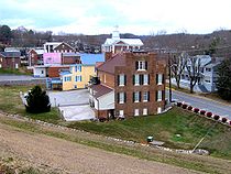 Dandridge, looking west from the town's saddle dam
As of the census[1] of 2010, there were 2,721 people, 833 households, and 516 families residing in the town. The population density was 509 people per square mile (196.5/km²). There were 833 housing units at an average density of 156.0 per square mile (61.8/km²). The racial makeup of the town was 92.44% White, 6.54% African American, 0.24% Native American, 0.05% Asian, 0.19% from other races, and 0.53% from two or more races. Hispanic or Latino of any race were 0.96% of the population.
There were 749 households out of which 27.9% had children under the living with them, 54.7% were married couples living together, 11.5% had a female householder with no husband present, and 31.0% were non-families. 28.3% of all households were made up of individuals and 10.8% had someone living alone who was 65 years of age or older. The average household size was 2.30 and the average family size was 2.81.
In the town the population was spread out with 24.0% under the , 7.8% from 18 to 24, 26.3% from 25 to 44, 21.8% from 45 to 64, and 20.2% who were 65 years of age or older. The median age was 39 years. For every 100 females there were 100.2 males. For every 100 females age 18 and over, there were 87.4 males.
The median income for a household in the town was $34,167, and the median income for a family was $40,357. Males had a median income of $31,667 versus $21,176 for females. The per capita income for the town was $19,753. About 9.4% of families and 13.1% of the population were below the poverty line, including 18.4% of those under age 18 and 10.8% of those age 65 or over.
History
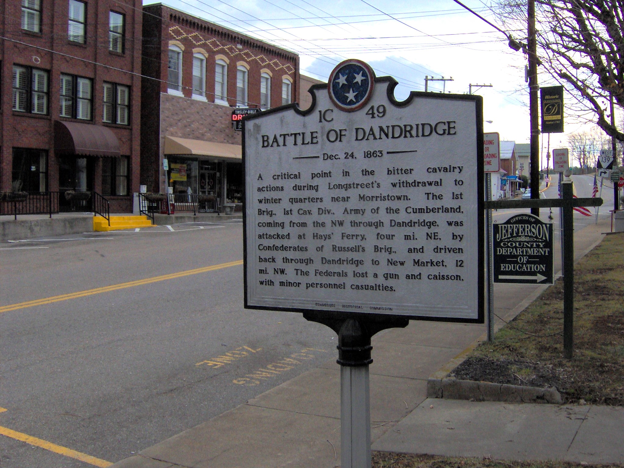
 THC marker on Gay Street, recalling the Battle of Dandridge
In the 16th century, a substantial Native American chiefdom known as Chiaha was located on Zimmerman's Island, just southwest of Dandridge along the French Broad River. Spanish explorer Hernando de Soto spent several weeks at Chiaha in 1540 and Juan Pardo built a small fort near chiefdom's main village in 1567. Both expeditions were in en route to the chiefdom of Coosa in what is now Georgia. Zimmerman's Island is now submerged by Douglas Lake.[6]
The first Euro-American settlers arrived in Dandridge in 1783, and the town was officially incorporated in 1793 as the county seat of Jefferson County, which had been created the previous year.[7] The town was named for Martha Dandridge Washington, the wife of the first president of the United States.[4]
On December 24, 1863, at the height of the American Civil War, a skirmish occurred at Dandridge as Confederate General James Longstreet and Union General Ambrose Burnside struggled for control of Knoxville. As Longstreet's army retreated to Morristown, a detachment of his army intercepted and routed a pursuing Union brigade just north of Dandridge. The Union troops were forced to fall back to New Market.[8]
The construction of Douglas Dam in 1942 flooded much of the best farmland in Jefferson County, and threatened to flood most all of downtown Dandridge, which was situated below the proposed reservoir's high water mark. Residents of the town successfully petitioned then-First Lady Eleanor Roosevelt, however, pointing out that Dandridge was the only town in the United States named for the wife of George Washington. The Tennessee Valley Authority constructed a saddle dam between downtown Dandridge and the lake. The dam rises almost immediately behind the Town Hall, and runs roughly parallel to Main Street.[9]
References
- ^ a b "American FactFinder". United States Census Bureau. http://factfinder.census.gov. Retrieved 2008-01-31.
- ^ "US Board on Geographic Names". United States Geological Survey. 2007-10-25. http://geonames.usgs.gov. Retrieved 2008-01-31.
- ^ "Find a County". National Association of Counties. http://www.naco.org/Counties/Pages/FindACounty.aspx. Retrieved 2011-06-07.
- ^ a b Billie McNamara, "Jefferson County, Tennessee Genealogy & History," 1996-2004. Retrieved: 18 February 2008.
- ^ "US Gazetteer files: 2010, 2000, and 1990". United States Census Bureau. 2011-02-12. http://www.census.gov/geo/www/gazetteer/gazette.html. Retrieved 2011-04-23.
- ^ Charles Hudson, The Juan Pardo Expeditions: Explorations of the Carolinas and Tennessee, 1566-1568 (Tuscaloosa, Ala.: University of Alabama Press, 2005), 36-40.
- ^ Estle Muncy, "Jefferson County." The Tennessee Encyclopedia of History and Culture, 2002. Retrieved: 18 February 2008.
- ^ Tennessee Historical Commission Marker IC 49 on the Jefferson County Courthouse lawn in Dandridge. Information accessed: 17 February 2008.
- ^ Derek Hodges, "Construction, Spurred by War Efforts, Broke Records." The Mountain Press, 17 September 2007. Retrieved: 18 February 2008.
External links
Municipalities and communities of Jefferson County, Tennessee Cities 
Towns Dandridge | New Market | White Pine‡
Unincorporated
communitiesFootnotes ‡This populated place also has portions in an adjacent county or counties
Categories:- Populated places in Jefferson County, Tennessee
- Towns in Tennessee
- County seats in Tennessee
- Morristown metropolitan area
- Populated places established in 1793

Wikimedia Foundation. 2010.