- Maryville, Tennessee
-
Maryville, Tennessee — City — Maryville, Tennessee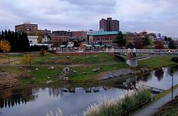 Location of Maryville, Tennessee
 U.S. Census Map
Coordinates: 35°44′59″N 83°58′33″W / 35.74972°N 83.97583°WCoordinates: 35°44′59″N 83°58′33″W / 35.74972°N 83.97583°W Country United States State Tennessee County Blount Government – Type Council-manager – City manager Greg McClain – Mayor Tom Taylor Area – Total 15.9 sq mi (41.2 km2) – Land 15.9 sq mi (41.2 km2) – Water 0.0 sq mi (0.0 km2) Elevation 940 ft (290 m) Population (2010) – Total 27,258 – Density 1,452.4/sq mi (560.8/km2) Time zone Eastern (EST) (UTC-5) – Summer (DST) EDT (UTC-4) ZIP codes 37801-37804 Area code(s) 865 FIPS code 47-46380[1] GNIS feature ID 1292868[2] Maryville is the county seat of Blount County, Tennessee,[3] in the Southeastern United States. The city is located 20 miles (32 km) south of Knoxville. Maryville's population was 27,258 at the 2010 census. It is included in the Knoxville Metropolitan Area. Maryville has received a number of accolades for its quality of life. The cable channel A&E named the city to its list of "Top Ten Cities to Have It All". Maryville is a short distance from popular tourist destinations such as the Great Smoky Mountains National Park, Dollywood, Gatlinburg, and Pigeon Forge.
Contents
Geography
Maryville is located at 35°44′59″N 83°58′33″W / 35.74972°N 83.97583°W (35.749857, -83.975805)[4].
According to the United States Census Bureau, the city has a total area of 15.9 square miles (41 km2), all of it land.
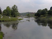
Maryville lies in the Foothills of the Great Smoky Mountains. Chilhowee Mountain, the outermost ridge of the Western Smokies, rises prominently to the south. Chilhowee's eastern flank— known locally as "The Three Sisters"— is visible from almost anywhere in the city, and dominates the southern horizon along US-321 between Maryville and Walland. Maryville is bordered on the north by Maryville's twin city, Alcoa, Tennessee. A number of small suburbs— including Wildwood, Ellejoy, and Clover Hill— surround Maryville to the east and west.
Major streets
- Broadway, the main street of the downtown area, is an alignment of U.S. Route 411 and partly of U.S. Route 129. It continues to Sevierville to the east and Monroe County to the west.
- Lamar Alexander Parkway, an alignment of U.S. Route 321, continues to Lenoir City to the west and Townsend and the Great Smoky Mountains National Park to the east.
- Maryville-Alcoa Bypass, an alignment of U.S. Route 129 and part of the primary route between Maryville and Knoxville
- Montvale Road (State Route 336)
- Morganton Road, which runs parallel to US-411, connects Maryville to Greenback and the old Morganton area to west.
- Cusick Street crosses Broadway at the center of the downtown area. It extends north through Alcoa toward Louisville.
- Washington Street (State Route 35)
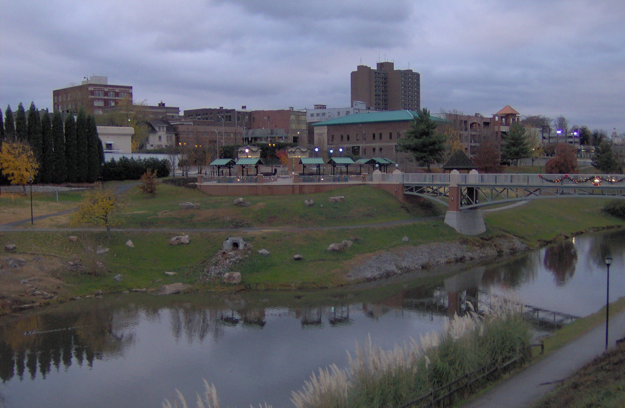
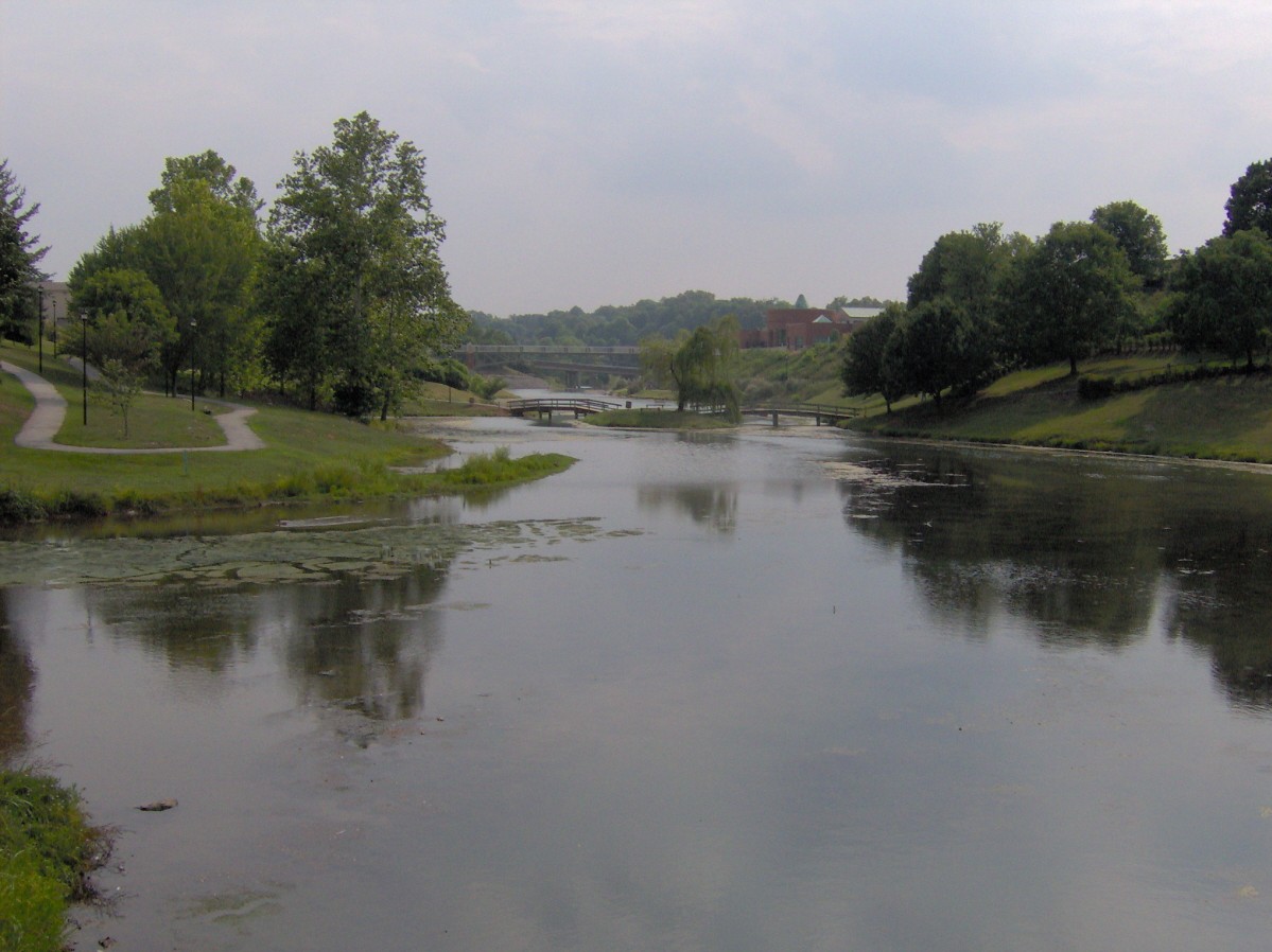
Parks
 Greenbelt Park
- Maryville Alcoa Greenway
- Bicentennial Park (Greenbelt)
- Amerine Park
- Eagleton Park
- Everett Park
- John Sevier Park
- Pearson Springs Park
- Sandy Springs Park
Demographics
As of the census[1] of 2000, there were 23,120 people, 9,050 households, and 6,045 families residing in the city. The population density was 1,452.4 people per square mile (560.7/km²). There were 9,795 housing units at an average density of 615.3 per square mile (237.6/km²). The racial makeup of the city was 93.59% White, 2.95% African American, 0.22% Native American, 1.55% Asian, 0.03% Pacific Islander, 0.53% from other races, and 1.14% from two or more races. Hispanic or Latino of any race were 1.38% of the population.
There were 9,050 households out of which 32.1% had children under the age of 18 living with them, 52.3% were married couples living together, 11.9% had a female householder with no husband present, and 33.2% were non-families. 29.8% of all households were made up of individuals and 13.9% had someone living alone who was 65 years of age or older. The average household size was 2.38 and the average family size was 2.95.
In the city the population was spread out with 23.9% under the age of 18, 9.8% from 18 to 24, 27.0% from 25 to 44, 21.7% from 45 to 64, and 17.6% who were 65 years of age or older. The median age was 38 years. For every 100 females there were 85.7 males. For every 100 females age 18 and over, there were 81.4 males.
The median income for a household in the city was $40,143, and the median income for a family was $49,182. Males had a median income of $35,434 versus $23,444 for females. The per capita income for the city was $21,556. About 7.8% of families and 10.1% of the population were below the poverty line, including 12.3% of those under age 18 and 9.6% of those age 65 or over.
Climate
Average temperatures in July range from 69 degrees low to 87 degrees high. Average temperatures in January range from 29 degrees low to 46 degrees high.[5] Most of the year is very pleasant with mild temperatures.
History
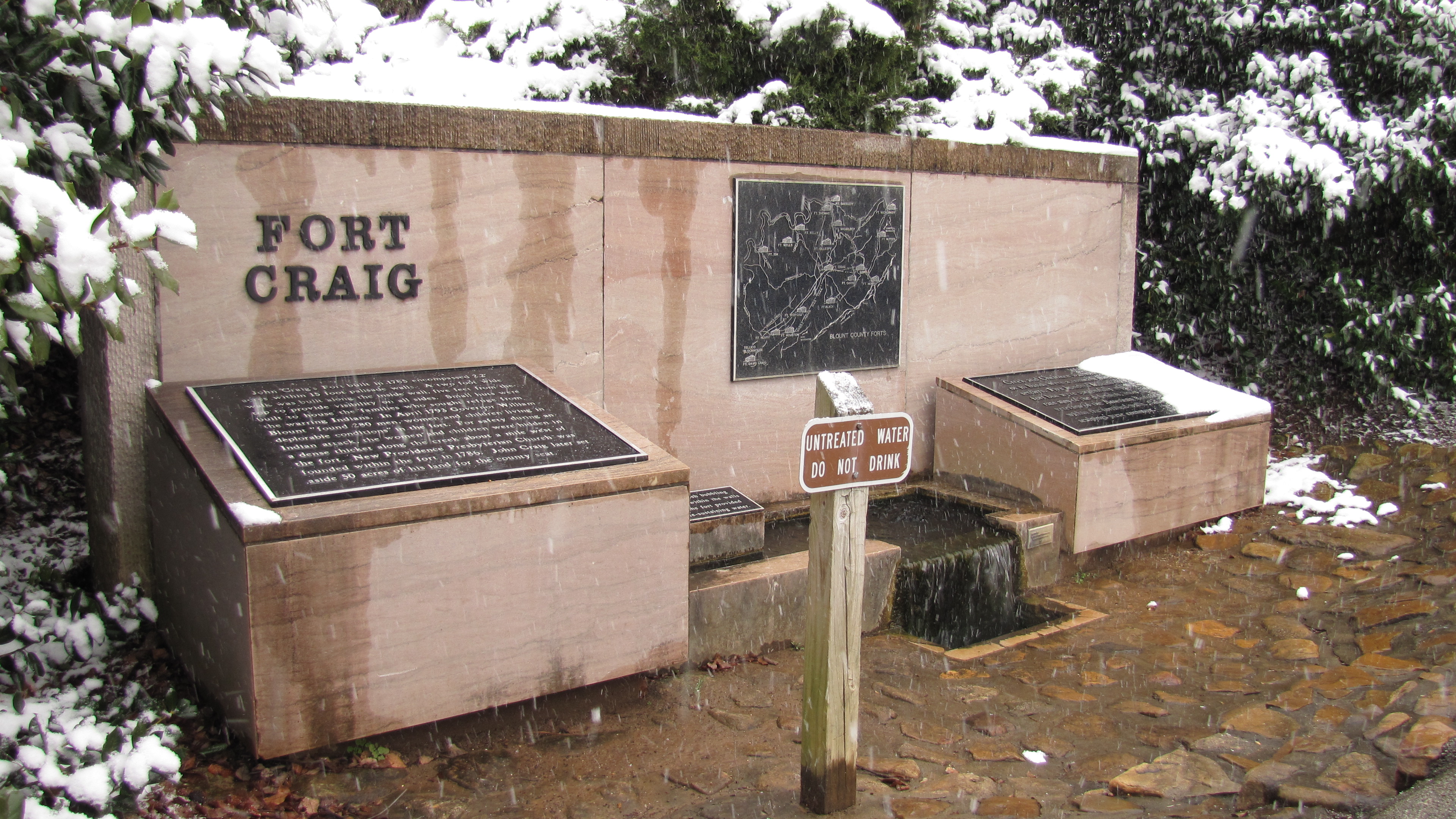
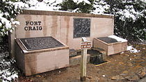 Monument marking the spring that once supplied water to Fort Craig
When the first Euro-American explorers arrived in the area, they found the Great Indian Warpath, which ran along the route where the modern US-411 has been built. It was long used by the indigenous peoples of the area. A historic Cherokee village known as Elajay was situated at the confluence of Ellejoy Creek (named after the village) and Little River. Its site was near the modern Heritage High School. Ensign Henry Timberlake passed through the village in 1762 while returning from his expedition to the Overhill villages to the west. He reported that it had been abandoned.[6]
In 1785, Revolutionary War veteran John Craig built a wooden palisade enclosing cabins at what is known as Fort Craig (or Craig's Station) at present-day Maryville. Such stations were built throughout the frontier to defend settlers against attacks from the Cherokee. "On April 11, 1793, when settlers believed Indian attacks were imminent, 280 men, women, and children gathered in small huts at John Craig's station on Nine Mile Creek."[7]
Craig donated 50 acres (200,000 m²) next to his fort for the founding of a new town. Incorporated as a city on July 11, 1795, the settlement was named in honor of Mary Grainger Blount, wife of the territorial governor William Blount. Blount County was named after him.[8]
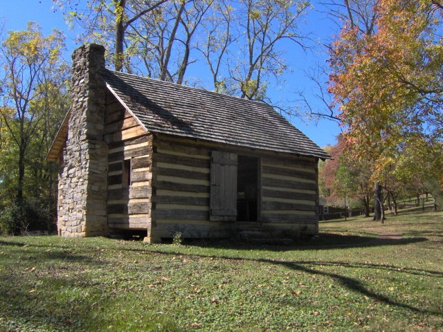
The family of Sam Houston moved to Maryville from Virginia in 1808, when Houston was 15. His older brothers put him to work as a clerk in a store they established in town, but he ran away. Houston lived for a few years with the Cherokee at Hiwassee Island, on the Hiwassee River, where he became fluent in their language and appreciative of their culture. After his return to Maryville about 1811, Houston started a one-room schoolhouse. He signed up for the army during the War of 1812 and rose rapidly in rank, beginning his military and political career. The schoolhouse still stands just off US-411 near the community of Wildwood.
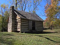 Sam Houston Schoolhouse in Maryville
Maryville was a center of abolitionist activity throughout the early 19th-century; it was generated mostly by the Society of Friends, which had a relatively large presence in Blount County. They were supported by anti-slavery advocates such as Isaac L. Anderson, the founder of Maryville College.[9]
When Tennessee voted on the Ordinance of Secession in 1861, only 24% of Blount Countians voted in favor of seceding from the Union.[10]
Although staunchly pro-Union throughout the Civil War, Maryville was not liberated by federal troops until May 1864. In August of that year, a Confederate cavalry raid, under the command of General Joseph Wheeler, attacked the courthouse where the Union troops had taken shelter. To try to dislodge the federal soldiers, Confederates set fire to several buildings, including a store where the city's records were being kept. Polly Tool, an African-American slave, rescued most of the records. She was honored by a statue in the Blount County courthouse. In 1869, Maryville elected W.B. Scott, the second African-American mayor in U.S. history.[11]
In the 1970s, after several department stores and other retailers moved from the downtown area to Alcoa's Midland shopping center, the city spent $10 million on a renewal project called "Now Town." Traffic was re-routed, facades were placed on old buildings, slums were cleared, and the Bicentennial Greenbelt Park was created. The project failed to attract business back to the downtown locations; instead retailers moved to the new Foothills Mall a few years later. The downtown area remained in decline until the 2000s, when the city agreed to reverse many of the "Now Town" changes.
U.S. Senator Lamar Alexander was born in Maryville in 1940. Alexander served as Governor of Tennessee from 1979–1987 and Secretary of Education (1991–1993) under the first President George H. W. Bush. He ran unsuccessful campaigns for president in 1996 and 2000, both times announcing his candidacy for the Republican Party from his hometown of Maryville. In 2002, he was elected to the U.S. Senate, succeeding Fred Thompson.
Economy
Top employers
According to Maryville's 2010 Comprehensive Annual Financial Report,[12] the top employers in the area were:
# Employer # of Employees 1 Clayton Homes 2,511 2 Denso 2,500 3 Blount Memorial Hospital 2,198 4 Blount County Schools 1,600 5 Alcoa, Inc. 1,368 6 Ruby Tuesday 1,301 7 Blount County 745 8 Maryville City Schools 658 9 Walmart 603 10 Marriott Business Services 546 11 APAC-Tennessee 525 12 Reinhart FoodService 483 13 City of Maryville 336 14 Sanford 300 15 Rockford Manufacturing 300 16 City of Alcoa 284 17 Alcoa City Schools 227 Education
City
- Coulters Grove Intermediate School (under construction)
- Foothills Elementary School
- Fort Craig School of Dynamic Learning
- John Sevier Elementary School
- Maryville High School
- Maryville Intermediate School
- Maryville Middle School
- Sam Houston Elementary School
Private/parochial
- Maryville Christian School
- Apostolic Christian Academy
Maryville College
Maryville is home to Maryville College, a private four-year liberal arts college. It was founded in 1819 by Presbyterian minister Isaac L. Anderson for the purpose of furthering education and enlightenment. The college is one of the fifty oldest colleges in the United States and the twelfth oldest institution in the South.[13] It is associated with the Presbyterian Church (USA). It enrolls about 1,103 students. Maryville College's mascot is the Scots. The sports teams compete in NCAA Division III athletics in the Great South Athletic Conference and the USA South Athletic Conference.
Other colleges
- Satellite campus of Pellissippi State Community College
Notable people
- Lamar Alexander - Senior U.S. Senator from Tennessee; former Governor of Tennessee, Secretary of Education and Republican presidential candidate[14]
- Isaac L. Anderson - Founder of Maryville College
- Albert Brigance - author and special education resource specialist
- Charles W. Cansler - educator and civil rights advocate[15]
- Mike Cross - musician[16]
- David L. Eubanks - Christian preacher and president of Johnson Bible College[17]
- Phillip Fulmer - former Tennessee Volunteers football coach (1992–2008)
- Jack Greene - Country music singer, famous for his #1 hit, "There Goes My Everything".[18]
- George Washington Harris - humorist; lived near what is now Wildwood, c. 1839–1843[19]
- Sam Houston - Texas revolutionary, politician and governor of Tennessee and Texas; lived in Maryville intermittently c. 1808—1813[20]
- Lee Humphrey - college basketball player[21]
- Melanie Hutsell - television and movie actress[22]
See also
References
- ^ a b "American FactFinder". United States Census Bureau. http://factfinder.census.gov. Retrieved 2008-01-31.
- ^ "US Board on Geographic Names". United States Geological Survey. 2007-10-25. http://geonames.usgs.gov. Retrieved 2008-01-31.
- ^ "Find a County". National Association of Counties. http://www.naco.org/Counties/Pages/FindACounty.aspx. Retrieved 2011-06-07.
- ^ "US Gazetteer files: 2010, 2000, and 1990". United States Census Bureau. 2011-02-12. http://www.census.gov/geo/www/gazetteer/gazette.html. Retrieved 2011-04-23.
- ^ Weather.com. Retrieved: 4 September 2011.
- ^ Henry Timberlake, Samuel Williams (ed.), Memoirs, 1756-1765 (Marietta, Georgia: Continental Book Co., 1948), pp. 118-119.
- ^ Walter Durham, "Frontier Stations", Tennessee Encyclopedia of History and Culture, accessed 27 Aug 2010
- ^ Inez Burns, History of Blount County, Tennessee: From War Trail to Landing Strip, 1795-1955 (Nashville: Benson Print Co., 1957), 2-30.
- ^ Durwood Dunn, Cades Cove: The Life and Death of An Appalachian Community, Knoxville, TN: University of Tennessee Press, 1988, 125.
- ^ Robbie Jones, The Historic Architecture of Sevier County, Tennessee, Sevierville, TN: Smoky Mountain Historical Society, 1997, p. 33
- ^ "Maryville Historic Timeline", City of Maryville
- ^ City of Maryville CAFR
- ^ Maryville College website. Retrieved: 4 September 2011.
- ^ "Meet Lamar". Alexander for Senate. http://www.lamaralexander.com/index.cfm?Page=Biography. Retrieved 2010-09-09.
- ^ Robert Booker, Charles Warner Cansler, Tennessee Encyclopedia of History and Culture, 2009. Retrieved: 6 April 2011.
- ^ Mike Cross biography from official website. Retrieved: 14 February 2011.
- ^ Johnson Bible College - Our History. Retrieved: 14 February 2011.
- ^ Jack Greene - Official site. Retrieved: 14 February 2011.
- ^ M. Thomas Inge, High Times and Hard Times (Nashville: Vanderbilt University Press, 1967), p. 18n.
- ^ Sam Houston - Chronology. Retrieved: 14 February 2011.
- ^ Lee Humphrey - ESPN player profile. Retrieved: 14 February 2011.
- ^ IMDb - Melanie Hutsell. Retrieved: 14 February 2011.
External links
Municipalities and communities of Blount County, Tennessee County seat: MaryvilleCities Alcoa | Friendsville | Louisville | Maryville | Rockford | Townsend
Town CDPs Unincorporated
communitiesHappy Valley | Walland | Tallassee
Footnotes ‡This populated place also has portions in an adjacent county or counties
Categories:- Maryville, Tennessee
- Cities in Tennessee
- Populated places in Blount County, Tennessee
- County seats in Tennessee
- Knoxville metropolitan area
- History of Tennessee
- Populated places established in 1785

Wikimedia Foundation. 2010.