Chilhowee Mountain

Chilhowee Mountain
Chilhowee Mountain

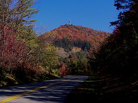
Foothills Parkway approaching Look Rock, on the crest of Chilhowee Mountain
Elevation 2,843 ft (867 m)
Location
Location Blount County, Tennessee, USA
Range Great Smoky Mountains
Coordinates 35°43′50″N 83°49′12″W / 35.73047°N 83.81993°W / 35.73047; -83.81993Coordinates: 35°43′50″N 83°49′12″W / 35.73047°N 83.81993°W / 35.73047; -83.81993
Topo map USGS Kinzel Springs (TN)

Chilhowee Mountain is a low ridge at the outer edge of the Great Smoky Mountains that stretches between the Little Tennessee River (specifically Chilhowee Lake) to the west and the Little Pigeon River watershed to the east. While not part of the Great Smoky Mountains National Park, the mountain's crest is traversed by the westernmost section of Foothills Parkway.

While the mountain is 35 miles (56 km) long, it rarely reaches a width of more than 3 or 4 miles (6.4 km). Little River cuts a large gap in the middle of the mountain (near Walland), dividing it into eastern and western sections. The highest point on the western section is 2,650 ft (808 m) at a knob known as Look Rock. The highest point on the eastern section, known as "The Three Sisters," rises to 2,843 feet (866m), and is a prominent landmark visible from nearby Maryville, Tennessee.


External links


Wikimedia Foundation. 2010.

Игры ⚽ Поможем сделать НИР

Look at other dictionaries:

  • Chilhowee Mountain Retreat — (Maryville,США) Категория отеля: 3 звездочный отель Адрес: 5110 Little Do …   Каталог отелей

  • Chilhowee — has a number of meanings: Chilhowee (Cherokee town), an ancient Cherokee village in Blount County and Monroe County, Tennessee Chilhowee Dam, a reservoir and dam development project in Tennessee Chilhowee formation, a rock formation Chilhowee… …   Wikipedia

  • Chilhowee (Cherokee town) — Coordinates: 35°33′08″N 84°00′27″W / 35.55231°N 84.00737°W / 35.55231; 84.00737 …   Wikipedia

  • Chilhowee Park (neighborhood) — Houses along Woodbine Avenue in Chilhowee Park Chilhowee Park is a residential neighborhood in Knoxville, Tennessee, USA, located off Magnolia Avenue in the East Knoxville area. Developed as a streetcar suburb in the 1890s, this neighborhood was… …   Wikipedia

  • Foothills Parkway — The Foothills Parkway is a national parkway which, if completed, will traverse the foothills of the northern Great Smoky Mountains in East Tennessee, located in the Southeastern United States. The 71 mile (114 km) parkway will ideally connect U.S …   Wikipedia

  • Walland, Tennessee — Walland   Unincorporated community   Miller s Cove, with Chilhowee Mountain on right …   Wikipedia

  • Happy Valley, Tennessee — For the World War II temporary community at Oak Ridge, see Happy Valley, Oak Ridge, Tennessee. Happy Valley is an unincorporated community in Blount County, Tennessee, United States, near the Great Smoky Mountains National Park. Although it is… …   Wikipedia

  • Overhill Cherokee — Timberlake s Draught of the Cherokee Country The term Overhill Cherokee refers to the former Cherokee settlements located in what is now Tennessee in the southeastern United States. The name was given by 18th century European traders and… …   Wikipedia

  • Little River (Tennessee) — Infobox River river name = Little River caption = Middle Prong near the confluence of Thunderhead and Lynn Prongs origin = Slopes of Clingmans Dome in Sevier County, Tennessee. mouth = Tennessee River at Fort Loudoun Lake basin countries = USA… …   Wikipedia

  • Maryville, Tennessee —   City   Maryville, Tennessee …   Wikipedia

Share the article and excerpts

Direct link
Do a right-click on the link above
and select “Copy Link”