- List of counties in Washington
-
There are 39 counties in the U.S. state of Washington. Washington was carved out of the western part of Washington Territory and admitted to the Union as the 42nd state in 1889.[1] The first counties were created from unorganized territory in 1845.[2]
Washington's postal abbreviation is WA and its FIPS state code is 53.
List
County FIPS code
[3]County seat
[4]Established
[4]Origin
[2]Etymology
[2]Population
[4]Area
[4]Map Adams County 001 Ritzville 1883 Whitman County John Adams (1735-1826), second President of the United States 18,728 1,925 sq mi
(4,986 km²)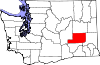
Asotin County 003 Asotin 1883 Garfield County The Nez Percé name for Eel Creek 21,623 636 sq mi
(1,647 km2)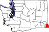
Benton County 005 Prosser 1905 Yakima and Klickitat Counties Thomas Hart Benton (1782 – 1858), a Missouri U.S. Senator 175,177 1,703 sq mi
(4,411 km2)
Chelan County 007 Wenatchee 1899 Okanogan and Kittitas Counties A Native American word meaning deep water, likely referring to Lake Chelan 72,453 2,922 sq mi
(7,568 km2)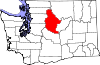
Clallam County 009 Port Angeles 1854 Jefferson County A Klallam word meaning "the strong people" 71,404 1,745 sq mi
(4,520 km2)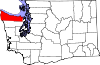
Clark County 011 Vancouver 1845 Original county William Clark (1770 – 1838), the co-captain of the Lewis and Clark Expedition 425,363 628 sq mi
(1,627 km2)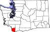
Columbia County 013 Dayton 1875 Walla Walla County The Columbia River 4,078 869 sq mi
(2,251 km2)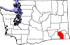
Cowlitz County 015 Kelso 1854 Original county Cowlitz, an Indian tribe 102,410 1,139 sq mi
(2,950 km2)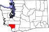
Douglas County 017 Waterville 1883 Lincoln County Stephen A. Douglas (1813 - 1861), U.S. Senator from Illinois. 38,431 1,821 sq mi
(4,716 km2)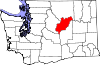
Ferry County 019 Republic 1899 Stevens County Elisha P. Ferry (1825 - 1895), first Governor of Washington State 7,551 2,204 sq mi
(5,708 km2)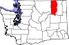
Franklin County 021 Pasco 1883 Whitman County Benjamin Franklin, writer, orator, inventor, and U.S. founding father 78,163 1,242 sq mi
(3,217 km2)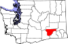
Garfield County 023 Pomeroy 1881 Columbia County James A. Garfield, twentieth U.S. President 2,266 710 sq mi
(1,839 km2)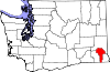
Grant County 025 Ephrata 1909 Douglas County Ulysses S. Grant, eighteenth U.S. President 89,120 2,681 sq mi
(6,944 km2)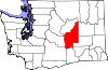
Grays Harbor County 027 Montesano 1854 Thurston County Grays Harbor, a body of water named after explorer and merchant Robert Gray 72,797 1,917 sq mi
(4,965 km2)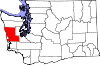
Island County 029 Coupeville 1853 Thurston County Whidbey and Camano Islands 78,506 209 sq mi
(541 km2)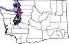
Jefferson County 031 Port Townsend 1852 Thurston County Thomas Jefferson, third U.S. President and principal author of the Declaration of Independence 29,872 1,809 sq mi
(4,685 km2)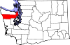
King County 033 Seattle 1852 Thurston County William Rufus King, vice president of the United States under Franklin Pierce; officially renamed in 1986 after Martin Luther King, Jr. 1,931,249 2,126 sq mi
(5,506 km2)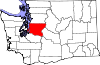
Kitsap County 035 Port Orchard 1857 King and Jefferson Counties Chief Kitsap, leader of the Suquamish tribe 251,133 396 sq mi
(1,026 km2)
Kittitas County 037 Ellensburg 1883 Yakima County Kittitas tribe word of uncertain meaning, with popular translations ranging from "white chalk" to "land of the plenty" 40,915 2,297 sq mi
(5,949 km2)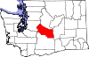
Klickitat County 039 Goldendale 1859 Walla Walla County Klickitat Tribe 20,318 1,872 sq mi
(4,848 km2)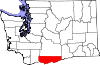
Lewis County 041 Chehalis 1845 Original county Meriwether Lewis (1774 – 1809), the co-captain of the Lewis and Clark Expedition 75,455 2,408 sq mi
(6,237 km2)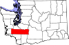
Lincoln County 043 Davenport 1883 Whitman County Abraham Lincoln, sixteenth U.S. President 10,570 2,311 sq mi
(5,985 km2)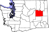
Mason County 045 Shelton 1854 King County C.H. Mason, first Secretary of Washington Territory 60,699 961 sq mi
(2,489 km2)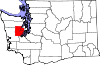
Okanogan County 047 Okanogan 1888 Stevens County A Salish Native American word meaning rendezvous 41,120 5,268 sq mi
(13,644 km2)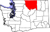
Pacific County 049 South Bend 1851 Lewis County The Pacific Ocean 20,920 975 sq mi
(2,525 km2)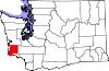
Pend Oreille County 051 Newport 1911 Stevens County The Pend d'Oreille Native American tribe 13,001 1,400 sq mi
(3,626 km2)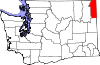
Pierce County 053 Tacoma 1852 Thurston County Franklin Pierce, 14th President of the United States 795,225 1,676 sq mi
(4,341 km2)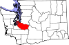
San Juan County 055 Friday Harbor 1873 Whatcom County San Juan Island 15,769 175 sq mi
(453 km2)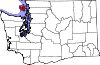
Skagit County 057 Mount Vernon 1883 Whatcom County The Skagit Native American tribe 116,901 1,735 sq mi
(4,494 km2)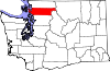
Skamania County 059 Stevenson 1854 Clark County A Chinookan word meaning "swift water" 11,066 1,656 sq mi
(4,289 km2)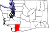
Snohomish County 061 Everett 1861 Island County The Snohomish tribe 713,335 2,090 sq mi
(5,413 km2)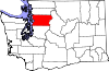
Spokane County 063 Spokane 1879 Stevens County The Spokane Native American tribe 471,221 1,764 sq mi
(4,569 km2)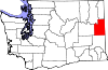
Stevens County 065 Colville 1863 Walla Walla County Isaac Ingalls Stevens, the first governor of the Washington Territory. 43,531 2,478 sq mi
(6,418 km2)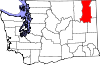
Thurston County 067 Olympia 1852 Lewis County Samuel R. Thurston, the Oregon Territory's first delegate to Congress 252,264 727 sq mi
(1,883 km2)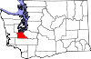
Wahkiakum County 069 Cathlamet 1854 Cowlitz County Leader of Wahkiakum ("Tall Timber"), Native American tribe 3,978 264 sq mi
(684 km2)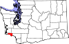
Walla Walla County 071 Walla Walla 1854 Skamania County The Walla Walla Native American tribe, and also another name for running water 58,781 1,270 sq mi
(3,289 km2)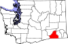
Whatcom County 073 Bellingham 1854 Island County Nooksack word meaning "noisy water" 201,140 2,120 sq mi
(5,491 km2)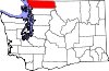
Whitman County 075 Colfax 1871 Stevens County Marcus Whitman (1802 - 1847), a Presbyterian missionary. 44,776 2,159 sq mi
(5,592 km2)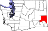
Yakima County 077 Yakima 1865 Ferguson County (defunct) The Yakama Native American tribe 243,231 4,296 sq mi
(11,127 km2)
References
- ^ "Historical Timeline of Events Leading to the formation of Washington State". http://www.wsulibs.wsu.edu/holland/masc/PNWTimeline.htm. Retrieved 2008-08-09.
- ^ a b c "Washington Counties". Online Encyclopedia of Washington State History. HistoryLink.org. Archived from the original on 2008-03-28. http://web.archive.org/web/20080328235316/http://www.historylink.org/results.cfm?keyword=countythumbnails. Retrieved 2008-05-06.
- ^ "EPA County FIPS Code Listing". US Environmental Protection Agency. http://www.epa.gov/enviro/html/codes/wa.html. Retrieved 2008-05-06.
- ^ a b c d National Association of Counties. "NACo - Find a county". http://www.naco.org/Template.cfm?Section=Find_a_County&Template=/cffiles/counties/state.cfm&state.cfm&statecode=WA. Retrieved 2008-05-06.
Locations in the state of Washington Communities Cities · Towns · Census-designated places (CDPs) · Undesignated communities · Unrecognized communities · Indian reservationsGeography Regions · Other places · Bodies of waterOther  State of Washington
Olympia (capital) Topics State government | Cities | Towns | Congressional delegation | City governments | Governors | History | Geography | People | Legislative initiatives | Popular initiatives | Legislature | Music | Parks | Highways | Symbols | Visitor attractions
Society Demographics · Economy · Education · Politics
Regions Larger cities and
metropolitan areasSeattle | Seattle metropolitan area | Spokane | Tacoma | Tri-Cities | Vancouver | Bellevue | Everett | Yakima
Smaller cities Aberdeen | Anacortes | Arlington | Auburn | Bainbridge Island | Battle Ground | Bellingham | Bonney Lake | Bothell | Bremerton | Burien | Camas | Centralia | Cheney | Cle Elum | Coupeville | Covington | Des Moines | East Wenatchee | Edmonds | Ellensburg | Enumclaw | Federal Way | Fort Lewis | Grandview | Hoquiam | Issaquah | Kelso | Kenmore | Kennewick | Kent | Kirkland | Lacey | Lake Forest Park | Lake Stevens | Lakewood | Langley | Longview | Lynden | Lynnwood | Mabton | Maple Valley | Marysville | Mercer Island | Mill Creek | Monroe | Moses Lake | Mountlake Terrace | Mount Vernon | Mukilteo | Naches | Oak Harbor | Olympia | Pasco | Port Angeles | Port Orchard | Port Townsend | Prosser | Pullman | Puyallup | Redmond | Renton | Richland | Sammamish | SeaTac | Sedro-Woolley | Selah | Shelton | Shoreline | Silverdale | Spokane Valley | Sunnyside | Toppenish | Tukwila | Tumwater | University Place | Walla Walla | Wapato | Washougal | Wenatchee | West Richland | Woodinville | Zillah
Counties Adams | Asotin | Benton | Chelan | Clallam | Clark | Columbia | Cowlitz | Douglas | Ferry | Franklin | Garfield | Grant | Grays Harbor | Island | Jefferson | King | Kitsap | Kittitas | Klickitat | Lewis | Lincoln | Mason | Okanogan | Pacific | Pend Oreille | Pierce | San Juan | Skagit | Skamania | Snohomish | Spokane | Stevens | Thurston | Wahkiakum | Walla Walla | Whatcom | Whitman | Yakima
Categories:- Lists of U.S. counties by state
- Washington (state) counties
- Washington (state)-related lists


Wikimedia Foundation. 2010.