- Marysville, Washington
-
Marysville, Washington — City — 
Flag
SealNickname(s): The Strawberry City Marysville in Washington State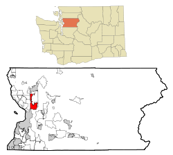
Coordinates: 48°3′46″N 122°9′48″W / 48.06278°N 122.16333°WCoordinates: 48°3′46″N 122°9′48″W / 48.06278°N 122.16333°W Country United States State Washington County Snohomish Founded 1872 Incorporated March 20, 1891 Government - Mayor Jon Nehring Area - Total 9.8 sq mi (25.3 km2) - Land 9.6 sq mi (24.8 km2) - Water 0.2 sq mi (0.5 km2) Elevation 20 ft (6 m) Population (2010) - Total 60,020 - Density 2,639.7/sq mi (1,019.2/km2) Time zone PST (UTC-8) - Summer (DST) PDT (UTC-7) ZIP codes 98270-98271 Area code 360 FIPS code 53-43955[1] GNIS feature ID 1512435[2] Website www.marysvillewa.gov Marysville is a city in Snohomish County, Washington, United States. The population was 60,020 at the 2010 census. Marysville is known as "The Strawberry City" due to the large number of strawberry farms that once surrounded the city in its earlier days. Over the past decade, and continuing today, large residential, commercial, and industrial growth has transformed this city. Marysville ranks as the second largest city in the county after Everett.[3]
Contents
History
Main article: History of Marysville, WashingtonMarysville's history begins with the signing of the Point Elliott Treaty in 1855. After the treaty was signed, the local area had opened for settlement and the timber industry quickly took hold, with several claims being staked during the 1860s in the area that would become Marysville. The loggers and the nearby Tulalip reservation provided ample opportunities for trade, and in 1872 a small government trading post was established. James P. Comeford and his wife, Maria, moved to the area after he was appointed proprietor of the trading post by the federal government.
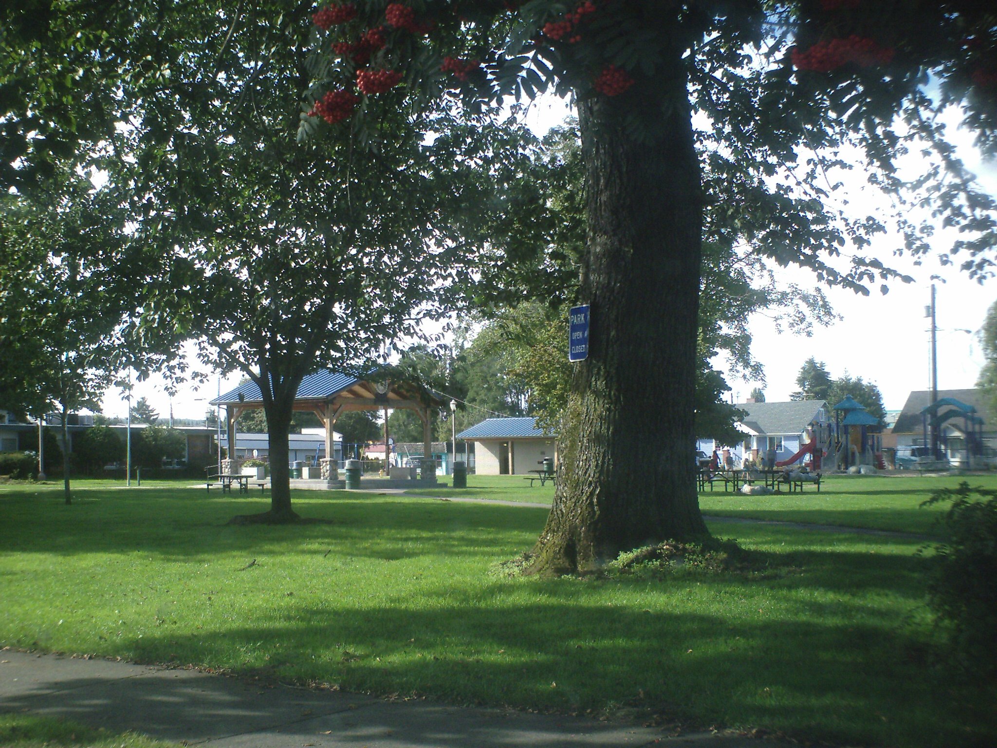
 Comeford Park in Marysville, named for James and Maria Comeford.
In 1874, Comeford paid $450 for logged timber claims consisting of 1,280 acres (5.2 km2) of land. Four years later, they built a new store with living quarters attached and a small dock with a plank road called Front Street. Mrs. Comeford began teaching classes to local children and Mr. Comeford ran the post office, both of these provided out of their home.
Little growth took place in Marysville until the mid-1880s. The first saw mill opened in 1887, followed by three additional mills over the next few years. The railroad came to town in 1889, which was followed by more growth.
Marysville was officially incorporated on March 20, 1891 and its December 30, 2009 annexation made Marysville the second largest city in Snohomish County – with a total population of 58,040.
2008 Make-over
In his 2008 State of the City Address, mayor Dennis Kendall announced that the Marysville City Council has decided to re-make over Downtown.[4] The project will involve:
- Improving West-side streets to redevelop
- Add structured parking
- Support 3rd St. business
- Make pedestrian connections
- Reduce traffic and do some "Green Street" treatment
- Develop Mill/P.W. site and market as unique site
- Restore the Ebey Waterfront trail and shoreline
- Add a roundabout to access the sawmill site and Downtown from SR 529
- Improve Ebey Waterfront Park and Boat Launch
- And redevelop Marina into Water Quality facility and mixed-use development
Later on, the city will redevelop the Marysville Mall. The Council is doing this to make Marysville look utopian compared to other areas. This probably will attract visitors and tourists.
Also, the Marysville City Hall will be moved to a new civics campus that will be designed by Everett Community College students.
Geography
Marysville is located at 48°3′46″N 122°9′48″W / 48.06278°N 122.16333°W (48.062743, −122.163332).[5]
According to the United States Census Bureau, the city has a total area of 9.8 square miles (25.3 km²), of which, 9.6 square miles (24.8 km²) of it is land and 0.2 square miles (0.5 km²) of it (1.94%) is water.
There are 4 neighborhoods within the city of Marysville. They are North Lakewood, Sunnyside/Whiskey Ridge (not to be confused with the actual city in Yakima County), Downtown Marysville, and North Marysville.
Demographics
Historical populations Census Pop. %± 1890 262 — 1900 728 177.9% 1910 1,239 70.2% 1920 1,244 0.4% 1930 1,354 8.8% 1940 1,748 29.1% 1950 2,259 29.2% 1960 3,117 38.0% 1970 4,343 39.3% 1980 5,544 27.7% 1990 10,328 86.3% 2000 25,315 145.1% 2010 60,020 137.1% As of the census[1] of 2000, there were 25,315 people, 9,400 households, and 6,608 families residing in the city. The population density was 2,640.1 people per square mile (1,019.2/km²). There were 9,730 housing units at an average density of 1,014.7 per square mile (391.7/km²). The racial makeup of the city was 88.21% White, 1.02% African American, 1.60% Native American, 3.82% Asian, 0.36% Pacific Islander, 1.89% from other races, and 3.10% from two or more races. Hispanic or Latino of any race were 4.83% of the population.
There were 9,400 households out of which 40.5% had children under the age of 18 living with them, 54.1% were married couples living together, 11.3% had a female householder with no husband present, and 29.7% were non-families. 23.5% of all households were made up of individuals and 10.4% had someone living alone who was 65 years of age or older. The average household size was 2.66 and the average family size was 3.15.
In the city the age distribution of the population shows 30.1% under the age of 18, 7.9% from 18 to 24, 32.9% from 25 to 44, 17.7% from 45 to 64, and 11.3% who were 65 years of age or older. The median age was 33 years. For every 100 females there were 95.2 males. For every 100 females age 18 and over, there were 90.6 males.
The median income for a household in the city was $47,088, and the median income for a family was $55,796. Males had a median income of $42,391 versus $30,185 for females. The per capita income for the city was $20,414. About 3.7% of families and 5.6% of the population were below the poverty line, including 4.0% of those under age 18 and 5.9% of those age 65 or over.
Economy
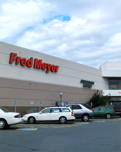
 The Fred Meyer along State Avenue (old U.S. Route 99) is an example to the retail in Marysville's economy.
For much of its existence, Marysville was a rural area known for farming and for lumber production, although other, smaller industries existed, providing a diverse economy that has played an important role in Marysville's growth over the years. This economic diversity has also been a major factor during times of economic crisis such as the Great Depression, when Marysville's economy did not suffer to the same extent as other towns in the area, which had largely been dependent on the timber trade and mining.[6]
Although farms still operate in the area around the city, the lumber industry has all but ceased and is no longer a major factor in the local economy. The community has largely transitioned over the past two decades into a city with a large retail and service-based economy, and is closely intertwined economically with its neighbors throughout the Puget Sound area through large regional employers such as Boeing and Microsoft. The naval station in nearby Everett and its support facilities also play an increasing role in the local economy.
Newer shopping places in the area include the Seattle Premium Outlets, located with in Tulalip, on the west side of I-5. A new shopping center is near there including a Kohl's and Ross. There is also a WinCo grocery store in that shopping center.
Arts and culture
Annual cultural events
Marysville holds an annual Strawberry Festival in the third week of June, which is highlighted by a grand parade. The first Strawberry Festival was held in 1932.
Summer Jubilee is an August event that offers free school supplies and haircuts for children in the community, typically drawing over 10,000 visitors to its Asbery Field location. Summer Jubilee is a ministry of several Christian churches within Marysville.
Museums
The Marysville Historical Society, a group devoted to saving the history of Marysville, has bought some land off of historic Armar Road near Jennings Park that will become the official museum of Marysville.
Library
Marysville is served by the Sno-Isle Library system, a 2-county system with a large branch in Marysville.
Parks and recreation
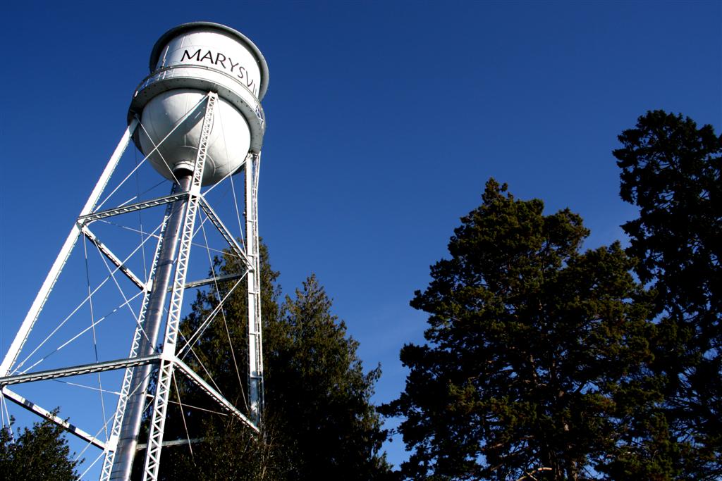
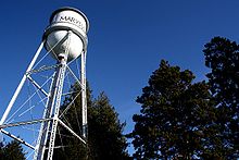 Marysville water tower
The City of Marysville has several historic parks and places. They include Comeford Park, Jennings Park, the Marysville Water Tower, the Gehl House, Ken Baxter Senior Center, and more. All are public and do not require a fee to get into.
The two 150,000 gallon Marysville water towers were constructed in 1921, but have not held water since the 1970s. Red beacons on the top of the towers were used until the late 1940s to alert police that they needed to respond to an emergency. The only surviving tower is located in Comeford Park. The other tower was located on Second Ave., but was demolished in 1987 along with many of Marysville's historical buildings, to make way for the Marysville Mall which was built on top of six square blocks that comprised much of what was originally downtown Marysville.
Comeford Park is a park in Downtown Marysville next to the Ken Baxter Senior Center. It houses the Marysville Water Tower and a large gondola in the middle of the park that was donated by Marysville's Rotary Club. The park also has a children's playground.
Jennings Park is a park near Downtown Marysville that is located off of historic Armar Road. The park holds the historic Gehl House, a small log cabin that has been remodeled to look like what life would have been in 1884. The park features a children's area and a large trail that leads to another children's area and a pond for fishing.
The Ken Baxter Senior Center is a senior center in Downtown Marysville located in historic Comeford Park. The senior center served formerly as a city hall, police station, jail, fire station, and library before becoming a senior center in 1997.
Government
City Council
The Marysville City Council meets for work sessions the 1st and 3rd Mondays and the regular business meetings are on the 2nd and 4th Monday of each month. Each meeting starts at 7 pm in the City Hall and there are no meetings in August.
Education
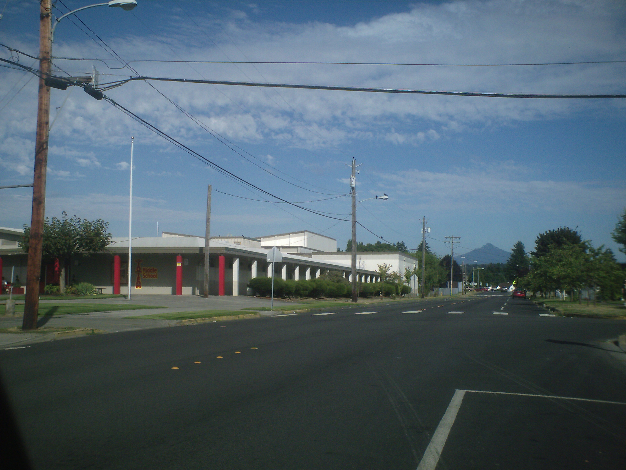
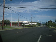 Totem Middle School (formerly Marysville Junior High School) in Marysville. Mount Pilchuck can be seen in the background.
For most of its history, the city of Marysville had a single school district within its municipal boundaries, the Marysville School District. However, over the past decade the geographic territory of the city has increased substantially due to annexations. As a result, parts of four school districts are contained within the city limits:
- Marysville School District
The school district is host to the following high schools: Marysville Pilchuck High School, Marysville Getchell High School (opened in 2010[7]), Heritage High School, Marysville Alternative High School, and Marysville Arts and Technology High School (which shares a site with Heritage High School and the 10th Street Middle School).[8] Heritage High School is located on the Tulalip Reservation and has mainly Native American students. The district is also known for its 2003 teachers' strike, which is still the largest education strike in state history.
Media
Marysville is served by a weekly newspaper, the Marysville Globe and the North County Outlook, which also serves Arlington, Tulalip, and Lakewood. Other newspapers that provide coverage of Marysville include the daily Everett Herald and the daily newspaper The Seattle Times.
Infrastructure
Transportation
Marysville is a city located along the Interstate 5 corridor. It has many state highways running through city limits and connecting the city to other areas. The state highways and Interstates near and in Marysville include:
 Interstate 5
 State Route 9 (connected via State Route 528)
Marysville also has one major non-state highway connector that runs through the city, State Avenue. The route from the interchange with Interstate 5 to the intersection with State Route 528 (Fourth Street) in Downtown is known as State Route 529. The route from Interstate 5 to 116th Street and then west on 116th Street to Interstate 5 formerly was known as Interstate 5 Business.
Marysville is connected by several Community Transit routes that connect the city to Seattle, the University of Washington, and more. There are 6 major bus stops in Marysville that are park and rides, park and pools, and flyer stops. There is no Amtrak or railroad connections to Marysville. The nearest station is Everett Station located in Everett. There are no airports in Marysville city limits. The nearest municipal airport is Arlington Municipal.
There is one official biking/hiking trail near Marysville and it is the Centennial Trail. There have been some proposals for a trail in the East Marysville.[9]
Mayors
Main article: List of mayors of Marysville, WashingtonThere have been 32 mayors since 1891, when Mark Swinnerton was elected. The Honorable Mayor Jon Nehring, a resident of Marysville for 17 years, was appointed by City Council in July 2010 to serve as mayor. He served several years as mayor pro tem.[10] Each mayor may serve up to two 4-year terms.
Symbols
- The seal of Marysville, Washington consists of an outline of a house and Mount Pilchuck inside the words City of Marysville, Washington. The flag of Marysville has a white background with the seal in the center, and a thick blue stripe and 2 thin green and blue stripes on the side. Both the seal and the flag are pictured above.
References
- ^ a b "American FactFinder". United States Census Bureau. http://factfinder.census.gov. Retrieved 2008-01-31.
- ^ "US Board on Geographic Names". United States Geological Survey. 2007-10-25. http://geonames.usgs.gov. Retrieved 2008-01-31.
- ^ http://www.ofm.wa.gov/pop/april1/rank.pdf
- ^ "Mayor Dennis Kendall's 2008 State of the City Address" (PDF). Marysville Messenger (Vol. 19, No. 1). city of Marysville. Winter 2008. http://ci.marysville.wa.us/DownloadFTP/newsletters/winter2008mm.pdf. Retrieved September 15, 2008.
- ^ "US Gazetteer files: 2010, 2000, and 1990". United States Census Bureau. 2011-02-12. http://www.census.gov/geo/www/gazetteer/gazette.html. Retrieved 2011-04-23.
- ^ HistoryLink Essay: Marysville – Thumbnail History
- ^ Marysville Getchell High School opens its doors for its first day of classes ever
- ^ Marysville schools defying the portable stereotype
- ^ Sheets, Bill (February 19, 2008). "Marysville trail draws resistance". Everett Herald. http://www.heraldnet.com/article/20080219/NEWS01/780428720. Retrieved April 27, 2008.
- ^ "Marysville, WA – Official Website – Office of the Mayor". http://marysvillewa.gov/index.aspx?nid=188.
External links
- Marysville Tulalip: The City and The Tribe
- City of Marysville
- Marysville Public Library (A branch of the Sno-Isle Libraries)
Marysville, Washington History and People 
Education Marysville School District • Arlington School District • Lakewood School District • Lake Stevens School DistrictPlaces Washington • Snohomish County  State of Washington
Olympia (capital) Topics State government | Cities | Towns | Congressional delegation | City governments | Governors | History | Geography | People | Legislative initiatives | Popular initiatives | Legislature | Music | Parks | Highways | Symbols | Visitor attractions
Society Demographics · Economy · Education · Politics
Regions Larger cities and
metropolitan areasSeattle | Seattle metropolitan area | Spokane | Tacoma | Tri-Cities | Vancouver | Bellevue | Everett | Yakima
Smaller cities Aberdeen | Anacortes | Arlington | Auburn | Bainbridge Island | Battle Ground | Bellingham | Bonney Lake | Bothell | Bremerton | Burien | Camas | Centralia | Cheney | Cle Elum | Coupeville | Covington | Des Moines | East Wenatchee | Edmonds | Ellensburg | Enumclaw | Federal Way | Fort Lewis | Grandview | Hoquiam | Issaquah | Kelso | Kenmore | Kennewick | Kent | Kirkland | Lacey | Lake Forest Park | Lake Stevens | Lakewood | Langley | Longview | Lynden | Lynnwood | Mabton | Maple Valley | Marysville | Mercer Island | Mill Creek | Monroe | Moses Lake | Mountlake Terrace | Mount Vernon | Mukilteo | Naches | Oak Harbor | Olympia | Pasco | Port Angeles | Port Orchard | Port Townsend | Prosser | Pullman | Puyallup | Redmond | Renton | Richland | Sammamish | SeaTac | Sedro-Woolley | Selah | Shelton | Shoreline | Silverdale | Spokane Valley | Sunnyside | Toppenish | Tukwila | Tumwater | University Place | Walla Walla | Wapato | Washougal | Wenatchee | West Richland | Woodinville | Zillah
Counties Adams | Asotin | Benton | Chelan | Clallam | Clark | Columbia | Cowlitz | Douglas | Ferry | Franklin | Garfield | Grant | Grays Harbor | Island | Jefferson | King | Kitsap | Kittitas | Klickitat | Lewis | Lincoln | Mason | Okanogan | Pacific | Pend Oreille | Pierce | San Juan | Skagit | Skamania | Snohomish | Spokane | Stevens | Thurston | Wahkiakum | Walla Walla | Whatcom | Whitman | Yakima

Stanwood Arlington Darrington Tulalip Indian Reservation 
Granite Falls  Marysville

Everett Everett Lake Stevens Categories:- Cities in Washington (state)
- Populated places in Snohomish County, Washington
- Cities in the Seattle metropolitan area
- Populated places established in 1872
- Marysville, Washington


Wikimedia Foundation. 2010.